Government Response To Crossing Petition ‘Shameful’
The title of this post, is the same as that of this article on the BBC.
This is the sub-heading.
The government has “moved the goalposts” in its response to calls for an underpass to be installed at a busy level crossing, an MP has said.
These three opening paragraphs add more detail.
More than 4,500 people signed a petition calling for any replacement of the level crossing at London Road in Bicester to include access for cars, as well as for cyclists and pedestrians.
In its response, the Department for Transport said vehicular access to any crossing replacement would be “subject to both affordability and feasibility”.
Callum Miller, the MP for the north Oxfordshire market town, said the response – and in particular the suggestion of a footbridge – was “shameful”.
A few weeks ago, I went to see this important level crossing and wrote Bicester Village Station – 28th May 2025.
Network Rail Objects To Wrexham To London Service
The title of this post, is the same as that of this article on the BBC.
This is the sub-heading.
Concerns have been raised about plans for a direct rail service between Wrexham and London, including fears over safety at level crossings.
These three paragraphs add details to the story.
Network Rail warned the line was already congested and there was not enough timetable capacity for extra services.
In a report, it said increased use would raise the risk of a collision at crossings along the route and that it could not support the application, put forward by a new open-access rail operator called the Wrexham, Shropshire and Midlands Railway (WSMR).
The new service would link Wrexham, Gobowen, Shrewsbury, Walsall and Coleshill up with the capital.
This Google Map shows the area of the crossing.
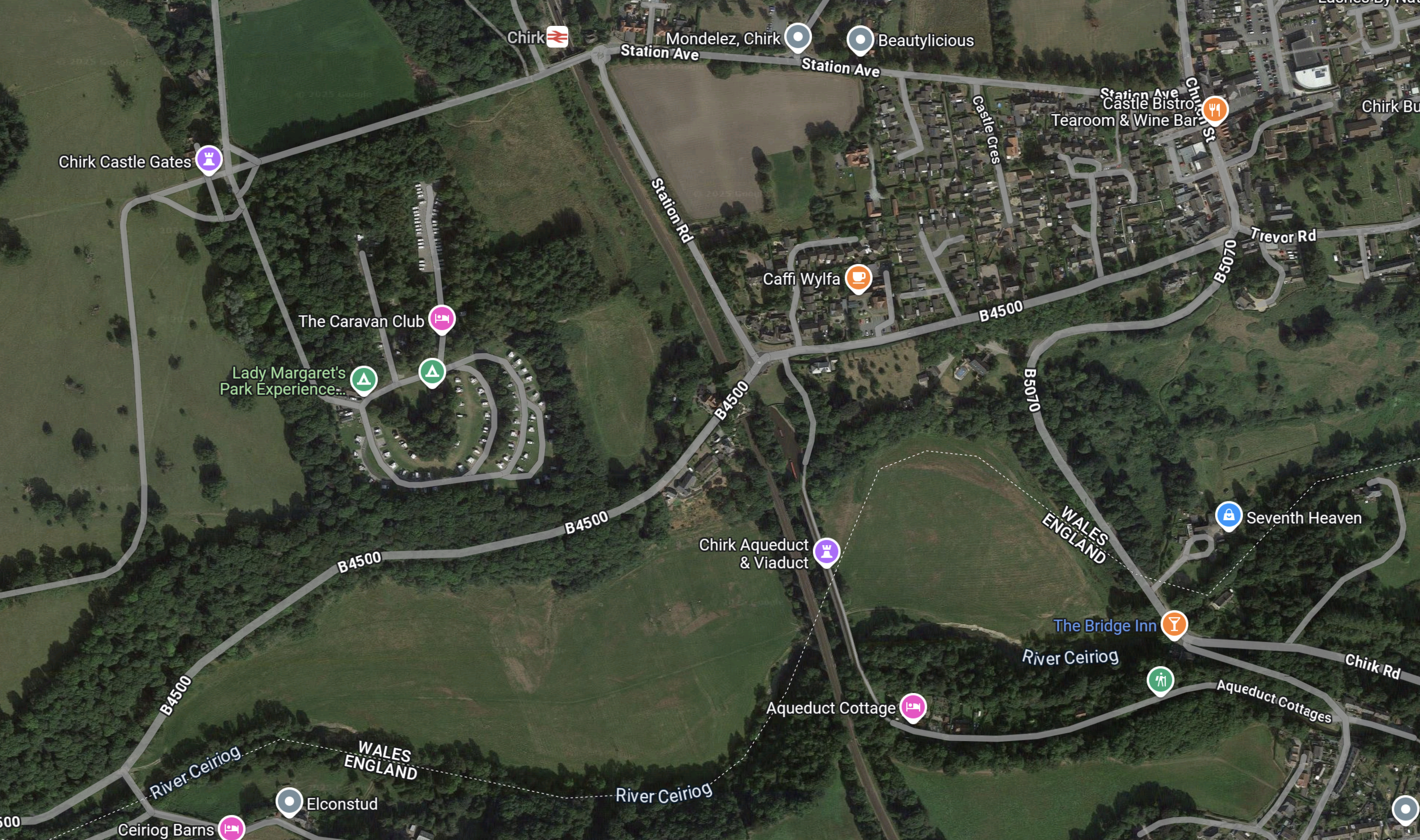
Note.
- Chirk station, which is fully-accessible via ramps, is at the top of the map.
- The railway between and running down the middle of the map.
- The railway has a maximum speed of 70 mph.
- The Aqueduct and the Viaduct crossing the valley of the River Ceirog together.
- The large caravan park.
- Chirk Castle Park.
If the Viaduct level crossing is in this area, it is a serious accident waiting to happen.
The BBC article says this about the crossing.
They include the Viaduct level crossing in Shropshire, which it said was “used by large groups and is also a hot spot for trespassing and fatalities”.
The operator said work would need to be carried out to make it safe.
North Shropshire MP Helen Morgan has previously spoken out on the safety of the crossing, which is close to the Chirk Viaduct.
She has written to Network Rail to request additional safety measures be put in place.
Network Rail said it had reviewed the safety of the crossing and brought forward plans to install crossing lights, which should be in place in December this year.
Note.
- I hope this is enough. But, I do know that the level crossing lights work well at Thurston station in Suffolk.
- It must help, that there is a bridge at the station.
The line between Wolverhampton and Wrexham, except for a short 15 mph section at Shrewsbury has at least a 70 mph maximum speed.
As electric trains, including battery-electric ones, have fast acceleration and deceleration would it not be possible for them to slow down for the level crossings?
This could even be done automatically using digital signalling.
Conclusion
I believe that this level crossing problem is solvable.
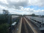
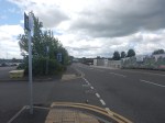
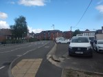
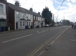
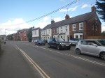
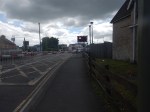
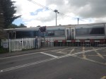
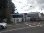
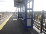
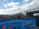
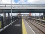
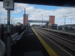
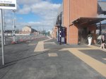
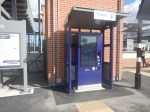
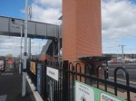
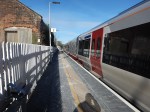
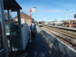
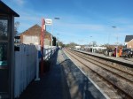
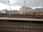
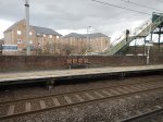
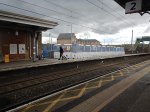
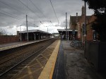
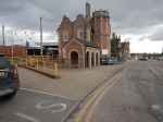
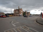
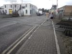
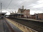
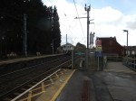
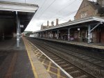
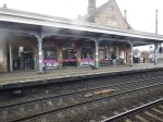
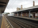
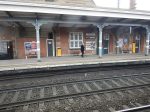
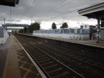
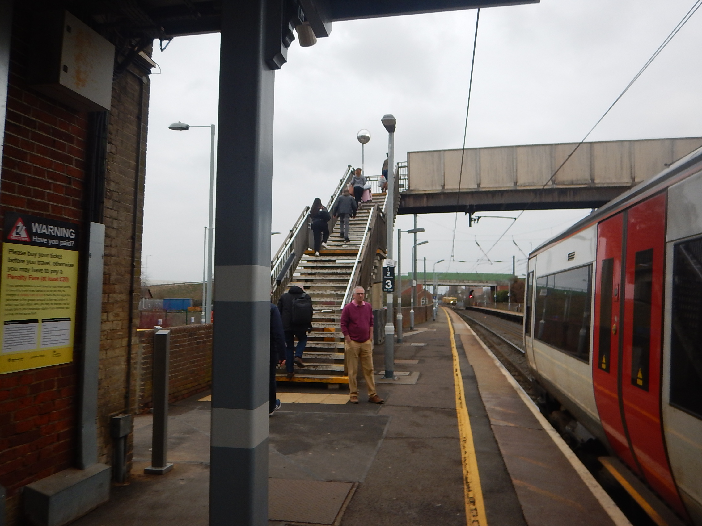
Bicester Village Station – 28th May 2025
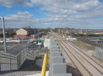
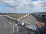
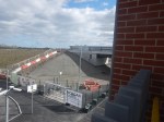
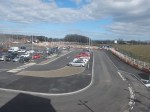
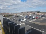
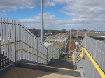
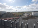
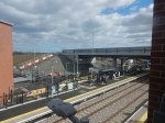
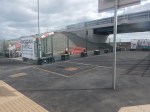
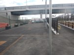
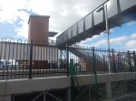
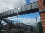
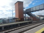
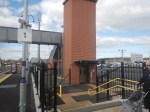
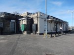
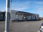
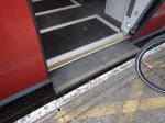
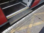
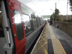
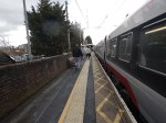
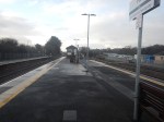
I went to Bicester Village station today and took these pictures.
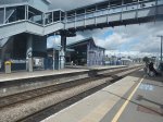
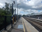
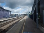

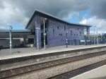
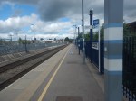
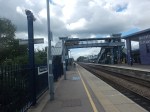
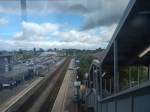
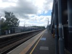
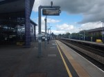
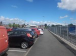
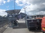
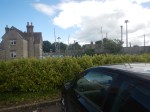
Note.
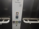
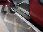
- The station is fully step-free, with lifts.
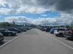
- There is a reasonable coffee-shop.
- There is a very large car-park.
There are two trains per hour (tph) in both directions between Marylebone and Oxford stations.
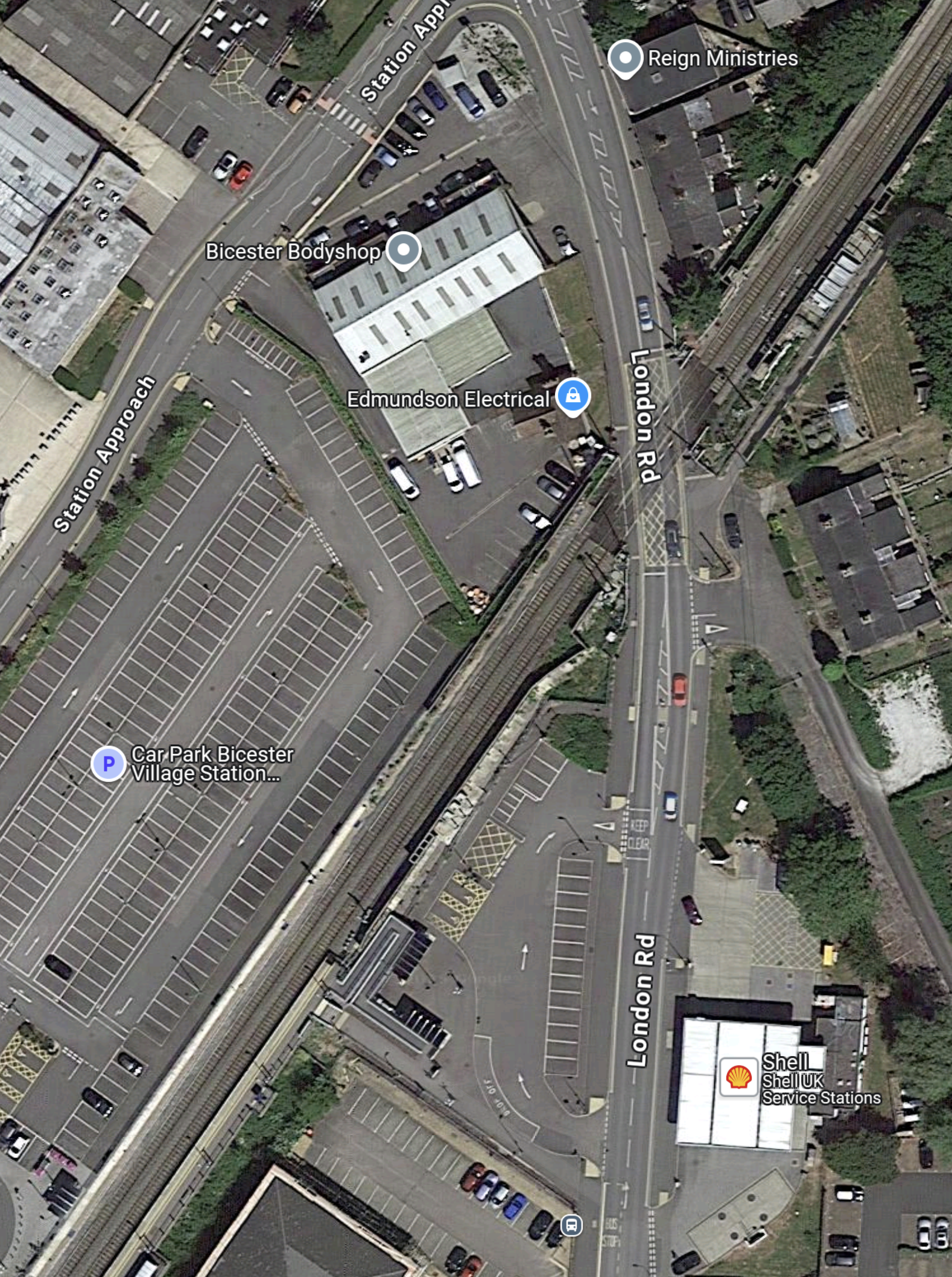
This Google Map shows the station.
Note.
- London is to the North.
- Oxford is to the South.
- The footbridge dates from October 2021 and is not shown on the map.
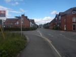
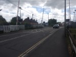
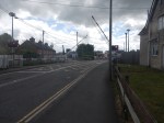
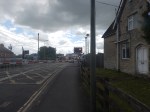
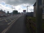
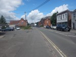
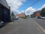
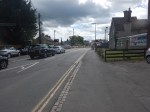
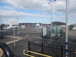
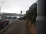
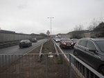
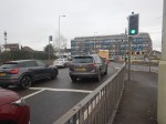
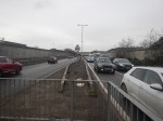
- The London Road level crossing is in the North-East corner of the map.
- The London Road level crossing is a problem, as I indicated in Bicester MP Calls On Chancellor To Fund London Road Crossing.
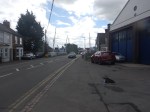
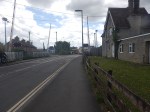
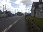
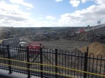
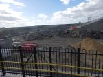
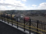
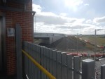
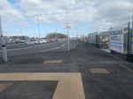
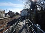
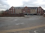
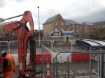
- To take the pictures of the level crossing, I crossed the footbridge to the North-West side of the station and walked through the car park to the station entrance on Station Approach. I then walked past the Bicester Bodyshop and Edmundson Electrical to the level crossing.
- The Shell garage can be clearly seen behind the level crossing.
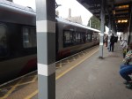
During my walk of about thirty-five minutes three trains passed over the level crossing.
These are my thoughts.
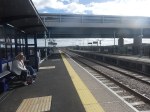
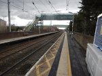
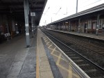
The Long Platforms
The platforms are long.
- The Oxford-bound platform, which is Platform 1, is 240 metres long.
- The London-bound platform, which is Platform 2, is 230 metres long.
Both platforms will take a pair of five-car Hitachi Express Trains.
It looks to me, that East-West Rail are expecting a large number of passengers.
East-West Rail Plans For Powering Trains
I detailed these in Plans For Powering Trains And Details Of Our Upcoming Consultation.This post was based on an East-West Rail news item with the same title.
Distances include.
- London Marylebone and Oxford – 66.8 miles.
- Bletchley and Oxford – 47.2 miles.
Both distances are within range of five-car Hitachi Express Trains, that have been fitted with batteries.
I also suspect other manufacturers could supply suitable trains.
Thoughts On The London Road Level Crossing
This article on the BBC is entitled Level Crossing Petition Supported By Thousands.
This is the sub-heading.
A petition calling for a fully accessible underpass at a town’s level crossing has received more than 3,000 signatures.
These three paragraphs add more detail.
Launched by MP for Bicester and Woodstock Calum Miller, the petition calls on the government to ensure any replacement of the level crossing at London Road in Bicester includes access for cars, not just cyclists and pedestrians.
It is set to be closed on safety grounds when the East West Rail (EWR) line becomes fully operational, which many fear would cut off crucial access to thousands of residents.
Mr Miller will present the petition, which can only be signed in person, in Parliament on 3 June.
The argument is certainly hotting up.
But I believe, that a bridge that meets everybody’s requirements might be possible to be built.
- Suppose that all trains and locomotives passing through the level crossing had to be self-powered. Passenger trains could be battery-electric and freight locomotives could be either hydrogen or battery powered through the location of the level crossing.
- The track could also be lowered through the crossing.
- These actions would reduce the height of any bridge taking the road over the railway.
It looks to me that on the Northumberland Railway, which has recently opened, they had a similar problem, but they were able to squeeze a bridge into the space, as this 3D Google Map shows.
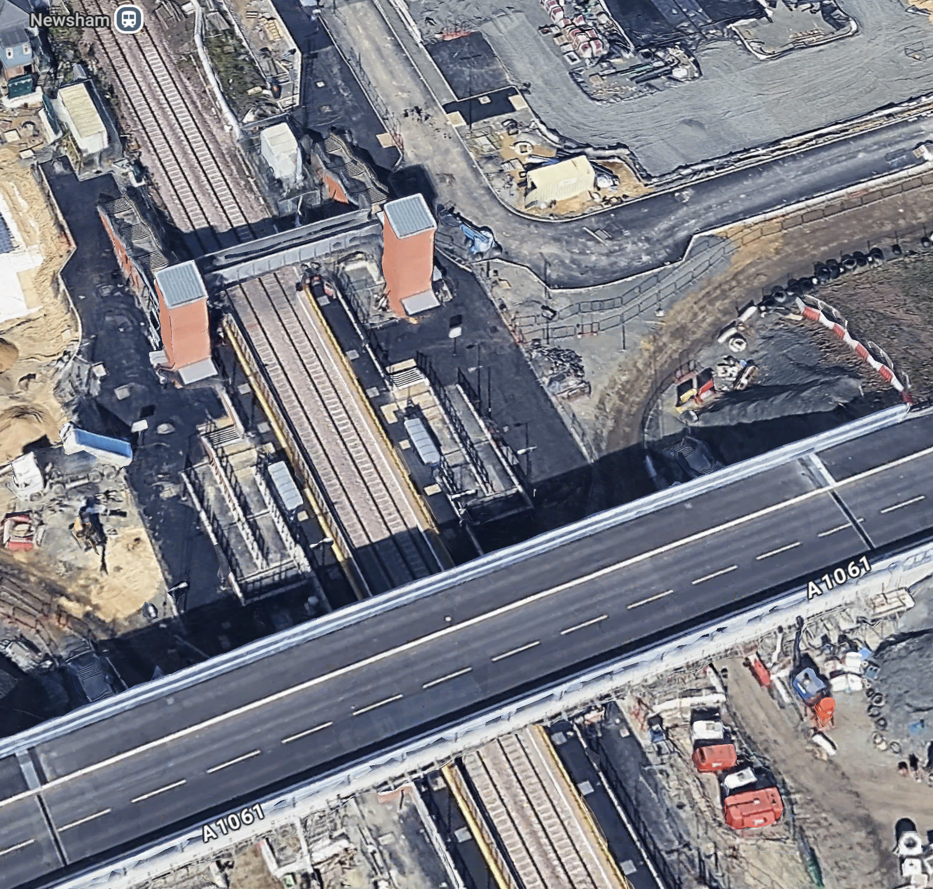
Note.
- The bridge looks like it carries a two-lane road and a pedestrian/cycle way.
- There is no electrification.
- I believe that the Northumberland Line could be run by battery-electric trains.
- The road bridge has been built to accept all traffic using the railway.
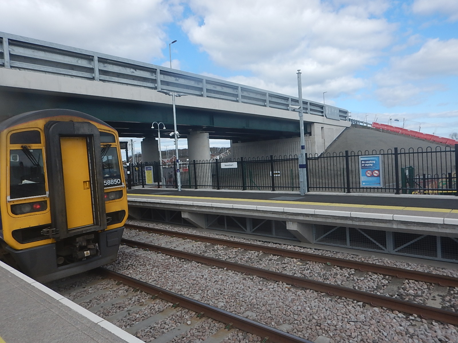
In Newsham Station – 30th March 2025, there are several pictures of the bridge. This one shows the bridge with a train.
In Trains: £34m For Revival Of 50-Year-Old North-East Railway Line, I said this about battery-electric trains for the Northumberland Line.
I’m drawn inextricably to the conclusion, that the trains should be 100 mph battery-electric trains.
Hitachi, who have a factory in the North-East, have announced their Regional Battery Train in July 2020, which is described in this Hitachi infographic.

These trains can be based on Class 385 trains.
- They are 100 mph trains.
- They come in three- and four-cars lengths.
- The three-car trains have 206 seats.
- They can work in pairs.
- They can use 25 KVAC overhead electrification.
- They have a range of 90 kilometres or 56 miles on battery power.
- The batteries would be charged on the ECML between Benton North junction and Newcastle station.
- The battery packs will be designed and manufactured by Hyperdrive Innovation in Sunderland.
- They have big windows for the views.
I’m sure Hitachi and Hyperdrive would like a fleet in service, just up the road from their factories.
Could a similar or even thinner bridge be squeezed in at Bicester Village station to take London Road over the railway?
I think it can, if they use some of the latest 3D modelling.
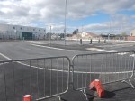
Newsham Station – 30th March 2025
Today, I went to Newcastle and took a ride to the recently-opened ; Newsham station on the Northumberland Line.

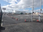

Note.
- The road bridge over the railway.
- When complete there will be a lot of parking space.
- The orange bollards in the parking could be electric vehicle chargers, ready to be unveiled.
- The full step-free access over the railway via the lifts is already working.
- British Railways, its predecessors and many other countries would have just put in a level crossing.
- The Completed platform is wide.
- Both platforms already have a shelter.
- There are help points, information displays, facilities for those with limited hearing and readers for smart ticketing on both platforms.
- There is a ticket machine by both lift towers.
- The disabled parking is already marked out.
- The brickwork and other workmanship is top-class.
- There is space behind the platforms for taxis, buses and emergency service vehicles.
- There is enough clearance under the two bridges for overhead electrification.
There is still some finishing off and landscaping to do, but it is a station with everything.
I have some other thoughts.
The High Quality Lifts Are By Stannah
Several of the passengers I saw, were getting on in years.
Does the maker of the well-advertised stair-lifts use station lifts, which are likely to be used by those of reduced mobilility, as a promotional tool?
The Station Will Be One Of The Best Rural Stations In The UK, When It is Complete
I can see other stations on a similar theme being built.
Especially, where a level crossing is to be eliminated.
This Google Map shows the level crossing and former station at Six Mile Bottom, near where I used to live.
Note.
- The Cambridge and Newmarket railway goes across the map.
- Cambridge is to the West and Newmarket is to the East.
- The main Newmarket to London road crosses the railway here in a level crossing.
- Newmarket is to the North and London and the M11 is to the South.
- There used to be a station here and some want it back.
- There have been several incidents on the level crossing and Greater Anglia have had serious damage to more than one train.
A station like Newsham would be ideal here.
I can see Morgan Sindall building a few more on this theme.
Could they licence the design to construction companies all over the world?
I’ve certainly, seen similar layouts in Eastern Poland, where there are lots of level crossing accidents, according to our guide on one trip. But he said Russia is a lot worse for level crossing accidents.
Saxmundham Station – 14th March 2025
On Friday, I went to Saxmundham to view the presentation of LionLink.
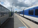
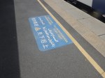
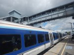
I took these pictures of Saxmundham station.


Note.
- The trains are two of Greater Anglia’s excellent Class 755 trains.
- The line is double track at Saxmundham station.
- The station building suffered a devastating fire 2018 and has since been rebuilt.
- Access between train and platform is step-free. See the gap fillers in the first two pictures.
- The tracks are crossed by the use of the level-crossing.
- There was a new comfortable and warm waiting room.
- There is a small car park.
- There is an hourly train in both directions to Ipswich and Lowestoft.
The station is in walking distance from the town.
These are my thoughts.
Extra Services
This OpenRailwayMap shows Saxmundham station and the Aldeburgh branch, which also serves the Sizewell power stations.

Note.
- The blue arrow indicates Saxmundham station.
- The yellow track is the East Suffolk Line.
- A disused branch line curves East, to the North of Saxmundham station and then South to the former site of Aldeburgh station.
- Sidings for Sizewell C construction trains will be built along this branch line.
Would it not be a good idea to reinstate the railway to Aldeburgh and run a second hourly train between Aldeburgh and Ipswich?
- There is space for a Platform 0 at Ipswich station.
- There is only the hourly Ipswich and Lowestoft train in both directions on the East Suffolk Line.
- Simple one platform stations would be needed at Leiston, Sizewell, Thorpness and Aldeburgh.
- There is probably enough double track for the extra train.
The current Ipswich and Saxmundham service takes about 34 minutes, so I suspect two trains would be needed for an Ipswich and Aldeburgh shuttle.
In the Wikipedia entry for Aldeburgh station, there is this paragraph.
In 1929 the LNER introduced luxurious Pullman day excursion trips from Liverpool Street to various seaside resorts. The service, known as the Eastern Belle, served Felixstowe on Mondays, Frinton and Walton on Tuesdays, Clacton on Wednesdays and Thorpeness and Aldeburgh on Thursdays and Fridays. The service ended in September 1939 when the Second World War broke out.
Perhaps not a Pullman service, but a kids special in the summer holidays.
Could Bealings Station Be Rebuilt?
Bealings station, which used to be between Westerfield and Woodbridge stations was closed in 1956.
This Google Map shows its location.

The station is now the Mallard House Business Centre.
Stowmarket Station – 14th March 2025
tThe one and only time, that I’ve used Stowmarket station, was when I’d taken my Lotus in for a service near Diss and I was getting back to Newmarket, with a change at the station.
So as I was going to Stowmarket station, I felt with the judicious use of a East Anglian Ranger ticket, I could combine the trips to Stowmarket and Saxmundham stations.
I also wanted to look at the progress on the new footbridge that I wrote about in Stowmarket Station To Go Step-Free.
I took these pictures.
Note.
- I arrived on the Norwich-bound platform, crossed the tracks by the level crossing and then left from the Ipswich-bound platform.
- The station has a cafe.
- The footbridge in the pictures is a temporary one to ease construction.
- The station buildings are Grade II Listed.
There doesn’t appear to have been much progress on the new footbridge.
I do have some other thoughts.
Greater Anglia’s Stadler Trains Are Step-Free Between Train And Platform
The first two and last pictures in the gallery show this feature.
I arrived on a Class 745 train and left on a Class 755 and both train classes have gap fillers, that do their job automatically.
We need more of this technology to protect the elderly, those with restricted movement and the just untrained stupid.
Housing By The Station
It appears that two blocks of flats have been built on railway land or the station car park.
The bridge also appears to give the owners and residents access across the railway.
Is this thoughtful holistic design or just a bribe to get planning permission?
Who Will Use The Footbridge?
Two main lines effectively cross at Stowmarket.
- The Great Eastern Main Line between Ipswich and Norwich goes through Needham Market, Stowmarket and Diss.
- The Ipswich and Ely Line between Ipswich and Cambridge goes through Needham Market, Stowmarket, Elmswell, Thurston, Bury St. Edmunds, Kennett, Newmarket and Dullingham.
So, if you need to go between say Newmarket and Diss, you would change trains at Stowmarket. Hopefully, the bridge will encourage train travel.
New Housing In East Anglia
On the main railway lines between Cambridge, Ipswich and Norwich, there used to be a lot more stations.
- There are eight closed stations between Stowmarket and Cambridge.
- There are three closed stations between Stowmarket and Ely .
- There are two closed stations between Stowmarket and Ipswich.
- There are eight closed stations between Stowmarket and Norwich.
Note.
- A new Soham station was built between Stowmarket and Ely. Passenger numbers are rising with each year.
- I have double-counted Higham and Saxham and Risby stations on both the Ely and Cambridge routes.
- But that still leaves nineteen stations, that might be good sites to build new houses.
- The East-West Railway intend to build a new A14 Parkway station to link the A14 road to the Ipswich and Ely Line.
- When housing is taken into account, some stations will give a better return on investment.
Could the new footbridge at Stowmarket be part of a wide ranging plan to build more housing in towns and villages along the railways of East Anglia?
Was The Old Footbridge Too Low?
This picture was taken of the old bridge.
Was the bridge too low for some container trains?
Bicester MP Calls On Chancellor To Fund London Road Crossing
The title of this post, is the same as that of this article on the Oxford Mail.
This is the sub-heading.
An MP has called on the chancellor for funding to keep a town’s level crossing open ahead of the budget this week.
These are the first two paragraphs.
The MP for Bicester and Woodstock, Calum Miller, has written to the chancellor, Rachel Reeves, ahead of Wednesday (October 30), calling on her to fund the London Road Crossing in Bicester.
The East Railway project will result in the London Road Crossing being closed to vehicles, bikes and pedestrians for more than 45 minutes every hour and could, as a result, be closed permanently by Network Rail.
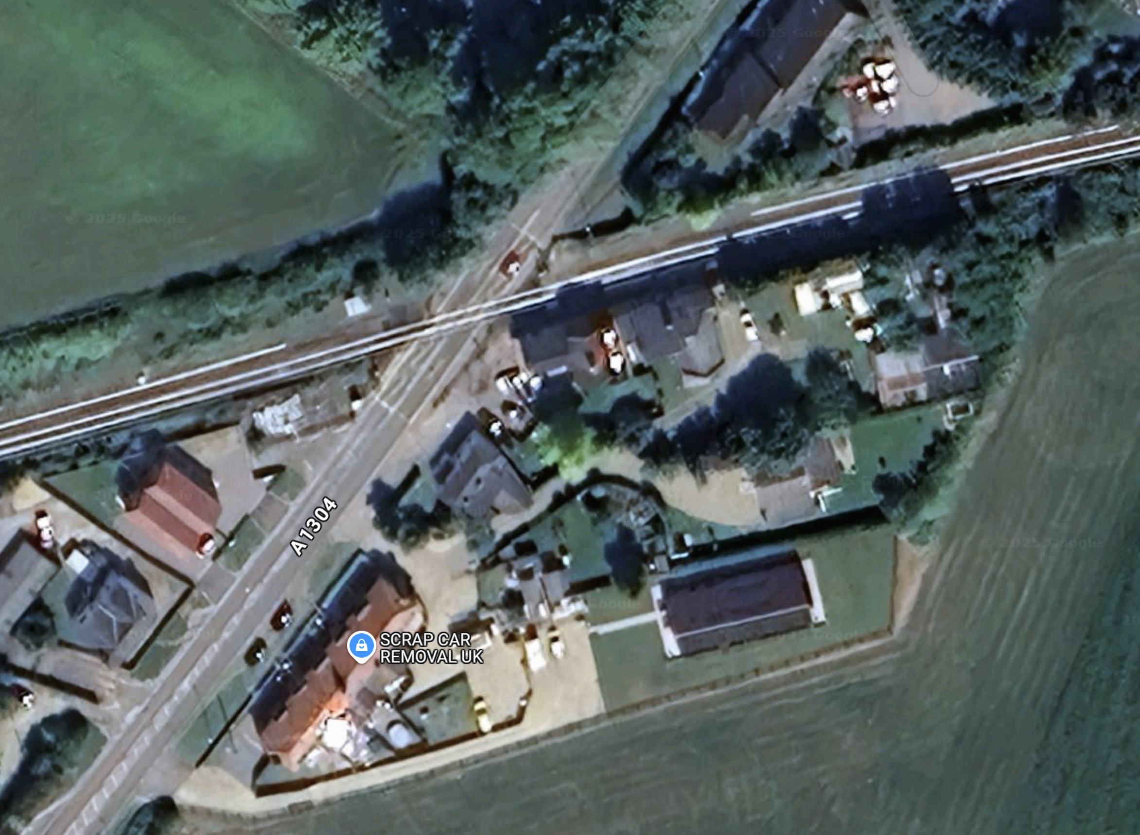
This Google Map shows the level crossing.
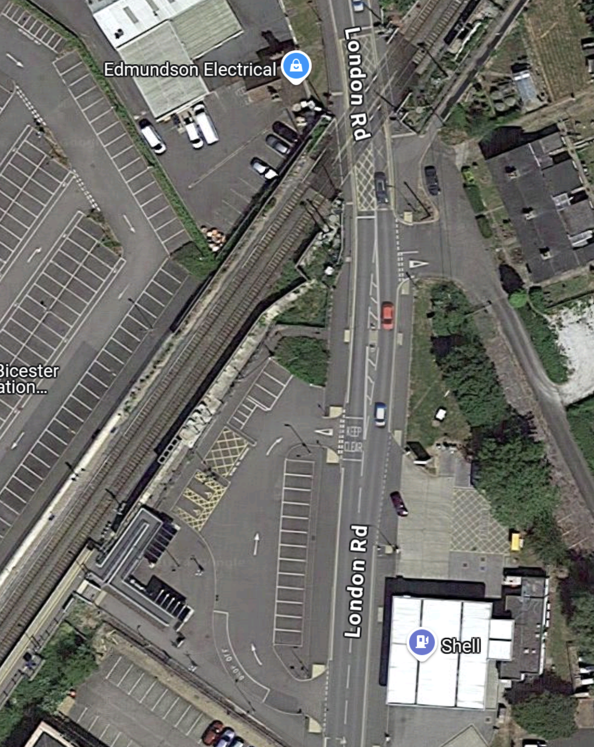
Note.
- London Road runs North-South across the map.
- There is a petrol station on the East side of London Road.
- Bicester Village station is on the West side of London Road.
- Bicester Village station is surrounded with lots of car parking.
- The level crossing is at the top of the map, where level crossings normally are.
This Google Map is a closer view of the level crossing.
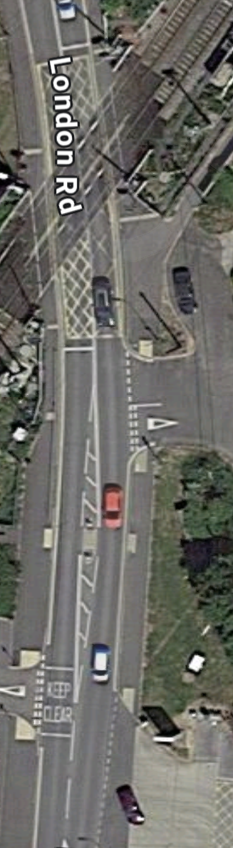
There seems to be several side roads giving access to side-roads and car-parks.
It is a very crowded site with in addition to the level crossing, there is a station, a Shell garage and lots of car parking.
I shall go and have a look next week, but at least the filling station should go. After all, who will want petrol and diesel in a few years?
Par Station – 10th February 2024
Par station will see changes because of the Mid-Cornwall Metro.
I took these pictures as I passed through.
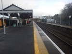
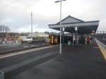
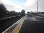
Note.
- The level crossing was busy with cars every time I crossed it.
- The semaphore signalling.
- The arriving GWR Castle in the last picture.
This Google Map shows Par station.
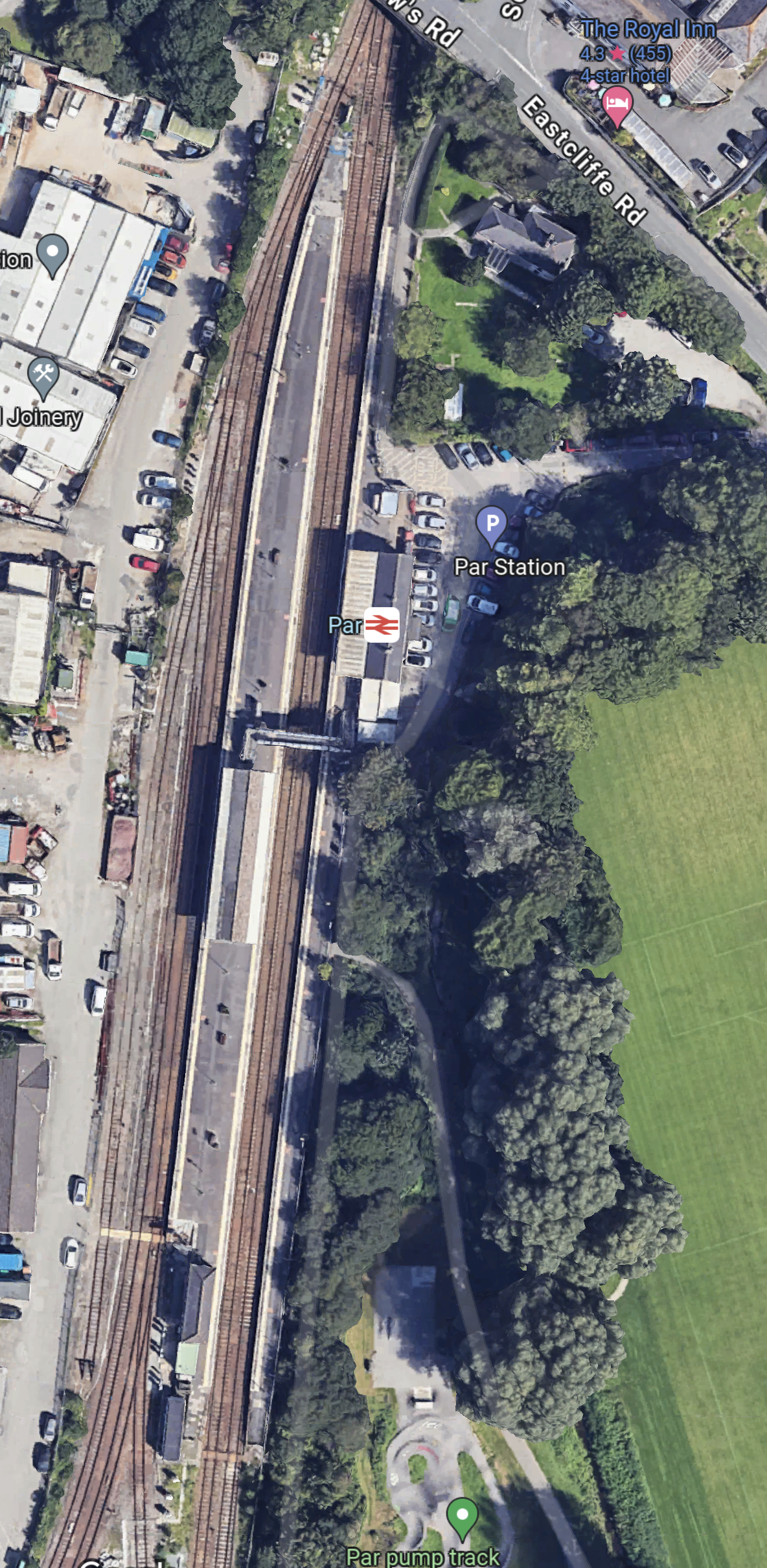
Note.
- There three platforms. Platform 1 is in the East, with Platforms 2 and 3 forming an island platform.
- There is a footbridge connect the platforms together.
- The Atlantic Coast Line leaves the map in the South West Corner.
As one of the modifications for the Mid-Cornwall Metro, the footbridge will be replaced with one that is step-free.
I have a few thoughts.
Will The Mid-Cornwall Metro Reverse At Par Station?
This OpenRailwayMap shows the track layout at Par station.
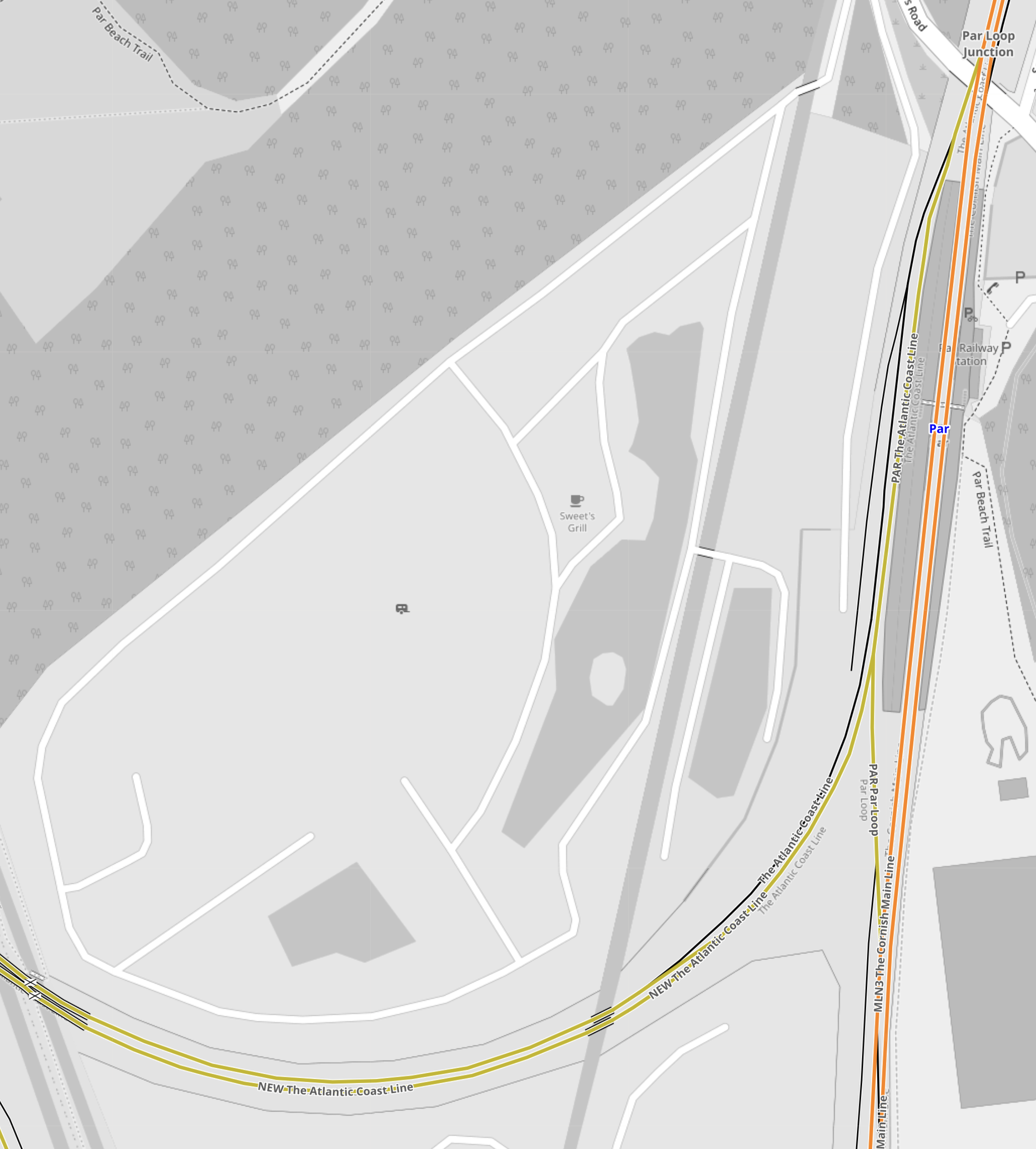
Note.
- The tracks shown in orange form the Cornish Main Line.
- The tracks shown in yellow that curve away to the West are the Atlantic Coast Line.
- The busy level crossing is shown in the South-West corner of the map.
- The Atlantic Coast Line connects to Platform 3 on the West side of the station.
- The track layout allows trains to access Platform 3 from both directions on the Cornish Main Line.
It does look like, Mid-Cornwall Metro trains will have to reverse every time, they call at Par station.
Could The Cornish Main Line Be Electrified At Par Station?
At some point in time, it will be desirable to run zero-carbon trains both on the Mid-Cornwall Metro and the Cornish Main Line.
- Plymouth and Par is a distance of 34.7 miles.
- Truro and Par is a distance of 19 miles.
- Newquay and Par is a distance of 20.8 miles.
- All of these distances would be in range of a typical battery-electric train.
- In The Data Sheet For Hitachi Battery Electric Trains, I said that a Hitachi express train with a battery range of 43.5 miles.
To my untrained eye, it looks like Par station wouldn’t be the most difficult place to electrify.
I believe there are possibilities to put an island of electrification at Par to give the trains a quick Splash-and-Dash before continuing.
Google Starts Building £790m Site In Hertfordshire
The title of this post, is the same as that of this article on the BBC.
This is the sub-heading.
Google has invested $1bn (£790m) to build its first UK data centre
These are the first four paragraphs.
The tech giant said construction had started at a 33-acre site in Waltham Cross, Hertfordshire, and hoped it would be completed by 2025.
Google stressed it was too early to say how many jobs would be created but it would need engineers, project managers, data centre technicians, electricians, catering and security personnel.
The prime minister said it showed the UK had “huge potential for growth”.
The project marked the latest investment by a major US tech firm in Britain, after Microsoft announced it would invest £2.5bn to expand data centres for artificial intelligence (AI) across the UK.
Note.
- By “completed by 2025” do they mean completed before 2025 or completed by the end of 2025. Judging by the time they took to build their London HQ, its the latter.
- Rishi is right about the UK having a huge potential for growth! Especially, if the nihilists of the United States vote in the Big Orange!
- Judging by the total spend of £2.5 billion on data centres and the £790 million for this one, this looks to be the first of three.
But where is this data centre going to be built?
This article on EssexLive is entitled Google To Move Into Waltham Cross With £788m Data Centre To Support ‘AI Innovation’, where this is said.
The new data centre will go on land at Maxwell’s Farm, next to the A10 Great Cambridge Road and around one mile from the M25 junction 25. Debbie Weinstein, Google vice president and managing director in the UK and Ireland, set out the decision in a blog post on Thursday, January 18 – the fourth day of the World Economic Forum’s Davos 2024 in Switzerland.
This is a Goggle Map of that area, when I searched for Maxwell’s Farm.
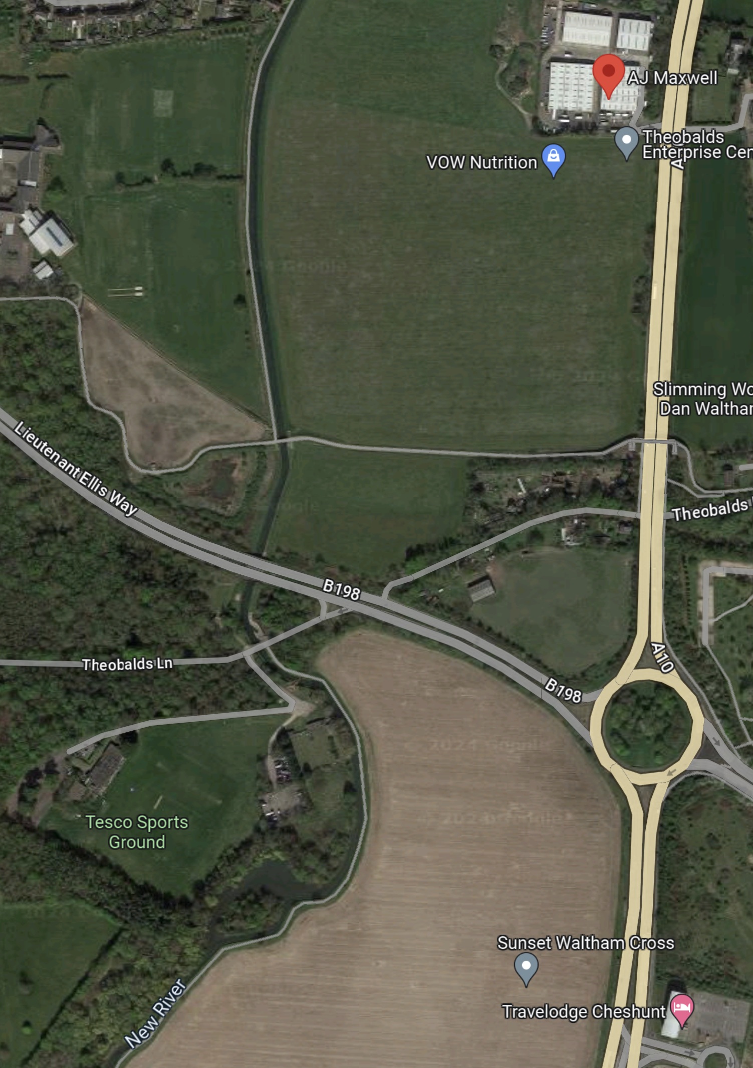
Note.
- The red arrow indicates the result of my search, which Google interpreted as A.J. Maxwell.
- The dual-carriageway road running down the East side of the map is the A10 between London and Cambridge.
- The A10 road joins the M25 at Junction 25.
- The arrow to the South-West of the roundabout indicates the new studios; Sunset Waltham Cross, which is being built.
- At the other side of the studio site, there is a label saying New River and this important piece of London’s water infrastructure can be traced to the top of the map.
- The other dual-carriageway road is the B198 or Lieutenant Ellis Way.
- A quick calculation shows that 33 acres is roughly a 365 metre square.
I would suspect that the data centre will lie somewhere between the A10, the B198 and the New River.
This Google Map shows the South-East corner of the site.
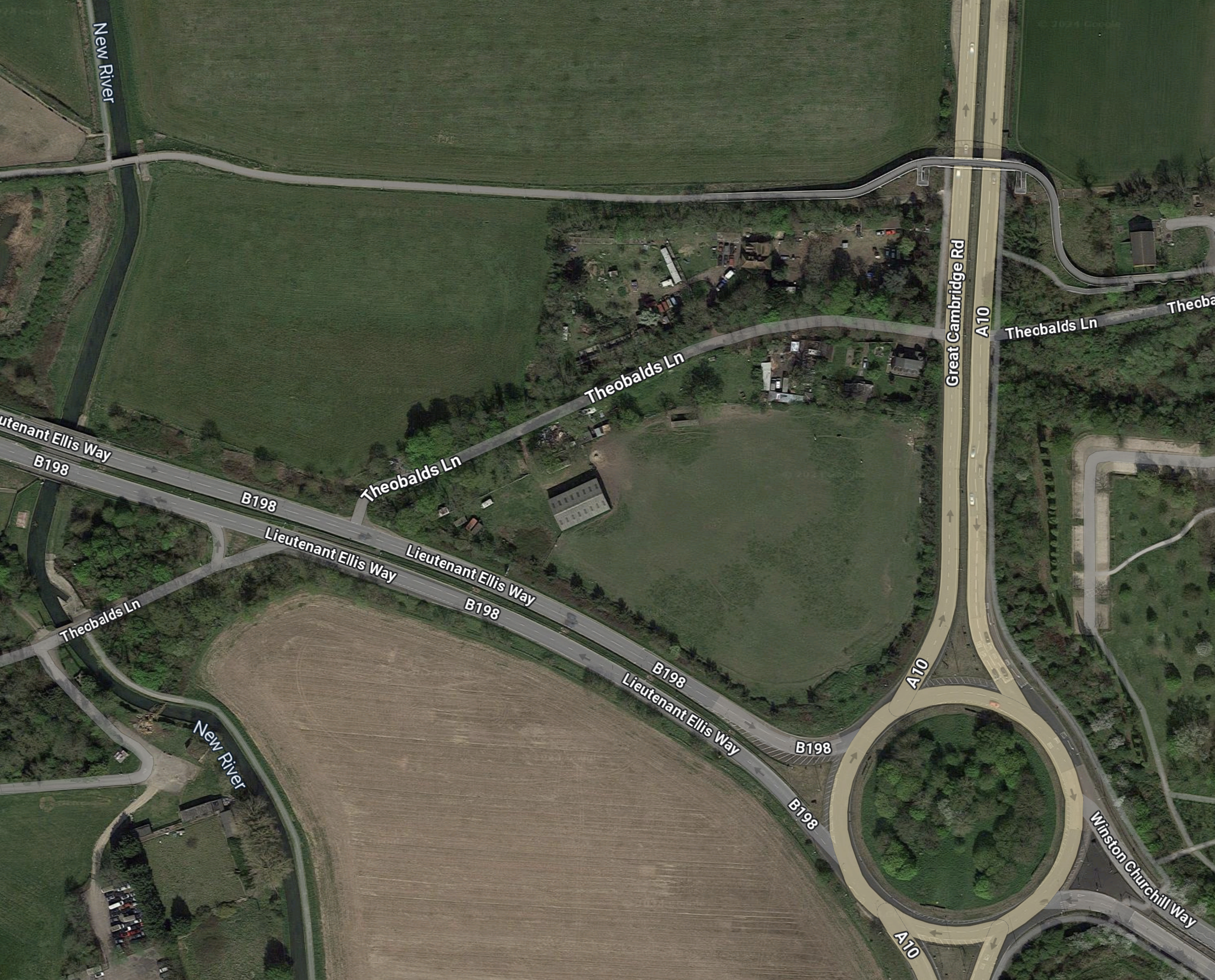
Note.
- There appears to be a lane running East-West, that crosses over both the A10 and the New River.
- Theobalds Lane appears to have some housing and possibly a farm.
- The smaller field by the roundabout appears to have some animals using it as grazing.
- The field between the East-West lane and Theobalds Lane appears to have a good crop of cereal.
The East-West lane would appear to be a possible Southern border of the site.
This Google Map shows where the East-West lane goes.
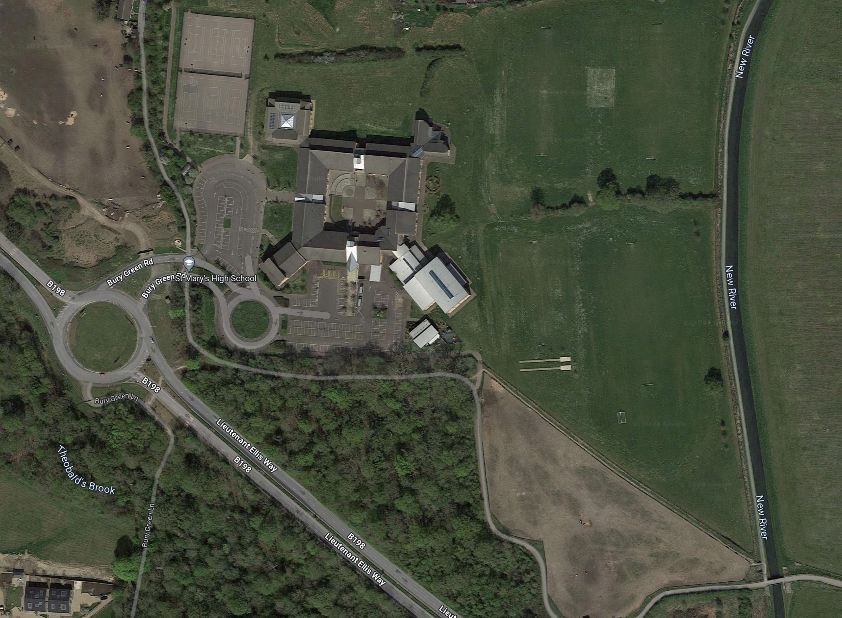
Note.
- The lane leads to Queen Mary’s High School.
- The school also has access from Lieutenant Ellis Way.
- The New River appears to form, the Eastern boundary of the school site.
- There are sports pitches between the New River and the school.
The New River looks to be the Western boundary of the Google site.
This Google Map shows around the red arrow from the Google search that led me to this area.
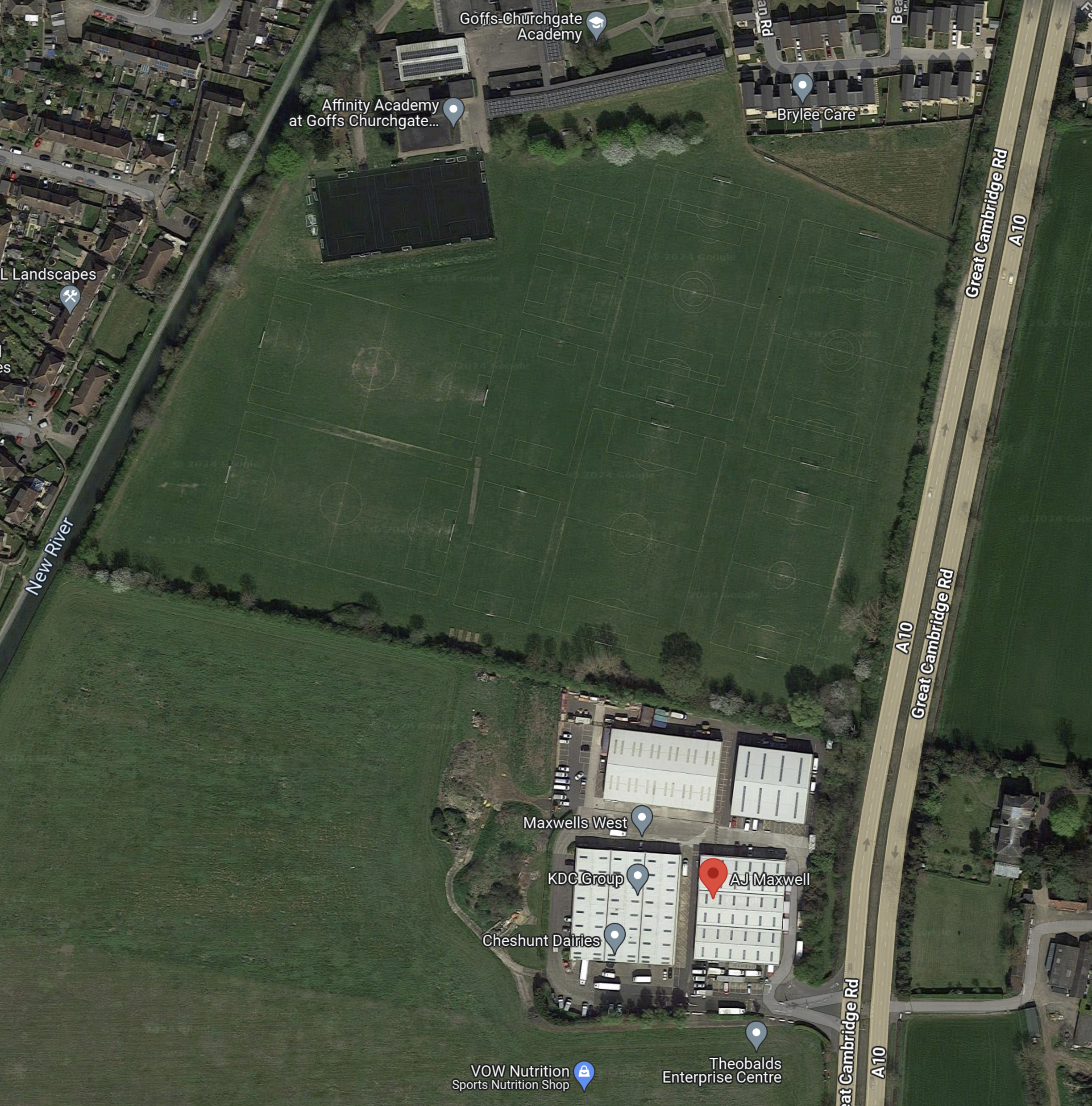
Note.
- A.J. Maxwell is identified by the red arrow in the Theobalds Enterprise Centre.
- The New River can be seen at the West of the map.
- A hedge runs roughly East-West to the North of the Enterprise Centre.
- North of the hedge are a number of football pitches, which appear to belong to the Affinity Academy at Goffs Churchgate.
The hedge could be the Northern boundary of the Google site.
This Google Map shows the area between the South of the Enterprise Centre and the East-West lane I picked out earlier.
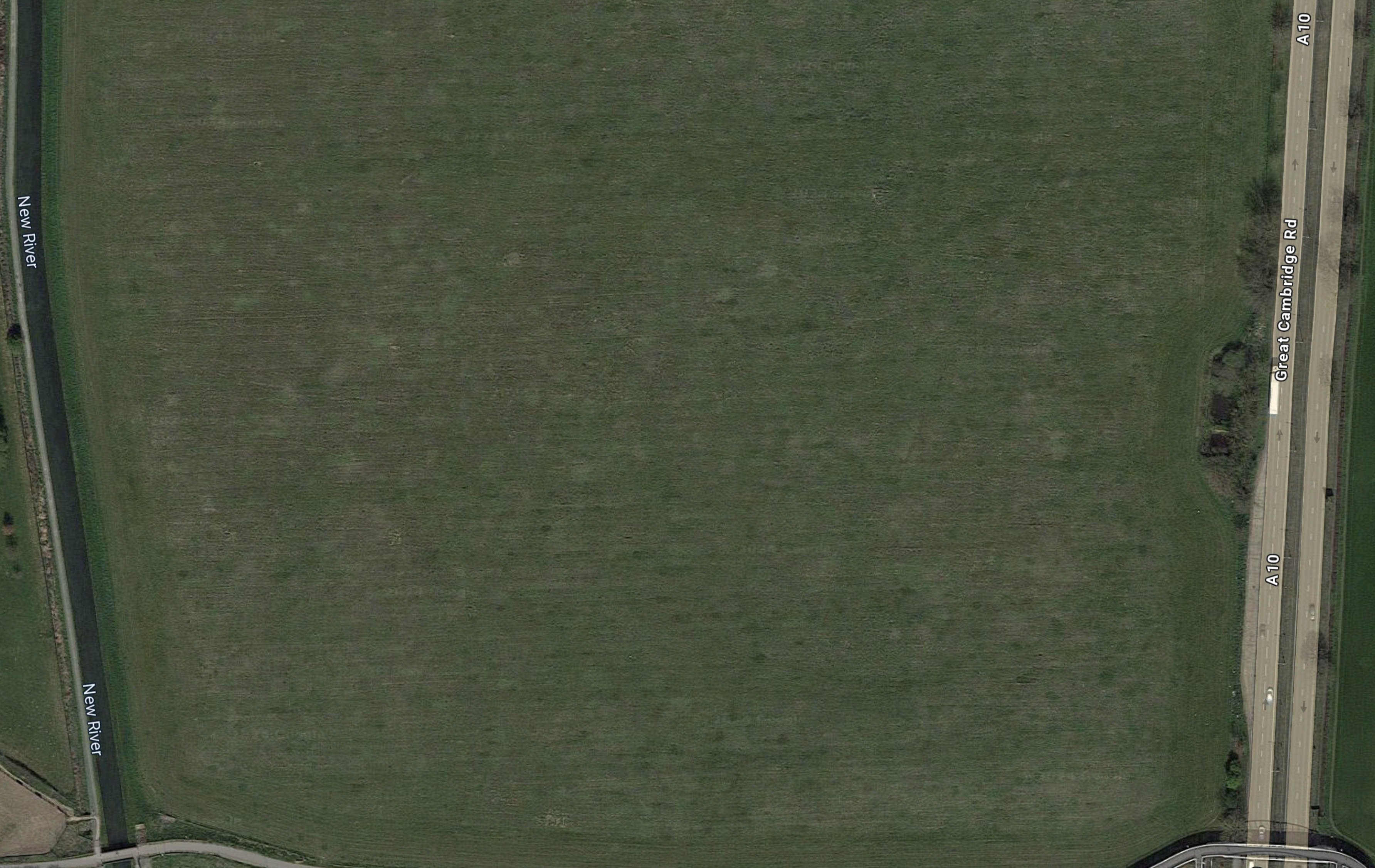
A crude measurement indicates it could be around 33 acres or slightly more.
This picture is used in nearly all the news reports about the Data Centre.

Note.
- Could that be the gentle curve of the New River on the left?
- With the high fence, the New River forms an almost-mediaeval defence against trespassers.
- There looks to be a dual-carriageway road running down the other side of the site, which would be the A10.
- Between the A10 and the site, there appears to be loots of dark areas, which I take to be car parks.
- Are the car-parking spaces in the front of the picture marked for those, who are disabled? There certainly appear to be chargers on some spaces.
I have a few thoughts.
The Relative Locations Of Google’s Data Centre And Sunset Studios?
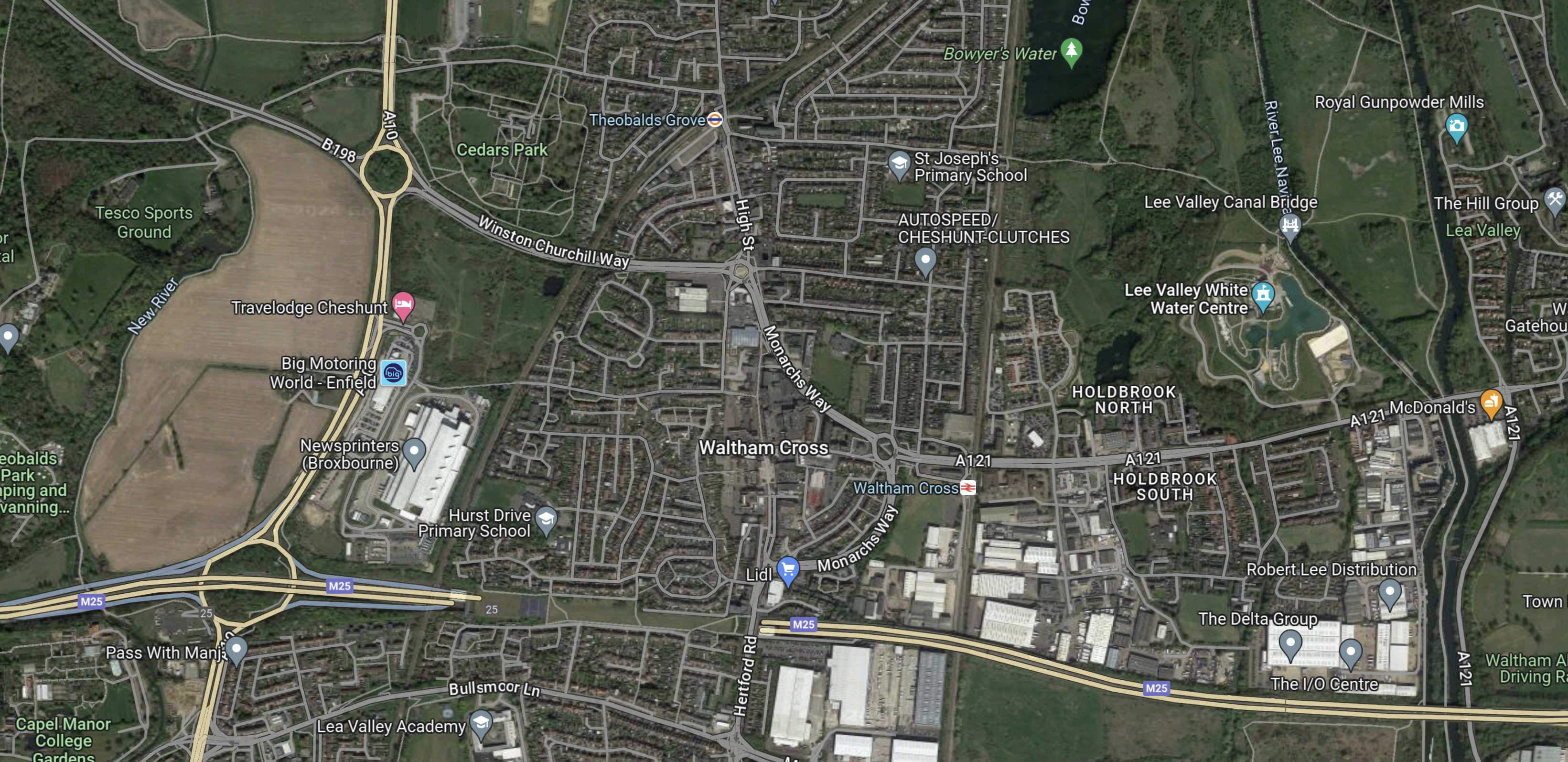
This Google Map shows the two sites to the West of the A10.

Note.
- St. Mary’s High School is in the North-West corner of the map.
- Cheshunt Football Club is in the North-East corner of the map.
- The dual-carriageway A10 runs North-South on the map.
- I believe that Google’s Waltham Cross Data Centre will be located in the field to the West of the A10, at the top of the map.
- The A10 connects to the M25 at Junction 25, which is in the centre at the bottom of the map.
- In The Location Of Sunset Studios In Broxbourne, Sunset Studios are placed to the North West of the Junction 25 roundabout.
- Just as the A10 forms the Eastern boundary of both sites, the New River forms the Western boundary.
The two sites are close together between the A10 and the New River, separated by the dual-carriageway Lieutenant Ellis Way.
Will Google’s Data Centre Be Storing Data For Sunset Studios?
I’ve never worked in the production of films, but these days with digital electronic cameras, CGI, motion capture and other techniques, producing a film must need huge amounts of data storage.
- So have Sunset Studios outsourced their data storage needs to Google?
- Perhaps too, Sunset Studios found the local authority welcoming and this attitude was recommended to Google.
- Both sites will need local services like electricity, gas, sewage and water.
I suspect that there would be cost savings in construction and operation, if the two sites shared the utilities.
Providing Electricity And Heat For Both Sites
Consider.
- I estimate from information given in the Wikipedia entry for Google Data Centres, that a data centre needs between 10 and 12 MW.
- There is no obvious power source like offshore wind or a nuclear power station nearby.
- There is the 715 MW Rye House gas-fired power station, which is a few miles away.
- In Google Buys Scottish Offshore Wind Power, I talked about how Google had signed a Corporate Power Purchase Agreement to buy 100 MW from the Moray West offshore wind farm.
Google and Sunset Studios would also want an electrical and heat supply that is at least 100 % reliable.
Liverpool University had the same problem on their hundred acre campus in the centre of Liverpool.
- The University decided to build their own 4 MW Combined Heat and Power Unit (CHP), which is described in this data sheet.
- It is fired by natural gas.
- On their web site, Liverpool University state that their CHP can be adapted to different fuel blends. I take this includes zero-carbon fuels like hydrogen and carbon-neutral fuels like biomethane.
But given their location in Waltham Cross close to the Lea Valley, CHP units may have a use for their carbon dioxide.
This Google Map shows between Junction 15 of the M25 and Tomworld.

Note.
- Junction 25 of the M25, where it joins the A10 is in the South-West corner of the map.
- The sites of Google’s Data Centre and Sunset Studios can be picked out with reference to the previous map.
- Tomworld is in the North-East corner of the map.
- So why should Tomworld need a lot of carbon-dioxide?
This Google Map shows Tomworld.
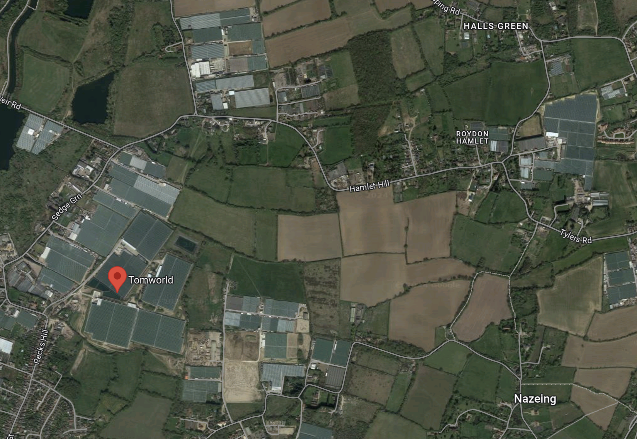
Note.
- This web page indicates what Tomworld do.
- They have 44 acres of glass growing tomatoes, about five miles to the North-East of Google’s Data Centre.
- The map has lots of other greenhouses.
I know of a guy, who has a large greenhouse, that grows tomatoes for the supermarkets.
- He heats the greenhouse with a gas-fired Combined Heat and Power Unit (CHP).
- The electricity produced runs his business.
- Any surplus electricity is fed into the grid.
- The carbon dioxide is fed to the plants in the greenhouse, which helps them grow quality tomatoes.
I just wonder, if carbon dioxide from CHP units at Google’s Data Centre and Sunset Studios could be used by the multitude of greenhouses in the Lea Valley.
Could A Carbon Dioxide Pipeline Be Built Along The M25?
This Google Map shows the Northern section of the M25, South of Waltham Cross.
Note.
- The M25 running East-West across the bottom of the map.
- Junction 25 of the M25 in the South-West corner of the map.
- The A10 running North-South at the West of the map.
- Google’s data centre and Sunset Studio are to the West of the A10.
- The River Lee, which has numerous water courses is at the East of the map.
I wonder, if a carbon dioxide pipeline could be built along the M25 to connect the producers to those who could use it?
- It would not be a dangerous pipeline as carbon dioxide is a fire extinguisher.
- It wouldn’t be a huge pipe.
I think it would be possible.
Google’s Commitment To Being Zero-Carbon
This blog post on the Google web site is entitled Our $1 Billion Investment In A New UK Data Centre, has a section, which has a sub-title of 24/7 Carbon-Free Energy By 2030, where this is a paragraph.
Additionally, we’re also exploring new and innovative ways to use the heat generated by data centres, and this new facility will also have provisions for off-site heat recovery. Off-site heat recovery presents an opportunity for energy conservation that benefits the local community, as it allows us to capture the heat generated by the data centre so that it can be used by nearby homes and businesses. The data centre is also set to deploy an air-based cooling system.
If they are using off-site heat recovery, it would be logical to use waste carbon dioxide from CHPs to provide carbon dioxide for the local horticultural businesses.
Will Google Be Building A Vertical Farm Nearby?
In Schneider Electric: Vertical Farming – The Next Yield In Data Centre Sustainability, I noted that some data centres are paired with vertical farms to increase their sustainability.
Could Google be doing that in Waltham Cross?
- They will have a lot of waste heat.
- They will have a fair bit of carbon dioxide, which could be used to help plants grow.
- The local workforce probably contains a lot of experience of market gardening.
I like the idea of pairing a data centre and a vertical farm.
Public Transport Access
Consider.
- Increasingly, the cost of electric vehicles, medical problems and the UK economic situation are causing people to adopt a car-free lifestyle.
- After my stroke, my eyesight deteriorated such, that I am no longer allowed to drive.
- Others may live in one-car families and it may not be their’s to use every day.
- Or your car may just break down on the way to work.
For these and probably lots of other reasons, any large site employing a lot of employees, must have a valid way of getting there by public transport.
The nearest rail station to Google’s Data Centre and Sunset Studios is Theobalds Grove station.
This Google Map shows the roads between the sites and the station.
![]()
Note.
- The Sunset Waltham Cross label in the South West corner.
- Google’s Data Centre will be just off the map to the West of the A10.
- Theobalds Grove station is marked by the TfL roundel in the North-East corner of the map.
- There would appear to be no bus stops on Winston Churchill Way or the A10.
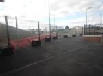
I walked South from the station to Winston Churchill Way, where I took these pictures.
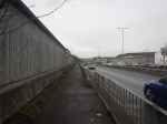
Note.
- At that point, I gave up because of the cold and pollution.
- It was also a Saturday morning about midday.
The route I took is certainly not an alternative route to get to Google’s Data Centre or Sunset Studios.
A Possible Station At Park Plaza North
This article on the BBC is entitled Broxbourne: Two New Stations Planned.
This is the sub-heading.
Two new train stations could be built in Hertfordshire if plans to tighten planning policies are adopted.
This is the first paragraph.
Broxbourne Borough Council said stops at Park Plaza North – between Turkey Street and Theobalds Grove London Overground stations – and Turnford on the London to Bishop’s Stortford route would be subject to a consultation.
Later the BBC say that Park Plaza North station will be South of the A121 Winston Churchill Way near Waltham Cross
This Google Map shows the area South-East of the roundabout, where Winston Churchill Way meets the A10.
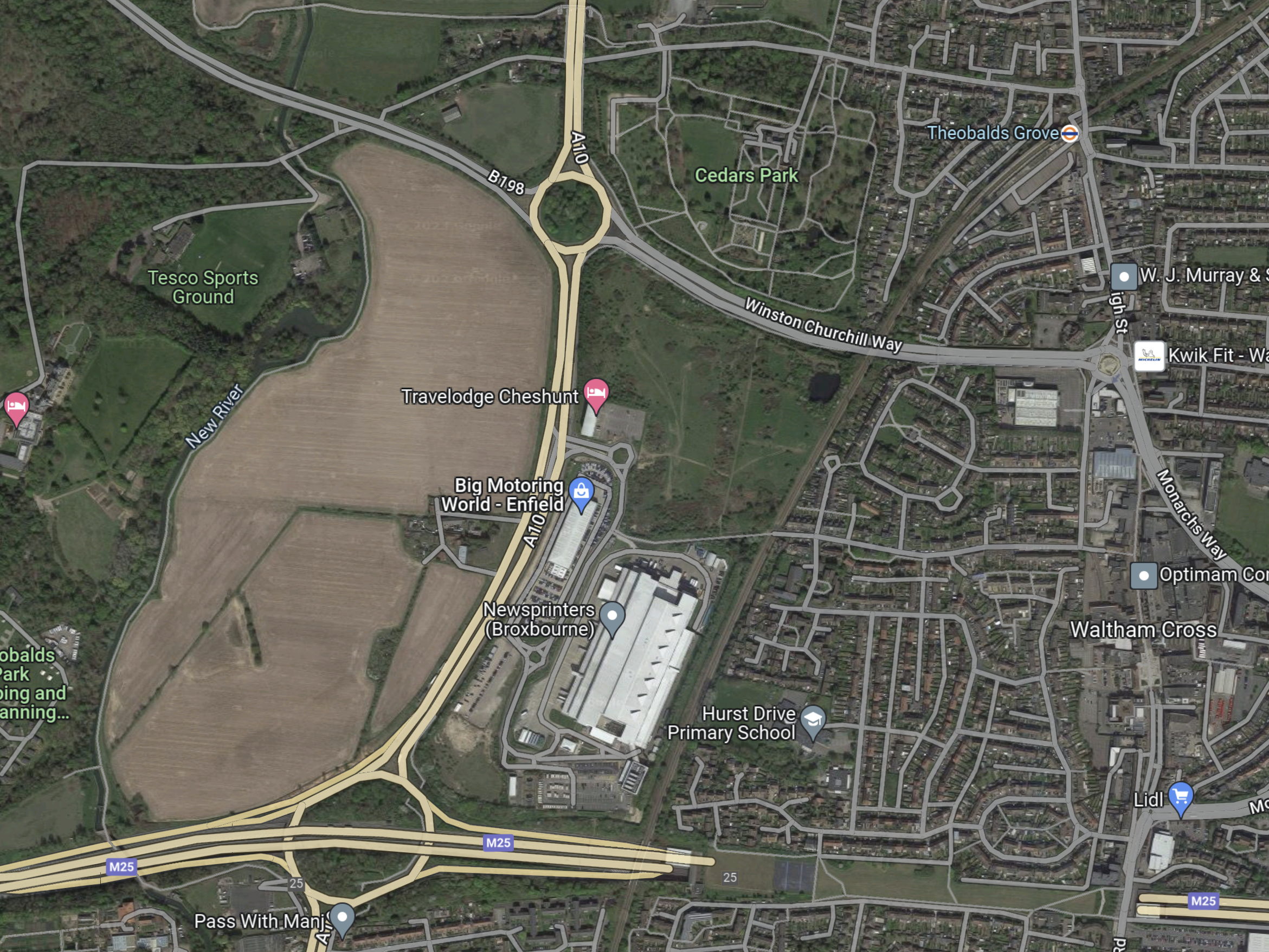
Note.
- The green patch of land to the South-East of the roundabout where Winston Churchill Way meets the A10 appears to be ripe for development.
- Looking at the green patch with a higher resolution, the land is little more than high class scrub beloved of newts.
- The London Overground line to Cheshunt runs down the East side of the site.
- To the North, the London Overground crosses Winston Churchill Way to get to Theobalds Grove station.
- To the South, the London Overground crosses the M25 to get to Turkey Street station.
- There is a lane running East-West along the South edge of the site, which crosses the railway in a level crossing.
This picture clipped from Google StreetView shows the level crossing.
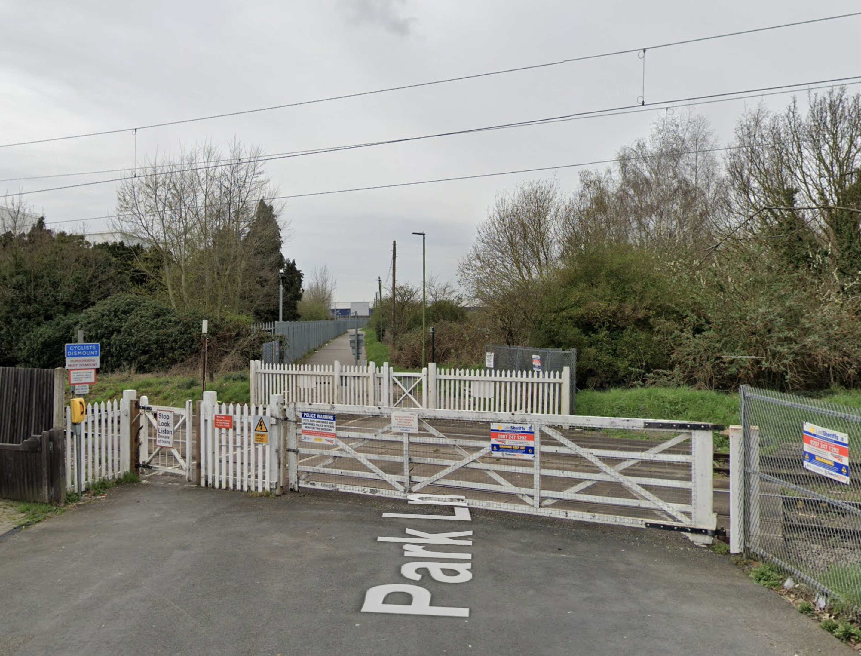
This is certainly one, that drivers dread.
This GoogleMap shows the level crossing and a stretch of the London Overground.
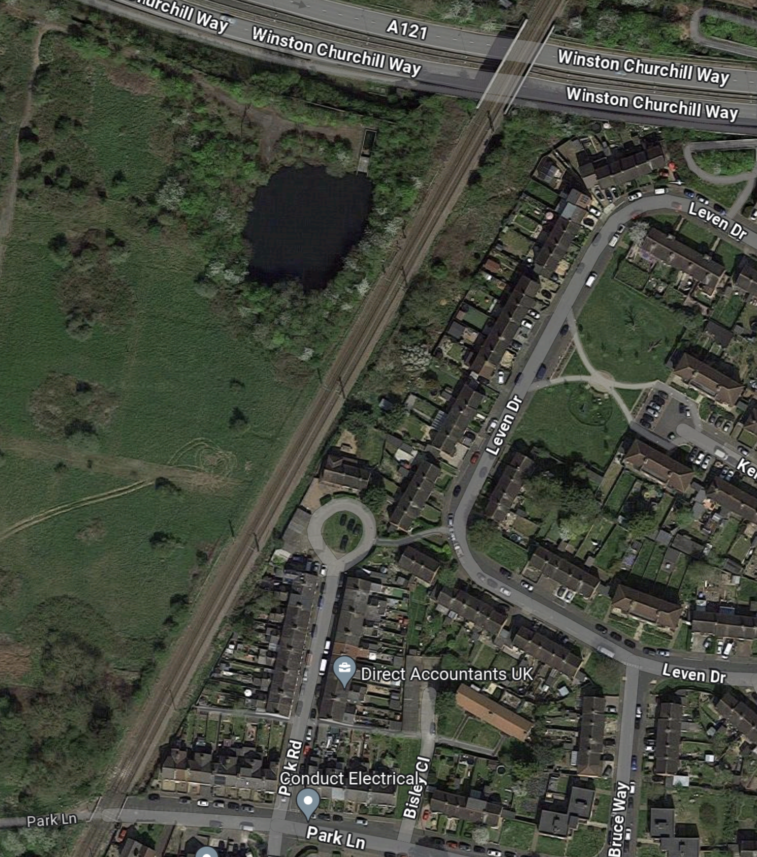
Note.
- The level crossing is in the South-East corner of the map.
- There isn’t much space to put a London-bound platform on the East side of the tracks, South of the Park Road circle.
- There is plenty of space to put a Cheshunt-bound platform on the West side of the tracks.
- North of the Park Road circle, there would appear to be space for two platforms.
It will need a lot of ingenuity to provide a safe and efficient solution to the problems of the level crossing and fitting a station in this limited space.
The first thing I’d do, would be to dig an underpass for pedestrians and cyclists to connect the two halves of Park Lane.
East West Rail: Could A New Rail Link ‘Tear Apart’ A Village?
The title of this post, is the same as that of this article on the BBC.
This is the sub-heading.
A new £5bn railway line connecting Cambridge and Oxford will transform much of the area between the two university cities. It could see one Bedfordshire village grow from a population of about 600 to more than 44,000. What would that change mean for people living there and how do they feel about it?
This Google Map shows the village.
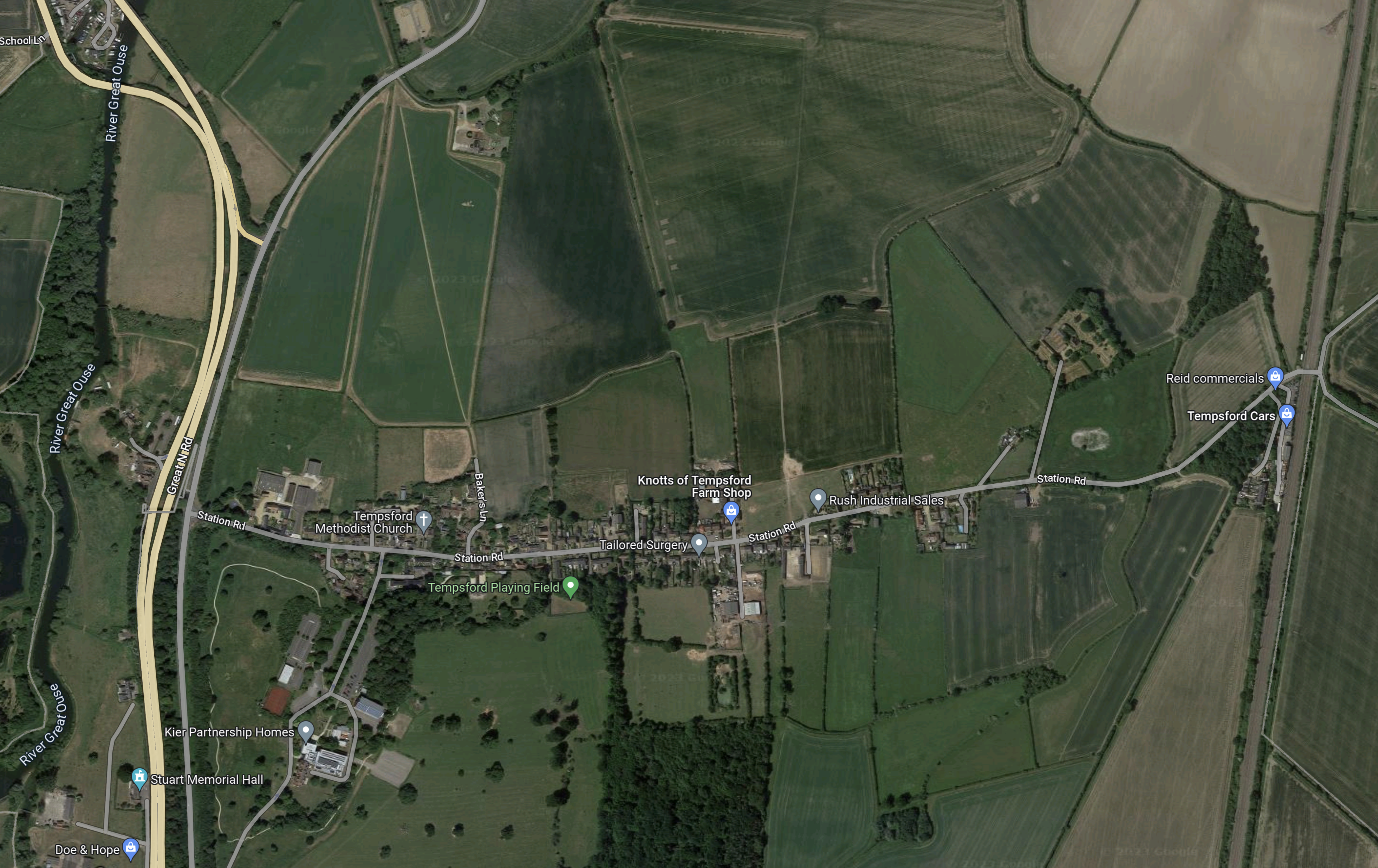
Note.
- On the West side of the map there is the Great North Road and the Great Ouse.
- On the East side of the Map, there is the electrified East Coast Main Line.
- The village is strung along the East-West lane in the middle of the map, which is inevitably named Station Road.
It appears to have a surgery, a playing field and a Methodist church, but not much else.
I have some thoughts.
Bedford And Tempsford
This Google Map shows Bedford and Tempsford.
Note.
- Bedford is in the South-West corner of the map.
- Tempsford is in the North-East corner of the map.
I wouldn’t be surprised to see the East West Railway take an East West route to Tempsford, that skirted to the North of Bedford.
In East-West Rail: Through Bedford, I discuss how the East West Railway could branch away to the East from the Midland Main Line.
Tempsford And Cambourne
The next station to the East is Cambourne station.
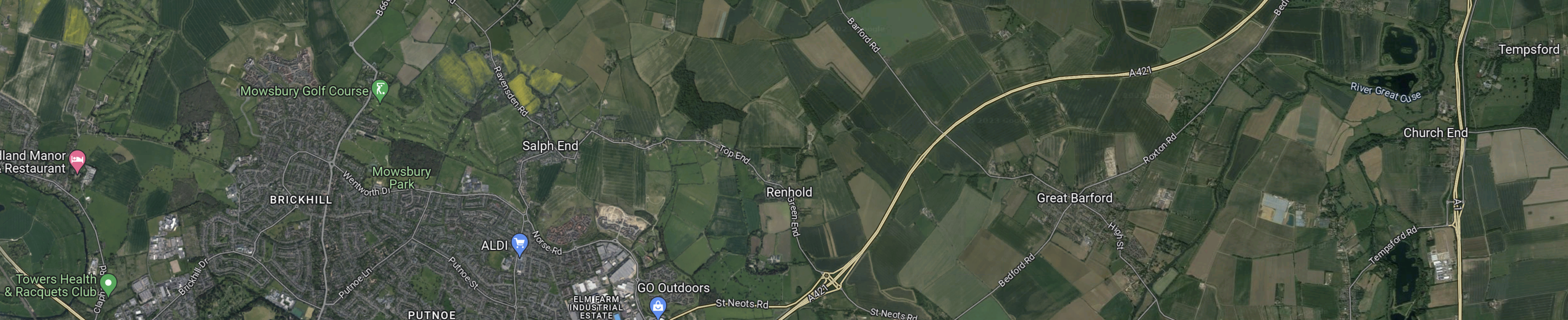
This Google Map shows Tempsford and Cambourne.
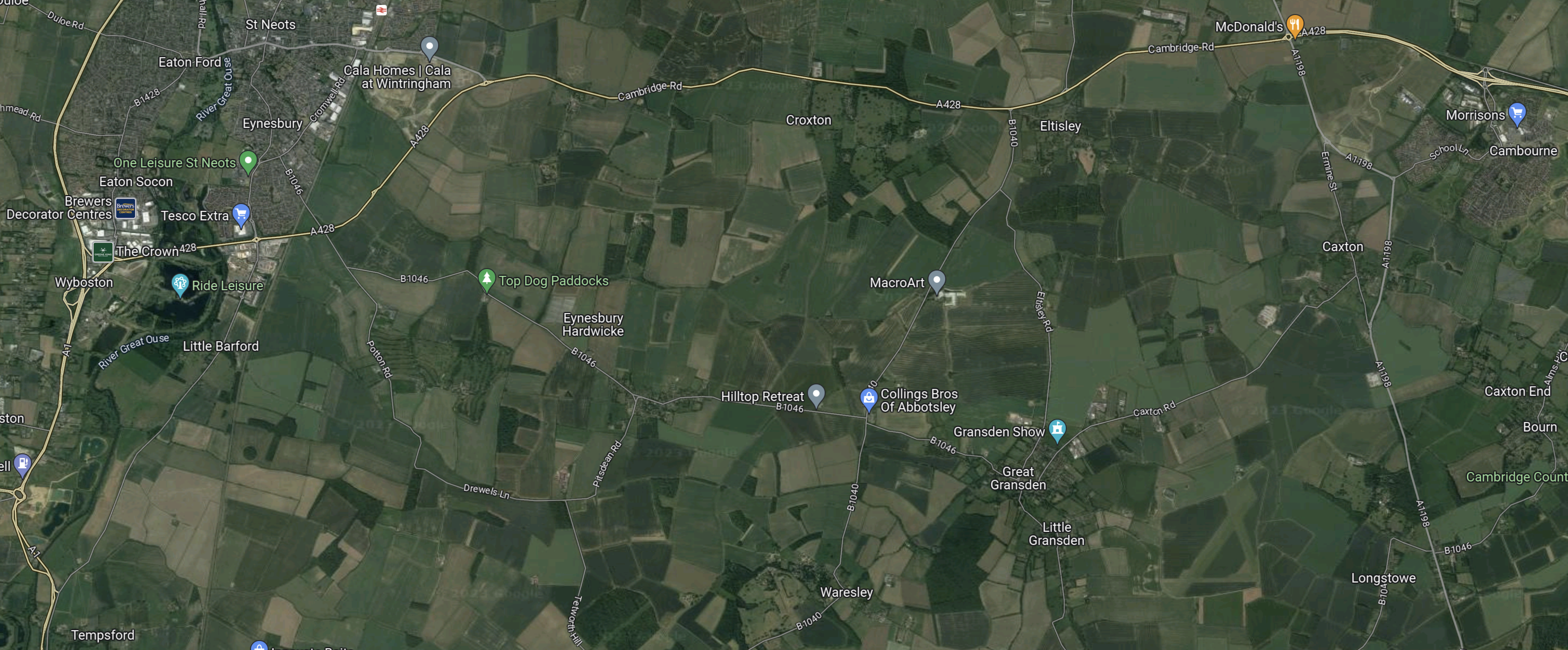
Note.
- Tempsford is in the South-West corner of the map.
- Cambourne is in the North-East corner of the map.
- St. Neots station can be picked out on the Northern edge of the map.
I wouldn’t be surprised to see the East West Railway take a North-Easterly route from Tempsford.
The Possible Station Site At Tempsford
This Google Map shows where Station Road crosses the East Coast Main Line.

Note.
- There are a few industrial businesses on what was probably the old station site.
- There doesn’t appear to be any housing.
I flew my virtual helicopter lower and took this image.
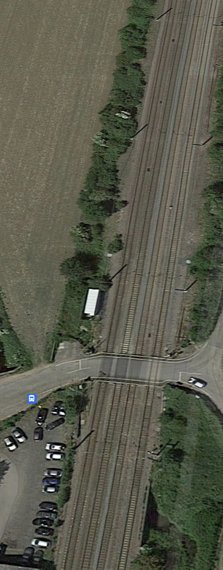
Note.
- It is a level crossing.
- There is a car waiting to cross on the Eastern side.
- There is also a bus stop on the Western side.
This must be an accident waiting to happen as the speed limit on the trains through here is 125 mph. Remember Upton Nervet, where seven were killed and sixty-six were injured!
Hopefully, the new design of Tempsford station will incorporate a combined rail and road bridge or tunnel.
The Route Of The Railway At Tempsford
I think it is more likely that the railway would go roughly East-West to the North of Station Road.
