Network Rail’s Test Track Take Centre Stage As Hydrogen Is Delivered By Rail For The First Time
The title of this post, is the same as that of this press release from GeoPura.
These three paragraphs introduce the story.
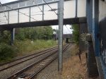
Network Rail, working with rail and energy partners Freightliner and GeoPura, has transported hydrogen for the first time on Britain’s rail network, marking a major step forward for both the rail and energy sectors.
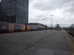
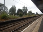
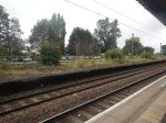
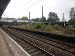
The milestone was achieved yesterday (Wednesday 3 December) at Network Rail’s Test Tracks* site in Tuxford, where freight operator Freightliner hauled a train of gas containers from Doncaster to High Marnham – marking Britain’s first shipment of hydrogen by rail.
It was part of a rail and energy industry innovation event showcasing several hydrogen initiatives. This included the first re-engineered hydrogen-powered shunting locomotive – seen as a step towards replacing diesel – another milestone towards the rail industry’s goal of becoming net zero. The event also demonstrated HPU hydrogen-powered generators, lighting towers and support vehicles.
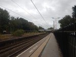
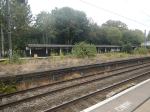
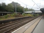
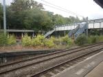
These two paragraphs describe Network Rail’s test track at Tuxford and GeoPura’s hydrogen production facility at High Marnham.
Network Rail’s site at Tuxford runs all the way to High Marnham, where it sits adjacent to HyMarnham Power, the UK’s largest green hydrogen production facility operated by GeoPura and JG Pears. Built on the site of a former coal-fired power station, HyMarnham Power is one of the world’s first rail-connected hydrogen production facilities, and Network Rail’s Tuxford site will be the world’s first net-zero railway testing facility.
Currently, hydrogen is transported by road. This breakthrough marks a major step towards the rail network becoming a ready-made hydrogen distribution system, a rolling pipeline, with connections to all major industrial and urban centres across Britain – proving the practical capability of rail to transport hydrogen at scale. Hydrogen will also be utilised to decarbonise wider rail operations, from construction to ongoing maintenance and off-grid operations.
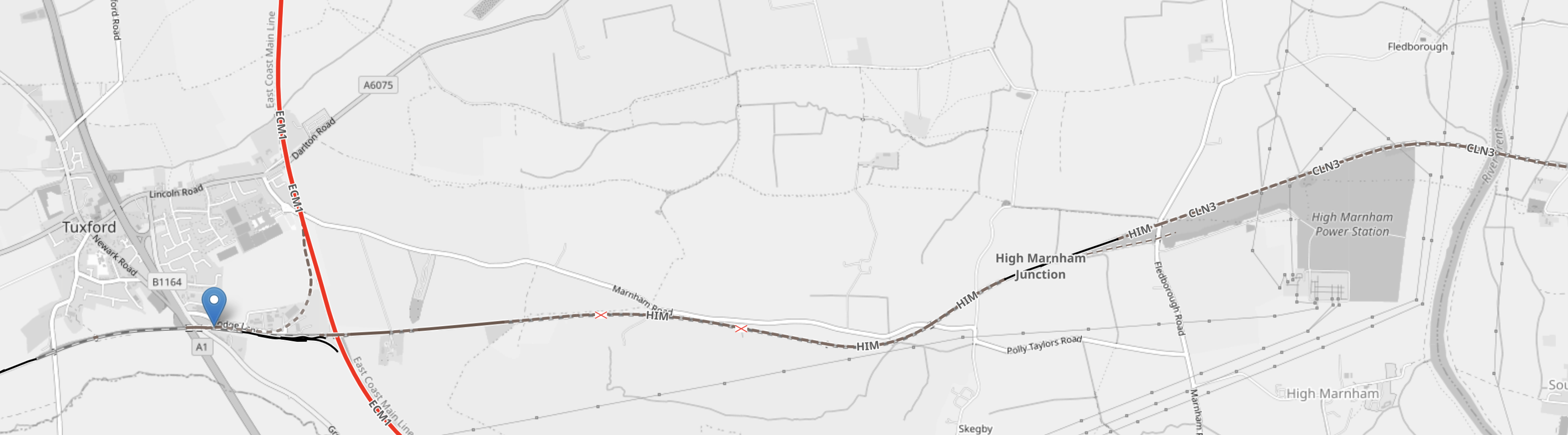
This OpenRailwayMap shows Tuxford and High Marnham.
Note.
- The blue arrow is Tuxford West junction.
- The North-South red track is the East Coast Main Line. East-West track indicated by the blue arrow is Network Rail’s Test Track
- The grey area, to the South of the Test Track in the East is the former site of High Marnham power station, where GeoPura have their hydrogen facility.
- If you continue East on the Test Track it connects to the Sheffield and Lincoln Line at Pye Wipe junction.
Sheffield could be the sort of city, that would need a lot of hydrogen to decarbonise.
Has Hydrogen Been Transported From ICI’s Former Site At Runcorn By Rail
I ask this question, as I used to work at Runcorn in the 1960s, and I don’t remember seeing any hydrogen railway wagons.
I asked Google AI, the question in the title of this section and received this answer.
Hydrogen is typically transported from the INEOS (formerly ICI) site in Runcorn via pipeline or by road in cryogenic liquid tanker trucks or gaseous tube trailers, but it has not been historically transported by rail from that specific site.
The first ever trial shipment of hydrogen by rail on Britain’s network took place only very recently, in December 2025, as part of an industry innovation event. This trial involved transporting hydrogen containers from Doncaster to High Marnham, adjacent to the HyMarnham Power green hydrogen production facility.
It looks like my memory and Google AI agree.
Manchester To London Train To Run Without Passengers
The title of this post, is the same as that of this article on the BBC.
This is the sub-heading.
A train service taking commuters from Manchester to London is to run empty for around five months following a decision by the rail regulator.
These three paragraphs add more detail.
A decision by the Office of Rail and Road (ORR), means the 07:00 GMT service operated by Avanti West Coast from Manchester Piccadilly to London will still run but will only be used to carry staff from mid-December.
An Avanti West Coast spokesperson said they were “disappointed” with the decision, which would “clearly impact those customers who already use these services”.
An ORR spokesperson said the decision was made on “robust evidence” from Network Rail to guard against possible service disruption on the West Coast Main Line.
It is a long article on the BBC and I suspect, it is one of those, that should be fully-read before commenting.
I looked up last Friday’s service and found this.
- It was an eleven-coach Class 390 train.
- The train goes via Macclesfield, Stoke-on-Trent and Stafford, but only stops to pick up passengers at Stockport.
- It left on time at 07:00.
- It arrived in London at 09:20, which was twenty-one minutes late.
I think, I’ll see this train arrive on Monday.
Could Avanti West Coast Be Planning A Fast Service From Both Liverpool and Manchester?
Consider.
- Manchester Piccadilly has a 07:00 train to Euston, that takes two hours via Stoke-on-Trent.
- The train also stops at Stockport.
- The Manchester Piccadilly train is an eleven-car Class 390 train, that is 265.3 metres long.
- Liverpool Lime Street has a 06:43 train to Euston, that takes two hours and 11 minutes via Crewe, that stops at Runcorn.
- The Liverpool Lime Street train is a seven-car Class 807 train, that is 182 metres long.
Note.
- I wonder, if at some time in the future, these two services could both be run by seven-car Class 807 trains, that joined at Crewe.
- This might not have been possible with Class 390 trains, as the pair of trains would have been very long.
- Class 390 trains may not be able to split and join.
- I don’t think any extra paths would be needed.
This would give Crewe, Liverpool, Manchester, Runcorn and Stockport, a fast early train to Euston.
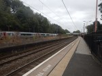
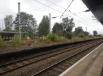
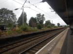
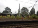
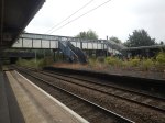
Managing Earthworks In A Changing Environment
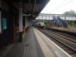
This image shows the train derailment at Shap at 06:10 on Monday.
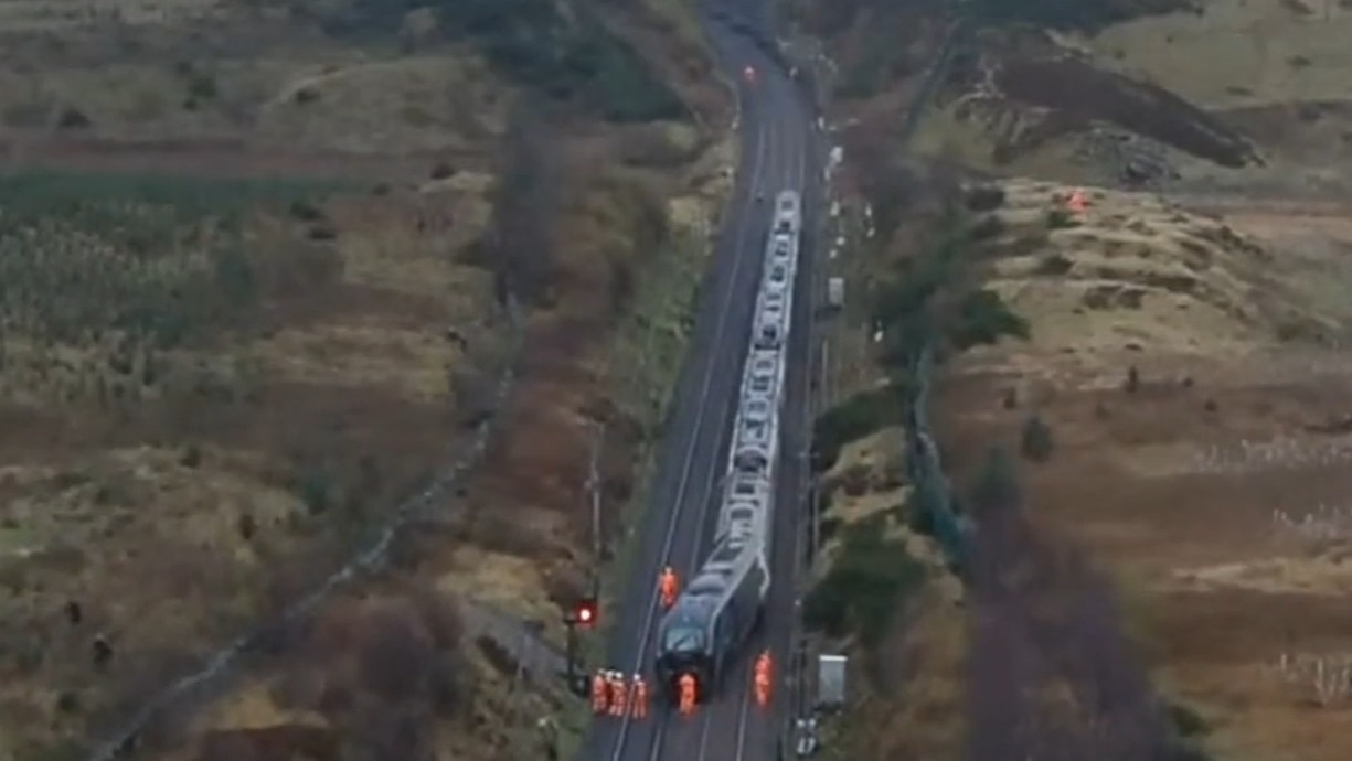
The BBC and others were talking about the cause of the derailment being a landslide.
So it was perhaps appropriate that the latest edition of Rail Engineer had a sponsorsed feature with a title of Managing Earthworks In A Changing Environment.
It is well-worth a full read.
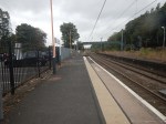
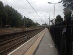
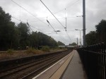
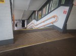
The New Clock At London Bridge Station
These pictures show the new clock at London Bridge station.


This story on the Network Rail web site, which is entitled A New Timepiece For The Railway, gives more details.
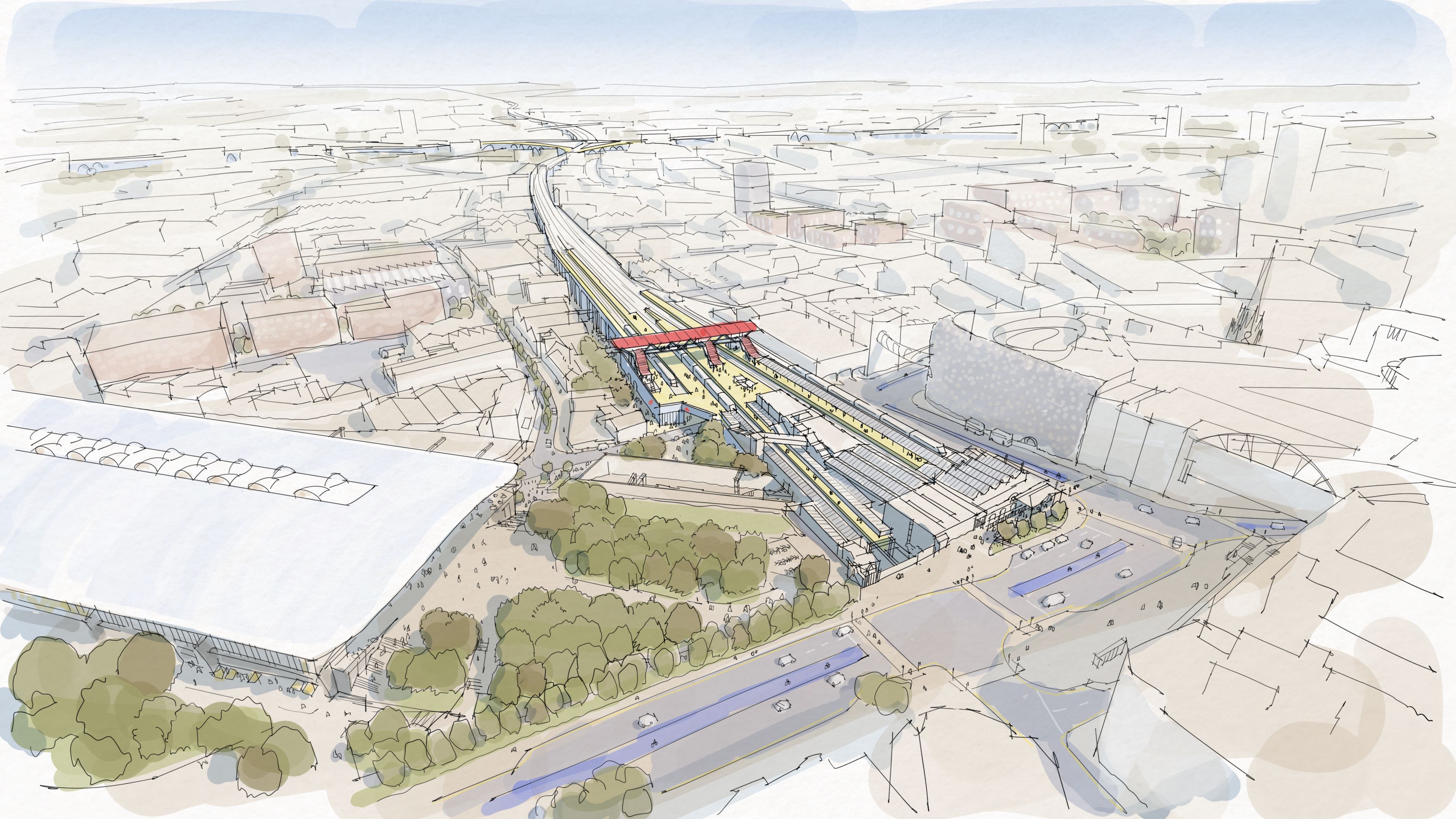
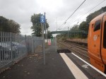
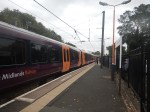
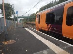
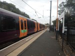
Midlands Rail Hub Looks To The Future With Preferred Alliance Partners
The title of this post, is the same as that of this press release from Network Rail.
The press release has a spectacular picture, which I’m showing here.
Note.
- High Speed Two’s Curzon Street station is on the left.
- Birmingham Moor Street station is in the centre.
- There appears to be parkland between the two stations.
- Is that the West Midlands Metro running across in front of Moor Street station?
This OpenRailwayMap shows the railway lines in the area.
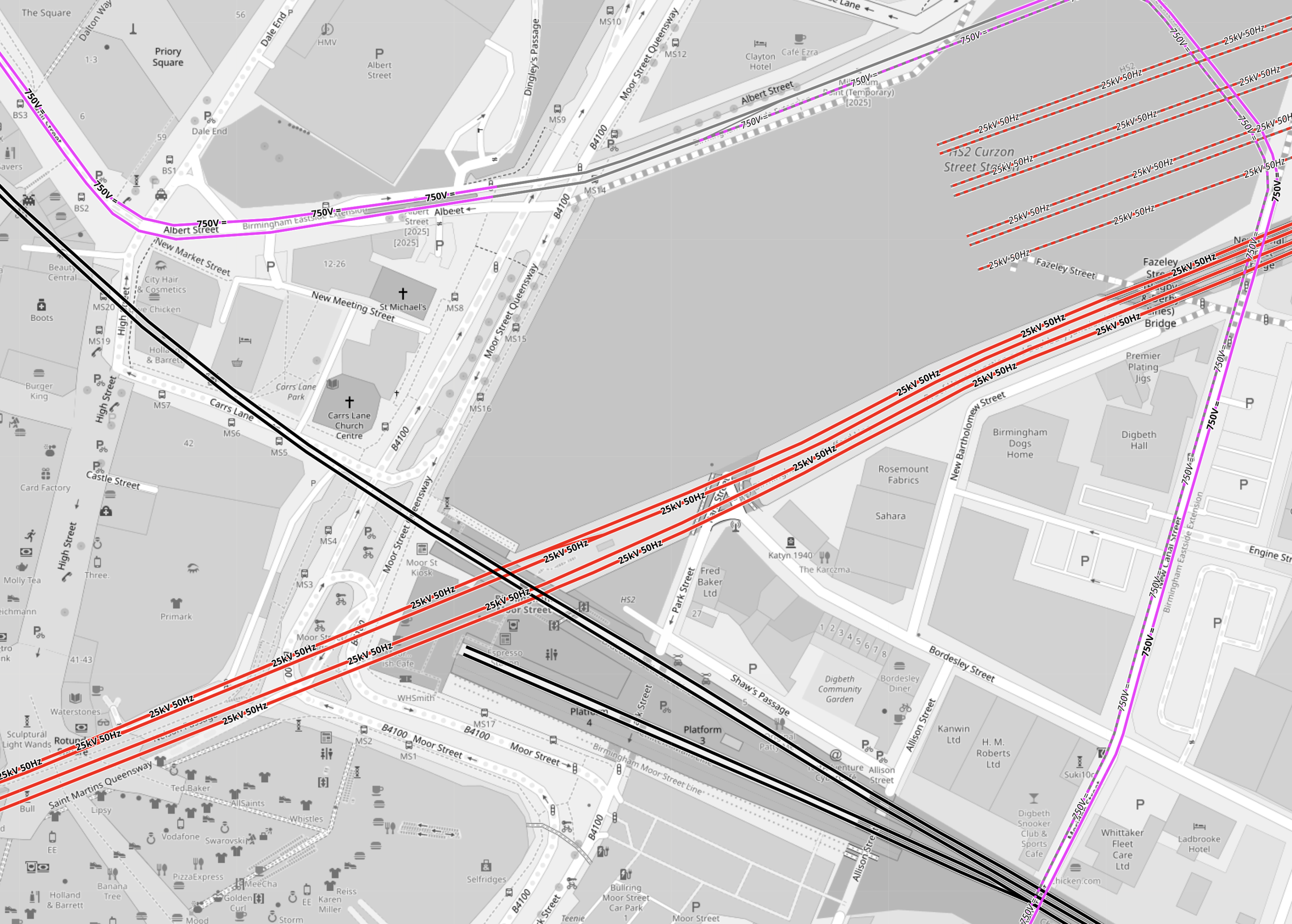
Note.
- Electrified tracks are shown in red.
- Tracks without electrification are shown in black.
- West Midlands Metro tracks are shown in mauve.
- The red tracks going diagonally across the map are the four electrified tracks going into Birmingham New Street station.
- Birmingham New Street station is off the map to the West.
- To the North of the tracks going into Birmingham New Street station, there are the seven platforms of High Speed Two’s Curzon Street station.
- The four platforms without electrification are shown South of the tracks into Birmingham New Street station.
- Two platforms at Birmingham Moor Street station are through platforms, that pass under Birmingham City Centre to Birmingham Snow Hill station.
- The other two platforms at Birmingham Moor Street station are bay platforms.
- The West Midlands Metro appears to take a loop around the stations.
But when you get into the words of the press release, there are a lot of vegetables and very little meat.
- The Midlands Rail Hub could cost around £1.75bn if delivered in full.
- The government’s recent spending review committed to progress the next stage of Midlands Rail Hub.
- Alongside this, planning is underway to begin to deliver two smaller but significant upgrades to benefit passengers as quickly as possible.
- The Alliance partners will be VolkerRail, Laing O’Rourke, AtkinsRéalis, Siemens Mobility, and Network Rail.
These four paragraphs indicate the work, that could be done.
The biggest change will be connecting the Chiltern main line, which runs into Moor Street, with the Camp Hill lines which run towards the South West and East Midlands via two new chords in Bordesley, near Birmingham city centre.
The transformation of the network will include running more train services on key routes through Birmingham and significantly improving connections for the millions of people who use the railway every day.
Work will be prioritised to explore how smaller, but vital, pieces of work which will provide passengers and communities with quicker benefits, including new journey options and more trains can be delivered as soon as possible.
They include reopening platform 4 at Snow Hill station so additional Chiltern Railways services can run directly between Birmingham’s business district and London Marylebone, and redeveloping Kings Norton station and the lines through it so extra Cross City trains can be added and new Midlands Rail Hub-enabled services can call there.
Three projects are specifically mentioned.
- The new chords in Bordesley.
- The reopening of platform 4 at Snow Hill station.
- The redeveloping of Kings Norton station.
I shall now look at each in detail.
The New Chords At Bordesley
This OpenRailwayMap shows the tracks going into and around Birmingham Moor Street station.
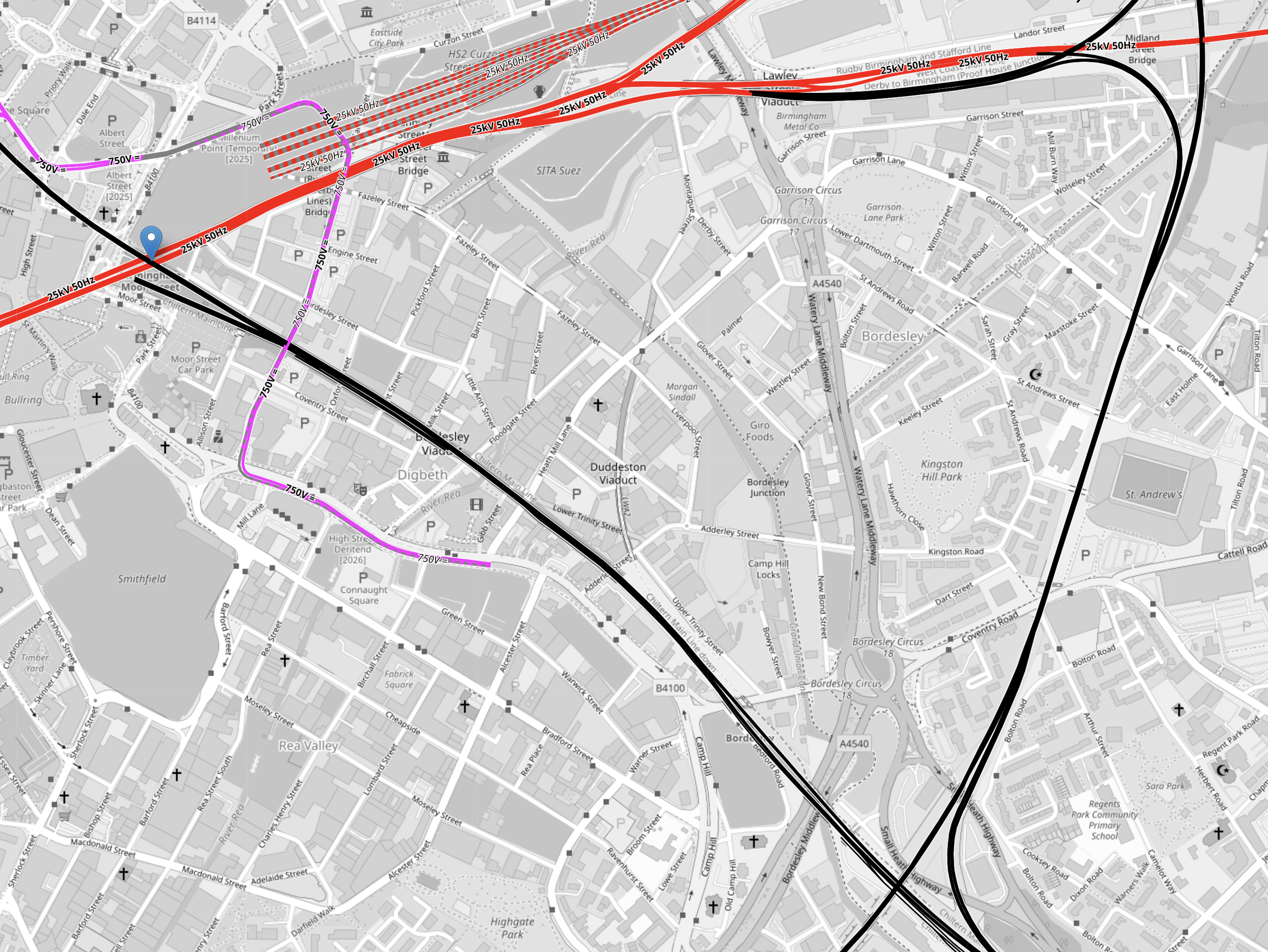
Note.
- Electrified tracks are shown in red.
- Tracks without electrification are shown in black.
- West Midlands Metro tracks are shown in mauve.
- The red tracks going diagonally across the map are the four electrified tracks going into Birmingham New Street station.
- Birmingham New Street station is off the map to the West.
- To the North of the tracks going into Birmingham New Street station, there are the seven platforms of High Speed Two’s Curzon Street station.
- The black track running NW-SE is the Chiltern Main Line between London Marylebone and Birmingham Moor Street stations.
- Birmingham Moor Street station is indicated by the blue arrow in the North-West corner of the map.
- The black track running NE-SW is the Camp Hill Line, that allows services to cross Birmingham.
Two new chords will be built where the Chiltern Main and the Camp Hill Lines cross, to allow services on the Camp Hill Line to call at Birmingham Moor Street station.
Consider.
- The press release described these chords as the biggest change.
- The chords will probably not be fully used, until the new stations are built on the Camp Hill Line.
- There may be need for extra platforms at Birmingham Moor Street station to accommodate any new services.
For these reasons, I suspect that these chords could well be the project that is pushed back to a later date.
The Reopening Of Platform 4 At Snow Hill Station
This OpenRailwayMap shows the track layout at Birmingham Snow Hill station.
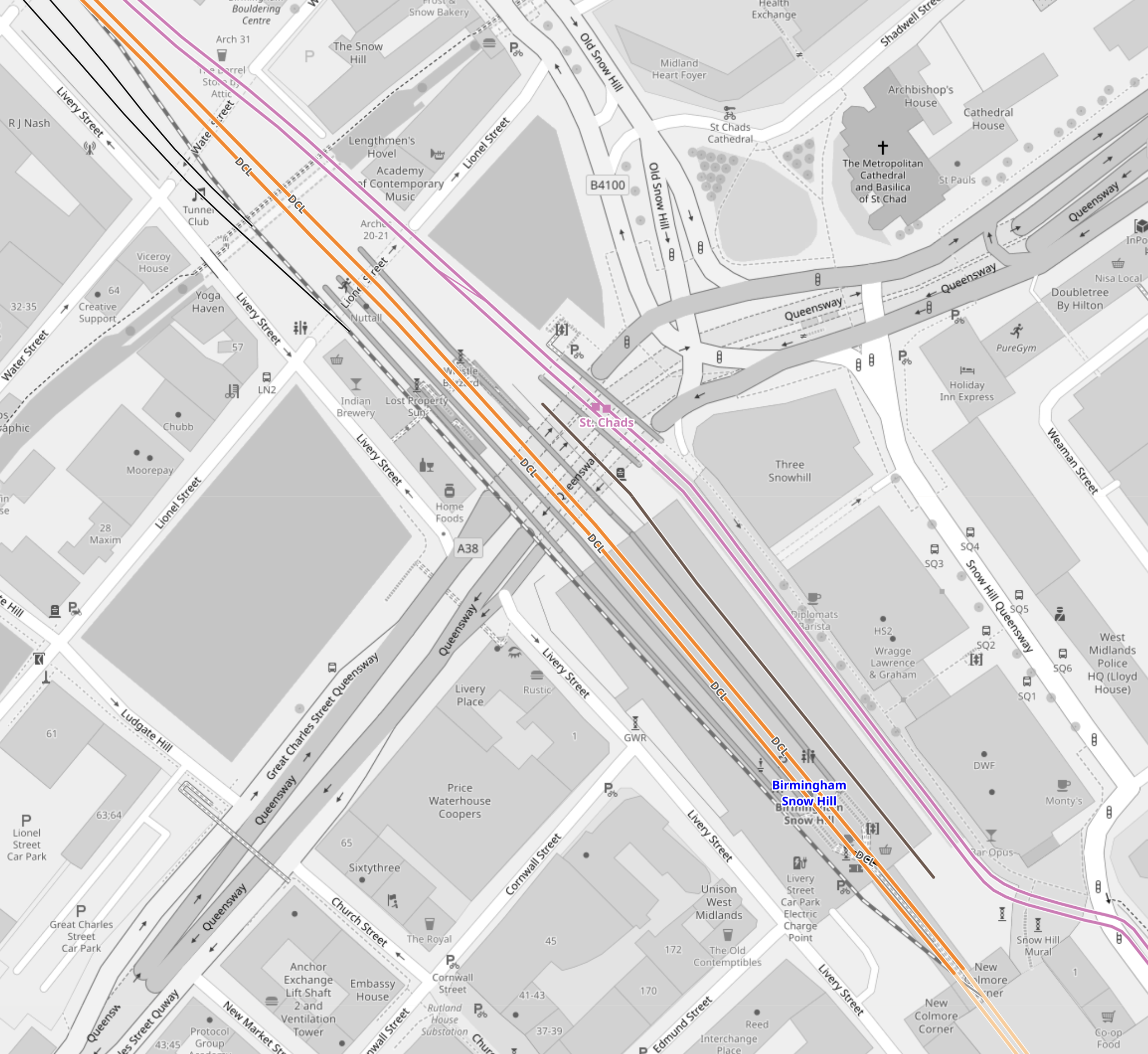
Note.
- The two lilac tracks are the West Midlands Metro.
- The two orange tracks are the two through tracks between Birmingham Moor Street and Stourbridge Junction stations.
- Platform 3 is the Southbound track to Birmingham Moor Street on the right.
- Platform 2 is the Northbound track to Stourbridge Junction on the left
- Platform 1 is a loop on left.
- Platforms 1, 2 and 3 are all bi-directional.
- The closed Platform 4 is on the right and is shown by the black track.
I would expect that this reopening could be fairly straightforward and may also have worthwhile benefits.
- Would an extra platform, allow all Chiltern services to serve both Birmingham Moor Street and Birmingham Show Hill stations?
- Chiltern would probably find it easy to extend services from Birmingham to the North-West of the city.
- In this century, services have run as far as Wrexham from Marylebone.
- If all Chiltern services terminated at Birmingham Show Hill station would this have operational and/or marketing advantages?
- If all Chiltern services terminated at Birmingham Show Hill station would this, make it easier for some passengers to get a train to London and the South?
- If all Chiltern services terminated at Birmingham Show Hill station would this release a platform at Birmingham Moor Street station for other services?
These are a few pictures of Birmingham Snow Hill station.


Platform 4 at Birmingham Snow Hill station could be a Build One Platform-Get One Free At Another Station situation!
The Redeveloping Of Kings Norton Station
This will probably be needed for running services on the Camp Hill Line, so why not get some of the work done early, so the rebuilding doesn’t effect existing services?
This OpenRailwayMap shows the Eastern end of Kings Norton station
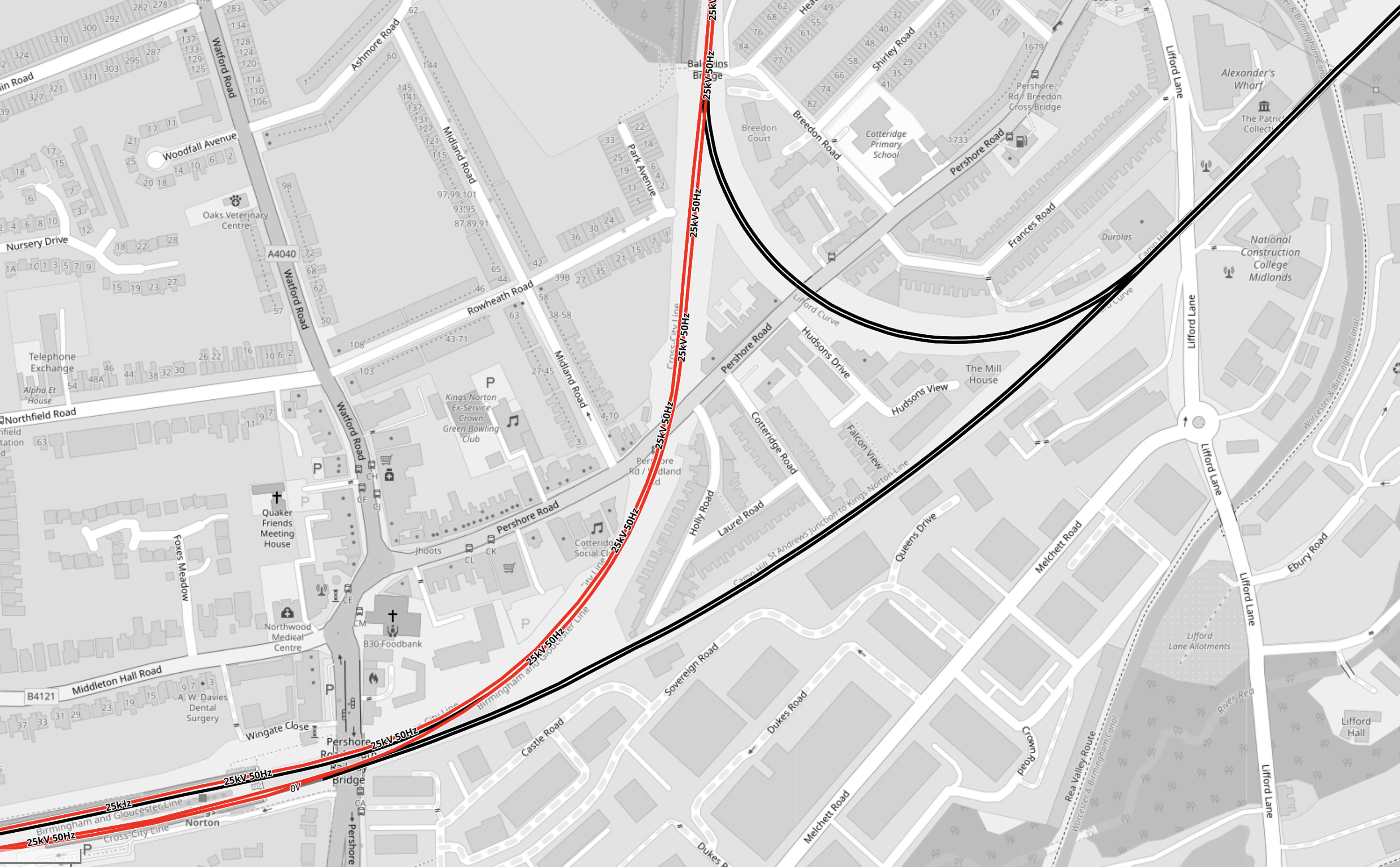
Note.
- Electrified tracks are shown in red.
- Tracks without electrification are shown in black.
- The station has four platforms, but some are unused.
- Two platforms are on an island, with a single platform on either side.
This OpenRailwayMap shows the Western end of Kings Norton station.
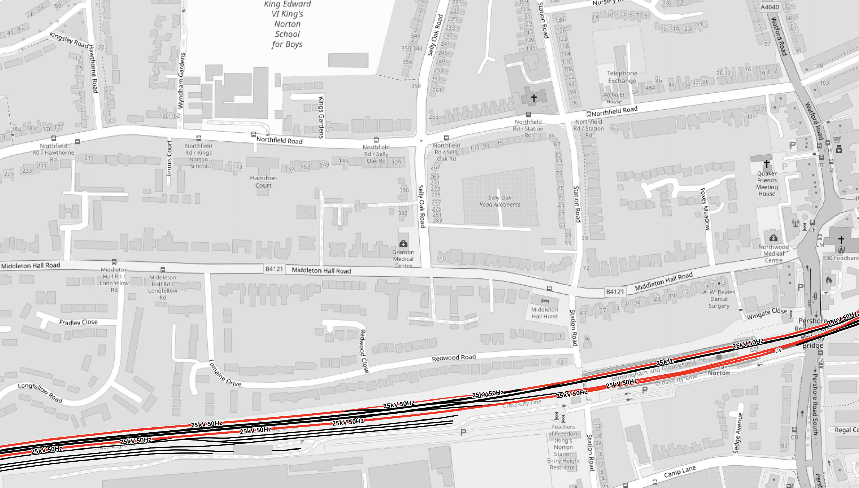
The notes to the previous map apply.
These two paragraphs from the Wikipedia entry for Kings Norton station, describe the station.
With the development of both bus and tram services, the need for such a large facility reduced from the 1930s onwards. The result is that today although all four platforms remain in place, only the outer two are in passenger use, with the middle island platforms now derelict.
Refurbished as part of the Cross-City line in 1978, it retained some of its original features following refurbishment, unlike the other ‘cross city line’ stations. The original station building survived, leased out for commercial purposes, until it was demolished in February 2006 for safety reasons. An extension car park provides a Park and Ride facility.
Disabled-access doesn’t seem to be the best either.
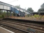
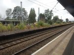
These pictures show the station.
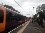

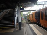
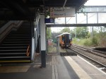
Note.
- As I guessed, there is no disabled-access.
- But there are Braille markings on the handrails down to the platforms.
- Two CrossCountry trains are seen going through the station.
- The local Class 730 trains, lights and information screens appeared to be new.
- Three platforms are electrified, but the fourth is not.
- The electrification structure could probably be used to electrify the fourth platform.
- Only the two outside platforms ; 1 and 4 are in use, with the central island platforms ; 2 and 3 left derelict.
- There is car parking and possibly space for more.
- The two active platforms are 150 metres long and the six-car Class 730 trainstrains appear to be 144 metres long.
- The Class 220 trains, that are run by CrossCountry Trains appear to be 93 metres long.
It was one of the scruffiest stations, that I’ve ever seen.
These are my thoughts on the station.
Handling The Camp Hill Line
Refurbishing Kings Norton Station
I don’t feel, that this will be the most horrendous of jobs, as it is very much a job, where all the rubbish and wild forest is removed and new platforms and a bridge are built.
South Eastern Railway Deploys IsoMat Thermal Technology To Keep Trains On The Tonbridge To Hastings Line Running In Hot Weather
The title of this post, is the same as that of this news item on the Network Rail web site.
This is the sub-heading.
A new type of technology is being trialled on the Tonbridge to Hastings railway line to help keep trains running in hotter weather, and more reliable journeys for passengers and freight customers.
These two paragraphs add more details.
The South Eastern Railway has partnered with UK green tech start-up Flint Engineering to combat excessive heat in railway signalling cabinets that can exceed 70°C, with a new patented system that requires no power, maintenance, or internal cabinet modifications, and can be installed in under an hour.
Flint’s innovative IsoMat technology delivers peak temperature reductions of over 21%, on the hottest days, transferring thermal energy thousands of times more efficiently than copper or aluminium alone.
This is one of those ideas, that could be filed under Too Good To Be True.
This picture shows the device in operation.
I can see this device having many uses, in the most surprising places.
Agreement To Eliminate Mobile Blackspots On Britain’s Lines
The title of this post, is the same as that of this article on Railway/PRO.
This is the sub-heading.
Network Rail and telecoms companies, Neos Networks and Freshwave signed an agreement named Project Reach to boost connectivity and remove mobile signal blackspots on the Britain’s rail network.
These first three paragraphs add more detail.
The ground-breaking public-private partnership delivers on the government’s Plan for Change mission to kickstart economic growth with ultra fast fibre optic cable across country’s busiest rail lines.
This is a multi-year project with the first installation of mobile infrastructure expected to begin in 2026 and fully rolled out by 2028.
The new deal will eliminate mobile signal blackspots in tunnels on key rail routes up and down the country, transforming daily journeys for millions of passengers who currently face the frustration of dropped calls and interrupted streaming on key routes between London, Manchester, Newcastle and Cardiff.
Note.
- Finance appears to be coming from both the public and private sector. Is this setting a dangerous precedent for Starmer and Rachel from Accounts.
- It is a £300 million project.
- In addition, a second project will tackle black-spots in 57 tunnels.
- Would the technology allow or improve other services on trains, where they could use mobile phone technology?
It is an ambitious and much-needed project, that could encourage many people to increase their use of rail transport.
Years ago, I built a new office on the farm, where I lived. The mobile coverage was bad in the new office, which was annoying. Someone suggested a piece of kit, that pointed at the nearest mobile phone mast and rebroadcast mobile signals, which solved the problem.
I suspect that Neos Networks and Freshwave can do the connection at 125 mph, that the solution, that I used, did without moving.
Conclusion
Sounds to me, that every train and rail line should have this technology installed.
Footage Released Of East West Rail’s First Commercial Freight Train
The title of this post, is the same as that of this news item from Network Rail.
These four paragraphs give detail to the story.
The inaugural journey was part of a dual first, as it also saw the entry into service of Maritime Transport’s Northampton Gateway Terminal.
This Easter Network Rail completed its work there to join the 35-acre freight facility directly to the West Coast Main Line via the Northampton Loop.
The modern junction design allows freight trains to enter and exit the site at speeds of up to 40mph, which is eight times faster than conventional freight connections.
Clearing the railway junction much faster will significantly improve both passenger and freight journeys – as it reduces the impact on other services running on the main line.
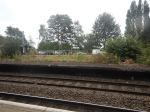
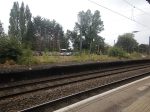
This OpenRailwayMap shows the location of Maritime Transport’s Northampton Gateway Terminal.
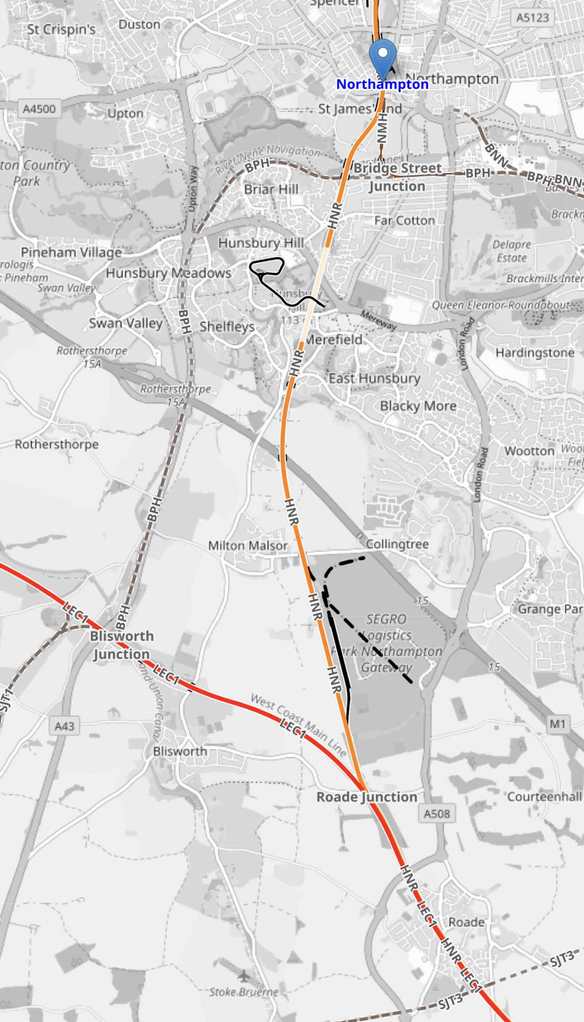
Note.
- The red track running diagonally across the bottom half of the map is the West Coast Main Line.
- The orange track running North-South is the Northampton Loop of the West Coast Main Line.
- The blue arrow indicates Northampton station.
- The grey line running diagonally across the map, vaguely parallel to the West Coast Main Line is the M1 Motorway.
- The SEGRO Logistics Park Northampton Gateway is indicated between the Northampton Loop and the M1 Motorway.
This Google Map shows the layout of the logistics park to a larger scale.

Note.
- The Northampton Loop of the West Coast Main Line running North-South across the map.
- The M1 Motorway running between the North-West and South-East corners of the map.
- Junction 15 is the M1 junction in the South-East corner of the map which connects the logistics park and the A45 to the M1.
- Junction 15A is the M1 junction in the North-West corner of the map which connects the A43 and Northampton services to the M1.
- There is probably space to add more warehouses and other facilities.
The logistics park is well connected to both rail and road.
This second Google Map shows the rail connection to the logistics park in more detail.
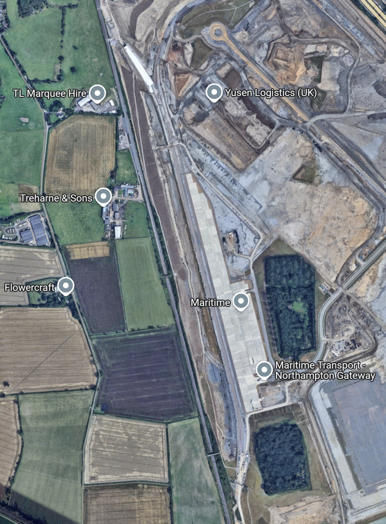
From this map, it appears that Network Rail have met their objective outlined in this paragraph of the news item.
The modern junction design allows freight trains to enter and exit the site at speeds of up to 40mph, which is eight times faster than conventional freight connections.
As only freight trains and slower passenger trains use the Northampton Loop, I would expect that freight trains should be able to enter and leave the logistics park with the minimum of disruption to traffic on the Northampton Loop.
The Route Of Yesterday’s Train
These three paragraphs from the Network Rail news item describe the route.
The first commercial freight train has travelled along the East West Rail line as part of its journey into a new strategic rail freight interchange in Northampton.
Shortly after 13:00 yesterday (Monday 16 June) the service* from Didcot came onto the new infrastructure at Oxford, travelling the 35 miles to Milton Keynes to connect with the West Coast Main Line.
It marked the first time East West Rail infrastructure has been used for commercial freight, after many months of signaller training and train driver learning since the £1.2bn railway was completed in October 2024.
This OpenRailwayMap shows the route from Didcot to Milton Keynes.
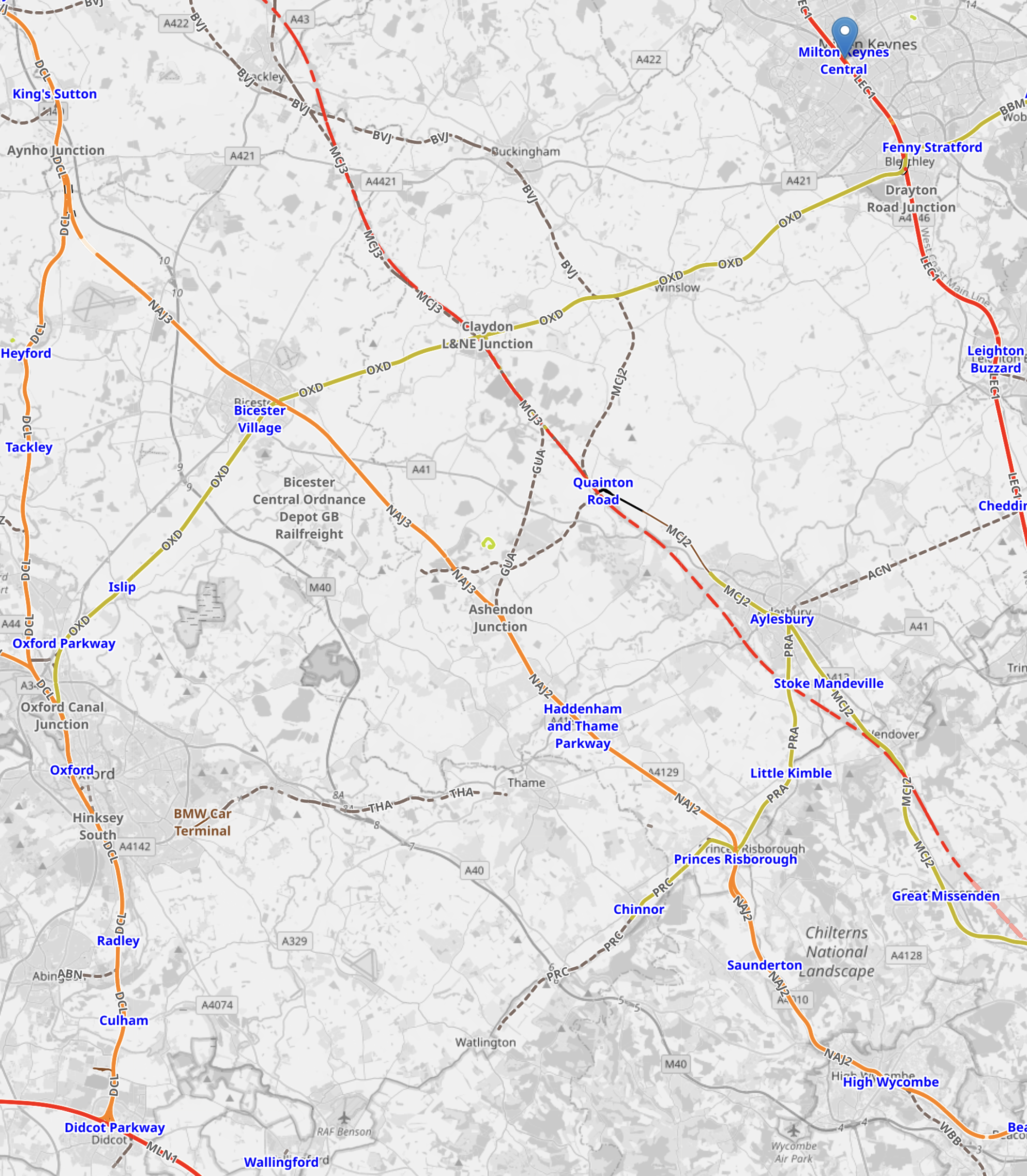
Note.
Didcot Parkway station is in the South-West corner of the map.
Milton Keynes Central is in the North-East corner of the map and marked with a blue error.
The route is via Oxford, Oxford Parkway, Bicester Village, Winslow and Bletchley.
This video shows the train passing Winslow.
£2.1bn North Wales Rail Overhaul Plans Unveiled
The title of this post is the same as this article on the BBC.
This is the sub-heading.
A £2.1bn plan to overhaul north Wales’ railway network has been unveiled by Welsh Transport Secretary Ken Skates, but with no funding commitment from the UK government so far.
These three introductory paragraphs add more detail.
The proposals include more services, the introduction of pay-as-you-go “tap in tap out” technology, electrification of lines and a Metro-style service linking Wrexham and Liverpool.
Promising the plans would mean “better stations and more trains”, Welsh ministers have committed an initial £13m, with substantial UK government cash needed to realise the proposals.
The UK government has been asked to comment.
Having lived in Liverpool for seven years, I can understand how this upgrade will benefit Wales and also bring the area closer to Liverpool and Merseyside, to the benefit of the wider region.
There is also this press release from the Welsh Government, which is entitled “METRO IS GO” with Network North Wales.
This press release says plans include.
- Commencing work on the line between Wrexham and Liverpool as the crucial first phase of delivering metro services direct between the two cities.
- Doubling train services between Wrexham and Chester next May.
- Bringing forward the introduction of 50% more services across the North Wales mainline from December 2026 to next May – resulting in a new service from Llandudno to Liverpool and extending the Manchester Airport service to Holyhead in place of Llandudno.
- Upon completion of rail line works at Padeswood, increase train services between Wrexham and Bidston to 2 trains per hour within the next three years, ahead of the introduction of 4 trains per hour that will run direct between Wrexham and Liverpool by 2035.
- The existing Borderlands Line will also be renamed the Wrexham – Liverpool line.
- Key stations on the Wrexham – Liverpool line will be improved in the next 12 months.
- Trains operating on the Wrexham – Liverpool line will be wrapped to reflect the communities and football clubs they serve.
- Introducing Pay as You Go tap in tap out technology – covering connections between Gobowen and Rhyl, and along the full length of the Wrexham -Liverpool line
- Working with Network Rail to determine the feasibility of a rapid delivery of a new test railway station at Deeside Industrial Park, to gauge demand for permanent services to the park.
- A new, multi-million pound electrification innovation fund to develop a plan to decarbonise the railway in North Wales and enable more frequent metro services and additional stations
- Match funding for step-free access at Shotton and Ruabon stations.
- Working with local authorities to develop plans for Gateway multi-modal interchanges at Holyhead, Bangor, Caernarfon and Wrexham.
- A new T13 bus service – connecting Rhyl, Ruthin, Denbigh and Wrexham.
- Examining options to re-open stations and build new stations to serve employment growth areas.
- A new bus network specifically designed to link communities with industrial estates in the Flintshire and Wrexham Investment Zone.
It all seems very comprehensive.
The Current Wrexham And Liverpool Route
This OpenRailwayMap shows the railways of North Wales between Chester, Flint and Wrexham Central.
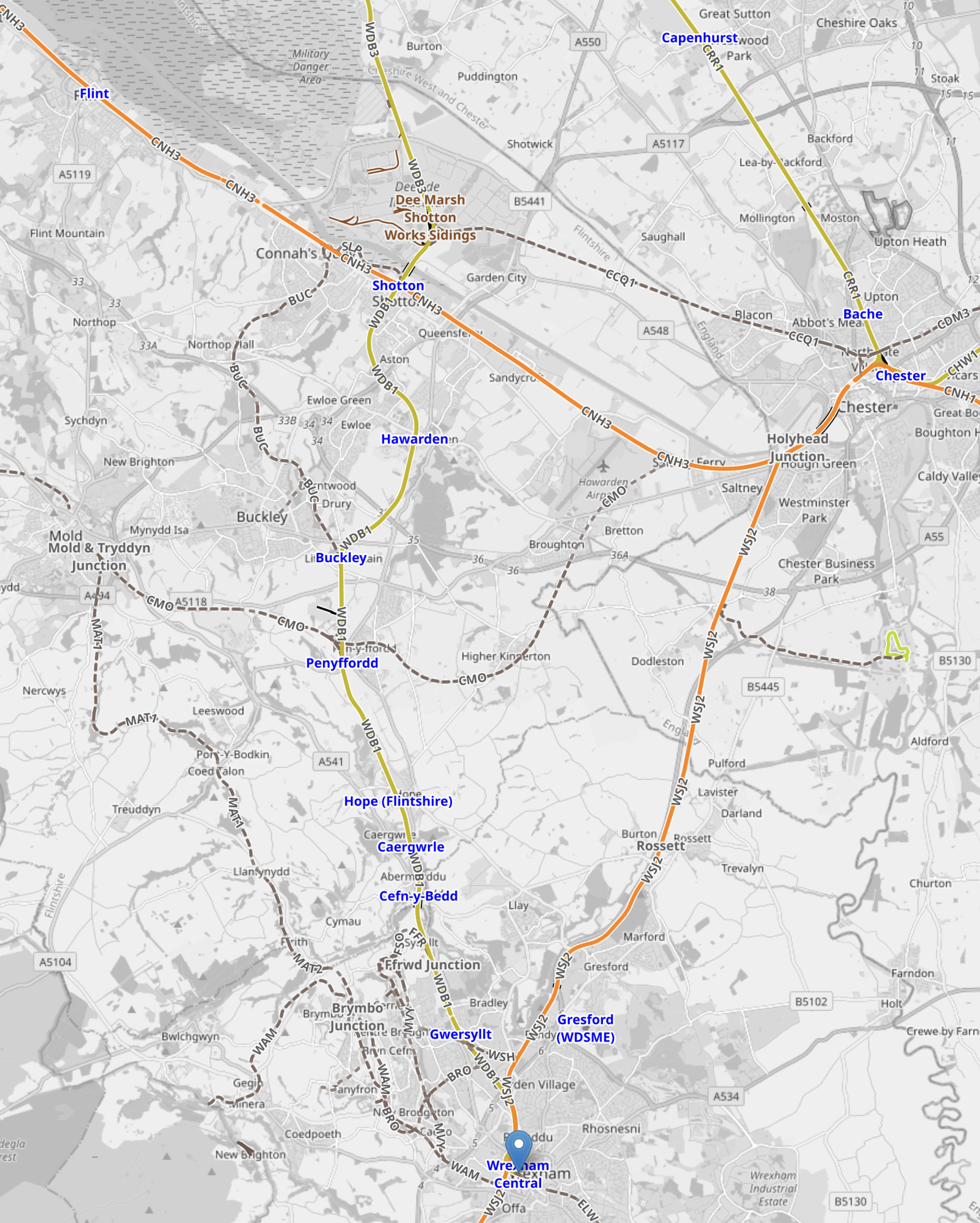
Note.
- Wrexham Central station is at the bottom of the map indicated by the blue arrow.
- Chester is in the North-East corner of the map, where three orange tracks meet.
- The orange track running East from Chester is the North Wales Coast Line to Crewe
- The orange track running West from Chester is the North Wales Coast Line to Shotton, Flint and then on to Llandudno, Bangor and Holyhead.
- The orange track running South from Chester goes to Wrexham.
- The yellow track running North from Chester is Merseyrail to Liverpool.
- Flint station is in the North-West corner of the map, with Shotton station between Chester and Flint stations.
- The yellow track running North from Wrexham Central station to Shotton station is the Borderlands Line to Bidston for Liverpool.
This second OpenRailwayMap shows the two Wrexham stations and the lines to Liverpool and Chester.
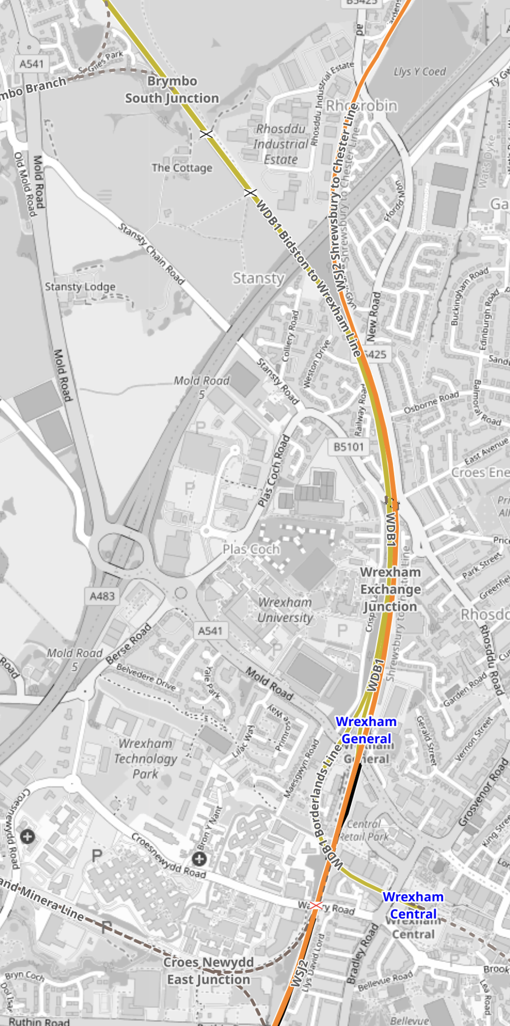
Note.
The orange track running North-South is the Chester and Shrewsbury Line, which runs through Wrexham General station.
The yellow track running North -West is the Borderlands Line to Shotton and Bidston for Liverpool.
Wrexham Central station is on an extension of the Borderlands Line.
This third OpenRailwayMap shows where the Borderlands Line crosses the River Dee on the Hawarden Bridge.
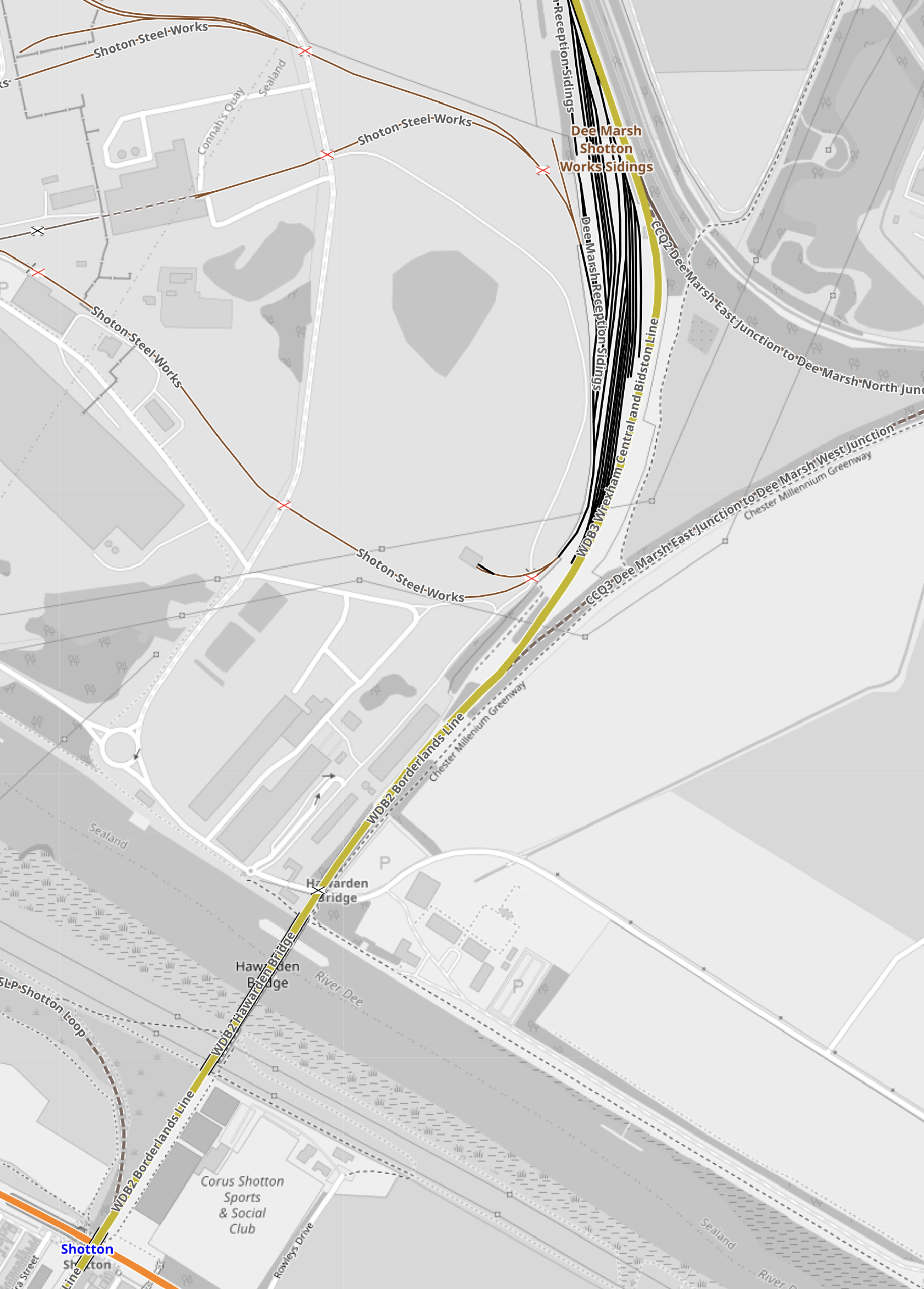
Note.
- Running across the South-West corner of the map is the River Dee.
- The orange track in the South-West corner of the map is the North Wales Coast Line between Chester and Holyhead.
- The yellow track is the Borderlands Line between Wrexham and Bidston for Liverpool.
- The Borderlands Line crosses the River Dee on the Hawarden Bridge.
- Shotton station is a poor interchange between the two lines.
- Hawarden Bridge station is North of the river.
This fourth OpenRailwayMap shows where the Borderlands Line joins Merseyrail’s Wirral Line at Bidston station.
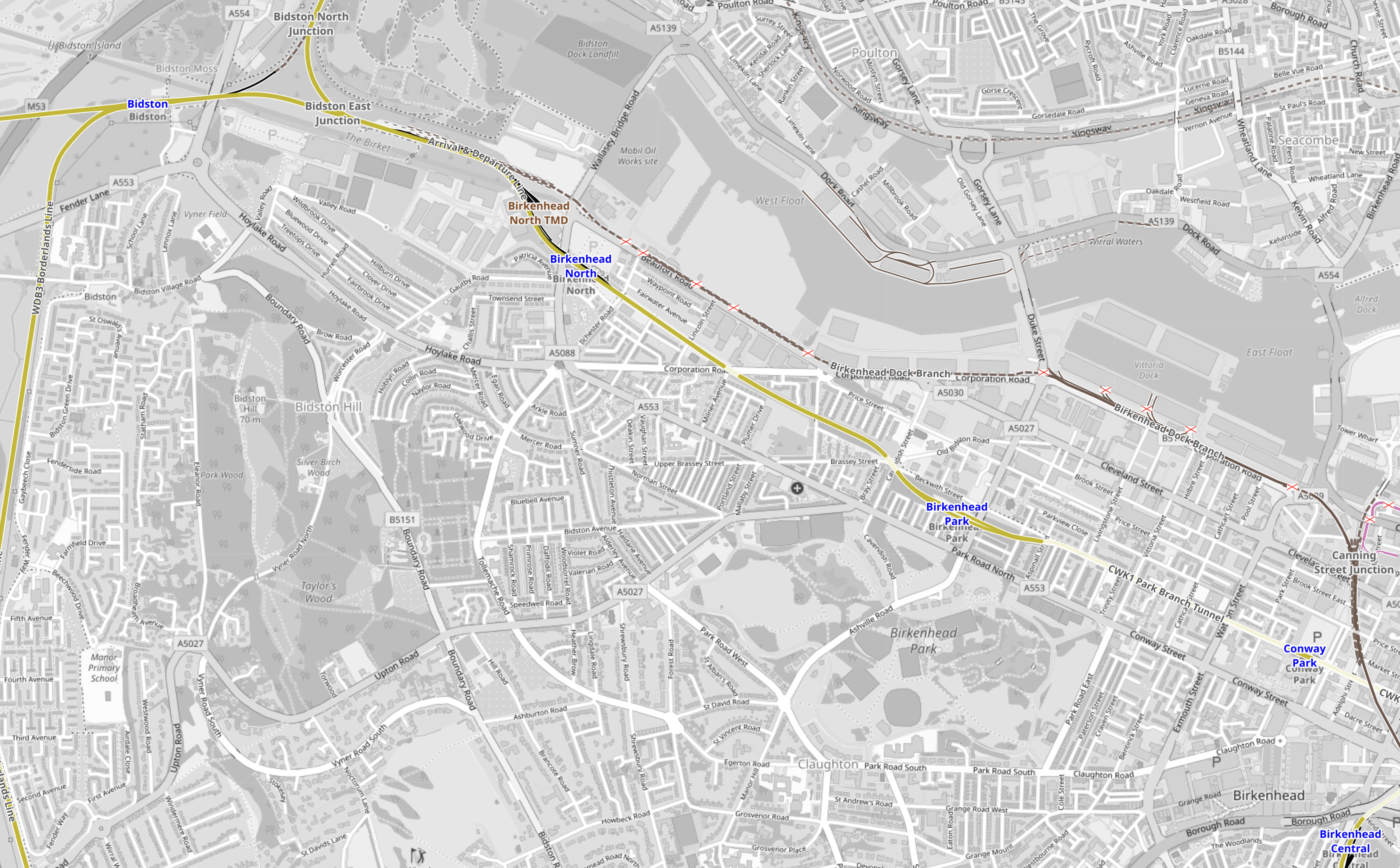
Note.
- Bidston station is in the vNorth-West corner of the map.
- The yellow track running West from Bidston station is Merseyrail to West Kirby.
- The yellow track running South from Bidston station is the Borderlands Line to Wrexham.
- The yellow track running North from the triangular junction to the East of Bidston station is Merseyrail to New Brighton.
- The yellow track running East from the triangular junction to the East of Bidston station is Merseyrail to Liverpool via Birkenhead North, Birkenhead Park, Conway Park and Hamilton Square stations.
- Birkenhead Central station is in the South-Eastern corner of the map and is on Merseyrail’s branches to Chester and Ellesmere Port stations.
Services from Chester, Ellesmere Port, New Brighton and West Kirby all combine at Hamilton Square to go round the stations under the centre of Liverpool; James Street, Moorfields, Lime Street, Central and James Street (again).
Wrexham And Liverpool Improvements
These plans concern the Borderlands Line or the Wrexham and Liverpool Line.
- Commencing work on the line between Wrexham and Liverpool as the crucial first phase of delivering metro services direct between the two cities.
- Upon completion of rail line works at Padeswood, increase train services between Wrexham and Bidston to 2 trains per hour within the next three years, ahead of the introduction of 4 trains per hour that will run direct between Wrexham and Liverpool by 2035.
- The existing Borderlands Line will also be renamed the Wrexham – Liverpool line.
- Key stations on the Wrexham – Liverpool line will be improved in the next 12 months.
- Trains operating on the Wrexham – Liverpool line will be wrapped to reflect the communities and football clubs they serve.
- Introducing Pay as You Go tap in tap out technology – covering connections between Gobowen and Rhyl, and along the full length of the Wrexham -Liverpool line
- Working with Network Rail to determine the feasibility of a rapid delivery of a new test railway station at Deeside Industrial Park, to gauge demand for permanent services to the park.
- A new, multi-million pound electrification innovation fund to develop a plan to decarbonise the railway in North Wales and enable more frequent metro services and additional stations
- Match funding for step-free access at Shotton and Ruabon stations.
- Examining options to re-open stations and build new stations to serve employment growth areas.
There looks a lot to do, but none of the actions would appear to be that large and expensive.
Running Class 777 Trains Between Wrexham Central Station And Liverpool City Centre
Consider.
- There is no way, that the Office of Road and Rail will allow any more third rail electrification.
- Class 777 trains could be fitted with pantographs, if the trains need to be charged on the tracks past Bidston station.
- Siemens Mobility have developed a Rail Charging Converter, that I wrote about in Technology Behind Siemens Mobility’s British Battery Trains Hits The Tracks.
- I suspect Stadler have some similar technology for the Class 777 trains.
- Wrexham Central station is a single platform station.
- Bidston and Wrexham Central stations are 27.5 miles apart or a 55 mile round trip.
- In New Merseyrail Train Runs 135km On Battery, I describe how a Class 777 train ran for over eighty miles on battery power.
In Liverpool City Centre, trains would join services from Chester, Ellesmere Port, New Brighton and West Kirby and go round a loop through James Street, Moorfields, Liverpool Lime Street, Liverpool Central and James Street.
This Google Map shows Wrexham Central station.
Note.
- The single track, with the platform alongside.
- There would be plenty of space on the North side of the track to put up a short length of overead wire to charge the trains.
- The station appears to be surrounded by a shopping centre.
One platform should be able to handle four trains per hour (tph)
This second Google Map shows Bidston station.
Note.
- Bidston station is indicated by the station symbol.
- Merseyrail’s line between West Kirby and Liverpool runs through the station.
- Trains to Liverpool take the Eastern point of the triangular junction.
- Trains to New Brighton take the Northern point of the triangular junction.
- Trains to West Kirby and Wrexham take the Westerly lines, from Bidston station.
Work will probably need to be done at the junction, where the West Kirby and Wrexham line split.
I discuss the work at Padeswood in Train Frequency Focus In North Wales Transport Commission’s Interim Recommendations.
It doesn’t seem to me, that to be able to run 2 or even 4 tph between Wrexham Central and Liverpool, is going to need a large budget. Although, a few extra Class 777 trains, with a battery-electric capability, will be needed.
But this corner of Wales will have one of the world’s first battery-electric international trains.
New And Improved Services And Stations
These plans concern new and improved services and stations on the Borderlands Line or the Wrexham and Liverpool Line.
- The existing Borderlands Line will also be renamed the Wrexham – Liverpool line.
- Key stations on the Wrexham – Liverpool line will be improved in the next 12 months.
- Trains operating on the Wrexham – Liverpool line will be wrapped to reflect the communities and football clubs they serve.
- Introducing Pay as You Go tap in tap out technology – covering connections between Gobowen and Rhyl, and along the full length of the Wrexham -Liverpool line
- Match funding for step-free access at Shotton station.
- Examining options to re-open stations and build new stations to serve employment growth areas.
Deeside Industrial Park Station
This is planned for Deeside Industrial Park station.
Working with Network Rail to determine the feasibility of a rapid delivery of a new test railway station at Deeside Industrial Park, to gauge demand for permanent services to the park.
This Google Map shows Deeside Industrial Park
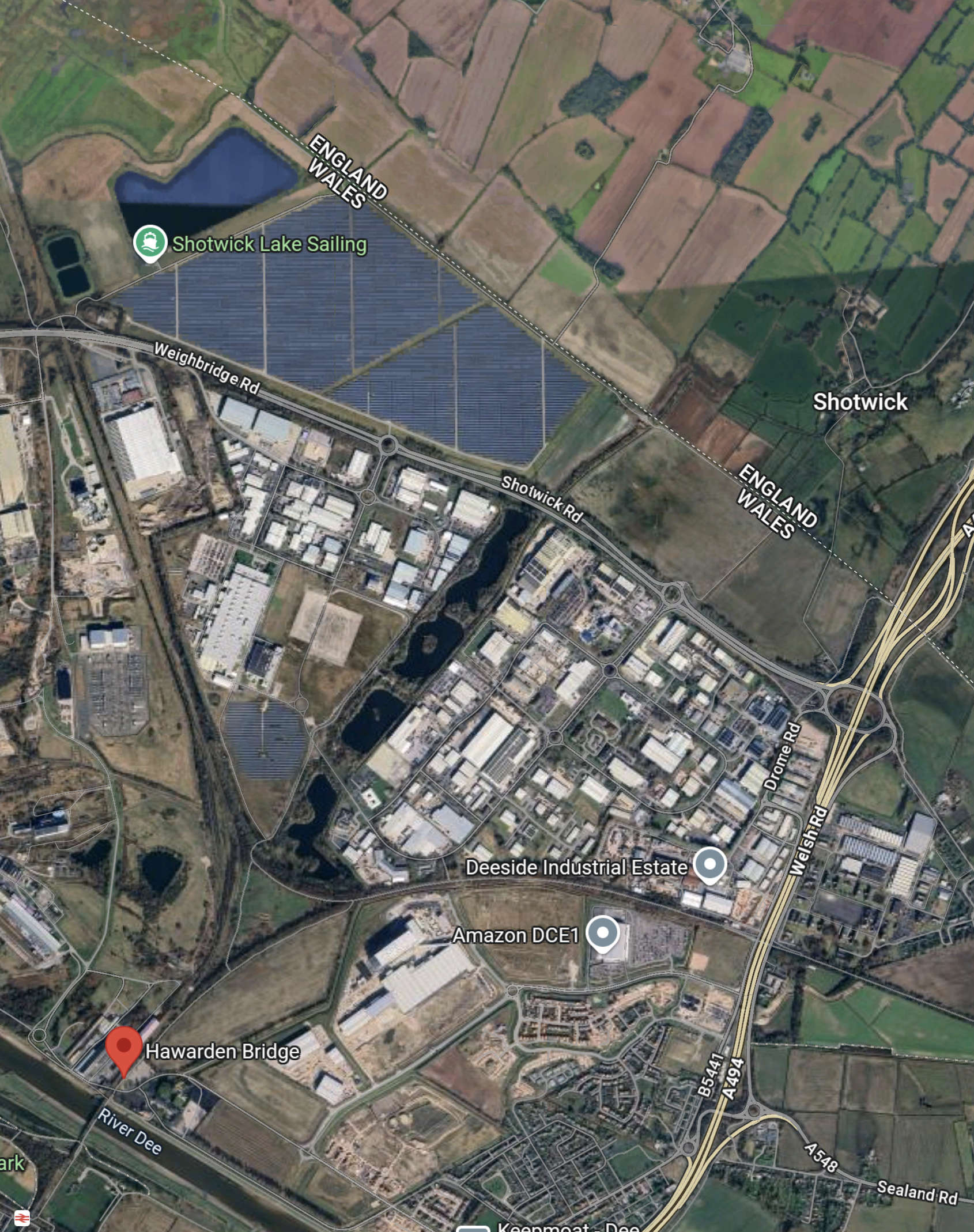
Note.
Shotton station is in the South West corner of the map.
Hawarden Bridge station is indicated by the red arrow.
The double-track Borderlands Line runs between the two stations and then Northwards between the warehouses and factories of the estate.
This second Google Map shows the area to the North of the two stations in greater detail.
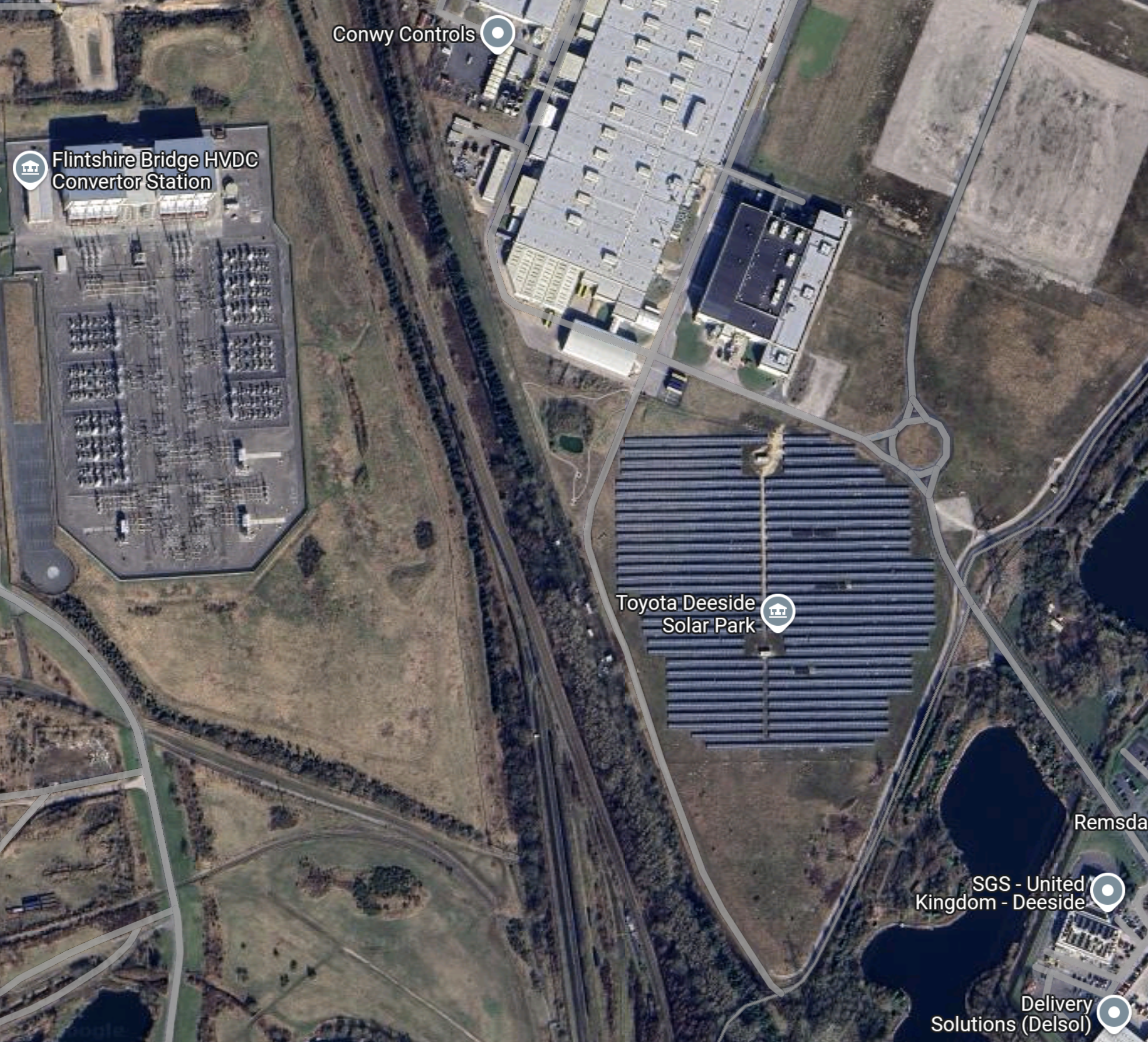
Note.
- Flintshire Bridge Converter Station is the Southern end of the 2.2 GW Western HVDC Link from Scotland.
- Toyota’s Deeside Solar Park.
- The Borderland’s Line running between the substation and the solar park.
It does appear there could be plenty of space for a station.
Network Rail on Merseyside certainly have access to to a temporary station, as these pictures show of one’s use at Liverpool South Parkway station, which I wrote about in Liverpool South Parkway Station Stands In For Lime Street.


Note.
- It was mainly built of scaffolding.
- It was long enough for an eleven-car Class 390 train.
It could certainly be rearranged to make a temporary two-platform station.
But why a temporary station?
- It may turn out, that Bidston and Wrexham Central is too long for battery-electric trains.
- But Deeside Industrial Park station would be about half-way, so an ideal place for a pit-stop.
- It’s also got plenty of electricity.
- Toyota might also want to see how it helps the operation of their engine plant.
Network Rail might want to try out the idea of building a temporary station elsewhere in the future.
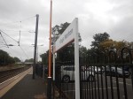
The Lack Of Information At Edinburgh Waverley Cost Me £55.10
The ongoing works at Edinburgh Waverley ruined my day. I had intended to come up to the city to take some photographs for this blog and see an old friend, who like me is widowed.
I also wanted to take a train to Leven to see the new stations.
I have a very unusual skin and on some days I can’t use ticket machines, so I need to use a human in a ticket office.
Today was one of those days and to complicate matters, I couldn’t find the ticket office.
I also wasted more time finding platform 17 for Leven.
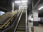
Going back to London, where I live, my friend advised me to take the escalators from Princes Street to get into the station, which I have used many times before.
But they were shut and I missed the 16:13 Lumo to London by about a minute.
To get home, I had to buy another ticket on LNER for £55.10.
If there had been more information, perhaps in leaflets or from real people around the station, I would have had a much better day.
