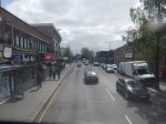
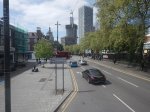
The Proposed Lionel Road Station On the West London Orbital Railway
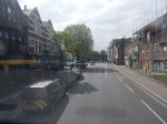
Starting with Lionel Road station may seem a strange place to start, but this important station for supporters of Brentford FC, may in the end define how the new line is designed and built.
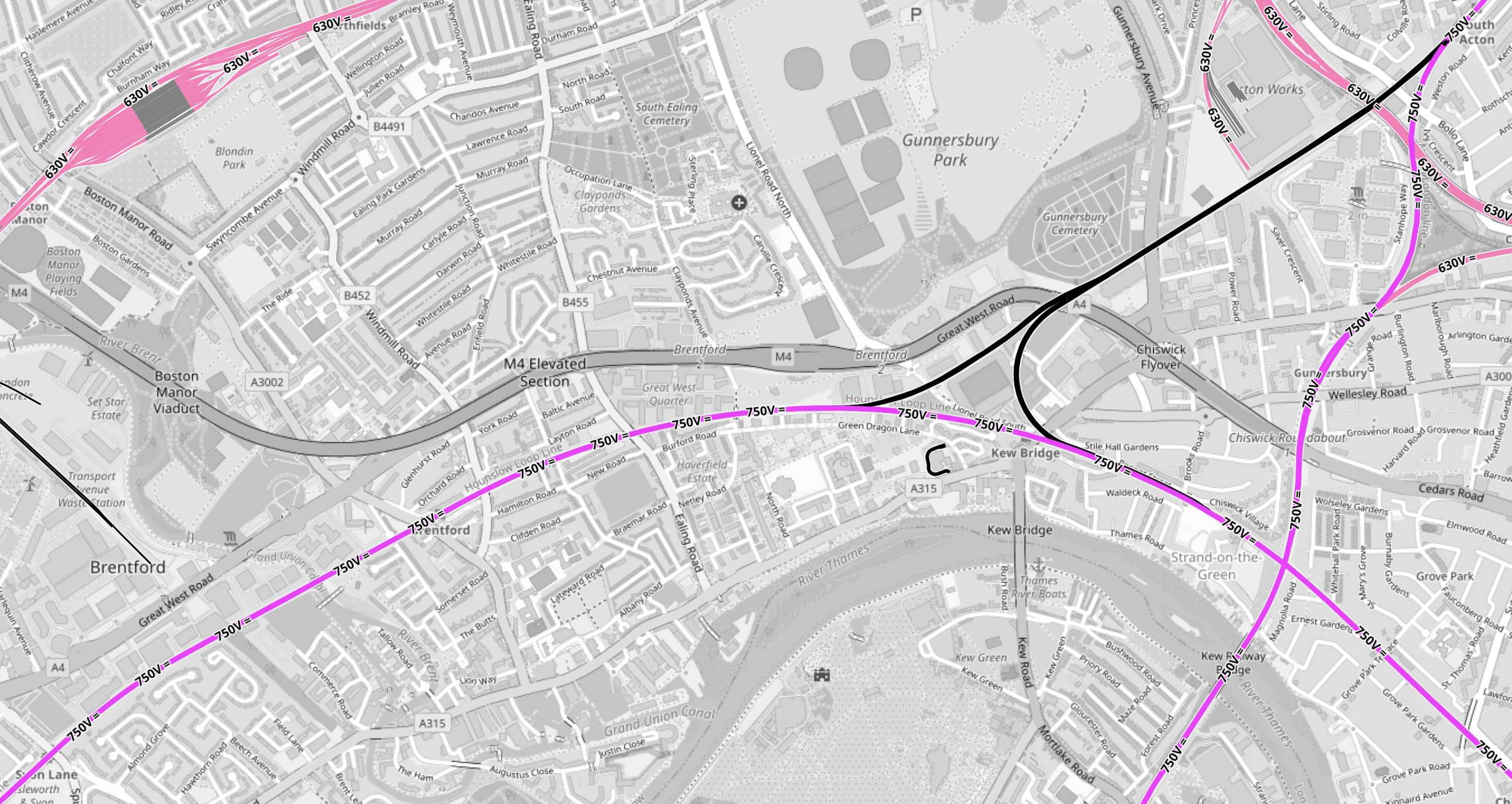
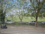
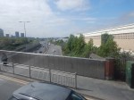
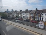
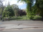
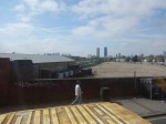
This OpenRailwayMap shows the tracks around the stadium, that has been built for the Premier League football club, which is now called the Gtech Community Stadium.
Note.
- In the North-West corner of the map is the Piccadilly Line branch to Heathrow Airport.
- Northfields Depot is prominent, with the station of the same name to its East.
- South Acton station is in the North-East corner of the map.
- Syon Lane station is in the South-West corner of the map.
- The West London Orbital Railway runs between these two stations.
- Lilac sections are electrified and black sections have none.
- South Acton station is also on the North London Line, which runs North-South to Richmond station off the bottom of the map.
- Syon Lane Station is also on the Hounslow Loop Line, which curves across the bottom half of the map to the South-East corner.
- Click the map to show it to a larger scale.
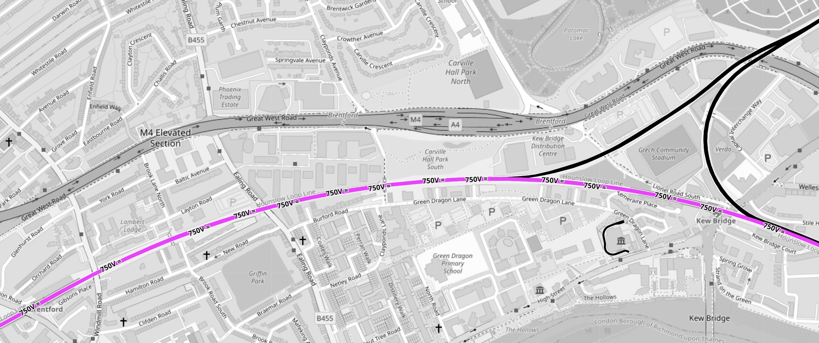
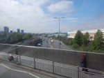
This second OpenRailwayMap shows triangular junction in the middle of the first map to a larger scale.
Note.
- The Gtech Community Stadium sits in the middle of the triangular junction.
- Provision has been made in the layout of the stadium for the station to be on the North-West leg of the triangular junction.
- Kew East Junction is in the North-East corner of the map.
- Old Kew Junction is in the South-West corner of the triangular junction.
- New Kew Junction is in the South-East corner of the triangular junction.
- The lilac track crossing the map is the electrified Hounslow Loop Line.
- The M4/A4 runs across the map
- Only the Southern leg of the triangular junction is electrified.
- Click the map to show it to a larger scale.
These are some of my thoughts.
Lionel Road Station Will Be Unlikely To Be Electrified
Consider
- It will be extremely unlikely that between South Acton station and Old Kew junction will be electrified with third-rail electrification because of safety issues.
- There is a very long chance, that it might be decided to create a 25 KVAC overhead electrified route across London, by means of the North London Line.
- I believe hydrogen trains will be developed for freight services.
- The station will have large numbers of passengers on match-days, so safety may determine an electrification-free station.
- The electrification gap is only 1.4 miles, which is well within range of a battery-electric train.
I think it is more likely that hybrid trains will use what is available.
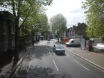
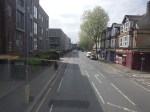
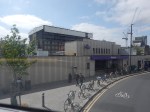
Will Lionel Road Station Be Step-Free?
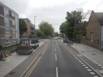
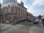
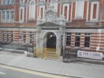
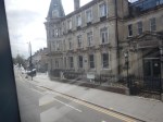
Sixty years ago, I used Manchester United station to see a match.
This Google Map shows the station.
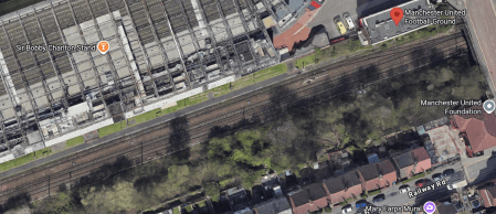
Note.
- The station is a single platform tucked in behind the South stand.
- The station entrance is indicated by a red arrow.
- When I went in the 1960s, the train was a steam-hauled shuttle from the city centre.
- This Wikipedia entry gives more details.
I suspect a similar space-saving design could be used at Lionel Road station.
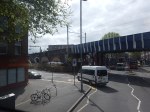
There will be a need for a bridge if the station is used on more than match days.
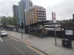
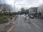
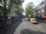
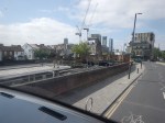
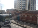
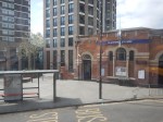
Will Lionel Road And Kew Bridge Stations Be An Out Of Station Interchange?
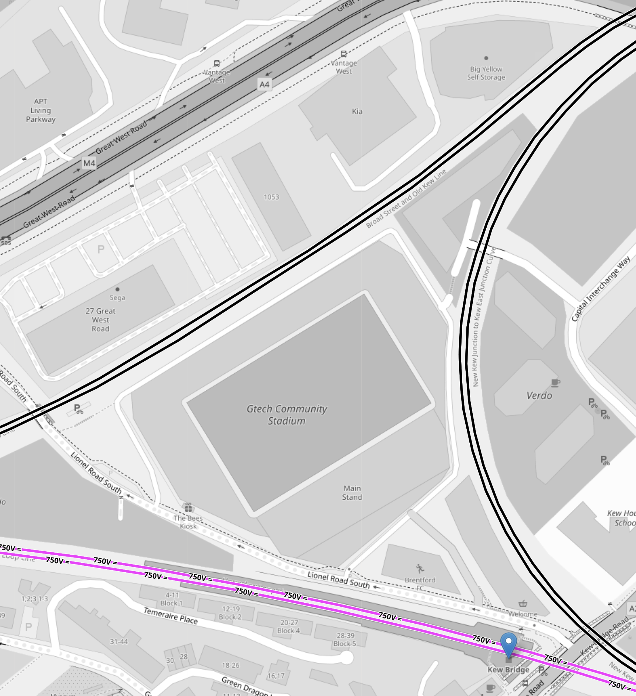
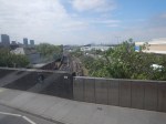
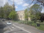
This OpenRailwayMap shows the triangular junction, with the GTech Community Stadium in the middle.
Note.
- Lionel Road station will be on the North-West side of the station.
- Kew Bridge station is marked by a blue arrow.
- There appear to be walking routes all over the plot on which the stadium sits.
- All sides of the junction are double track.
I think an Out-Of-Station Interchange would be useful, especially for those who don’t know the area.
How Easy Will It Be To Get To Lionel Road Station From Major London Stations?
These are my best estimates at a degree of difficulty.
- Bank – 1 Change – Take Central Line with a change at Old Oak Common Lane to Lionel Road.
- Blackfriars – 1 Change – Take Thameslink with a change at Brent Cross West to Lionel Road.
- Bond Street- 1 Change – Take Elizabeth Line with a change at Old Oak Common Lane to Lionel Road.
- Cannon Street – 2 Changes – Get out at London Bridge – Take Thameslink with a change at Brent Cross West to Lionel Road.
- Charing Cross – 1 Change – Take Bakerloo Line with a change at Harlesden to Lionel Road.
- City Thameslink – 1 Change – Take Thameslink with a change at Brent Cross West to Lionel Road.
- Euston – 1 Change – Take Watford DC Line with a change at Harlesden to Lionel Road.
- Farringdon – 1 Change – Take Thameslink with a change at Brent Cross West to Lionel Road.
- King’s Cross – 1 Change – Take Thameslink with a change at Brent Cross West to Lionel Road.
- Liverpool Street – 2 Changes – Get out at Stratford – Take the Overground with a change at South Acton to Lionel Road.
- Liverpool Street – 1 Change – Take Elizabeth Line with a change at Old Oak Common Lane to Lionel Road.
- London Bridge – 1 Change – Take Thameslink with a change at Brent Cross West to Lionel Road.
- Marylebone – 1 Change – Take Bakerloo Line with a change at Harlesden to Lionel Road.
- Moorgate – 1 Change – Take Elizabeth Line with a change at Old Oak Common Lane to Lionel Road.
- Old Street – 2 Changes – Go to Moorgate – Take Elizabeth Line with a change at Old Oak Common Lane to Lionel Road.
- Oxford Circus – 1 Change – Take Bakerloo Line with a change at Harlesden to Lionel Road.
- Paddington – 1 Change – Take Elizabeth Line with a change at Old Oak Common Lane to Lionel Road.
- Piccadilly Circus – 1 Change – Take Bakerloo Line with a change at Harlesden to Lionel Road.
- St. Pancras – 1 Change – Take Thameslink with a change at Brent Cross West to Lionel Road.
- St. Paul’s – 1 Change – Take Central Line with a change at Old Oak Common Lane to Lionel Road.
- Tottenham Court Road – 1 Change – Take Elizabeth Line with a change at Old Oak Common Lane to Lionel Road.
- Vauxhall – 2 Changes – Go to Oxford Circus – Take Bakerloo Line with a change at Harlesden to Lionel Road.
- Victoria – 2 Changes – Go to Oxford Circus – Take Bakerloo Line with a change at Harlesden to Lionel Road.
- Waterloo – Direct – Direct train to Kew Bridge.
- Waterloo – 1 Change – Take Bakerloo Line with a change at Harlesden to Lionel Road
Note.
- It does appear that the connections in stations like Brent Cross West, Harlesden and Old Oak Common Lane, will make a lot of difficult cross-London journeys easier.
- But not many journeys to the GTech Community Stadium, finish at Kew Bridge station.
- Most journeys pick up the West London Orbital at Brent Cross West, Harlesden or Old Oak Common Lane, which probably means these three stations should be step-free.
- As I’ve been writing this, I do wonder if now is the time to create a pedestrian connection between City Thameslink and St. Paul’s stations, that I wrote about in A Pedestrian Connection Between City Thameslink Station And St. Paul’s Tube Station.
I do believe though that there are places on the Central Line, where small projects can give a high return on expenditure.
Conclusion
Surprisingly, this is a lot more than just a station for a Premier League football club.
Unlocking Euston Station
I dread using Euston station.
The connections to the London Underground in the station, involve a long walk to or from your train and then outside the station to.
- The Northern and Victoria Lines just outside the station.
- The sub-surface lines at Euston Square station, which is a long walk.
There is no connection to the Lizzie Line.
I have probably written more project management software, than any other individual in the world.
Good project managers and probably a few bad ones too, talk about getting all your ducks in a row or doing everything in the right order.
If High Speed Two is going to terminate at Euston, then the first sub-project must be to connect Euston station properly to the Metropolitan, Circle and Hammersmith & City or sub-surface lines of the Underground, which have new spacious air-conditioned trains and run on a line that is digitally signally, so the capacity can be easily increased.
The sub-surface lines also link, the National Rail stations of Liverpool Street, Moorgate, Farringdon, King’s Cross, St. Pancras, Euston, Paddington, Victoria, Charing Cross and Blackfriars, and could be connected to Fenchurch Street and Marylebone. It also has links to the Lizzie Line.
Improve the interchanges and this marvelous Victorian system could unlock London’s transport system like no other.
Five years ago, a similar arrangement to that at St. Pancras was proposed with subways under Euston Road that linked to extended platforms at Euston Square Underground station, by means of lifts and escalators.
Why has this new link between National Rail at Euston and sub-surface Underground not been built? I estimate that it would have taken a couple of years and have fitted in with all the work being done in front of Euston station.
The current Mayor never mentions the project, but then it is a North London project, so it doesn’t interest him and his supporters.
The Design Of The Updated Euston Underground Station
Ian showed this visualisation of the updated Euston Underground station.
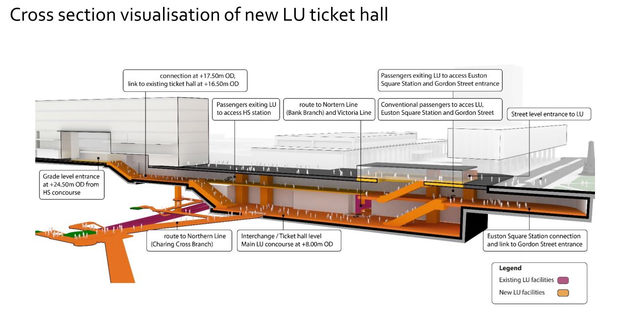
At a first look, it appears to be a very similar concept to the entrance to the Underground in front of St. Pancras station.
Click on the image to show it large and you can pick out the following.
- West is to the left and East is right.
- Much of the construction appears to replace the original car park and taxi rank.
- The upper level looks like where passengers enter and leave the station.
- The subway to Euston Square station and the new Gordon Street entrance joins to the upper level towards the Eastern end.
- There is grade access between the upper level and the High Speed Two concourse.
- There are lots of escalators to travel between levels. The square orange columns could be lift towers.
- The lower level is the Interchange/Ticket Hall level.
- The lower level is not much higher than the Charing Cross branch of the Northern Line.
- The design seems to make clever use of levels to make changing easier.
- The access between the lower level and the Charing Cross branch of the Northern Line at the Western end of the station, appears to be comprehensive and step-free.
- The access between the lower level and the Victoria Line and the Bank branch of the Northern Line, appears to use the current route, which will probably be upgraded to be fully step-free.
This second image shows the design from above the platforms of the conventional section of Euston station.
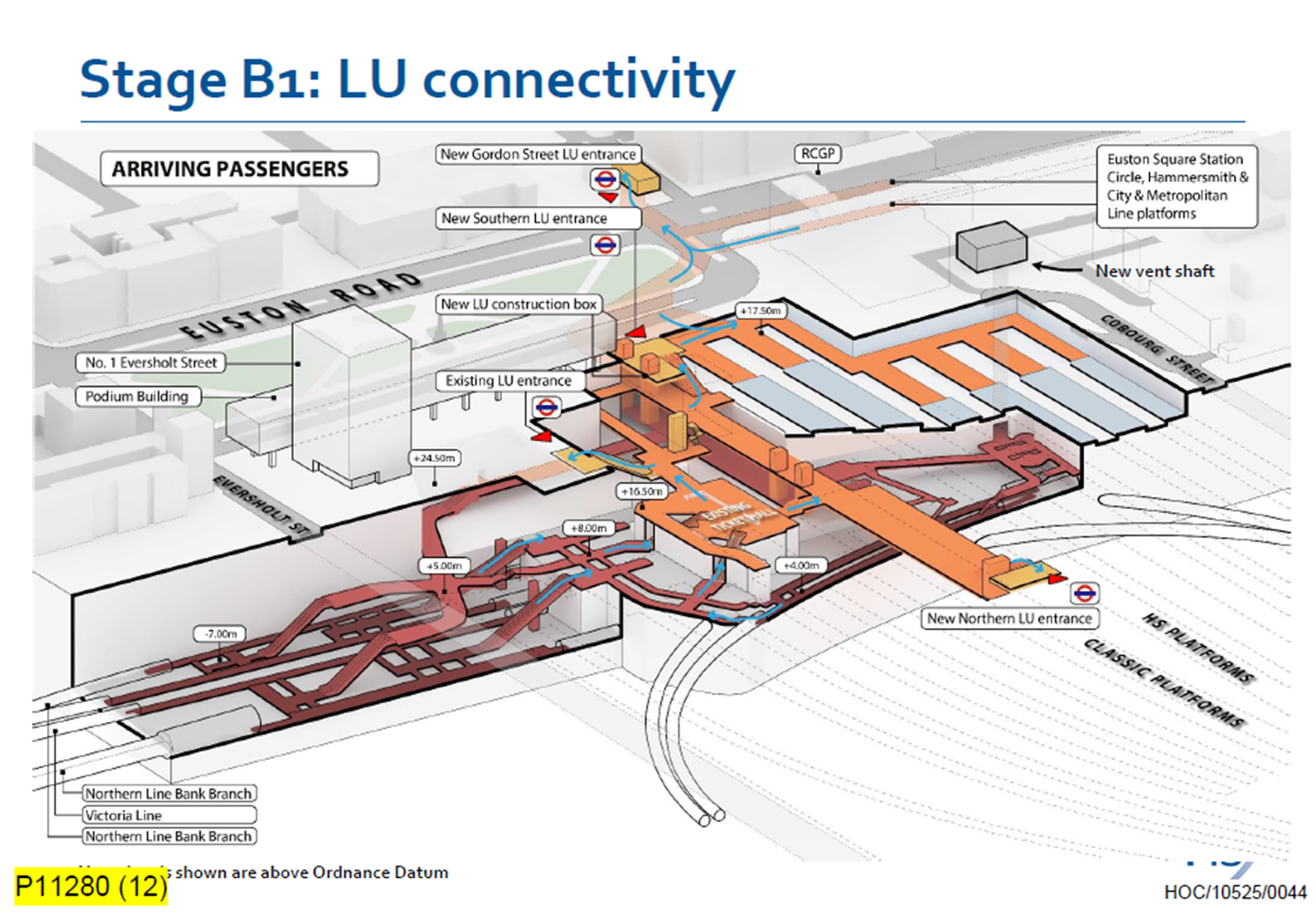
Click on the image to show it large and you can pick out the following.
- The complicated passages, escalators and lifts of the existing four platforms serving the Bank branch of the Northern Line and the Victoria Line.
- The cross passage connecting these lines to the platforms of the Charing Cross branch of the Northern Line.
- The two up and two down escalators leading to the existing ticket hall.
- The Charing Cross branch of the Northern Line curving in and away from the station. See the earlier map of the Underground lines.
- The eleven High Speed platforms on the West side of the station.
- The thirteen Classic platforms on the East side of the station.
- The new Northern entrance to the Underground between the two sets of platforms. How convenient!
- There appears to be a wide passage between the Northern and Southern entrances, with connections to the lines branching off.
- The subway to the new Gordon Street entrance is shown at the top of the image.
The design seems to have separated access to the two branches of the Northern line, by creating a new high-capacity route to the Charing Cross branch.
I also think, that the design allows the station to be built without disrupting passengers using the Underground and the current Euston station.
- A large hole for the station can be excavated, without touching existing access.
- It could then be fitted out section by section.
- Once the new access to the Charing Cross branch of the Northern Line is complete, the current access to the Northern and Victoria Lines can be refurbished.
Arriving At Euston
Imagine you are a passenger arriving from the North, who knows the Underground line, you need to take, you would then enter the Underground station using the new Northern entrance.
- For the Bank branch of the Northern Line or the Victoria Line, you would go through the existing ticket hall and down the escalators, much as you do now! Except that you’d enter the ticket hall on the other side from the East side of the passageway connecting the two entrances. New lifts appear to be shown.
- For the Charing Cross branch of the Northern Line, you would take the passages, lifts and escalators on the West side of the passageway connecting the two entrances.
- If you wanted the sub-surface lines, you would just keep going and take the new subway, which connects to the Eastern ends of the platforms at Euston Square station.
It will certainly do me fine, if I arrive at Euston, as I’ll walk through the subway and get in the front of any Eastbound train for Moorgate station, where being in the front is convenient for the exit and the nearby bus stop to my home.
This route will surely be one of the ways arriving passengers at Euston will get Crossrail to Abbey Wood, Canary Wharf and Shenfield stations. In Crossrail – Northern – Northern City Interchange At Moorgate Station, I show some visualisations of Moorgate station and the connectivity.
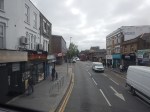
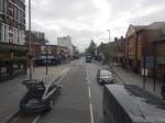
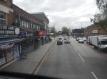
Between Walthamstow Central And Canning Town Stations On A 69 Bus
I have a feeling, that the 69 bus route, which currently runs between Walthamstow Central and Canning Town stations, could be usefully extended to become.
- A new route through the Silvertown tunnel.
- A formal connection between the Eastern ends of the Victoria and Jubilee Lines
- Part of Superloop
I took these pictures from the front of the top deck.
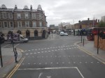
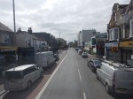
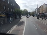
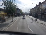
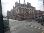


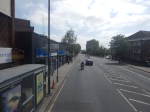
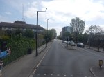
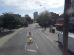
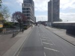
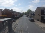


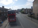
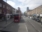
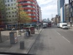
Note.
- I was sitting at the front of the bus on the right side of the top deck.
- Walthamstow Central station is served by the Victoria Line and the London Overground.
- The 69 bus runs every few minutes.
- Walthamstow Central station has a well-connected modern bus station.
- Leyton Midland Road station is on the Gospel Oak to Barking Line.
- The Leyton Engineer appears to be a beautifully restored pub.
- The six-lane A12 East Cross Route is crossed on a bridge just before Leyton station.
- Leyton station is on the Central Line.
- Maryland station is on the Elizabeth Line.
- The Great Eastern Main Line and the Elizabeth Line are crossed on a bridge at Maryland station.
- The prominent church is St. John’s, Stratford.
- Plaistow station is on the Metropolitan Line.
- Canning Town station is on the Jubilee Line and is a hub for the Docklands Light Railway.
- Canning Town station is suffering a degree of refurbishment at the moment and is a bit of a nightmare on foot at the moment.
The 69 bus route connects eight railway stations and at least eight railway lines.
The roads are generally wide and there are more trees than in other parts of London.
Could The Silvertown Tunnel Handle More Buses?
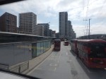
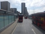
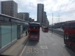
In A Return Journey Through The Silvertown Tunnel On A 129 Bus, I took these pictures inside the Silvertown Tunnel when the bus was coming North.
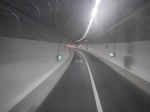
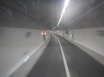
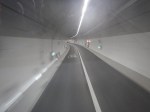
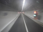
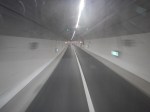
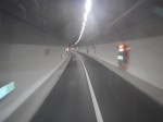
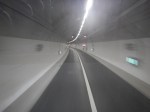
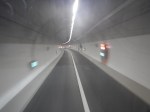
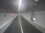
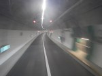
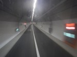
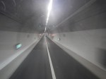
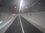
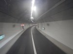
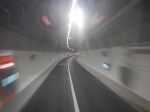
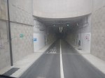
Note.
- The left lane is marked Bus Lane.
- Only one car is visible in the right lane.
- The tunnel seems well-lit.
I have some thoughts
Where’s The Traffic?
It does appear that two apparently empty lanes in each direction, don’t carry a large number of vehicles.
- Have the tolls and arguments frightened traffic away?
- Are the tolls too high?
- From the full set of pictures in the linked post, it would appear more vehicles were using the Blackwall Tunnel.
- Could it be that drivers are frightened of getting a speeding ticket?
- Are drivers frightened of sharing the tunnel with buses and heavy trucks?
Both bores of the Silvertown Tunnel seem to have similar traffic levels.
What’s The Capacity Of A Bus Lane?
In the Wikipedia entry for bus lane, this is said.
The busiest bus lane in the United States is the Lincoln Tunnel XBL (exclusive bus lane) along the Lincoln Tunnel Approach and Helix in Hudson County, New Jersey, which carries approximately 700 buses per hour during morning peak times an average of one bus every 5.1 seconds.[ In contrast, the Cross-Harbour Tunnel in Hong Kong carries 14,500 buses per day, or an average of about 605 an hour all day (not just peak times), but the bus lane must give way to all the other road users resulting in long queues of buses.
Perhaps a more realistic example of tunnel capacity from the UK, would be the Victoria Line, which handles thirty-six * eight-car trains per hour (tph) in both directions in two tunnels.
I would certainly expect that if Dear Old Vicky can manage 36 x 8-car trains per hour, then the Silvertown tunnel could handle thirty-six buses per hour.
Especially, if the buses had a distance keeping capability, as many trains do.
How Many Buses Per Hour Are Planned to Use The Silvertown And Blackwall Tunnels?
This handy map from Transport for London, shows the three bus routes passing through the Silvertown and Blackwall Tunnels.
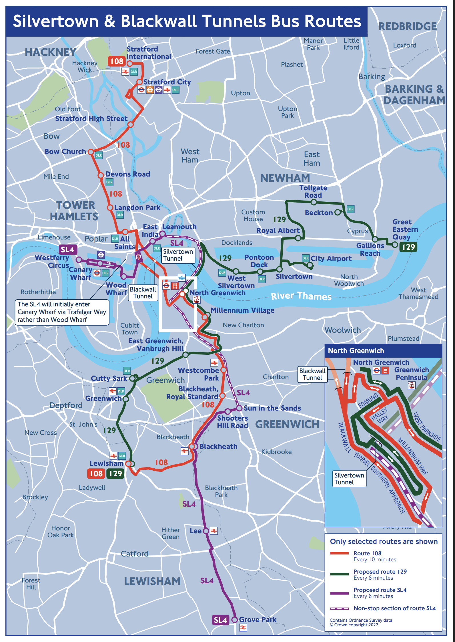
Click the map to show it to a larger scale.
The map gives these frequencies for the three bus routes using the tunnels.
Bus Route SL4
Operates once every 8 minutes or at seven buses per hour.
Bus Route 108
Operates once every 10 minutes or at six buses per hour.
Bus Route 129
Operates once every 8 minutes or at seven buses per hour.
Silvertown Tunnel Bicycle Shuttle
Google AI says this.
The Silvertown Tunnel cycle shuttle bus runs approximately every 12 minutes, operating daily from 6:30 am to 9:30 pm, except for Christmas Day, offering a safe and quick way for cyclists to cross the Thames.
This operates at five buses per hour.
Number Of Buses Through The Tunnels
There will be around nineteen buses per hour, through the Silvertown Tunnel and six through the Blackwall.
The Silvertown Tunnel looks like it has been designed to accept more buses.
One thing this means, is that if the Blackwall gets shut, then the 108 can use some of the spare capacity in the Silvertown Tunnel.
Could A Coach Station For Europe Use Some Of The Spare Capacity?
In Development To The West Of The North Entrance Of The Silvertown Tunnel, I displayed this.
This Google Map shows the site to the West of the North entrance of the Silvertown Tunnel.
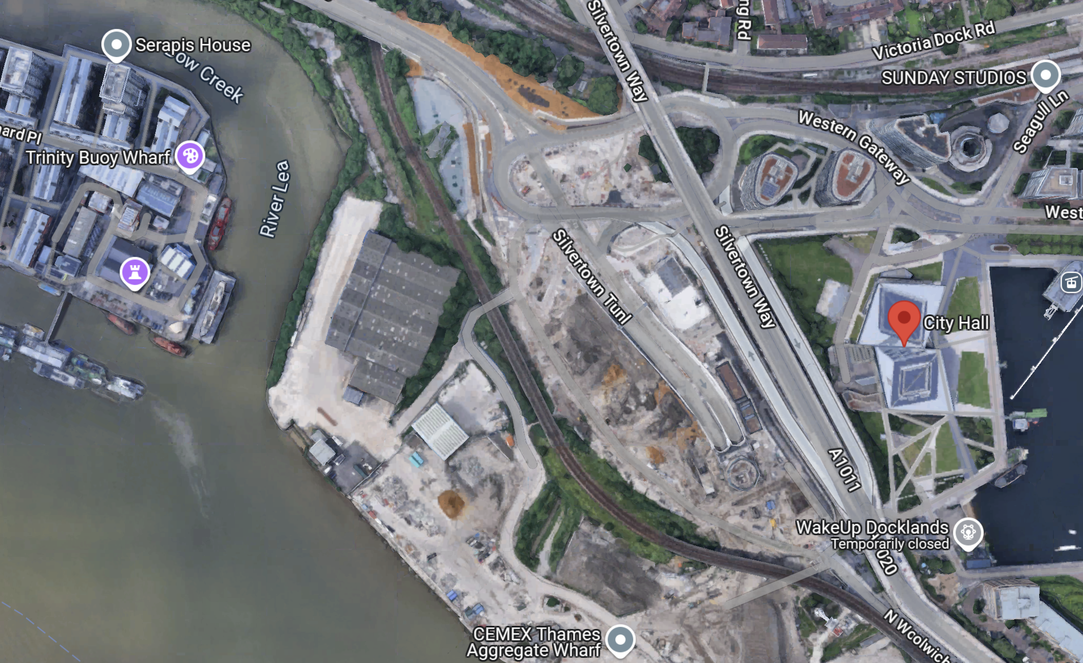
Note.
- The red arrow indicates City Hall.
- There is a large site between the DLR and the river.
- The Docklands Light Railway separates the site from the North entrance of the Silvertown Tunnel.
- The CEMEX Thames Aggregate Wharf seems to occupy part of the site.
This picture shows the North entrance of the Silvertown Tunnel from the cable-car.
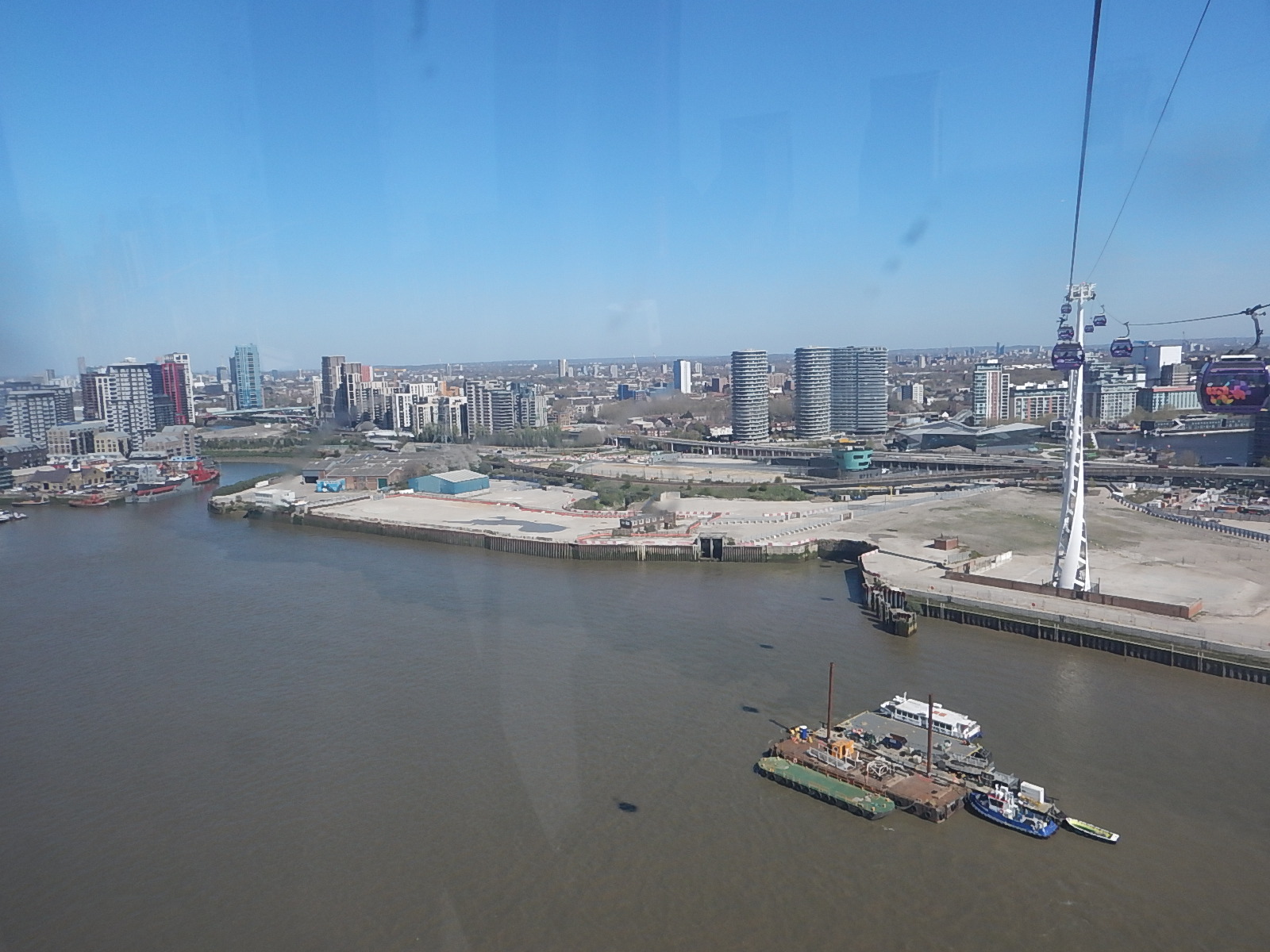
It is surely a site with development potential, as Roy Brooks would say.
It will probably be used for more tower blocks along the Thames.
But could it be used for a coach station to handle the increasing number of coaches between London and the Continent?
- A Docklands Light Railway station could be built to serve the site.
- Thames Clippers could also serve the site.
- Coaches could use the Silvertown Tunnel to start their journey out of the capital.
It is certainly a possibility.
Could The Silvertown Tunnel Be Used For Route-Proving For The Docklands Light Railway?
In TfL Considering Extending DLR As Far As Abbey Wood, I discussed extending the Docklands Light Railway to Thamesmead or Abbey Wood.
This map from Ian Visits shows the area.

Running a four buses per hour service through the Silvertown Tunnel, would be an ideal way of proving what is the best route.
Extending The Docklands Light Railway To The West
No matter how the Docklands Railway is extended to the East, either by physical means like extra branches or by virtual means like connecting to bus routes, this will mean that there will need to be more terminal capacity in the West, to take the pressure off Bank and Tower Gateway stations.
In A Connection Between City Thameslink Station And The Docklands Light Railway, I described a proposal to extend the Docklands Light Railway to Euston, St. Pancras and Victoria.
In the Wikipedia entry for the Docklands Light Railway, there is a section describing a proposed Euston/St. Pancras Extension.
This is said.
In 2011, strategy documents proposed a DLR extension to Euston and St Pancras. Transport for London have considered driving a line from City Thameslink via Holborn north to the rail termini. The main benefit of such an extension would be to broaden the available direct transport links to the Canary Wharf site. It would create a new artery in central London and help relieve the Northern and Circle lines and provide another metro line to serve the High Speed line into Euston.
This map from Transport for London, shows the possible Western extension of the DLR.
With all the problems of the funding of Crossrail 2, that I wrote about in Crossrail 2 Review Prompts Fresh Delays, could this extension of the DLR, be a good idea?
Consider.
- Victoria, Euston and St. Pancras are prosposed Crossrail 2 stations.
- It would link Canary Wharf and the City of London to Eurostar, Northern and Scottish services and High Speed Two.
- It would give all of the Docklands Light Railway network access to Thameslink.
- A pair of well-designed termini at Euston and St. Pancras would probably increase frequency and capacity on the Bank branch of the system.
- The DLR is getting new higher capacity trains.
- Bank station is being upgraded with forty percent more passenger capacity.
- Holborn station is being upgraded and hopefully will be future-proofed for this extension.
- One big advantage at City Thameslink, is that Thameslink and the proposed DLR extension will cross at right-angles, thus probably making designing a good step-free interchange easier.
- The Bank Branch of the DLR currently handles 15 tph, but could probably handle more, if they went on to two terminal stations at St Pancras and Victoria..
- Waterloo and City Line can run at twenty-four tph.
Cinderella she may be, but then she always delivers, when there is a desperate need, just as she did magnificently at the 2012 Olympics.
Something is needed to handle the extra passengers at Euston, that will be brought to London by High Speed Two. Cinderella is the only way to deliver a connection in a reasonable time.
The only problem with this extension of the DLR, is that compared to the rest of the system, the views will be terrible.
For myself and all the others living along the East London Line, with a step-free change at Shadwell, we would get excellent access to Euston, St. Pancras and Victoria.
But could the line still be called the Docklands Light Railway, as it spreads its tentacles further?
More Mushroom Management On TfL Buses
After my experience in Mushroom Management On TfL Buses, I’ve changed my weekend breakfast routine at weekends, to one where on Saturdays and Sundays, I eat breakfast in London’s poshest Leon at Hanover Square, which I wrote about in A Quality Takeaway With A Station And A Large Garden.
It is a large restaurant.
It has comfortable seating.
It is within my not very long walking distance of the Bakerloo, Central, Elizabeth, Jubilee and Victoria Lines, and Oxford Street with all its buses.
There is a garden with seating in the square.
This picture shows the frontage of the building.
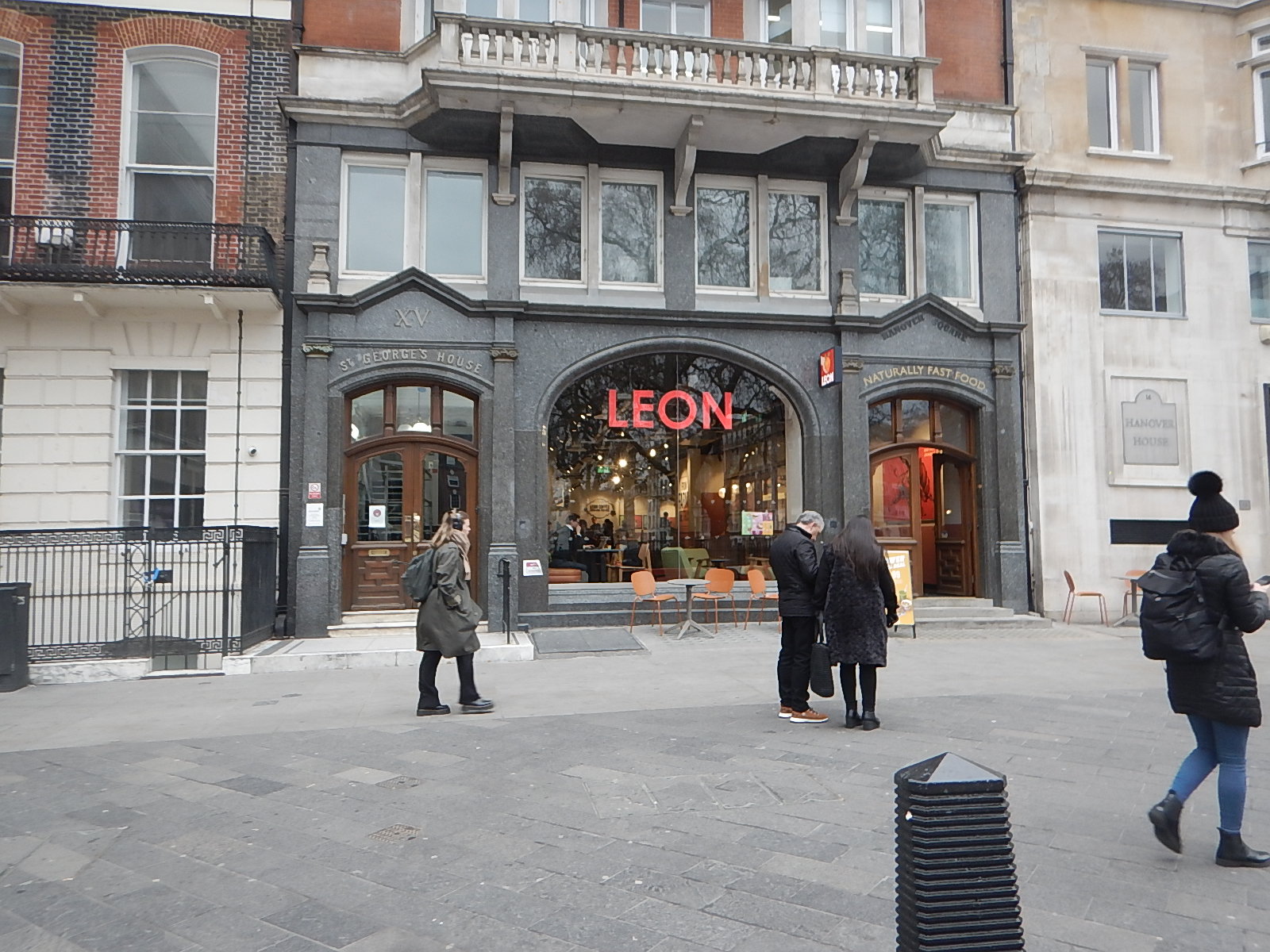
It’s certainly not your average takeaway or fast food outlet.
Normally, Hanover Square is a very easy location for me to travel to.
- I walk round the corner to the stop for the 38 bus.
- The 38 buses are usually every 3-4 minutes and I travel to Tottenham Court Road station.
- I go one stop on the Elizabeth Line, travelling in the rear of the train to Bond Street station.
- I’m then at the right end of the station to exit directly into Hanover Square, after riding up from the depths on a long escalator.
Leon is just a fifty metre walk away.
Today, there were no problems, although I did cut it a bit tight.
But all was fine in the end and I had a good full-English breakfast.
A Difficult Journey Home!
When, I set off from home, I wasn’t sure which way, I would come home.
In the end, I decided to come home the simple way of taking the Elizabeth Line to Moorgate station and then getting the 141 bus from there, as it stops close to my home.
But this route has the Elizabeth Line end-changing problem, in that the Hanover Square entrance at Bond Street station is at the Eastern end of the train and the Moorgate entrance at Liverpool Street station is at the Western end of the train.
So at some point in the journey, I would have to take a two-hundred metre walk, either on the platform or inside the train. The latter is not easy on a train to and from Heathrow, as it is often stuffed full with cases in the aisle. Why do people want to take all the contents of their house on holiday?
So I decided to go via a reverse at Whitechapel, where I positioned myself at the Western end of the train for exit at Moorgate.
It really was necessary to install travellators at Liverpool Street station on the Elizabeth Line, as between the two entrances is a long walk, as this graphic shows.
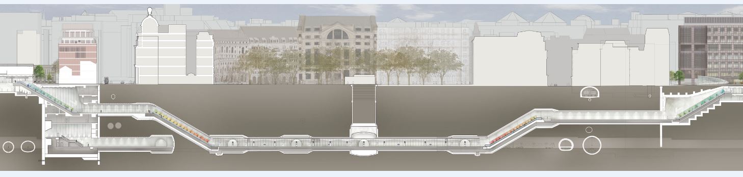
Note.
- Moorgate is to the left
- Liverpool Street is to the right.
But then Transport for London wanted a spectacular line with spectacular stations, that would win awards. Which it has!
I alighted from the train at the Moorgate end of the station, which meant that after two escalator rides and a short walk, I was at the 141 bus stop on the surface.
But there were no buses of any numbers calling at the stop.
This was because of the Lord Mayor’s Show, which meant there were no buses through the City.
But.
- There were no posters at stations saying that the show was taking place and buses would be diverted.
- Displays on bus stops were not saying anything about the show.
- The BBC hadn’t mentioned the Lord Mayor’s Show on the TV this morning.
- The BBC doesn’t have a local news at weekends, which would surely have mentioned the show and its effects on public transport.
- The display on the bus stop at Moorgate was still broken, as it has been for six months.
- There was a small information poster on the bus stop, but it was positioned too high for me to see.
- Taxis seemed to be avoiding the City.
There were a few stewards about and one suggested, that I walked to Old Street, which would not be easy on my legs.
In the end, I decoded that a retreat via Whitechapel and Dalston Junction was probably the best way to get home, as the Overground would be unlikely to be effected.
But I made the mistake of getting on a Circle Line train at Moorgate, so I didn’t get to Whitechapel.
Instead, I walked to the 141 and 21 bus stop at Monument station and caught a 21 bus North. I hoped that I would be able to connect to the 141 bus, that I needed to get home.
I did get safely home, but only after two long waits at bus stops, where I changed bus routes twice.
Conclusion
Transport for London need to devise bus plans for all major events and publicise them well in advance.
In London’s New 733 Bus Route, I described how Transport for London put in a temporary bus route between Finsbury Square and Oval stations to replace the Northern Line during the upgrade of Bank station.
As the Lord Mayor’s Show happens every year, surely the same plan can be rolled out each year, with any appropriate changes.
I’d be interested to know whether other large cities have plans for big celebrations in city centres.
Why The Elizabeth Line Must Be Extended To Ebbsfleet International
There are various plans to link the Elizabeth Line to Ebbsfleet International.
In Elizabeth Line To Ebbsfleet Extension Could Cost £3.2 Billion, I showed this map from the Abbeywood2Ebbsfleet consultation.
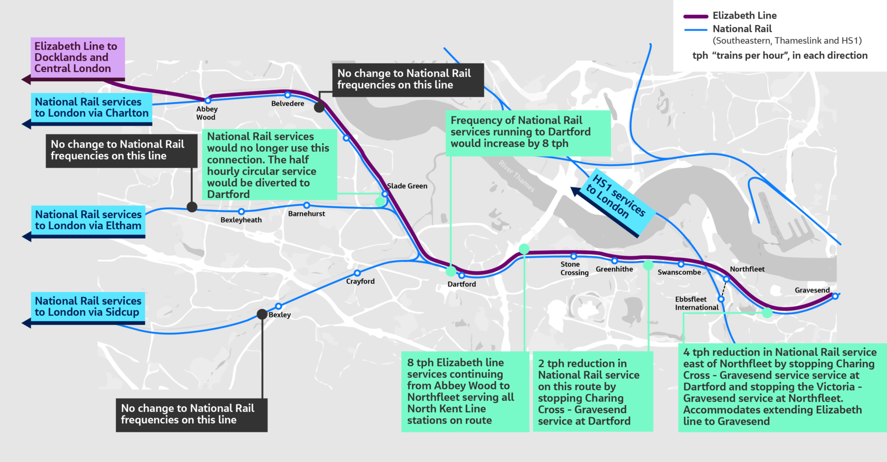
There doesn’t appear to be too much new infrastructure, except for a proper connection between Northfleet and Ebbsfleet stations. References on the Internet, say that the similar-sized Luton DART connection at Luton Airport, cost around £225 million.
The Elizabeth Line connects to the following.
- Bond Street
- Canary Wharf
- City of London
- Farringdon for Thameslink
- Heathrow Airport
- Old Oak Common for High Speed Two
- Liverpool Street station
- Oxford Street
- Paddington station
- Slough for Windsor
- Tottenham Court Road for the British Museum, Oxford Street, Soho, Theatreland and the Underground.
- West End of London
- Whitechapel for the Overground and Underground
For many people like me, the Elizabeth Line at Ebbsfleet will provide one of the quickest ways to get to and from European trains.
High Speed Two Services
This diagram shows High Speed Two services, as they were originally envisaged before Phase 2 was discontinued.
Note.
- Trains to the left of the vertical black line are Phase 1 and those to the right are Phase 2.
- Full-Size trains are shown in blue.
- Classic-Compatible trains are shown in yellow.
- The dotted circles are where trains split and join.
- In the red boxes routes alternate every hour.
- Was Lancaster chosen as it’s close to the new Eden Project Morecambe?
Click on the diagram to enlarge it.
Destinations served by the current foreshortened High Speed Two or High Speed Two Lite will be.
- Birmingham Curzon Street
- Birmingham Interchange
- Carlisle
- Carstairs
- Crewe
- Edinburgh Haymarket
- Edinburgh Waverley
- Glasgow Central
- Lancaster
- Liverpool Lime Street
- Lockerbie
- Macclesfield
- Manchester Airport
- Manchester Piccadilly
- Motherwell
- Oxenholme
- Penrith
- Preston
- Runcorn
- Stafford
- Srockport
- Stoke-on-Trent
- Warrington Bank Quay
- Wigan North Western
- Wilmslow
That is twenty-five stations.
I would add these extra stations.
- Bangor
- Blackpool
- Chester
- Holyhead
- Llandudno Junction
- Wrexham
Note.
- These extra six stations would make High Speed Two, a line for more of the people.
- Because the Eastern leg is cancelled, the paths that would have served that leg can be used to provide services for the West of the country.
The East of the country could be served by updating the East Coast Main Line.
The Development Of Eurostar
Consider.
- Eurostar and Thalys have now merged and I can see them providing extra direct services between London and Europe.
- Bordeaux, Cologne, Frankfurt and Geneva have been mentioned as possible destinations.
- Most of the new destinations, will be served by extending current services from Amsterdam, Brussels and Paris appropriately.
But to cope with the extra numbers of passengers, there will have to be extra passenger capacity at St. Pancras and/or Ebbsfleet International.
High Speed Two And Continental Services
Currently, if you want to go from the North of England or Scotland to the Continent, you do one of the following.
- Take a train to King’s Cross and walk across to St. Pancras International.
- Take a train to St. Pancras and walk to the International section of the station.
- Take a train to Euston and walk or take a bus, taxi or Underground to St. Pancras International.
Note.
- Passengers from North Wales take the Euston route.
- Some passengers will take an Elizabeth Line train to Farringdon and then take Thameslink to St. Pancras International.
- Passengers arriving at Paddington on Heathrow Express will probably take a taxi to St. Pancras International.
- Passengers arriving at Paddington on a budget will probably take the Underground to St. Pancras International.
For Londoners and those travellers, who know London well, the routes to St. Pancras International, are not to bad but they could be better.
If the current foreshortened High Speed Two or High Speed Two Lite finishes at Old Oak Common station, passengers will have to use the following routes for their onward journey.
- Elizabeth Line
- Great Western Railway – local services.
- Heathrow Express
- North London Line of the London Overground, or whatever the Mayor at the time calls it.
If the full High Speed Two or High Speed Two Lite finishes at Euston station, passengers will have to use the following routes for their onward journey.
- Avanti West Coast
- Circle, Hammersmith & City and Metropolitan Lines
- London North Western – local services
- Northern Line
- Victoria Line
- Watford DC Line of the London Overground, or whatever the Mayor at the time calls it.
These routes will be in addition to those at Old Oak Common station.
There will be two routes between High Speed Two and St. Pancras International station.
- Passengers arriving at Old Oak Common will take an Elizabeth Line train to Farringdon and then take Thameslink to St. Pancras International.
- Passengers arriving at Euston will walk or take a bus, taxi or Underground to St. Pancras International.
I am not sure that either route will have enough capacity, if High Speed Two attracts a large number of passengers.
Extend High Speed Two To Euston
I believe that this is essential, as it improves the connectivity greatly, at the bottom end of High Speed Two, as several Underground Lines will be connected to High Speed Two.
Extend The Elizabeth Line from Old Oak Common To Ebbsfleet International
I believe this too is essential, as it gives the North of England and Scotland, the connection to the Continent that they need.
There could be cross-platform connections at both Old Oak Common and Ebbsfleet International between the Elizabeth Line and the high speed lines.
Conclusion
Politicians should stop the dithering and act to give the UK, the rail connection it needs up and down the country and to the Continent.
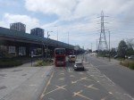
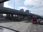
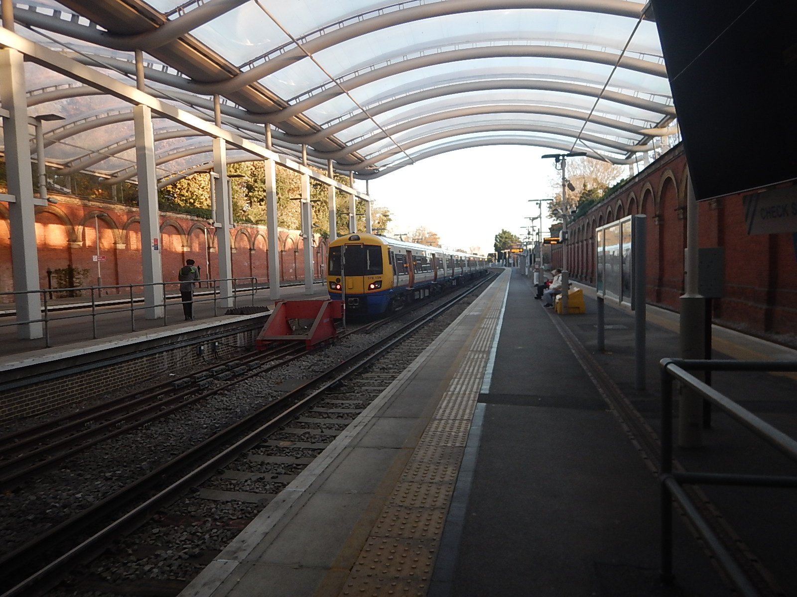
London Overground Train Makes Rare Diversion To London Bridge Station
The title of this post, is the same as that of this article on Ian Visits.
This is the sub-heading.
On Sunday morning, a London Overground train paid a visit to London Bridge station — a station that the Overground doesn’t usually visit.
These were the first two paragraphs.
It was here for a test run ahead of a special service that will run on Easter Sunday, and the test was needed to ensure that what worked on paper also worked in practice.
The reason for the Easter Sunday special is weekend engineering works elsewhere which would mean no Southern trains between Victoria and London Bridge, while at the same time, the London Overground south of the river can’t go north.
Note.
- Judging by Ian’s pictures, it was a very thorough test of clearances and ramp functions.
- According to Real Time Trains, the two services used platform 5 at Crystal Palace and Platform 13 at London Bridge.
- The distance was 7.5 miles.
- Services took 23 minutes to London Bridge and 19 minutes for the return.
This image shows a London Overground train in Platform 5 at Crystal Palace station.
In Overground To London Bridge Under Consideration, I talked about how Transport for London were thinking about creating a new Overground service between London Bridge and Crystal Palace.
Sunday’s test also shows that if the paths are available, London Overground can run a service between London Bridge and Crystal Palace.
Given that the times for the out and return trips were 23 and 19 minutes on Sunday, it appears to me, that the following is possible.
- One train could run an hourly service.
- Two trains could run a two trains per hour (tph) service.
Trains could terminate in platform 3, which is on the right in the image and only has two trains per day.
There would be the following trains to London from Crystal Palace.
- London Overground – Four tph to Canada Water, Whitechapel and Highbury and Islington.
- London Overground – Two tph to London Bridge
- Southern – Two tph to London Bridge
- Southern – Four tph to London Victoria
These would total to.
- Canada Water – four tph for Jubilee Line
- Highbury & Islington – four tph for Victoria and North London Lines
- London Bridge – four tph for Thameslink, Jubilee and Northern Lines
- London Victoria – four tph for Victoria, Circle and District Lines
- Whitechapel – four tph for Elizabeth, Victoria, Circle, District and Hammersmith & City Lines
Note.
- The two extra tph to London Bridge even everything up to four tph.
- The London Bridge and Crystal Palace service could be run by any suitable train and I suspect it could be eight cars. What about using some of the spare Class 379 trains?
The London Bridge and Crystal Palace service wouldn’t need trains with a tunnel evacuation capability, so could use Class 378, 379, 387 or 710 trains.
Connecting The Bakerloo, Elizabeth and Victoria Lines At Oxford Circus Station
To my mind it is a design fault of the Elizabeth Line, that it does not correct directly to the Victoria Line.
This OpenRailwayMap shows the various lines at Oxford Circus station.

Note.
- Oxford Street running East-West across the top of the map.
- The Central Line runs under Oxford Street.
- Regent Street running North-South down the map.
- The Bakerloo Line runs under Regent Street.
- The buff tracks running East-West are the Elizabeth Line.
- Hanover Square is above the Elizabeth Line at the Western edge of the map.
- The tracks of the Victoria Line can be picked outrunning North-South down the map.
- They pass through Oxford Circus station at the outside to give cross-platform interchange with the Bakerloo Line.
Consider.
- Oxford Circus station is not step-free.
- The Elizabeth Line entrance in Hanover Square is step-free.
I believe, as at Bank station, that a deep tunneled connection could be made between Oxford Circus station and the Elizabeth Line entrance in Hanover Square.
Note.
- It could be below the foundations of the buildings.
- A travellator might make it easier for some.
- There could even be shops, cafes and perhaps toilets in the tunnel.
There might not need to be any new street entrances to the below ground complex.
Jobs, Homes And The Economy: Bakerloo Line Upgrade And Extension To Be Transformational For London
The title of this post, is the same as that of this article on Rail Technology Magazine.
This is the sub-heading.
The government has been urged to use the upcoming spring budget to commit to upgrading and extending the Bakerloo line after a new impact assessment found its effects could be transformational.
These three paragraphs introduce the article.
The impact assessment – commissioned by Central London Forward, a partnership of 12 central London boroughs – finds that such a move would boost the economy, unlock new homes, create new jobs, and more.
The upgrade would centre around new trains and signalling, while the extension would take the terminus to Lewisham in the first phase, and eventually to Hayes – adding 14 new stations.
The impact assessment concludes that the extension and upgrade of the Bakerloo line would create 9,700 jobs, 190,000 square metres of commercial floorspace, as well as generate £1.5bn of GVA.
The article is a must-read and eloquently puts the case for the Bakerloo Line Extension.
I have a few thoughts.
A Loop At Brixton For The Victoria Line
This has been proposed and the Wikipedia entry for the Victoria Line has this paragraph.
Proposals have been made to extend the line one stop southwards from Brixton to Herne Hill, a significant interchange in south London providing access to Kent, Blackfriars, London Bridge and Sutton. The latter station would be on a large reversing loop with a single platform removing a critical capacity restriction eliminating the need for trains to reverse at Brixton and provide a more obvious route for passengers who look for the nearest tube station before any other transport options.
I like this idea.
- It will make it easier to run the full frequency of 33 trains per hour (tph) between Brixton and Walthamstow Central stations.
- Loops at Heathrow and Liverpool seem to work very well.
- A single-platform with platform-edge doors has a high level of safety.
- Only one tunnel boring machine (TBM) would be needed.
- Large lifts could be used between the surface and the platform.
- It is a more affordable option.
But perhaps most importantly, I am sure, the loop could be built whilst other services at Brixton and Herne Hill were running almost without disruption, as services did at Kennington, whilst the Battersea Extension of the Northern Line was built.
A Loop At Elephant And Castle For The Bakerloo Line
I have spent forty years involved in project management, writing software for project managers and generally listening to some of the thoughts and experiences of some of the best engineers from all over the world.
One common thread, which is best illustrated by how the size of lift possible increased in the North Sea in the 1970s, is that as time has progressed machines have got bigger and more capable, and the techniques of using them has improved immeasurably.
The Crossrail tunnel boring machines (TBM) make those used on the Jubilee Line extension or the Channel Tunnel look like toys. But not only are the TBMs bigger and faster, they have all the precision and control to go through the eye of the smallest needle.
If we look at the proposals for the Bakerloo Line Extension, there have been several differing ideas. Some envisage going under Camberwell and in others the trains terminate on the Hayes line.
Transport for London (TfL), obviously know the traffic patterns, but do we really want to take the chance of say connecting the Hayes line to the Bakerloo and then finding that it’s not the best solution?
What we should do is augment the services in the area, by providing a good alternative transport route, that links to some of the traditional rail lines to give even more flexibility. We certainly shouldn’t repeat the grave mistake that was made at Brixton in the 1960s by not connecting the Victoria line to the surface rail lines.
This is Transport for London’s indicative map of the extension.

I have reason to believe that the Northern Line Extension may be being built as an extension to the Kennington Loop.
So could we design the Bakerloo Line Extension as a loop starting and finishing at Elephant and Castle calling at important stations?
A possible route could be.
- Elephant and Castle – Interchange with Northern Line and National Rail including Thameslink
- Old Kent Road 1 – Proposed on Map
- Old Kent Road 2 – Proposed on Map
- New Cross Gate – Interchange with London Overground and National Rail
- Lewisham – Interchange with Docklands Light Railway and National Rail including Hayes Line
- Catford Bridge – Interchange with Catford station and National Rail including Hayes Line and Thameslink
- Peckham Rye – Interchange with London Overground and National Rail
- Camberwell – Interchange with National Rail including Thameslink
- Elephant and Castle
The advantages of this simple design are.
- The tunnel would be excavated in one pass by a single TBM.
- The line could be deep under any existing infrastructure.
- Most stations would be simple one-platform affairs, with perhaps only large lifts and emergency stairs, to give unrivalled step-free access for all from the street to the train. Surely lifts exist, that are large and fast enough to dispense with escalators.
- For safety, passenger convenience and flows, and other reasons, the stations could have two entrances, at opposite ends of the platform.
- The simple station entrances would be much easier to position on the surface, as they wouldn’t need to be much bigger than the area demanded by the lifts.
- A single loop would only need half the number of platform edge doors.
- At stations like New Cross Gate, Lewisham, Catford and Peckham Rye the lifts would surface within the confines of the existing surface stations.
- The route has interchanges with the Brighton Main Line, East London Line, Hayes Link, Thameslink and other services, so this would give lots of travel possibilities.
- Trains do not need a terminal platform, as they just keep going on back to Elephant and Castle.
- The loop would be operationally very simple, with no points to go wrong. TfL have aspirations to run twenty-seven trains per hour on the Bakerloo and a simple reversing loop , which would mean the driver didn’t have to change ends, must certainly help this. It would probably be a lot more difficult to get this capacity at the northern end of the line,where Harrow and Wealdstone doesn’t have the required capacity and the only possibility for a reversing loop would be north of Stonebridge Park.
- Elephant and Castle would need little or no modification. Although it would be nice to have lifts to the Bakerloo Line.
- Somewhere over two billion pounds has been quoted for the extension. A single loop with simple stations must be more affordable.
The main disadvantage is that the loop is only one-way.
But making even part of the loop two-way would create all the operational difficulties of scheduling the trains. It would probably be better, less costly and easier to make the trains go round the loop faster and more frequently.
But if a passenger went round the loop the wrong way and changed direction at Elephant and Castle that would probably only take a dozen minutes or so.
Alternatively, I’m sure some New Routemasters would step up to the plate and provide service in the other direction between the stations.
Future Rolling Stock For The Bakerloo Line
This has a section in the Wikipedia entry for the Bakerloo Line, where this is said.
In the mid 2010s, TfL began a process of ordering new rolling stock to replace trains on the Piccadilly, Central, Bakerloo and Waterloo & City lines. A feasibility study into the new trains showed that new generation trains and re-signalling could increase capacity on the Bakerloo line by 25%, with 27 trains per hour.
In June 2018, the Siemens Mobility Inspiro design was selected.[ These trains would have an open gangway design, wider doorways, air conditioning and the ability to run automatically with a new signalling system.[35] TfL could only afford to order Piccadilly line trains at a cost of £1.5bn. However, the contract with Siemens includes an option for 40 trains for the Bakerloo line in the future. This would take place after the delivery of the Piccadilly line trains in the late 2020s.
A loop from Elephant and Castle with a train every 2¼ minutes, is not going to be short of passengers.
The Catford Interchange
Catford and Catford Bridge stations are not far apart.
In An Opportunity At Catford, I talked about what could be done to create a full step-free interchange, which could be connected to the Bakerloo Line loop underneath.
Would It Be Possible For The Bakerloo And Watford DC Lines To Use The Same Trains?
I answered this question in a post with the same name and this was my conclusion.
A common fleet used by the Bakerloo and Watford DC Line would appear to give advantages and it has been done successfully before.
But what the Bakerloo Line, the Watford DC Line, the Abbey Line and the Bakerloo Line Extension need is a good dose of holistic design.
The current trains on the Watford DC Line would be moved to the London Overground. They could be ideal for the future West London Orbital Railway.
Would There Be Advantages In Creating The West London Orbital Railway And Extending The Bakerloo Line As One Project?
Consider.
- The two lines will have an interchange station at Harlesden, which will need to be rebuilt.
- The current trains on the Watford DC Line could be cascaded to the West London Orbital Railway.
- As new trains are delivered to the Piccadilly Line, some of the current trains could be cascaded to the Bakerloo Line.
- Major work for the Bakerloo Link Extension includes a new tunnel, updated signalling and at least seven underground stations.
- Major work for the West London Orbital probably includes track refurbishment, new signalling and updated stations.
I believe that with good project management, that if these two lines were to be created together, this would be advantageous.
Conclusion
I have only outlined how the two projects might be done together.
But I am absolutely certain, that someone with full knowledge of both projects could build the two at a very affordable cost.
Are Londoners The Tunnel Kings?
I was born in 1947 and it was in the early 1960s, that I started to develop an interest in engineering, which eventually led me to study Electrical Engineering and Electronics at Liverpool University.
Like most Londoners, I was a frequent user of the Underground and for six or seven years, I took the Piccadilly Line many days between Oakwood and Southgate to go to Minchenden Grammar School. Often, after school, I would go on to my father’s print works near Word Green tube station.
But not memories of London’s tunnels were so memorable at that time. One day, we were driving to see my Uncle Bert in Broadstairs and we were held in the Blackwall Tunnel for an hour or so because of an accident.
Perhaps, this is why I can remember a black-and-white video of digging the Western Tunnel of the Dartford Crossing so vividly. But as Raymond Baxter probably explained to BBC viewers at the time, it dug using a Greathead shield under pressure to keep the water out. It was probably the last tunnel dug under the Thames using methods, that would have been familiar to Victorian engineers.
This British Pathe video shows some of the construction of the Western tunnel.
This paragraph from the Wikipedia entry for the Eastern Tunnel describes its construction.
Construction was approved in April 1971, with an initial expected opening date in 1976. Work was delayed due to a lack of funds, which was resolved by EEC funding granted in 1974. The second tunnel opened in May 1980, allowing each tunnel to handle one direction of traffic, by which time the joint capacity of the two tunnels had increased to 65,000 vehicles per day. Connection of the crossing to the M25 was completed on the northerly Essex side in September 1982 (Junction 31), and to the southerly Kent side in September 1986 (Junction 1a)
The tunnels may be inadequate in terms of capacity, but they have certainly done a reliable job for sixty and forty-three years respectively.
There are other tunnels under the Thames, that have been built in my lifetime.
- Thames Cable Tunnel – 1970 – National Grid’s 400 kV cable.
- High Speed One – 2007
- Dartford Tunnel (East) – 1980
- Dartford Tunnel (West) – 1963
- Dartford Cable Tunnel – 2004
- Docklands Light Railway Tunnel – 2009
- Elizabeth Line Tunnel – 2014
- Millennium Dome Cable Tunnel – 1999
- Jubilee Line Tunnels – 1999 – Planned by Artemis
- Blackwall Runnel (East) – 1967
- Isle of Dogs Jubilee Line Tunnels – 1999 – Planned by Artemis
- Docklands Light Railway Tunnel – 1999 – Planned by Artemis
- Deptford Cable Tunnel –
- Jubilee Line Tunnels – 1999 – Planned by Artemis
- Victoria Line Tunnel – 1971
- New Cross to Finsbury Market Cable Tunnel – 2017
- Wimbledon to Pimlico Cable Tunnel – 1996
- London Power Tunnels – 2018, 2011
There are also these tunnels, which don’t go under the Thames
Bank Station Expansion And New Southbound Northern Line Tunnel – 2022
- Elstree to St. John’s Wood Cable Tunnel – 2005
- Heathrow Rail Tunnels – 1998
- Lee Tunnel – 2016
- Limehouse Link Tunnel – 1993
- Lower Lea Valley Cable Tunnels – 2008
- Northern Line Extension To Battersea – 2021
- Piccadilly Line Extension To Heathrow – 1975-2008
- Thames Tideway Tunnel – Estimated completion in 2025 – Tunnelling ended in 2022.
- Thames Water Ring Main – 2010
Note.
- The date is the opening date.
- I am pleased to see that at least some projects were planned, with the software, I wrote in a Suffolk attic.
In my lifetime, at least 27 substantial tunnels have been completed, a very large proportion of which have been on time and on budget, with the possible exception of the Heathrow Rail Tunnels, which collapsed.
So Why Has London Got A Good Record On Tunnelling?
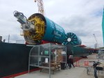
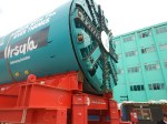
In Millicent And Ursula Prepare To Go Tunnelling, I describe my visit to the Tideway Open Day today to see the tunnel boring machines; Millicent and Ursula before they went tunnelling.
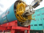
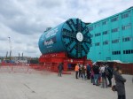
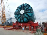
On that Sunday morning, I also chatted with the engineers and tunnelers.
- All had worked on at least one of London’s previous tunnels.
- One had worked on the Second Dartford Tunnel, the Channel Tunnel and Crossrail.
- A couple said, that after the Tideway finished, they would be off to High Speed Two.
Is London’s good record on delivering tunnels safely and on time and on budget, a case of lots of experience and practice makes perfect?
If it is, we should definitely think hard about how we handle large projects.
Wind Farms
Many have been constructed this way.
- The grid substation and connection to the grid is built.
- The foundations of the turbines are installed.
- The turbines are erected.
- All the turbines are commissioned.
This sequence or something like it can be applied to onshore and offshore wind farms.
- Most jobs are repeated many times by specialist teams using purpose-built cranes, ships and other equipment.
- Bigger wind farms, just need more repeated operations.
- All operations are generally in a small geographical area.
- I suspect specialist software has been built to project manage, the building of wind farms. If it hasn’t, I have my ideas.
Project management should be relatively easy.
