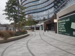
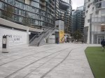
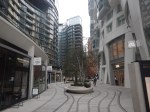
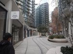
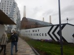
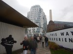
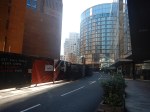
The New Entrance To Battersea Power Station Station – 7th October 2025
The new entrance to Battersea Power Station station opened recently, so I went to have a look.


Note.
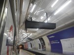
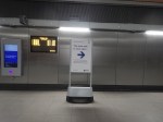
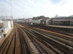
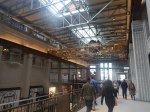
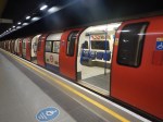
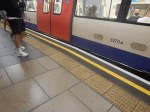
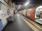
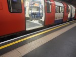
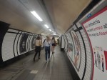
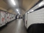
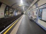
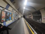
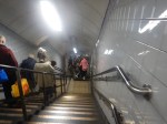
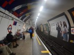
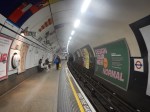
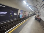
- The first picture shows the terrible train indicators in Moorgate station.
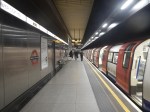
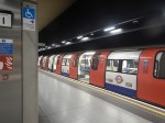
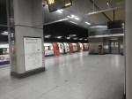
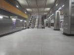
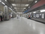
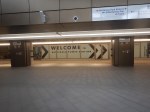
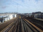
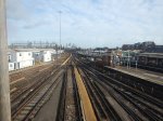
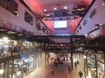
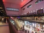
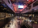
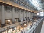
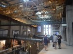
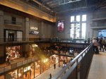
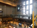
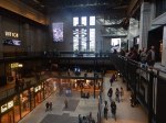
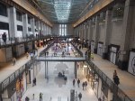
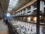
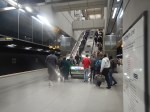
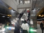
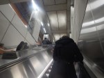
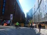
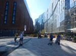
- Comparing the next three pictures with the first, show how much better the lighting is in Battersea Power Station station is compared to Moorgate station.
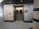
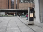
- Someone had the thought to put up a sign to indicate the new entrance.
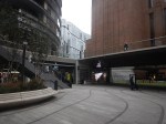
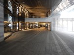
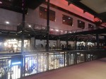
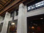
- The entrances are at opposite ends of a spacious ticket hall.
- There are lifts to the surface.
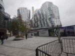
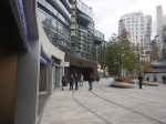
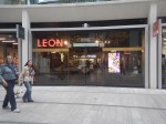
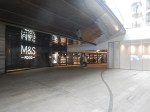
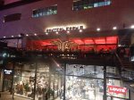
- Exit is direct into a parade of smart shops.
- The Leon is more upmarket, than their Hanover Square outlet.
- There is a Boots, an M & S Food and a Zara close to the new entrance to the station.
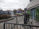
- There was a lot more greenery, than when I last visited.
I finished my visit by walking down to the river to catch the Thames Clipper back to London Bridge station.
Did Plans For Crossrail Ever Include A Station At Holborn?
I have only one North-South bus route, where I live.
The 141 bus connects Palmers Green and London Bridge station.
- The 141 bus was the replacement for the 641 trolley bus, which was the main link between Wood Green, Turnpike Lane and Harringay, and the City of London, when I was a child.
- The vehicles are up to ten years old Wrightbus diesel hybrids.
- The route suffers badly from overcrowding as it connects, Bank and Moorgate stations in the City of London, with the outer reaches of the Piccadilly Line.
The overcrowding on the 141 bus route has got worse in the last couple of years because of the following.
- The rebuilding of London Bridge station brought more passengers to the 141 bus route.
- The opening of the new London Bridge bus station at London Bridge station has improved access to the buses at London Bridge station.
- The improvement of the connection of the buses to the Docklands Light Railway, Central Line and Northern Line at Bank station.
- The opening of the Battersea branch of the Northern Line, which brings more passengers to Bank station.
- The opening of the new Cannon Street entrance to Bank Underground station.
- The opening of the Elizabeth Line through Moorgate station.
- Recently, a new walking route between Moorgate and Liverpool Street was opened, which will bring more passengers to the buses on Moorgate.
- The rebuilding of Old Street station brought more passengers to the 141 bus route.
So what was the response of the Mayor and Transport for London, to all this increase of passenger numbers?
The 21 bus, which shadowed the 141 route, and doubled the number of buses through where I live, was moved to serve Holloway.
It was a big crime against mathematics and the wishes of our long-serving Labour MP; Meg Hillier.
So to handle many more passengers between London Bridge station and Newington Green through the City of London, the number of buses was halved.
I believe that the overcrowding will get worse because of the improvements, that Transport for London have planned.
- The Piccadilly Line will be getting new air-conditioned trains within a couple of years and these will inevitably attract more passengers to the line.
- On the other hand the air-conditioning may persuade passengers to use the Piccadilly Line more than they do now. Instead of changing to the 141 bus at Manor House station, passengers could change at Finsbury Park, King’s Cross St. Pancras or Holborn stations for other routes to the City of London.
- The third line to receive the new air-conditioned trains will probably be the Central Line, which would create another East-West air-conditioned line and bring more passengers to Bank station.
- The Central Line could give some relief for the buses through Bank, if an extra station was built on the Central Line to interchange with Shoreditch High Street station on the East London Line of the London Overground.
- The fourth line to receive the new air-conditioned trains will probably be the Waterloo and City Line, which would create another air-conditioned line and bring more passengers to Bank station.
- It is likely, that more services will be added to the Elizabeth Line, which will bring more passengers to Moorgate station.
- It is likely, that more services will be added to the Northern City Line, which will bring more passengers to Moorgate station.
- The Mayor is also planning to pedestrianise Oxford Street, which may fill up the Central Line with extra passengers.
It looks to me, that there will be a need for a large increase of bus capacity through the City of London on a North-South axis.
On the other hand, the City of London have stated that they will pedestrianise many of their streets.
So what can be done to avoid gridlock in the City of London?
Develop The Northern City Line At Moorgate
I use this route regularly to and from Moorgate station.
- It already has new Class 717 air-conditioned trains.
- The route is already digitally signalled in conjunction with the East Coast Digital Programme.
- It has two platforms at Moorgate station.
- Highbury & Islington station has interchanges with the Victoria Line and the North and East London Lines of the London Overground.
- Finsbury Park station has interchanges with the Victoria Line and National Rail services.
- Bowes Park station has an out of station interchange with Bounds Green station on the Piccadilly Line.
- Step-free access needs improving.
- The Victorians had plans to extend the line to Lothbury near Bank station.
If the Northern City Line could handle more passengers, would passengers get to all parts of the City of London by changing at Finsbury Park and walking from Moorgate or Old Street stations?
I regularly go between my house and Moorgate, by taking a bus to Essex Road station and using the Northern City Line.
I believe that with improvements on the Northern City Line, the line could be turned into a very valuable part of London’s rail infrastructure.
Connect The Central Line And The East London Line At Shoreditch High Street Station
I wrote about this proposal in Will Shoreditch High Street Be Connected To The Central Line?
The Elizabeth Line needed to be completed before this could be started.
Build The Western Extension Of The Docklands Light Railway
I wrote about this proposal in The Bank Station Upgrade And The Western Extension Of The DLR.
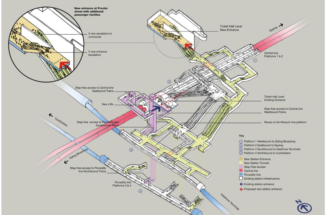
Rebuild Holborn Station
The interchange between Piccadilly and Central Line at Holborn station is difficult to say the least.
Holborn station is being extended with a new entrance. As with Euston, I suspect it has been designed with a feasible place for DLR platforms to be added.
This document on the TfL web site, gives more details of what is proposed at Holborn station.
I extracted this visualisation of the proposed station.
This map from carto.metro.free.fr shows the lines in the through and around the station.
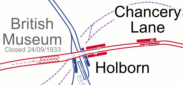
.Note, the Elizabeth Line, which is shown by dotted lines passes to the North of the station.
Conclusion
Not all these improvements need to be done, but each would improve transport in the City of London.
‘No Constraints’ On Clapham Junction Tube Extension
The title of this post, is the same as that of this article on the BBC.
This is the sub-heading.
There are no physical restrictions to extending the Northern line to Clapham Junction, an investigation has found.
These are the first three introductory paragraphs.
In a new report, Wandsworth council said there were “no engineering or geological constraints” that would prevent an extension.
The council is now carrying out a public consultation to see whether there is strong local support for the extension.
Clapham Junction, one of London’s busiest stations, is home to the Overground and National Rail services.
The Current State According To Wikipedia
This Wikipedia section, says this about the current state of the extension to Clapham Junction station.
Provision has been made for a future extension of the Northern line to Clapham Junction station, with a reserved course underneath Battersea Park. During the public inquiry into the extension in 2014, the inspector noted that although an extension to Clapham Junction would be desirable, it was unnecessary to meet the needs of the Vauxhall Nine Elms Battersea regeneration area. Additionally, it was noted that an extension to Clapham Junction could overwhelm the extension, due to the high demand.
As part of consultations into Crossrail 2 in 2014, the developer of the Battersea Power Station site suggested that Battersea could be the location of a station instead of at King’s Road Chelsea. This would provide a link between the area and Clapham Junction station. Despite the proposal for the future Crossrail 2 project to serve the station, local residents and politicians have continued to request a future extension of the Northern line to Clapham Junction. In March 2023, Mayor of London Sadiq Khan stated that the “case for an extension is not readily apparent, given Clapham Junction’s existing high levels of connectivity”.
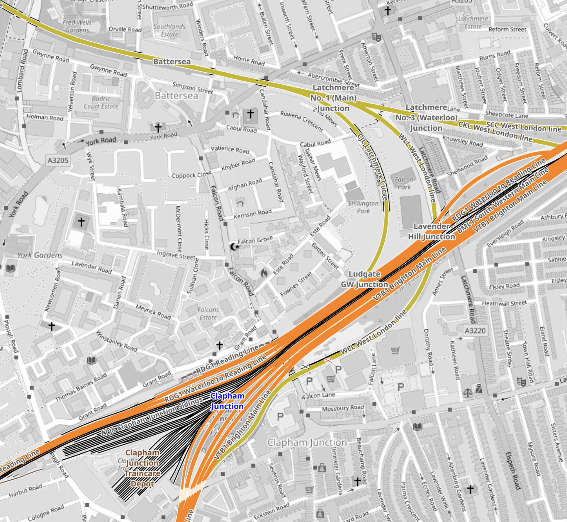
This map from OpenRailwayMap shows the railways that lie between Battersea Power Station and Clapham Junction stations going via Battersea Park.
Note.
- Battersea Power Station station is in the North-East corner of the map.
- Clapham Junction station is in the South-West corner of the map.
- The rounded D-shape by the river is the Children’s Zoo in Battersea Park.
Going via Battersea Park is a rather roundabout and long route.
High Speed One and High Speed Two tunnels have and are being bored under existing railways.
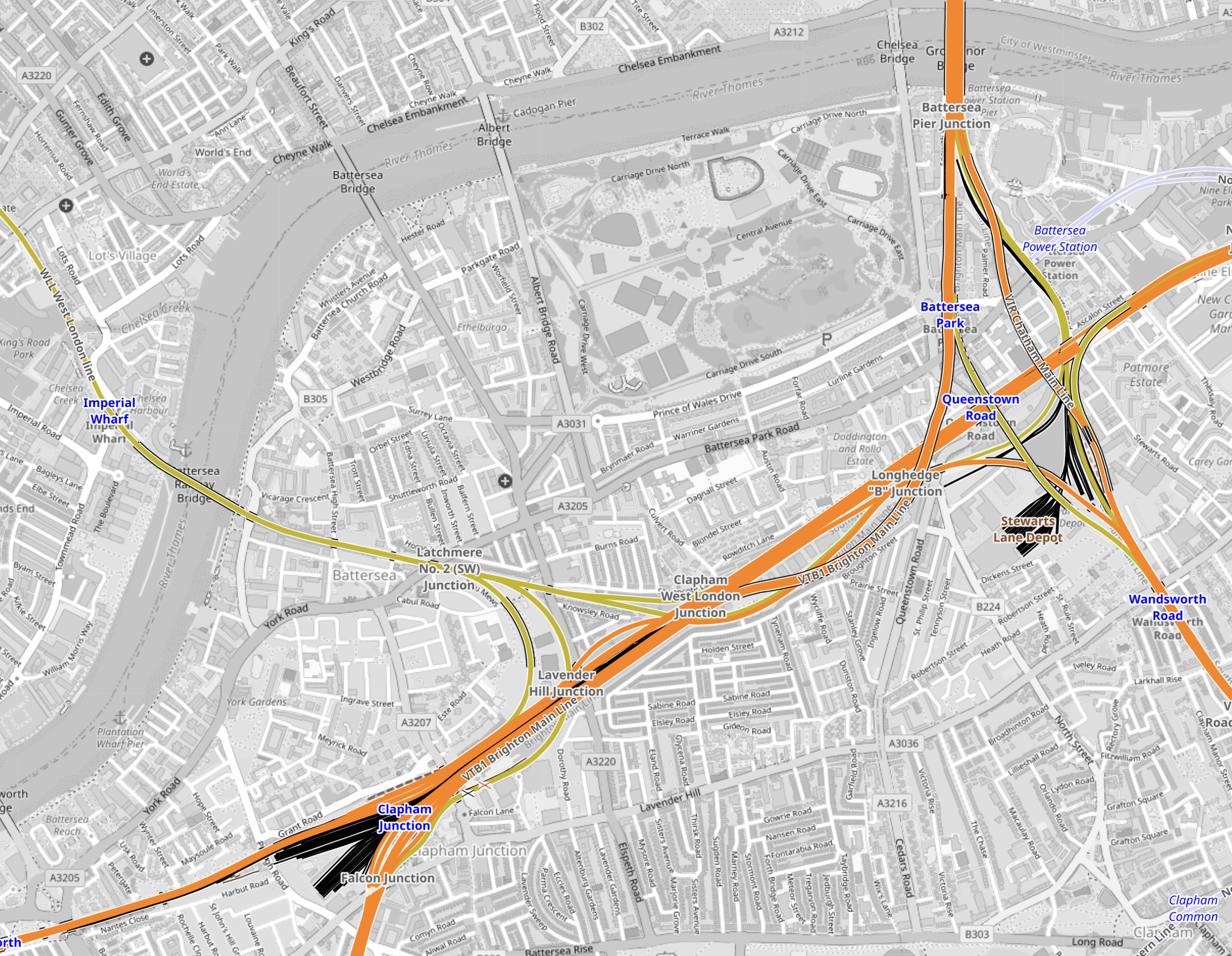
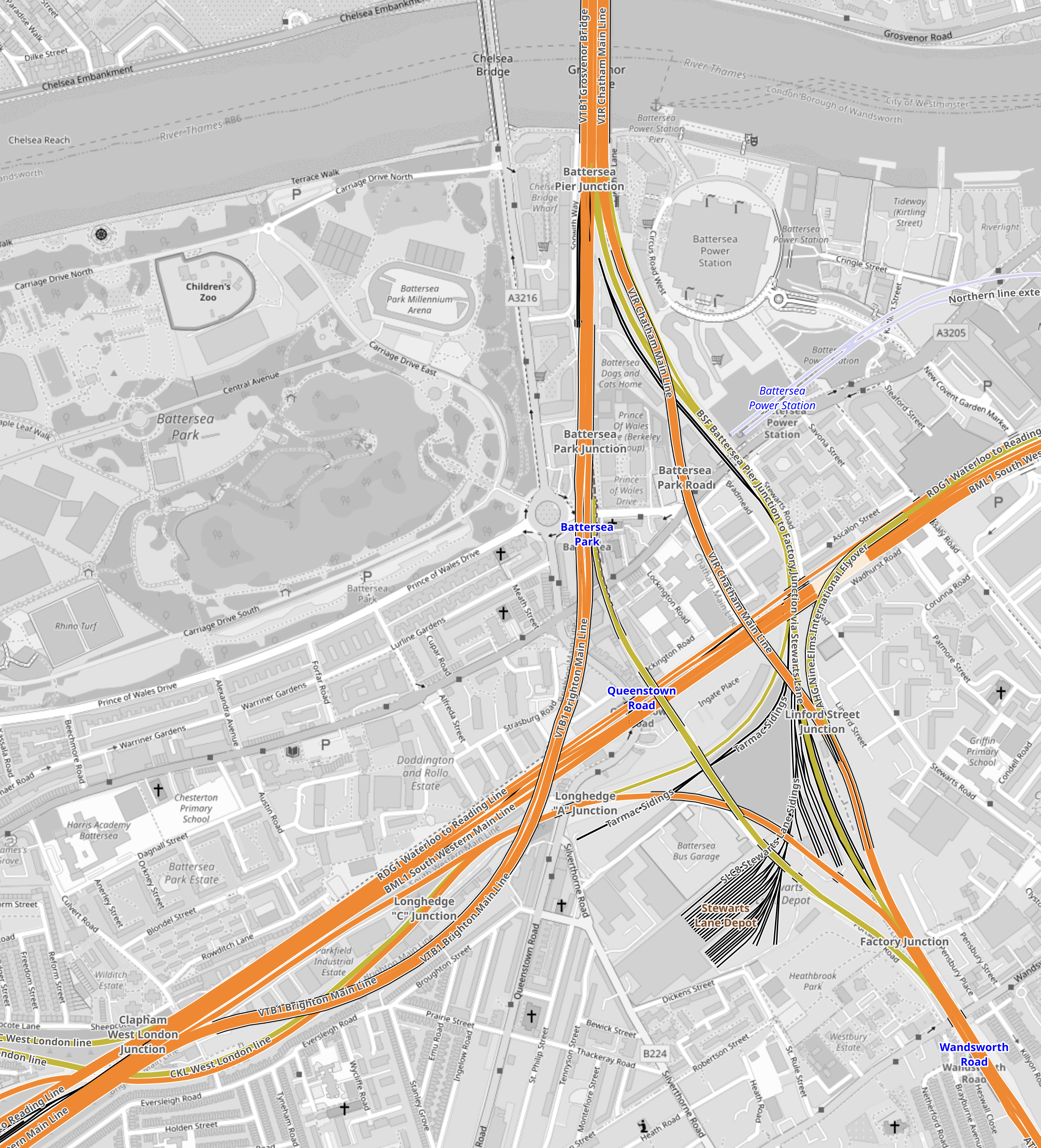
This map from OpenRailwayMap shows the railways that lie between Battersea Power Station and Clapham Junction stations.
Note.
- Battersea Power Station station is in the North-East corner of the map.
- Clapham Junction station is in the South-West corner of the map.
- The main line between Waterloo and Clapham Junction stations runs diagonally across the map.
- Branching North from this line is the line between Victoria and Clapham Junction stations.
Could an Underground sized railway be bored between Battersea Power Station and Clapham Junction stations?
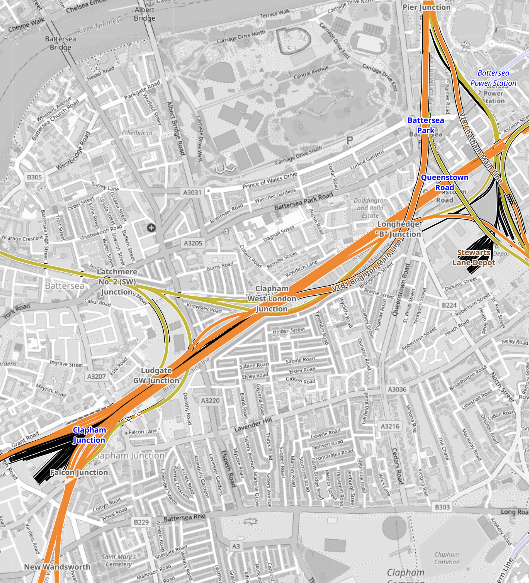
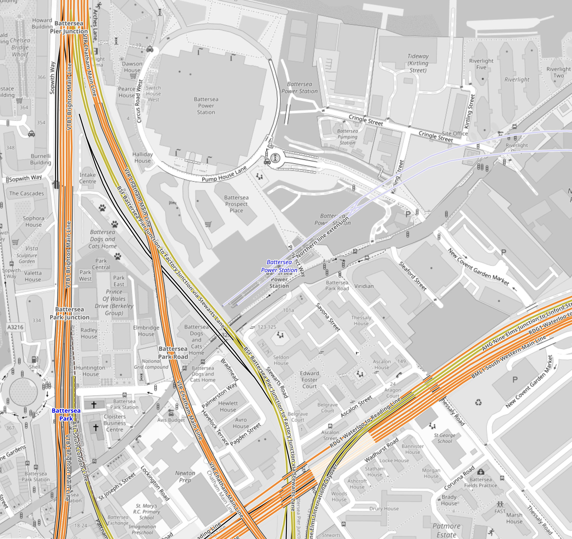
This map from OpenRailwayMap shows the railways around Battersea Power Station station.
Note.
- Battersea Power Station station is in the North-East corner of the map.
- The orange line going North-South is the line between Victoria and Clapham Junction stations.
I suspect if they used the Irish Tunnelling Method or hand digging, as was used recently at Bank, twin tunnels could be dug from Battersea Power Station station to deep under the Waterloo and Clapham Junction line.
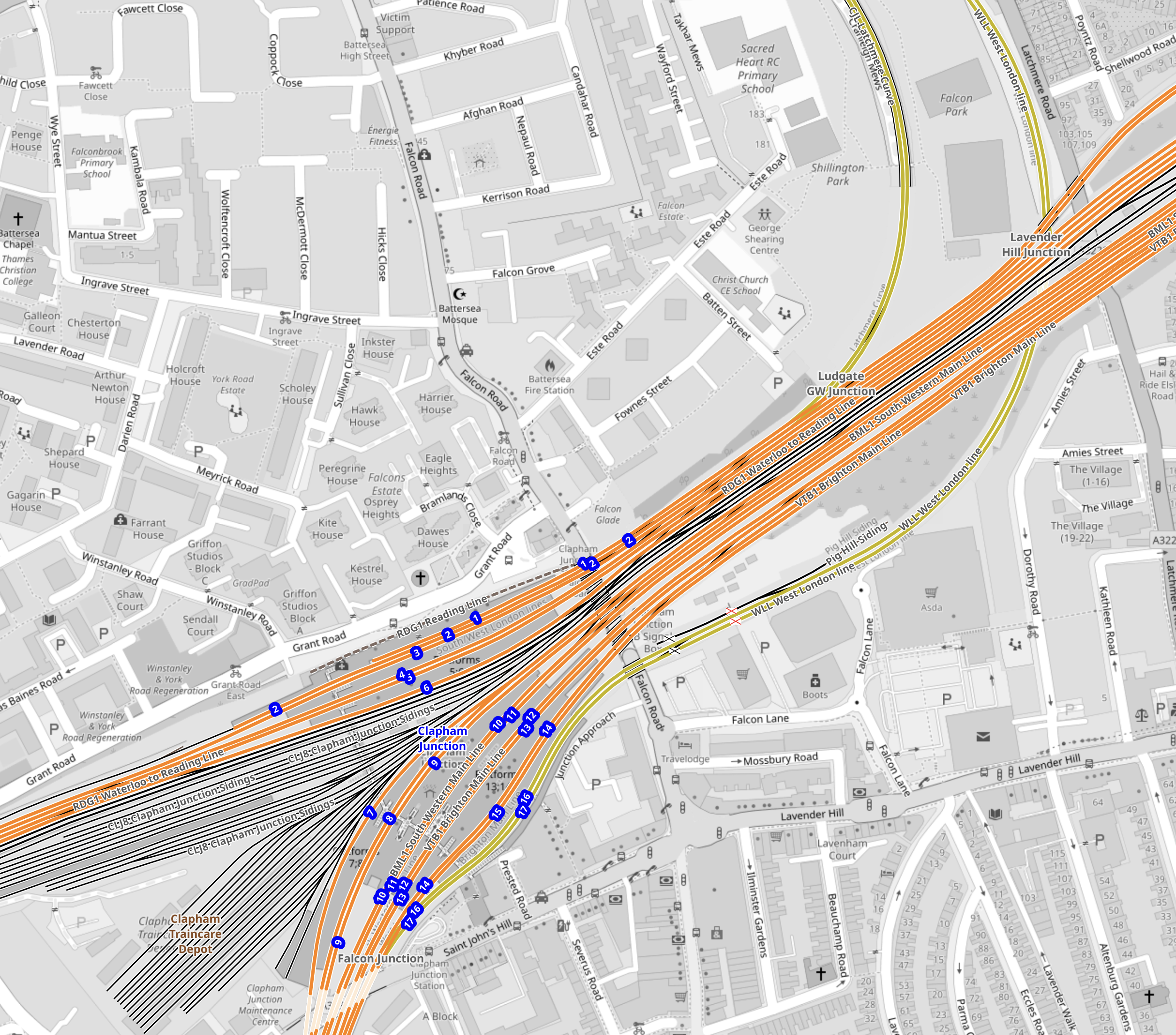
This map from OpenRailwayMap shows the railways around Clapham Junction station.
Note.
- Clapham Junction station is in the South-West corner of the map.
- Two deep underground platforms for the Northern Line would be built to the North-East of Clapham Junction station.
- Escalators and lifts would transfer passengers to and from the existing platforms.
- I suspect the Victorian infrastructure is fairly simple and elegant escalators can be threaded through, as they have been at London Bridge station.
I believe that a modern spectacular interchange can be built at Clapham Junction station to connect the National Rail lines with the Northern Line extension at Battersea Power Station station.
Thoughts On Extending The Northern Line To Clapham Junction
As I wrote in Northern Line Could Be Extended To Clapham Junction In Regeneration Plans, the extension of the newly-built extension to Battersea Power Station station could be further extended to Clapham Junction station.
Railways Between Battersea And Clapham
This map from OpenRailwayMap shows the tracks that run between the two stations.

Note.
- Battersea Power Station station is in the North-East corner of the map.
- The orange and yellow lines going North from that corner go to Victoria station.
- The orange and yellow lines going North-East from that corner go to Waterloo station.
- The yellow line going West is the West London Line to Shepherds Bush and Willesden Junction stations.
- Clapham Junction station is in the South-West corner of the map.
I estimate that the distance between Battersea Power Station and Clapham Junction stations is about three kilometres.
This map from OpenRailwayMap shows an enlargement of the tracks around Battersea.
Note.
- The tracks going North over the River to Victoria station.
- The tracks going East to Waterloo station.
- The tracks going South West to Clapham Junction station.
- The tracks from Victoria pass over and then join the tracks from Waterloo to continue to Clapham Junction station.
Battersea Power Station station can be seen to the North-East of the junction.
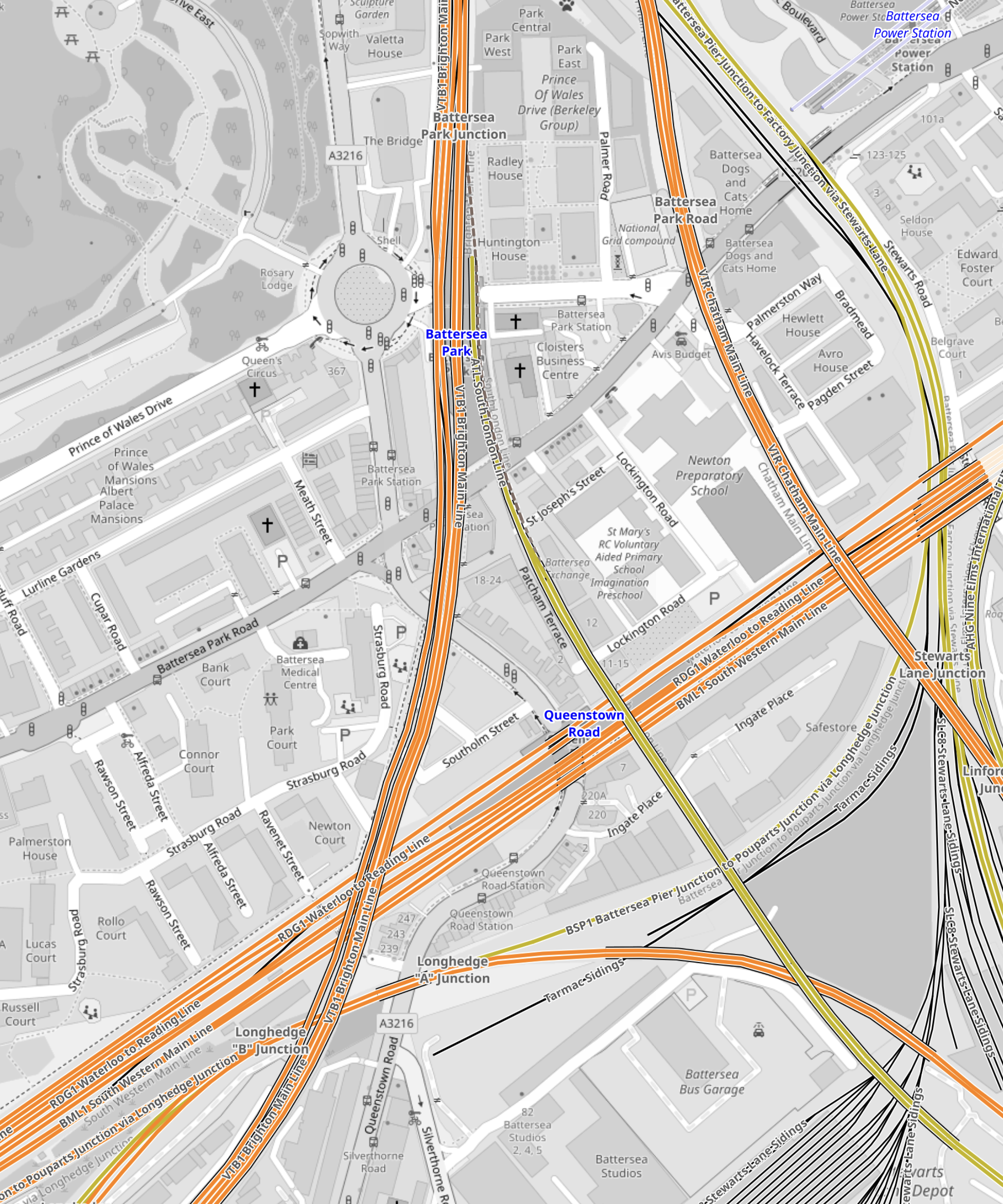
This map from OpenRailwayMap shows an enlargement of the tracks around Battersea Power Station station.
Note how the tracks go through Battersea Power Station station and terminate just before the lines into Victoria station.
It should also be noted that the platforms at Battersea Power Station station are reached using two sets of escalators, so they could be over forty metres below the surface. This would surely make the construction of tower blocks with deep foundations easier over the Northern Line.
But the depth would also enable an extended Northern Line to be below any existing or future construction.
This map from OpenRailwayMap shows the approaches to Clapham Junction station.
There are certainly a lot of tracks through Clapham Junction station.
Reasons For The Extension Of The Northern Line To Clapham Junction
These reasons come to mind.
To Enable Development In The Area
This is always a good reason.
In Network Rail To Outline Business Case For Clapham Junction Redevelopment, I said this.
The Rail Technology Magazine article talks of decking over the whole station and putting two million square feet of development on top. But it also cautions, it would be very expensive.
With that amount of development, there would be a need for as many transport links as possible.
To Improve Access To The Elizabeth Line For Passengers On Trains To And From Victoria
Victoria station does not have an Underground Line, that connects to easily the Elizabeth Line.
The best route to use is described in The Lizzie Line And Circle/District Line Interchange At Paddington – 1st July 2022, where you use the Circle to Paddington.
- To go to the West on the Elizabeth Line, take the Circle/District Line to Paddington.
- To go to the East on the Elizabeth Line, take the District Line to Whitechapel.
- To go to Liverpool Street take the Circle Line all the way.
Getting to the stations between Paddington and Liverpool Street means a change at either of those stations.
At Waterloo, you can use the Northern Line, which has a direct connection to Tottenham Court Road on the Elizabeth Line.
Connecting to the Northern Line at Clapham Junction will give Victoria-bound passengers, the advantages of those going to Waterloo.
An Alternative Way Of Connecting Victoria To The Elizabeth Line
The lack of an easy connection between the Victoria and the Elizabeth Line is a pain and I believe that it was a major omission in the design of the Elizabeth Line.
- Dear Old Vicky has a frequency of upwards of thirty trains per hour (tph)
- With some improvements at stations like Oxford Circus, Highbury & Islington and Walthamstow Central, the line could handle some more passengers.
- More step-free access would also help increase capacity.
- Engineers are a competitive bunch and I could see the day, when Vicky is running at 40 tph.
If Vicky was running at forty full tph, it would be moving 45120 passengers per hour.
This would mean that to match the passenger capacity of the older line, the Elizabeth Line would have to be running at a frequency of thirty tph.
As passengers at the ends of the line have difficulty getting to places like Paddington and Heathrow, a connection between the two Queens would really help.
Vicky was universe-class in the 1960s and now she needs updating to the 21st Century.
This map from cartometro shows the Lines through Bond Street and Oxford Circus stations.
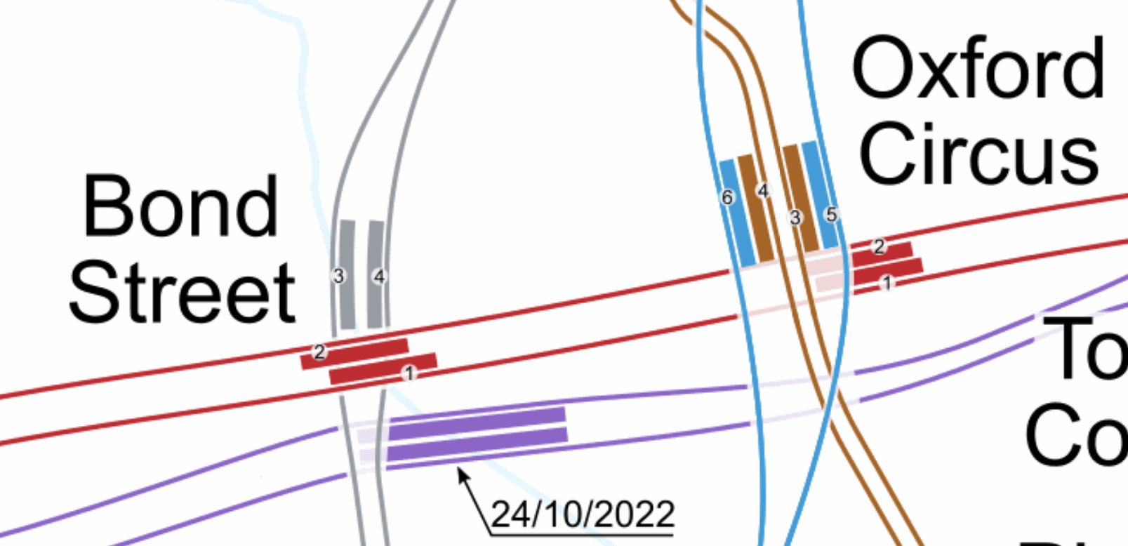
Note.
- The Bakerloo Line is shown in brown.
- The Central Line is shown in red.
- The Elizabeth Line is shown in purple.
- The Victoria Line is shown in light blue.
- The Elizabeth Line is the deepest line.
In addition, consider.
The Eastern exit of the Elizabeth Line at Bond Street station has three escalators and lifts. It also opens onto Hanover Square, so it won’t suffer from overcrowding problems outside.
- Hanover Square is just a garden, with no car park underneath, so pedestrian tunnels could pass under it
- I also suspect there are no existing or planned buildings between the two stations with deep foundations that would block a pedestrian tunnel.
- With the capability and ingenuity of three-D design software, I can see wide tunnels being created that would link Oxford Circus and the two Bond Street stations.
- The new wide tunnels at Bank station have opened up the station’s capacity and all the tunnels were dug traditionally.
- If it was felt to be needed, moving walkways could be added, just as they have been at Bank station.
I am absolutely sure, that by using the ideas and methods, that have worked so well in the upgrade of Bank station, that Oxford Circus and Bond Street stations could be turned into a London Superhub Station, that connects all the Underground lines together and has entrances all over the area.
The benefits of such a station would be.
- It would provide a high-capacity link between London’s two highest-capacity Underground Lines; Elizabeth and Victoria.
- It would provide a high-capacity link between the Elizabeth Line and Euston, St. Pancras and King’s Cross.
- It would provide a high-capacity link between the Elizabeth Line and Victoria.
- It would provide a high-capacity link between the Elizabeth Line and High Speed Two.
- Areas like Brixton, Haringey and Walthamstow would gain a much needed link to the Elizabeth Line for Heathrow and Paddington.
Wikipedia says this about the building of the Bank Station Upgrade.
As part of the development of the scheme, TfL worked with potential bidders to improve the design of the station from TfL’s original design. The design proposed in the winning bid by Dragados was 9.7% cheaper than the original design (saving TfL £60m), took 10 months less time to construct than the original design (the proposed closure of the Northern line was also 5 weeks shorter), and the layout of the station was more efficient. This substantially improved the benefit–cost ratio by 45% to 3.5:1.
The Mayor should be knocking on the door of Dragados and asking them for a price for a design and build for a West End Superhub station.
A Possible Route For The Extension Of The Northern Line To Clapham Junction
I suspect that the simplest route for the extension of the Northern Line would be to bore or dig a twin-track railway underneath the numerous other railways in the area.
It could terminate in two underground platforms at Clapham Junction station.
This is the first map of this post and it shows the tracks that run between the two stations.
Note.
- Battersea Power Station station is in the North-East corner of the map.
- Clapham Junction station is in the South-West corner of the map.
The Western of the pair of orange Lines going off the map in the North-East corner of the map is the Brighton Main Line.
It passes through Battersea Park station.
It passes over the South Western Main Line out of Waterloo.
It then loops to the West and joins the lines to Clapham Junction on the Southern side.
It serves four platforms at Clapham Junction; 12 and 14 are up platforms and 13 and 15 are down platforms.
This Google Map shows an overview of Clapham Junction station.
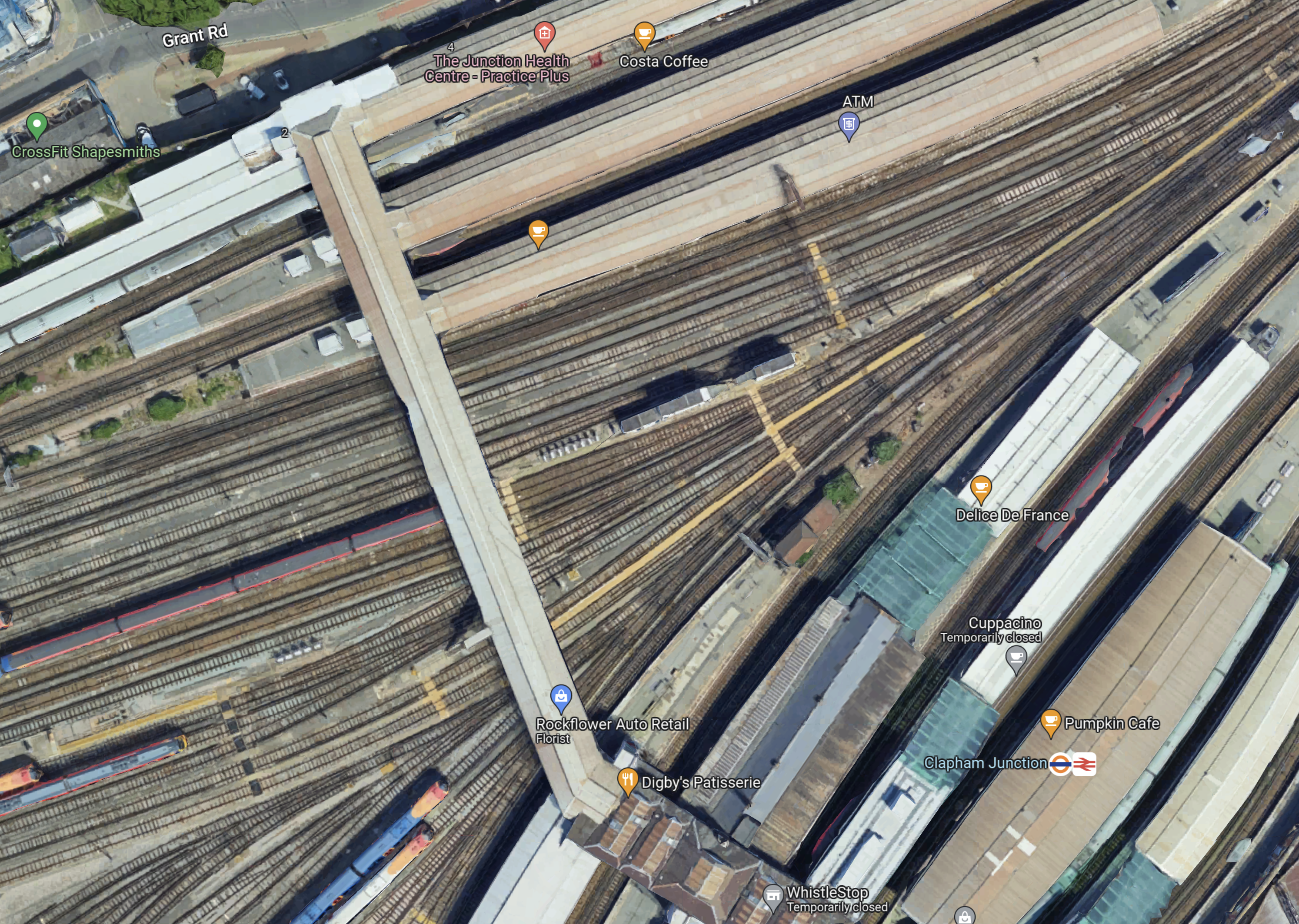
Note.
- Platforms 1 and 2 at the top of the map, handle London Overground services.
- Platforms 3 to 11 handle South Western Train services.
- Platforms 12 to 17 handle Southern services.
- Platforms 9 and 10 have a Delice de France cafe.
- Platforms 11 and 12 have a Cuppacino cafe.
- Platforms 13 and 14 have the logos.
- All platforms have full step-free access with lifts to the wide footbridge that connects all platforms.
The platforms don’t seem to be very wide and putting stairs and escalators down to underground platforms could be a difficult proposition.
This map from OpenRailwayMap shows shows the platforms at Clapham Junction station and the track layout to the West of the footbridge.
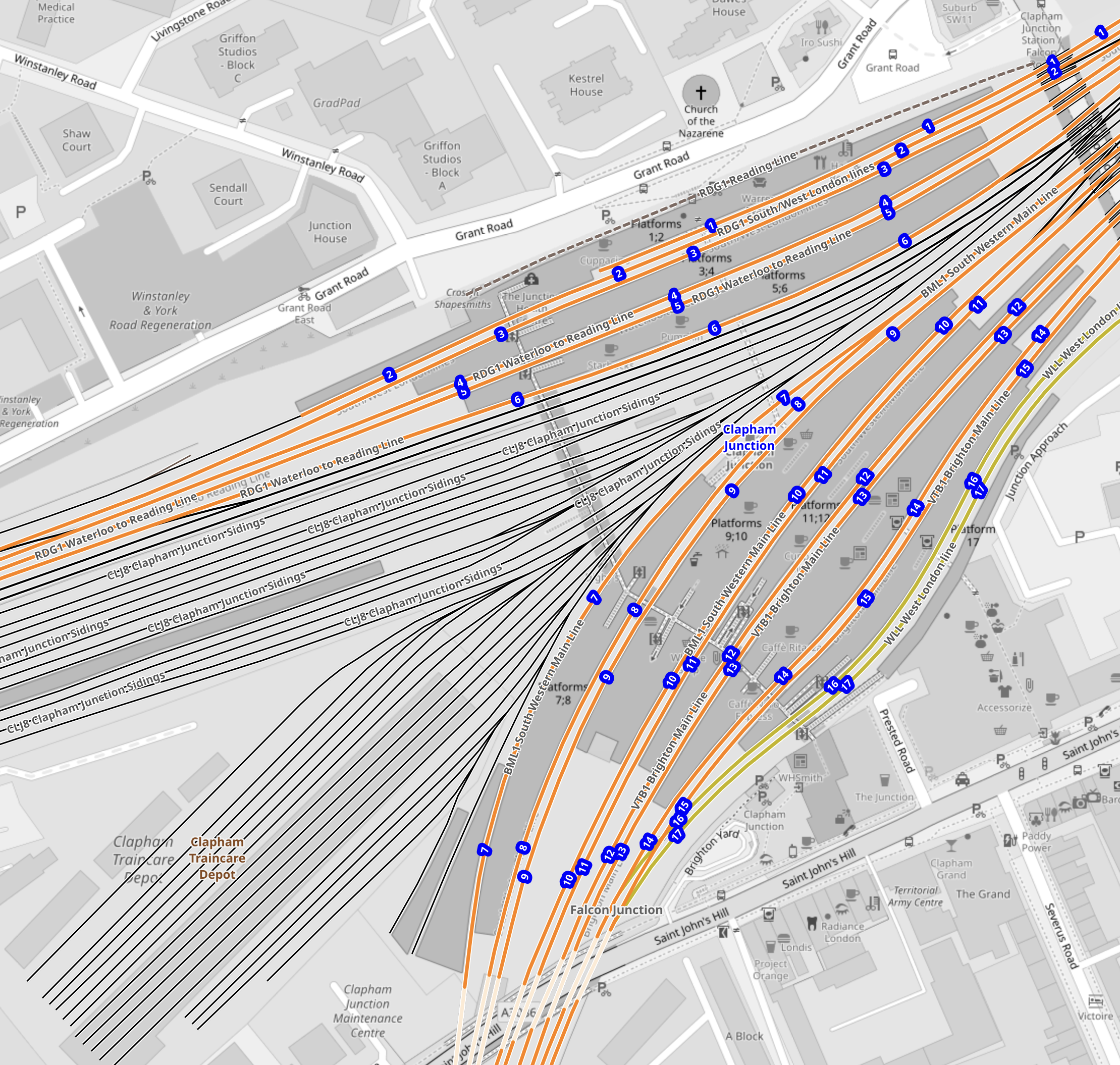
Note.
- The tracks through the platforms are shown in orange.
- The blue dots are platform numbers.
- The bridge connecting all the platforms is shown shaded in the middle of the map.
- To the West of the bridge are Clapham Junction Sidings and Clapham Traincare Depot.
These pictures were taken from the bridge.
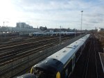
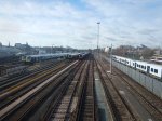
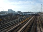
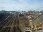
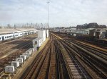
Note.
- The top row of pictures were taken looking West.
- The bottom row of pictures were taken looking East.
- Many of the tracks are electrified.
- There is a lot of space to park trains.
Will all the space be needed now, that a new depot has been built at Feltham.
Could Two New Surface Platforms Be Built For The Extension Of The Northern Line To Clapham Junction?
Consider.
- The step-free bridge across all the platforms at Clapham Junction station works well.
- It is connected to the streets around the station at both ends.
- Clapham Junction station will be redeveloped and surplus depot land could be used for housing.
- As the maps show, there is a large gap in the platforms between the South Western Railway and the Southern sides of the station.
- As Battersea Power Station station can turn services on the Northern Line with only two platforms, there would only need to be the same number of Northern Line platforms at Clapham Junction.
So could an extra pair of platforms be built under the bridge, with stairs and a lift similar to the existing platforms?
- The platform would have full step-free access.
- The platforms could be long enough for any future trains.
- There could be sidings for a few trains.
- The tunnels from Battersea Power Station would surface just outside the station.
- There would need to be a crossover or a turnback siding for operational reasons.
I also think, that once the depot and sidings at Clapham Junction have released the space, the new platforms and tracks could be installed without interrupting main line services through the station.
Would The Extension Of The Northern Line Be Electrified?
Consider.
- Merseyrail were not allowed to use third-rail electrification to Headbolt Lane station and had to use batteries.
- The Northern Line was extended to Battersea Power Station station using London’s four-rail electrified system.
- Clapham Junction station has third-rail electrification everywhere.
I think that the authorities would be very churlish not to allow electrification to Clapham Junction.
Conclusion
I believe it is possible to extend the Northern Line to two new surface platforms at Clapham Junction station.
But I also believe that using similar methods to those used in the Bank Station Upgrade, that a full interchange between the Elizabeth and Victoria Lines can be built at Oxford Circus and Bond Street.
.
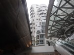
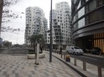
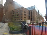
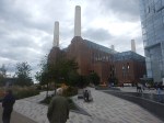
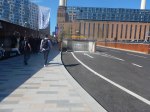
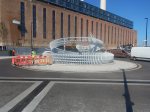
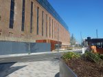
Battersea Power Station – 14th October 2022
I went to Battersea Power Station today and took these pictures.


Note.
- The picture of my jacket was taken in the toilet. All male toilets should have a hook for jackets.
- The crane is still in place.
- There are a number of shops still to open.
- There was no food store, although a Marks and Spencer’s food store is coming soon.
- The only place to have a coffee and cake and sit down was Starbucks. But I never eat in an American cafe or eat American food, as I don’t trust their gluten labelling.
One guy I met described it as Dubai without the sand.
I have some thoughts.
Getting There
There are two main routes.
- Northern Line to Battersea Power Station station.
- Thames Clipper to Battersea Power Station pier.
I went by the Northern line, changing both ways at Tottenham Court Road station to and from the Elizabeth Line.
- This interchange is a short walk and step-free, if you use the lift.
- There are no trains to Battersea Power Station on the Bank branch of the Northern Line.
- There are five trains per hour (tph) to Battersea Power Station, with an extra two tph in the Peak.
- There are no Night Tube trains to Battersea Power Station.
I can see this service being improved.
Arriving At Battersea Power Station By Underground
Punters were certainly arriving.
Gluten-Free Food
There was absolutely none, that I could find.
At least though a Gordon Ramsay restaurant is opening soon.
Signage
It wasn’t good. But then I have found several modern shopping centres work on this principle.
Conclusion
Canary Wharf is better.
- Partly because the shops are more useful and to my taste.
- But mainly because it is on the Elizabeth and Jubilee Lines, and the DLR.
- All rail lines go through Canary Wharf rather than terminate there.
Battersea Power Station might be better, when the Northern Line is extended to Clapham Junction station.
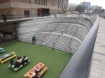
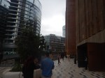
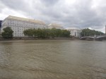
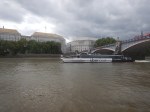
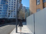
Battersea Power Station Station To Battersea Power Station Pier – 18th September 2022
I walked between Battersea Power Station station and Battersea Power Station pier.


Note.
- A new route between the station and the pier has been opened up, which is shorter.
- The development opens on the fourteenth of next month, but there is already some good restaurants and coffee shops.
- The corgi was the first one I’d met for a few years.
I walked between the station and the pier in under ten minutes.
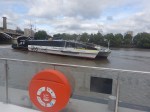
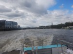
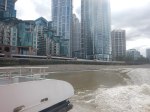
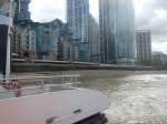
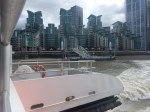
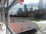
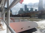
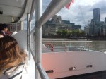
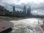
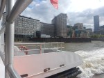
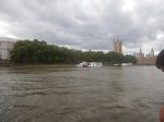
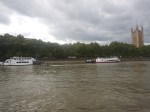
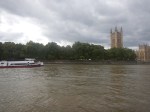
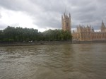
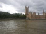
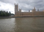
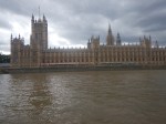
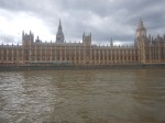
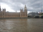
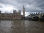
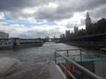
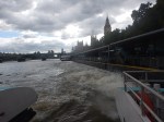
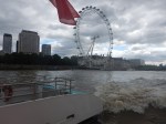
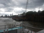
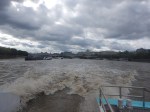
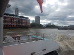
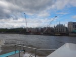
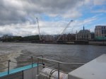
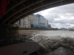
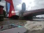
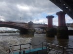
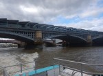
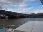
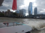
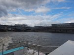
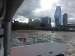
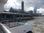
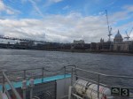
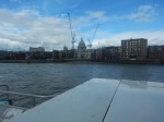
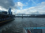
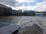
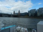
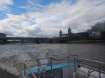
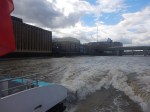
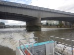
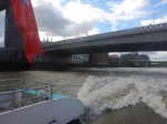
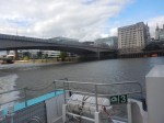
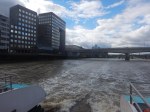
Battersea Power Station To London Bridge – 18th September 2022
I took a Thames Clipper from Battersea Power Station to London Bridge.
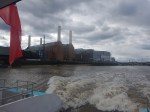
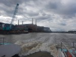
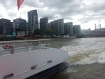
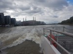
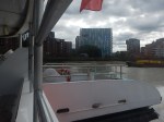
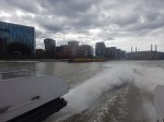
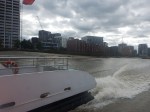
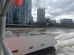
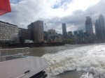
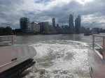
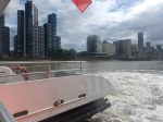
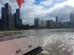
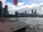
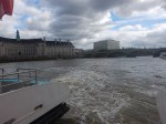
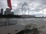
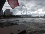
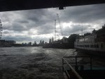

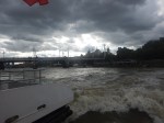
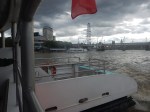
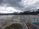
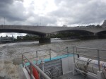
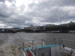
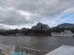
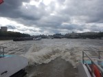
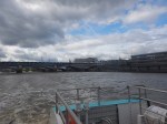
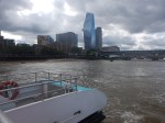
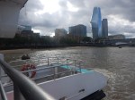
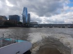
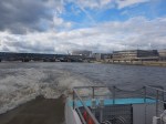
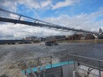
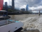
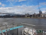
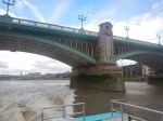
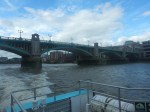
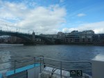
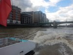
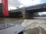
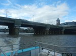
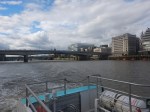
Note.
- The South Bank is generally to the left in the pictures.
- I took a Northern Line train to Battersea Power Station pier.
- As I finished at London Bridge pier, it was convenient for the Northern Line.
- I took these pictures from the back of the boat in the open as the windows were so dirty.
- In some pictures you can see the power of the boat, as it pulls away from the stops.
- The boat passed three of the super sewer sites.
- There were large numbers on the South Bank queuing to pay their respect to The Queen.
The fare was £7.70 on my Oyster card and the journey took under forty minutes.
London’s Newest Property Hotspot Has Been Revealed — And It’s On The NLE Tube Line
The title of this post, is the same as that of this article on the Metro.
This doesn’t surprise me one bit.
Any new train or tram line, whether it is under or over the ground always creates a property hot spot.
That’s why London needs to develop the West London Orbital Railway, Crossrail to Ebbsfleet and New Bermondsey station as soon as possible, as the areas they serve need a lift.
On a wider view, it is also why reopening rail lines is such a good policy. Some might object to property hot-spots, but most residents of the UK, like it when property prices rise!
Thoughts On Splitting The Northern Line
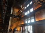
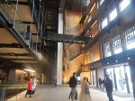
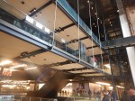
In Battersea Power Station Station Opens, I talked about the scale of the new Battersea Power Station station.
- It looks like it could have three entrances.
- It’s got four escalators and two lifts to go to down to platform level.
- It has two terminal platforms.
I feel it has been designed to handle as many passengers and trains as Morden station.
- Morden station has five platforms.
- The station is step-free.
- The station handles ten million passengers per year.
The signalling can handle up to thirty trains per hour (tph) to Morden.
It looks to me that Battersea Power Station station has been designed to be big enough to take half the trains from North London with ease.
The Bank Station Upgrade
In the Bank Station Upgrade, nearly a mile of new train tunnel and several shorter pedestrian tunnels were built.
They were dug not with a tunnel boring machine, but by traditional methods, that would have been understood by Brunel and the ancient Egyptians; pick and shovel, but probably assisted by the best modern electrical diggers and trucks.
I would expect that any tunnelling needed to split the Northern Line will not use an expensive tunnel boring machine.
The Northern Line will be going back to the future.
The Proposed Split
There has been talk of splitting the Northern Line into two separate lines for some years.
- The Western Line (Charing Cross Line) would run between Edgware and Battersea Power Station via Camden Town, Euston, Charing Cross and Kennington.
- The Eastern Line (Bank Line) would run between High Barnet and Morden via Camden Town, Euston, Bank and Kennington.
Note.
- I will call the two lines the Bank and Charing Cross Lines.
- Both lines could have Victoria Line frequencies of at least thirty tph.
- It is generally felt that the split would need a rebuild at Camden Town station to handle the extra passengers.
- Camden Town station also needs better access between the trains and the street.
- There would need to be better connections at Kennington and Euston stations.
Surely, the main advantages of the split would be as follows.
- Trains on both lines would go end-to-end without crossing a junction, where signals and points were constantly switching trains. This is why the Victoria Line can handle more than thirty-three tph.
- Trains will run at Victoria Line frequencies on both lines.
- All trains at Camden Town and Kennington stations would use a route without points to go as fast as possible through the station.
- Eliminating the points, would make both lines more reliable.
- Euston station will have upwards at least sixty tph connecting it to Crossrail.
Effectively, the new Bank and Charing Cross Lines would be able to perform just like Dear Old Vicky.
I will now look at where work needs to or could be done to successfully split the two lines.
Kennington Station
In Could Access Between Platform And Train Be Improved At Kennington Station?, I outlined how passengers might use Kennington station to change between the Bank and Charing Cross Lines.
I developed this rule.
The rule would appear to be if you’re on one line and are going to a station on the other, you change at Kennington station.
Staff would need to be on the platform to help those, who were changing direction.
But I do think changing can be made to work well with step-free access between train and platform on all four platforms at Kennington station.
It will be interesting to see, what proportion of train changes at Kennington are simple cross-platform changes, where there is no use of the steep stairs. I think it could be quite high.
I believe Kennington station will grow into a very smooth interchange between the Bank and Charing Cross Lines.
Although, there’ll be a problem for some time, if you’re in a wheelchair and want to go between Morden and Battersea Power station.
This could be solved by lifts between each pair of platforms and the intermediate level passage, which connects to the lifts to the surface.
The Camden Town Problem
This map from cartometro.com shows the lines around and through Camden Town station.

Note.
- Camden Town station has four platforms.
- The Eastern pair are under Kentish Town Road and connect to High Barnet in the North.
- The Western pair are under Camden High Street and connect to Edgware in the North.
- In each pair of tracks the Northbound track is above the Southbound track.
- There is a level passage between the two Northbound tracks, so it is an easy interchange, if you’re on the wrong train going North.
- The passage between the two Southbound tracks has stairs at either end, if you want to change Southbound trains at the station.
But the real problem lies South of the station; the horrendously complicated Camden Town Junction.
The junction must be able to handle trains going between the following stations.
- Bank and Edgware
- Bank and High Barnet
- Charing Cross and Edgware
- Charing Cross and High Barnet
Note in the map, that the High Barnet tracks dive under the Edgware tracks so they can form two separate pairs of tracks to Euston, only one of which goes via Mornington Crescent.
If there was a similar junction on the motorways of the UK or the Interstate Highways of the US, it would have years ago been simplified.
The split will mean the following.
- The Eastern pair of platforms will still be connected to High Barnet as now, but will also be directly connected to the tracks that go directly to Euston and on to Bank.
- The Western pair of platforms will still be connected to Edgware as now, but will also be directly connected to the tracks that go to Euston via Mornington Crescent and on to Charing Cross.
- Camden Town Junction could be seriously simplified, with perhaps the ability to swap between routes only available for depot and engineering movements.
I do suspect, it would also mean all trains from High Barnet will go via Bank and all trains via Edgware will go via Charing Cross.
- A proportion of passengers would have to change at Camden Town.
- Both routes would connect to High Speed Two at Euston.
- Both routes connect to the Central, Jubilee, Piccadilly and Victoria Lines.
- Improvements promised for Euston will give better access to the Sub-Surface Lines.
I think it will be a case of winning some good routes and losing others. Disgusted from Finchley might complain.
But then there will be Crossrail, which as it connects to both lines at Tottenham Court Road and Moorgate could give serious advantages.
The split isn’t without passengers who will object to losing their preferred route.
Camden Town Station
This document on TfL’s web site gives more details of the proposed capacity upgrade at Camden Town station. This schematic of the tunnels, platforms and walkways shows how the station could look in a few years time.

Note.
- New tunnels are shown in light grey.
- Existing tunnels are shown in dark grey.
- The Northbound platforms are above the Southbound ones.
- The tunnels in the foreground are those of the Charing Cross Line.
- The far tunnels are those of the Bank Line.
- The new Buck Street entrance is labelled 8.
- There is a new pedestrian tunnel between the two Northbound Lines.
- Below it is a new tunnel between the two Southbound Lines.
- There is an existing passage linking the four lines.
The full upgrade is very much on the back burner, but could Camden Town station be upgraded with the proposed extra cross passages.
- These would enable passengers to change lines easily on the level.
- Passengers changing between the Bank and Charing Cross Lines could be kept away from the existing escalators and the space at their bottom.
- The tunnels would increase the circulation area.
- The tunnels would be part of the new Buck Street entrance if it were to be built.
I feel with improved cross-platform interchange, Camden Town could function as an interchange station between the Bank and Charing Cross Lines.
A similar rule as I used for Kennington station would apply for passengers.
The rule would appear to be if you’re on one line and are going to a station on the other, you change at Camden Town station.
Staff would need to be on the platform to help those, who were changing direction.
But it would be a more comprehensive and easier interchange than Kennington, as all changes would be without steep stairs.
Once Camden Town station is working well with the new cross passages, I would then get a developer to put a large development on the proposed site of the Buck Street entrance, with a new entrance with lifts and escalators underneath, that reached down to the new cross tunnels.
After what the contractors did at Whitechapel, I suspect this could be achieved, whilst keeping the trains running and leaving the existing Camden Town station intact.
This Google Map shows the area between Camden Road and Camden Town stations.
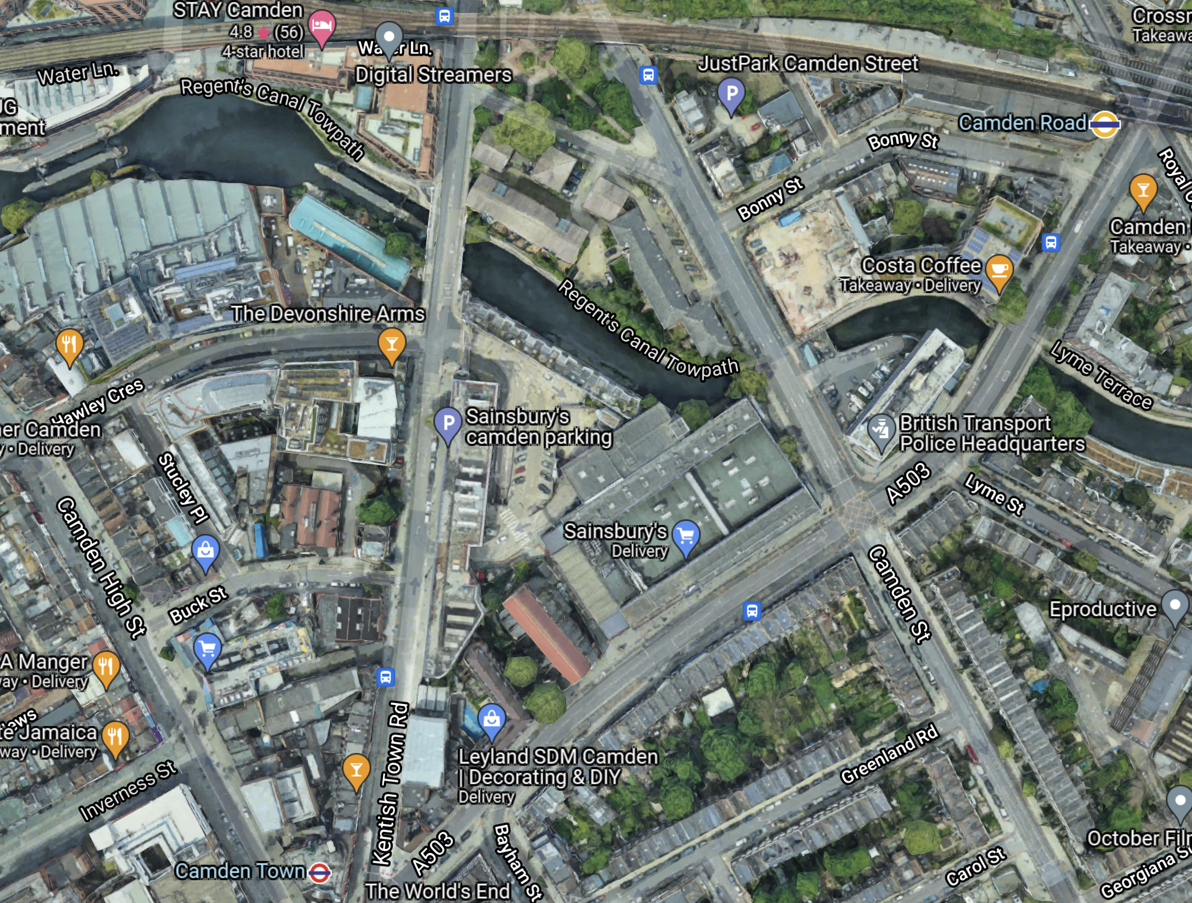
Note.
- Camden Road station on the North London Line is in the North-East corner of the map.
- Camden Town station is at the bottom of the map towards the West.
- The Charing Cross Line to Edgware is under Camden High Street.
- The Bank Line to High Barnet is under Kentish Town Road.
- Buck Street is to the North of Camden Town station connecting Camden High Street and Kentish Town Road.
- The red-roofed building in Buck Street is the former Hawley School, which is now owned by Transport for London and is earmarked for the new station entrance.
- The Regent’s Canal, which has a convenient towpath, runs East-West across the map.
- A lot of development is happening on the North bank of the canal.
The map doesn’t show how difficult it is to walk between the two stations along the busy Camden Road.
In Between Camden Road And Camden Town Stations Along The Canal, I walked between the two stations along the canal and then up Kentish Town Road. It took me fourteen minutes in total with seven minutes between the canal and Camden Town station.
I believe the following will happen.
- People living and working in the new developments will need access to Camden Town station.
- The Regent’s Canal towpath will be updated into a safer walking route between Camden Lock and Camden Road station, that serves a lot of the developments.
- More tourists will need to get to Camden Lock and the markets.
These will increase the need for extra capacity at Camden Town station.
The only way it will get built is by a private developer, who puts a lot of housing on the Buck Street site and sells it as quality housing in an iconic location.
A lot of politicians won’t like it, but solving the problems at Camden Town station, which is an overcrowding accident waiting to happen, is more important than their egos.
These pictures show some of the features of Camden Town station.
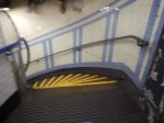
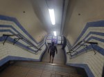


I believe Camden Town station could grow quickly into a very smooth interchange between the Bank and Charing Cross Lines.
In a few years time, when the Buck Street entrance is built, the capacity problems will be on their way to solution.
Finally, once the Buck Street entrance is complete, the original station can be refurbished.
Euston Station, Crossrail, Crossrail 2 and the Northern Line
Consider.
- Euston station is a very busy station and it will be even busier, when High Speed Two opens.
- Crossrail 2 will not be built before High Speed 2 opens.
- The Victoria Line doesn’t connect to Crossrail.
- The only connection between Euston station and Crossrail are the two branches of the Northern Line.
Splitting the Northern Line into the Bank and Charing Cross Lines will increase the number of Northern Line trains through Euston to at least sixty tph, if both lines can handle Victoria Line frequencies.
It looks to me, that making the Northern Line step-free at Euston is the best short-term alternative to building Crossrail 2.
Euston Station
Euston station is the third station, where the Bank and Charing Cross Lines connect.
This map from cartmetro.com shows the Northern Line through Euston station.
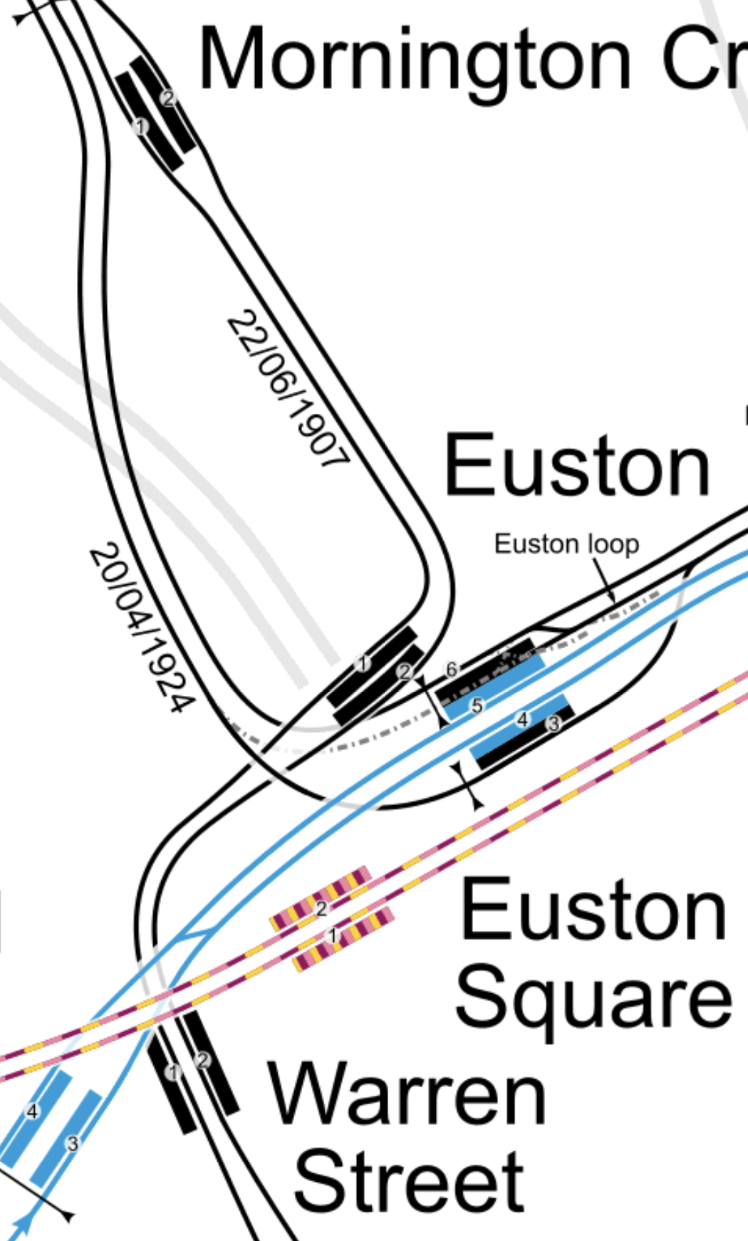
Note.
- The Northern Line is shown in black.
- The Victoria Line is shown in blue
- The Sub-Surface Lines are shown in purple and yellow.
In the map, the platforms are as follows going from top to bottom.
- Platform 1 – Northbound – Northern – Charing Cross to Camden Town
- Platform 2 – Southbound – Northern – Camden Town to Charing Cross
- Platform 6 – Southbound – Northern – Camden Town to Bank
- Platform 5 – Northbound – Victoria – Victoria to Walthamstow
- Platform 4 – Southbound – Victoria -Walthamstow to Victoria
- Platform 3 – Northbound – Northern – Bank to Camden Town
It is a bit unusual as the cross-platform interchange between Bank and Victoria Lines involves a change of direction.
With the development of Euston station for High Speed Two, I am sure interchange between the two branches of the Northern Line and the other lines at Euston will be made step-free.
Plans have already been published that will connect Euston Square station and Euston station. I wrote about it in The New Step-Free Entrance At Euston Square Station.
These pictures are of Euston station.
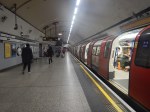
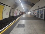
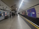
I feel the wide Platform 6 could give scope for innovation.
Level Access Between Train And Platform
I believe that many platforms on the Northern Line can be modified to give level access between train and platform.
In Could Access Between Platform And Train Be Improved At Kennington Station?. I outlined how it could be achieved at Kennington station.
At Kennington station, all platforms are straight and this is a prerequisite to making the access level.
I also feel that any straight platform with a Harrington Hump could effectively be given a full length hump.
I suspect that a lot of stations could be converted to level access between train and platform
Conclusion
I believe that splitting the Northern Line would be very worthwhile.
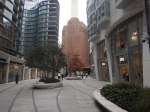
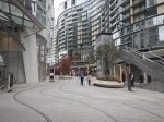
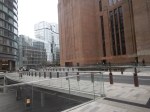
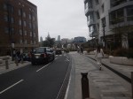
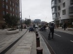
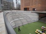
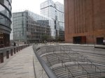
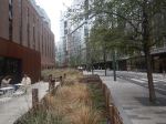
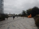
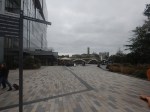
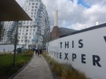
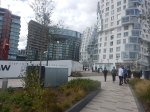
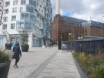
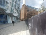
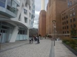
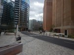
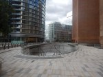
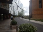
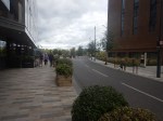
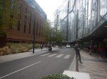
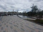
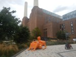
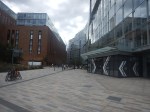
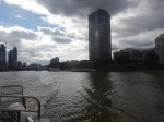
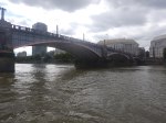
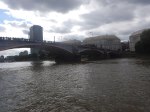
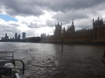
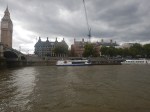
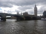
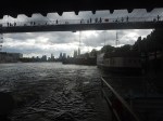
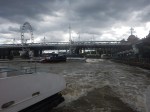
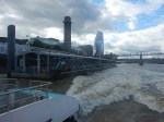
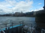
From Battersea Power Station Station To The River
I took these pictures as I walked from Battersea Power Station station to Battersea Power Station pier to get a Thames Clipper back to London Bridge.
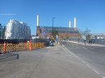
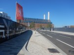
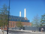
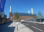
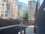
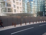

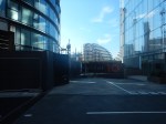

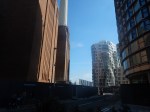


Note.
- There appears to be fake smoke coming out of the chimney in the third picture.
- I think the second entrance to the station will be close to where I walked.
- To my taste there appeared to be a lot of car parking.
The walk took me under ten minutes.
