Could The Madrid And Lisbon High Speed Line Become Iconic?
This article on Railway Gazette International is entitled ADIF AV Agrees EIB Loan As Extremadura High Speed Link Makes Progress.
This sentence in the first paragraph gives details of the route.
The loan will support completion of the 282 km high speed line between Talayuela, Plasencia Cáceres, Mérida and Badajoz.
It will carry both passengers and freight and eventually link Madrid and Lisbon.
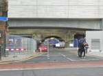
The article shows a spectacular bridge under construction.
So I got out my helicopter and decided to go and look for the bridge.
These are some sections and stations along the line.
The Railway Gazette article says this about the route to the East of Plasencia.
East of Plasencia however, land acquisition and preparatory works have proceeded more slowly. On this section, broad gauge tracks are to be laid as far as Talavera de la Reina, where there would be a junction with the conventional network and a gauge-changer. Passenger trains would then continue over 1 435 mm gauge tracks to join the existing Toledo – Madrid high speed line south of the capital.
Note.
- As I started from the East, it’s the other way round.
- If there is a gauge change and Iberian (broad) gauge to the West of Talavera de la Reina, is this to make it easier to connect to the Portuguese network?
- On the other hand, I thought, that all European-funded lines, as this one is, are supposed to be standard gauge.
- Will freight trains use gauge-change to get through?
As the Spanish do gauge-change well, I suspect they know what they’re doing, even if I don’t!
Two Routes From Madrid
Consider.
- Currently, trains between Madrid and Talavera de la Reina, use a single track line.
- The only sections of double-track are in stations and on the approaches to Madrid, after the trains pass Humanes de Madrid EMU depot.
- Plans appear to exist to link the new high speed route to Madrid, by using the existing Madrid and Toledo high speed line.
- This would reduce journey times and possibly increase capacity.
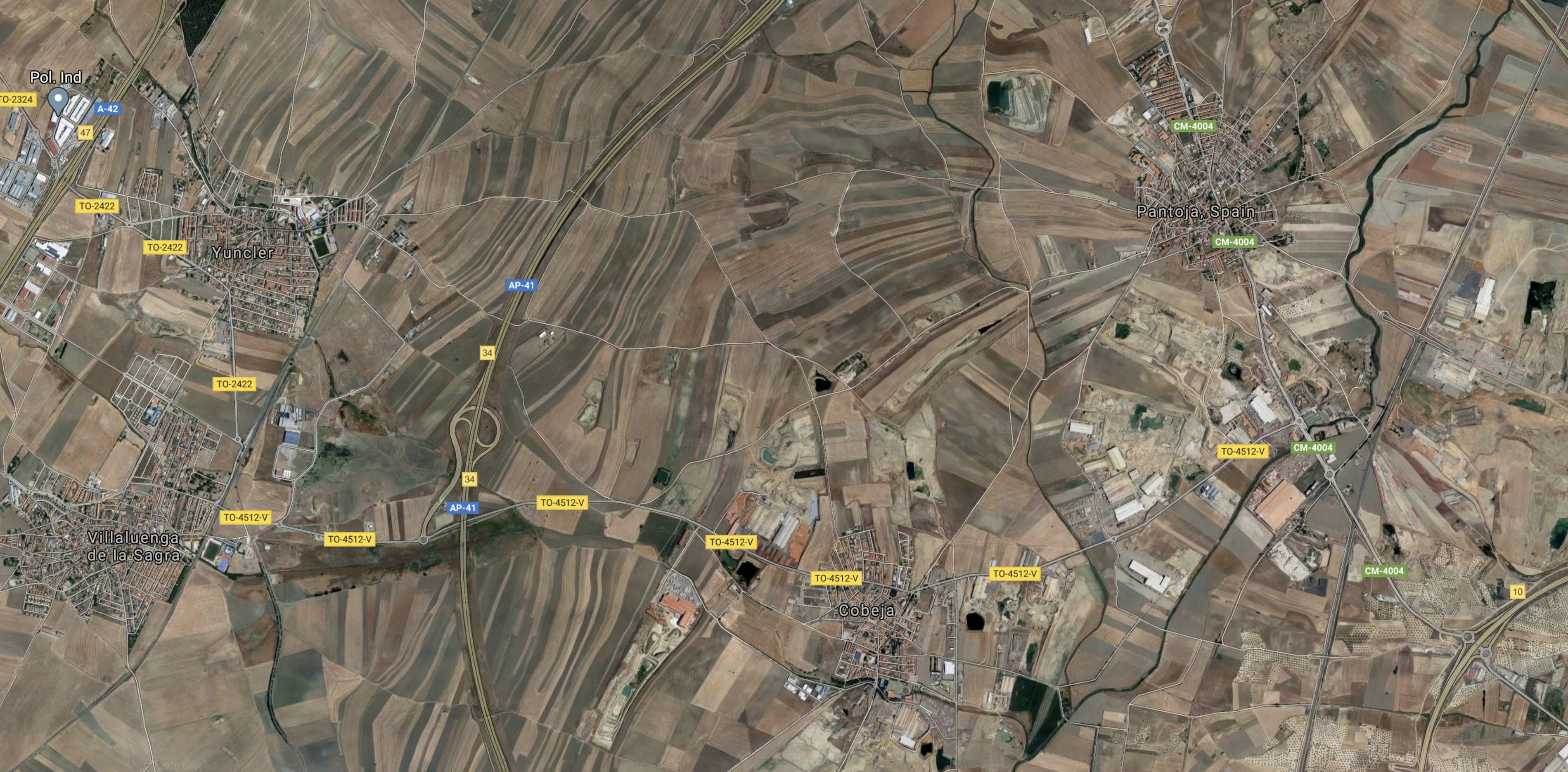
This Google Map shows the area between Msdrid and Toledo.
Note.
- The current single-track line between Madrid and Talavera de la Reina leaves the map in the South-Western corner.
- The line goes to the West of Villa Luenga de la Sagra and Yuncler before going to Madrid in a NNE direction.
- The Madrid and Toledo high speed line, runs diagonally in a SSW direction from the North-East corner of the map.
- The high speed line passes to the West of Cobeja and Pantoja.
Looking at the map, I don’t think it would be impossible to create a link between the two lines.
The Area Is Mainly Agricultural
This Google Map shows the mainly agricultural nature of the land.

Between Madrid and Talavera de la Reina, it also appears to not be very challenging and there doesn’t appear to be a major river, that would need to be crossed.
This should make construction easier!
Talavera de la Reina
This Google Map shows the railway station at the city of Talavera de la Reina.

Note.
- Madrid is to the East using standard gauge tracks.
- Badajoz is to the West using broad gauge tracks. Or does the standard gauge continue?
- The gauge change will be needed somewhere and it looks like it will happen here.
I can’t find any work here concerned with building the new high speed tracks.
Oropesa de Toledo
This Google Map shows the railway station in the town of Oropesa de Toledo.
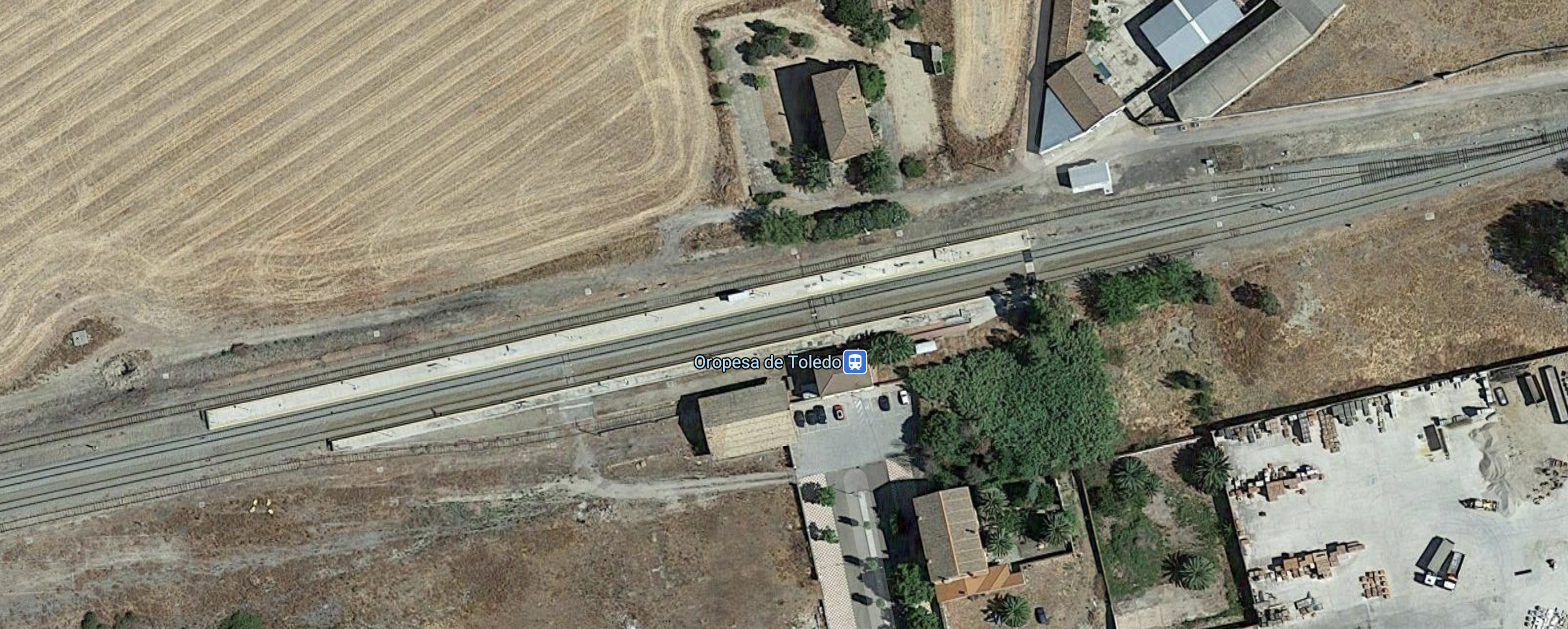
There is no sign of the high speed line.
Note.
- The high speed line stops rather abruptly. Will it continue in a tunnel?
- The current single-track railway, at the top of the map.
- The border between the two provinces at the right of the map.
No clues as to the gauge of the high speed lines.
Navalmoral de la Mata
The current line goes through the municipality of Navalmoral de la Mata.
This Google Map shows the station.

There appeared to be no sign of the new high speed line. On one of my maps it is shown to the North.
The Eastern End Of The High Speed Line
The first sight of the new high speed line was at the border of Extremadura.

Note.
- The high speed line stops rather abruptly. Will it continue in a tunnel?
- The current single-track railway, at the top of the map.
- The border between the two provinces at the right of the map.
No clues as to the gauge of the high speed lines.
Casatejada
This Google Map shows the municipality of Casatejada.
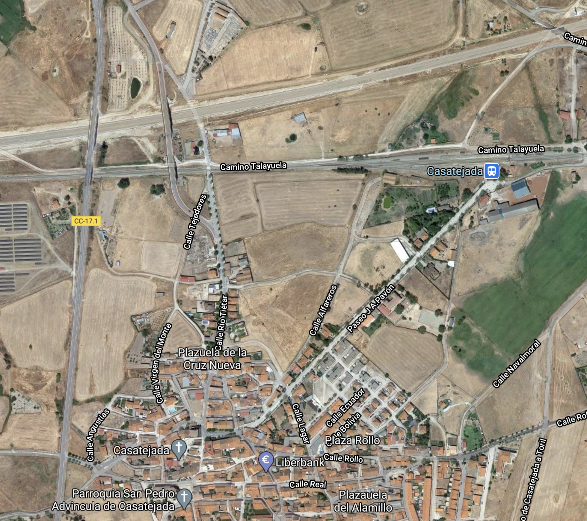
Note.
- The route of the new high speed line to the North.
- Wikipedia doesn’t say much about it.
It may have a station, but it doesn’t have too many trains.
The section of the high speed line ends just to the West of Casatejada, as this Google Map shows.
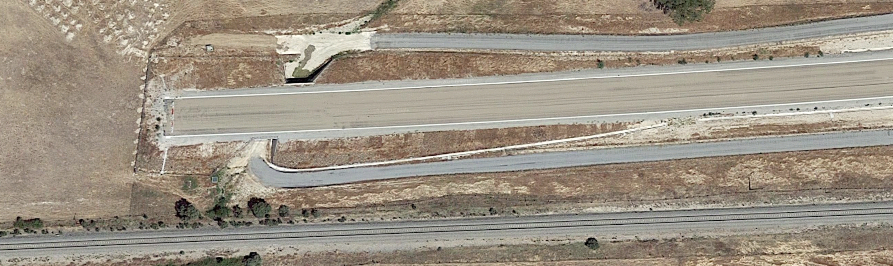
This section of the high speed line would seem to go all the way to the Eastern edge of Extremadura, which I showed in a previous section.
La Bazagona
This Google Map, shows the area of La Bazagona.
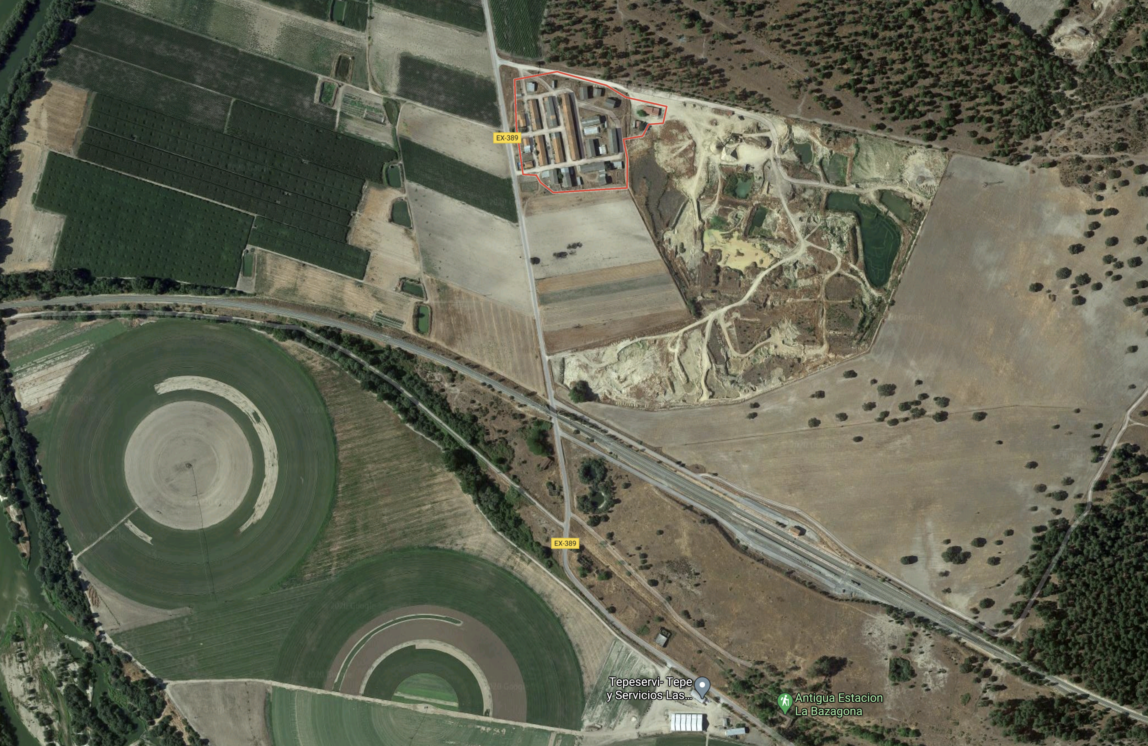
Note.
- The current railway curving across the map to the South-East corner.
- The two circle farms.
- Is a new community being built here?
It certainly looks like a new station is being built to serve the area.
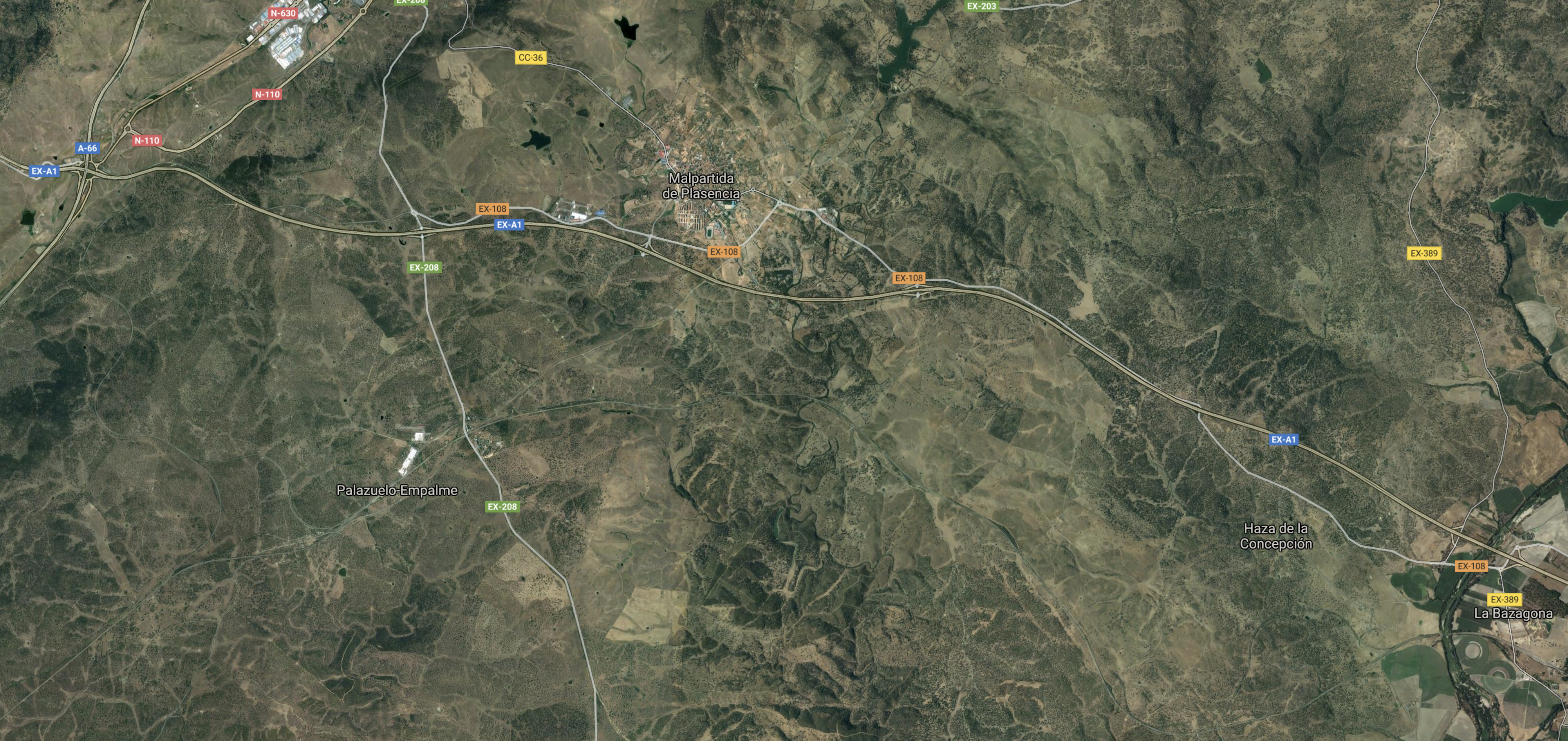
West Of La Bazagona
Consider.
- West of La Bazagona, except for the current line, that goes via Monfrague, Mirabel and Cañaveral.
- My European railway atlas, indicates the new high speed route goes between Monfrague and Plasencia and calls at a station called Plascencia Fuenteduñas.
- I can’t locate Plascencia Fuenteduñas.
This Google Map shows the area to the West of La Bazagona.
Note.
- La Bazagona is in the South-East corner of the map.
- Plasencia is creeping into the map in the North-West corner.
- The location of the current Monfrague station appears as a white dash and dot and to the West of the North-South road.
The current railway runs East West between La Bazagone and Monfrague.
Monfrague
This Google Map shows that except for a tobacco factory, there’s not much near Monfrague station.
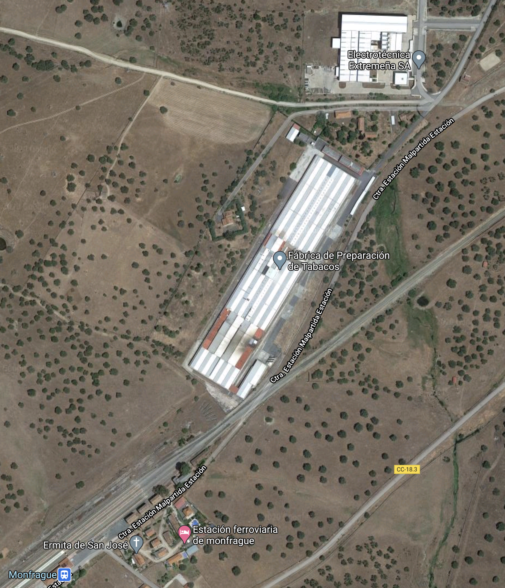
On other maps, where it is to a smaller scale, the station and the surrounding buildings appear as a dash and a dot.
It appears the station only has one train per day. But it was December, when I checked.
Mirabel
Mirabel is a municipality on the current line, that is shown in this Google Map.

From Wikipedia it appears to be worth a visit.
A Diversion of the Current Route
Between Mirabel and Cañaveral, the old route takes a diversion to the East.
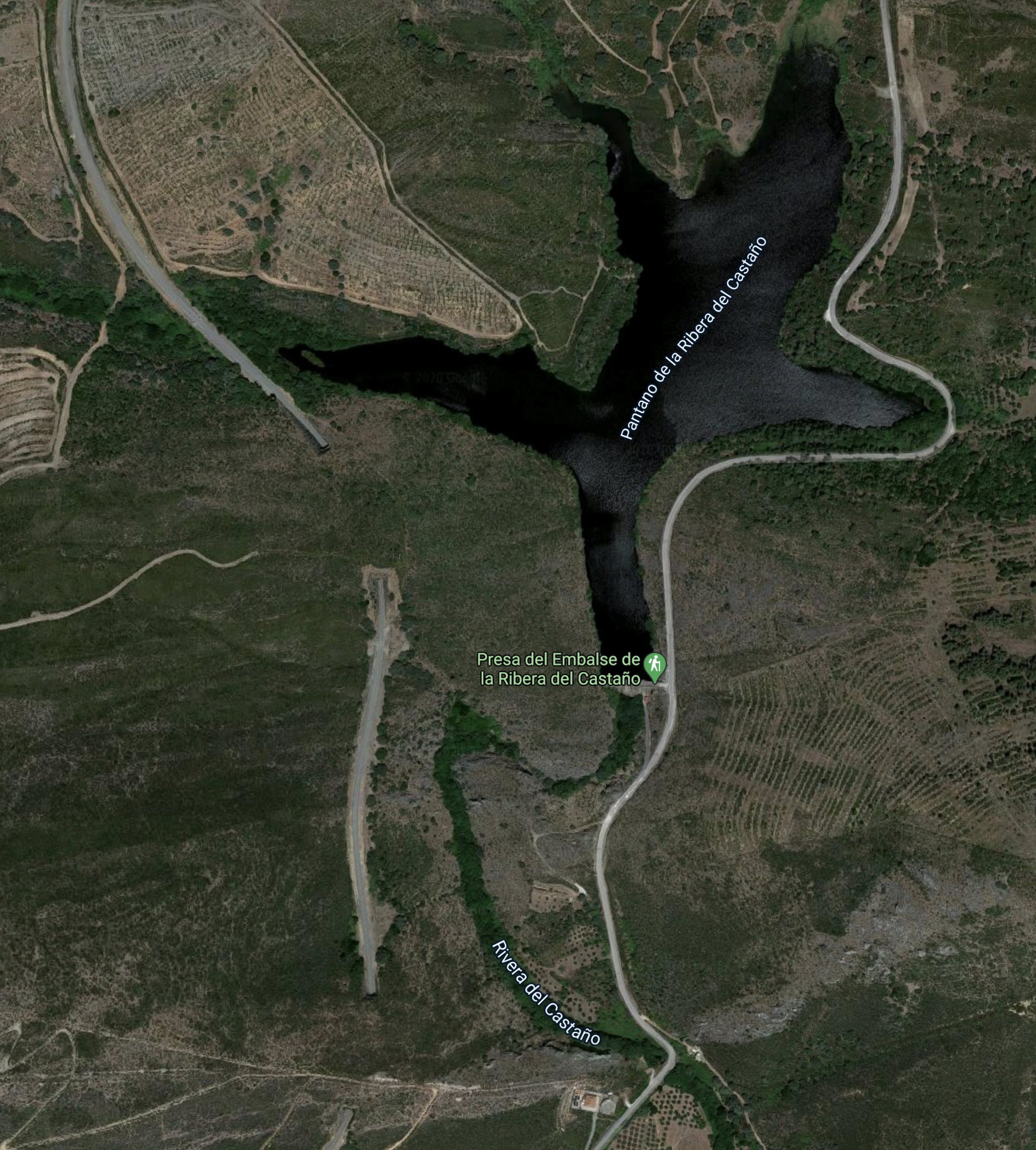
The railway goes to the West of the lake.
The green label indicates, it’s a hiking area.
The High Speed Line Becomes Visible Again
Since La Bazagona, I have followed the current route, but this Google Map shows where construction starts again for the new high speed line.
Note,
This is an enlargement of the South-West corner of the map.

Note the new high speed line, which stops abruptly.
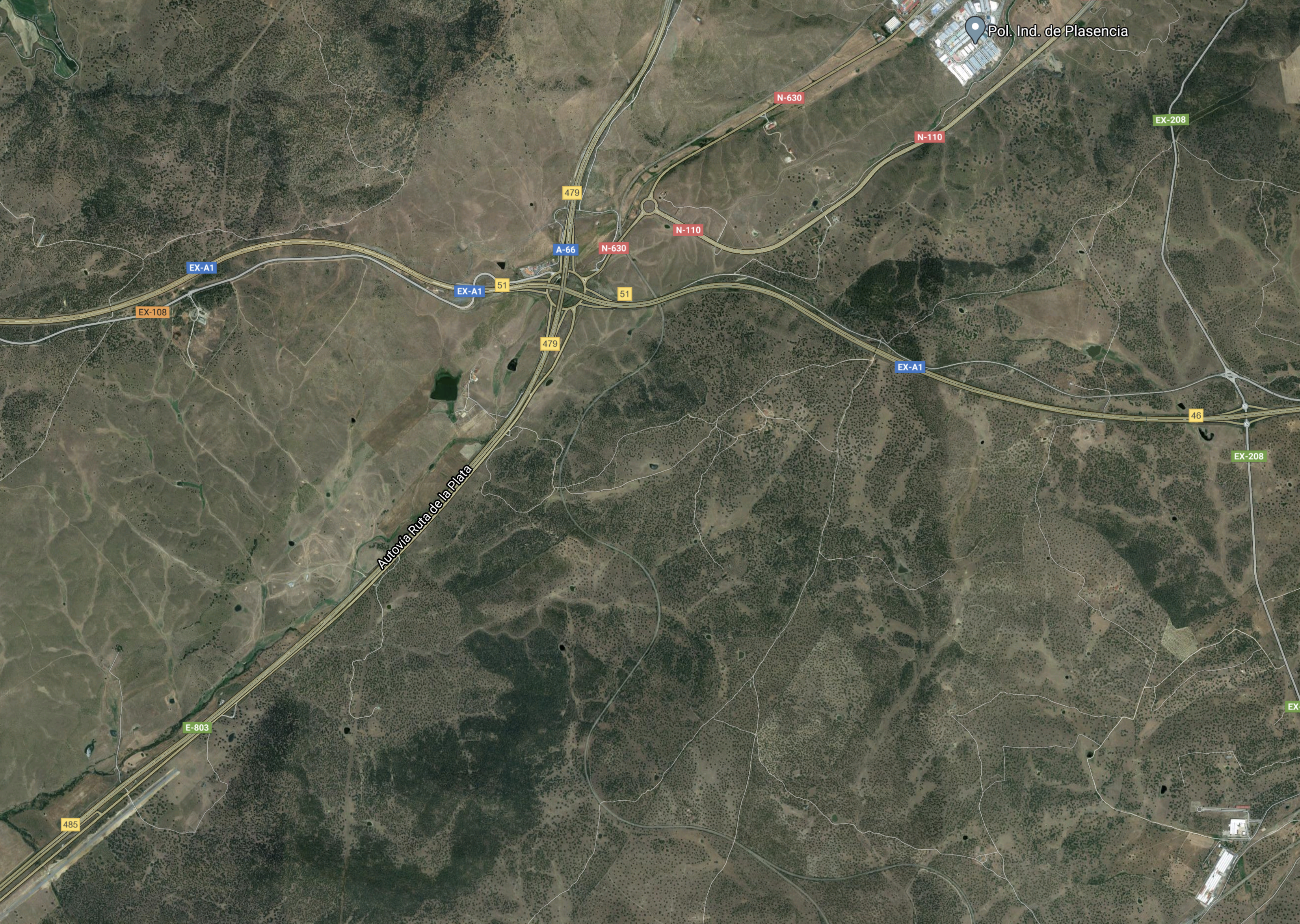
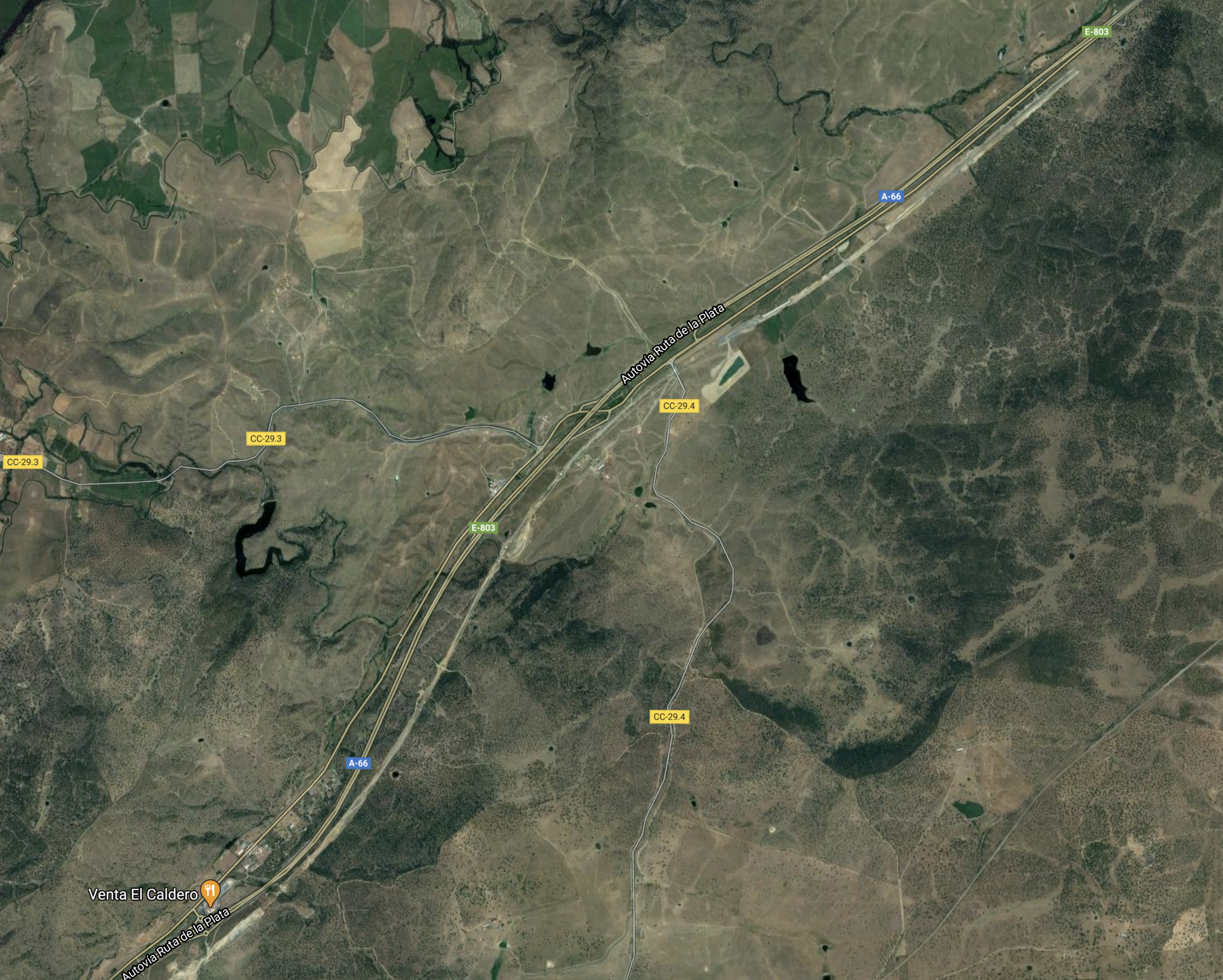
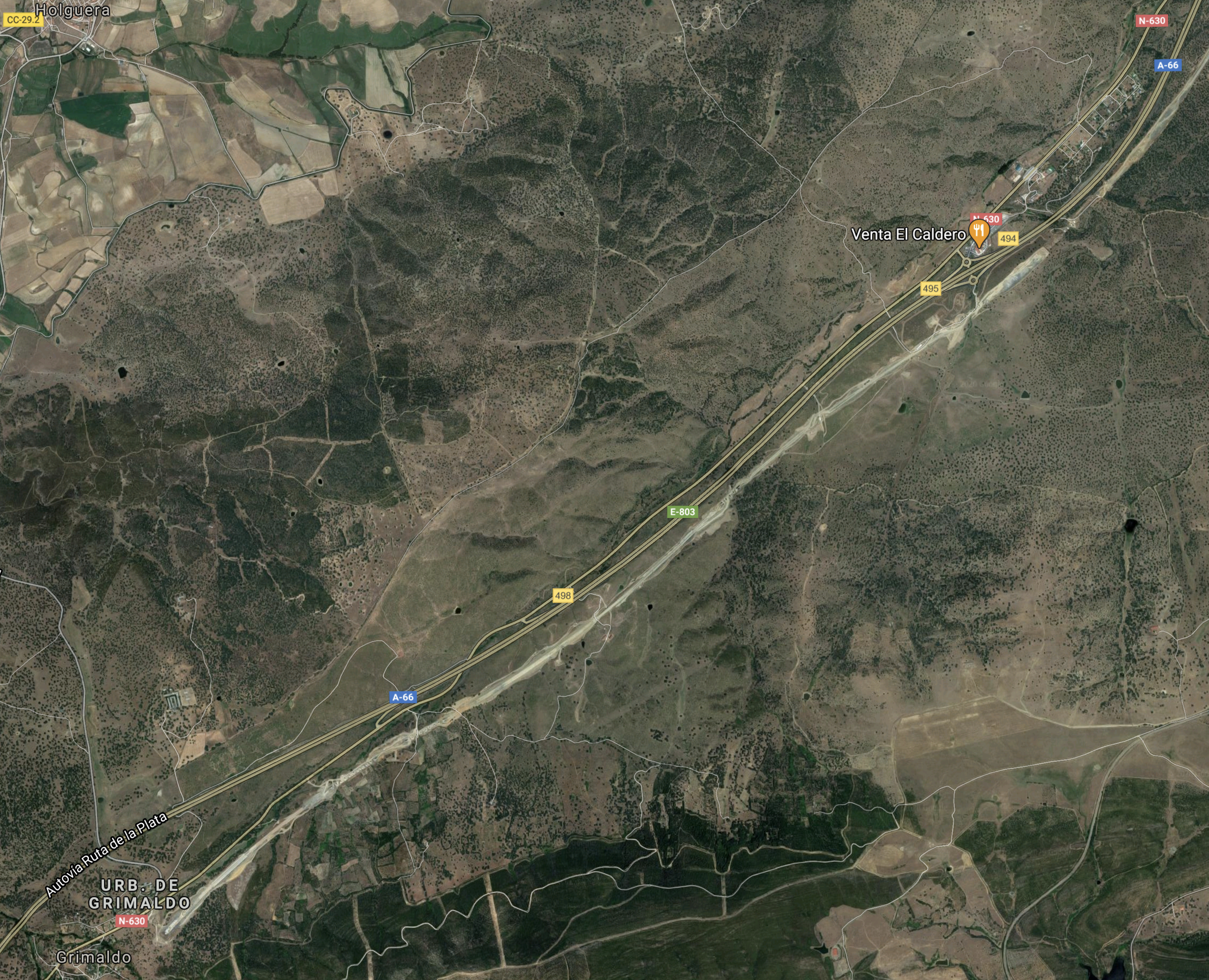
North and South Of Venta El Caldero
This map shows the construction to the North of Venta El Caldero.
And this map shows the construction to the South of Venta El Caldero.
Note.
- The scar new railway is to the East of the A66 road.
- The railway construction stops abruptly North of Venta El Caldero.
Grimaldo is in the South-West corner of the map.
Grimaldo To Cañaveral
This Google Map shows the route of the high speed line from Grimaldo to Cañaveral.
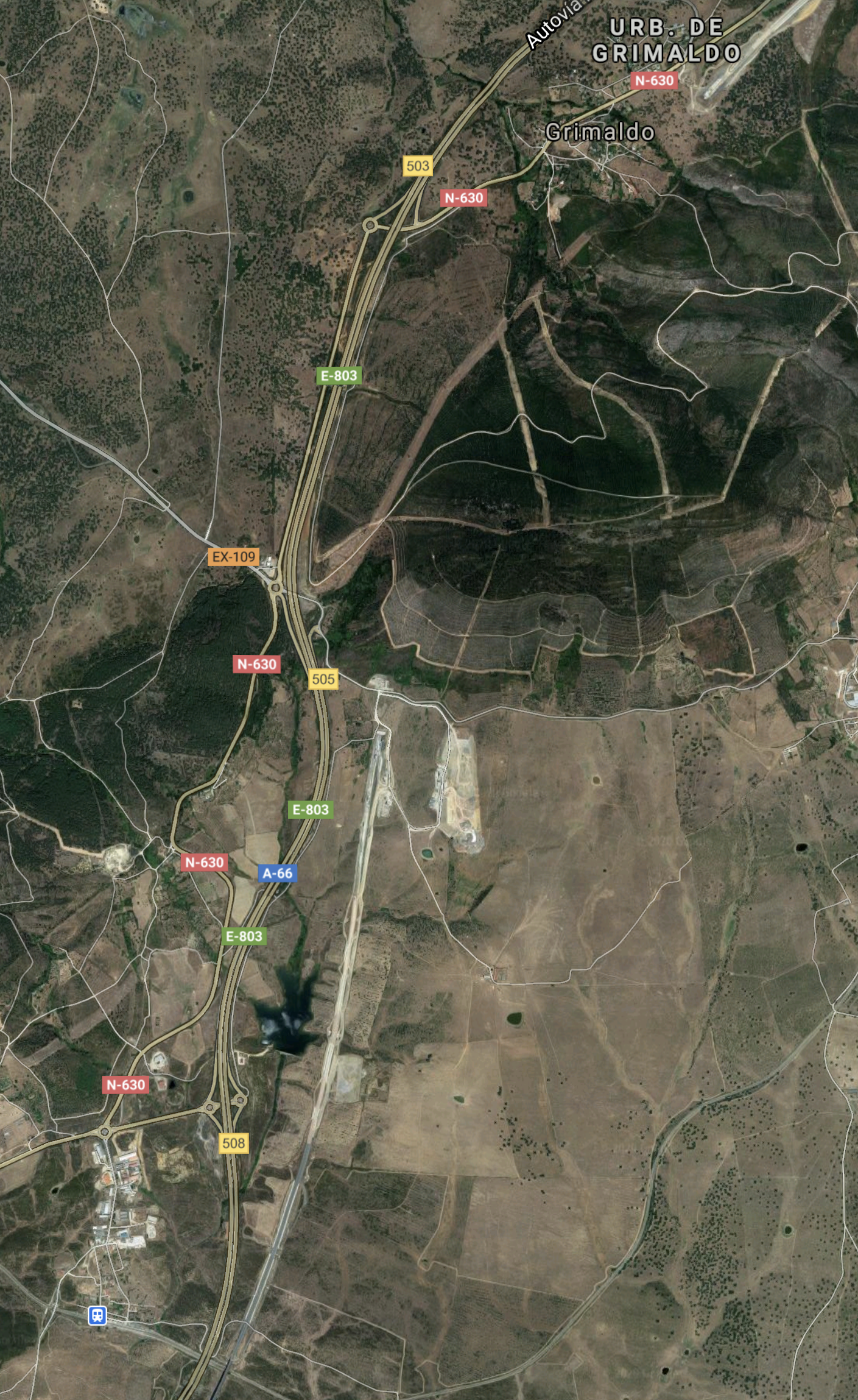
Note how the scar of the railway construction is to the East of the A66 Motorway.
Cañaveral
This Google Map shows Cañaveral station on the current line and the track of the new high speed line.
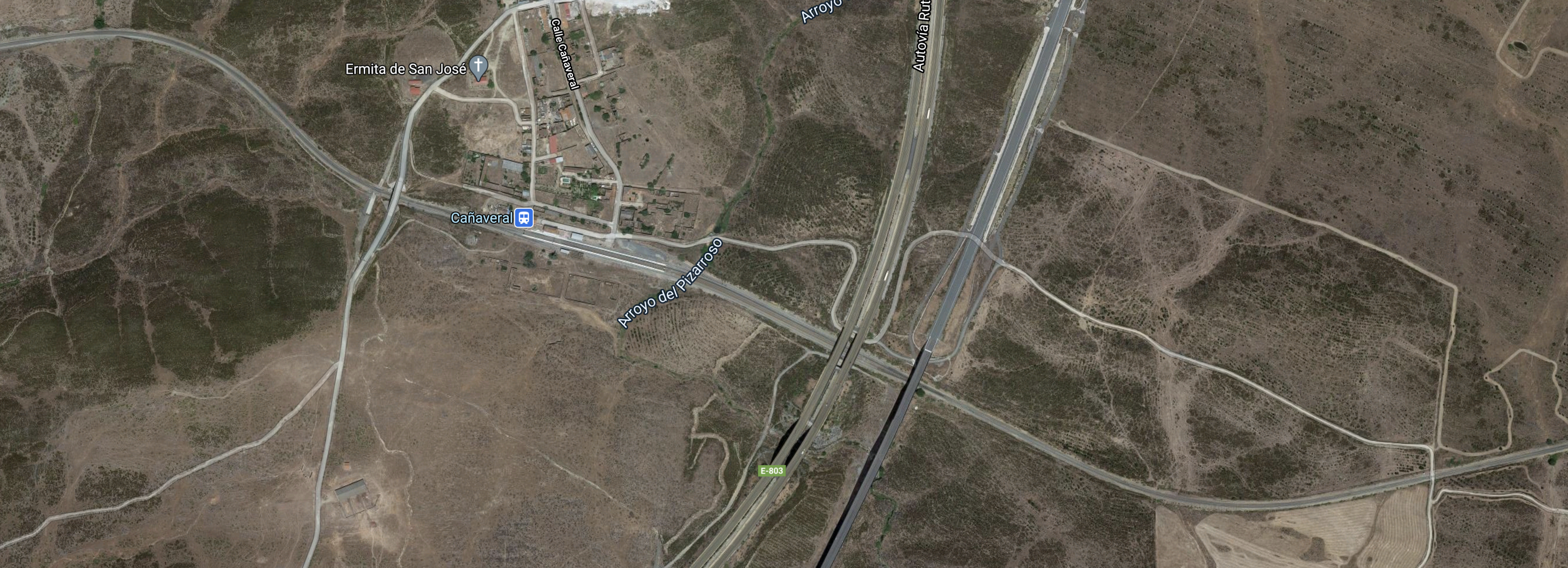
This map illustrates how the new high speed line is so much more direct, which in itself will save time.
From Cañaveral To The Tagus
This map shows the scar of the construction of the high speed line from Cañaveral to the Tagus.
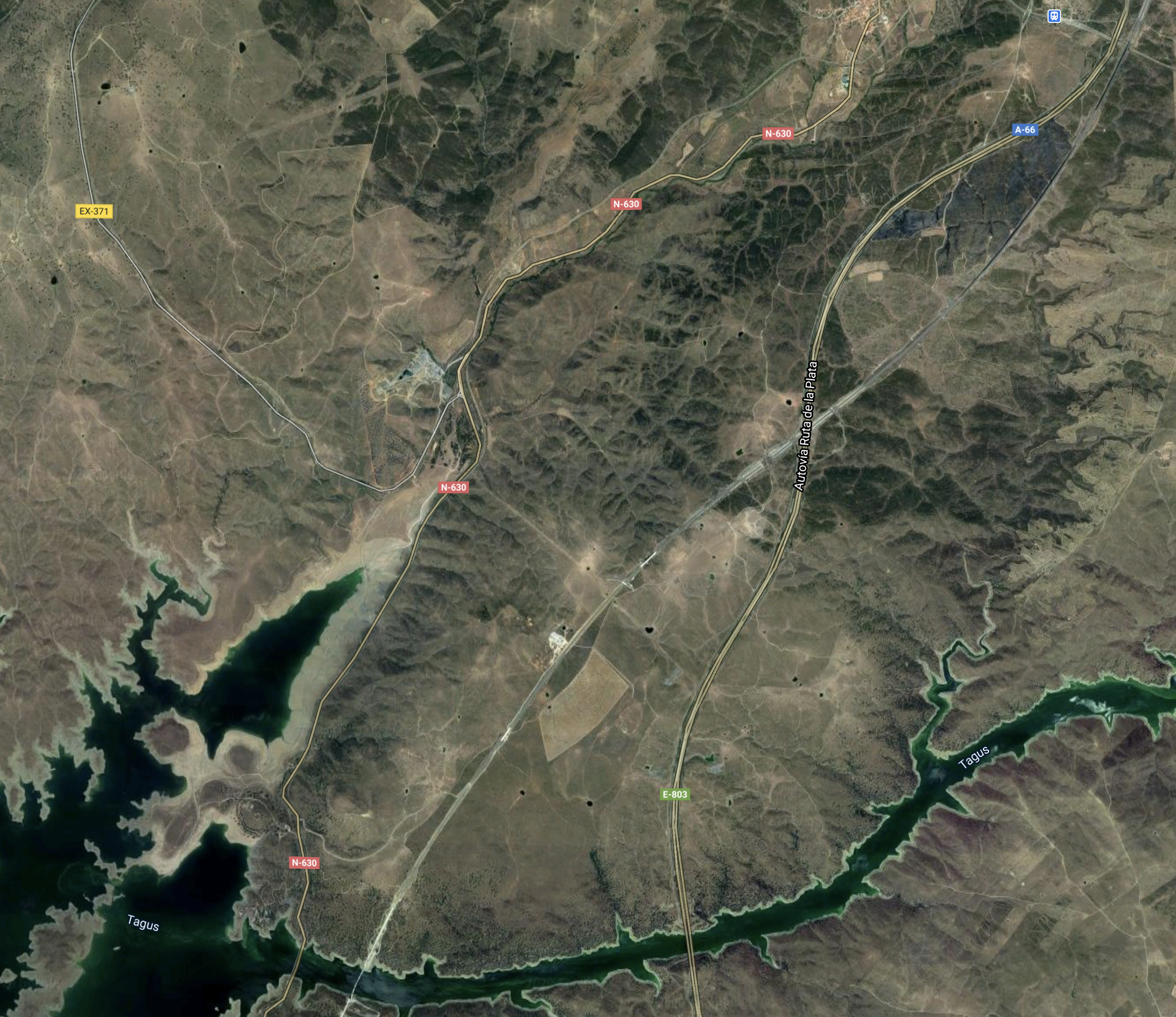
Note.
- The River Tagus across the bottom of the map.
- Cañaveral is in the North-East corner of the map.
- The scar of the railway construction running North-Easterly across the map.
A lot of the features, as the railway crosses the River Tagus, will come clearer in the next section.
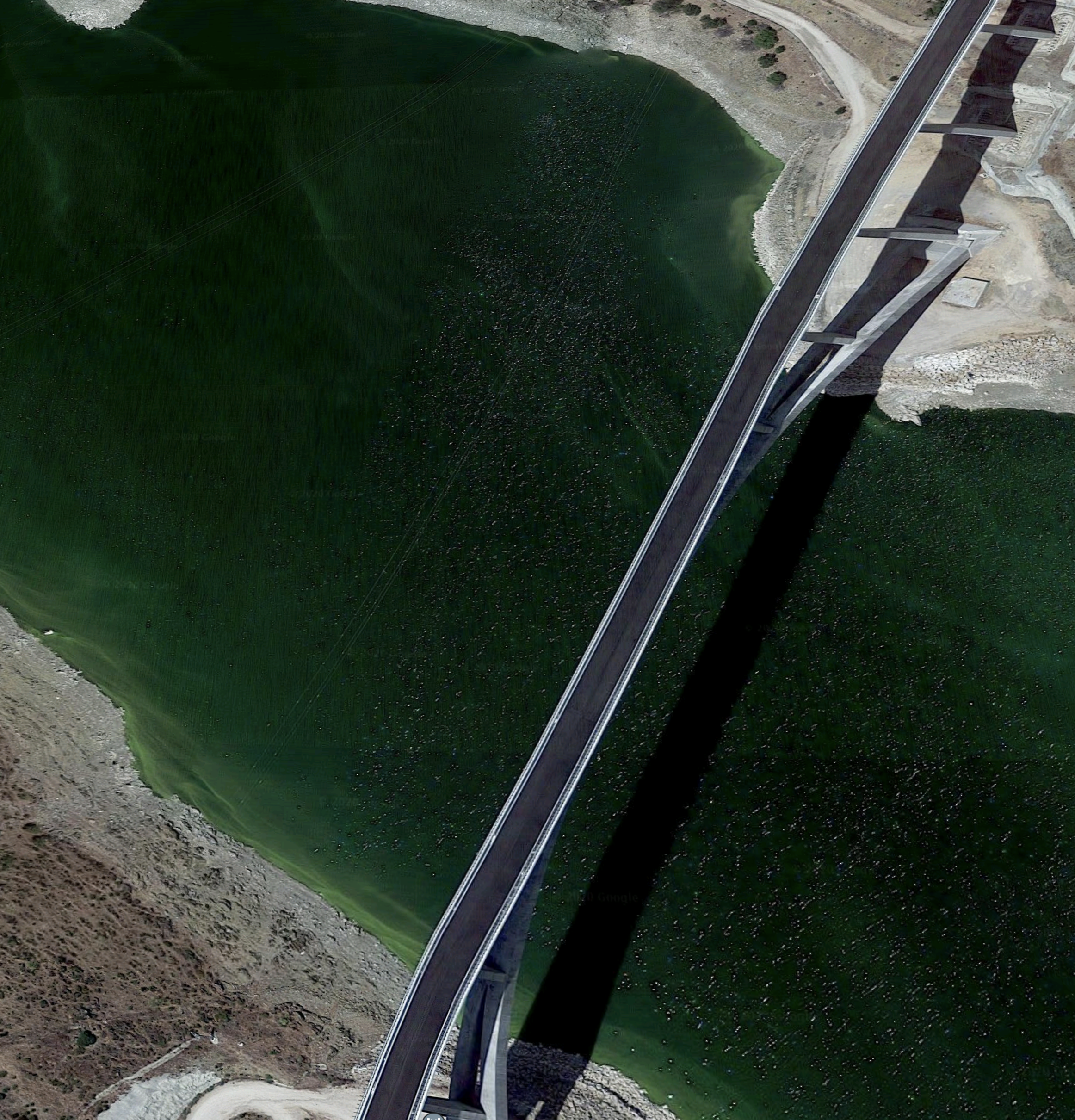
Crossing The Tagus
This Google Map shows where the railway crosses the River Tagus.
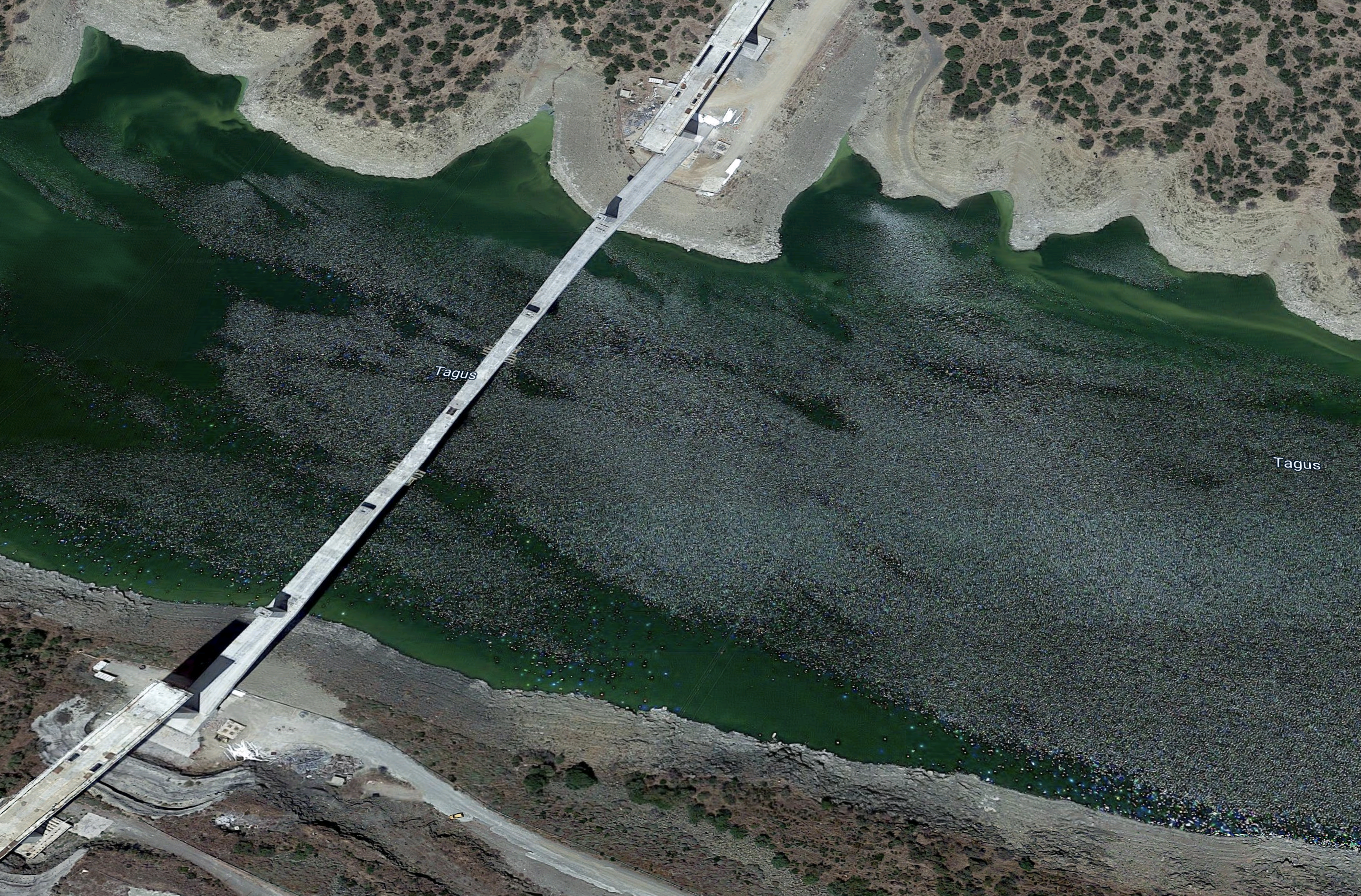
This second map shows the Northern end of the bridge on a larger scale.
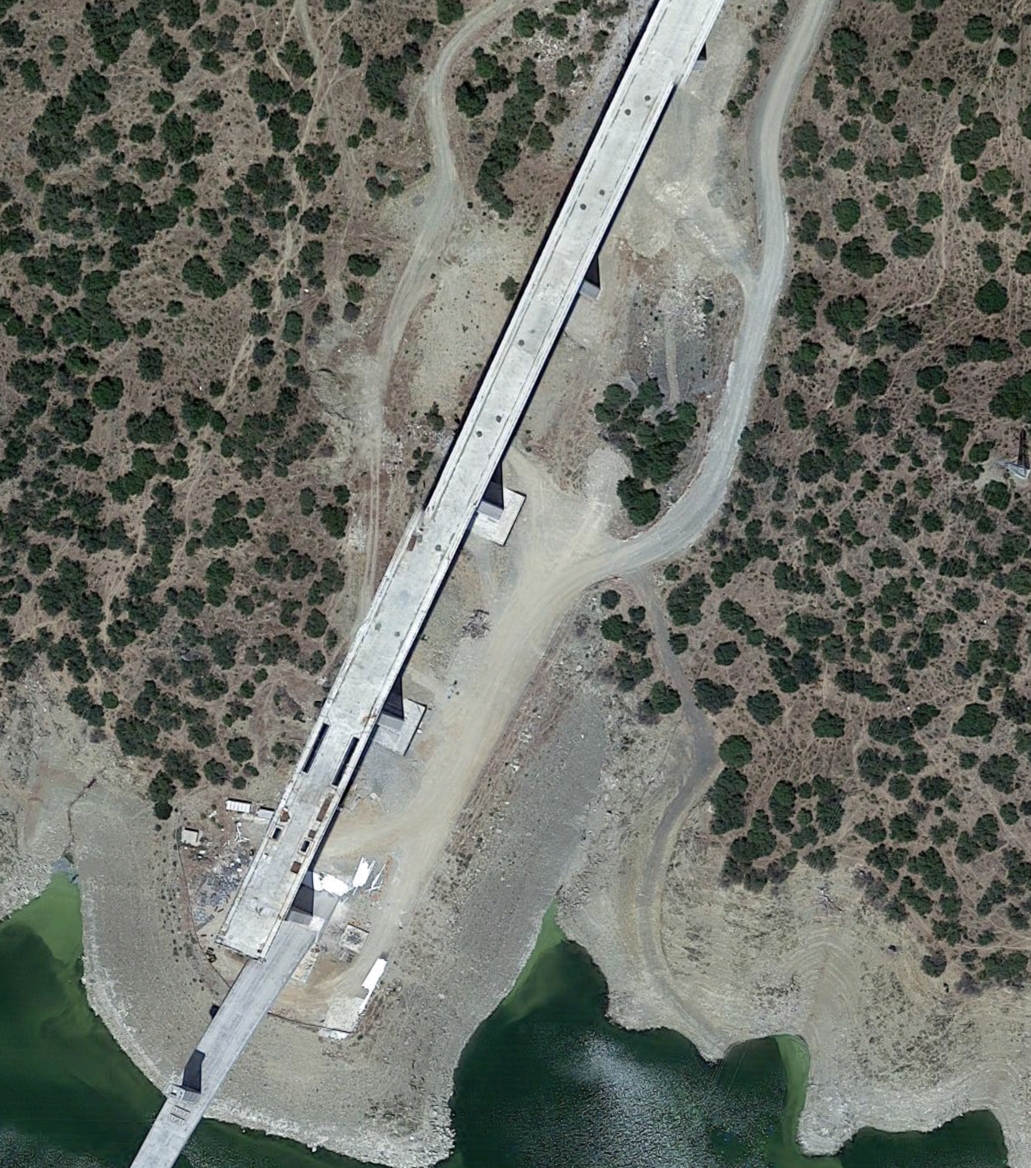
Is this bridge a double deck bridge with a road underneath a rail track?
Almonte River Railway Viaduct
This Google Map shows the viaduct over the Almonte river.
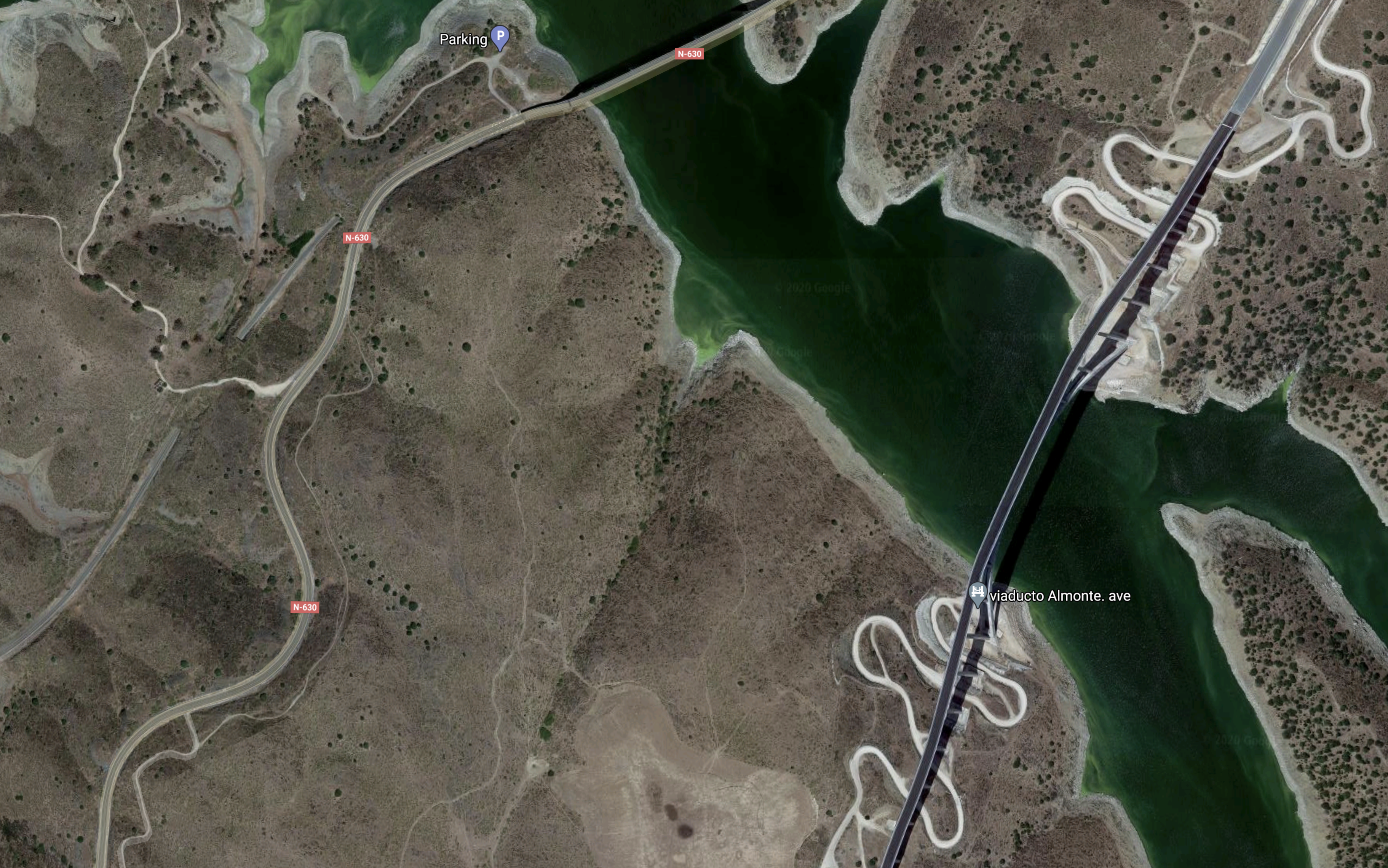
Note.
- It is the Eastern bridge on the map.
- It will carry a double-track high speed railway.
- At 384 metres it is the longest railway arch bridge in the world.
- It is seventy metres high, so the views should be good.
- It is 54 metres longer than the Silver Jubilee bridge over the Mersey.
The other bridge to the West is shown in this Google Map.
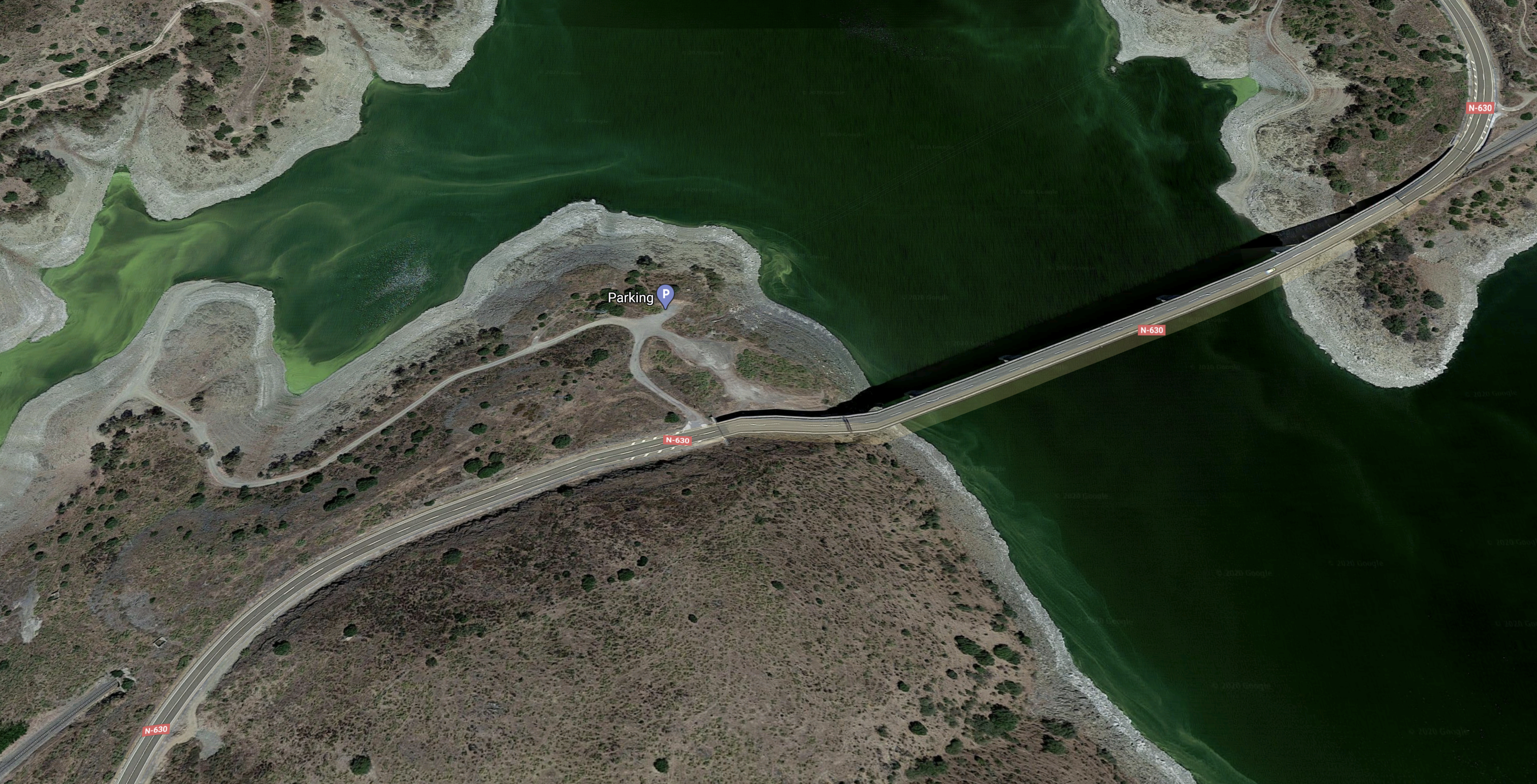
It appears to be a double-deck bridge, with a road on top of as single track railway.
This third Google Map clearly shows the arch.
It certainly is a bridge I want to experience.
The Old And New South Of The Almonte
I had to include this Google Map.

Note.
- The old and the new bridges over the Rio Almonte.
- The current railway meanders about.
- A lot of the track-bed of the new railway is complete.
There would appear to be a viewpoint and parking to explore the area.
Cáceres
This Google Map shows the joining of the old and new lines to the Nothe of the Cáceres
Note.
- The most Westerly line is the scar of the conscruction of the new high speed line.
- Next to it, is the current line.
The lines would appear to join to go through Cáceres. This must surely mean, they are the same gauge.
This second map shows the station in the city of Cáceres.
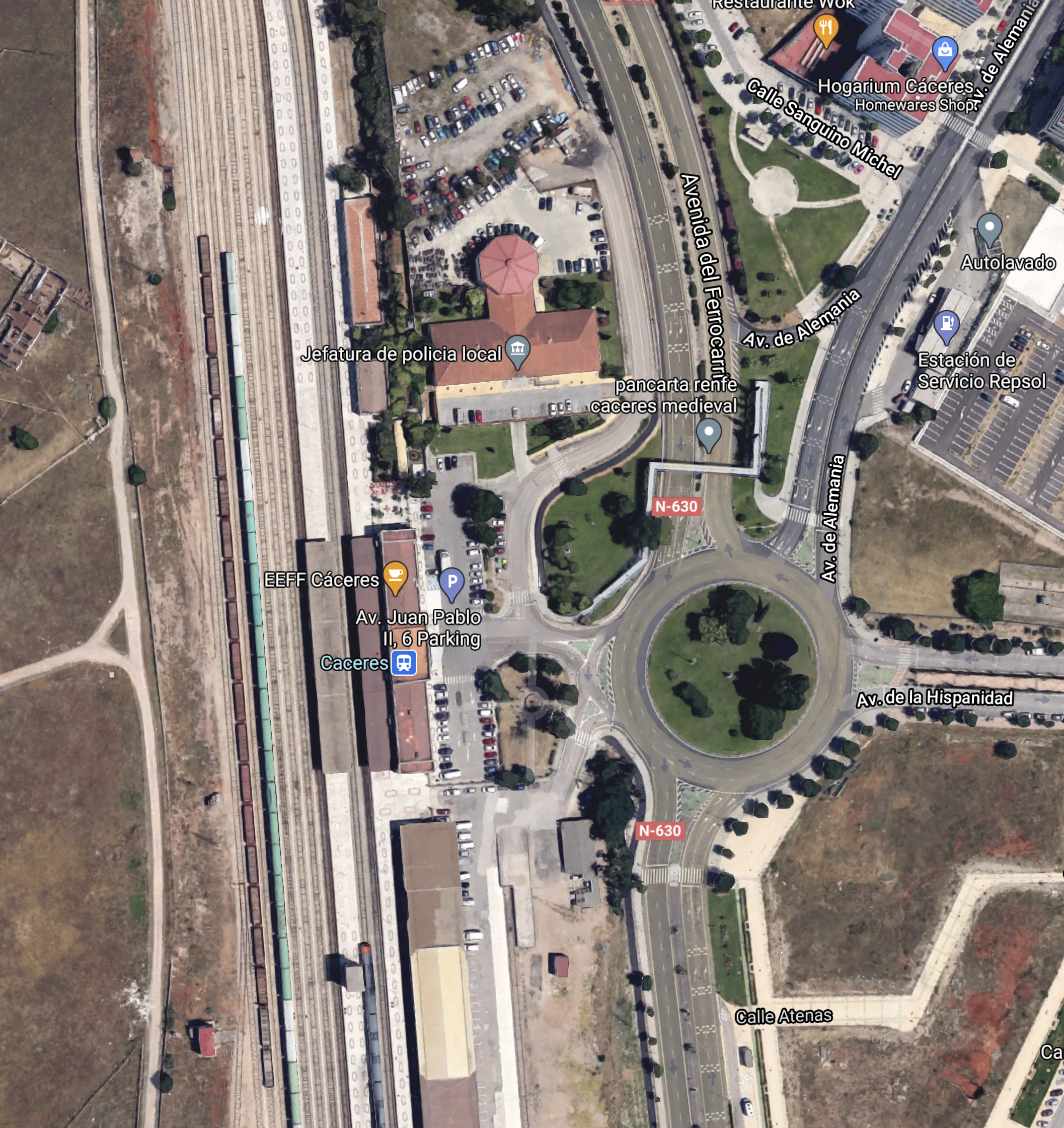
Reading Wikipedia, it looks to be the sort of place for an overnight stop or more.
Building The New Line South Of Cáceres
A new double-track High Speed Line is being built alongside the existing single track, as this Google Map shows.
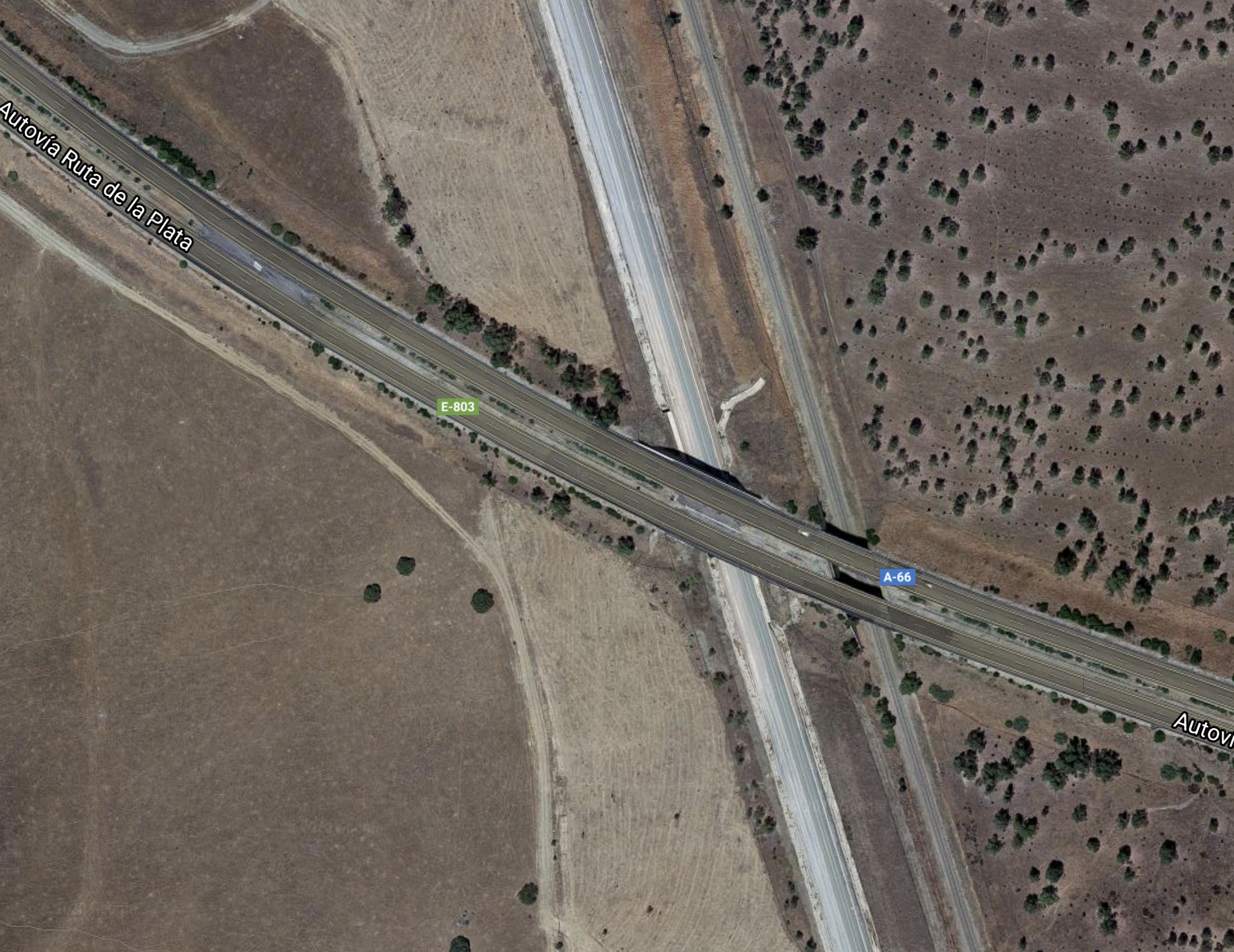
Note.
- The road is the A66.
- The new railway is on the Western side, with the old one on the East.
This second map, taken in the same area, appears to show rail and railway being constructed along the same route.

The third map shows a tunnel on the route.
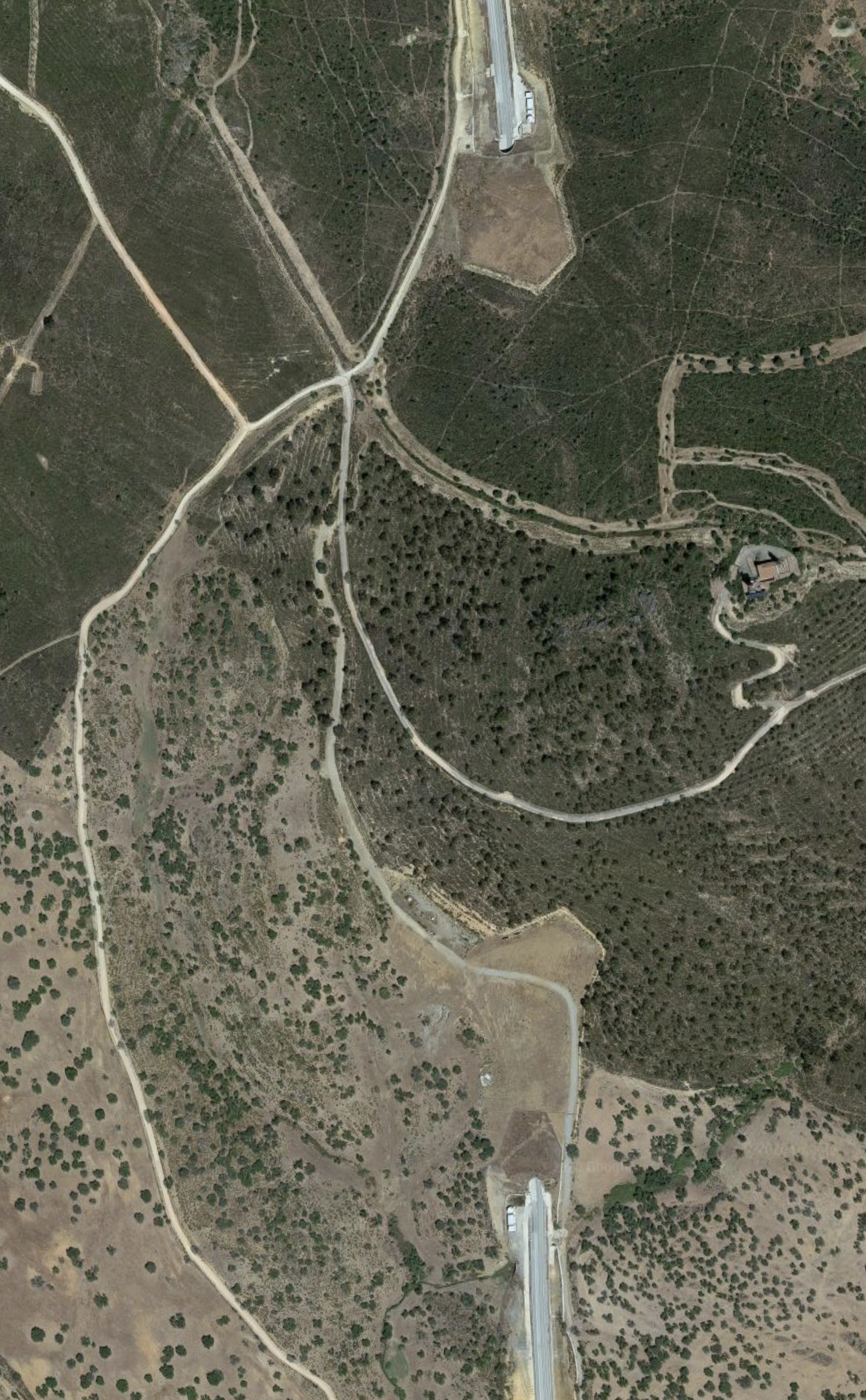
It goes straight through a range of mountains.
Aljucén
This Google Map shows the track layout at Aljucén.
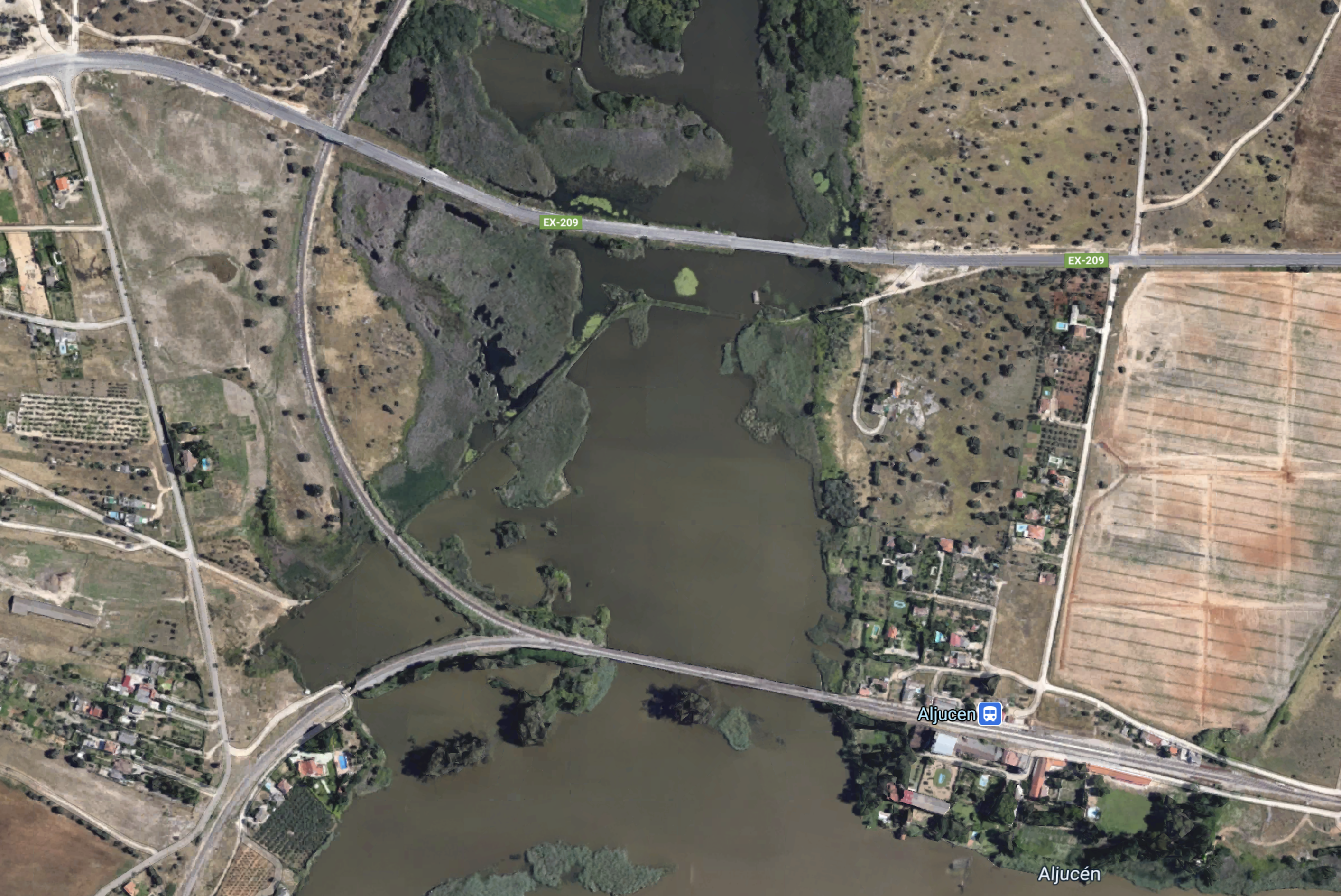
Note.
- Aljucen station is on the East bank of the river.
- The North branch of the railway goes North to Caceres.
- The South branch of railway goes West to Badajoz.
Trains between Caceres and Badajoz, may go East to Mérida to reverse.
Mérida
As I said, the city of Mérida is to the East of Aljucén.
This Google Map shows the area between Aljucén and Mérida .
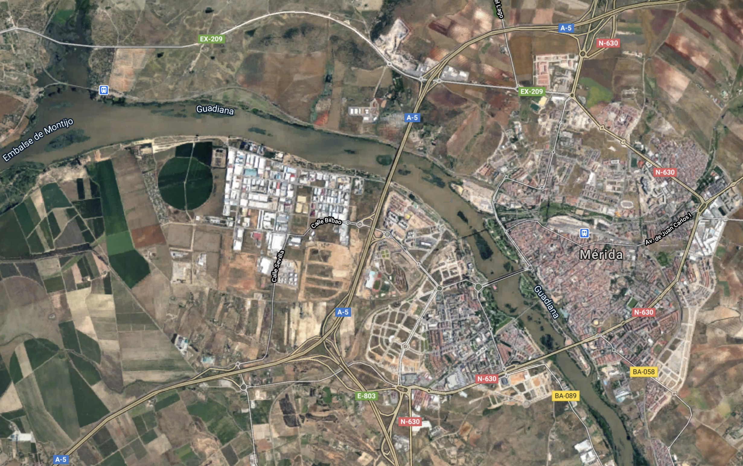
This second map, shows the large railway yard and the station at Mérida .
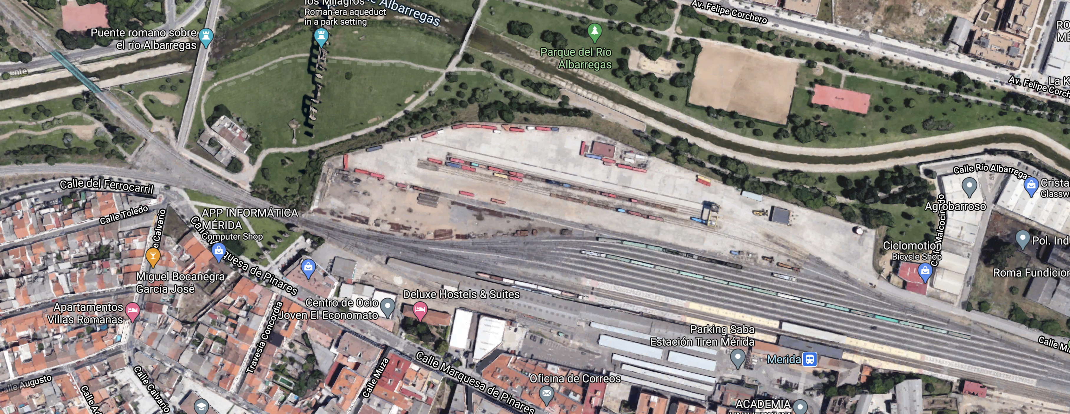
Note how the railway splits into two at the West of the station. One line takes the North side of the river and the other the South.
Onward To Badajoz
The Railway Gazette article says this about the section of the railway between Cáceres and Badajoz.
By late November, the 58∙8 km of double track between Plasencia and Cáceres was complete, while a single track has been built over the 80 km between Cáceres, Mérida and Badajoz. At Montijo, between Mérida and Badajoz, a junction is to be built to link the high speed line and the adjacent conventional line, which is to be electrified as part of work to modernise the east-west route across Extremadura between Badajoz and Puertollano.
Puertollano is to the East.
- The city lies on the main high speed rail line between Madrid and Seville.
- Trains take four hours between Puertollano and Badajoz.
- It has a solar thermal power station.
It looks to me, that if I was going to Badajoz, I’d fly to Seville and take the train, with a change at Puertollano.
Guardiana del Caudillo
This Google Map around Guadina del Caudillo station is typical of much of the route between Aljucén and Badajoz.
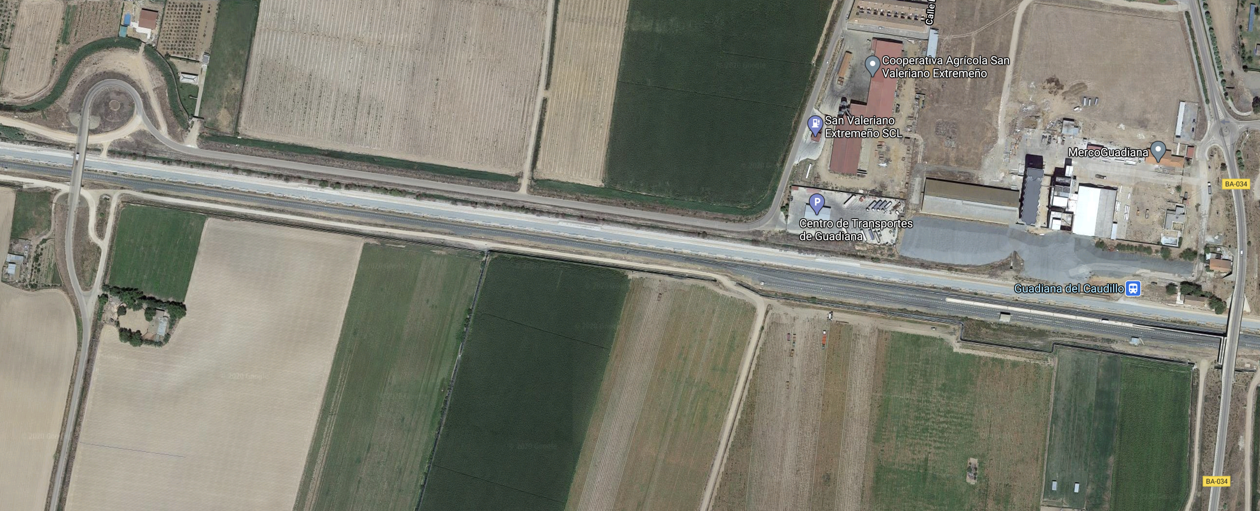
It appears that a double-track high speed railway is being built alongside the current single track.
Badajoz
This Google Map shows the current single-track railway passing North-West South-East through the city of Badajoz.
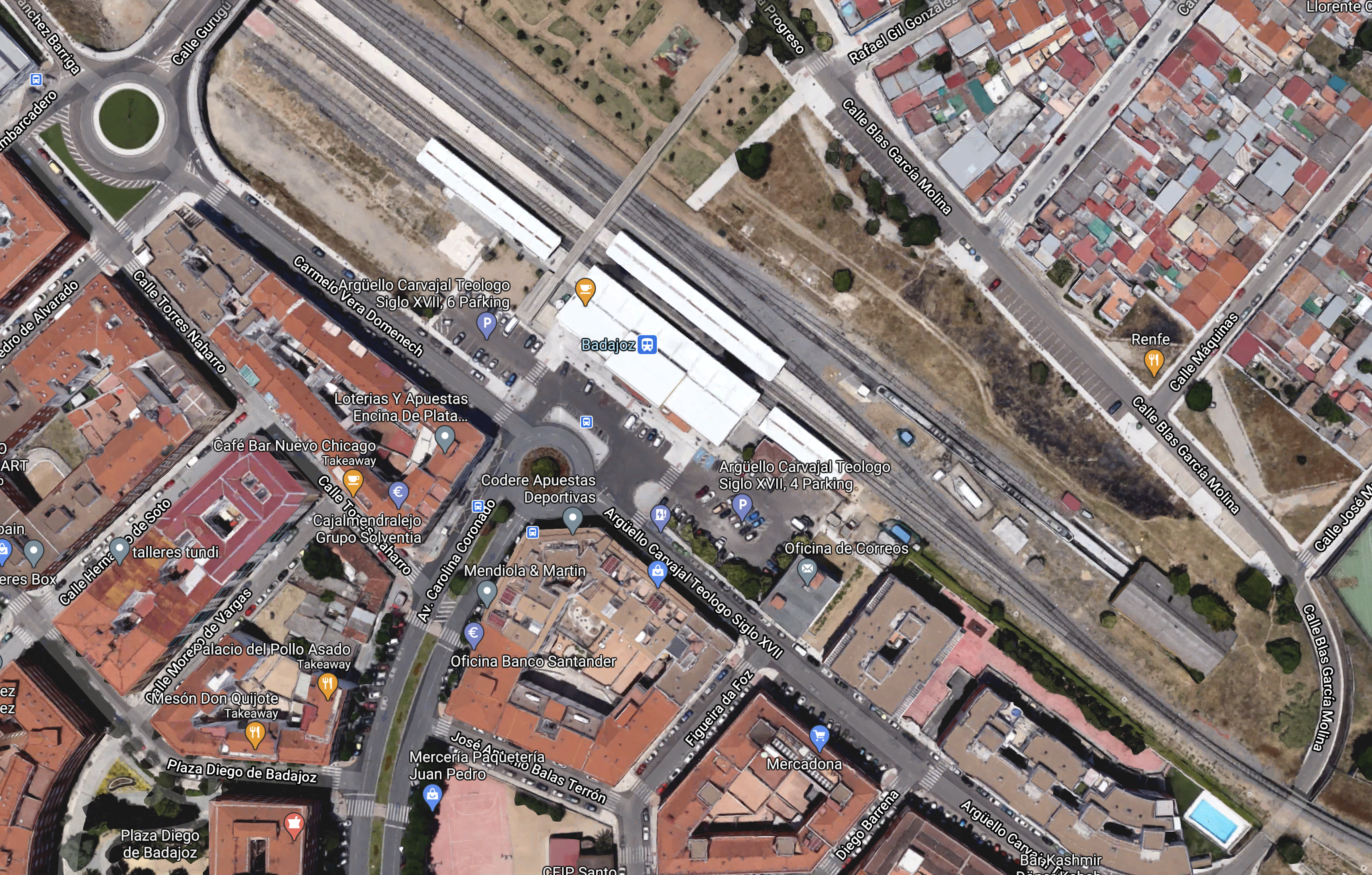
Note.
- Portugal is a few miles to the North-West.
- The station appears to be in the centre of the city.
This second map shows the border.

Note.
- The single-track curving around the South-West corner of the map.
- Underground water must be good, as they’re farming in circles.
Given the closeness of Badejoz to the border, the Spanish city could be a good place to break a journey.
Conclusion
This high speed line would appear to be easier to build than High Speed Two in some ways.
- A rail route already exists and in many places, the Spaniards are using a similar route.
- The population density appears low.
- The route is only about as long as London and Sheffield.
On the other hand, there are some tunnels and hills and some substantial river crossings.
Writing, this has made me want to visit, this part of Spain, where I’ve never been.
I would fly to Lisbon and gradually work my way back, stopping in places like Badajoz, Caceres and Toledo, before taking a train back to London.
Could The Madrid And Lisbon High Speed Line Become Iconic?
I think it could, as it will be a line with beautiful scenery between two of Europe’s must-visit capitals.
Start-up Bags $7m To Bring Tourists To Edge Of Space On A Balloon
The title of this post is the same as that of this article on SiliconRepublic.
This paragraph describes it.
The start-up aims to use a series of space balloons – attached with a pressurised capsule – to fly equipment and tourists to the edge of space on a six hour flight. The company’s first test flight of its Neptune 1 craft is expected towards the end of Q1 2021 from NASA’s Kennedy Space Center Shuttle Landing Facility. While the first test will consist of an uncrewed, unpressurised capsule, Space Perspective hopes to begin crewed operations by 2024.
What a concept!
- It’s affordable edge of space travel for all!
- Learn more from their web site.
- From the pictures, it looks like each trip would carry about ten passengers, in normal clothes,
- I can see lots of these installed over the world.
- When can I book, a trip on one of these from Central London? Or from somewhere in say the mountains of Switzerland?
On this page of their web site, they describe a typical flight.
Flown by a pilot, Neptune takes up to eight passengers called “Explorers” on a six-hour journey to the edge of space and safely back, where only 20 people have been before. It will carry people and research payloads on a two-hour gentle ascent above 99% of the Earth’s atmosphere to 100,000 feet, where it cruises above the Earth for up to two hours allowing passengers to share their experience via social media and with their fellow Explorers. Neptune then makes a two-hour descent under the balloon and splashes down, where a ship retrieves the passengers, the capsule, and the balloon. Neptune’s commercial human spaceflight launches are regulated by the FAA Office of Commercial Spaceflight.
Note.
I’ve already flown at 60,000 feet in an aircraft. In Concorde!
Even a humble Airbus A320 can fly at 41,000 feet.
Splashdown in the Thames Estuary or Lake Geneva? Why not?
No-one ever had a worthwhile idea or made a useful fortune by thinking with the herd.
Greater Anglia Trains Hit 10-year High For Punctuality
The title of this post is the same as that of this article on North Norfolk News.
This is the first two paragraphs.
Greater Anglia has recorded its best figures for punctuality in a decade, latest figures have revealed.
More than nine out of every ten trains ran on time in November, helping the company achieve its best punctuality result for 10 years and second-best of the past 20 years.
That is very good, with punctuality figures very close to a hundred percent.
What the article doesn’t mention, is that Greater Anglia’s trains in Norfolk and Suffolk are now typically step-free, with those in wheelchairs to be able to roll in without a ramp.
How much has this feature contributed to the outstanding punctuality?
Arcola Energy Introduces A-Drive Fuel Cell Powertrain Platform
The title of this post, is the same as that of this article on NGTNews.
This is the introductory paragraph.
Arcola Energy, a company that specializes in hydrogen and fuel cell systems, has developed a proprietary hydrogen fuel cell (HFC) powertrain platform – designed for vehicle applications requiring high-duty cycle capabilities and fast refueling.
\we will see more hydrogen powertrains produced by big companies; like Cummins and Daimler and small companies like Arcola.
Many of the smaller ones, will perish. just like many smaller car companies did in the first seventy years of the twentieth century. Who remembers names like Allard, Borgward, Humber, Panhard and Riley?
I suspect, that in the near future, wherever you live and you come up with an idea, that needs zero-carbon motive power, there will be a convenient company to provide you with that power, using hydrogen.
One of my clients with Daisy used to be Cummins Engines. They told me most firmly, that if I ever needed a diesel engine to provide power for an application, they would customise one of their engines to fit my application.
Now that Cummins have gone into hydrogen in a big way with the purchase of Hydrogenics, will we see a similar philosophy?
Full Steam Ahead For Second Entrance At Hackney Central Overground Station
The title of this post is the same as that of this article on the Hackney Gazette.
The first paragraph says it all.
A second entrance at Hackney Central Overground station could be up and running by the end of 2021, after receiving planning approval yesterday.
I’m pleased and this was my comment to the article.
I am 73 and live between Dalston Junction and Highbury Corner, so if I’ve been to the Eastfield Shopping Centre and am coming home with a heavy parcel, I sometimes find it heavy going, as I either have to cross the footbridge at Hackney Central and get a 38 bus or do a bit of shuttling about to get one of the buses from Dalston Junction.
This entrance will mean I can get out at Hackney Central and get the bus in Graham Road.
Provided of course, the pedestrian crossings are arranged with the new entrance and the buses.
I don’t think we can ever have too many station entrances.
Thoughts On Mass Vaccination
We should steal an idea from the French.
In the first wave of the virus, they had to move seriously ill patients all over the country and to Germany, where there was bed space.
So they converted a TGV to a hospital train.
This page on the SNCF web site, is entitled Covid-10: Behind the Scenes Of Our High-Speed Hospital Train.
Could we not create a Vaccination Train using one of the recently withdrawn InterCity 125s?
They are easily shortened to any convenient length and the carriages have a very smooth ride.
The French converted their hospital train in 48 hours, so surely we can do as well!
The trains have the advantage, that they are certified go to over ninety percent of UK main line railway stations.
Network Rail have a track inspection train, called the New Measurement Train, that works a pattern all over the UK. It is based on an InterCity 125 and is full of delicate instruments, designed to keep the railways of the UK safe.

The picture shows Network Rail’s New Measurement Train at Westbury station.
The Vaccination Train or Trains could be based at a convenient central location, where the vaccine would be safely stored.
- Trains would be loaded overnight with the vaccine and other stores and locate early to their site for the day.
- Sites would typically be stations, where a platform existed that was long enough for the train.
- Staff to both process the vaccine and treat patients could either go on the train or be drawn from local medical staff, or be a mixture of the two.
- Specialists handling the vaccine would probably come from the centre, as this would ensure totally correct handling of the vaccine.
- They would set up at a suitable site and handle the patients booked for the day.
- Injections could even take place on the train, in specially fitted out carriages.
I would think, that the train would be self contained and generate all its own electricity.
Go-ahead For £900m London Bishopsgate Goodsyard
The title of this post, is the same as that, of this article on Construction Enquirer.
It seems a good scheme.
- Mixed-use urban quarter.
- 500 homes, half affordable.
- 1.4m sq ft of workspace
- Public park sitting on top of restored historic railway arches
- Six acres of public realm.
There is only one major problem, as far as I can see. – If Crossrail is still running late, this project could further delay it, by stealing the resources needed to finish the job.
Yet again, the Mayor has given planning permission to a project that could delay Crossrail, by stealing its resources.
Planning permission, should be conditional on Crossrail being finished.
A Central Line Connection To The East London Line At Shoreditch High Street Station
Shoreditch High Street station will be very close to the development.


There will be twenty trains per hour (tph) on London Overground’s East London Line.
Under Future Proposals in the Wikipedia entry for the station, this is said.
There have also been discussions of creating an interchange with the Central line between Liverpool Street and Bethnal Green which runs almost underneath the station. However, this would not be able to happen until after the Crossrail 1 project is complete, due to extreme crowding on the Central line during peak hours.
I think it will be a good idea, to create the connection.
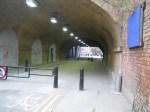
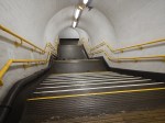
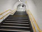
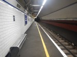
Is This A Simple And Affordable Solution To Providing Step-Free Access At Essex Road Station?
The access to and from the platforms at Essex Road station, is not the best.
There is a set of tunnels beneath the two platforms.
- The tunnels are connected to the surface, by a pair of large lifts and an emergency spiral staircase.
- The tunnels are connected to the platforms by two wide sets of stairs.
- One set of stairs is for passengers leaving the station and the others are for those arriving.
This set of pictures shows some of stations underground features.


It looks to be a difficult station to make step-free.
- The platforms are narrow.
- There is very little space in the station building to add more lifts direct to the platform.
- I’m not sure,but the rail tunnels might be under the Canonbury Road, which runs outside the station.
Unless its possible to use the Greenford solution.
This picture shows the inclined lift/stairs and escalator installation at Greenford station.
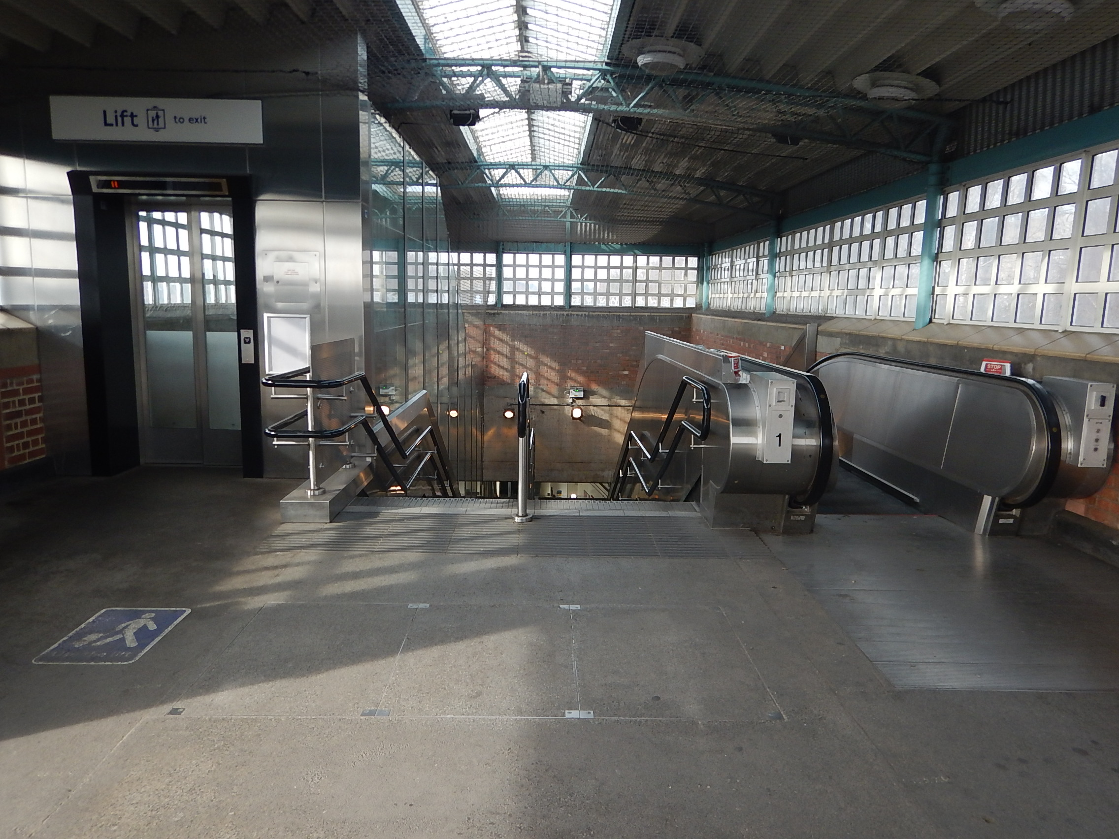
Note.
- The inclined lift has a capacity of about 4-6 people in normal times.
- The staircase is double, with a handrail up the middle.
- The escalator is permanently set to up.
It should be noted that Greenford station has two Central Line platforms and one National Rail platforms.
Could this type of installation be used at Essex Road station?
I will look at a few points and issues.
Station Usage
It should be said, that despite the different natures of the station, we are not comparing apples with oranges, as to get between the street and platforms at both stations, passengers have to use the stairs at Essex Road station or the multi-mode installation at Greenford station.
Entries and exits to Essex Road station over the last four years are as follows.
- 2016-17 – 811,000
- 2017-18 – 861,000
- 2018-19 – 857,000
- 2019-20 – 768,000
The average is 824,000
National Rail entries and exits to Greenford station over the last four years are as follows.
- 2016-17 – 230,000
- 2017-18 – 151,000
- 2018-19 – 153,000
- 2019-20 – 170,000
The average is 176,000
Central Line entries and exits to Greenford station over the last four years are as follows.
- 2015 – 4,720,000
- 2016 – 4,810,000
- 2017 – 4,680,000
- 2018 – 4,250,000
The average is 4,615,000
The total for Greenford station is 4,791,000 or nearly six times as much as Essex Road station.
In fact, the difference is bigger than that as Essex Road station could have a pair of installations, so the capacity of each of the Essex Road installations, would only need to be a twelfth of that of the Greenford installation.
The Simplest Installation
The simplest installation would surely be to fit an inclined lift at the side of one of the existing staircases.
The staircase would probably be halved in width, but quite frankly they are not safe for anybody encumbered with a pushchair or a heavy suitcase.
There would also need to improvements to the routes between the main lifts and the inclined lift.
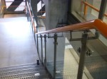
London’s Single Escalators
London has several single escalators.


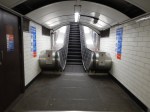
Three pictures are from Moorgate and the other one is at Greenford.
Could Pairs Of An Inclined Lift And An Escalator Be Fitted In At Essex Road Station?
It would be tight to fit a pair in one staircase, but I’m sure it would be possible. Especially, if the shaft could be widened a bit.
If they could be made to fit, then a simple program of works could be applied.
- Close one staircase and use the other staircase for both entry and exit. As there is a cross-tunnel, passengers would be able to walk between the lifts and the platforms, by walking about an extra thirty metres or so.
- The closed tunnel would then be gutted and an inclined lift and escalator would be fitted and tested.
- Once complete and tested, it would be opened to passengers.
- The station would now be entrance-only or exit-only, whilst the second lift and escalator were fitted and tested.
Being entrance-only or exit-only would not be the greatest problem, as the 271 bus parallels the rail route between Highbury & Islington and Moorgate stations.
Could An Inclined Lift And A Pair Of Escalators Be Fitted?
In this installation, one shaft would be fitted with a pair of escalators and the other with an inclined lift.
A similar program of works to that I laid out previously would be applied.
Conclusion
Essex Road station could be made step-free.
Because of the bus routes in the area and the 271 in particular, it wouldn’t cause the greatest of inconveniences to close the station for some time.
Why I’ll Delay Having The Coronavirus Vaccine
The vaccines are coming for the covids, but I won’t be having a jab, if one is offered to me, in the first round. I may not be offered one, as I am only 73 and in good health.
But there are many out there, who need the vaccine more than I do, who will be given lower priority than myself.
So I’ll wait!
I am also a diagnosed coeliac on a gluten-free diet and my statistical researches and news reports, show that communities and groups with high levels of undiagnosed coeliacs have suffered badly from the covids.
These communities and groups include.
- Anybody born before 1960, as there was no test for coeliac disease in children before then.
- Ashkenazi Jews. My coeliac genes come from an ancestor in this group.
- Irish
- Caribbean. West Africans have a tendency to coeliac disease and what better way to bring it out, than starve them on slave ships and feed them on only bread and water.
I have also found a research paper, that shows, that India could now experience a coeliac disease epidemic, caused by modern strains of wheat. See Coeliac Disease: Can We Avert The Impending Epidemic In India?
Coeliacs on a gluten-free diet, are an interesting group, in that according to peer-reviewed research by Joe West of Nottingham University, they are 25 % less likely to suffer from cancer.
How can one disease protect you from another?
My coeliac disease was indicated by low-levels of B12, as gluten was damaging my gut and stopping it absorbing vital vitamins. By removing the gluten from my diet, my B12 levels returned to normal.
So it’s the diet that protects my health.
If you think, you are coeliac, don’t be put off by horror stores of multiple endoscopies and the difficulty of sticking to a gluten-free diet. I may have been one of the first individuals tested, by the current genetic method, which is now used by most GPs. A blood sample is sent off for a test and that is generally all that is done in most cases. I heard in 48 hours.
So why is it beneficial in the case of cancer?
It can only be, that with all those vitamins, coeliacs on a gluten-free diet have a very healthy immune system.
So does, this immune system, help protect coeliacs from the covids?
Until proven otherwise, my statistical research, thinks it does!
So I believe, that I can afford to wait.
Has Good Project Management Helped The UK Get The Vaccine Early?
Professor Van-Tam, this morning on BBC Breakfast, praised the planning of the drug companies and the various health bodies in charge of certification of the vaccines.
As someone, who was at the heart of the Project Management Revolution in the 1970s and 1980s, this cheers me.
Looking back, my biggest contribution to project management, was to prove that you didn’t need to use a large mainframe computer and software would work on a small desk-sized machine and ultimately on a personal computer, thus bringing project management to everyone.
Work Begins On New Substation For World’s Longest Electricity Cable Between Denmark and Lincolnshire
The title of this post, is the same as that, of this article on Lincolnshire Live.
This is the sub-title.
Britain and Denmark will be able to share enough clean energy to power 1.5 million homes.
The Viking Link is a 1400 MW at 525 KV electricity interconnector between Bicker Fen in Lincolnshire and Revsing in Jutland, Denmark.
This Google Map, shows the location of Bicker Fen, about halfway between Boston and Sleaford.

This second map shows an enlarged view of the Bicker Fen area.
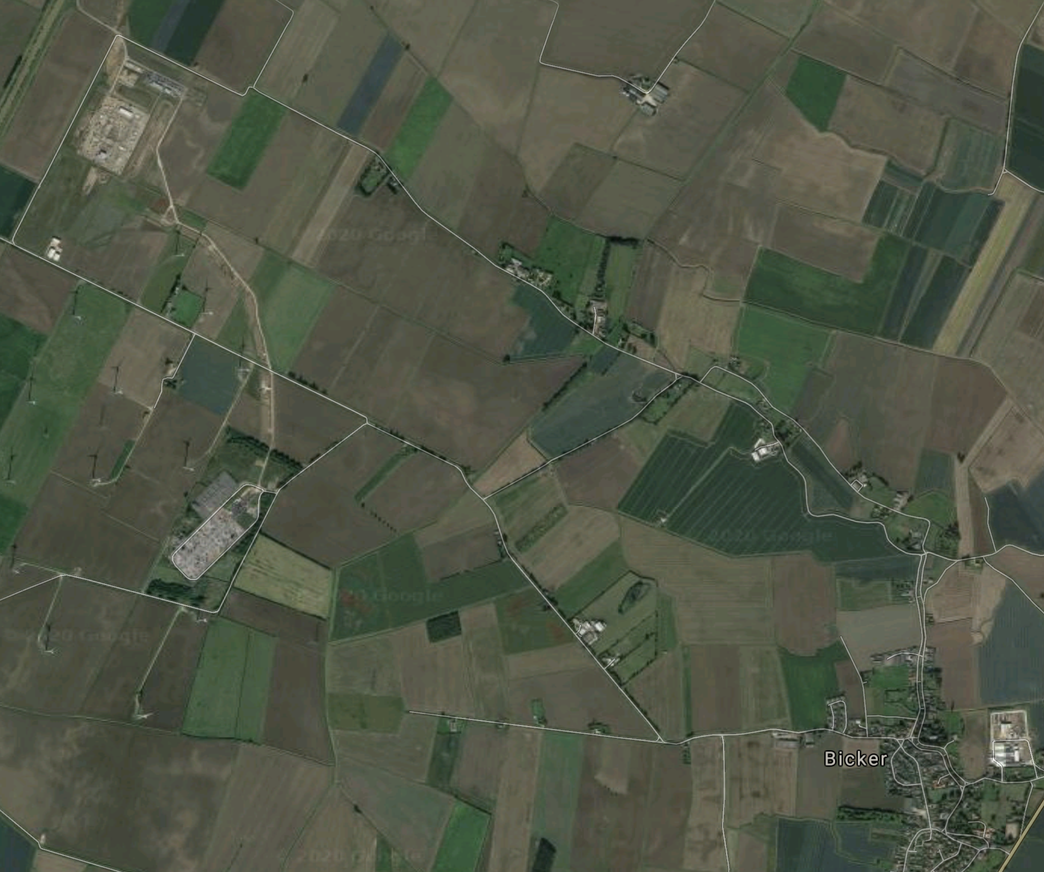
Note.
- The village of Bicker in the South-East corner of the map.
- In the North-West corner of the map is Bicker Fen Wind Farm.
This third map shows the wind farm.
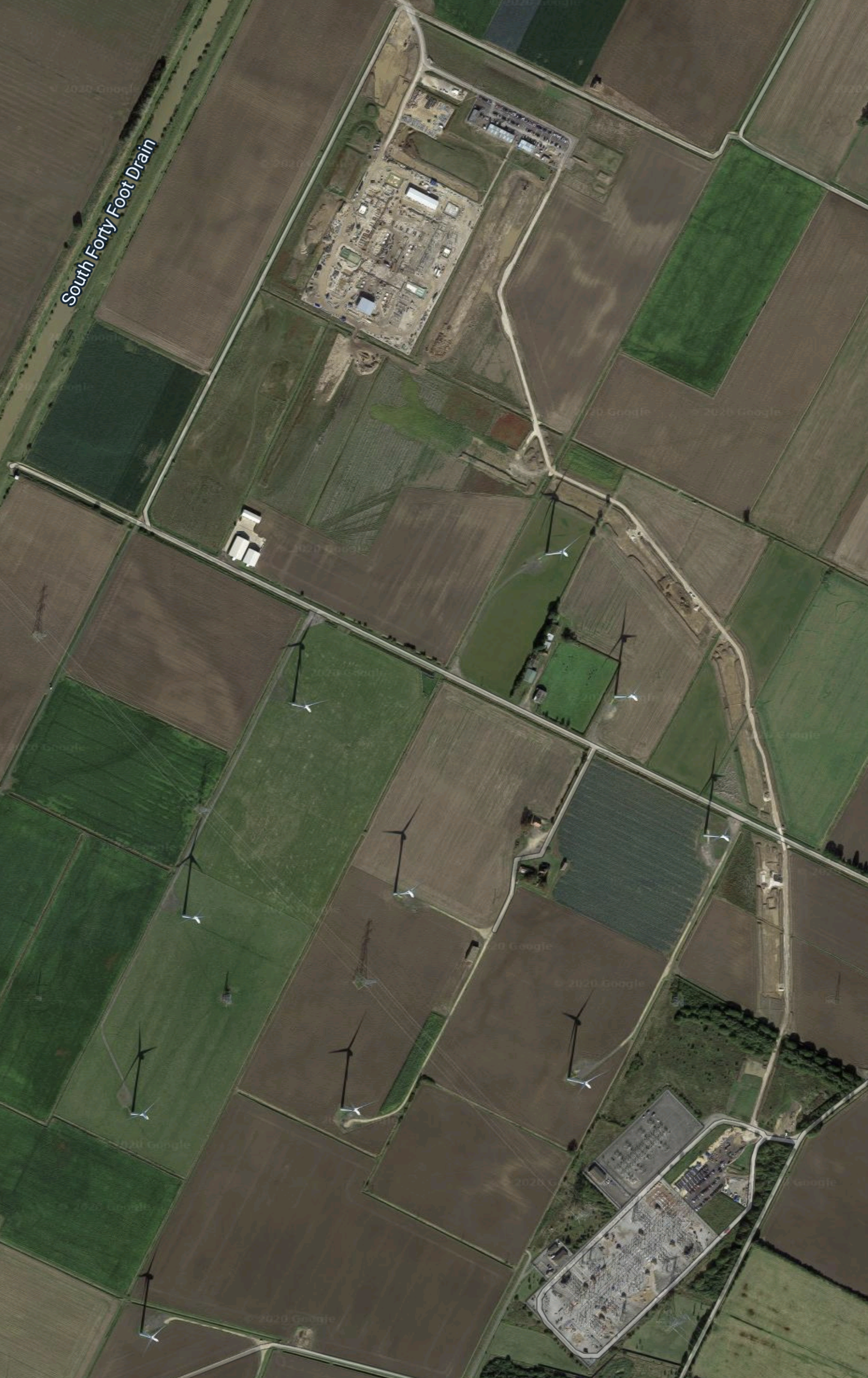
Note the thirteen wind turbines between the two sub-stations full of wo electrical gubbins.
This sentence from the Wikipedia entry for Bicker, gives more details of the wind farm and the future plans for the area.
North of the main line of 400 kV pylons is the Bicker Fen windfarm consisting of 13 turbines producing 26 MW (2 MW each), enough for 14,000 homes. The construction of the windfarm met some local objection. The windmills sit north from Poplartree Farm and were built in June 2008 by Wind Prospect for EdF. They are of the type REpower MM82, made in Hamburg. Bicker Fen substation is also the proposed landing site for a 1,400 MW power cable from Denmark called Viking Link, as well as the proposed offshore wind farm Triton Knoll.
Triton Knoll is a big wind farm, with a planned capacity of 857 MW and should start producing electricity in the next couple of years.
Conclusion
The Viking Link and Triton Knoll are obviously a good fit, as the UK will be able to exchange energy as required.
But it would appear that there’s one thing missing from this setup – energy storage.
I wouldn’t be surprised to see a large battery built at Bicker Fen. Something, like one of Highview Power‘s CRYOBatteries might be ideal.
