Strategic Outline Business Case Submitted For Reopening Tavistock To Plymouth Rail Line
The title of this post, is the same as that of this news topic on the Devon County Council web site.
This is the sub-heading for the news item.
The Strategic Outline Business Case for the reopening of the Tavistock to Plymouth rail line has been submitted.
These three paragraphs outline the proposal.
Our submission to the Government’s Restoring Your Railway programme sets out the rationale for reopening the line between Bere Alston and Tavistock.
The scheme would reinstate approximately five miles of track and deliver a new single platform station at Tavistock, which would serve around 21,000 residents of Tavistock, Horrabridge, Lamerton, and Mary Tavy.
An hourly Tavistock-Plymouth service would stop at Bere Alston, Bere Ferrers and the west Plymouth stations, while maintaining the existing two-hourly service between Plymouth and Gunnislake.
I have a few thoughts.
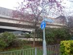
The Connection At Bere Alston Station
This OpenRailwayMap shows the track layout at Bere Alston station.
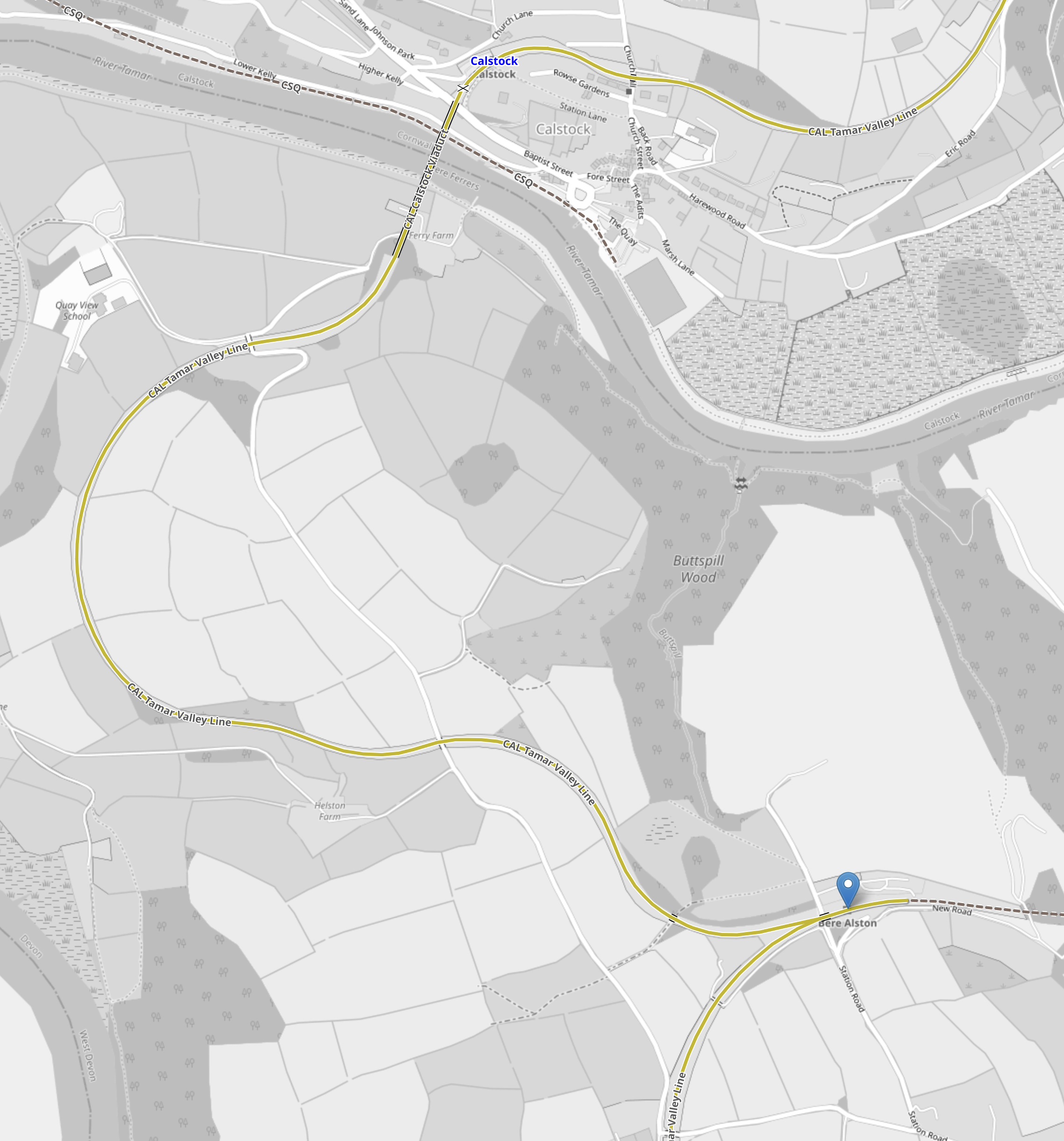
Note.
- Bere Alston station is indicated by the blue arrow.
- The line between Bere Alston and Tavistock goes East from Bere Alston station and is shown as a black dotted line.
- The single-track Tamar Valley Line between Plymouth and Gunnislake stations, is shown in yellow.
- Tamar Line trains reverse in Bere Alston stations.
- Plymouth is to the South.
- Gunnislake is to the North.
It would appear to be a simple connection.
The Route Between Bere Alston Station And Tavistock
This OpenRailwayMap shows the route between Bere Alston Station And Tavistock.
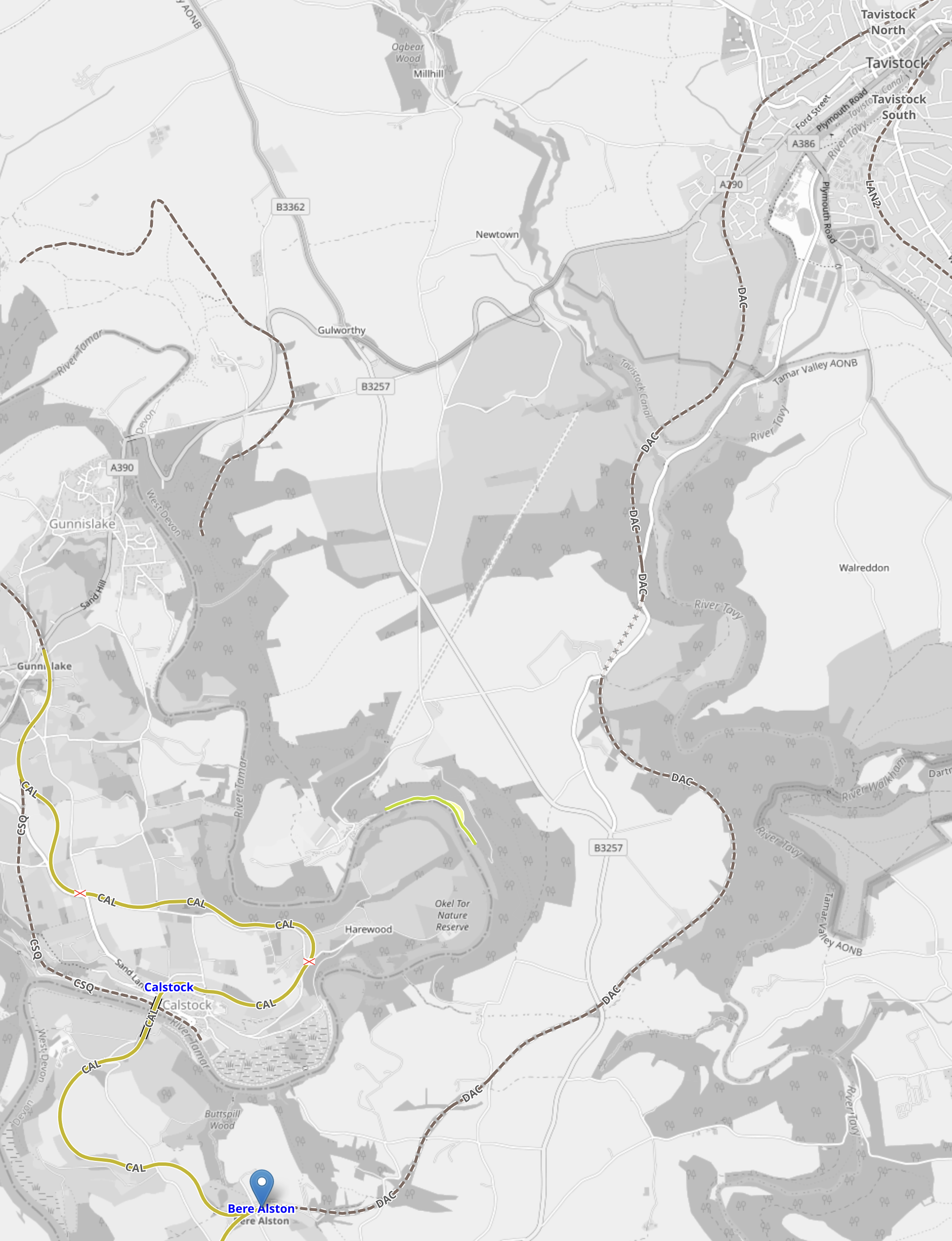
Note.
- Bere Alston station is indicated by the blue arrow.
- The single-track Tamar Valley Line between Plymouth and Gunnislake stations, is shown in yellow.
- Tavistock is in the North-East corner of the map.
- The dotted line between Bere Alston and Tavistock shows the route of the proposed reopened railway.
The new railway follows the route of a railway that closed in 1968.
These two paragraphs from the Wikipedia entry for Tavistock North station, describe the state of the railway between Tavistock North and Bere Alston stations.
The station building has been restored and converted into three self-catering cottages. The stationmaster’s house is being restored as a private dwelling, while the goods yard, now known as Kilworthy Park, houses the offices of West Devon Borough Council. The track bed for about one mile (1.6 km) south of Tavistock North station is open to the public as a footpath and nature reserve, and it is possible to walk across the viaducts that overlook the town.
The rest of the track bed south of Tavistock is almost intact to Bere Alston, where it joins the present-day Tamar Valley Line. There has been discussion regarding the re-opening of a rail link for a number of years. Engineering assessment has shown that the track bed, and structures such as bridges and tunnels, are in sound condition.
It doesn’t appear that restoring the track will be the most challenging of tasks.
But it does appear that extending the railway to the former Tavistock North station, would be a very challenging task indeed.
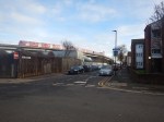
The Proposed Station At Tavistock
This OpenRailwayMap shows the track as it runs through Tavistock to the former Tavistock North station.
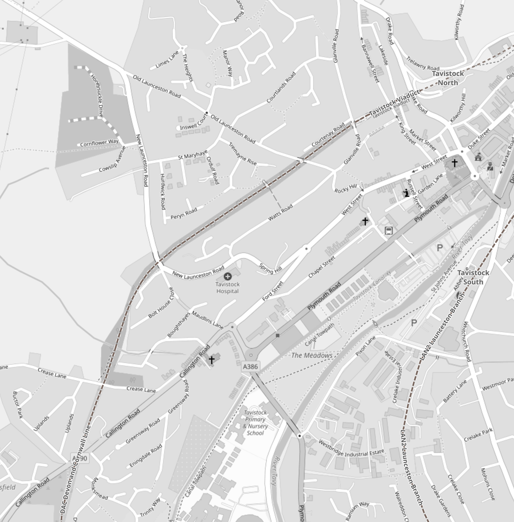
Note.
- The former railway is shown as a dotted line running diagonally SW-NE across the map.
- The former Tavistock North station is shown in the North-East corner of the map.
- This railway turns South as it leaves the town.
- The single-platform station will be built, where the railway crosses the A390.
- Another former railway passes through the town to the South-East, that passes through the former Tavistock South. station.
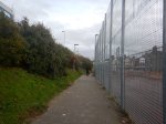
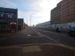
Between the former Tavistock North station and the A390 is now the Tavistock Viaduct Walk, which is about a mile long.
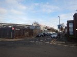
This Google Map shows where the track-bed of the old railway approaches the A390.
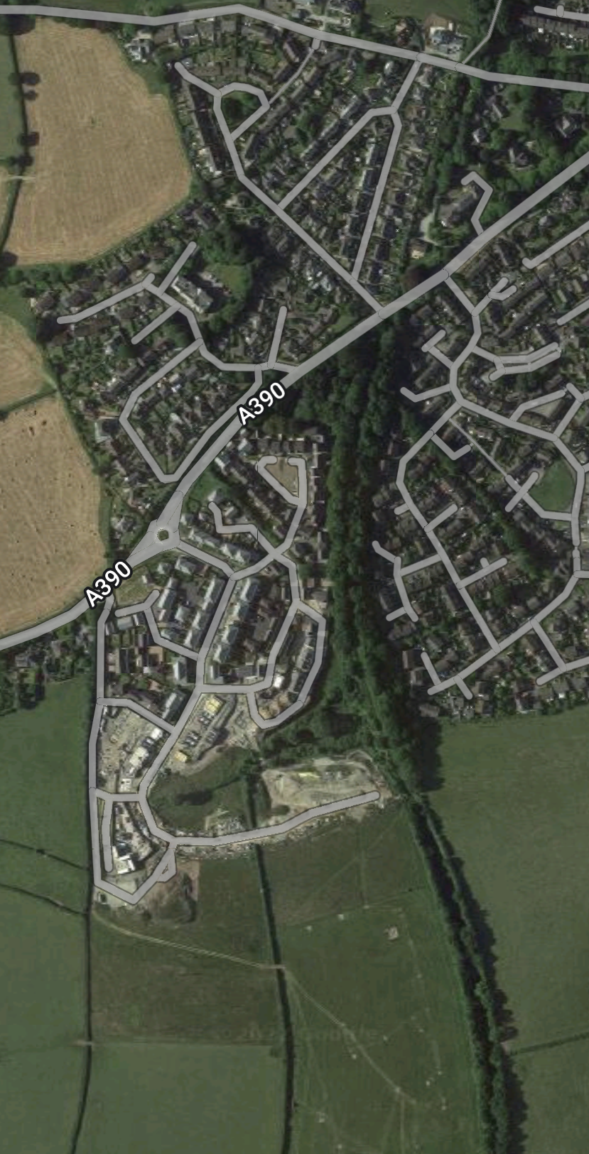
Note.
- The green scar of the former railway approaching from the South.
- The A390 running diagonally across the map.
- The plans only include a one-platform station, which I suspect is all that will fit.
Could this be a station without car-parking?
There’s not much space to put it!
Will It Be Possible To Extend From Tavistock To Okehampton?
The Line between Bere Alston and Tavistock North stations used to extend to Okehampton and train operators and Local Authorities are keen to provide a new link, in case the railway gets washed away again at Dawlish.
It’s not so much for passengers, as coaches can be used between Okehampton and Bodmin Parkway stations along the A30.
But an alternative route for freight is needed.
I would hope that the new Tavistock station will be capable of being modified, so that trains can run between Plymouth and Okehampton stations.
What Class Of Train Will Be Used Between Plymouth And Tavistock?
As a Class 150 train is used from Plymouth to Gunnislake, I suspect a Class 150 train will be used.
But the station will probably be long enough for a five-car Class 802 train.
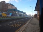
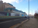
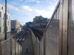
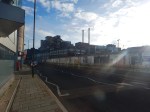
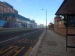
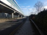
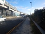
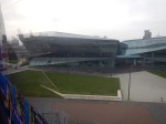
The Southern Entrance To London City Airport
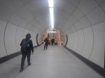
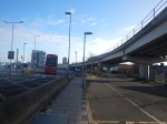
I entered London City Airport by a different route today, taking these pictures as I walked.


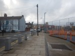


Note.
- The route is level.
- It is on the Southern side of Hartmann Road, which is the main entrance road for the airport.
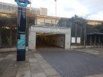
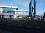
- There is a pedestrian tunnel under Hartmann Road into the airport.
- There are stairs and lifts into the Docklands Light Railway station at the airport.
- The lifts so all the way to the platforms of the DLR.
- The route is level from the lifts to the airport.
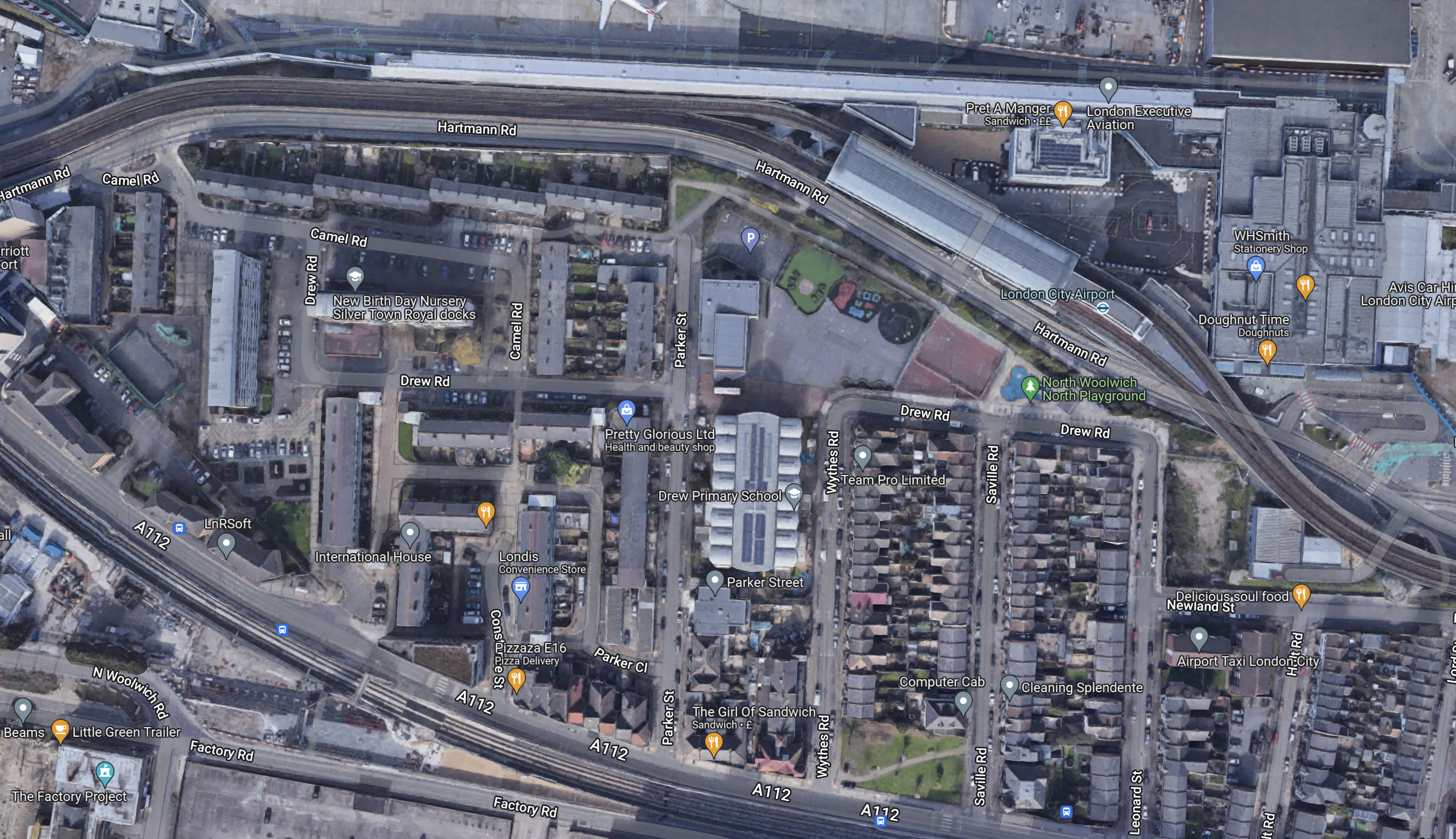
This Google Map shows the walk.
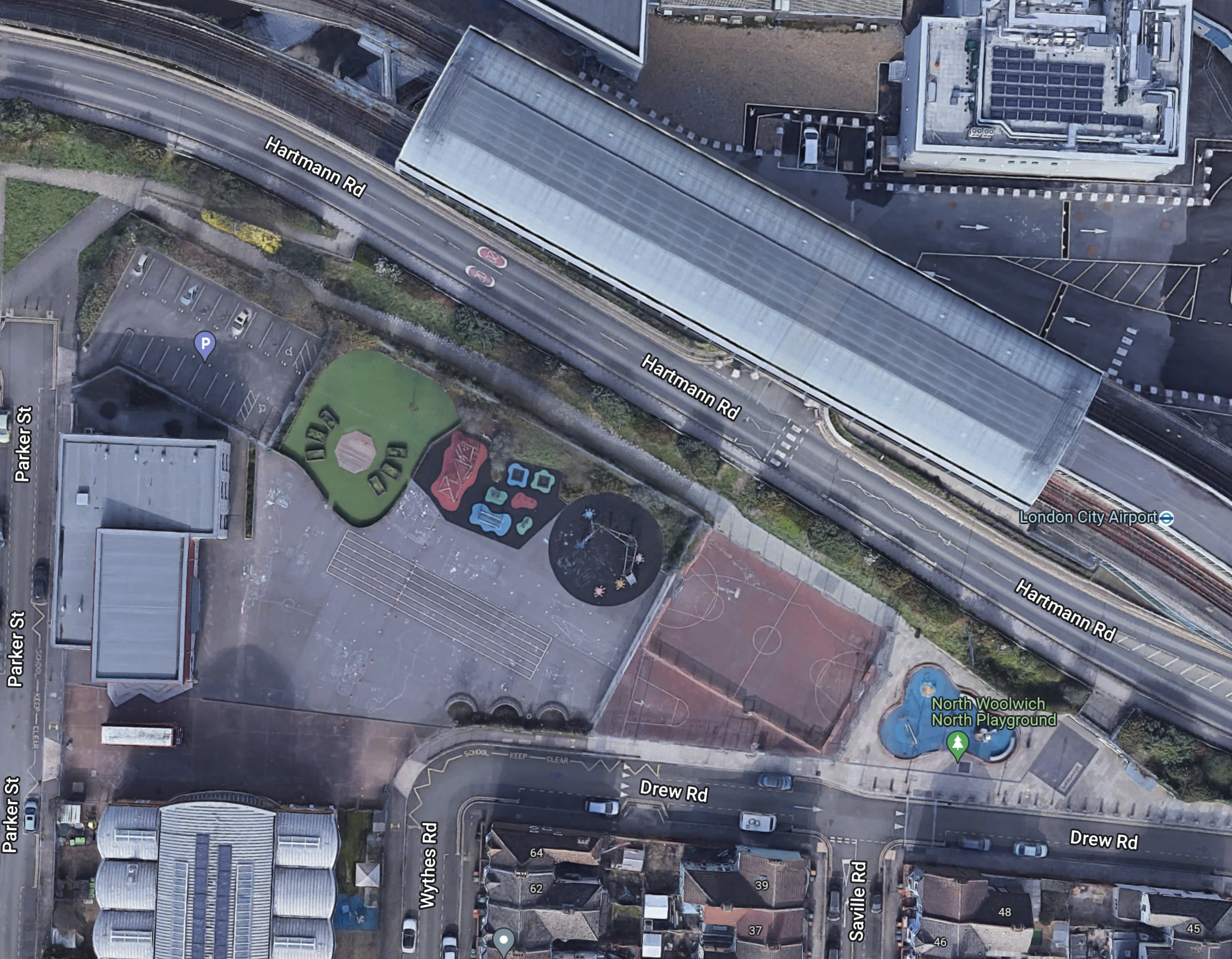
Note.
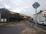
I walked along the path, that runs NW-SE on the Northern side of the various courts and playgrounds.
The entrance to the DLR station is at the South-East end of the path at the junction of Drew and Saville Roads.
This Google Map shows a 3D visualisation of the entrance.
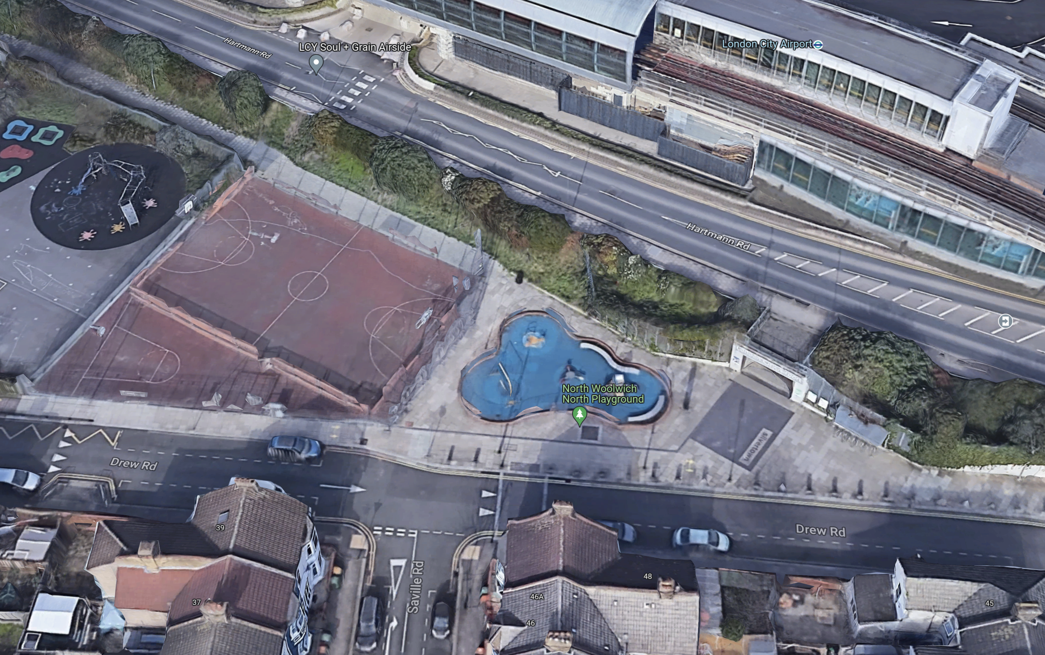
Note.
- The path runs on the North side of the football pitch.
- The Southern entrance is to the right of blue play area.
- Drew Road runs across the entrance.
- It looks like there is a drop-off point for passengers, where the car is parked by the football pitch.
Would it be possible to create a waking route from this Southern entrance to a rebuilt Silvertown station on the Elizabeth Line?
This Google Map shows the area between the Southern entrance to the airport and the footbridge over the Elizabeth Line.
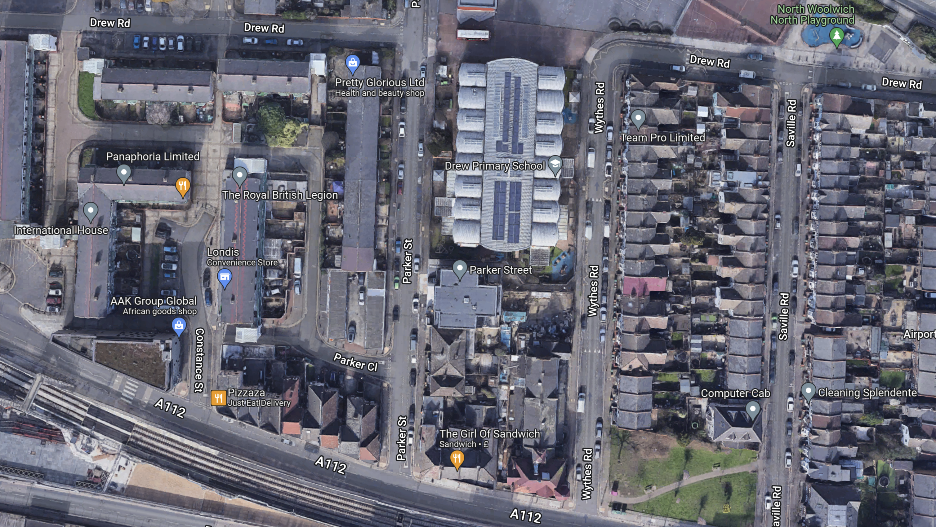
Note.
- The Southern entrance to the airport is in the North-East corner of the map.
- The footbridge over the Elizabeth Line is in the South-West corner of the map.
- The large building in the middle is Drew Primary School.
- Whytes Road, Saville Road and Leonard Street lead between the Southern entrance to the airport and the A112.
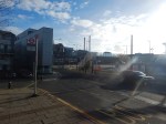
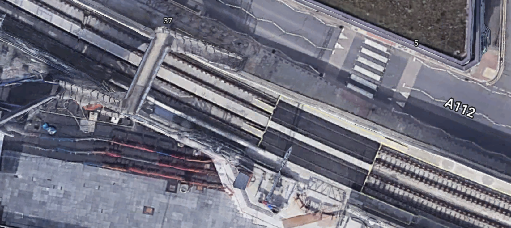
I took these pictures of the A112 and the footbridge a few days ago.


I think it would be possible to run a fleet of small electric shuttle buses on the route.
Elizabeth Line Trains From Silvertown Station
Currently, the following trains pass through the site of the original Silvertown station.
- Reading and Abbey Wood stopping at Twyford, Maidenhead, Taplow, Burnham, Slough, Langley, West Drayton, Hayes & Harlington, Southall, Ealing Broadway, Paddington, Bond Street, Tottenham Court Road, Farringdon, Liverpool Street, Whitechapel, Canary Wharf, Custom House and Woolwich.
- Maidenhead and Abbey Wood stopping at Taplow, Burnham, Slough, Langley, Iver, West Drayton, Hayes & Harlington, Southall, Ealing Broadway, Paddington, Bond Street, Tottenham Court Road, Farringdon, Liverpool Street, Whitechapel, Canary Wharf, Custom House and Woolwich.
- Heathrow Terminal 4 and Abbey Wood stopping at Heathrow Terminals 2 & 3, Hayes & Harlington, Southall, Hanwell, West Ealing, Ealing Broadway, Acton Main Line, Paddington. Bond Street, Tottenham Court Road, Farringdon, Liverpool Street, Whitechapel, Canary Wharf, Custom House and Woolwich.
- Heathrow Terminal 5 and Abbey Wood stopping at Heathrow Terminals 2 & 3, Hayes & Harlington, Southall, Hanwell, West Ealing, Ealing Broadway, Acton Main Line, Paddington, Bond Street, Tottenham Court Road, Farringdon, Liverpool Street, Whitechapel, Canary Wharf, Custom House and Woolwich.
Note.
- All four services have a frequency of two trains per hour (tph).
- Paddington, Bond Street, Tottenham Court Road, Farringdon, Liverpool Street, Whitechapel, Canary Wharf, Custom House and Woolwich have a frequency of eight tph.
- Heathrow Terminals 2 & 3 has a frequency of two tph and it has extra connections to Heathrow Terminal 4 and Heathrow Terminal 5.
The number of services will increase in May 2023.
Stadler Presents Mock-Up Of Tram-Trains For German And Austrian Operators
The title of this post, is the same as that of this article on Railway Gazette.
This is the first paragraph.
A mock-up of the Citylink tram-trains that Stadler is to supply to operators in Karlsruhe, Saarbrücken, Neckar-Alb, Oberösterreich and Salzburg was unveiled at the Betriebshof West depot in Karlsruhe on December 13.
This is the most interesting paragraph.
‘Maximum standardisation and the fact that the order was shared between different operating companies reduces the costs by to up to €1m per vehicle’, said Karlsruhe Mayor Frank Mentrup at the unveiling ceremony.
It shows the value of standardisation and large orders.
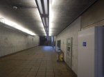
Passenger Tunnel Linings At Waterloo Underground Station
This pictures show the cast-iron pedestrian tunnel linings at Waterloo tube station.
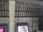
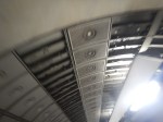


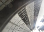
The Jubilee Line opened in 1999.
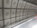
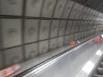
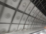
In the last few years, concrete has been able to be 3D-printed, so it can now be produced in different shapes.


All these wall and roof panels on the Elizabeth Line were made by 3D-printing of concrete.
Conclusion
Design has progressed in 25 years.
Striking “Bellingham” Bridge Set To Light Up HS2’s Gateway Into Birmingham
The title of this post, is the same as that of this news item from High Speed Two.
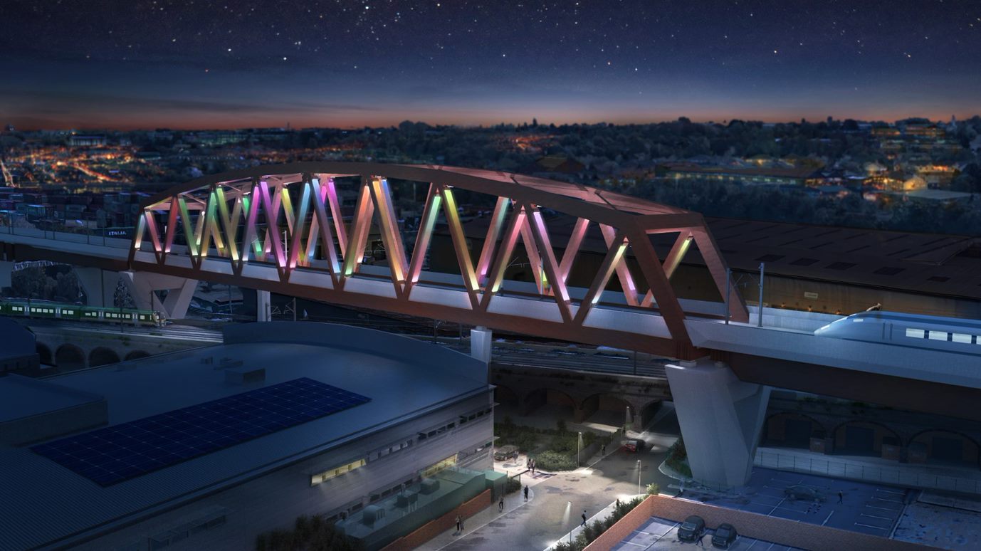
These three paragraphs describe the bridge in detail.
HS2 Ltd has revealed designs for the 150-metre section of viaduct as part of the approach to Birmingham’s new Curzon Street Station, including a 25-metre-high truss which will create a new icon on the city’s skyline.
A unique light installation, designed by British artist Liz West, will introduce a dynamic colour palette to the apertures of the steel truss, framing views of the city. Titled Out of the Blue, the proposed artwork will establish the bridge as a stunning feature of the city’s landscape both during the day and at night, when the artwork will come to life.
The Curzon 2 bridge, which has been nicknamed “The Bellingham Bridge” by the team in honour of England superstar and Stourbridge-born Jude Bellingham’s performances at the World Cup, is the tallest structure in the sequence of viaducts and structures that make up the Curzon Street Approaches. These Approaches take HS2 into Birmingham’s new city centre station. The bridge consists of a gently curved truss in weathering steel which carries HS2 over the Victorian brick rail viaduct below.
There are several more visualisations on the High Speed Two web site.
Low Carbon Construction Of Sizewell C Nuclear Power Station
Sizewell C Nuclear Power Station is going to be built on the Suffolk Coast.
Wikipedia says this about the power station’s construction.
The project is expected to commence before 2024, with construction taking between nine and twelve years, depending on developments at the Hinkley Point C nuclear power station, which is also being developed by EDF Energy and which shares major similarities with the Sizewell plant.
It is a massive project and I believe the construction program will be designed to be as low-carbon as possible.
High Speed Two is following the low-carbon route and as an example, this news item on their web site, which is entitled HS2 Completes Largest Ever UK Pour Of Carbon-Reducing Concrete On Euston Station Site, makes all the right noises.
These three paragraphs explain in detail what has been done on the Euston station site.
The team constructing HS2’s new Euston station has undertaken the largest ever UK pour of Earth Friendly Concrete (EFC) – a material that reduces the amount of carbon embedded into the concrete, saving over 76 tonnes of CO2 overall. John F Hunt, working for HS2’s station Construction Partner, Mace Dragados joint venture, completed the 232 m3 concrete pour in early September.
The EFC product, supplied by Capital Concrete, has been used as a foundation slab that will support polymer silos used for future piling works at the north of the Euston station site. Whilst the foundation is temporary, it will be in use for two years, and historically would have been constructed with a more traditional cement-based concrete.
The use of the product on this scale is an important step forward in how new, innovative environmentally sustainable products can be used in construction. It also helps support HS2’s objective of net-zero construction by 2035, and achieve its goal of halving the amount of carbon in the construction of Britain’s new high speed rail line.
Note.
- Ten of these slabs would fill an Olympic swimming pool.
- I first wrote about Earth Friendly Concrete (EFC) in this post called Earth Friendly Concrete.
- EFC is an Australian invention and is based on a geopolymer binder that is made from the chemical activation of two recycled industrial wastes; flyash and slag.
- HS2’s objective of net-zero construction by 2035 is laudable.
- It does appear that this is a trial, but as the slab will be removed in two years, they will be able to examine in detail how it performed.
I hope the Sizewell C project team are following High Speed Two’s lead.
Rail Support For Sizewell C
The Sizewell site has a rail connection and it appears that this will be used to bring in construction materials for the project.
In the January 2023 Edition of Modern Railways, there is an article, which is entitled Rail Set To Support Sizewell C Construction.
It details how sidings will be built to support the construction, with up to four trains per day (tpd), but electrification is not mentioned.
This is surprising to me, as increasingly, big construction projects are being managed to emit as small an amount of carbon as possible. Sizewell C may be an isolated site, but in Sizewell B, it’s got one of the UK’s biggest independent carbon-free electricity generators a couple of hundred metres away.
The writer of the Modern Railways article, thinks an opportunity is being missed.
I feel the following should be done.
- Improve and electrify the East Suffolk Line between Ipswich and Saxmundham Junction.
- Electrify the Aldeburgh Branch Line and the sidings to support the construction or agree to use battery-electric or hydrogen zero-carbon locomotives.
Sizewell C could be a superb demonstration project for low-carbon construction!
Sizewell C Deliveries
Sizewell C will be a massive project and and will require a large number of deliveries, many of which will be heavy.
The roads in the area are congested, so I suspect rail is the preferred method for deliveries.
We already know from the Modern Railways article, that four tpd will shuttle material to a number of sidings close to the site. This is a good start.
Since Sizewell A opened, trains have regularly served the Sizewell site to bring in and take out nuclear material. These occasional trains go via Ipswich and in the last couple of years have generally been hauled by Class 88 electro-diesel locomotives.
It would be reasonable to assume that the Sizewell C sidings will be served in the same manner.
But the route between Westerfield Junction and Ipswich station is becoming increasingly busy with the following services.
- Greater Anglia’s London and Norwich services
- Greater Anglia’s Ipswich and Cambridge services
- Greater Anglia’s Ipswich and Felixstowe services
- Greater Anglia’s Ipswich and Lowestoft services
- Greater Anglia’s Ipswich and Peterborough services
- Freight services serving the Port of Felixstowe, which are expected to increase significantly in forthcoming years.
But the Modern Railways article says this about Saxmundham junction.
Saxmundham junction, where the branch meets the main line, will be relaid on a slightly revised alignment, retaining the existing layout but with full signalling giving three routes from the junction protecting signal on the Down East Suffolk line and two in the Down direction on the bidirectional Up East Suffolk line. Trap points will be installed on the branch to protect the main line, with the exit signal having routes to both running lines.
Does the comprehensive signalling mean that a freight train can enter or leave the Sizewell sidings to or from either the busy Ipswich or the quieter Lowestoft direction in a very safe manner?
I’m no expert on signalling, but I think it does.
- A train coming from the Lowestoft direction needing to enter the sidings would go past Saxmundham junction on the Up line. Once clear of the junction, it would stop and reverse into the branch.
- A train coming from the Ipswich direction needing to enter the sidings would approach in the wrong direction on the Up line and go straight into the branch.
- A train leaving the sidings in the Lowestoft direction would exit from the branch and take the Up line until it became single track. The train would then stop and reverse on to the Down line and take this all the way to Lowestoft.
- A train leaving the sidings in the Ipswich direction would exit from the branch and take the Up line all the way to Ipswich.
There would need to be ability to move the locomotive from one end to the other inside the Sizewell site or perhaps these trains could be run with a locomotive on both ends.
The advantage of being able to run freight trains between Sizewell and Lowestoft becomes obvious, when you look at this Google Map, which shows the Port of Lowestoft.
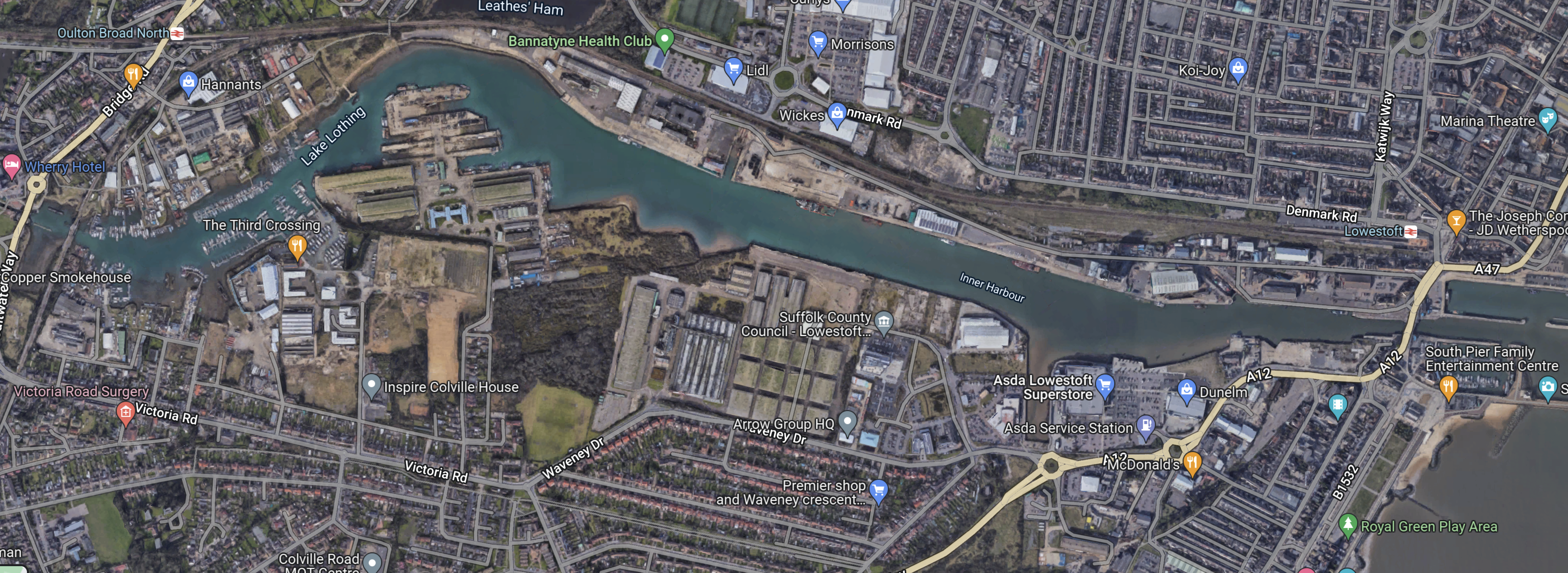
Note.
- The Inner Harbour of the Port of Lowestoft.
- The East Suffolk Line running East-West to the North of the Inner Harbour.
- Lowestoft station at the East side of the map.
I doubt it would be the most difficult or expensive of projects to build a small freight terminal on the North side of the Inner Harbour.
I suspect that the easiest way to bring the material needed to build the power station to Sizewell would be to do the following.
- Deliver it to the Port of Lowestoft by ship.
- Tranship to a suitable shuttle train for the journey to the Sizewell sidings.
- I estimate that the distance is only about 25 miles and a battery or hydrogen locomotive will surely be available in the UK in the next few years, that will be able to provide the motive power for the return journey.
In The TruckTrain, I wrote about a revolutionary freight concept, that could be ideal for the Sizewell freight shuttle.
In addition, there is no reason, why shuttle trains couldn’t come in from anywhere connected to the East Suffolk Line.
Zero-Carbon Construction
Sizewell C could be the first major construction site in the UK to use electricity rather than diesel simply because of its neighbour.
Conclusion
I shall be following the construction methods at Sizewell C, as I’m fairly sure they will break new ground in the decarbonisation of the Construction industry.
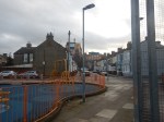
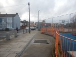
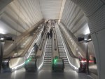
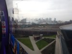
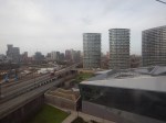
A Walk From London City Airport Through Silvertown To The Elizabeth Line
I went for a walk from London City Airport, this morning.


This Google Map shows the area between London City Airport and the Elizabeth Line.
Note.
- The airport is just off the map at the top.
- A plane is partially visible in the middle.
- The Docklands Light Railway runs across the map from the top-left corner, through the station for the airport.
- The Elizabeth Line runs across the map from the middle of the left hand side.
- The blue dots alongside the Elizabeth Line are bus stops.
- The bus stop, that is shown in the third picture, is marked by the rightmost blue dot.
- I estimate it’s about a three-hundred metre walk between Railway and the airport.
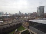
This second map shows the footbridge over the Elizabeth Line from where I took some of the pictures.
Note.
- The bridge has been designed to have lifts added.
- Squeezing a station in here, appears to be just about possible, but it would need a precision design.
- For safety reasons platform-edge doors would be needed.
- I suspect, it would be the first station of its design ever built.
The biggest problem would be the actual building, as it would probably mean closing the railway for at least a few weeks.
Conclusion
This was a station, that should have been built in the first phase of the creation of the Elizabeth Line.
Could Greater Anglia Run A Comprehensive Service For East Anglia?
Consider.
- In the last fifty years, there have been direct trains between London Liverpool Street and Lowestoft stations.
- In the last forty years, there have been direct trains between London Liverpool Street and Peterborough stations.
- Greater Anglia currently run an hourly train between London Liverpool Street and Ipswich stations, with stops at Stratford, Shenfield, Chelmsford, Hatfield Peverel, Witham, Kelvedon, Marks Tey, Colchester and Manningtree
- Frequencies on both routes were not high and less than four trains per day (tpd), but they must have been a demand for these services.
- Greater Anglia promised to run a Lowestoft service, when they successfully reapplied for the franchise.
- Greater Anglia have 38 Class 755 trains, of which 14 are three-cars and 24 are four-cars.
- Class 755 trains can run in twoses and possibly threeses. (Suffolk dialect for twins and triplets!)
Could these elements be assembled to provide a comprehensive East Anglia service?
- A pair of Class 755 trains would leave Liverpool Street for Ipswich.
- They would takeover some of the paths of the hourly Liverpool Street and Ipswich service and run possibly about four or five tpd, according to demand.
- Between Liverpool Street and Ipswich the trains could stop at Stratford, Shenfield, Chelmsford, Hatfield Peverel, Witham, Kelvedon, Marks Tey, Colchester and Manningtree
- The services would splitgoing North and join going South at Ipswich
- One train would go to Peterborough with stops at Needham Market, Stowmarket, Elmswell, Thurston, Bury St. Edmunds, Soham, Ely, Manea, March and Whittlesea.
- The other would go to Lowestoft with stops at Woodbridge, Melton, Wickham Market, Saxmundham, Darsham, Halesworth, Brampton, Beccles and Oulton Broad South.
Note.
- The Class 755 trains would use electricity, where electrification exists.
- They would use diesel on lines without electrification.
- They would be able to hold 100 mph, so wouldn’t delay other trains.
- Seventeen towns would get new direct services to and from London.
- A Class 745 train is 236.6 metres long, whereas a pair of four-car Class 755 trains is only 161.4 metres.
- A three-train formation of Class 755 trains is only 5.5 metres longer than a single Class 745 train.
I am fairly sure no new substantial infrastructure would be required.
I have some further thoughts.
Example Timings
These timings to and from London are based on current timings of the Class 745 and 755 trains.
- Ipswich – 60 mins
- Stowmarket -70 mins
- Bury St. Edmunds – 88 mins
- Soham – 108 mins
- Ely – 117 mins
- March – 136 mins
- Peterborough – 158 mins
- Woodbridge – 75 mins
- Melton – 80 mins
- Wickham Market – 86 mins
- Saxmundham – 97 mins
- Darsham – 104 mins
- Halesworth – 113 mins
- Brampton – 119 mins
- Beccles – 128 mins
- Oulton Broad South – 138 mins
- Lowestoft – 146 mins
Notes.
- Times to and from Ipswich are based on typical services at the current time.
- I have assumed that there are no stops South of Ipswich.
- Saxmundham is the closest station to Sizewell and could be important in bringing in construction workers for Sizewell C.
I think some of the times like those to and from Bury St. Edmunds, Ipswich, Lowestoft, Saxmundham and Woodbridge could create popular routes.
Battery-Electric Trains
Consider.
- I wrote about Stadler’s expertise with battery-electric trains in Stadler FLIRT Akku Battery Train Demonstrates 185km Range.
- 185 km. is 115 miles.
- The Class 756 trains for Transport for Wales are similar trains to the Class 755 trains fitted with batteries.
- In Battery Power Lined Up For ‘755s’, I wrote about plans to put batteries in the Class 755 trains.
These sections of lines are not electrified on the routes I have talked about.
- Haughley Junction and Ely – 38 miles
- Ely and Peterborough – 30.5 miles
- Westerfield and Lowestoft – 38 miles
As there is electrification at Ely, Haughley, Peterborough and Westerfield and South to London, I am fairly certain the route could be run by battery-electric trains.
Electrification To Sizewell C
In the January 2023 Edition of Modern Railways, there is an article, which is entitled Rail Set To Support Sizewell C Construction.
It details how sidings will be built to support the construction, with up to four trains per day (tpd), but the electrification word is not mentioned.
This is surprising to me, as increasingly, big construction projects are being managed to emit as small an amount of carbon as possible. High Speed Two is being built this way and I suspect Rolls-Royce’s SMR design will minimise carbon emissions during manufacture and construction. It will be very surprising if Sizewell C doesn’t follow High Speed Two’s example. After all, it may be an isolated site, but in Sizewell B, it’s got one of the UK’s biggest carbon-free electricity generators a couple of hundred metres away.
The writer of the Modern Railways article, thinks an opportunity is being missed.
I feel the following should be done.
- Improve and electrify the East Suffolk Line between Ipswich and Saxmundham Junction.
- Electrify the Aldeburgh Branch Line and the sidings to support the construction or agree to use battery-electric or hydrogen zero-carbon locomotives.
One of the collateral benefits of electrifying from Ipswich to Saxmundham Junction, is that it will make it easier for battery-electric Class 755 trains to work Ipswich and Lowestoft services.
- If the trains were to leave Saxmundham Junction going North with a full battery, they should be able to travel to Lowestoft and return.
- Battery-electric Class 755 trains could bring in workers from Ipswich or Lowestoft and further afield.
- It could even leave behind a zero-carbon branch line to Sizewell, Leiston and Aldeburgh, with two tph to Ipswich.
Sizewell C could be a superb demonstration project for low-carbon construction!
The Lowestoft-Great Yarmouth Conurbation
The Wikipedia entry for Lowestoft says this about the town.
The estimated population in the built-up area exceeds 70,000. Its development grew with the fishing industry and as a seaside resort with wide sandy beaches. As fishing declined, oil and gas exploitation in the North Sea in the 1960s took over. While these too have declined, Lowestoft is becoming a regional centre of the renewable energy industry.
Whilst the Wikipedia entry for Great Yarmouth says this about the town.
Great Yarmouth, often called Yarmouth, is a seaside town and unparished area in, and the main administrative centre of, the Borough of Great Yarmouth in Norfolk, England; it straddles the River Yare and is located 20 miles (30 km) east of Norwich. A population of 38,693 in the 2011 Census made it Norfolk’s third most populous. Its fishing industry, mainly for herring, shrank after the mid-20th century and has all but ended.[3] North Sea oil from the 1960s supplied an oil-rig industry that services offshore natural gas rigs; more recently, offshore wind power and other renewable energy industries have ensued.
Wikipedia also said this about the population of the wider Great Yarmouth.
The wider Great Yarmouth borough had a population of around 92,500, which increased to 97,277 at the 2011 census.
Taken together they are one of the largest conurbations in East Anglia.
The main means of transport between the two towns is by road.
Surely, two towns of over 70,000 people, who are only a few miles apart need a rail connection.
Onward From Lowestoft To Great Yarmouth
If the comprehensive East Anglia service, I’m discussing is to be truly comprehensive, it must serve the Norfolk Broads and Great Yarmouth.
This would also improve the connectivity between two of the largest coastal towns in East Anglia, that I indicated in the last section.
This OpenRailwayMap shows a cunning plan proposed by Network Rail to connect Lowestoft and Great Yarmouth.
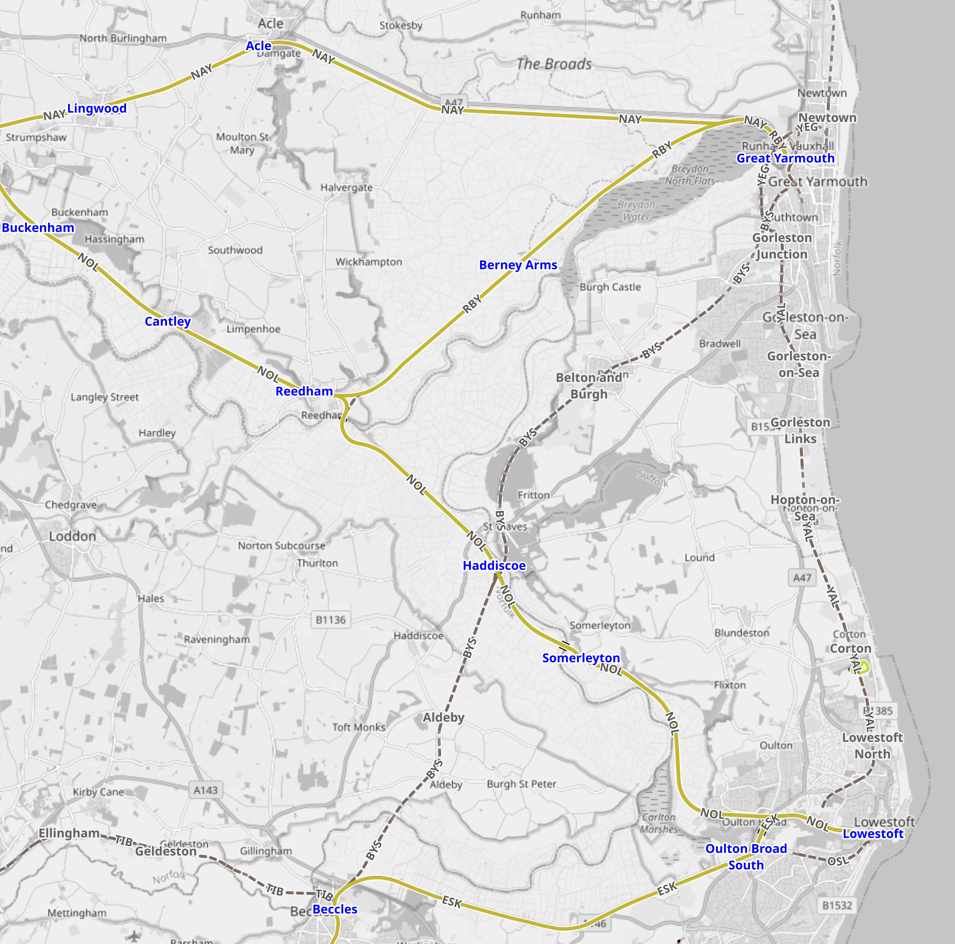
Note.
- Great Yarmouth is in the North East corner of the map.
- Two lines lead West from Great Yarmouth station, with the more Northerly route going direct to Norwich and the more Southerly one going to Norwich via Berney Arms and Reedham.
- Lowestoft is in the South East corner of the map.
- Two lines lead West from Lowestoft station, with the Northern route going to Norwich via Reedham and the Southern one going to Ipswich via Oulton Broad South.
- The route of a coastal railway connecting the two towns is also shown.
Network Rail’s cunning plan is indicated on this second nap from OpenRailwayMap.
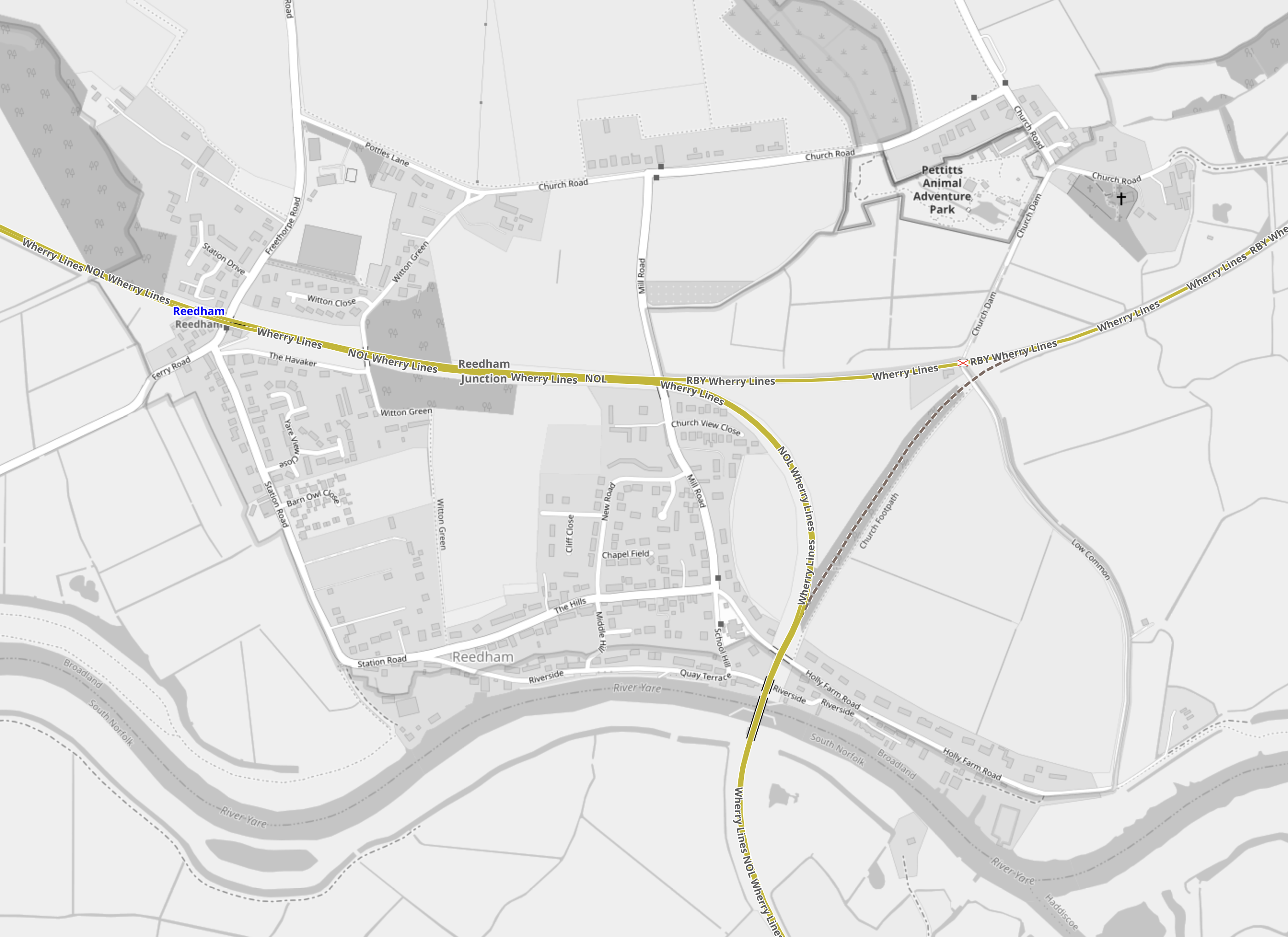
Note.
- Reedham station is in the North-West corner of the map on the line to Norwich.
- To the East of the station is a triangular junction.
- The track from the North-East corner of the junction is the line to Great Yarmouth.
- The track from the Southern corner of the junction is the line to Lowestoft.
- Unfortunately, the South-Eastern leg of the junction was removed in 1880.
In Norfolk Rail Line To Remain Closed As £68m Upgrade Project Overruns, I said this.
Network Rail are talking about reinstating the Reedham Chord to create a more direct route between East Anglia’s largest North-Eastern towns. This is said about the Reedham Chord in Direct Yarmouth Services in the Wikipedia entry for Lowestoft station.
In January 2015, a Network Rail study proposed the reintroduction of direct services between Lowestoft and Yarmouth by reinstating a spur at Reedham. Services could once again travel between two East Coast towns, with an estimated journey time of 33 minutes, via a reconstructed 34-chain (680 m) north-to-south arm of the former triangular junction at Reedham, which had been removed in c. 1880. The plans also involve relocating Reedham station nearer the junction, an idea which attracted criticism.
This sounds a good plan to me.
- It would allow direct services between Lowestoft and Great Yarmouth.
- It would allow direct services between Ipswich and Great Yarmouth with a reverse at Lowestoft in about two hours.
- With possible charging at Lowestoft and/or Great Yarmouth, a scenic route could be created between Ipswich and Norwich for battery-electric Class 755 trains. If that doesn’t get people out of their cars then nothing will!
- Various leisure, tourism and work-related opportunities would be created.
Never in the field of railway engineering would such a small chord have given so much.
Sizewell C Issues
Sizewell C will be a massive project and I also suspect that like High Speed Two, it will be built in a manner that will be zero-carbon where possible.
We already know from the Modern Railways article, that four tpd will shuttle material to a number of sidings close to the site. This is a good start.
Since Sizewell A opened, trains have regularly served the Sizewell site to bring in and take out nuclear material. These occasional trains go via Ipswich and in the last couple of years have generally been hauled by Class 88 electro-diesel locomotives.
It would be reasonable to assume that the Sizewell C sidings will be served in the same manner.
But the route between Westerfield Junction and Ipswich station is becoming increasingly busy with the following services.
- Greater Anglia’s London and Norwich services
- Greater Anglia’s Ipswich and Cambridge services
- Greater Anglia’s Ipswich and Felixstowe services
- Greater Anglia’s Ipswich and Lowestoft services
- Greater Anglia’s Ipswich and Peterborough services
- Freight services serving the Port of Felixstowe, which are expected to increase significantly in forthcoming years.
But the Modern Railways article says this about Saxmundham junction.
Saxmundham junction, where the branch meets the main line, will be relaid on a slightly revised alignment, retaining the existing layout but with full signalling giving three routes from the junction protecting signal on the Down East Suffolk line and two in the Down direction on the bidirectional Up East Suffolk line. Trap points will be installed on the branch to protect the main line, with the exit signal having routes to both running lines.
Does the comprehensive signalling mean that a freight train can enter or leave the Sizewell sidings to or from either the busy Ipswich or the quieter Lowestoft direction in a very safe manner?
I’m no expert on signalling, but I think it does.
- A train coming from the Lowestoft direction needing to enter the sidings would go past Saxmundham junction on the Up line. Once clear of the junction, it would stop and reverse into the branch.
- A train coming from the Ipswich direction needing to enter the sidings would approach in the wrong direction on the Up line and go straight into the branch.
- A train leaving the sidings in the Lowestoft direction would exit from the branch and take the Up line until it became single track. The train would then stop and reverse on to the Down line and take this all the way to Lowestoft.
- A train leaving the sidings in the Ipswich direction would exit from the branch and take the Up line all the way to Ipswich.
There would need to be ability to move the locomotive from one end to the other inside the Sizewell site or perhaps these trains could be run with a locomotive on both ends.
The advantage of being able to run freight trains between Sizewell and Lowestoft becomes obvious, when you look at this Google Map, which shows the Port of Lowestoft.
Note.
- The Inner Harbour of the Port of Lowestoft.
- The East Suffolk Line running East-West to the North of the Inner Harbour.
- Lowestoft station at the East side of the map.
I doubt it would be the most difficult or expensive of projects to build a small freight terminal on the North side of the Inner Harbour.
I suspect that the easiest way to bring the material needed to build the power station to Sizewell would be to do the following.
- Deliver it to the Port of Lowestoft by ship.
- Tranship to a suitable shuttle train for the journey to the Sizewell sidings.
- I estimate that the distance is only about 25 miles and a battery or hydrogen locomotive will surely be available in the UK in the next few years, that will be able to provide the motive power for the return journey.
In The TruckTrain, I wrote about a revolutionary freight concept, that could be ideal for the Sizewell freight shuttle.
Great Yarmouth Racecourse
Great Yarmouth Racecourse is one of my favourite racecourses and I believe it is one of the attractions in Great Yarmouth, that would benefit from an improved rail service between Lowestoft and Great Yarmouth, as it would almost double those with efficient public transport access to the racecourse.
The walking distance between Great Yarmouth station and the racecourse is walkable for many and I remember doing it since C died.
With the train connection to Lowestoft and perhaps a courtesy bus from the station, I wouldn’t be surprised to see that a Lowestoft-Yarmouth rail connection being very good for the racecourse. Especially as road traffic between the two towns can be not the best.
Finishing At Norwich
There are operational reasons to carry on to Norwich, where Crown Point, is the home base for the Class 755 trains.
But it would also link a lot of places that are dependant on tourism and are also heavily involved in East Anglia’s energy industry.
Onward From Peterborough To Lincoln
If the Lowestoft service can extend to Great Yarmouth, an extension of the Peterborough service to Lincoln via Spalding and Sleaford might be possible.
But with LNER also serving Lincoln from Kings Cross, I doubt the route would carry many passengers to and from London.
Conclusion
A service from London, that splits into two trains at Ipswich for Lowestoft and Peterborough has possibilities.
The Northern End Of The Silvertown Tunnel
This map from OpenRailwayMap shows the Northern end of the Silvertown Tunnel.
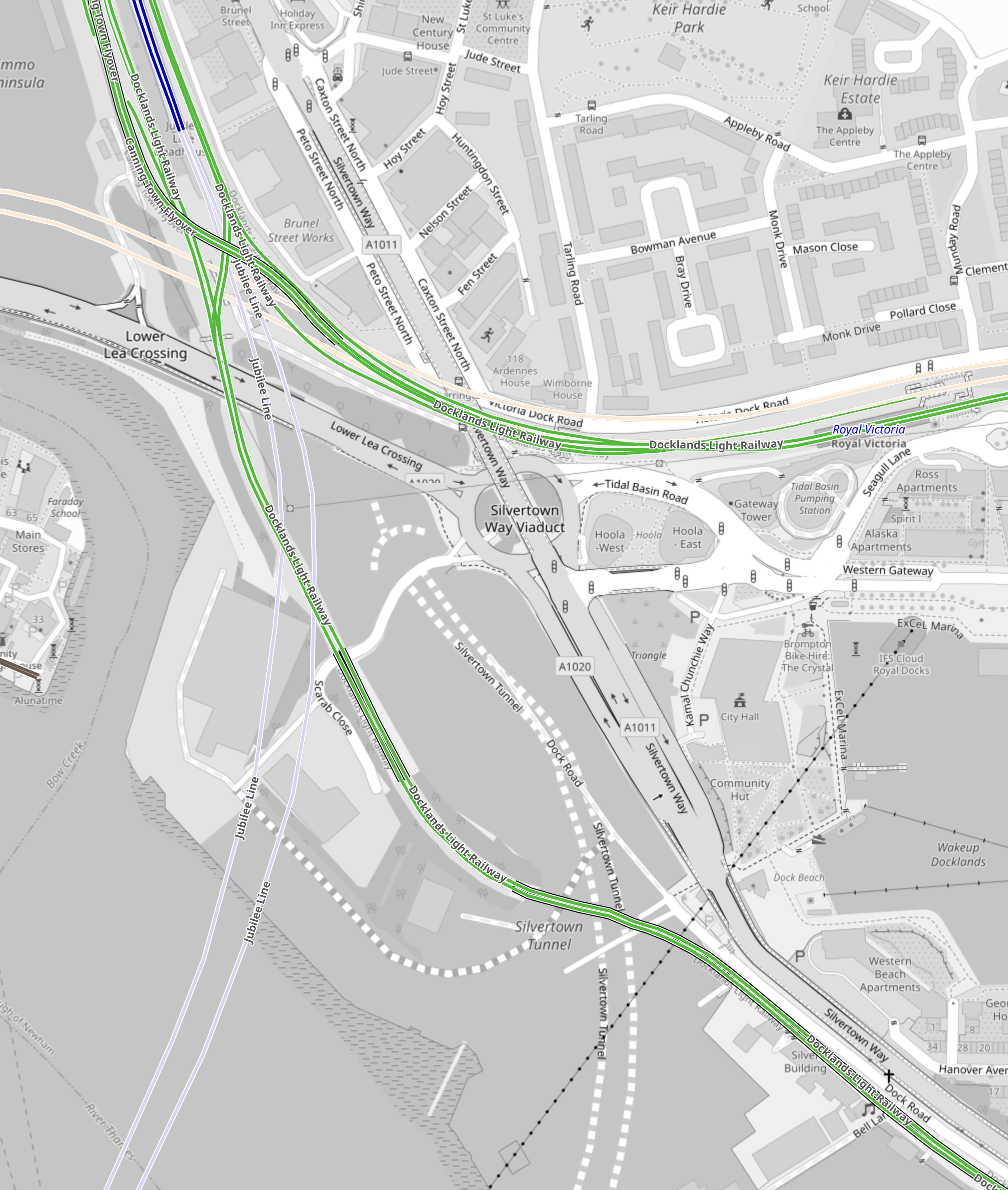
Note.
- The two dotted white lines show the route of the Silvertown Tunnel.
- The green lines are the Docklands Light Railway.
- The Northern green line is the Beckton branch.
- The Southern green line is the Woolwich Arsenal branch.
- The two silver-grey lines that loop across the top part of the map are the Jubilee Line.
- Canning Town Station is in the North-West corner of the map.
- The pair of cream lines across the map to the South of Canning Town station are the tunnels of the Elizabeth Line.
- The black dotted line going across the South-East corner of the map is the cable car.
This Google Map shows vaguely the same area.
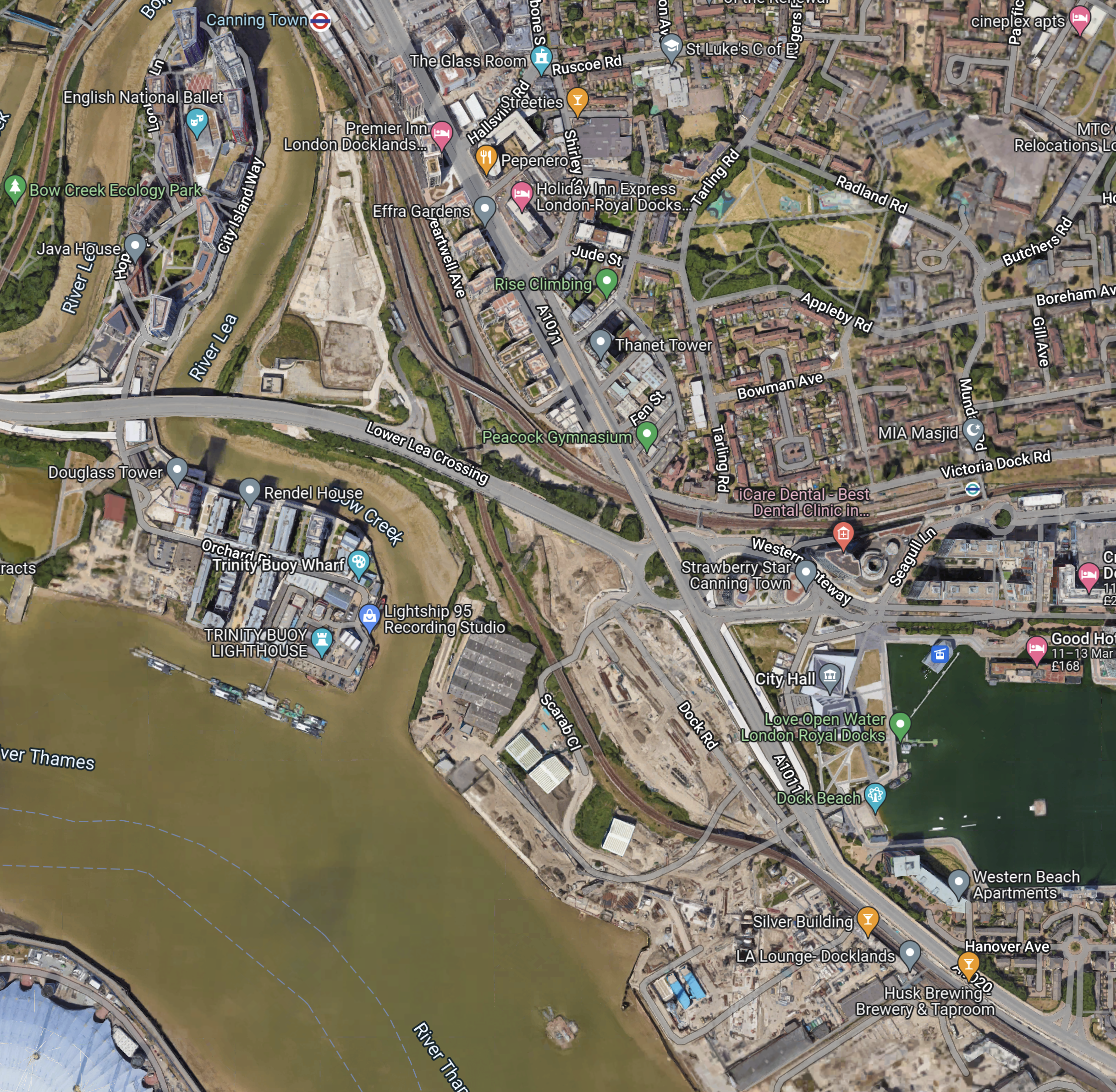
Note.
- Canning Town station at the North of the map in the middle.
- The dual carriage road running NW-SE past Canning Town station, is numbered A1011 in the North-West and A1020 in the South-East.
- The A1011 crosses over a roundabout and the Beckton branch of the DLR on a flyover.
- The roundabout is the Tidal Basin Roundabout, which will be the Northern connection of the Silvertown Tunnel.
- The road running West from the roundabout is the Lower Lea Crossing, which leads to Canary Wharf and the City.
- The water to the right, is the Royal Victoria Dock.
- The Royal Docks cable car station can be seen in the North-West corner of the dock.
- The new City Hall is between the cable car and the A1011.
Comparing the two maps, it appears that the Silvertown Tunnel will emerge somewhere in the cleared land to the West of the A1011.
This second Google Map shows the Tidal Basin roundabout, City Hall and the Royal Docks cable car station.
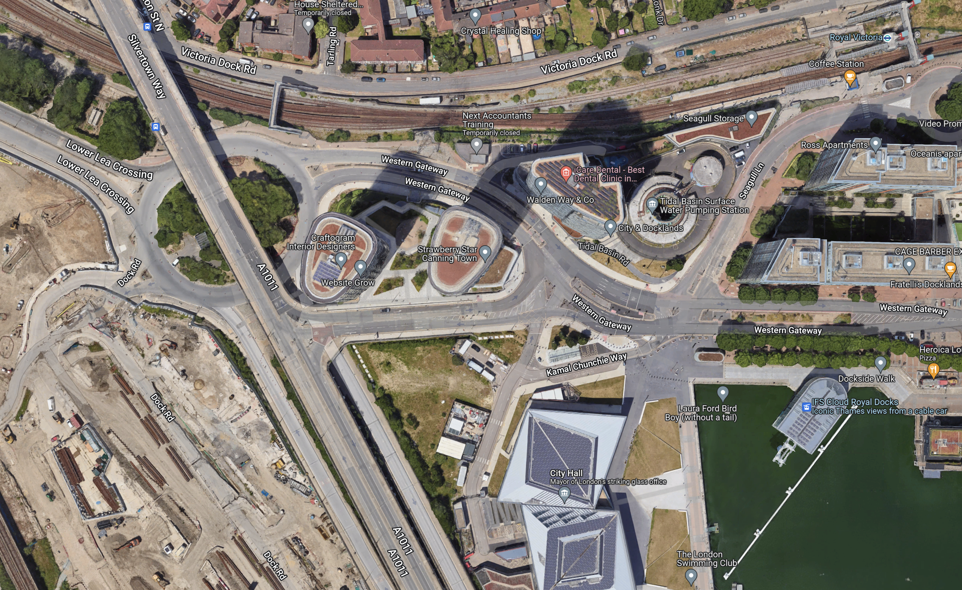
I took these pictures of the area from the cable-car yesterday.

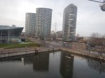
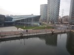
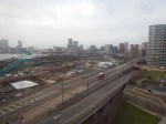
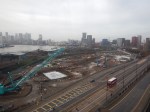
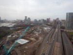
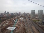
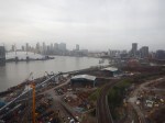
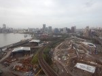
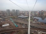
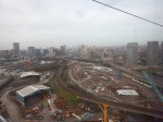

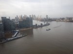
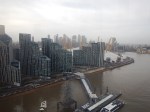
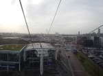
Note.
- The cable-car wasn’t busy.
- I was sitting alone on the Western side of the car.
I have some thoughts about the Silvertown Tunnel.
The Silvertown Tunnel Is Convenient For The New City Hall
From the Google Map, I included earlier, it looks like City Hall is on a loop from the Tidal Basin Roundabout.
it is also especially convenient for those members and officials who live in South London, who will just nip through the new tunnel.
I suspect that limousine access for the great and good to the old City Hall wasn’t as good.
The Obvious Truck Route To The City of London From the Channel Tunnel Will Be To Use The Silverton Tunnel
Recently. I have been watching the construction of 22 Ropemaker Street and I have surprised at how many large components for this building have come in by truck from Europe.
As they seem to arrive overnight, they are probably sneaked in by a secret route like the A13 to avoid a crossing of the River.
As Blackwall and Rotherhithe Tunnels don’t have a high clearance, could these components come into City through the Silvertown Tunnel.
I certainly feel that large truck access to Central London, is the major reason for building the Silvertown Tunnel.
But will large numbers of trucks using the Silverton Tunnel increase congestion on the roads in East London?
As Hackney and Newham are against the Silvertown Tunnel, I suspect they expect lots of traffic to be generated.
Will Satellite Navigation Systems Recommend Using The Silvertown Tunnel?
Of course they will and I suspect when the Northern section of the M25 is congested, vehicles will be sent through the Silvertown Tunnel and London to go North. I must admit, that my brain has sent me on that route to get through London, when the M25 is congested. But then I would generally have been driving a nippy Jaguar estate car, that could use Rotherhithe Tunnel or the bridges in Central London.
The Southern End Of The Silvertown Tunnel
This map from OpenRailwayMap shows the Southern end of the Silvertown Tunnel.
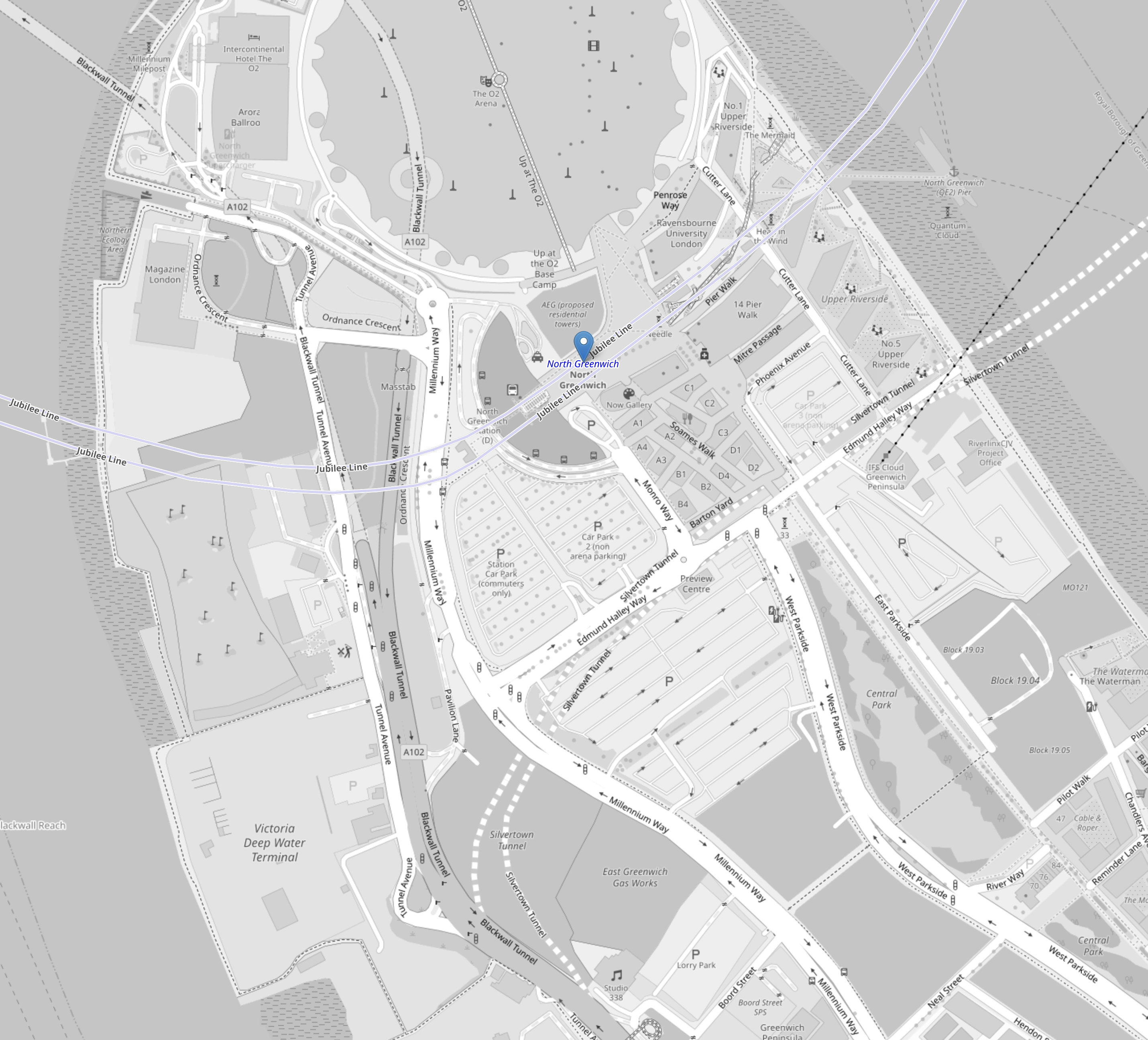
Note.
- The O2 Arena at the top of the map in the middle.
- The blue arrow below it, which indicates North Greenwich station.
- The two dotted white lines show the route of the Silvertown Tunnel.
- The two silver-grey lines that loop across the top part of the map are the Jubilee Line.
- The black dotted line between the Jubilee Line and the Silvertown Tunnel is the cable car.
This second OpenRailwayMap shows the Silvertown Tunnel’s junction with the approach to the Blackwall Tunnel.
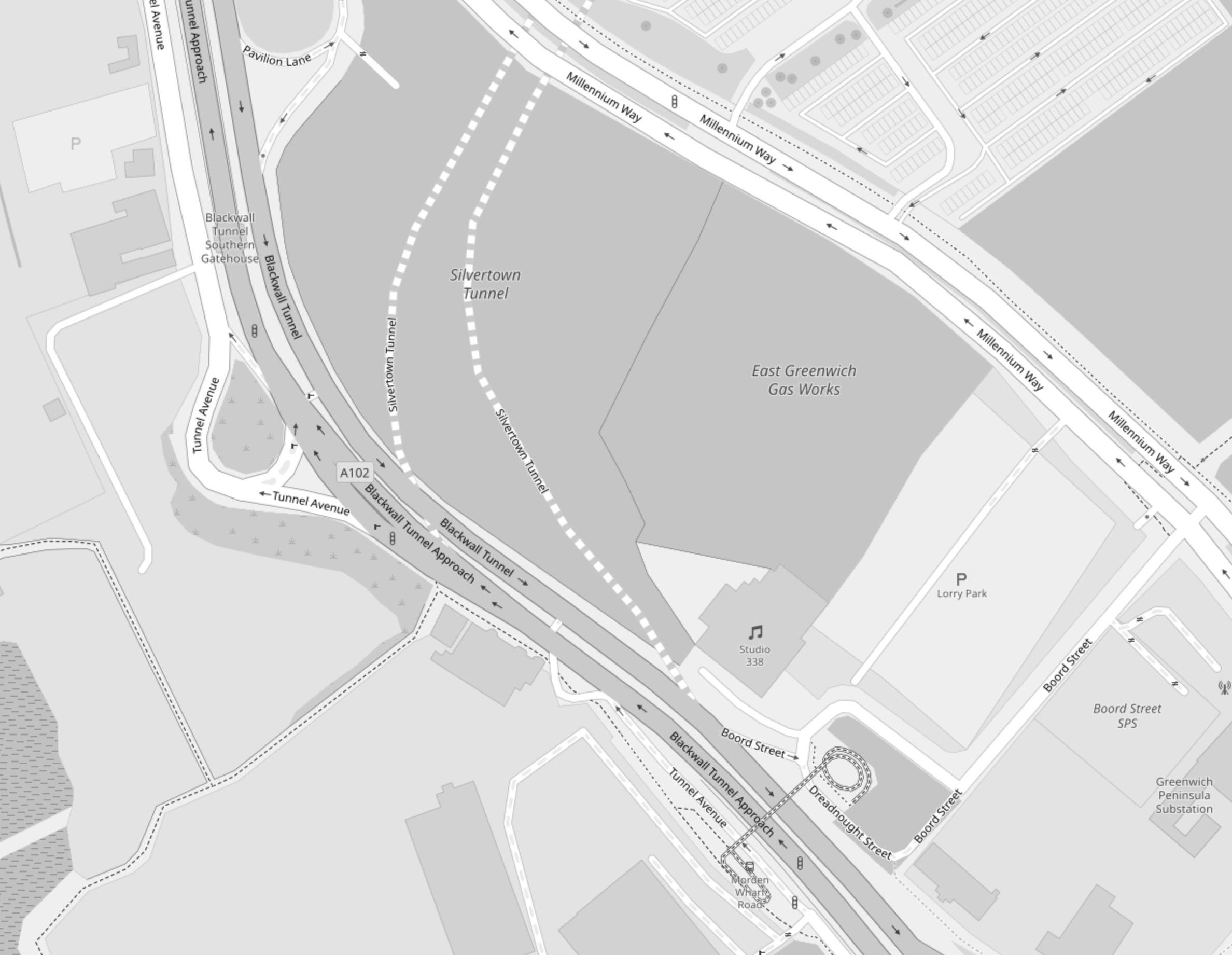
Note.
- The two dotted white lines show the route of the Silvertown Tunnel.
- Studio 338, which is a music and arts venue, is indicated by the double quaver.
- The site to the North of Studio 338 is labelled the East Greenwich Gas Works.
- The roads to the Northbound tunnel bores of both tunnels, split to the West of Studio 338.
- The roads from the Northbound tunnel bores of both tunnels, join to the West of Studio 338.
This Google Map shows the same area as the previous map.
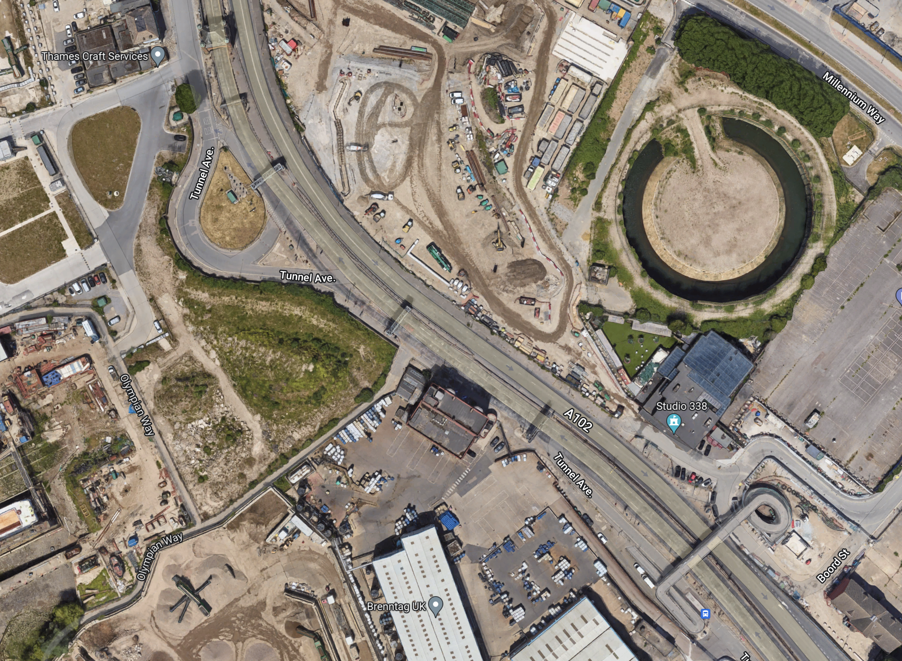
Note.
- Studio 338 is clearly marked.
- To its North is a circular structure on the site labelled as the East Greenwich Gas Works on the previous map.
- Could this be the remains of a gas holder?
Could it be that the works to the West of the circular structure are the start of tunneling?
Conclusion
It looks to me, that the designers of the Silvertown Tunnel have been able to squeeze in a junction between the approaches to the two tunnels, that should be fairly free-flowing.
