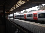
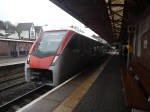
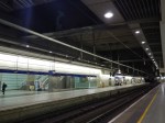
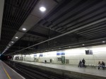
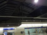
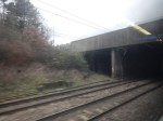
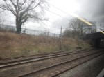
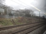
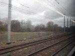
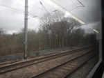
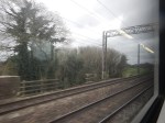
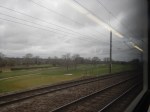
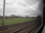
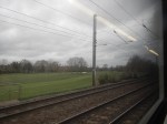
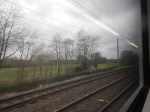
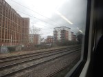
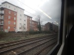
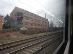
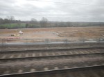
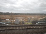
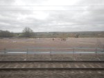
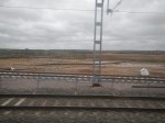
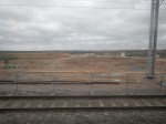
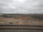
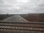
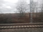
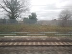
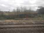
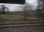
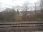
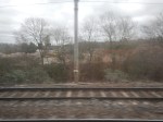
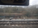
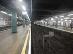
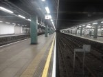
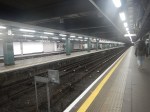
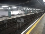
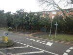
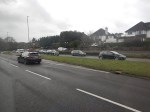
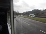
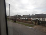
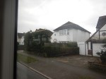
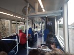
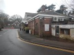
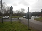
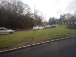
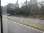
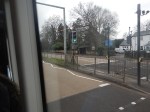
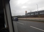
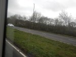
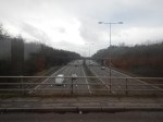
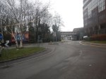
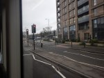
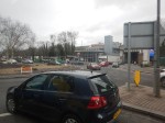
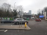
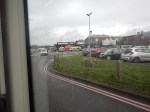
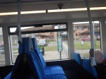
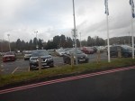
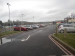
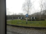
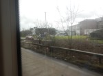
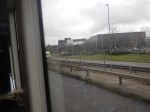
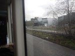
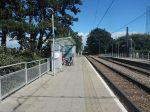
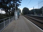
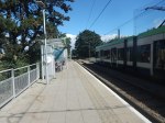
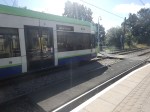
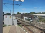
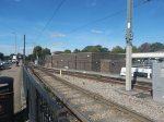
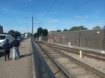
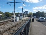
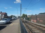
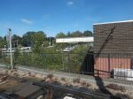
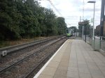
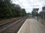
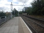
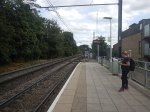
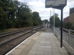
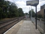
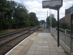
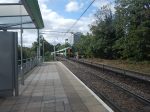
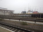
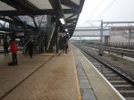
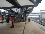
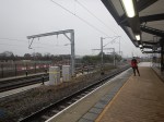
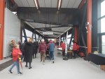
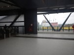
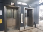
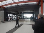
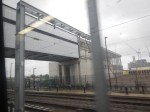
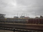
Cardiff And Caerphilly – 24th March 2026
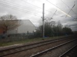
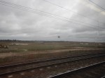
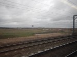
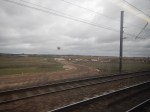
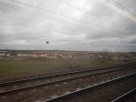
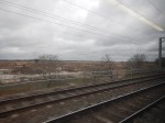
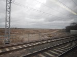
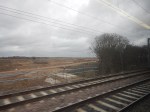
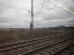
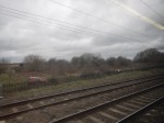
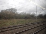
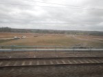
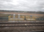
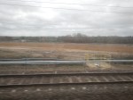
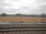
I took this pictures, as I rode up the Rhymney Valley from Cardiff to Caerphilly.
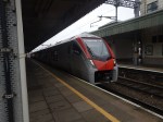
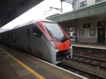
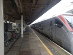
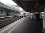

Note.
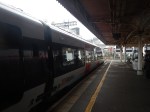
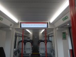
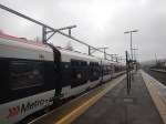
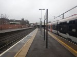
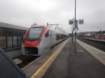
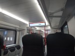
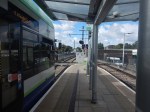
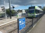
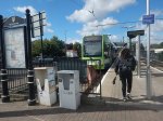
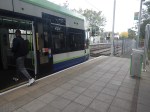
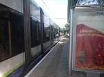
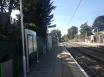
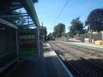
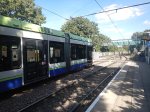
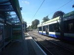
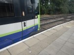
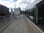
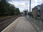
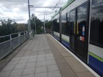
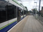
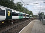
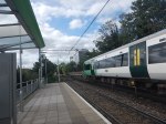
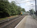
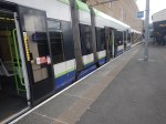
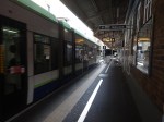
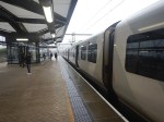
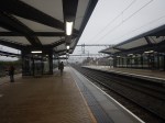
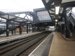
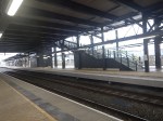
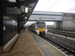
- The trains I took up and down the valley were both Class 756 tri-mode trains.
- My train reversed to Penarth in Platform 1.
- I think they were running using the diesel power in the power pack.
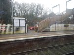
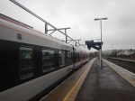
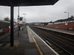
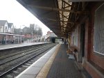
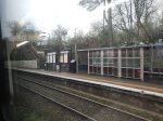
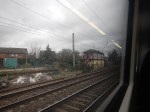
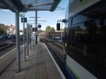
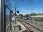
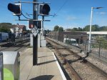
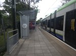
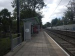
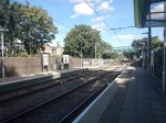
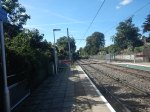
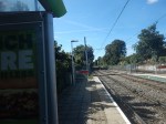
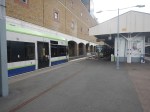
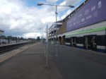
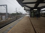
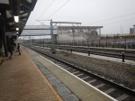
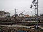
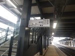
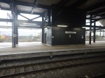
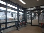
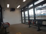
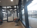
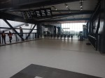
- There is an overhead conductor rail in Platform 1 at Caerphilly station to charge trains.
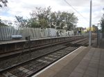
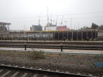
- The electrification North of Caerphilly station can be seen through the bridge in one of the pictures.
- Platforms 2 and 3 are not electrified.
I think Caerphilly station is a very neat electrification layout for occasional charging of battery-electric or tri-mode trains.
I have some specific thoughts.
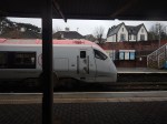
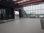
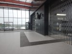
What Have Caerphilly And St. Pancras Thameslink Stations Got In Common?
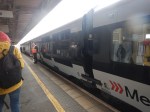
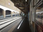
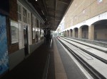
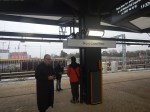
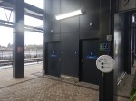
These pictures show the rigid conductor rail through St. Pancras Thameslink station.
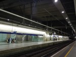
It looks remarkably similar to that in Platform 1 at Caerphilly station.
Judge in this picture.
The rails are probably out of the same Swiss electrification maker’s parts bin.
Both look equally professional with an I-section conductor, which could be aluminium, as it is lightweight and a good electrical conductor.
Google AI finds this.
The I-beam overhead conductor system used in St. Pancras Thameslink station is made of a hollow extruded aluminium profile. This system, known as a conductor beam, holds a conventional copper contact wire, providing a rigid, low-profile alternative to traditional overhead wires.
Key details:
Material: Extruded aluminium profile.
Structure: Hollow, designed to hold an un-tensioned, conventional copper contact wire.
Application: Developed by Balfour Beatty to reduce the required depth of overhead line equipment.
Installation: Often installed in a sinusoidal wave to ensure consistent wear on the pantograph.
This technology is used in areas with restricted overhead space, such as tunnels and some modern station approaches, to manage 25kV AC electrification.
It looks like it’s been used to provide a charging rail in Caerphilly station.
Is The Conductor Rail In Platform 1 Used To Create A Continuous Electrical Connection Around Caerphilly Station?
Look at this OpenRailwayMap, which shows the completed electrification through Caerphilly station.
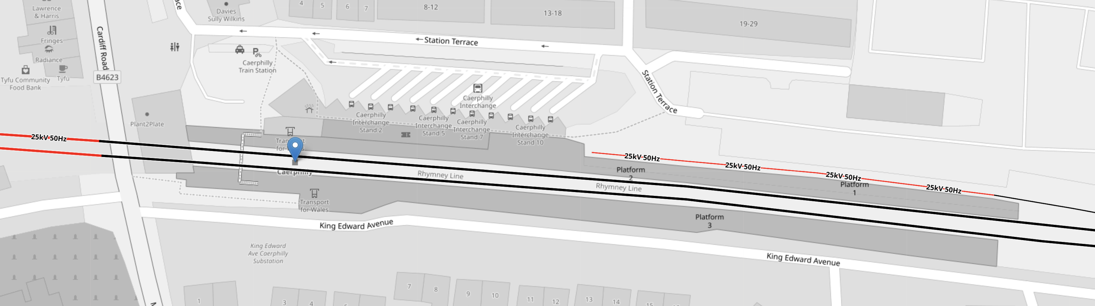
Note.
- Red tracks are electrified.
- Black tracks are not electrified.
- Caerphilly station is indicated by the blue arrow.
- The electrification continues to the Western end of the station.
- The two main platforms 2 & 3 are not electrified.
- The bay platform 1 is electrified to charge trains for return to Cardiff.
- Class 756 tri-mode electric-diesel-battery trains are already in service.
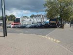
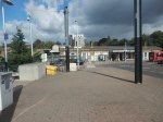
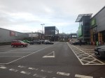
- There appears to be a comprehensive bus interchange.
The power for Platform 1 could come from the electrification at the Western end of the station.
I wouldn’t be surprised that the Rhymney Line will be fed with electricity at the heads of the valleys and it is fully-connected down to Cardiff to give a secure electrical connection.
Will Welsh Wind Power From The Heads Of The Valleys Be Used To Power The Cardiff Valley Lines?
To start with, as I know it can be blowy there, I asked Google AI, this question.
“Is Onshore Wind Planned At The Heads Of The Valleys In South Wales?”
I received this answer.
Yes, there is significant onshore wind energy development planned and in progress along the Heads of the Valleys area in South Wales. This region, encompassing areas like Merthyr Tydfil, Blaenau Gwent, and northern Rhondda Cynon Taf, is part of a broader push to increase onshore wind capacity in Wales, with many projects located on Natural Resources Wales forestry land.
Key Developments and Proposed Projects (2025-2026):
Trydan Gwyrdd Cymru: The Welsh government-owned developer has selected sites in South Wales for new, large-scale wind farms intended to be operational by 2040.
Carreg Wen Wind Farm: A planned 18-turbine project located between Aberdare and Maerdy (Rhondda Cynon Taf), near the Hirwaun/Heads of the Valleys area.
Hirfynydd Renewable Energy Park: A proposed project located on the Hirfynydd mountain range between Seven Sisters and Banwen, north of Neath, near the western end of the Heads of the Valleys.
Mynydd Llanhilleth and Trecelyn Wind Farms: Projects in the pre-application or planning stages by Pennant Walters in the Blaenau Gwent area.
Abergorki Wind Farm: A consented three-turbine project on Mynydd Maerdy (Rhondda Cynon Taf) with construction scheduled for 2026.
Operational Context:
Pen y Cymoedd: Already operational and currently the largest onshore wind farm in England and Wales, situated in the hills above the upper Neath, Afan, Rhondda, and Cynon Valleys.
Grid Infrastructure: Proposed new substations, such as one near Hirwaun (Rhondda Cynon Taf), are intended to connect these new projects to the national grid.
These developments are part of a target to generate 70% of Wales’ electricity from renewable sources by 2030, with a focus on areas previously identified as suitable for large-scale wind development.
Note.
- Pen y Cymoedd is the largest onshore wind farm in Wales and England, with an installed capacity of 228 MW.
- With the right size of battery, I’m fairly sure, that this wind farm could go a long way to powering the Cardiff Valley Lines.
- Carreg Wen Wind Farm is planned to be 108 MW wind farm.
- Hirfynydd Renewable Energy Park is planned to be a 100 MW hybrid development of wind turbines and solar with a battery.
- Mynydd Llanhilleth is planned to be a 48 MW wind farm.
- Trecelyn is planned to be a 20 MW wind farm.
- Abergorki is planned to be a 13 MW wind farm.
The total of new developments is 389 MW, which is about the same size as a Rolls-Royce SMR.
A First Look At SEGRO Logistics Park Radlett – 26th February 2026
The site of SEGRO Logistics Park Radlett can really only be seen from a train on the Midland Main Line going between Radlett and St Albans City stations.
I took these pictures from a Thameslink train going North.


I took these pictures from a Thameslink train going South.


Note.
- Most of the work at present is site clearance and landscaping.
- The Midland Main Line crossed over the M25 and goes under A414.
- Veralum Golf Course is on your left as you approach St Albans.
The Logistics Park is going to cover a large area.
I shall be following this project regularly.
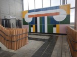
Are There Any Plans For The Bay Sub-Surface Platforms At Moorgate Station?
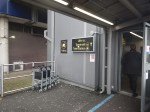
I use Moorgate station regularly, as there’s a Leon Restaurant just outside the station, that looked after me properly during the Covid-19 Pandemic, so when I’m in the area and need feeding I pop in.
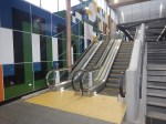
These pictures show the four bay platforms on the Sub-Surface lines.
Note.
- The pair of platforms to the left or South are numbered 5 and 6 and used to handle Thameslink trains, that ran to Moorgate station.
- Platforms 5 and 6 used to be electrified with 25 KVAC overhead wires.
- The pair of platforms to the right or North are numbered 3 and 4 and are used to terminate some Metropolitan Line services at Moorgate station.
- Platforms 3 and 4 are electrified with London Underground four-rail electrification.
- The number for Platform 4 can clearly be seen.
This map from cartometro shows the track layout in Farringdon, Barbican and Moorgate stations.
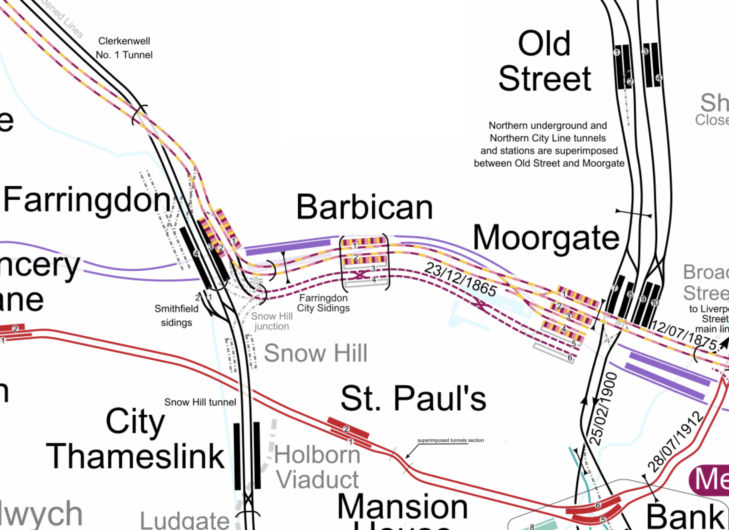
Note.
- The multi-coloured tracks and platforms of the Metropolitan, Circle and Hammersmith & City Lines running through Platforms 1 & 2 at Farringdon, Barbican and Moorgate stations.
- The multi-coloured tracks and platforms of the Metropolitan, Circle and Hammersmith & City Lines terminating in Platforms 3 & 4 at Moorgate station.
- The purple tracks and platforms of the Elizabeth Line running underneath the Metropolitan, Circle and Hammersmith & City Lines and their stations.
- The maroon and white tracks and platforms of Thameslink running through Platforms 3 & 4 in Barbican station and terminating in Platforms 5 & 6 at Moorgate station.
- The black tracks of Thameslink running through Farringdon and City Thameslink stations.
- It would appear there used to be two junctions to allow trains from Moorgate to go North through Farringdon station or South through City Thameslink station.
- The Thameslink tracks have two useful crossovers.
- The black tracks of the City branch of the Northern Line running through Old Street, Moorgate and Bank stations.
- The black tracks of the Northern City Line running through Old Street station and terminating in Moorgate station.
- The red tracks of the Central Line running through Chancery Lane, St. Paul’s and Bank station.
Because of the layout of the various tracks new connections and improvements may be possible.
Extending The Northern City Line To Bank Station
In Walking Along Moorgate – 30th September 2020, I describe some of the possibilities opened up by the design of Moor House, which has been built to allow more tunneling underneath.
I believe two extensions South from Moorgate station would be possible.
- It was intended by the builders of the Northern City Line, to take the route to just North of Bank station at Lothbury.
- Has The Possibility Been Created For A Pedestrian Tunnel Between Bank And Moorgate Stations?
Note.
- As the extension to Bank station has dug tunnels all over the place, I would expect that the engineers on that project would have a good idea on the best way to connect Moorgate and Bank stations.
- I usually use the Northern Line between Moorgate and Bank stations, but sometimes the Northern Line is rather crowded.
- The Northern City Line is being resignalled and may have an increased number of trains, so more passenger capacity may be needed.
- If a new station were to be built at Lothbury, it might be possible to improve step-free access to the Northern City Line.
- A new station on the Northern City Line and a pedestrian tunnel could connect to the newly-installed travelator at Bank station.
There are certainly serious possibilities to improve connections between Moorgate and Bank stations.
Could Metropolitan Line Trains Be Turned At Moorgate Station?
Currently, there are eight trains per hour (tph) between Aldgate and Uxbridge in the Off Peak.
With the new signalling on the Sub-Surface Lines would it allow more trains to operate, if some Metropolitan Line services were terminated in Platforms 3 & 4 at Moorgate station.
Would It Be Worthwhile To Run Thameslink Trains Again Into Moorgate Station?
It would only need to terminate trains from the North, as trains from the South can terminate at Black friars Station.
Perhaps a two tph service from a convenient station would suffice.
A Pedestrian Connection Between City Thameslink Station And St. Paul’s Tube Station
I covered this in A Pedestrian Connection Between City Thameslink Station And St. Paul’s Tube Station.
Sutton Station To Gatwick Airport By Hydrogen-Powered Bus
In Central London and Gatwick Airport For Free On A Freedom Pass, I indicated it was possible to go to Gatwick Airport for nothing, if you had a Freedom Pass, which is also a free bus pass for England.
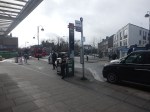
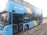
This morning I took public transport to Gatwick Airport by this route.
- I took a 43 bus to London Bridge station.
- This bus terminates in the bus station in front of the train station, so it was a simple step-free entry into the part of the station, where Southern Trains terminate.
- I took a Southern Train to Sutton station.
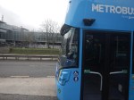
- I then took a Metrobus 420 bus from Sutton station to Gatwick Airport.
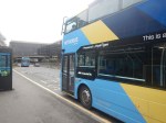
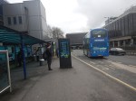
These pictures show the journey.
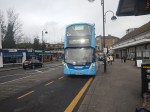


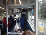


Note.
- The bus stop is directly outside the entrance to Sutton station.
- Sutton station is step-free.
- The information on the Metrobus’s buses at Sutton station is poor.
- The bus had a 74 number plate, so was registered after September 1st, 2024.
- The bus said it was a hydrogen bus.
- The seats were comfortable with leather facings.
- The route was mainly through rural Surrey.
- There were sections of dual-carriageway road with continuous 40 mph running.
- There were a number of steep hills.
- Previously, I have been told by a Bradford Councillor, that the City of Bradford is going for hydrogen-powered buses , as the city has lots of steep hills.
- The unusual Reigate and Redhill War Memorial on the A25.
- The route goes past Hadworth, Reigate and Redhill stations.
- Just before Gatwick Airport, the bus called at East Surrey Hospital.
I have some thoughts.
Does This Hydrogen Bus Have Almost The Quality Passengers Would Expect From A Coach?
Consider.
- I was very impressed with the quality of the bus and its fittings.
- But its biggest assets were the ride and mouse-quiet noise and being vibration-free.
- It was certainly up there, with the best British buses on UK roads.
- Strangely, I never rode in any of London’s Green Line coaches of the 1950s and 1960s.
But as Wrightbus are selling hydrogen-powered single-decker buses to the Germans, the quality must be of a certain standard.
The Performance Of The Bus
I would sum up the bus as follows.
- The bus didn’t hang around and it was well-driven.
- On much of the dual-carriageway, the bus appeared to be at the maximum speed limit of 40 mph
- Ride and seats were comfortable.
- There was virtually no vibration.
- At times, you almost felt you were in a top-of-the-range coach.
- The running gear is from German company ZF, which certainly doesn’t hinder the ride.
- The journey from Sutton to Gatwick Airport is twenty miles and took about ninety minutes.
I would feel that if Wrightbus design their CoachH2 chassis to the same standard of this bus, they’ll have a difficulty to meet sales demand.
Wrightbus Hydrogen Buses For My Local Bus Route 141
Consider.
- The 141 bus route is my local bus, which gets me to Moorgate, Bank, London Bridge and Manor House.
- The length of the full route is twenty miles and it takes about an hour to go from London Bridge station to Palmers Green.
- The route is currently run by older Wrightbus hybrid diesel-electric buses.
- I suspect that modern hydrogen buses could last almost all day on one fill of hydrogen, with perhaps a top-up at lunchtime.
They would have no difficulty handling the route and would greatly increase the customers current rock-bottom satisfaction.
Hydrogen Buses In Leafy Suburbs
- Where I live, is not particularly leafy or a suburb.
- But I seems to remember, when I moved here, that some of my neighbours complained about the noise of the 76 bus route.
- So Transport for London put on some quieter buses.
I would expect, that Metrobus might use the mouse quieter hydrogen buses in post areas, to avoid annoyance.
Hydrogen Buses As Route Extenders
Effectively, the Metrobus route 420 is acting as a route extender for Southern and Thameslink services coming South from London.
As it is a quality bus, that gets a move on, I suspect that some travellers, who previously took a train to Sutton, Tadworth, Reigate, Redhill or other stations and were then picked up, may take a hydrogen bus to a more convenient bus stop.
Because of the long range of a hydrogen bus or coach, zero-carbon performance, should be achieved without any range anxiety for passengers, driver or bus company.
Onward From Oakhampton Parkway Station
Consider.
- In 2014, storms destroyed the railway at Dawlish in Devon.
- As there was no alternative route, the storms cut everything west of Dawlish off from the rest of the UK.
- It is now likely, that a Park-and-Ride station will be built close to Okehanpton, which commuters would use for travel to Exeter.
- The main road to the South-West ; the A 30 will pass nearby.
It would appear, that Okehampton Interchange station could be used, if Nepture decided to show his power again.
Hopefully, the emergency plan will scare Nepture away.
Lumo To The Scottish Borders
Consider.
- Lumo have applied to extend some of their Edinburgh services to Glasgow.
- Talking to a friend in the Scottish Borders, they said, that travelers drive to Newcastle or Morpeth to catch Lumo for London.
- Four or five Lumo services every day stop in each direction at Morpeth station.
- So would it be sensible to run a bus or coach through the Scottish Borders to connect with the Lumo services?
This Google Map shows Morpeth in relation to the Border towns.
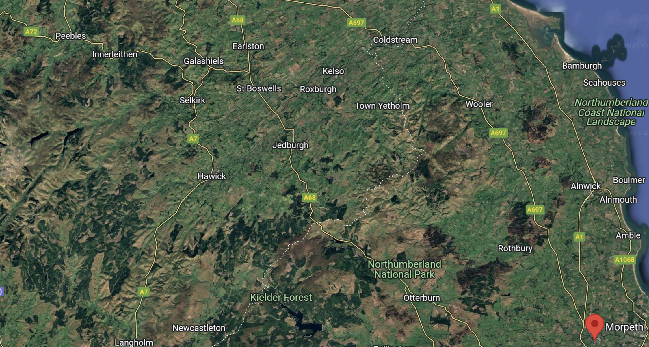
Note.
- Morpeth is marked by the red arrow in the South-East corner of the map.
- Galashiels, Galashiels, Hawick, Jedburgh, Peebles, Saint Boswells and Selkirk can be picked out on the map.
- The coach service would probably terminate at Galashiels, as it has a large bus terminal and and a railway station.
- Click the map to show it to a larger scale.
Morpeth to Galashiels is 69 miles and it should take about an hour and a half.
Hydrogen Buses As Rail Replacement Buses
Consider.
- I have had Rail Replacement Coaches as opposed to buses a few times in the UK.
- Once on the East Coast Main Line but usually on the Great Eastern Main Line to Ipswich or Norwich.
- They are generally more suited to their task. as they are faster and more luxurious.
- Many of our major rail lines run alongside trunk roads or motorways or fast dual carriageways.
So because hydrogen buses and coaches a have superior performance, than their diesel cousins, will hydrogen be the better fuel for a Rail Replacement Bus.
Metrobus’s Hydrogen Buses
This press release on the Metrobus web site is entitled Hydrogen Buses.
This is the sub-heading.
Our commitment to Zero Emissions
As part of our commitment to reducing emissions, twenty new hydrogen fuelled buses will operate on Fastway routes 10 & 20. These new buses demonstrate an ongoing commitment to reducing our local emissions. They deliver against science-based targets set by Metrobus and its parent company, The Go-Ahead Group, of becoming a net zero business by 2045 and decarbonising our bus fleet by 2035.
Conclusion
This bus is the best I’ve ridden in.
Central London and Gatwick Airport For Free On A Freedom Pass
I have always found it odd, that I can get to Heathrow Airport for free on my Freedom Pass, but for Gatwick Airport, I must buy a ticket.
Not that I’m bothered about the price of the ticket, but for some it might mean that they can’t get to their preferred holiday destination, as planes only fly from Heathrow.
The different treatment of the two airports must also annoy some airport and airline owners and bosses.
But recently, a free route for London’s Freedom Pass holders has opened.
This article on Inside Croydon is entitled Metrobus Rolls Out Zero-Emission Hydrogen Fleet Into Sutton.
These are the first two paragraphs.
Metrobus has been rolling out a fleet of hydrogen-powered buses, and last week its first double deckers, operating the 420 route from Sutton town centre to Gatwick Airport and Crawley, were brought into service.
Metrobus is planning on having more than 40 hydrogen-powered buses, in a partnership with West Sussex, Surrey and Kent county councils and Gatwick, in a £24million investment by the partners including a £10 million grant from the Department for Transport.
Note.
- The range of a Wrightbus Hydroliner is 280 miles on a full tank of hydrogen.
- It looks like as Crawley to Sutton station is a 42.2 miles round trip, so that means six round trips are possible on a tank of hydrogen.
- The Hydroliners may have the speed to use the M23 between Sutton and Crawley.
According to the article, refueling would be at Crawley.
A Zero-Carbon Extension To The Freedom Pass Zone
The free route for Freedom Pass holders to Gatwick Airport will be.
- Southern or Thameslink Train to Sutton.
- 420 bus to Gatwick Airport.
The article says this about the routes that are being planned.
The 420 route runs from Sutton town centre, through Belmont and Banstead, to Tadworth and then on to Reigate and Redhill, serving East Surrey Hospital before going on to the airport and Crawley. Metrobus is planning to use other hydrogen-powered buses on routes that will serve Caterham, Dorking, Tunbridge Wells, Haywards Heath and Brighton.
It appears that the hydrogen buses will add a large zero-carbon area to the Freedom Pass zone.
The only new infrastructure, would be the refueling equipment at Crawley.
I can also see the buses becoming an unusual tourist attraction for the area.
An Extension To An Electric Railway Or Tramway
They may also set a precedent for how a transport network can be extended in a zero-carbon manner from a tram or rail terminal served by an electric railway or tramway.
Battery electric buses could be used, but their range means that on anything but the shortest routes, they would constantly need recharging.
Okehampton Interchange Station
The first paragraph of the Wikipedia entry for Okehampton Interchange station describes it like this.
Okehampton Interchange (formerly known as Okehampton Parkway) is a proposed railway station in Okehampton on the Dartmoor Line. The station would be part of the Devon Metro and has been described as a priority station. The station is to be sited off Exeter Road, by the Business Park and close to the junction with the A30, in the Stockley Hamlet area of Okehampton. It would also serve 900 new homes to be built nearby.
But I believe that Okehampton Interchange station also has another purpose.
If the sea should destroy the coastal railway, as it did a few years ago, then passengers for the South-West could be ferried to and from Okehampton Interchange station by high-speed hydrogen-powered coaches along the A30, to catch trains to Exeter and London.
So, I would build a hydrogen filling station at Okehampton Interchange station, so that if the sea destroys the coastal railway again, the alternative is ready.
Normally, the hydrogen filling station would refuel local hydrogen buses, trucks, cars and other vehicles and those passing on the A30 to and from Cornwall.
Okehampton Interchange station would be the ultimate extension to an electric railway. Even if the Dartmoor Railway was worked by electro-diesel trains.
Council Opposes Six Track Plan For East West Rail
The title of this post, is the same as that of this article on the BBC.
This is the sub-heading.
Councillors have voted to oppose part of a major railway line being built through their district.
These four paragraphs add detail to the story
Bedford Borough Council wants the East West Rail (EWR) line to be made up of four tracks, rather than six, in the Poets area north of the town.
Thirty-seven homes would need to be demolished in order to accommodate the two additional tracks.
However, in their full-council meeting on Wednesday, members agreed to support other parts of the project, such as the relocation of Stewartby station and the closure of Kempston Hardwick.
An EWR spokesperson said it was committed to working with local communities.
This OpenRailwayMap shows the Midland Main Line and the East-West Rail through Bedford.
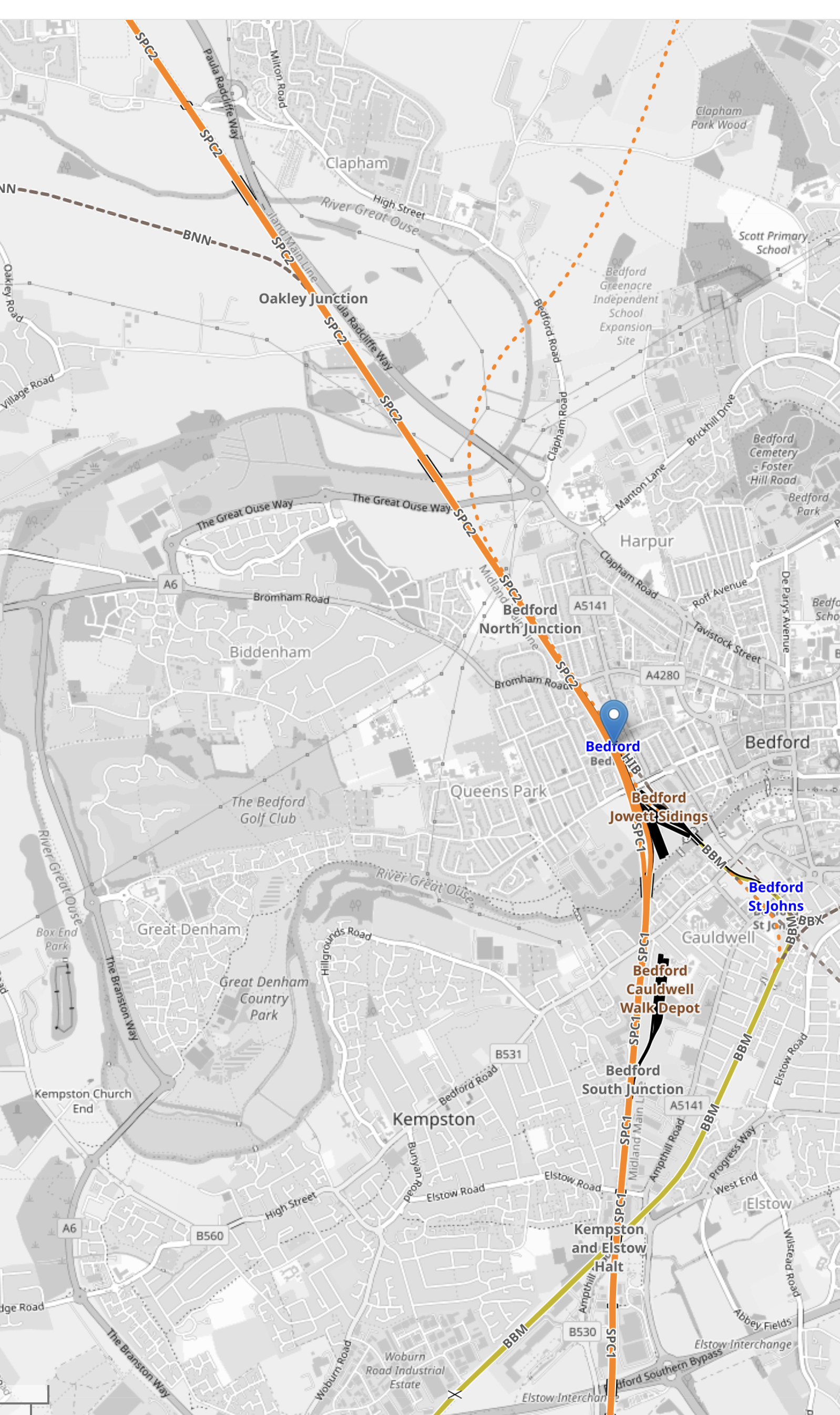
Note.
- The solid orange line running from the North-West corner of the map to its Southern edge is the electrified Midland Main Line.
- The blue arrow on this line indicates Bedford station.
- The blue lettering to the South-East of Bedford station, indicates Bedford St. Johns station.
- The yellow line connecting the two stations is the Eastern end of the Marston Vale Line, which connects Bedford and Bletchley stations.
- The Marston Vale Line will be taken over by the East-West Rail.
- Just North of Bedford station is Bedford North junction.
The East-West Rail branches away from Bedford North junction to the North-East on its way to Cambridge. It is shown as a dotted orange line.
This OpenRailwayMap shows Bedford station to a larger scale.
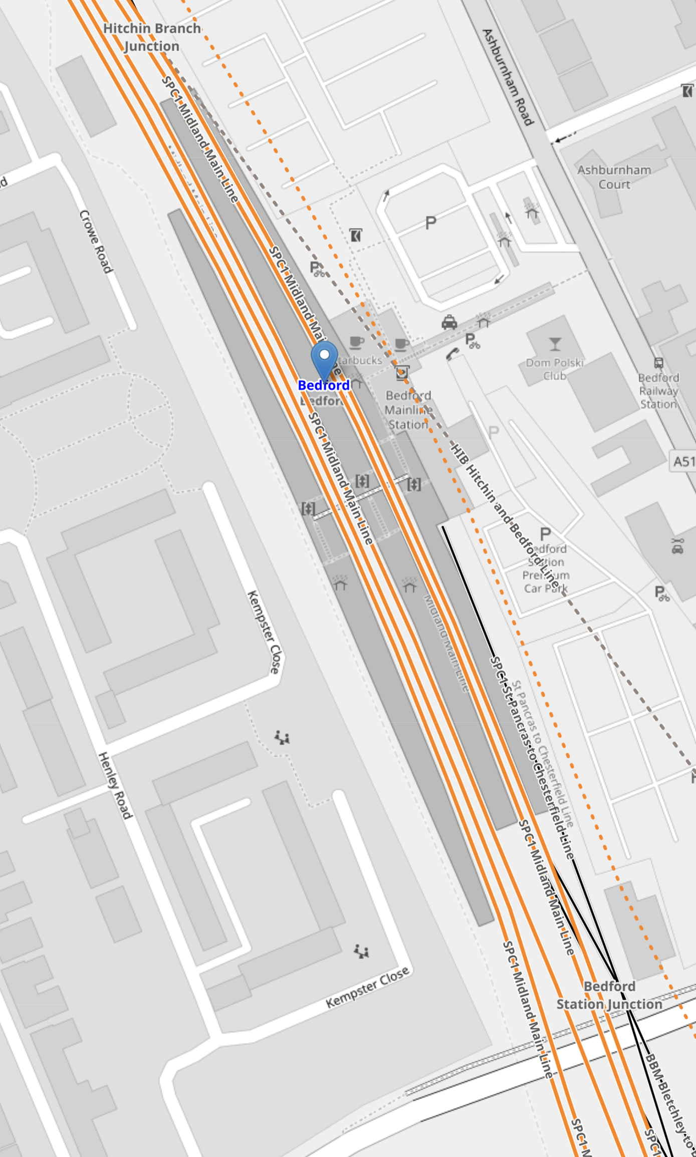
Note,
- The Western pair of orange lines are the current fast lines of the Midland Main Line.
- The Eastern pair of orange lines are the current slow lines of the Midland Main Line.
- To the East the orange dotted line shows indicates a proposed route of the East-West Rail.
- There appear to be crossovers that allow East-West Rail services to use Platforms 1 and 2 through Bedford station.
Between the Midland Main Line and East-West Rail platforms, the current Platform 1A used by the Marston Vale Line can be seen.
This picture show the current Marston Vale Line platform at Bedford station,
Note.
- The Marston Vale Line platform is on the left.
- It is numbered 1A.
- The platform is electrified, so can it be it used to terminate some Thameslink services.
It could also be used to terminate East-West Rail services from the West and if they were battery-electric trains they could be charged.
Oxford and Bedford is 51 miles or 82 kilometers, which is within range of a modern battery-electric train. Es[ecially, if it did a ‘splash and dash’ at Milton Keynes Central or Bletchley!
This OpenRailwayMap shows the lines to the North of Bedford station.

Note.
- The current four-track Midland Main Line running diagonally across the map.
- The East-West Rail running along on the East side and branching off to Cambridge.
- Crossovers between the Midland Main Line and East-West Rail.
It looks to me, that operation of East-West Rail trains through Bedford station will be as follows.
- Oxford to Cambridge trains will use the crossovers to call in the existing Platform 2 at Bedford station.
- Cambridge to Oxford to will use the crossovers to call in the existing Platform 1 at Bedford station.
- Trains that are not stopping could use the avoiding line along the East side of the station.
- Oxford to Bedford terminating trains, would stop in Platform 1A.
Because there would be a crossover between the Midland Main Line slow lines and the East-West Rail to the South and North of Bedford station, I suspect for operatuional reasons and safety Network Rail want a double track avoiding line.
Potential Tram Builders Announced For New London Trams
The title of this post, is the same as that of this article on RailAdvent.
These three paragraphs outline the design of the new trams.
Transport for London has issued an Invitation to Tender for four manufacturers to design and build a new fleet of trams.
Alstom UK, CAF, Hitachi and Stadler are the four manufacturers who can now proceed to the next stage of the procurement process with Transport for London to design and build the new trams.
The new trams are expected to feature air-conditioning, real time travel info and charging points, along with areas designed for wheelchair users and those with pushchairs and luggage.
It sounds that the new trams will be to a higher standard with more comfort and interior space.
These are my observations and thoughts.
Will There Be The Same Number of Trams?
These two paragraphs indicate the number of trams.
The initial contract will be for 24 new trams to replace the oldest trams on the network – which are now nearly 25 years old.
There is an option in the contract to replace the trams that were introduced from 2012.
Could this mean, that each tram would be replaced on a one-to-one basis?
It would surely make it easy to introduce the new fleet.
Will The New Trams Be Longer?
To me, the most significant words in the article are “areas designed for wheelchair users and those with pushchairs and luggage”.
As passengers seem to want to carry more and more with them on buses, trains and probably trams in London, I believe the new trams will probably need more interior space.
Increasing the width of the tram, would probably mean gauging difficulties, but with the lengthening of some platforms longer trams might be possible.
The current trams are as follows.
- 24 x Bombardier CR4000 – 30.1 metres – 70+138=208 = 6.9 pass/metre
- 12 x Stadler Variobahn – 32 metres – 72+134 = 206 = 6.4 pass/metre
Note.
- The total number of each tram type is at the left.
- Seats+Standing=Total Passengers.
- The Bombardier trams only have a single articulation, but it looks like the Stadler ones have four.
The longer Stadler trams seem less crowded, despite carrying two fewer passengers.
I have looked at the terminal platforms on maps and it appears, that 35 metre and possibly 40 metre trams would be possible.
At least in London, passengers are used to being told not to use the end door.
A 40 metre tram could probably handle over 250 passengers based on the Stadler passenger density.
Longer Trams Could Increase Capacity By Up To 25 %
I believe my figures show this could be possible.
More Articulations Should Mean A Tighter Turning Circle
This could help operation on some existing or new sections of London Tramlink.
Would Battery Tram-Train Operation Be Useful?
CAF’s trams in the West Midlands already have batteries and Stadler’s tram-trains in Cardiff will have batteries to extend routes on rail tracks, that don’t have electrification.
In Could Beckenham Junction To Birkbeck Be Run Using Third-Rail Tram-Trains?, I detailed how third-rail tram-trains could be used between Harrington Lane tram stop and Beckenham Junction station to create more capacity.
I believe that third-rail tram-trains would work, but that Health and Safety would outlaw the concept.
On the other hand, battery-electric tram trains could probably handle the link between train and tram routes.
If I was bidding for the TramLink contract, I’d make sure the trams could be updated with a battery-electric tram-train capability.
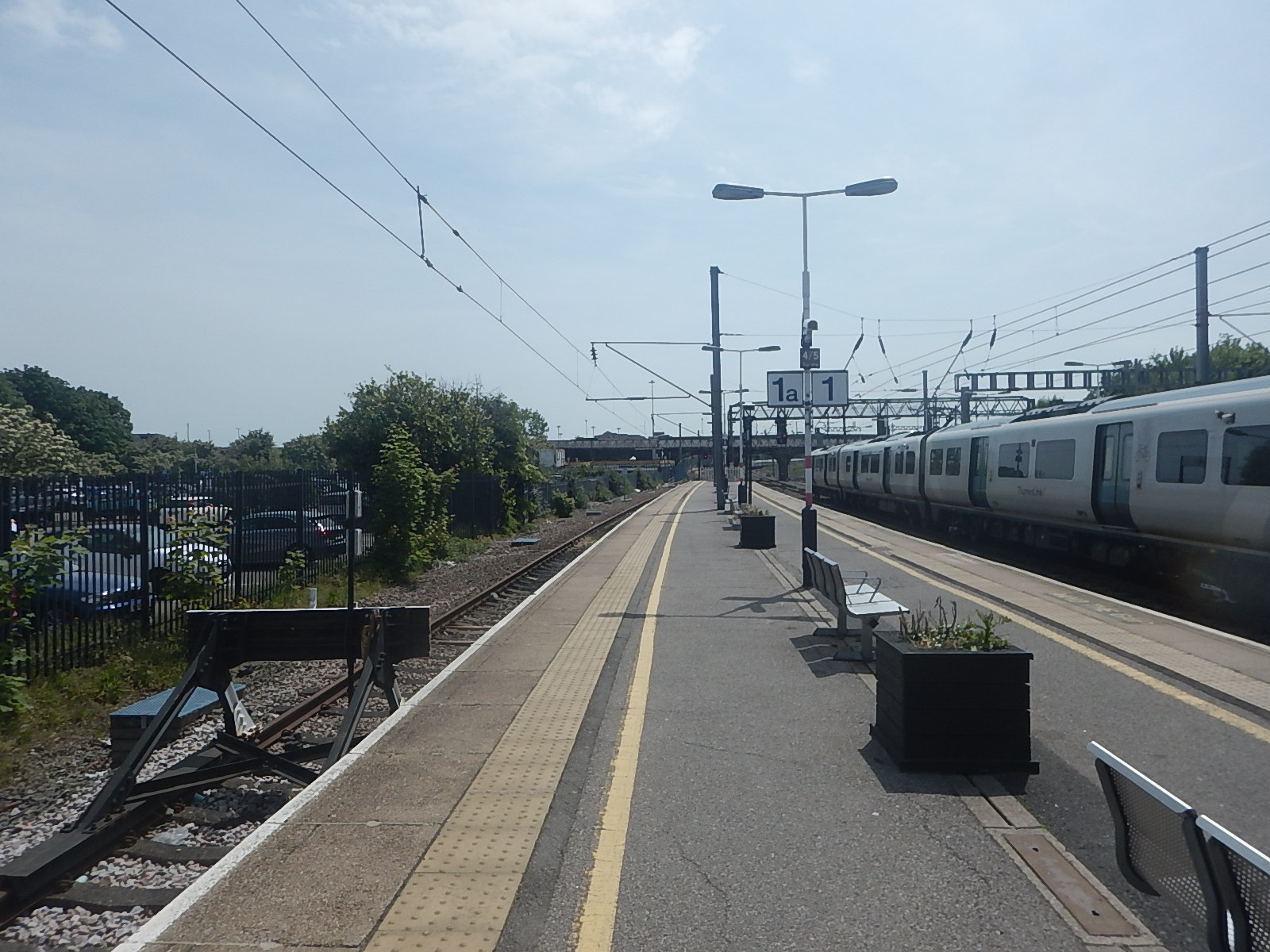
Increasing Capacity At Elmers End Tram Stop
Elmers End tram stop, is the only terminal on the London Tramlink with a single platform.
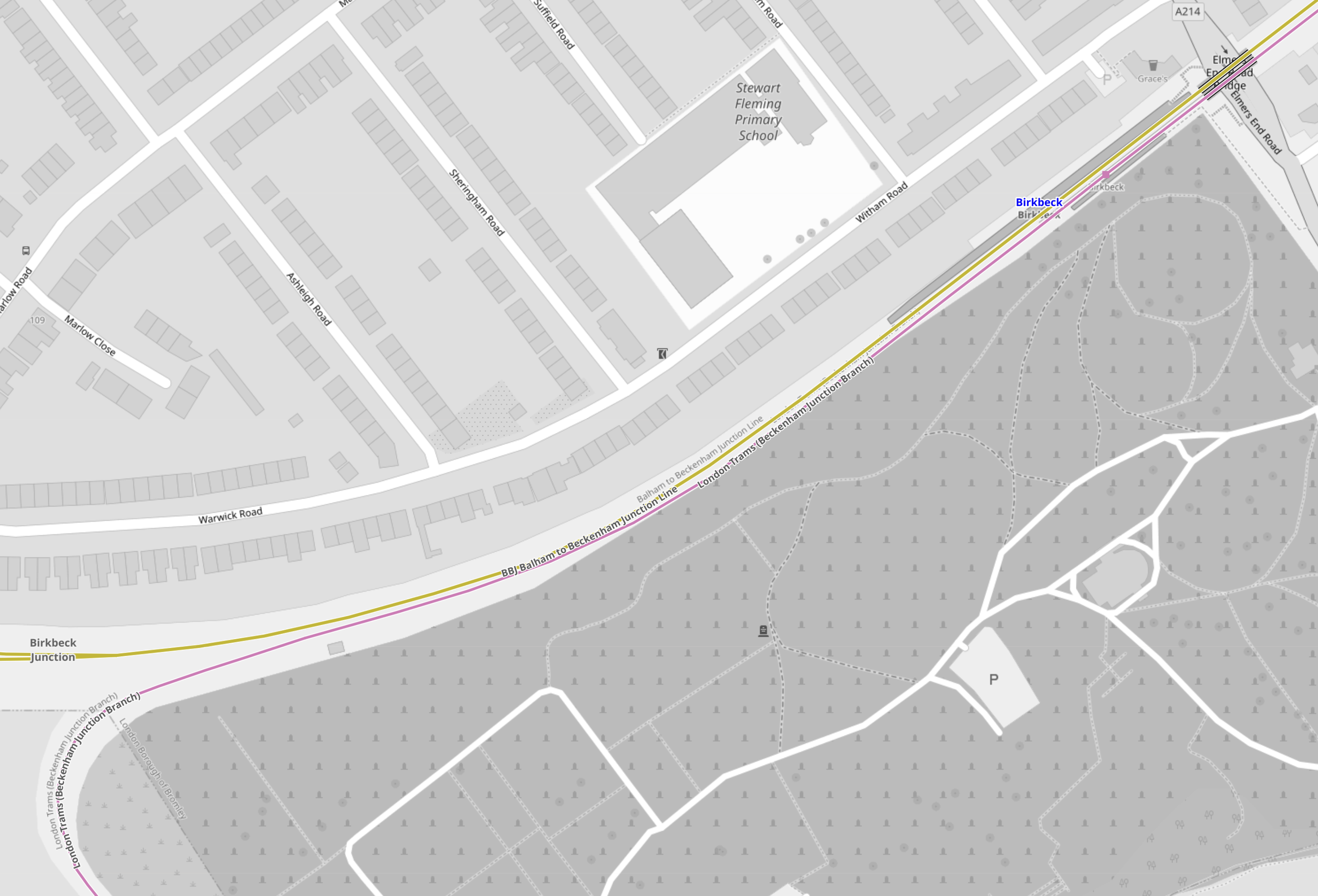
This map from OpenRailwayMap shows the platform layout at Elmers End station.
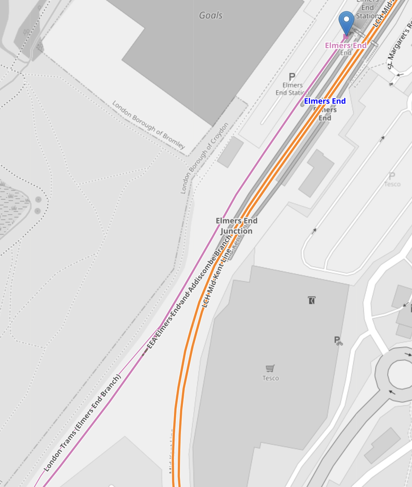
Note.
- The orange lines are the Hayes Line.
- The mauve line is the London Tramlink.
- The London Tramlink has a single platform on the North-West side of the Hayes Line.
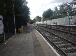
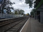
These pictures show Elmers End station and a tram in the London Tramlink platform.
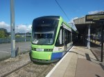
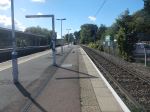
Note.
- The bridge in the station is not step-free.
- The tram is a five-section Stadler Variobahn.
- The tram platform would appear to be able to handle a tram, that is several metres longer than the 32.0 metre Stadler Variobahn.
- The London Tramlink has a typical off-peak service to Wimbledon every ten minutes from Elmers End tram stop.
The Wikipedia entry for Elmers End station, says this about Tramlink developments at the station.
Work is underway to open a second tram platform and double the tram line to Arena to increase capacity. As of March 2019, vegetation has been cleared to make way for the new line. The platform was due to open in December 2020, but has been delayed.
My pictures show no ongoing work or evidence of the second Tramlink platform.
There are two main ways, that capacity can be increased at Elmers End station.
- Install a second platform and run more trams to the station.
- Run longer trams with a higher capacity.
Perhaps, Transport for London have decided, that the second way, is the best, especially, if the money saved, allows them to build a much-needed step-free footbridge at Elmers End station.
From my observations, I would estimate that Elmers End tram stop could accommodate a forty metre tram and possibly, one that was even longer.
Arena Tram Stop
The Arena tram stop, is where the Beckenham Junction and Elmers End branches join and split.
This map from OpenRailwayMap shows the platform layout at Arena tram stop.
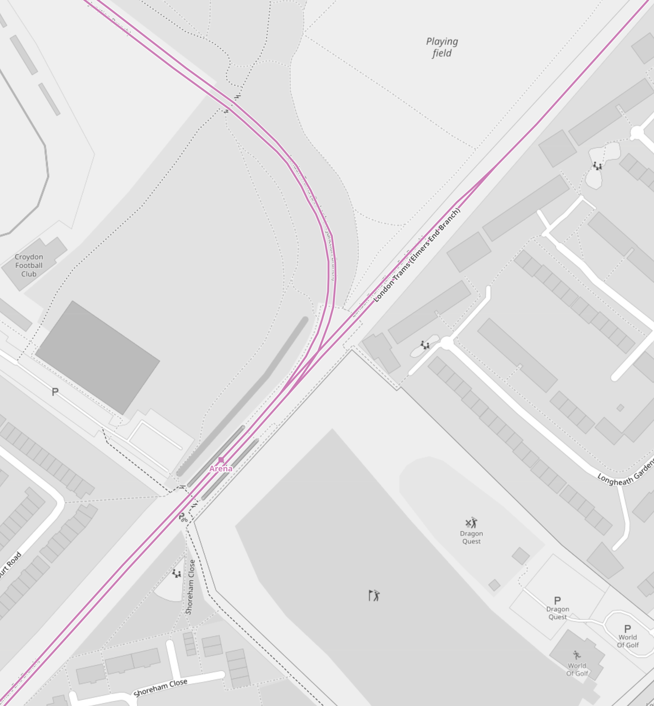
Note.
- The mauve lines are the London Tramlink.
- The line going North-East runs to Elmers End. It starts off as double-track at Arena tram stop and quickly becomes single track all the way to Elmers End. tram stop.
- The line going North-West runs to Beckenham Junction.
- The line going South-West runs to East Croydon and Wimbledon.
- The platforms are on the outside of both tracks.
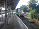
These pictures show Arena tram stop and some trams passing through.
Note.
- The tram platforms are generally a few metres longer than the trams.
- All tram doors are step-free to the platform.
- Passengers walk across the line in front or behind the trams.
- The platform is wide, so that passengers can stay well clear of the occasional passing tram. One picture shows a tram is signed “Not In Service”
I believe, that with some judicial platform lengthening, some selective door opening and trams stopping automatically in the right place on the platform, that longer trams could be handled in a stop like Arena.
As with Elmers End, I believe a forty metre tram will be possible, but this might not be the limit with clever design.
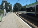
Handling Longer Trams At Beckenham Junction Tram Stop
This map from OpenRailwayMap shows the platform layout at Beckenham Junction tram stop.
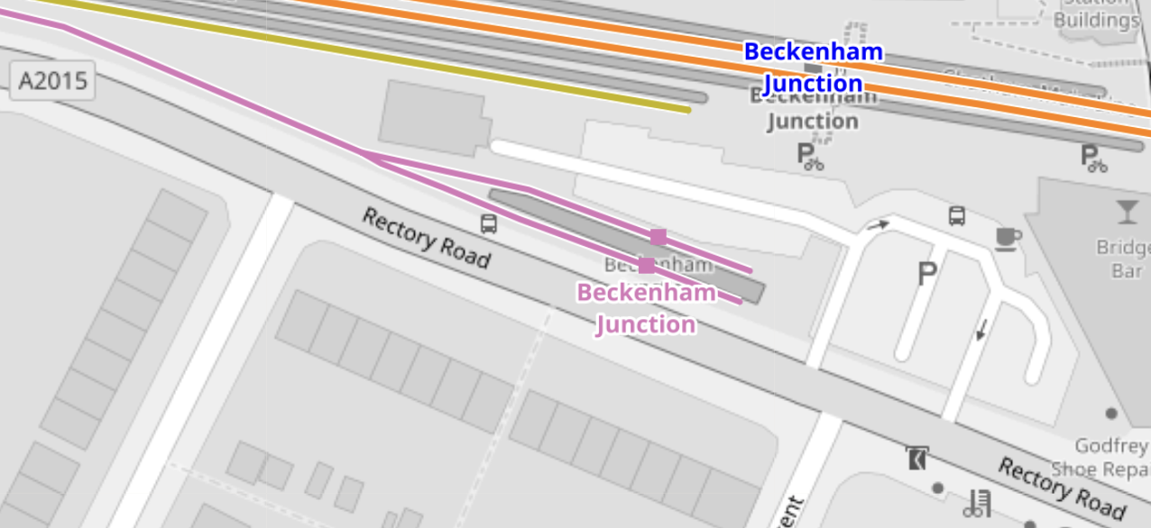
Note.
- The orange lines are the Chatham Main Line.
- The mauve line is the London Tramlink.
- There are a pair of short platforms for the London Tramlink.
- The platforms would be difficult to extend to the East.
- The platforms would be difficult to extend to the West, as the map above shows a building, just to the North of the junction of the two Tramlink platforms.
These pictures show Beckenham Junction station and the London Tramlink platforms.
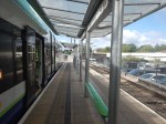
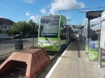

The Wikipedia entry for Beckenham Junction tram stop, says this about the Tramlink service.
Tram services at Beckenham Junction are operated by Tramlink. The tram stop is served by trams every 10 minutes to Wimbledon via Croydon. This is reduced to a tram every 15 minutes on Saturday evenings and Sundays.
Perhaps, the solution to lengthen Tramlink platforms at Beckenham Junction is to do the following.
- Rebuild the building to the North of the junction of the two Tramlink platforms.
- Extend the two Tramlink platforms to the West.
- Move the junction between the two Tramlink platforms to the West.
These pictures show the building in detail.

Note.
- There is a Network Rail van outside the building.
- The building looks like it dates from about 2000, when the Tramlink was built.
- Perhaps, the building houses power supply or signalling equipment for the Tramlink.
After the modifications, operation would be the same, but longer trams could be handled.
Trams And Trains Between Birkbeck And Beckenham Junction Stations
This short section of track must be one of the most unusual and complicated in the UK.
- There are three dual National Rail and Tramlink stations; Birkbeck, Avenue Road and Beckenham Road.
- Each station has a single bi-directional National Rail track and/or platform.
- Birkbeck has a single bi-directional Tramlink platform.
- Avenue Road and Beckenham Road each have two Tramlink platforms.
Engineer; Baldrick was obviously having one of his cunning phases.
This map from OpenRailwayMap shows the track/platform layout at Birkbeck station/tram stop.
Note.
- The yellow line is the National Rail line between Crystal Palace and Beckenham Junction.
- The mauve line is the London Tramlink between Croydon and Beckenham Junction.
- There is no rail connection between the two lines.
Birkbeck station/tram stop has bi-directional platforms on both National Rail and London Tramlink.
These pictures were taken at the Birkbeck station/tram stop.


Note.
- The two bi-directional platforms.
- The wire fence between the tracks.
- The two tracks appear to be the same level, but the National Rail platforms seem quite a bit higher.
From the pictures, I would estimate that the Birkbeck tram stop platform is currently about thirty-five metres and could probably handle a forty metre tram with selective door opening.
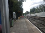
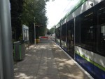
This map from OpenRailwayMap shows the track/platform layout at Avenue Road station/tram stop.
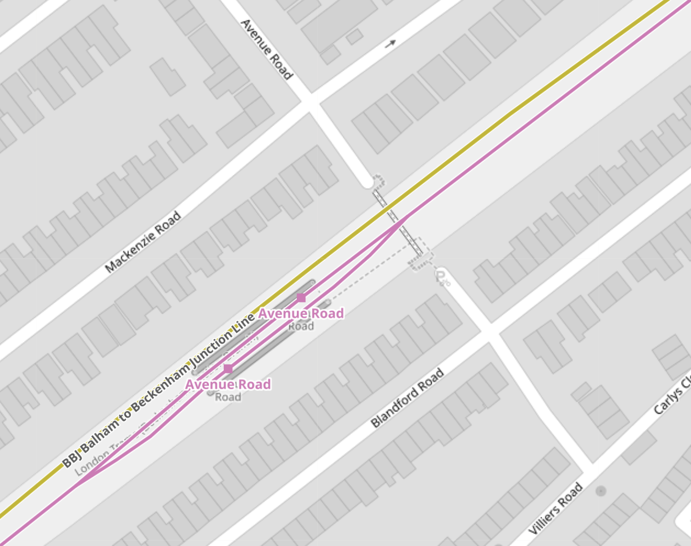
Note.
- The yellow line is the National Rail line between Crystal Palace and Beckenham Junction.
- The National Rail line isn’t shown to have a platform.
- The mauve line is the London Tramlink between Croydon and Beckenham Junction.
- There is no rail connection between the two lines.
London Tramlink has a loop through the tram stop and each branch has a platform.
These pictures were taken at the Avenue Road tram stop.
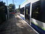
I would estimate the the loop at Avenue Road tram stop could handle a forty metre tram and possibly one of forty-five metres, judging the loop against this thirty-two metre Stadler tram.
This map from OpenRailwayMap shows the track/platform layout at Beckenham Road station/tram stop.
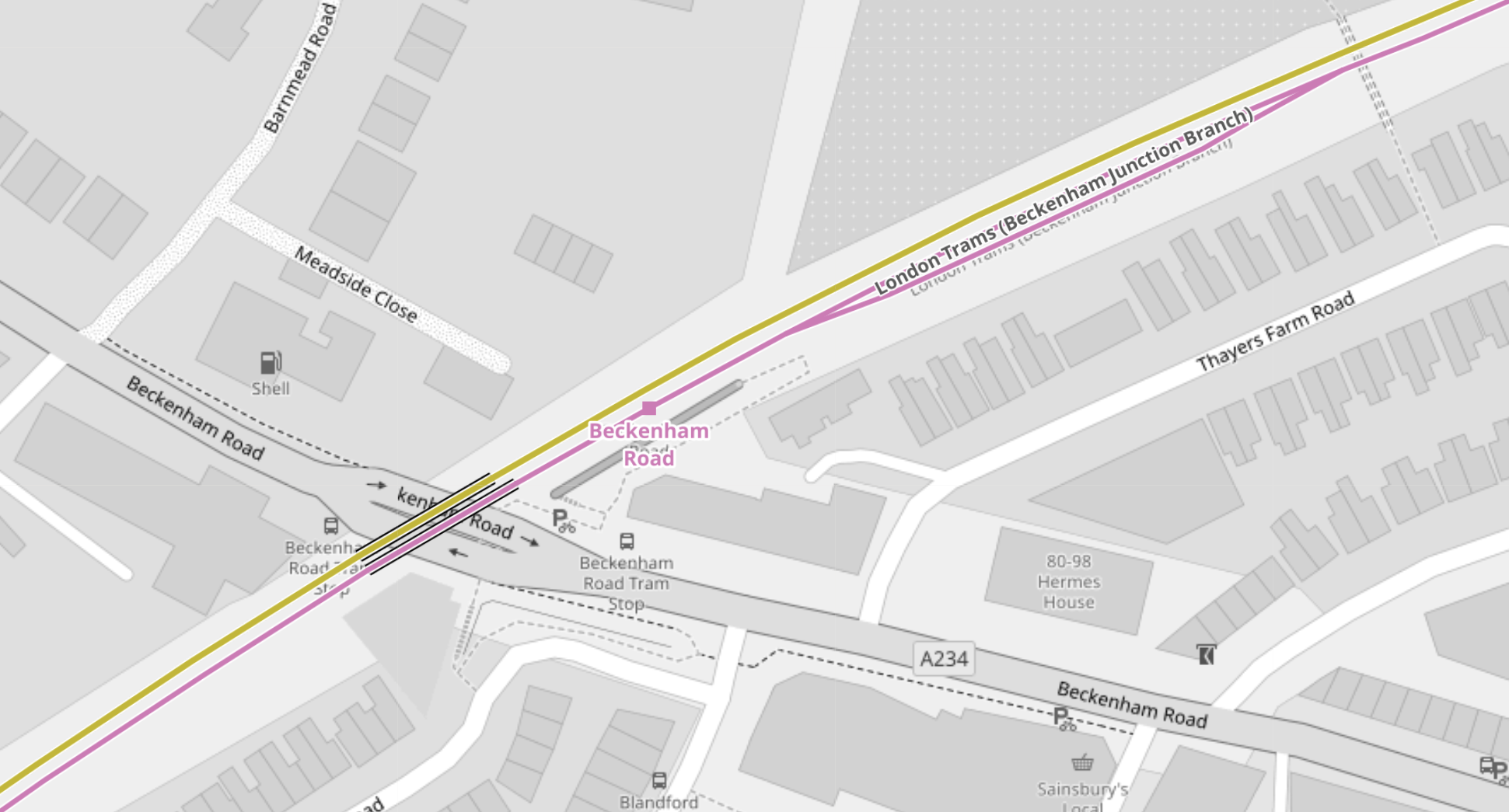
Note.
- The yellow line is the National Rail line between Crystal Palace and Beckenham Junction.
- The National Rail line isn’t shown to have a platform.
- The mauve line is the London Tramlink between Croydon and Beckenham Junction.
- There is no rail connection between the two lines.
The London Tramlink has a single bi-directional platform.
There is also a loop in the London Tramlink to the East of Beckenham Road station/tram stop to allow trams to pass.
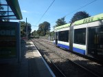
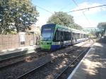
These pictures were taken at the Beckenham Road tram stop.
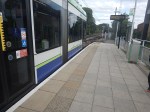

Note.
- A train conveniently came through from London Bridge to Beckenham Junction, when I was taking pictures.
- Several pictures show trams using the loop to the East of the tram stop.
- Both types of tram were pictured in the tram stop.
- The platform in the tram stop is wide.
From the pictures, I would estimate that the Beckenham Road tram stop platform is currently about thirty-five metres and could probably handle a forty metre tram with selective door opening.
Tram-Train Operation Between Birkbeck And Beckenham Junction Stations
I am certain that if this track was being designed today, tram-train operation would be used.
- There would be two tracks, with one for each direction, through Birkbeck, Avenue Road and Beckenham Road stations.
- Both tracks would have dual-height platform at each station/tram stop, so tram and train passengers got level boarding.
- Trains would use third-rail power and trams would use battery-power.
Unfortunately, tram-trains didn’t exist, when the London Tramlink was designed.
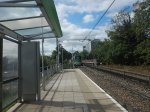
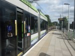
Handling Longer Trams At New Addington Tram Stop
This map from OpenRailwayMap shows the platform layout at New Addington tram stop.
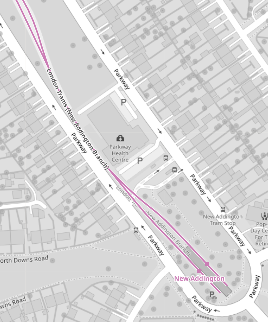
These pictures show the New Addington tram stop and the London Tramlink platforms.
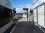


If some of the grassland around the platforms was allocated to the tram stop, I suspect the platforms could be lengthened.
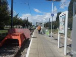
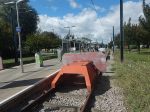
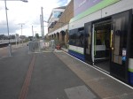
Handling Longer Trams At Wimbledon Station
This map from OpenRailwayMap shows the platform layout at Wimbledon station.
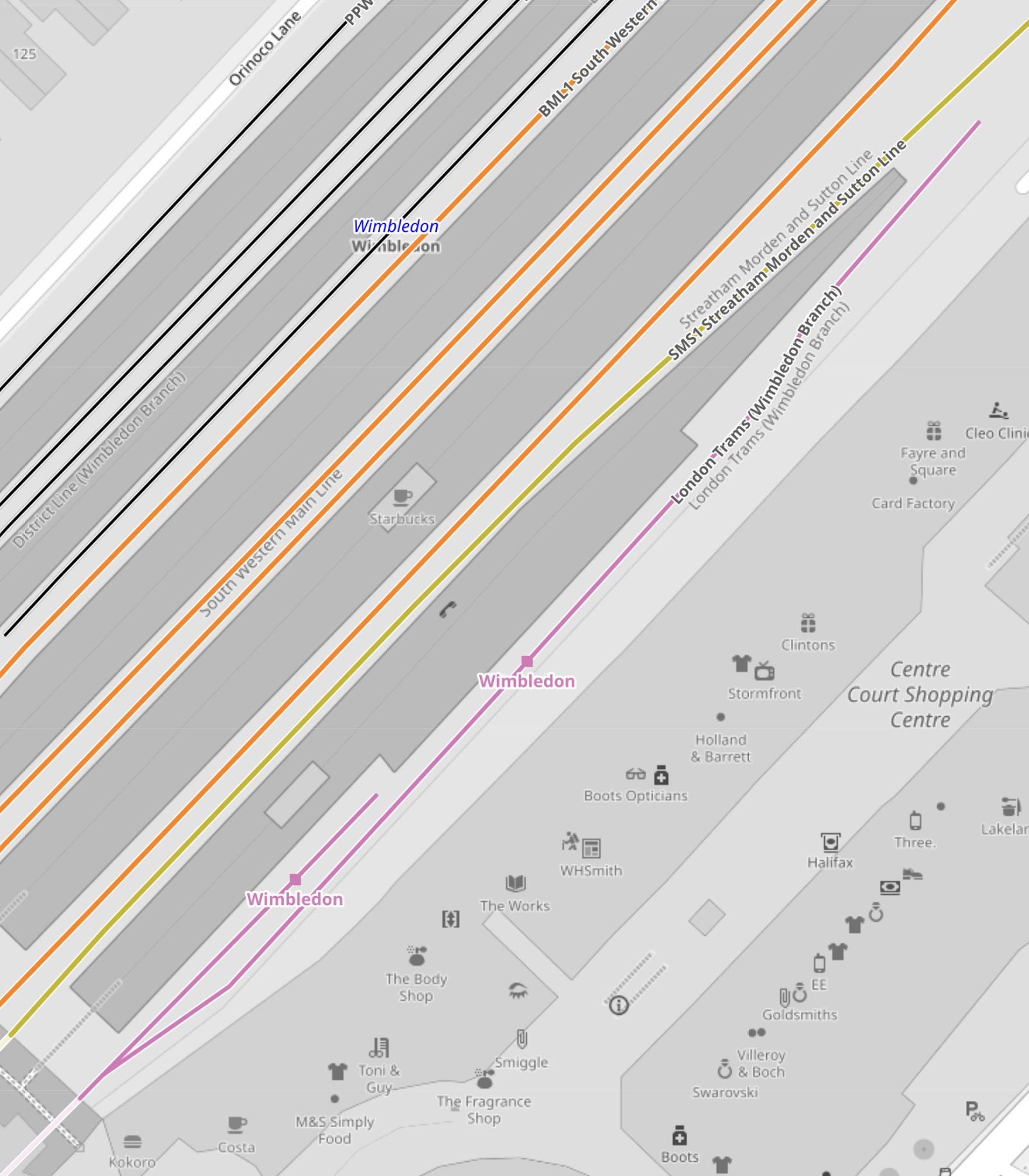
Note.
- The mauve line is the London Tramlink.
- There are two platforms; 10A and 10B, which are indicated with a separate dot.
- Platform 9, which is used by Thameslink, is the other side of Platform 10, so interchange to Thameslink is excellent.
- The main tram platform 9/10 is wide.
- The platforms are step-free to the trams, with lifts to the station bridge and the other platforms and Way Out.
I suspect that when the second platform was built, both platforms were made longer than the thirty-two metres needed for the Stadler trams.
These pictures show the two platforms.
Could another platform be created on the other side of the tracks to give better access to the tracks?
Conclusions
My first conclusion is that the London Tramlink could be run by a new fleet of the same number of trams, that were a few metres longer than the current 30.7/32 metres of the current trams.
- I suspect that forty metre trams would be possible, with a few modifications to platforms.
- It might even be possible to have forty-five metre trams, with a more substantial rebuild at Beckenham Junction.
- Trams could overhang platforms and selective door opening could be used.
- Forty metre trams would carry 25 % more passengers than the current trams.
- The Elmers End and Wimbledon terminals already seem to be capable of handling forty metre long trams and possibly could take trams a few metres longer.
I suspect that Elmers End and Wimbledon, could be the first route, where the longer trams were introduced, as the trams should be able to shuttle between the two end terminals to the current timetable.
The New Addington tram stop would be brought into operation next.
- Platforms would be lengthened as required.
- Trams operate a frying pan loop from New Addington to Croydon, with an Off Peak frequency of 7-8 minutes.
- I suspect that one platform won’t be able to handle this frequency.
- The last point probably means that the two platforms will need to be lengthened.
Works at the New Addington tram stop could be tricky, but not substantial.
Initially, the service to Beckenham Junction could be run by the existing Stadler Variobahn trams.
I believe that a lot of work will need to be done to get Beckenham Junction ready for the new trams if they are longer, which I suspect they are.
- The Network Rail installation will have to be relocated.
- The two platforms will have to be lengthened.
I suspect the works will be substantial.
But I do believe, that there is scope to plan all the works at the terminals, so they can be done efficiently, whilst at least maintaining a partial service.
My second conclusion, is that it will be possible to build a financial model, which shows infrastructure costs against tram lengths.
Longer trams will cost more and cost more for infrastructure, but they will carry more passengers and collect more fare revenue.
‘Rollercoasters In My Back Yard’: Welcome To Universal Studios Bedford
The title of this post, is the same as that of this article on The Times.
This is the sub-heading.
Britain’s answer to Orlando could be a 480-acre world boasting big rides, bigger films and 7m visitors a year. Some locals are far from enchanted
These three paragraphs introduce the story.
Picture the scene: It’s a snowy Christmas Eve, 2030, at King’s Cross station. Dozens of families from across the UK and Europe gather as the station speakers announce: “The train now leaving platform 9¾ is the Hogwarts Express, calling at the Wizarding World of Harry Potter. And Bedford.”
The stuff of JK Rowling’s fiction? Perhaps not.
For, if all goes to plan, a featureless 480 acres of industrial and agricultural land a short broomstick’s ride from downtown Bedford will, by the end of the decade, become one of the world’s most spectacular theme parks.
I have a few thoughts.
Eden Project Morecambe
Eden Project Morecambe will be the first of a new generation of theme parks in the UK.
The new Eden Project is to be developed at Morecambe, which is close to Lancaster. As Lancaster will be an High Speed Two terminus, Eden Project North could be connected to HS2 by a high tech shuttle like the Luton DART. So the Eden Project North will also attract day trippers from a large proportion of England and the South of Scotland.
I believe increasingly we will see theme parks, bringing in their visitors on futuristic public transport systems.
The Location Of Universal Studios Bedford
This map from Universal Destinations & Experiences shows the location of the site of the proposed Universal Studios Bedford.
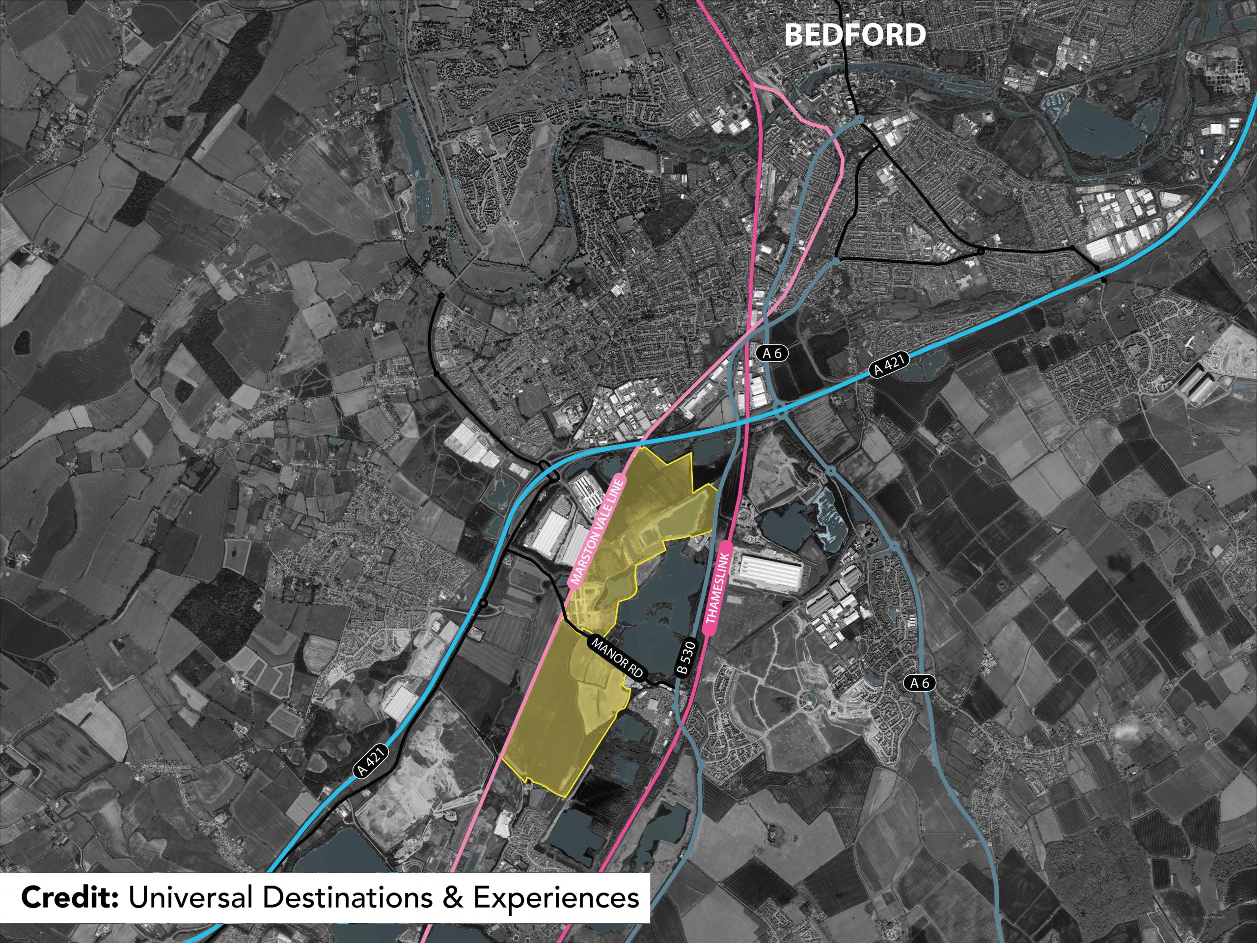
Note.
- The site is shown by yellow shading.
- The blue lines are major roads.
- The pink lines are railways.
- The rail link running to the West of the site is currently the Marston Vale Line, which is being developed into the East West Railway between Oxford and Cambridge via Milton Keynes.
- The East West Railway will also connect to Ipswich, Norwich and Reading.
- The rail link running to the East of the site is the Midland Main Line, which links St. Pancras station with Derby, Nottingham and Sheffield.
The site certainly has excellent transport connections.
Expanding Rail Connections At Universal Studios Bedford
I believe that in these days of climate change, that theme parks and other attractions like sports stadia and shopping centres will develop their rail connections.
Universal Studios Bedford could have two stations.
- Kempston Hardwick on the East West Railway.
- Their own station on the Midland Main Line.
Note.
- Both stations could be connected by a futuristic people mover transporting visitors around the site.
- Using current train times, trains would take thirty minutes between the theme park and St. Pancras for Eurostar to and from Europe.
- Thameslink’s trains could shuttle visitors to and from Luton Airport.
It should also be noted that several of Southern England’s most visited sites are just a train ride away.
Easy Places To Visit
These attractions would be easy to visit.
- Bicester Village – Direct train from Kempston Hardwick after 2024.
- Cambridge – Direct train from Kempston Hardwick after 2030.
- London – Direct train from the new station after it’s built.
- Oxford – Direct train from Kempston Hardwick after 2024.
- Woburn Safari Park – Direct train from Kempston Hardwick after 2024.
Note.
All trains would be electric or battery-electric powered.
I have assumed that rail services between Oxford and Bedford open in 2024.
I have assumed that rail services between Oxford and Cambridge open in 2030.
Conclusion
This is an interesting idea, which is at an excellent location. But will the locals like it?
Brent Cross West Station – 10th December 2023
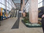
The new Brent Cross West station opened today, so I went to have a look.


Note.
- There are two island platforms.
- The platforms can handl2 12-car Class 700 trains.
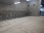
- The Eastern island, which is Platforms 1 and 2, is for Thameslink and has two escalators, two lifts, two sets of stairs and two toilets.
- The toilets on the Eastern platforms are an identical pair to cater for everyone.
- The Western island, which is Platforms 3 and 4, is for the main lines and has one lift and two sets of stairs.
- The arriving Thameslink Class 700 train is stopping in Platform 1 on the way to London.
- Signs indicate a cafe, but I couldn’t find it, so I assume that is for the future.
- The shelters on the platforms are heated.
- Both entrances have two lifts, at least one or two escalators and stairs.
The outside photos were taken two days later.
I have some other thoughts.
The Station Layout
The station has a slightly unusual and very practical layout.
- There is a longish and high bridge over the multiple tracks through the station.
- It is step-free with lifts and escalators at each end to give step-free access across the railway.
- The bridge is wide and is built for cycles.
- The trains are accessed from a spacious lobby, which is separated from the bridge by a long gate-line.
- The lifts, stairs and escalators all lead down from the spacious lobby.
The station must have a very high passenger capacity.
The Track Layout
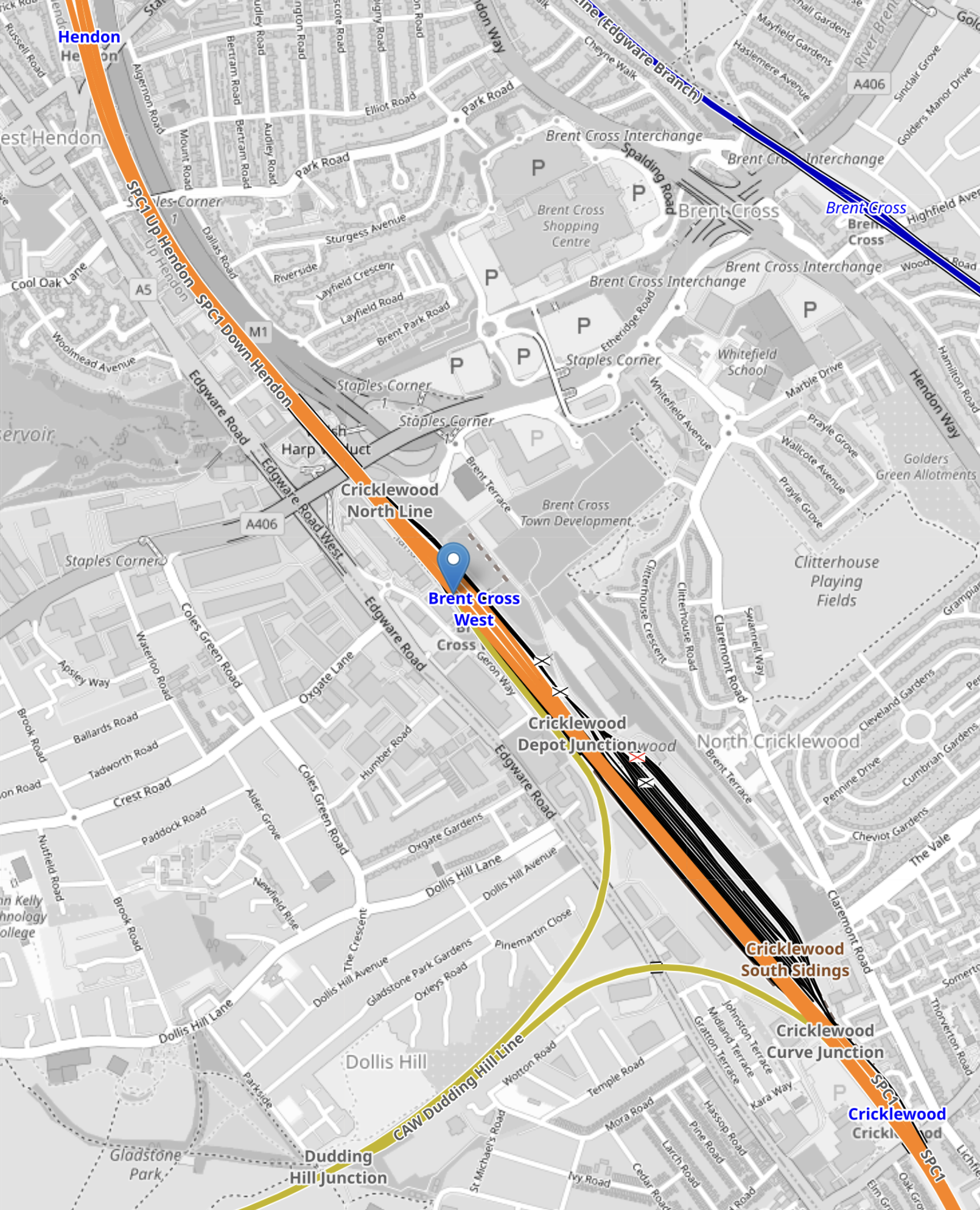
This OpenRailwayMap shows the track layout at the station.
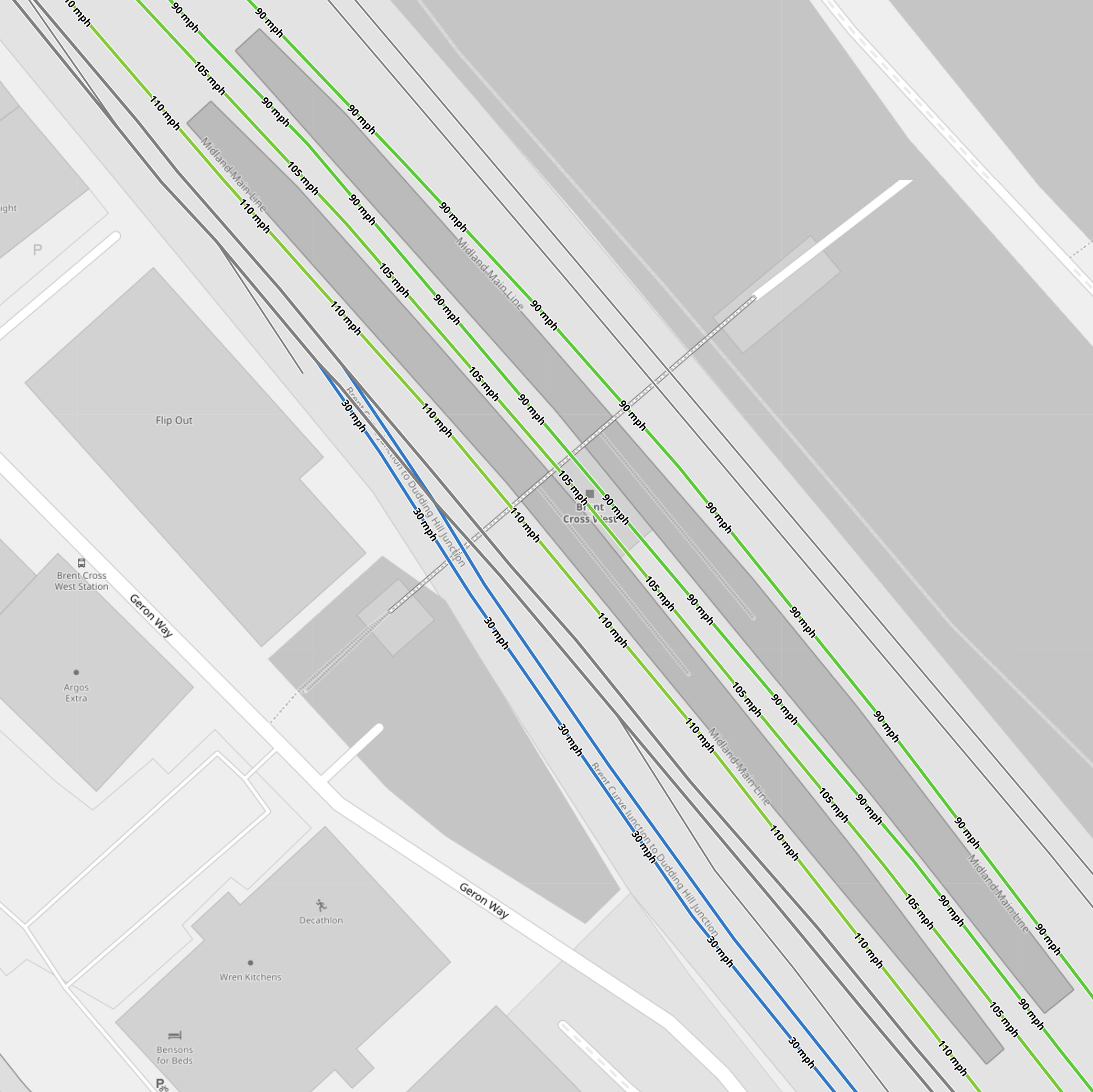
Note.
- The Eastern island platform between the 90 mph Thameslink tracks.
- The Western island platform between the 100-105 mph main line tracks.
- The two most-Easterly tracks give access to the Cricklewood Depot.
- The two black tracks
- The blue tracks connect to the Dudding Hill Line.
- The two black tracks between the blue tracks and the main line tracks are the Up and Down Hendon tracks, which run between Hendon and West Hampstead Thameslink stations, which seem to allow trains to cross over from one side of the tracks to the other.
The large number of tracks must make operation easier.
The West London Orbital Railway
The Hendon and Kew Bridge route of the West London Orbital Railway is planned to call at Brent Cross West station.
It looks like it will use the two Hendon tracks through Brent Cross West and Hendon stations and trains will take the Dudding Hill Line to Neasden to the South of Brent Cross West station.
The West London Orbital Railway will connect Hendon and Brent Cross West station to High Speed Two and the Elizabeth Line, so it will be a very important connection for the residents of the area.
This OpenRailwayMap shows the track layout between the Dudding Hill Line and Hendon.
Note.
- Hendon station is in the North-West corner of the map.
- The orange tracks are the Midland Main Line
- Brent Cross West station is marked by the blue arrow.
- The yellow tracks going towards the South-West are the Dudding Hill Line.
The Hendon route will need new platforms at Hendon and Brent Cross West station.
Conclusion
I like the station and I think others will be built on similar principles.
Passing Brent Cross West Station – 1st November 2023
I took these pictures of the Eastern entrance of the station, as my train passed this morning.
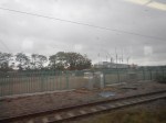
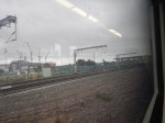
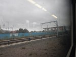

Note.
- There doesn’t seem to be much going on.
- There seem to be very few of the Orange Army around.
- None of the staff I talked to at St. Pancras, knew anything about the station’s opening date.
Perhaps, the station is due to open on Timetable Change Day; 10th December, 2023? It certainly looks, that it might be able to.
