South Yorkshire Now Has Better North-South Connections
The December 14th 2025 timetable change was a big day for South Yorkshire.
Three big changes will transform, public transport in South Yorkshire.
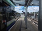
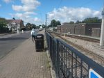
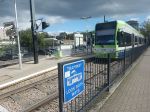
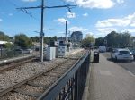
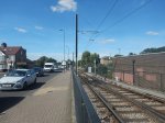
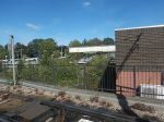
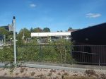
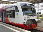
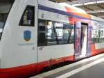
The Opening Of A New Tram-Stop At Magna Science Adventure Centre On The Tram-Train Route Between Sheffield And Rotherham
The Magna Science Adventure Centre is described like this in the first paragraph of its Wikipedia entry.
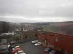
Magna Science Adventure Centre is an educational visitor attraction in Rotherham, South Yorkshire, England.
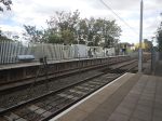
This map shows the site and the tram-train track between Sheffield and Rotherham.
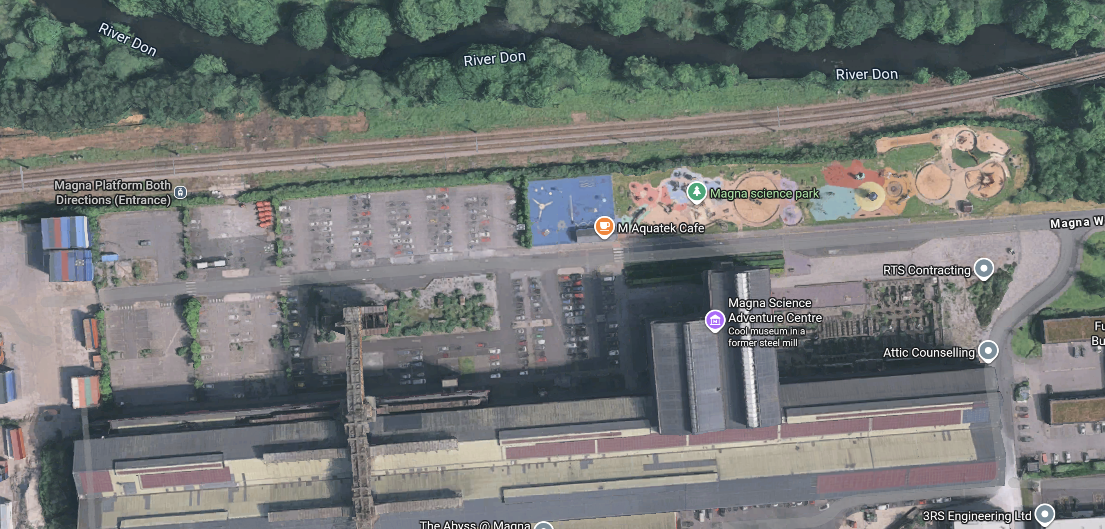
Note.
- The tram-train track runs East-West across the top of the map.
- Sheffield is to the West and Rotherham is to the East.
- At the Western end of the site, a label indicates the position of the Magna Platform.
- The position of the tram-train stop is already marked.
- There will be 29 extra Park-and-Ride spaces.
- The Magna Science Adventure Centre is indicated by the purple arrow in the middle of the map.
- Magna Way runs East-West through the site.
- There are four pavilions: Earth, Air, Fire, and Water.
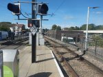
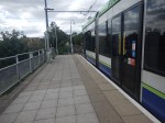
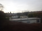
This article on the BBC is entitled Lifts And Bridge Added As Tram Stop Takes Shape.
This picture from the article shows the bridge with lifts.

Note.
It will be an impressive tram stop.
It doesn’t look like it will be long before it opens.
But as yet no information is available.
Google AI gave this answer.
The new Magna Tram Train stop is scheduled to open in early 2026.
Construction of the new £10 million station and Park & Ride facility in Rotherham, part of a wider investment in the South Yorkshire Supertram network, is currently on track.
The new stop will improve access to the Magna Science Adventure Centre, local businesses, and link up with existing walking and cycling routes, aiming to ease congestion in the Lower Don Valley.
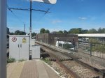
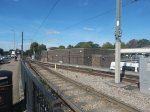
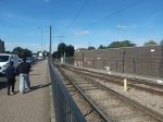
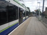
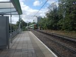
I shall be going next week to take photographs of the tram stop.
The Increase In Frequency Of Express Trains Serving Doncaster On The East Coast Main Line
Since the December 14th 2025 timetable change, the Monday to Friday express trains, that stop at Doncaster on the East Coast Main Line have included.
- CrossCountry – 8 trains per day (tpd) in both directions.
- Grand Central – 4 tpd in both directions.
- Hull Trains – 7 tpd in both directions.
- LNER- 3.5 trains per hour (tph) in both directions.
- TransPennineExpress – 1 tph in both directions.
Note.
- This totals to 173 express trains per day stopping at Doncaster
- Or about 7 tph in both directions or a train every 8.5 minutes.
- This is about a thirty percent increase in frequency.
- Doncaster has become the Crewe of South Yorkshire.
I can see this large number of express trains to Doncaster bringing large numbers of visitors to go to the Magna Science Adventure Centre or its tram stop for onward connection to other destinations on the Sheffield Supertram network.
The trouble is, that at present the Magna tram stop is not connected to Doncaster station.
This OpenRailwayMap shows the rail lines between Doncaster and Sheffield stations.
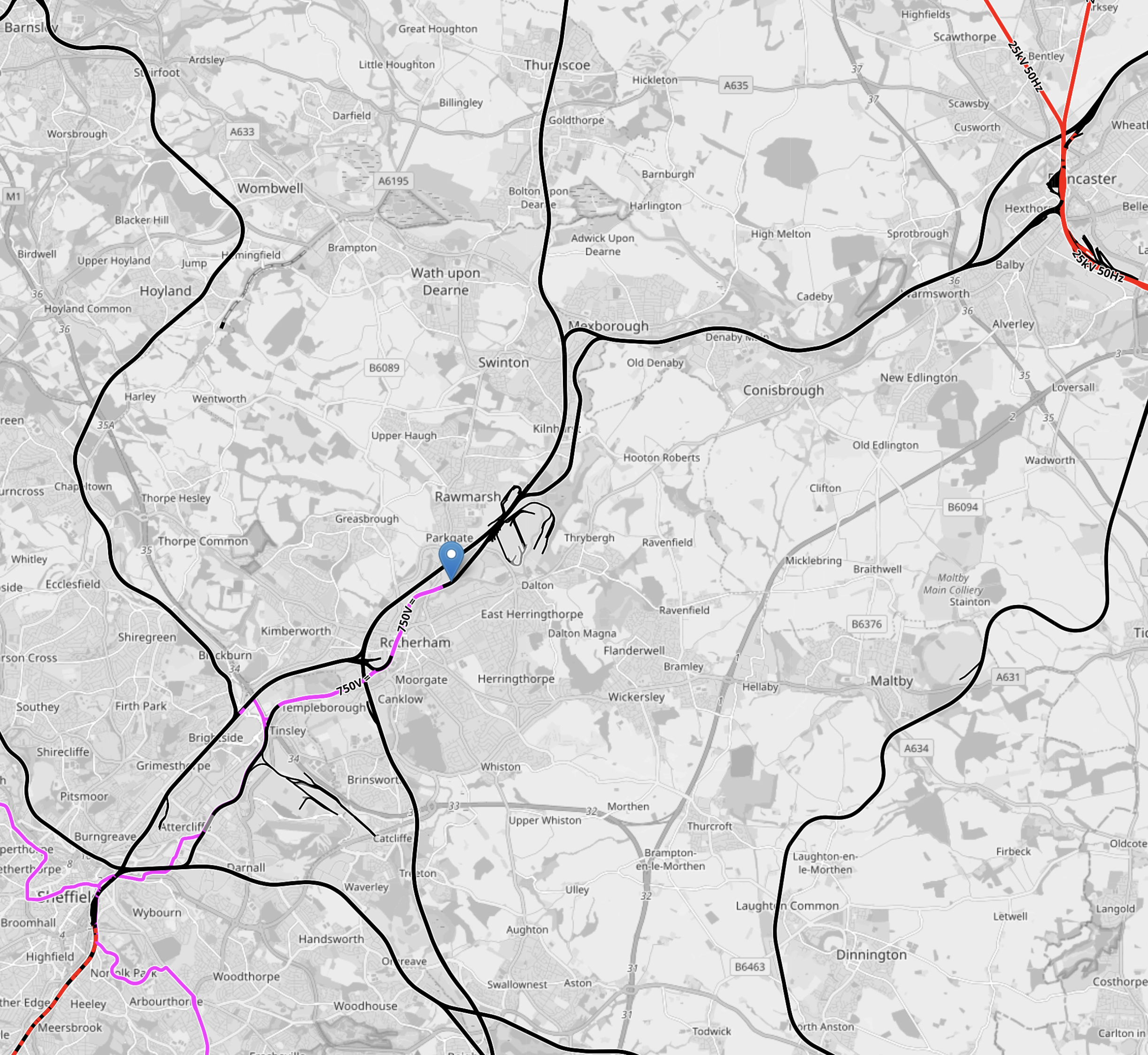
Note.
- The short length of red track in the North-East corner of the map is the East Coast Main Line.
- Doncaster station can be picked out.
- The short length of red track in the South-West corner of the map is the Midland Main Line, which connects Sheffield to London.
- Sheffield station is at the Northern end of the electrification, which will be installed soon.
- The pink tracks are the 750 VDC electrified tracks of the Sheffield Supertram.
- The blue arrow marks Rotherham Parkgate station, which is the limit of the current tram-train route.
The tram-train route needs to be extended so that the tram-trains can go between Rotherham Parkgate tram stop and Doncaster station.
The route seems to have these characteristics.
- It is about 11.8 miles long.
- Stops are Rotherham Central, Swinton (South Yorkshire), Mexborough and Conisborough.
- Diesel trains take about thirty minutes between Rotherham Central and Doncaster.
- All platforms at Doncaster are electrified with 25 KVAC.
- Platform 5 is a convenient bay platform at Doncaster, that could be used by the tram-trains.
- Sheffield’s Class 399 tram-trains can use 25 KVAC for traction.
- South Wales have similar Stadler tram-trains, that are to be fitted with batteries.
I am fairly sure, that a solution can be found so that Sheffield’s tram-trains can be extended to Doncaster station.
This OpenRailwayMap shows the route between Rotherham Parkgate tram stop and Doncaster station.
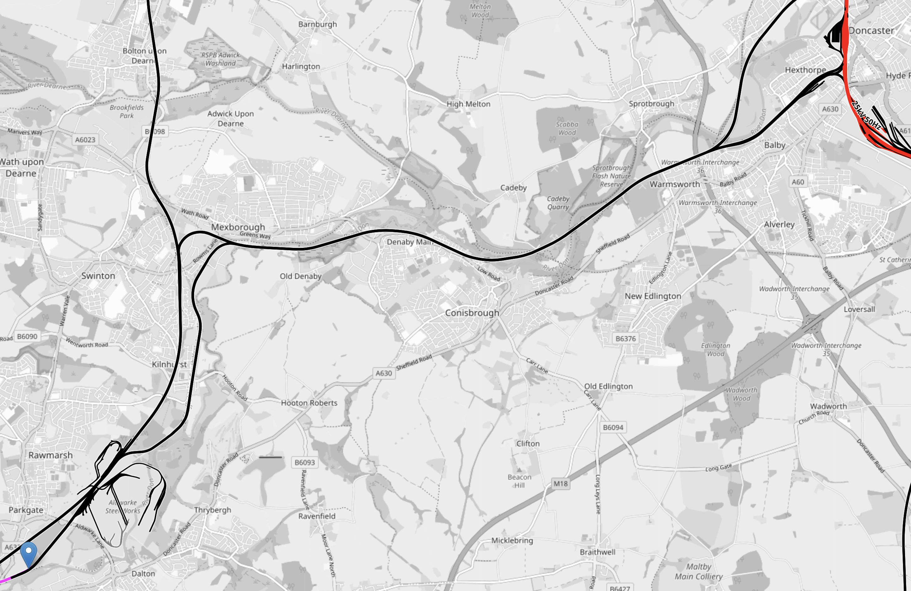
Note.
- The short length of red track in the North-East corner of the map is the East Coast Main Line.
- Doncaster station can be picked out.
- The short length of pink tracks are the 750 VDC electrified tracks of the Sheffield Supertram.
- The blue arrow marks Rotherham Parkgate station, which is the limit of the current tram-train route.
- Most of the route is not electrified.
As there is electrification at both ends, I suspect the easiest way of powering the trams would be to use batteries, as has been done in South Wales.
The New Class 810 trains between London St. Pancras And Sheffield On The Midland Main Line
These new Class 810 trains have started running this month and I suspect soe travellers will use these trains to go to Magna or its tram stop.
his OpenRailwayMap shows the tram routes in Sheffield city centre.
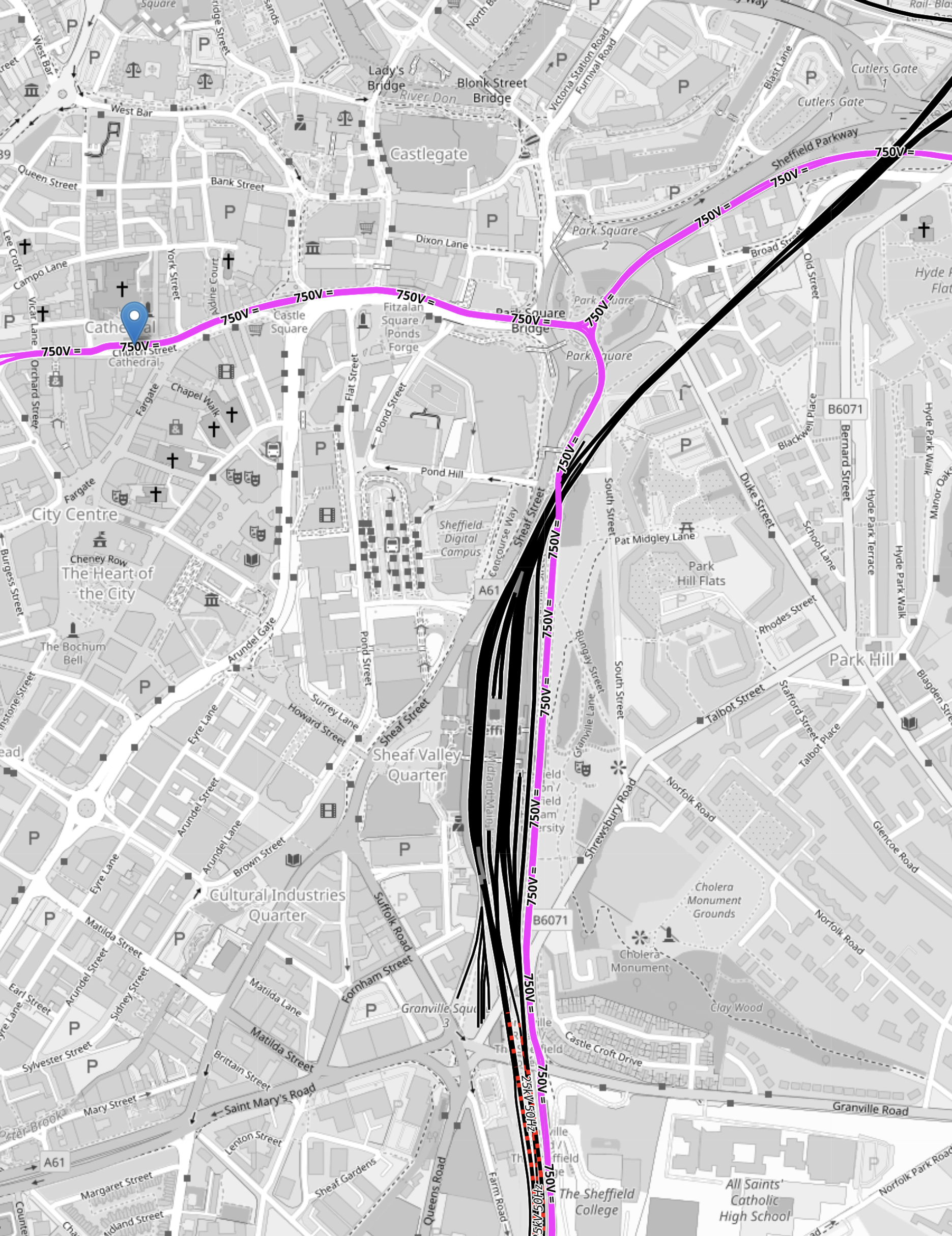
Note.
- The pink tracks are tram-tracks.
- The black tracks are unelectrified train tracks.
- The short lengths of red-and-black tracks are tracks to be electrified with 25 KVAC overhead, for the Class 810 trains.
- The blue error indicated the Cathedral tram-stop, where tram-trains will be caught to Magna.
- The mass of black tracks in the middle of the map is Sheffield station.
- There is a tram stop on the East side of the train station for the trams.
- Trams going South go to Halfway and Herdings Park.
- Trams going North-East go to Rotherham Parkgate and Meadowhall Interchange, and will go to Magna, when it opens.
- Trams going North-West go to Malin Bridge and Middlewood.
It is a difficult interchange between Cathedral and Sheffield station, if you are catching the tram-train, as it is a hard walk up hill, so it might be better if you are goinging between Sheffield station and the tram-train to change trams at Meadowhall South.
Support For Edinburgh Tram-Train Scheme
The title of this post, is the title of a third-of-a-page article in the June 2025 Edition of Modern Railways.
This is the first paragraph.
Final-Year civil engineering undergraduates at Heriot-Watt University’s Edinburgh campus have received warm support for a study in which they recommend reopening the city’s 7.5 mile South Suburban Railway, used for freight and diversions since 1962, using tram-trains.
It looks like they would start in the West at say Edinburgh Gateway or the Airport and would then turn South at Murrayfield to join the South Suburban Railway at Gorgie.
This OpenRailwayMap shows the tracks to the South of Murrayfield stadium.
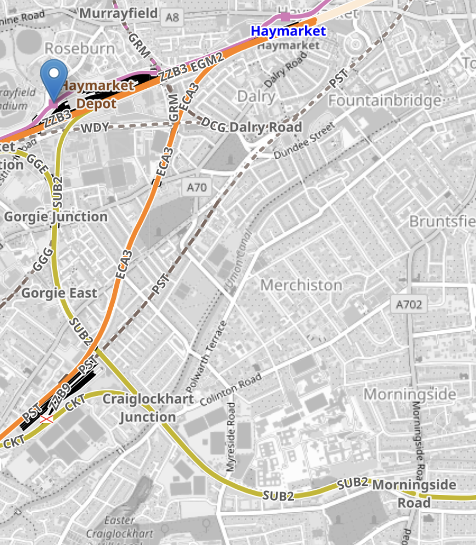
Note.
- The more Westerly-oriented orange tracks lead to Glasgow.
- The orange tracks running South-Westerly are the tracks to Carstairs.
- The yellow tracks are the South Suburban Railway.
- Tram-trains could then go all the way to Brunstane on the Borders Railway.
- The blue arrow indicates the tram-stop for Murrayfield.
- I would assume that the connection to the South Suburban Railway, is to the East of this stop.
- Gorgie East, Craiglockhart and Morningside Road were stations on the South Suburban Railway.
This map shows where the South Suburban and Borders Railways meet in a large triangular junction.
Note.
- Newcraighall station on the Borders Railway is in the South-East corner of the map.
- Brunstane station is to its North-West almost halfway up the map.
- The two stations are the North and South points of the triangular junction, where the South Suburban and Borders Railways meet.
- The South Suburban can be seen going West towards Gorgie and Murrayfield.
- Edinburgh’s beach at Portobello is in the North-East corner of the map.
- Between Murrayfield and Brunstane, there would be an appropriate number of tram stops and a tram-train every fifteen minutes.
Optionally, the route can be extended to Leith on a mothballed freight line.
This OpenRailwayMap shows the railways and tramways of Edinburgh between Brunstane, Edinburgh Waverley and Leith.
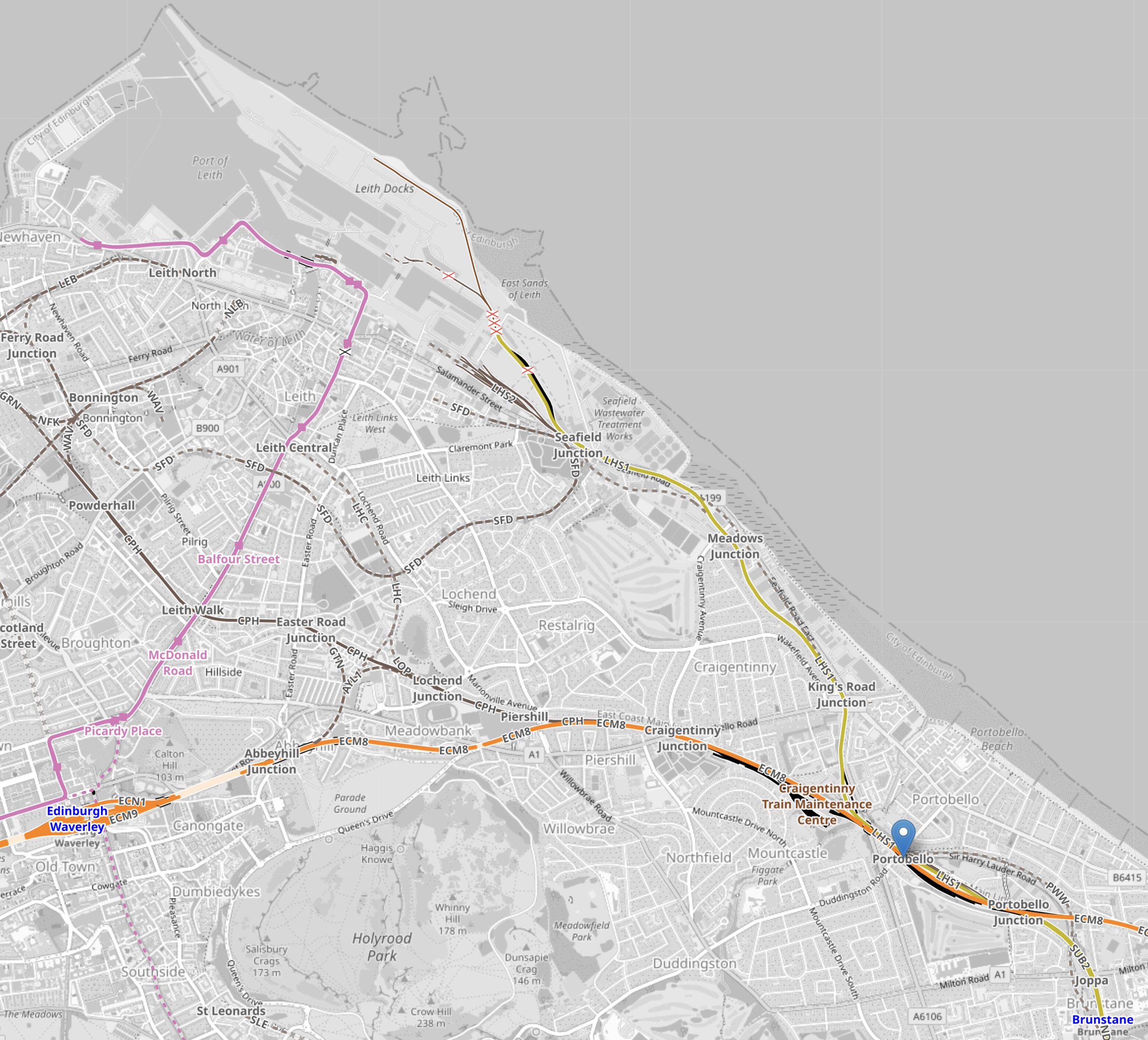
Note.
- The orange track running across the bottom of the map is the East Coast Main Line into Edinburgh Waverley station, which is clearly marked.
- The pink track is the Edinburgh tram to Newhaven.
- Brunstane station is in the South-East corner of the map.
- The site of the former Portobello station is marked by the blue arrow.
- The yellow track from Portolbello up the coast is a mothballed freight line to Leith Docks.
The proposal suggests that the tram-train route finishes at Leith Docks. One of the reasons, is that this part of Edinburgh, is not well served by public transport.
I have some extra thoughts.
Changing Between Borders Railway and the Tram-Train At Brunstane Station
Brunstane station, is a two-track station, with only one platform, so there may need to be track modifications.
Do Edinburgh’s Urbos Trams Have A Tram-Train Variant?
They do!
Do Edinburgh’s Urbos Trams Have A Battery Variant?
Battery tram-trains charged at either end of the route will be needed.
A battery-electric Urbos 3 tram, can be seen running through the City of Birmingham in England.
Conclusion
The proposal looks feasible to me. But the devil will be in the detail.
A Bespoke Tram-Train For The UK
Trams, tram-trains, trains and anything that runs on rails is generally very expensive.
Does this partly explain, why the UK has relatively few urban tramways and railways?
In Stadler Presents Mock-Up Of Tram-Trains For German And Austrian Operators, I discussed how five German and Austrian operators had got together to create a common tram-train design, that would be suitable for all the operators.
The mayor of one of the cities involved in the joint order, said savings of the order of a million euros per vehicle may have resulted from the common design.
I would also feel that savings in operational costs, design of infrastructure, spares inventory and other costs would also result.
Identical tram-trains would make through running between networks easier.
Where Could Tram-Trains Be Used In The UK?
Consider.
- Currently, tram-trains are running in Sheffield and a battery-electric version of the same Stadler Citylink tram-train will soon be running in Cardiff.
- Cardiff, is developing a Cardiff Crossrail on tram-train principles across the city.
- Sheffield have said that they will be replacing their trams and I believe they could use developments of their excellent Stadler tram-trains.
- Sheffield is likely to extend their tram system and might include tram-trains to Doncaster.
- Cities that have talked about adding tram-trains to their tram networks include Birmingham, Blackpool, Manchester and Nottingham.
- Leeds is developing a metro system, which could be developed using tram-train principles.
- Glasgow has talked about a tram-train to Glasgow Airport for some time.
- The East-West Rail Link is proposing a tram-train link between Ipswich and Felixstowe to allow more freight trains into the Port of Felixstowe.
There could be quite a number of tram-trains being used in the UK, especially if they are used as at Felixstowe, to increase freight capacity into ports.
These are a few of my thoughts.
Battery-Electric Tram-Trains
I would envisage, that a lot of the new tram-trains would operate using batteries. Especially, as battery-electric trains are showing quite long ranges of upwards of thirty miles.
Already trams in Birmingham and trains on Merseyside, are operating using batteries and it avoids the expense of putting up catenary, if enough exists to charge the trams.
Replacement of Diesel Multiple Units By Battery-Electric Tram-Trains
There are some branch lines, where diesel multiple units run off a branch of an electrified main line.These services could be decarbonised by changing the rolling stock.
This OpenRailwayMap shows the St. I’ves Bay Line in Cornwall.
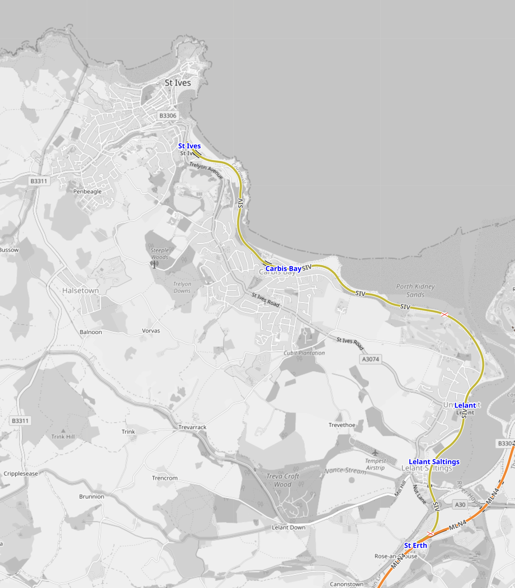
Note.
- The St. Ives Bay Line is shown in yellow.
- The Southern terminal is St. Erth station, where it connects to the Cornish Main Line, which is shown in orange.
- The Northern terminal is St. Ives station, which is towards the top of the map.
- The St. Ives Bay Line is 4.25 miles long.
- No tracks are electrified.
- There are three intermediate stations.
This second OpenRailwayMap shows St. Erth station in more detail.
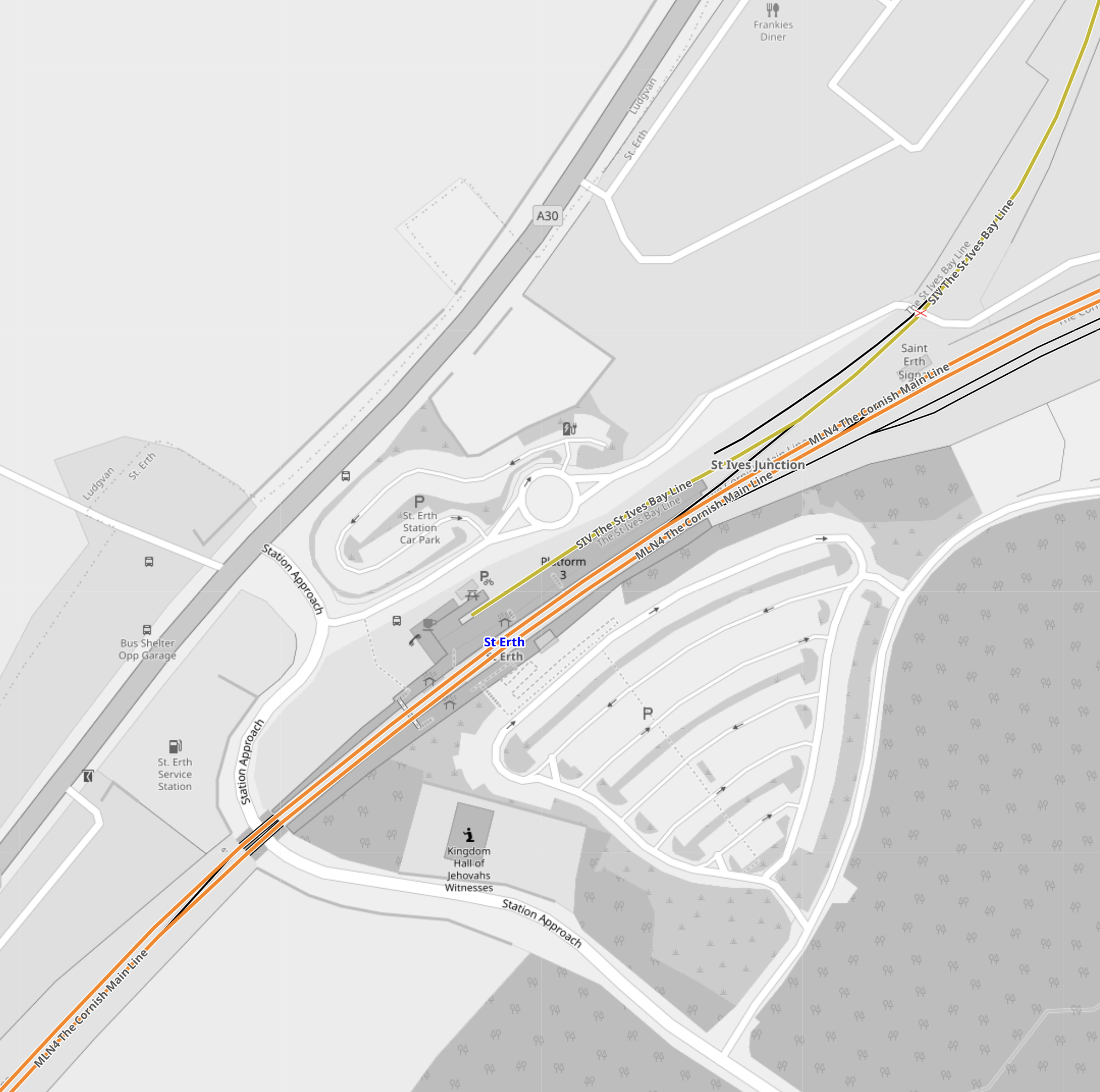
Note.
- The St. Ives Bay Line has its own platform at the side of the station.
- I am fairly certain, that some form of charging could be installed in this platform.
- At the other side of the Cornish Main Line are two sidings, which could be used for cleaning and maintenance.
A neat zero-carbon branch line could easily be created.
New Branch Lines To New Developments
In Sheffield Region Transport Plan 2019 – A New Tram-Train Route To A New Station At Waverley, I gave my view on a tram-train loop from the Sheffield-Lincoln Line to serve the Advanced Manufacturing Centre and new housing at Waverley.
The tram-train would run as a train to the branch line for the development and then run as a battery-electric tram, through the development.
As the Midland Main Line to Sheffield will be electrified, the tram-trains could be charged on the electrification in Sheffield station.
Build Them In Doncaster
Wabtec are closing Doncaster works.
Surely this would be the site to assemble the scores of tram-trains that could be needed in the UK.
Conclusion
Tram-trains could do a lot to improve the railways of the UK.
They would also help to decarbonise the existing system.
Hull Trains Eyes Worksop And Sheffield Launch
The title of this post, is the same as that of this article on Railway Gazette.
These are the two introductory paragraphs of the article.
Hull Trains’ proposed London King’s Cross – Worksop – Sheffield open access service would ‘give people more choice’, offer more flexibility in train fares and make the area better known, according to Labour Member of Parliament for Bassetlaw Jo White.
Speaking at the launch of FirstGroup’s Moving forward together: Why open access is essential for a better railway report on January 21, White said the service would increase opportunities for the growing population of Worksop, where new housing being built. Looking back at the history of open access, she said East Hull MP John Prescott had been a supporter of the original launch of Hull Trains.
I suspect that the ebullient John Prescott would have given full backing to Hull Trains proposed Sheffield service.
I have some thoughts about Hull Trains proposed service.
London Overground Syndrome
I am fairly certain, that this service will suffer from from London Overground Syndrome, which is defined like this.
This benign disease, which is probably a modern version of the Victorian railway mania, was first identified in East London in 2011, when it was found that the newly-refurbished East London Line and North London Line were inadequate due to high passenger satisfaction and much increased usage. It has now spread across other parts of the capital, despite various eradication programs.
It may be for slightly different reasons, but as Workshop station has good car parking and could have fast trains to London, it could attract passengers.
But I don’t think two trains per day will be enough.
Tram-Trains Between Sheffield And Retford Via Worksop
Consider.
- It’s under twenty-five miles between Sheffield and Retford, so this route would be possible using battery-electric tram trains, similar to those in South Wales.
- These tram-trains would also be suitable for the Robin Hood Line between Nottingham and Worksop via Mansfield.
- The speed limits are not fast and the distances are not great and I suspect battery-electric versions of Sheffield’s tram trains could handle all routes.
- By using temporal separation, Hull Trains services could be sneaked in early and late in the day.
As both cities of Nottingham and Sheffield have used or thought about using tram-trains, I’m sure Stadler could provide a suitable tram-train, that could work in the two cities and all the branch lines that used to serve the numerous coal mines.
It would be levelling up on a big way.
It could grow into a very comprehensive East Midlands Metro, that also served Derby, Doncaster and possibly Lincoln.
Stadler’s products can certainly be configured in many unusual ways.
Paris – Berlin Direct High Speed Train Service Launched
The title of this post, is the same as that of this article on the Railway Gazette.
This was the sub-heading.
A daily high speed train service linking Paris Est and Berlin Hbf was launched on December 16.
These four paragraphs outline a few details of the service.
It is operated through the Alleo partnership of SNCF Voyageurs and DB, with both French and German onboard staff and using DB Class 407 Velaro D trainsets built by Siemens Mobility.
The journey time is just over 8 h, using high speed lines from Paris to Strasbourg and from Frankfurt to Berlin, and calling at Strasbourg, Karlsruhe, Frankfurt Süd and Berlin-Spandau.
The service is targeted at both leisure and business travellers, with the operators highlighting the environmental benefits of the rail journey producing 2 kg of CO2, compared to 200 kg when flying.
Fares start at €59·99 in standard class and €69·99 in first.
Those prices seem good value.
I have just looked up going on the direct trains from Paris to Berlin on 19th Feb and coming back on the 21st.
These were the two trains.
- Paris Est – Berlin HBf 19th Feb – 09:55-18:03 – 8:08 – £52:00
- Berlin HBf – Paris Est 21st Feb – 11:54 – 20:00 – 8:06 – £86:50
Note.
- Why is it cheaper to go to the East?
- The Berlin HBf – Paris Est should allow you to catch a late Eurostar to London.
- easyJet could get you fast and affordably between Gatwick and Berlin Brandenburg Airport.
- Lumo can get you between London and Edinburgh for under £25:00.
New train services are opening up interesting trips.
Consider.
- I’ve not been to Berlin by train except from the East.
- I’ve not been to the new Brandenburg Airport.
- I’ve not done an eight-hour East-West daytime train trip across Europe.
- I want to look at Karlruhe and Chemnitz, and their new tram-trains.
I might organise my trip like this.
- Eurostar from London to Brussels
- Train from Brussels to Karlsruhe
- Overnight in Karlsruhe
- Train from Karlsruhe to Chemnitz
- Overnight in Chemnitz
- Train from Chemnitz to Berlin
- Overnight in Berlin
- Train from Berlin to Paris
- Walk between Paris Est and Paris Nord
- Eurostar from Paris to London
Note.
- I’ve done London to Karlsruhe in a day via Brussels.
- There will be three nights in hotels.
- It should be possible to do Berlin and London via Paris in a day.
I think I’ll at least plan it.
Potential Tram Builders Announced For New London Trams
The title of this post, is the same as that of this article on RailAdvent.
These three paragraphs outline the design of the new trams.
Transport for London has issued an Invitation to Tender for four manufacturers to design and build a new fleet of trams.
Alstom UK, CAF, Hitachi and Stadler are the four manufacturers who can now proceed to the next stage of the procurement process with Transport for London to design and build the new trams.
The new trams are expected to feature air-conditioning, real time travel info and charging points, along with areas designed for wheelchair users and those with pushchairs and luggage.
It sounds that the new trams will be to a higher standard with more comfort and interior space.
These are my observations and thoughts.
Will There Be The Same Number of Trams?
These two paragraphs indicate the number of trams.
The initial contract will be for 24 new trams to replace the oldest trams on the network – which are now nearly 25 years old.
There is an option in the contract to replace the trams that were introduced from 2012.
Could this mean, that each tram would be replaced on a one-to-one basis?
It would surely make it easy to introduce the new fleet.
Will The New Trams Be Longer?
To me, the most significant words in the article are “areas designed for wheelchair users and those with pushchairs and luggage”.
As passengers seem to want to carry more and more with them on buses, trains and probably trams in London, I believe the new trams will probably need more interior space.
Increasing the width of the tram, would probably mean gauging difficulties, but with the lengthening of some platforms longer trams might be possible.
The current trams are as follows.
- 24 x Bombardier CR4000 – 30.1 metres – 70+138=208 = 6.9 pass/metre
- 12 x Stadler Variobahn – 32 metres – 72+134 = 206 = 6.4 pass/metre
Note.
- The total number of each tram type is at the left.
- Seats+Standing=Total Passengers.
- The Bombardier trams only have a single articulation, but it looks like the Stadler ones have four.
The longer Stadler trams seem less crowded, despite carrying two fewer passengers.
I have looked at the terminal platforms on maps and it appears, that 35 metre and possibly 40 metre trams would be possible.
At least in London, passengers are used to being told not to use the end door.
A 40 metre tram could probably handle over 250 passengers based on the Stadler passenger density.
Longer Trams Could Increase Capacity By Up To 25 %
I believe my figures show this could be possible.
More Articulations Should Mean A Tighter Turning Circle
This could help operation on some existing or new sections of London Tramlink.
Would Battery Tram-Train Operation Be Useful?
CAF’s trams in the West Midlands already have batteries and Stadler’s tram-trains in Cardiff will have batteries to extend routes on rail tracks, that don’t have electrification.
In Could Beckenham Junction To Birkbeck Be Run Using Third-Rail Tram-Trains?, I detailed how third-rail tram-trains could be used between Harrington Lane tram stop and Beckenham Junction station to create more capacity.
I believe that third-rail tram-trains would work, but that Health and Safety would outlaw the concept.
On the other hand, battery-electric tram trains could probably handle the link between train and tram routes.
If I was bidding for the TramLink contract, I’d make sure the trams could be updated with a battery-electric tram-train capability.
Increasing Capacity At Elmers End Tram Stop
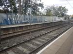
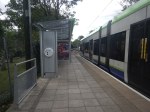
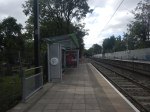
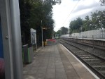
Elmers End tram stop, is the only terminal on the London Tramlink with a single platform.
This map from OpenRailwayMap shows the platform layout at Elmers End station.
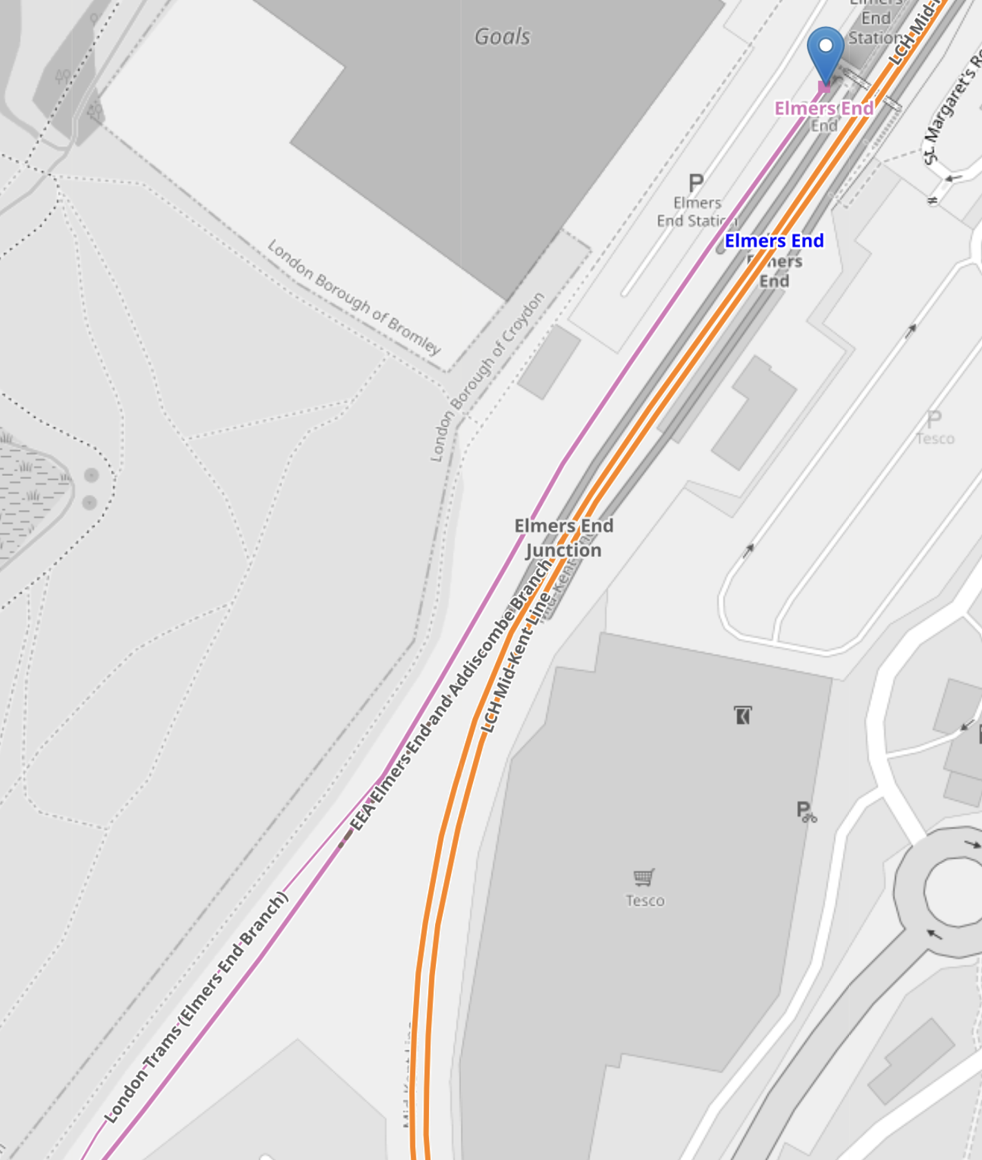
Note.
- The orange lines are the Hayes Line.
- The mauve line is the London Tramlink.
- The London Tramlink has a single platform on the North-West side of the Hayes Line.
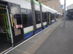
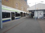
These pictures show Elmers End station and a tram in the London Tramlink platform.
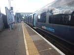
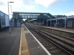
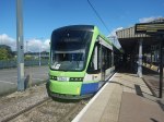
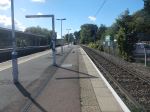
Note.
- The bridge in the station is not step-free.
- The tram is a five-section Stadler Variobahn.
- The tram platform would appear to be able to handle a tram, that is several metres longer than the 32.0 metre Stadler Variobahn.
- The London Tramlink has a typical off-peak service to Wimbledon every ten minutes from Elmers End tram stop.
The Wikipedia entry for Elmers End station, says this about Tramlink developments at the station.
Work is underway to open a second tram platform and double the tram line to Arena to increase capacity. As of March 2019, vegetation has been cleared to make way for the new line. The platform was due to open in December 2020, but has been delayed.
My pictures show no ongoing work or evidence of the second Tramlink platform.
There are two main ways, that capacity can be increased at Elmers End station.
- Install a second platform and run more trams to the station.
- Run longer trams with a higher capacity.
Perhaps, Transport for London have decided, that the second way, is the best, especially, if the money saved, allows them to build a much-needed step-free footbridge at Elmers End station.
From my observations, I would estimate that Elmers End tram stop could accommodate a forty metre tram and possibly, one that was even longer.
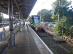
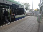
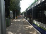
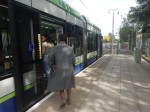
Arena Tram Stop
The Arena tram stop, is where the Beckenham Junction and Elmers End branches join and split.
This map from OpenRailwayMap shows the platform layout at Arena tram stop.
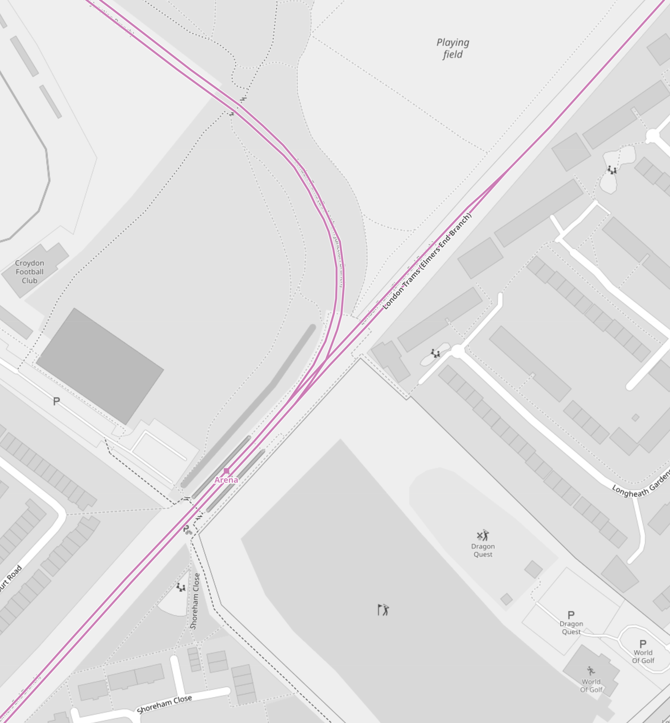
Note.
- The mauve lines are the London Tramlink.
- The line going North-East runs to Elmers End. It starts off as double-track at Arena tram stop and quickly becomes single track all the way to Elmers End. tram stop.
- The line going North-West runs to Beckenham Junction.
- The line going South-West runs to East Croydon and Wimbledon.
- The platforms are on the outside of both tracks.
These pictures show Arena tram stop and some trams passing through.
Note.
- The tram platforms are generally a few metres longer than the trams.
- All tram doors are step-free to the platform.
- Passengers walk across the line in front or behind the trams.
- The platform is wide, so that passengers can stay well clear of the occasional passing tram. One picture shows a tram is signed “Not In Service”
I believe, that with some judicial platform lengthening, some selective door opening and trams stopping automatically in the right place on the platform, that longer trams could be handled in a stop like Arena.
As with Elmers End, I believe a forty metre tram will be possible, but this might not be the limit with clever design.
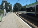
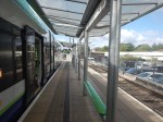
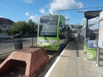
Handling Longer Trams At Beckenham Junction Tram Stop
This map from OpenRailwayMap shows the platform layout at Beckenham Junction tram stop.
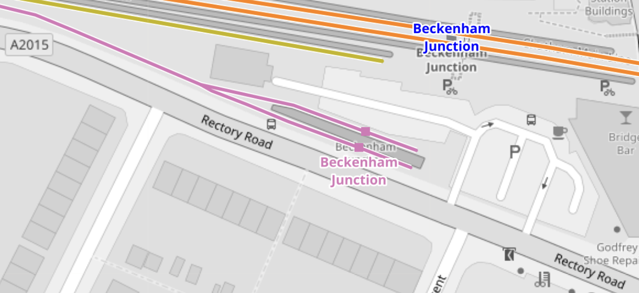
Note.
- The orange lines are the Chatham Main Line.
- The mauve line is the London Tramlink.
- There are a pair of short platforms for the London Tramlink.
- The platforms would be difficult to extend to the East.
- The platforms would be difficult to extend to the West, as the map above shows a building, just to the North of the junction of the two Tramlink platforms.
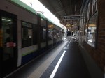
These pictures show Beckenham Junction station and the London Tramlink platforms.
The Wikipedia entry for Beckenham Junction tram stop, says this about the Tramlink service.
Tram services at Beckenham Junction are operated by Tramlink. The tram stop is served by trams every 10 minutes to Wimbledon via Croydon. This is reduced to a tram every 15 minutes on Saturday evenings and Sundays.
Perhaps, the solution to lengthen Tramlink platforms at Beckenham Junction is to do the following.
- Rebuild the building to the North of the junction of the two Tramlink platforms.
- Extend the two Tramlink platforms to the West.
- Move the junction between the two Tramlink platforms to the West.
These pictures show the building in detail.

Note.
- There is a Network Rail van outside the building.
- The building looks like it dates from about 2000, when the Tramlink was built.
- Perhaps, the building houses power supply or signalling equipment for the Tramlink.
After the modifications, operation would be the same, but longer trams could be handled.
Trams And Trains Between Birkbeck And Beckenham Junction Stations
This short section of track must be one of the most unusual and complicated in the UK.
- There are three dual National Rail and Tramlink stations; Birkbeck, Avenue Road and Beckenham Road.
- Each station has a single bi-directional National Rail track and/or platform.
- Birkbeck has a single bi-directional Tramlink platform.
- Avenue Road and Beckenham Road each have two Tramlink platforms.
Engineer; Baldrick was obviously having one of his cunning phases.
This map from OpenRailwayMap shows the track/platform layout at Birkbeck station/tram stop.
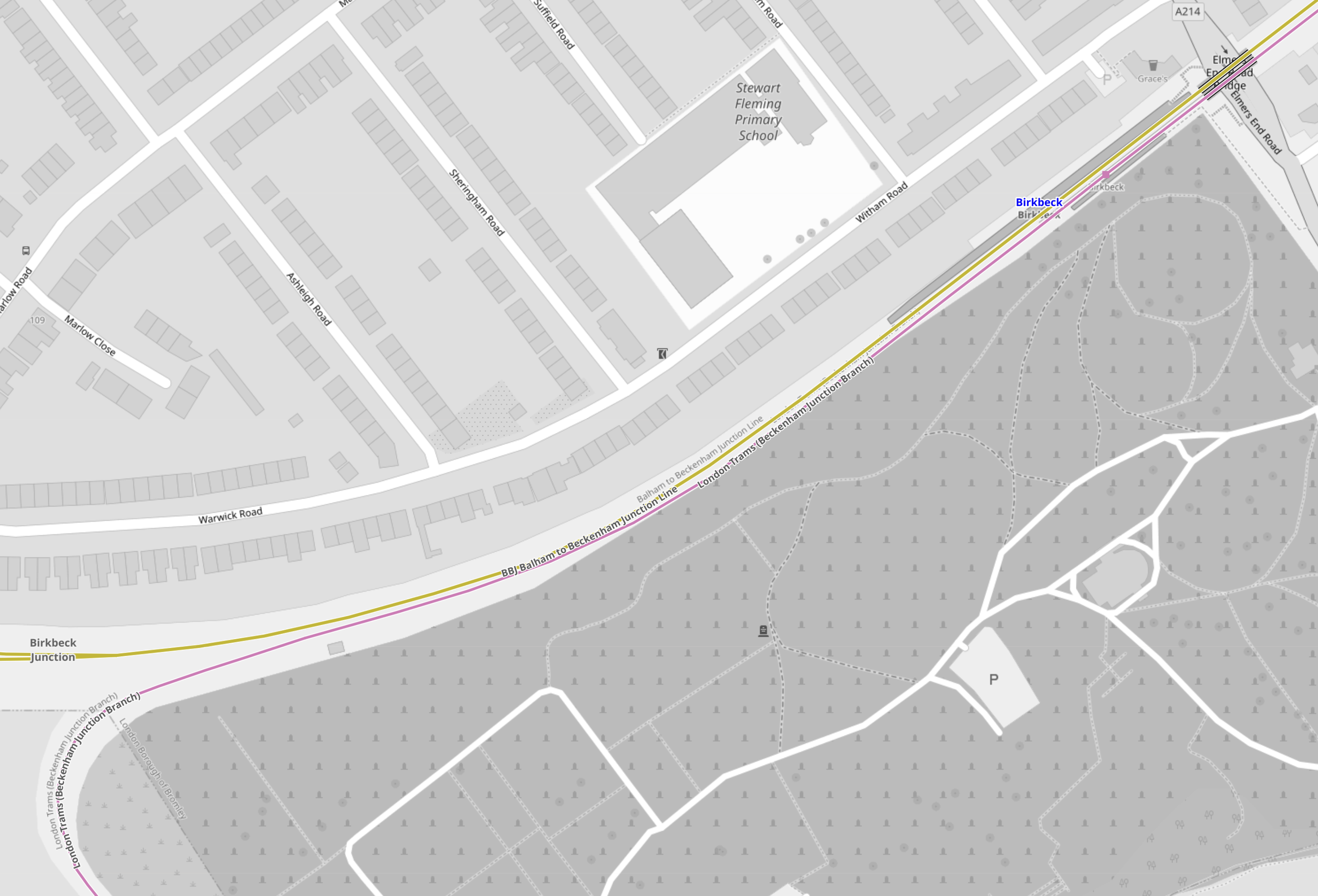
Note.
- The yellow line is the National Rail line between Crystal Palace and Beckenham Junction.
- The mauve line is the London Tramlink between Croydon and Beckenham Junction.
- There is no rail connection between the two lines.
Birkbeck station/tram stop has bi-directional platforms on both National Rail and London Tramlink.
These pictures were taken at the Birkbeck station/tram stop.

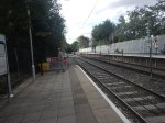
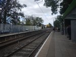
Note.
- The two bi-directional platforms.
- The wire fence between the tracks.
- The two tracks appear to be the same level, but the National Rail platforms seem quite a bit higher.
From the pictures, I would estimate that the Birkbeck tram stop platform is currently about thirty-five metres and could probably handle a forty metre tram with selective door opening.
This map from OpenRailwayMap shows the track/platform layout at Avenue Road station/tram stop.
Note.
- The yellow line is the National Rail line between Crystal Palace and Beckenham Junction.
- The National Rail line isn’t shown to have a platform.
- The mauve line is the London Tramlink between Croydon and Beckenham Junction.
- There is no rail connection between the two lines.
London Tramlink has a loop through the tram stop and each branch has a platform.
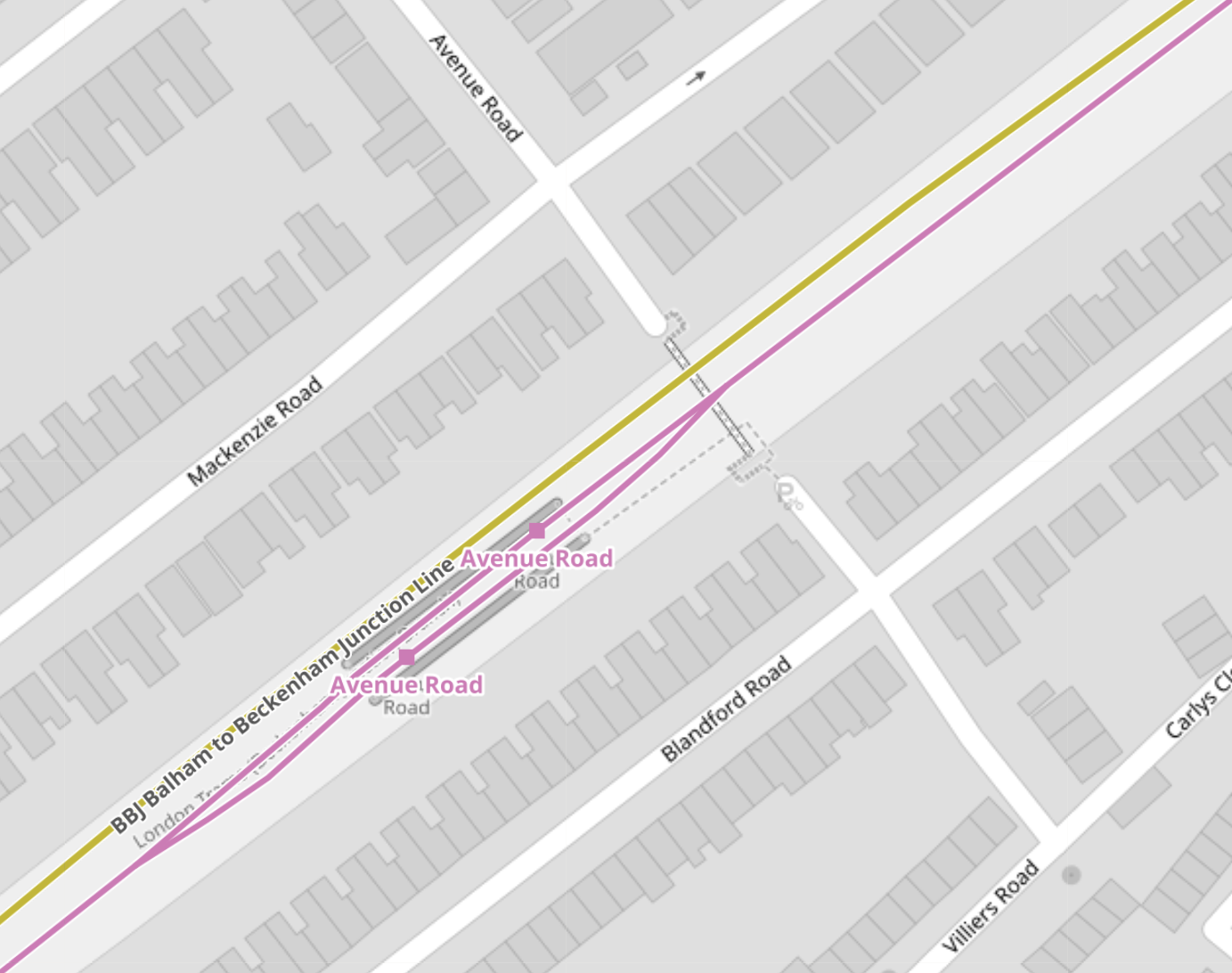
These pictures were taken at the Avenue Road tram stop.
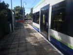
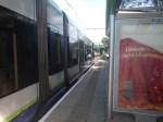
I would estimate the the loop at Avenue Road tram stop could handle a forty metre tram and possibly one of forty-five metres, judging the loop against this thirty-two metre Stadler tram.
This map from OpenRailwayMap shows the track/platform layout at Beckenham Road station/tram stop.
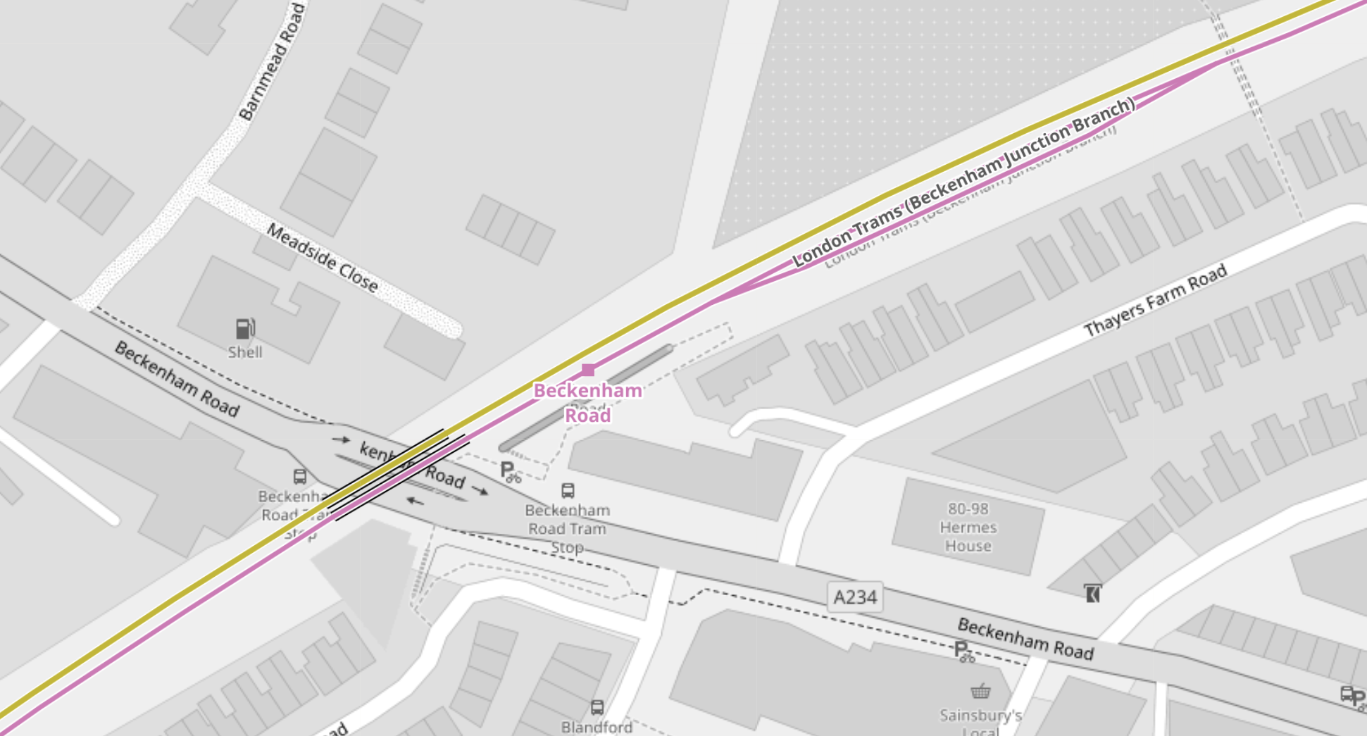
Note.
- The yellow line is the National Rail line between Crystal Palace and Beckenham Junction.
- The National Rail line isn’t shown to have a platform.
- The mauve line is the London Tramlink between Croydon and Beckenham Junction.
- There is no rail connection between the two lines.
The London Tramlink has a single bi-directional platform.
There is also a loop in the London Tramlink to the East of Beckenham Road station/tram stop to allow trams to pass.
These pictures were taken at the Beckenham Road tram stop.
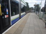
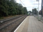
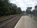
Note.
- A train conveniently came through from London Bridge to Beckenham Junction, when I was taking pictures.
- Several pictures show trams using the loop to the East of the tram stop.
- Both types of tram were pictured in the tram stop.
- The platform in the tram stop is wide.
From the pictures, I would estimate that the Beckenham Road tram stop platform is currently about thirty-five metres and could probably handle a forty metre tram with selective door opening.
Tram-Train Operation Between Birkbeck And Beckenham Junction Stations
I am certain that if this track was being designed today, tram-train operation would be used.
- There would be two tracks, with one for each direction, through Birkbeck, Avenue Road and Beckenham Road stations.
- Both tracks would have dual-height platform at each station/tram stop, so tram and train passengers got level boarding.
- Trains would use third-rail power and trams would use battery-power.
Unfortunately, tram-trains didn’t exist, when the London Tramlink was designed.
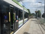
Handling Longer Trams At New Addington Tram Stop
This map from OpenRailwayMap shows the platform layout at New Addington tram stop.
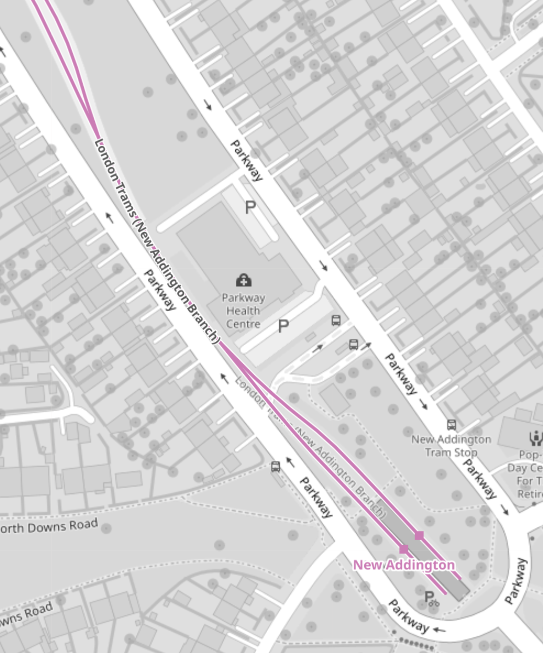
These pictures show the New Addington tram stop and the London Tramlink platforms.
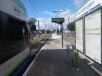
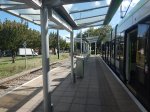

If some of the grassland around the platforms was allocated to the tram stop, I suspect the platforms could be lengthened.
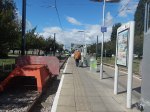
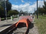
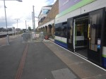
Handling Longer Trams At Wimbledon Station
This map from OpenRailwayMap shows the platform layout at Wimbledon station.
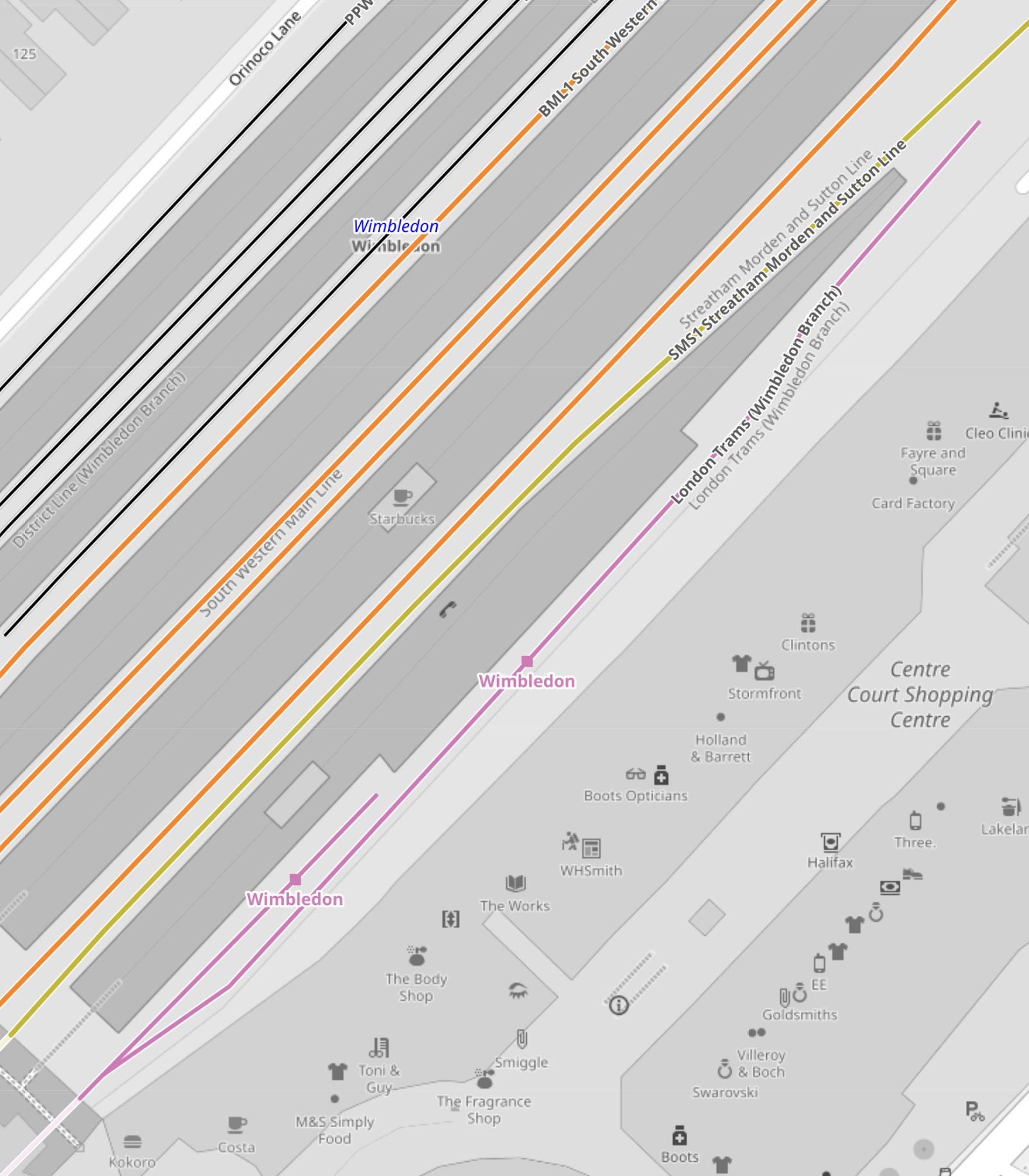
Note.
- The mauve line is the London Tramlink.
- There are two platforms; 10A and 10B, which are indicated with a separate dot.
- Platform 9, which is used by Thameslink, is the other side of Platform 10, so interchange to Thameslink is excellent.
- The main tram platform 9/10 is wide.
- The platforms are step-free to the trams, with lifts to the station bridge and the other platforms and Way Out.
I suspect that when the second platform was built, both platforms were made longer than the thirty-two metres needed for the Stadler trams.
These pictures show the two platforms.
Could another platform be created on the other side of the tracks to give better access to the tracks?
Conclusions
My first conclusion is that the London Tramlink could be run by a new fleet of the same number of trams, that were a few metres longer than the current 30.7/32 metres of the current trams.
- I suspect that forty metre trams would be possible, with a few modifications to platforms.
- It might even be possible to have forty-five metre trams, with a more substantial rebuild at Beckenham Junction.
- Trams could overhang platforms and selective door opening could be used.
- Forty metre trams would carry 25 % more passengers than the current trams.
- The Elmers End and Wimbledon terminals already seem to be capable of handling forty metre long trams and possibly could take trams a few metres longer.
I suspect that Elmers End and Wimbledon, could be the first route, where the longer trams were introduced, as the trams should be able to shuttle between the two end terminals to the current timetable.
The New Addington tram stop would be brought into operation next.
- Platforms would be lengthened as required.
- Trams operate a frying pan loop from New Addington to Croydon, with an Off Peak frequency of 7-8 minutes.
- I suspect that one platform won’t be able to handle this frequency.
- The last point probably means that the two platforms will need to be lengthened.
Works at the New Addington tram stop could be tricky, but not substantial.
Initially, the service to Beckenham Junction could be run by the existing Stadler Variobahn trams.
I believe that a lot of work will need to be done to get Beckenham Junction ready for the new trams if they are longer, which I suspect they are.
- The Network Rail installation will have to be relocated.
- The two platforms will have to be lengthened.
I suspect the works will be substantial.
But I do believe, that there is scope to plan all the works at the terminals, so they can be done efficiently, whilst at least maintaining a partial service.
My second conclusion, is that it will be possible to build a financial model, which shows infrastructure costs against tram lengths.
Longer trams will cost more and cost more for infrastructure, but they will carry more passengers and collect more fare revenue.
Riding Into the Future: Germany’s Pioneering Hydrogen-Powered Tram Project
The title of this post, is the same as that as this article on bnn Breaking.
This is the sub-heading.
Explore Germany’s groundbreaking project to develop a fuel cell-powered tram, leading the charge in sustainable urban mobility and reimagining the future of public transportation.
These are the first two paragraphs.
In the quiet, industrious corners of Germany, a revolution is unfolding on the tracks of public transportation. A consortium led by Hörmann Vehicle Engineering, alongside partners Heiterblick, Flexiva Automation & Robotik, and Technische Universität Chemnitz, has embarked on a groundbreaking journey to conceptualize, design, and test what could be the world’s next leap in eco-friendly mass transit: a hydrogen-powered tram. The project, aptly named the Hydrogen Tram for Next Generation, merges the realms of innovation, sustainability, and practicality, aiming to redefine urban mobility in ways we’ve only begun to imagine.
The project’s heart beats with a simple yet ambitious goal: to create a fuel cell-powered tram that doesn’t just exist as a prototype but thrives as a model for future public transportation. This initiative isn’t just about building a tram; it’s about reimagining the entire ecosystem surrounding urban mobility. From devising a robust refueling strategy to simulating operations and testing the fuel cell system, the collaborators are leaving no stone unturned. The project, with a generous €8 million budget, is buoyed by support from the federal government’s national hydrogen and fuel cell technology innovation program. This isn’t merely an experiment; it’s a statement of intent by Germany to lead the charge in sustainable transit solutions.
I have a few thoughts.
Chemnitz
These pictures show Chemnitz and its trams.


Note.
- Chemnitz used to be called Karl Marx Stadt.
- Chemnitz has some hybrid trams and tram-trains.
- I described how the Chemnitz trams work in Chemnitz Trams And The Chemnitz Model.
Chemnitz could be a very suitable place to try out the technology.
Hence, the involvement of Chemnitz University in the project doesn’t surprise me.
Tram-Trains
This article on Railway Gazette International, which is entitled Hydrogen Tram Development Project Underway, is also about the same project.
This is the first paragraph.
The Hydrogen Tram for Next Generation project has been launched to develop a fuel cell-powered vehicle which would enable services to be extended into new areas and tram-train routes created without the need for electrification.
It looks like this was added in the translation.
Tram Trains In South London
In The Third-Rail Tram-Train, I postulated using third-rail tram trains to extend the London Tramlink.
Since then Merseyrail have tried to extend, their third-rail electrified network and been told they couldn’t.
I have written these posts about using tram-trains to extend the London Tramlink.
- Could There Be A Tram-Train Connection At Reeve’s Corner?
- Would Third-Rail Tram-Trains Affect The Design Of The Proposed Streatham Interchange Station?
- The Cranleigh Line
- Thoughts On The Sutton Loop Line
- Could Third-Rail Tram-Trains Work The Epsom Downs Branch?
- Could Third-Rail Tram-Trains Be Used To Increase Services In South London?
- Could Beckenham Junction To Birkbeck Be Run Using Third-Rail Tram-Trains?
- Could Tram-Trains Be Used To Advantage In Croydon?
So would a hydrogen-powered tram-train be useful technology to extend the London Tramlink?
It just could be!
Zero-Carbon Between Manchester and Sheffield
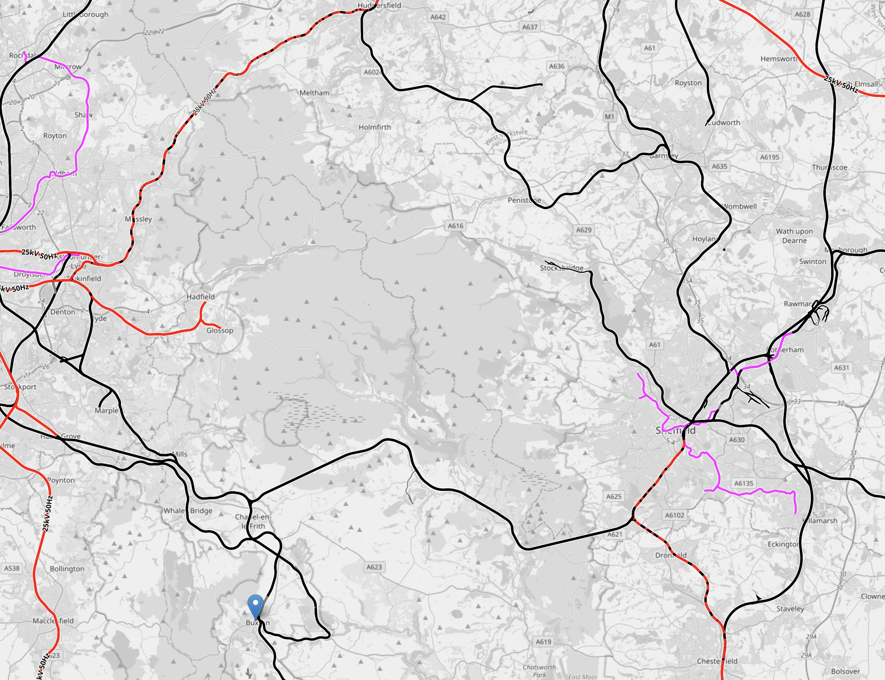
This OpenRailwayMap shows the electrification across the Pennines.

Note.
- Red lines are electrified with 25 KVAC overhead.
- Mauve lines are tram lines electrified with 750 VDC overhead.
- The mauve lines in the West are the Manchester Metrolink.
- The mauve lines in the East are the Sheffield Supertram
- Black lines are not electrified.
- Red and black lines are currently being electrified.
- The blue arrow at the bottom of the map indicates Buxton.
- To the North of Buxton, the line linking Manchester and Sheffield is the Hope Valley Line.
- Running North-East from Manchester is the main TransPennine route between Leeds and Manchester via Dewsbury and Huddersfield.
This OpenRailwayMap shows the TransPennine route between Morley and Mossley stations.
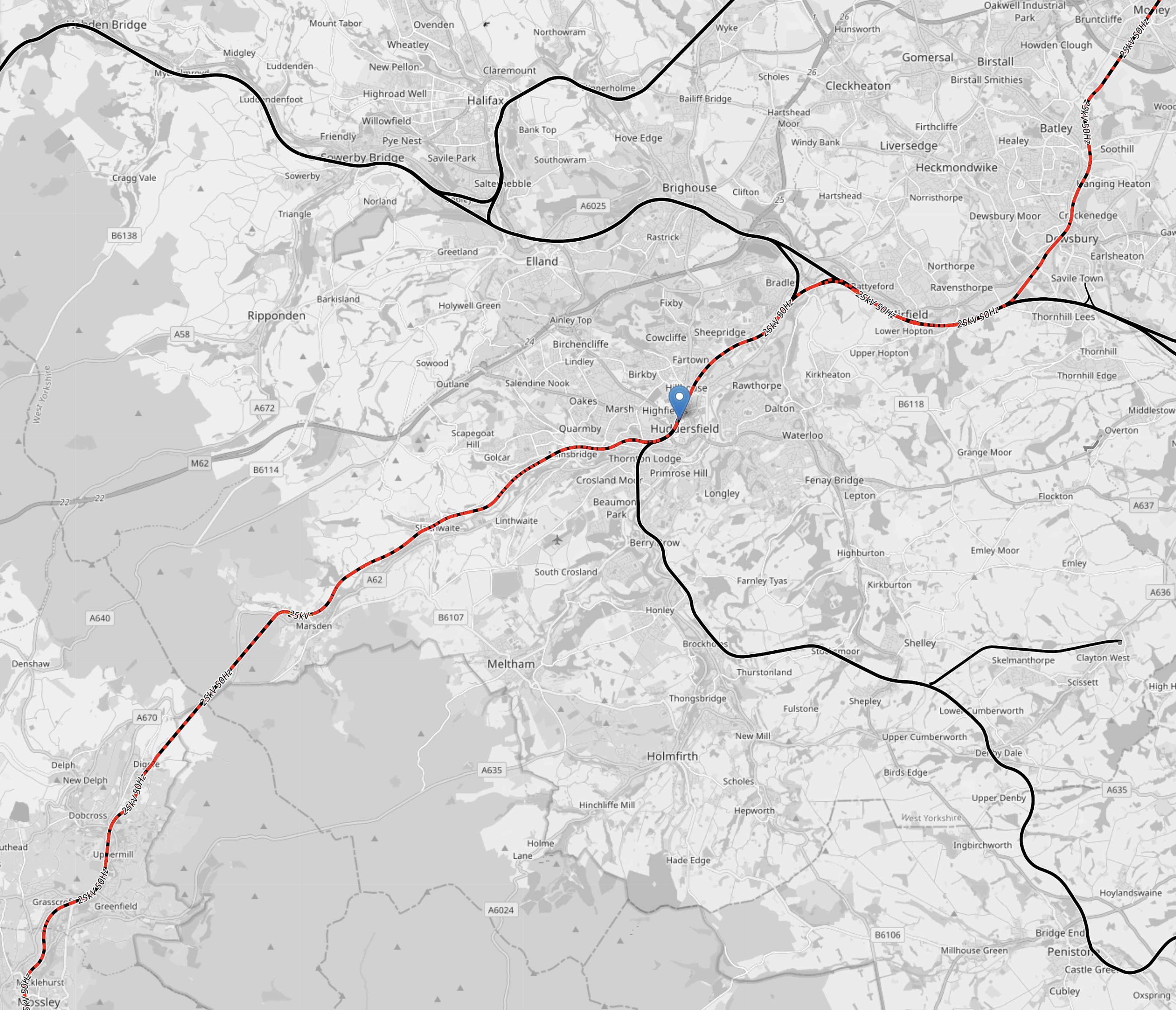
Note.
- Colours are as before.
- Morley station is in the North-East corner of the map.
- Huddersfield station is indicated by the blue arrow in the middle of the map.
- Mossley station is in the South-West corner of the map.
In a few years time, there will be 25 KVAC overhead electrification all the way between Leeds and Manchester via Dewsbury and Huddersfield.
This OpenRailwayMap shows the routes around Manchester and Sheffield and the connecting routes between Barnsley, Huddersfield, Manchester and Sheffield.
Note.
- Colours are as before.
- The blue arrow at the bottom of the map indicates Buxton.
- The line to Stocksbridge runs North-West from Sheffield.
- To its East the Penistone Line runs to Huddersfield via Barnsley.
- Manchester has a series of lines to the East that need to be electrified.
How many of these lines could be integrated into the tram systems of Manchester and Sheffield, by the use of hydrogen-powered tram-trains?
Hydrogen-powered tram-trains could share lines with battery-electric trains.
Tram-trains could run from say Cathedral in Sheffield to Piccadilly Gardens in Manchester.
Using self-powered trains would cut the need for expensive infrastructure.
The possibilities are endless and carbon free.
Conclusion
Hydrogen-powered trams and tram-trains could be a valuable tool for decarbonising trams and trains.
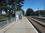
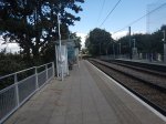
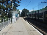
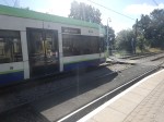
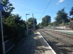
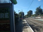
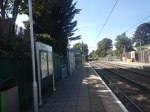
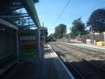
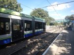
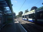
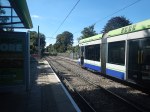
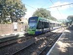
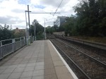
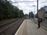
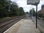
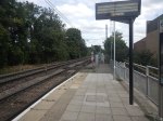
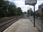
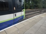
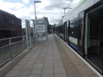
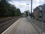
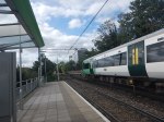
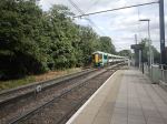
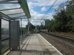
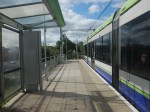
Penistone Line – 15th December 2023
I took these pictures on the Penistone Line today.
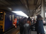
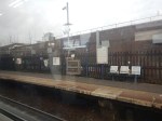

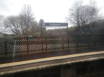
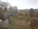
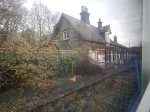


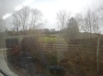

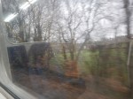
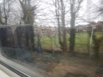
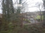


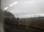


Note.
- I started at Sheffield station and travelled to Huddersfield station, before returning to Sheffield on the next train.
- The trains run hourly.
- There are 15 stops.
- The route had good views but it didn’t seem the train worked that hard.
- The route is 36.4 miles and trains are timed to take 75 minutes.
- That is an average speed of 29.1 mph.
- Most services were run by two car Class 150 trains, but some were run by three-car trains.
- The two trains I used were well patronised.
I have some thoughts and observations.
Could The Service Be Run Faster?
Consider.
- 29.1 mph doesn’t seem very fast.
- The maximum speed is 50 mph or less in places.
- The line North of Barnsley is single-track with passing loops at Penistone and Stocksmoor.
- Some of this single-track is on top of high viaducts, so could be difficult to double.
- Between Barnsley and Sheffield is double-track.
- To do the journey in an hour would need an average of 36.4 mph.
- Typically, Greater Anglia run their Class 755 trains at 34-36 mph.
As the Penistone Line has 15 stops, an electric train with faster acceleration and deceleration might be ideal for the route.
But I suspect it would be tight, but possible to do the journey in an hour.
Help And Money Is On Its Way!
This article on Kirkless Together is entitled £48million Funding Boost To Get Penistone Rail Line On The Right Track.
This is the first paragraph.
The government have just announced that we’ve been successful in a bid to their Levelling Up Fund for £48million, to support major improvements to the Penistone rail line.
That certainly sounds like a good start.
The article sums up what the funding means like this.
This funding means we’ll be able to improve the infrastructure along this rail line, and improve access as well. This will make the Penistone line a really important link between Huddersfield, Barnsley and Sheffield!
Improvements are outlined in this paragraph.
It will include station improvements creating better access and waiting facilities, increasing the speed of travel along the line and upgrading the rail infrastructure – including doubling sections of track, which will allow for two trains to travel on the northern section of the line every hour, in both directions.
Note.
- I feel that the current track layout could allow a theoretical two trains per hour (tph) service North of Barnsley, if both passing loops at Penistone and Stocksmoor were to be used.
- But it might not be very resilient to late trains and other problems, so extra double-track might be desirable, if it made the route more reliable.
I would expect that if possible, the improvements would allow trains to go between Sheffield and Huddersfield in an hour, as that would definitely attract more passengers to the service.
Could Battery-Electric Trains Run The Service On The Penistone Line?
Consider.
- Both Sheffield and Huddersfield stations will be electrified in the next few years, so the power supplies will be able to support charging of battery-electric trains.
- Sheffield and Huddersfield is only 36.4 miles.
- Hopefully, the track improvements would make the route less severe.
- The Penistone Line is self-contained with no other services on much of the route.
- There is time to charge the train at each end of the route.
In an article in the October 2017 Edition of Modern Railways, which is entitled Celling England By The Pound, Ian Walmsley says this in relation to trains running on the Uckfield Branch, which is not very challenging.
A modern EMU needs between 3 and 5 kWh per vehicle mile for this sort of service.
I don’t think the terrain of the Penistone line is much different from the Uckfield branch, so what are the figures for a three-car-battery electric train?
The answer would appear to be somewhere between 328 and 546 kWh.
According to the data sheet is now on the Stadler web site, the battery size of a Class 777 train is 320 KWh.
I feel that an off the shelf battery electric train could work the Penistone Line.
Could Tram-Train Operation Be Used?
Consider.
- A Sheffield tram driver told me that Sheffield’s Class 399 Tram-Trains are excellent on hills.
- The cousins of the Class 399 Tram-Trains run a similar service between Karlsruhe and Baden-Baden in Germany on bigger hills.
- Battery-electric Class 399 Tram-Trains are available and are being tested in Wales.
- Sheffield station handles Huddersfield services straight into one of two single bay platforms.
- Huddersfield station handles Sheffield services straight into a single bay platform.
- Major improvements to the Penistone Line will allow two trains per hour on the line.
I suspect if two trains per hour can be run using using diesel multiple units operating as a shuttle, then battery-electric Class 399 tram-trains could do the same.
A Tourist Tramway Across The Pennines
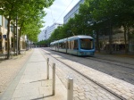
I feel there are possibilities to run tram-trains between Huddersfield and Manchester Piccadilly via Meadowhall and Sheffield stations.
This would create a unique tourist tramway across the Pennines.
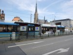
Huddersfield’s magnificient Grade 1 Listed station is being upgraded and electrified.
The Hope Valley Line has been upgraded in the last couple of years.
Through Sheffield will be upgraded and electrified for the Midland Main Line.
Stadler have built vehicles for lines like these in many places.
This could be the spectacular attraction that the North-Centre of England needs.
Wisbech To March Rail Link Options Being Discussed
The title of this post, is the same as that of this article on the BBC.
This is the sub-heading.
Four options for a “rail” service between the Fenland towns of Wisbech and March are being considered by Network Rail.
These four options appear to be.
- Conventional rail
- Tram-train
- Light rail
- Very light rail
Note.
- I suspect all modes have their supporters.
- But only the first two options would be able to connect to Ely or Cambridge.
- The last two options would probably just be a shuttle to March.
I have looked at the route on OpenRailwayMap and there is no less than a dozen level crossings between March and Wisbech.
Even for very light rail, the engineering costs of these level crossings will be large.
Conclusion
I have a feeling that the costs of the engineering required for this scheme might kill it.
Northern Trains Plans Framework Contract For 450 Multiple-Units
The title of this post, is the same as that of this article on Railway Gazette.
This is the first paragraph.
Northern Trains has invited expressions of interest in a framework contract covering the supply of up to 450 multiple-units to replace ‘significant quantities of its ageing fleet’.
These are other details.
- Firm orders would be placed in phases.
- The initial order would be for ‘multi-mode’ multiple-units.
- Battery-electric or electric-only trains would be included in subsequent orders.
- Trains would have a minimum design life of 35 years from acceptance.
- The ability for the multi-mode units to be converted to electric or battery-electric power as part of an ‘in-life decarbonisation’ programme.
These four paragraphs outline the framework agreement between Northern Trains, the train manufacturer and the owners, who will finance the trains.
The framework agreement would run for eight years, with Northern able to order rolling stock in multiple phases.
Each phase would include a train manufacturing and supply agreement and a technical support and spares supply agreement.
The supplier would provide tools and spare parts, and there would be options for the supply of mock-ups and a cab simulator. Northern is to run a separate procurement for an owning party which would purchase each fleet and lease it to the operator.
The owner would be party to each manufacturing and supply agreement, and there may be different owning parties for each order phase.
This is a well-thought out proposal, that would be worth around a billion pounds to the train manufacturer.
It would probably be based around a family of trains like Alstom’s Aventra, CAF’s Civity or Stadler’s FLIRT.
For a series of orders of such a value, I think we will see some excellent proposals.
The deal will transform rail travel in the North.
I have some thoughts.
Which Trains Will Be Replaced?
Northern Trains fleet includes these ageing trains.
- Class 150/0 diesel trains – 6 x three-car – 18 cars
- Class 150/1 diesel trains – 46 x two-car – 92 cars
- Class 150/2 diesel trains – 26 x two-car – 52 cars
- Class 155 diesel trains – 7 x two-car – 14 cars
- Class 156 diesel trains – 65 x two-car – 130 cars
- Class 158/0 diesel trains – 45 x two-car – 90 cars
- Class 158/9 diesel trains – 8 x three-car – 24 cars
- Class 319 electric trains – 12 x four-car – 48 cars
- Class 323 electric trains – 34 x three-car – 102 cars
- Class 333 electric trains – 16 x four-car – 64 cars
- Class 769 bi-mode trains – 8 x four-car – 32 cars
Note.
- These total to 273 trains and 661 cars.
- If the 16 Class 170 trains, which are of three-cars, were also to be replaced. that would bring the total trains to be replaced to 289 trains and 709 cars.
I would expect the difference between 273-289 current trains and 450 trains in the article, is explained by new services and increased services on certain routes.
Which Trains Could Be Retained?
Northern Trains fleet includes these new trains.
- Class 195 diesel trains – 25 x two-cars – 50 cars
- Class 195 diesel trains – 33 x three-cars – 99 cars
- Class 331 electric trains – 31 x three-cars – 93 cars
- Class 331 electric trains – 12 x four-cars – 48 cars
Note.
- These trains were all built by CAF in the last five years.
- These total to 101 trains and 290 cars.
But if they have an expected life of 35 years, the diesels will have to be converted to zero-carbon trains.
Will The CAF Trains Be Retained?
Consider.
- If all the ageing trains and those not built by CAF were to be replaced then that would be 289 trains and 709 cars.
- If the nearly-new CAF trains were also to be replaced that would be 390 trains and 999 cars.
- Add in a few more trains for expanded services and you’re got the figure of 450 trains given in this article.
- If the CAF trains were to be replaced, then Northern Trains would have an homogenous fleet of new trains from one manufacturer, with all the advantages in operation and maintenance.
On the other hand, I haven’t read any bad criticism of these CAF trains, so I will assume that there is no pressing reason to replace them.
And of course Northern Trains could have an homogenous fleet of new CAF trains.
This is said in the article.
The supplier would provide tools and spare parts, and there would be options for the supply of mock-ups and a cab simulator.
As this is specifically mentioned, do Northern lack a simulator for driver training?
What About The Manchester Bee Network And Other Local Networks?
Will these networks want to take control of their local trains?
If there is an homogenous fleet of new trains from one manufacturer, then surely, it would be easier to give control of some routes to the local transport interests.
Training and driver rostering could be retained in what was left of Northern Trains.
Tram-Trains
Tram trains would be an added complication, but as the South Wales Metro is showing, tram-trains are an interesting way of expanding a network.
