Could Anglia Railways’ London Crosslink Be Recreated As Part Of The London Overground?
This is the first paragraph of the Wikipedia entry for the original London Crosslink.
London Crosslink was a passenger train service operated by Anglia Railways between Norwich and Basingstoke, using the North London Line to bypass central London. Class 170 Turbostar diesel multiple units were used, and the service operated between 22 May 2000 and 28 September 2002, supported by funding from the Strategic Rail Authority through its Rail Passenger Partnership fund.
Note.
- The service called at Diss, Stowmarket, Ipswich, Colchester, Whitham, Chelmsford, Ingatestone, Romford, Stratford, Highbury & Islington, Camden Road, Willesden Junction, West Hampstead Thameslink, Brentford, Feltham, Staines, Woking, and Farnborough (Main)
- It ran six times on Monday to Friday and five times on Sunday.
- Feltham and Woking stations have a coach link to Heathrow.
- Journeys took around 3 hours and 44 minutes.
Over the years, attractions and other rail lines and stations served by the route have changed. improved and been added.
- In 2006, the Arsenal’s Emirates Stadium opened within walking distance of Highbury & Islington station.
- In 2012, the Olympic Stadium opened at Stratford and is now used by West Ham United.
- In 2020, Brentford Stadium opened within walking distance of Brentford station.
- There are long-term plans for a station at Brentford stadium.
- In 2022, Romford and Stratford stations were connected to the Elizabeth Line.
- In 2025, Beaulieu Park station was added to the Greater Anglia Main Line.
- In 2026, both ends of the route came under the control of Great British Railways.
At some point in the future, Old Oak Common Lane station will open to link the route to High Speed Two, the Great Western Main Line and the Elizabeth Line.
In Can The Signalling Of The London Overground Be Improved?, I looked in detail at the signalling of the London Overground and if it could handle more trains.
My conclusion was that on the East and North London Lines, another three trains per hour (tph) could probably be accommodated, which over an average day was probably around sixty trains.
As a restored London Crosslink would need just six paths per day, I would suspect the service could be restored, if it were thought to be a good idea.
I certainly feel that capacity would not be a problem.
These are a few other thoughts.
Will There Be Political Problems?
Providing the London Mayor approves, I can’s see any problem with Labour and I can’t see other parties objecting if passengers like it.
Would It Be Sensible To Use Lumo Branding And Trains?
Consider.
- Lumo is trusted branding.
- A five-car Lumo Class 803 train is 132 metres long and a pair of four-car London Overground Class 710 trains is 166 metres long, so I suspect platform length problems will be minimal.
- I doubt there will be problems on the Greater Anglia network.
- Stratford and Norwich is mainly a 100 mph network.
- Not all parts of the route have 25 KVAC overhead electrification, but batteries can be fitted to the Class 803 trains, that will cover any gaps.
- My calculations show that the modern trains will be twenty-two minutes quicker, than Anglia Railways Class 170 diesel trains.
- At one point Anglia Railways was owned by First Group, so FirstGroup may have knowledge of the problems of the route.
I believe it would be sensible to use Lumo branding and trains.
Could The Route Be Extended?
Consider.
- It could probably be extended to Winchester, Southampton and Bournemouth in the South.
- If offshore hydrogen takes off at Great Yarmouth, it might be worth extending with a reverse to Yarmouth in the North.
- Yarmouth has had a direct service from London in the past.
The service could also develop days out by the sea.
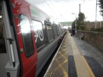
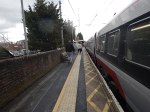
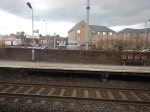
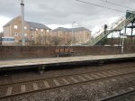
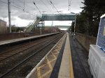
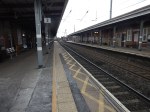
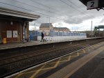
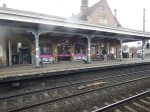
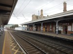
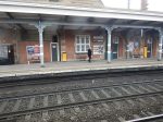
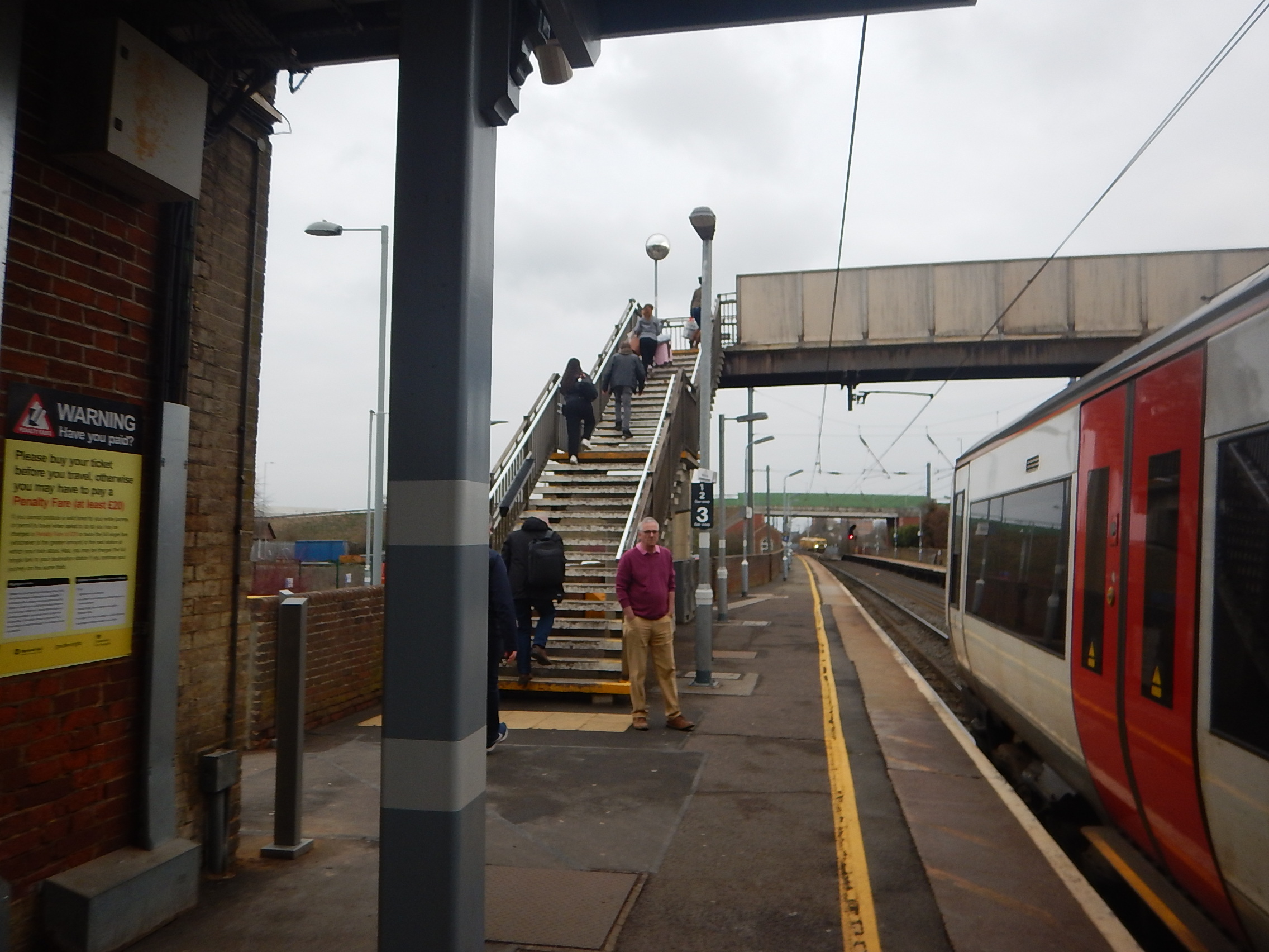
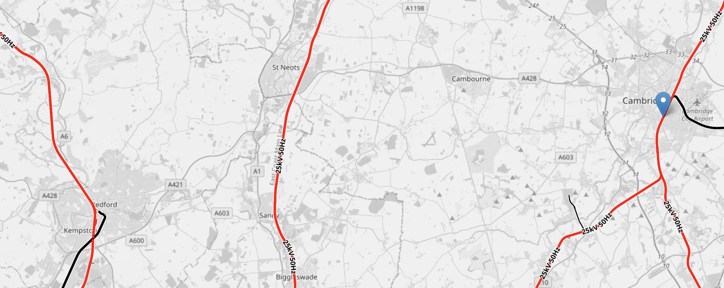
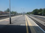
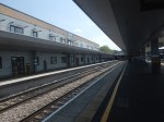
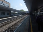
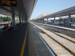
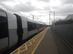
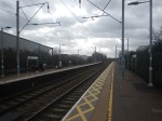
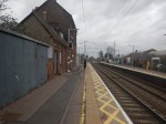
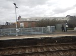
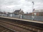
Stowmarket Station – 14th March 2025
tThe one and only time, that I’ve used Stowmarket station, was when I’d taken my Lotus in for a service near Diss and I was getting back to Newmarket, with a change at the station.
So as I was going to Stowmarket station, I felt with the judicious use of a East Anglian Ranger ticket, I could combine the trips to Stowmarket and Saxmundham stations.
I also wanted to look at the progress on the new footbridge that I wrote about in Stowmarket Station To Go Step-Free.
I took these pictures.

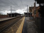
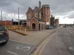
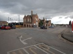
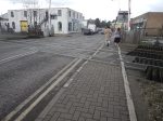
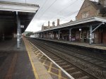

Note.
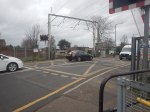
- I arrived on the Norwich-bound platform, crossed the tracks by the level crossing and then left from the Ipswich-bound platform.
- The station has a cafe.
- The footbridge in the pictures is a temporary one to ease construction.
- The station buildings are Grade II Listed.
There doesn’t appear to have been much progress on the new footbridge.
I do have some other thoughts.
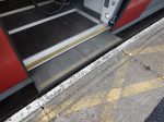
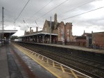
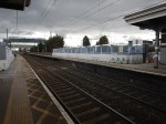
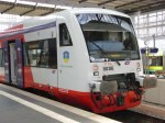
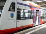
Greater Anglia’s Stadler Trains Are Step-Free Between Train And Platform
The first two and last pictures in the gallery show this feature.
I arrived on a Class 745 train and left on a Class 755 and both train classes have gap fillers, that do their job automatically.
We need more of this technology to protect the elderly, those with restricted movement and the just untrained stupid.
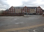
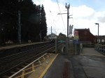
Housing By The Station
It appears that two blocks of flats have been built on railway land or the station car park.
The bridge also appears to give the owners and residents access across the railway.
Is this thoughtful holistic design or just a bribe to get planning permission?
Who Will Use The Footbridge?
Two main lines effectively cross at Stowmarket.
- The Great Eastern Main Line between Ipswich and Norwich goes through Needham Market, Stowmarket and Diss.
- The Ipswich and Ely Line between Ipswich and Cambridge goes through Needham Market, Stowmarket, Elmswell, Thurston, Bury St. Edmunds, Kennett, Newmarket and Dullingham.
So, if you need to go between say Newmarket and Diss, you would change trains at Stowmarket. Hopefully, the bridge will encourage train travel.
New Housing In East Anglia
On the main railway lines between Cambridge, Ipswich and Norwich, there used to be a lot more stations.
- There are eight closed stations between Stowmarket and Cambridge.
- There are three closed stations between Stowmarket and Ely .
- There are two closed stations between Stowmarket and Ipswich.
- There are eight closed stations between Stowmarket and Norwich.
Note.
- A new Soham station was built between Stowmarket and Ely. Passenger numbers are rising with each year.
- I have double-counted Higham and Saxham and Risby stations on both the Ely and Cambridge routes.
- But that still leaves nineteen stations, that might be good sites to build new houses.
- The East-West Railway intend to build a new A14 Parkway station to link the A14 road to the Ipswich and Ely Line.
- When housing is taken into account, some stations will give a better return on investment.
Could the new footbridge at Stowmarket be part of a wide ranging plan to build more housing in towns and villages along the railways of East Anglia?
Was The Old Footbridge Too Low?
This picture was taken of the old bridge.
Was the bridge too low for some container trains?
Porterbrook Raises £250m Of New Green Private Placements
The title of this post, is the same as that of this article on Railway Gazette.
This is the sub-heading.
Porterbrook, the UK’s leading rolling stock financier and asset management company, is delighted to announce the successful closing of its £250m Private Placement.
These are the first two paragraphs.
The transaction, which includes existing and new investors, has enabled the company to extend its debt maturity profile at attractive pricing and further diversify its investor base of US, UK and Swiss institutions.
Porterbrook owns a quarter of the national passenger rail fleet, and in recent years has significantly diversified its portfolio including taking ownership of the Long Marston Rail Innovation Centre in Warwickshire, confirming a 49% stake in Brodie Engineering in Kilmarnock, and financing the redevelopment of Bletchley Depot for West Midland Trains.
We must be doing something right on the railways, if US, UK and Swiss institutions are prepared to back them financially.
But then Aviva, who were formerly Norwich Union, backed Greater Anglia’s new Swiss trains.
Conclusion
Despite what some might think, it would appear that green investments aren’t all bad.
Plans For Powering Trains And Details Of Our Upcoming Consultation
The title of this post, is the same as that of a news item on the East West Rail web site.
This is the sub heading.
We’re pleased to share plans for how we’ll power trains on East West Rail, as well as information and dates of our public consultation on latest proposals for the project.
These are the first two paragraphs.
As part of our latest proposals, which we’ll be sharing for public consultation from 14 November, we’re providing information on our preference for green traction power in the form of discontinuous electrification with hybrid battery-electric trains, after the Chancellor confirmed government support for the project in yesterday’s budget.
As well as reducing carbon emissions, discontinuous electrification would mean overhead lines would only need to be installed along some sections of the route, which would reduce disruption to existing structures and potentially reduce visual impacts in more sensitive locations on the new railway between Bedford and Cambridge. This option would also cost less than full electrification and would need less land for things such as mast foundations.
There is also a short video, which explains discontinuous electrification.
I feel that to use discontinuous electrification and hybrid battery-electric trains is the way to go on this railway between Oxford and Cambridge.
- It is a zero-carbon solution.
- There is electrification at Reading. Didcot, Bletchley, Milton Keynes, Bedford and Cambridge along the route, so grid connections will be already available.
- Sandy, where East West Rail crosses the East Coast Main Line, is fully electrified and must have a grid connection.
- A small article in the November 2024 Edition of Modern Ralways, says that Hitachi are developing a smaller battery for commuter and suburban trains.
- Didcot to Oxford could be electrified and there is already a grid connection at Didcot.
Discontinuous electrification could be used to extend East West Rail to Norwich, Ipswich and Colchester.
These are my detailed observations and thoughts.
Existing Electrification
This OpenRailwayMap shows the electrification between Oxford and Bedford.
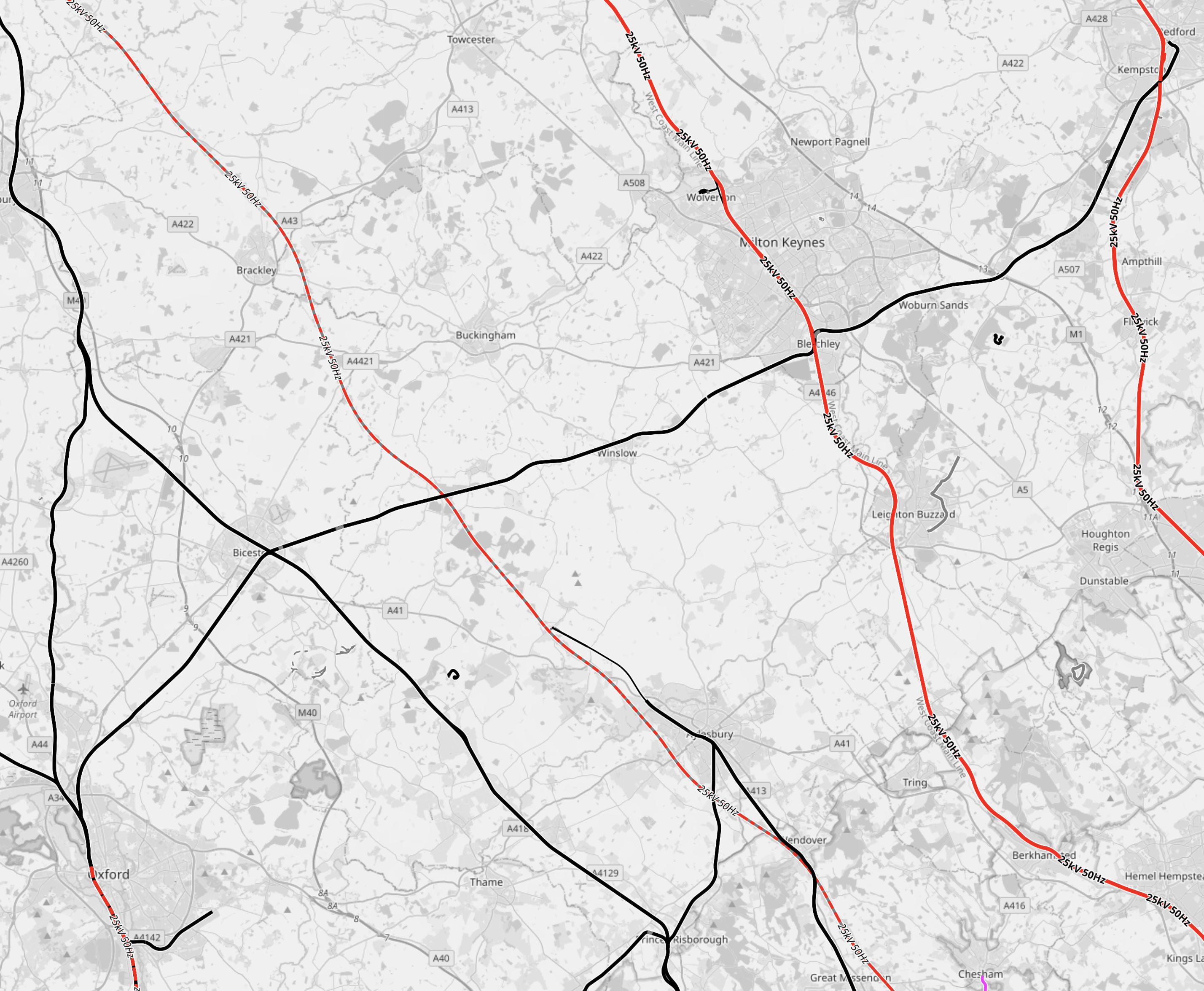
Note.
- Bold red lines are tracks electrified at 25 KVAC.
- Bold black lines are tracks without electrification.
- Oxford is in the South-West corner of the map.
- Bedford is in the North-East corner of the map.
- The bold black line of the Western section of the East West Rail connects the two cities.
- The lines through Oxford are shown as being electrified. The black stub pointing East to the South of Oxford is the Cowley Branch.
The rail lines crossing East West Rail from West to East are as follows.
- Chiltern Main Line – Not Electrified
- High Speed Two – Will Be Electrified
- West Coast Main Line – Electrified
- Midland Main Line – Electrified
I suspect all lines, except for the Chiltern Main Line, will be able to provide a grid connection for East West Rail.
This second OpenRailwayMap shows the electrification between Bedford and Cambridge.
Note.
- Bold red lines are tracks electrified at 25 KVAC.
- Bold black lines are tracks without electrification.
- Bedford is in the South-West corner of the map.
- Cambridge is in the North-East corner of the map.
- The Eastern section of the East West Rail connects the two cities.
- Both maps are to the same scale
The rail lines crossing East West Rail from West to East are as follows.
- Midland Main Line – Electrified
- East Coast Main Line – Electrified
- West Anglia Main Line – Electrified
I suspect all lines will be able to provide a grid connection for East West Rail.
Distances Without Electrification
These sections are not electrified.
- Oxford and Bletchley – 47.2 miles
- Bletchley and Bedford – 16.5 miles
- Bedford and Cambridge – 29.2 miles
- Ely and Norwich – 53.7 miles
- Norwich and Great Yarmouth – 18.4 miles
- Cambridge and Haughley Junction – 41.3 miles
I am assuming that the East West Rail could extend past Cambridge on these two routes.
- Ely, Thetford, Norwich and Great Yarmouth.
- Newmarket, Bury St. Edmunds, Stowmarket, Ipswich, Manningtree and Colchester.
All sections have electrification at both ends, if Didcot Junction and Oxford is electrified, as is expected to happen.
Train Battery Range Needed
The route layout, I have proposed means that if you go for the battery-electric train with the longest battery range you can afford and it can’t handle Ely and Norwich, the existing electrification can be extended to bridge the gap.
Application Of Discontinuous Electrification To Greater Anglia And Chiltern Railways
If discontinuous electrification can be applied to East West Rail, it can surely be applied to Greater Anglia and Chiltern Railways, given the fact that the route networks of all three companies overlap and share tracks.
Greater Anglia already have a fleet of Class 755 trains, which are designed to be converted to battery-electric operation.
With batteries fitted, I believe that these trains could handle most of the current routes they do now.
The other routes would be handled with selective lengths of overhead electrification in terminal stations to charge the trains before return.
Electrification Between Oxford And Bicester Village Stations
Oxford station has two North-facing bay platforms, that are used by Chiltern and other services terminating at the station from the North.


Note.
- Chiltern Railways already run two trains per hour (tph) between these platforms and Marylebone.
- I would assume the platforms will be used by East West Rail services, that terminate at Oxford station.
- If discontinuous electrification is to be used, then these two platforms could be electrified to charge trains before they return.
- East West Rail have not published their proposed services yet, but it could be one tph to both Milton Keynes Central and Bedford stations.
I can see Chiltern buying battery-electric trains to run services between Marylebone and Oxford, and some other routes.
Marylebone and Oxford is 66.7 miles, which is probably two far for even Stadler’s remarkable battery-electric trains, but if say between Oxford and Bicester Village station were to be electrified, would it make it possible to run battery-electric trains between Marylebone and Oxford with charging at both end of the route.
In Chiltern Sets Out New Fleet Ambitions, I talk about Chiltern’s possible new fleet, as proposed by their MD in September 2023.
Stadler Presents A World First In Berlin
The title of this post, is the same as that of this press release from Stadler.
These are the first two paragraphs.
With the RS ZERO, the rail vehicle manufacturer is presenting the successor to the successful Regio-Shuttle RS1 model. There is a choice of two modern and environmentally friendly drive technologies: Hydrogen and battery. Both will enable CO2 emission-free operation of secondary lines in the future.
Stadler today unveiled the prototype of the new RS ZERO, the innovative successor to the successful RS1 Regio-Shuttle. The Regio-Shuttle has been one of the most popular vehicles in German regional rail transport for 28 years, with around 500 RS1 vehicles currently in operation in Germany and the Czech Republic. Stadler is building on this proven technology and integrating state-of-the-art, environmentally friendly drive systems. The RS ZERO is optionally available with a hydrogen and/or battery drive and thus not only sets new standards for environmentally friendly rail transport, but also presents a world first.
These pictures from Chemnitz Trams And The Chemnitz Model, show the Regio-Shuttle RS1.


Note.
- The Regio-Shuttles can run as up to seven car trains.
- These Regio-Shuttles are electro-diesel.
- The distinctive diagonal windows.
- They can carry 170 passengers at 75 mph.
- They can run as train-trams using the Chemnitz model on compatible tram networks.
The Regio-Shuttle Wikipedia entry gives more details.
This image from the press release shows the prototype RS ZERO.
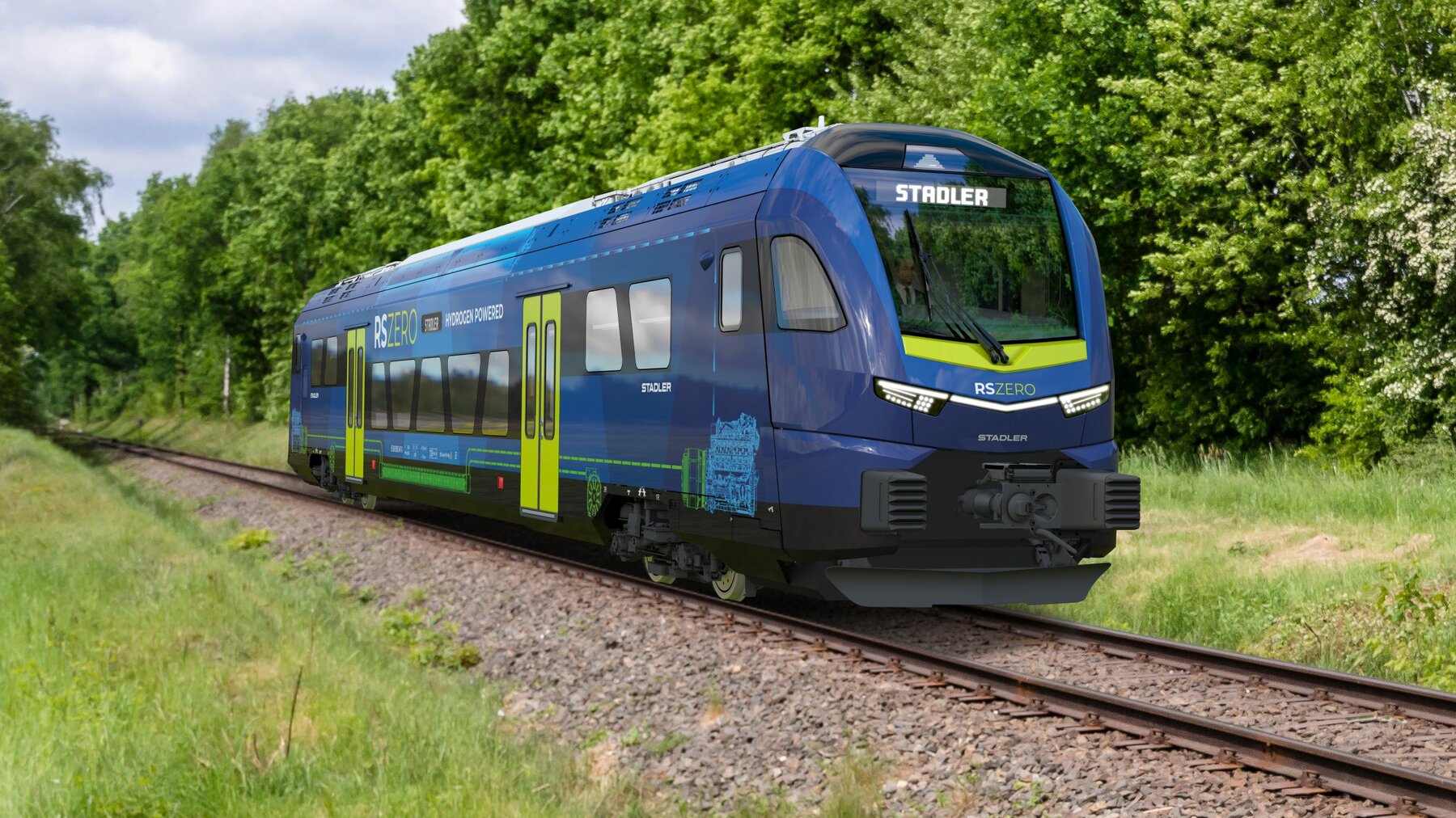
It looks very similar to my pictures from Chemnitz.
I have a few thoughts.
Comparison To A Class 150 Train
A Class 150 train can carry up to 149 seated passengers at 75 mph, which is similar to the RS ZERO.
As Stadler have built trains for Greater Anglia, Merseyrail and the Glasgow Subway, I believe that Stadler could build an RS ZERO, that would fit the UK loading gauge.
In What Train Is This?, I show the standard of interior, that can be achieved by refurbishing a Class 150 train, but unlike the RS ZERO, the train won’t be zero-carbon.
Does The RS ZERO Have A Toilet?
This is a paragraph from the press release.
The prototype of the RS ZERO presented today in Berlin is a one-car vehicle with hydrogen drive. Stadler is demonstrating the numerous design options with a multi-purpose area equipped for carrying bicycles, pushchairs and bulky luggage, lounge and comfort zones, standard and privacy seats, a wheelchair space, WC and a train office.
The train appears to be able to have what an operator might need.
What Will Be The Range Of An RS ZERO On Hydrogen?
I suspect, Stadler will provide a train, that will handle the route.
Conclusion
This could be a very handy train to decarbonise branch and secondary lines in the UK.
Minding The Gap: ‘It’s A Scandal, It’s A Death Trap’
The title of this post, is the same as that of this article on the BBC.
This is the sub-heading.
The announcement “mind the gap” is almost as much a part of travelling in London as the Tube sign or a red bus. But when is the gap between the train and the platform too far and too dangerous?
These are the first two paragraphs.
Eric Leach thinks he has the answer to that, and it is 30cm, or 12 inches. He knows this because while lying on the platform in agony having fallen over while getting off a train, he had time to look at the vertical drop between the train and the platform.
In February, at Ealing Broadway station in west London, he stepped off an Elizabeth line train onto the platform. Such was the force from the drop, that he broke a bone in his foot. He collapsed on the platform.
I went to Ealing Broadway station and took these pictures.
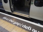

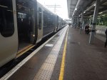
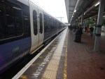
The gap is quite large, but not larger than many of the suburban trains in London.
These pictures are from Greater Anglia and Merseyrail.
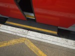
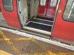

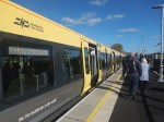
Note the gap-fillers below the door.
Conclusion
The Elizabeth Line can do better.
Sizewell C – South Park And Ride
This document on the Planning Inspectorate web site, is a description of the Southern Park and Ride for the Sizewell C Project.
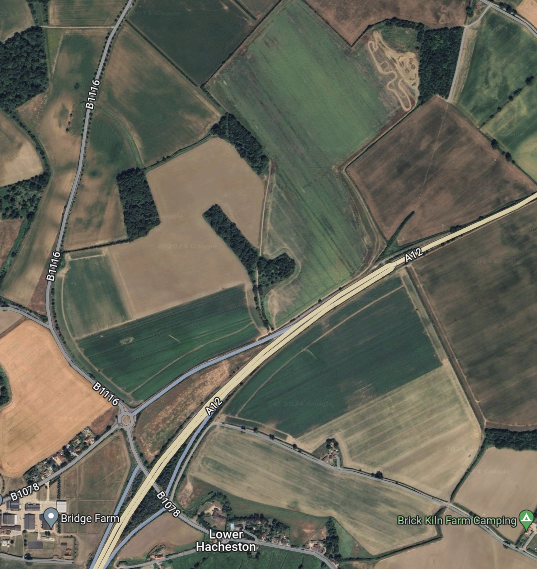
This Google Map shows the area of the Park-and-Ride site.
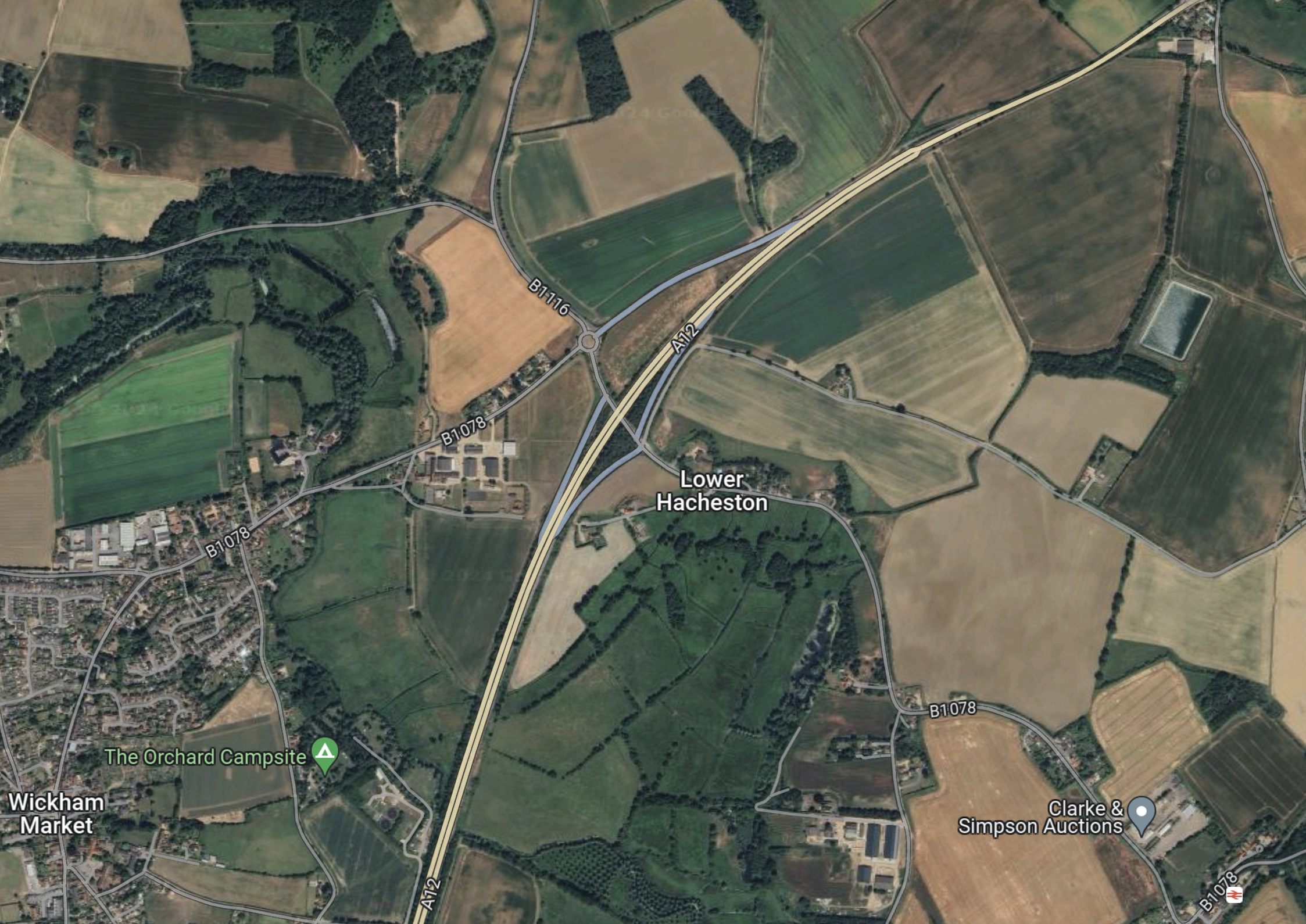
Note.
- Wickham Market is in the South-West corner of the map.
- The dual-carriageway is the Wickham Markey by-pass, which is part of the A12 between Ipswich and Lowestoft.
- Close to Lower Hacheston is the Northern junction of the by-pass which connects the B1116 and B 1078 roads to the A 12.
- If my memory serves me correctly, there is a small roundabout to the North of the A12, where the B 1116 and B 1078 cross, which is referred to as Fiveways Roundabout in some of the documentation.
- Wickham Market station is in the South-East corner of the map.
I know the area well, as I used to live less than ten miles to the West of Fiveways roundabout.
This shows the area to the North of Fiveways roundabout to a large scale.
The document on the Planning Inspectorate says this about the site.
The site comprises approximately 26.4 hectares (ha) of predominantly
agricultural land and highway land located north-east of Wickham Market.
The part of the site which would contain the parking and buildings, postal
consolidation building and Traffic Incident Management Area (TIMA) is
approximately 18ha in size, and located to the east of the B1078/B1116, to
the north of the A12. The remainder of the site encompasses a section of
the A12, and an associated slip road where highway improvements are
proposed to form the site access, and associated signage and road
markings, see Chapter 1, Figure 1.1 of this volume.
These are my thoughts.
There Is No Rail Connection
I wrote about the Northern Park-and-Ride in Sizewell C – North Park And Ride and there is one big difference.
The Northern Park-and-Ride is an easy walk from Darsham station.
- Darsham station has an hourly four-car train to Lowestoft and Ipswich.
- Some or all trains could be doubled in capacity as Greater Anglia has enough stock to do this.
- If required, trains could be run to and from London and intermediate stations.
- In the past, Network Rail have developed plans to extend the service as far as Yarmouth.
I believe that a rail connection at the Southern Park-and-Ride could have added flexibility for workers in Ipswich travelling to the Sizewell site.
Bus Routes
The frequency and timing of park and ride buses would depend on the
working patterns adopted during construction of the Sizewell C main
development site, and the number of workers to be moved during the shift
changeover periods. More frequent services would operate during staff
changeover and shift start/end periods. It is anticipated that there would be
three to nine buses from the proposed development per hour during shift
changeover period, and an hourly service outside shift changeover periods.There would be a maximum of 100 daily bus arrivals and 100 daily bus
departures from the proposed development to the Sizewell C main
development site. These buses would use the A12, two village bypass and
Sizewell link road once operational to travel to and from the Sizewell C main development site.
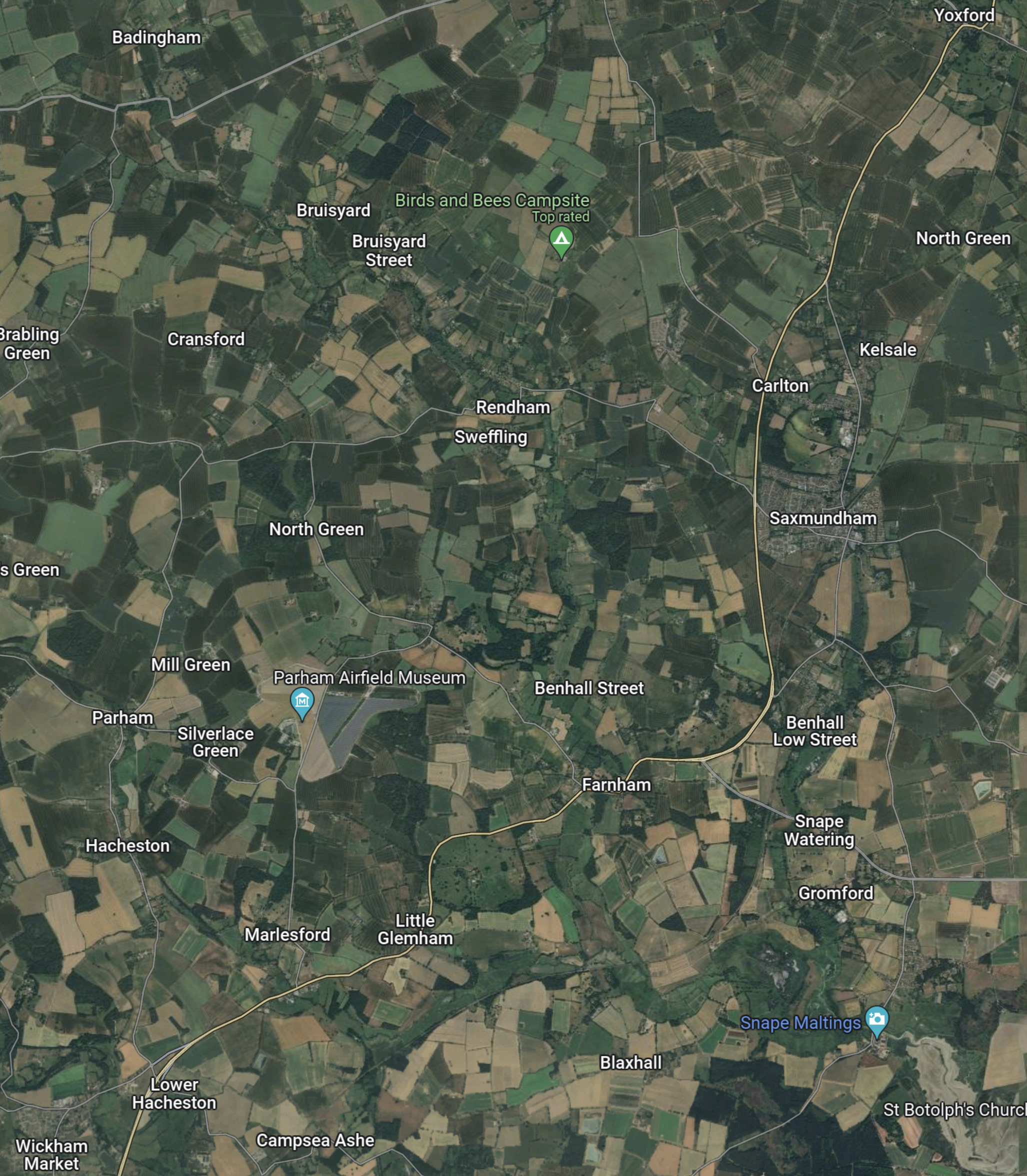
This Google Map shows the A 12 between the South Park-and-Ride site and Yoxford.
Note.
- Yoxford is in the North-East corner of the map.
- Wickham Market is in the South-West corner of the map.
- The A 12 is the cream road linking the two villages.
- The Southern Park-and-Ride will be to the North-East of Wickham Market.
- The Northern Park-and-Ride is a couple of miles North of Yoxford.
- Yoxford and Wickham Market are 11.8 miles apart.
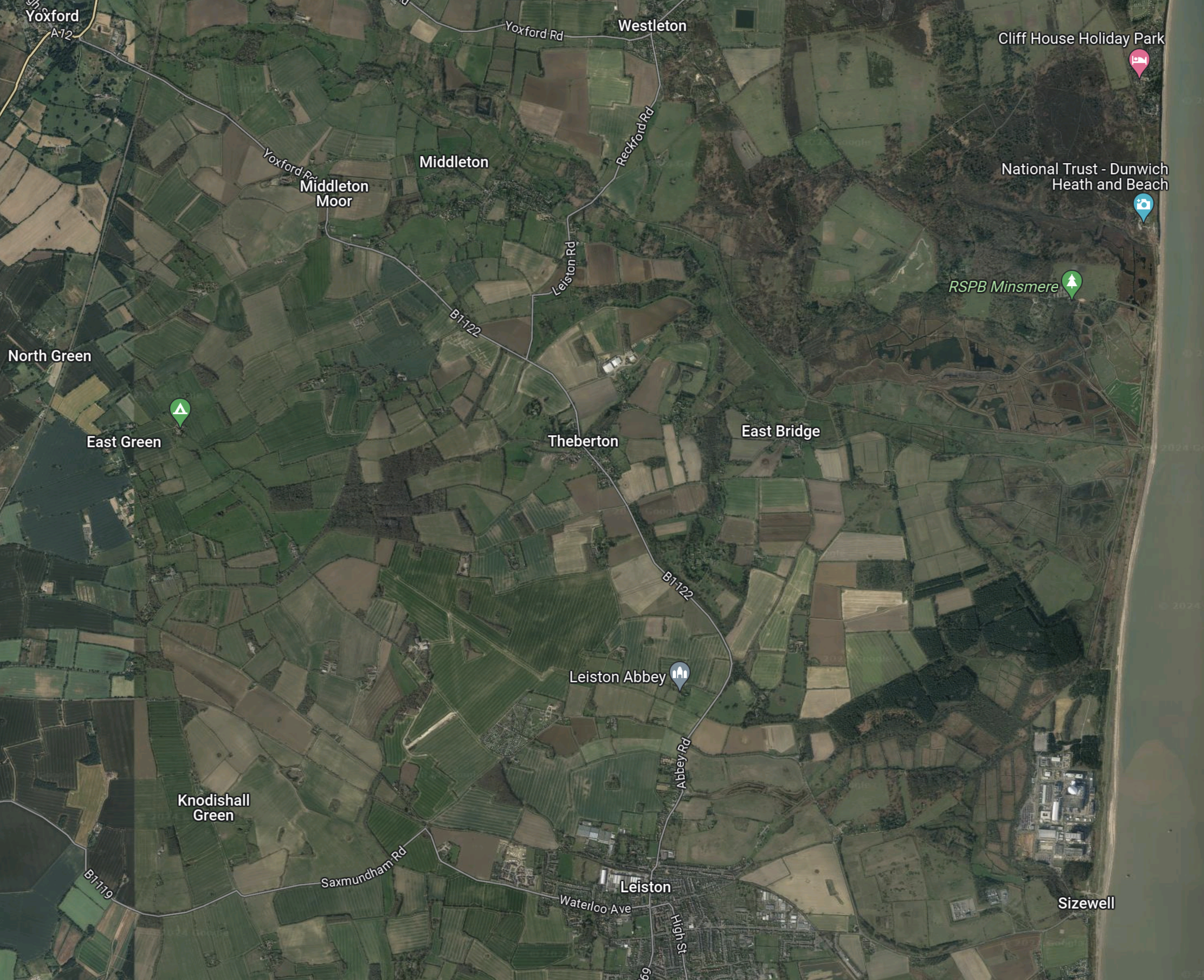
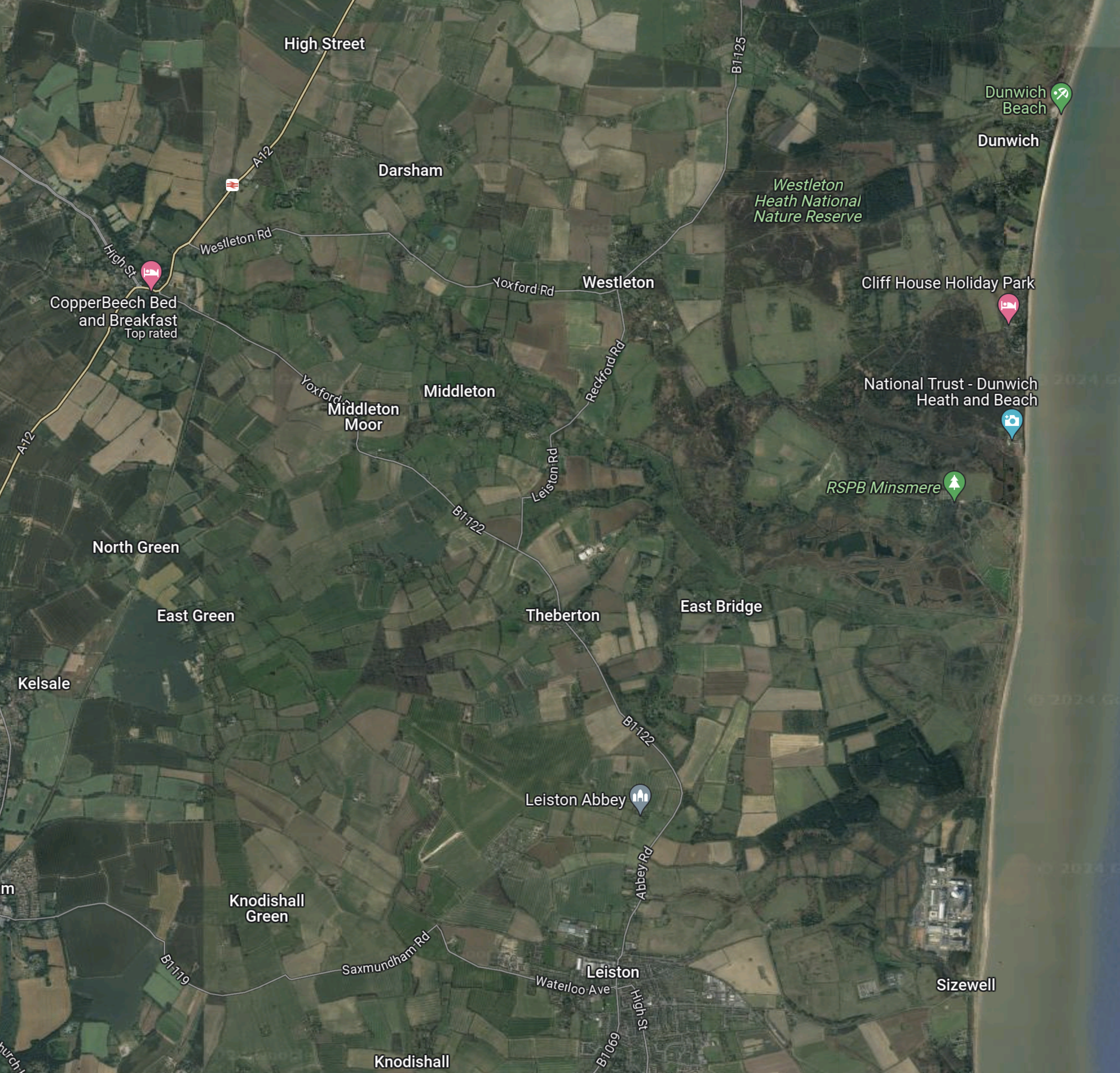
This third Google Map shows the route between Yoxford and Sizewell.
Note.
- Yoxford is in the North-West corner of the map.
- Sizewell is in the South-East corner of the map.
- Leiston Abbey is indicated by the arrow to the North of Leiston.
The B 1122 can be picked out through Middleton Moor and Theberton and then as it skirts Leiston Abbey.
It appears that both Park-and-Ride sites, use the same connection between the A 12 and Sizewell C.
Objections To The Park-and-Ride
This petition on change.org is entitled Stop Sizewell C Park and Ride at Wickham Market.
The petitioner is objecting on the following grounds.
- The size of the site.
- Spoiling of views.
- Disturbance to walkers and horse riders.
- Terrestrial ecology and ornithology will be affected by the site.
- Increase in traffic.
This was the petitioner’s conclusion.
In conclusion I oppose the Sizewell C southern park and ride site at Wickham Market and believe it should be sited further south on the A12 away from residential areas and near the A14.
The Ipswich Northern By-Pass
There is another large project scheduled for Ipswich in the next few years; the Ipswich Northern By-Pass.
This map clipped from the Ipswich Borough Council web site shows possible routes.

Note.
- Wickham Market is in the North-East corner of the map.
- One of the aims of the Northern by-pass is to open up land for housing.
- The railway between Ipswich and Darsham stations goes via Westerfield, Wiidbridge, Melton andWickham Market.
- Perhaps by phasing the developments, an area could be used for a Park-and-Ride, which has a road connection to the A 12.
- When the need for Park-and-Ride for Sizewell has decreased, the site could be handed over to housing.
It would certainly help, if the route of the Northern by-pass was settled soon.
Sizewell C – North Park And Ride
This document on the Planning Inspectorate web site, is a description of the Northern Park-and-Ride for the Sizewell C Project.
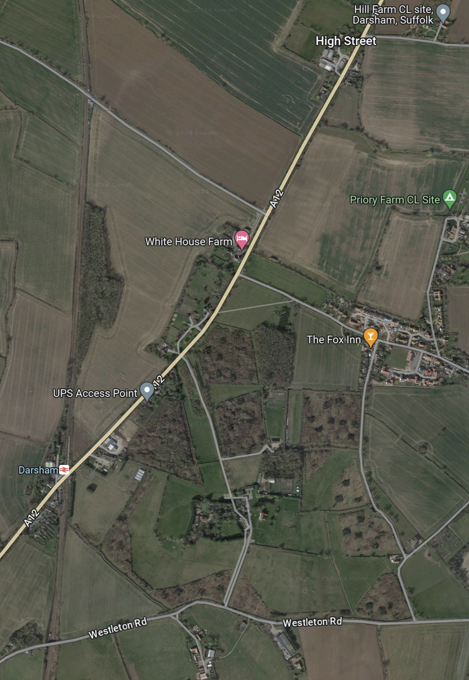
This Google Map shows the area of the Park-and-Ride site.
Note.
- The main road running SW-NE is the A 12 between Ipswich, Felixstowe and Woodbridge in the South and Lowestoft and Great Yarmouth in the North.
- The East Suffolk Line runs North-South at the West side of the map.
- Darsham station, which is indicated by the red logo on a white background is situated, where road and railway cross.
- The Fox Inn is in the village of Darsham and indicated by an orange arrow.
- The pink arrow to the North-West of the Fox Inn indicates White House Farm.
- The lane going North-West from the A 12 to the North of the farm is Willow Marsh Lane.
The document on the Planning Inspectorate says this about the site.
The site comprises approximately 27.9 hectares (ha) of predominantly
agricultural land but also includes sections of the A12 and Willow Marsh Lane
towards the north of the site. It is located west of the village of Darsham and
west of the A12, to the east of the East Suffolk line, and to the north of
Darsham railway station (see Chapter 1, Figure 1.1 of this volume). Further
detail on the site and the environmental baseline is provided in Chapters 1
and 4 to 12 of this volume of the Environmental Statement.
This second Google Map shows Darsham station.
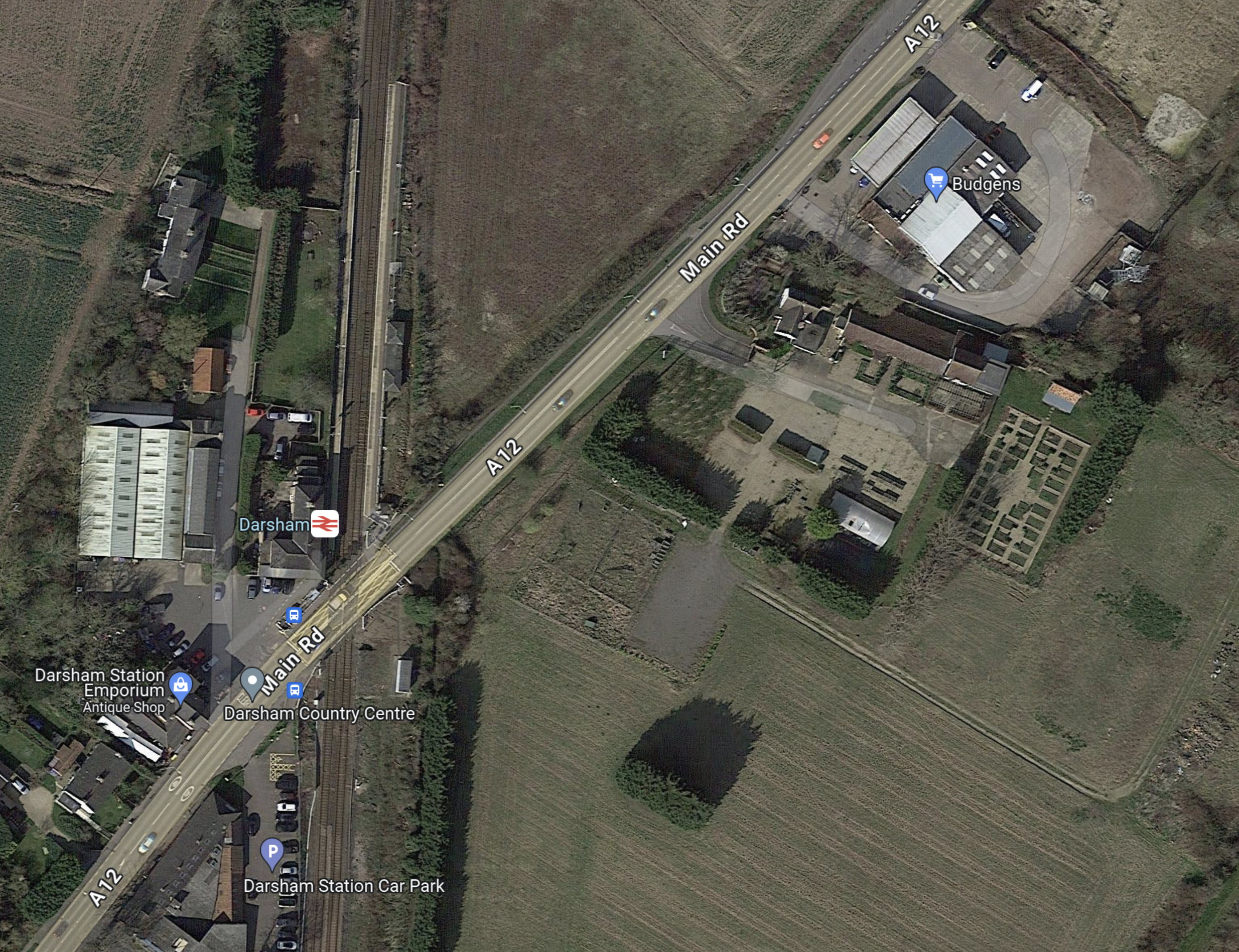
Note.
- Darsham station has long platforms.
- Crossing the line is by means of the level crossing.
- The Budgens store, which is indicated by the blue arrow also sells fuel.
- The station has a bus service.
- The Southern end of the Park-and-Ride site lies between the railway and the road at the North of the map.
The document on the Planning Inspectorate says this about walking between the Park-and-Ride site and the station.
There would be a pedestrian route from Darsham railway station along the
footway on the A12 to the south-east of the site. Pedestrians accessing the
site would leave the A12 and enter through a security gate provided in the
security fencing. Further details of access measures (such as key fobs,
CCTV, intercom system) would be agreed at the detailed design stage.
I could probably manage that at 76.
These are further thoughts.
The Current Rail Service
Currently, the rail service is as follows.
- One train per hour (tph) in both directions.
- |Trains are Class 755 trains, built by Stadler in Switzerland a few years ago.
- Each train can carry up to 229 passengers.
- Up to three trains can run together.
- Trains going to and from Lowestoft in the North call at Oulton Broad South, Beccles, Brampton and Halesworth.
- Trains going to and from Ipswich in the South call at Saxmundham, Wickham Market, Melton and Woodbridge.
- Travellers for London Liverpool Street change at Ipswich.
- The first train from London Liverpool Street would get you to Darsham at 11:00.
- This is not a bad train service but it could be improved.
Direct Trains Between London Liverpool Street And Lowestoft
In 2016, I wrote Making Sense Of The New East Anglia Franchise.
I wrote the following about Greater Anglia’s plans to run four trains per day between London Liverpool Street and Lowestoft.
There are going to be four direct services between London and Lowestoft each day. This probably initially means two trains to London in the morning peak and two trains back in the evening one.
When, I first moved back to Suffolk in the 1970s, I regularly caught a diesel-hauled train from Wickham Market to London for the day.
This is all motherhood and apple pie for those in Lowestoft wanting to go to London, but I suspect it isn’t the easiest service for a train operator to schedule efficiently and make money.
Would a train operator really want to start a full train at Lowestoft at say six in the morning and then have it wait around all day in London before returning in the evening?
The East Suffolk Line from Ipswich to Lowestoft has the following characteristics.
- It is fifty miles long.
- It is not electrified.
- It has a speed limit of 40-55 mph.
- There are nine intermediate stations. Many are just a single platform, and car parking is fairly limited.
- It has enough double-track and a passing loop at Beccles station to run a train in both directions at the same time.
- As it ran long trains in the past, I suspect, that most of the stations have platforms that can handle at least six-carriage trains.
- Trains would appear to take around ninety minutes for the whole journey
But the most important characteristic, is that every time the line is improved, more passengers come rushing out of the woodwork.
There would certainly be no problem with running bi-mode Flirts on this route, as London-Lowestoft is just the type of route for which they are designed.
- They would use their on-board diesel engines on the East Suffolk Line.
- As some would work along the busy lines to London, I suspect their top speed under electric power would be the same as the EMUs.
- Services to and from London, once on the Great Eastern Main Line, would join the high-speed race to and from the capital.
- At the start and finish of the day, the trains could use the electrified main line to position between Ipswich and Crown Point depot at around 100 mph.
- Abellio could use either a single three- or four-car train or perhaps two trains coupled together.
This service would pass through Darsham station, so it could provide a direct link between London and the Park-and-Ride.
It might also stop at stations like Manningtree, Colchester, Chelmsford and Stratford.
I am fairly certain, that a London Liverpool Street and Lowestoft services, that stopped at Darsham station, would improve labour availability and construction efficiency at Sizewell C.
A Connection To Yarmouth
There used to be a direct Yarmouth to Lowestoft Line, but now it is possible to use the Wherry Lines, with a reverse at Reedham station.
So will we be seeing the direct London-Lowestoft trains being extended to Yarmouth?
As Yarmouth hasn’t had a direct connection to London for years and there are lots of fast, capable new trains, I wouldn’t be surprised.
Especially, as Network Rail are talking about reinstating the Reedham Chord to create a more direct route between East Anglia’s largest North-Eastern towns. This is said about the Reedham Chord in Direct Yarmouth Services in the Wikipedia entry for Lowestoft station.
In January 2015, a Network Rail study proposed the reintroduction of direct services between Lowestoft and Yarmouth by reinstating a spur at Reedham. Services could once again travel between two East Coast towns, with an estimated journey time of 33 minutes, via a reconstructed 34-chain (680 m) north-to-south arm of the former triangular junction at Reedham, which had been removed in c. 1880. The plans also involve relocating Reedham station nearer the junction, an idea which attracted criticism.
If we take these current approximate timings.
- Ipswich to Lowestoft takes 90 minutes.
- Lowestoft to Reedham takes 27 minutes.
- Reedham to Yarmouth takes 16 minutes.
That means the service today would take 133 minutes, with a train reverse at Reedham station.
Note.
- Modern three-car bi-mode Flirt trains, with better speed, acceleration and braking than the current Class 170 trains.
- The short-cut along the Reedham Chord, which could save as much as ten minutes.
- A few selective improvements to save a minute here and there.
- Lowestoft station is redeveloped forty metres to the West and eighty metres to the South, as detailed in Wikipedia under Relocation Of The Station.
- I think it would be possible for an Ipswich-Yarmouth service to do the trip in around two hours.
The service would have the following characteristics.
- It would be timetabled for under the all-important two hours.
- Trains would turnround efficiently in a few minutes at either end of the line.
- It could be hourly with four trains or two-hourly with just two, used to run the service.
- All stops would be at the same minutes past each hour at each station.
- Trains would always leave Ipswich and Yarmouth at the same number of minutes past the hour.
- Lowestoft and Yarmouth get a regular hourly direct train service in just thirty-three minutes.
- Intriguingly if the trains left Ipswich and Yarmouth at the same time, they would pass each other at Beccles station, which incorporates a passing loop.
- As Beccles and its passing loop, fits so well into this schedule, I suspect that it was designed with the Reedham Chord and this type of service in mind.
- There would be no prizes for guessing the beer, that should be served on a train on this route.
I don’t think any better than an hourly service, could be run, without some extra passing loops or double-track.
This extension would make commuting between Sizewell and Yarmouth easier.
Bus Route Between Darsham And Sizewell
The document on the Planning Inspectorate says this about the buses and the route.
There would be a maximum of 100 daily bus arrivals and 100 daily bus
departures from the proposed development to the Sizewell C main
development site.Bus services between the proposed development and the Sizewell C main
development site would travel south on the A12 and use the new A12/B1122
roundabout (Yoxford Roundabout – see Volume 7 of the ES) to access the
B1122 and the Sizewell link road (once operational – see Volume 6 of the
ES) towards the Sizewell C main development site.
This Google Map shows Darsham station and the Sizewell site, as it exists today.
Note.
- The Sizewell site is in the South-East corner of the map.
- Darsham station is in the North-West corner of the map.
This second Google Map shows the A 12 between Darsham station and Yoxford.

Note.
- Darsham station is at the top of the map on the A 12.
- The village of Yoxford is on an S-bend of the A 12.
- A B& B is marked by a pink arrow.
The B 1122 connects Yoxford to the South-East corner of the map.
This third Google Map shows the route between Yoxford and Sizewell.
Note.
- Yoxford is in the North-West corner of the map.
- Sizewell is in the South-East corner of the map.
- Leiston Abbey is indicated by the arrow to the North of Leiston.
The B 1122 can be picked out through Middleton Moor and Theberton and then as it skirts Leiston Abbey.
Sizewell C seem to have made a good effort to get the workers to the site.
Why Isn’t A Passenger Train Run Between Ipswich And The Sizewell Site?
In Network Rail Prepares To Send Four Trains A Night Through Suffolk To Sizewell, I came to this conclusion.
I am fairly certain, that it is possible to move four freight trains in and out of the Sizewell site during the night, without doing any major works to the East Suffolk Line between Ipswich and Saxmundham junction.
- Adding extra track at Wickham Market would probably cause major disruption.
- Some level crossings will probably be improved.
But without a full double track between Ipswich and Saxmundham junction, I doubt there could be any increase in passenger services.
But with those track works, it might be possible to run an hourly service between Ipswich and Aldeburgh with calls at Westerfield, Woodbridge, Wickham Market, Saxmundham, Sizewell and Leiston.
This would give a two tph service between Saxmundham and Ipswich.
Objections To The Park-and-Ride
This document from Darsham Parish Council is entitled Consultation Response To Sizewell C.
This is the first paragraph.
Darsham Parish Council (Darsham PC) continues to oppose the proposed location of the Northern Park and Ride (NPR). We believe its location on an already busy single carriageway section of the A12 just north of the level crossing at Darsham Station, coupled with proposed roundabouts at Willow Marsh Lane and the A1120 junction in Yoxford are a recipe for traffic chaos extending northwards up the A12. We have no confidence in the traffic estimates submitted by EDF, which we believe underestimate the amount of local, through, agricultural and tourist traffic. This will be exacerbated by the proposed motel and further proposed development south of the station. We believe that traffic congestion on this main artery into Suffolk will adversely impact tourism throughout the AONB, which generates more than £360 million pa to the local economy (2018 figure). Further, we believe these volumes of traffic will generate excessive noise, vibration and pollution with serious negative impacts on those living alongside or close to the A12. Most significantly, Darsham PC has been advised that location of the NPR on this site could pose a significant flood risk to the railway (see below).
The Parish Council is also worried about flood risk to the railway.
The site of the NPR slopes down from Willow Marsh Lane towards the railway. A consulting engineer has advised us that the heavy clay soil here could pose a drainage and flood risk problem when compacted during the construction period. An appropriate sustainable semi-permeable surface could be utilised for car parking spaces to reduce run-off, with suitable drainage and reservoir capacity at the southern end to protect the railway from flooding. We submitted this evidence to EDF during the consultation period, but it has been ignored.
I suspect as with the opposition to Sizewell B, the opposition is led by second home owners, worried about the value of their investment.
Stadler’s FLIRT H2 Sets World Record For Hydrogen Powered Train
The title of this post, is the same as that of this article on Rail Technology Magazine.
These three paragraphs introduce the article.
Stadler’s FLIRT H2 has set the Guinness World Record for the longest distance achieved by a hydrogen-powered passenger train without refuelling or recharging.
The record attempt began on the evening of 20th March 2024 at the ENSCO test centre in Pueblo, Colorado, and concluded 46 hours later, with the train completing 2803 kilometres on a single tank filling.
A team of engineers from Stadler and ENSCO drove the vehicle in shifts during the attempt.
The journey is about the same distance as the crow flies between Edinburgh and Athens.
Stadler have also published this video.
The train appears to be a a Flirt, like Greater Anglia’s Class 755 trains or Transport for Wales’s Class 231 trains, with a power unit in the middle.

Note.
- The picture shows a Class 231 train at Cardiff Queen Street station.
- A Greater Anglia driver told me, these trains are 125 mph trains.
- The Flirt H2 has only two passenger cars, but UK Flirts are have three or four cars.
Perhaps we should buy a few of these trains for long routes like Liverpool and Norwich or Cardiff and Holyhead!
They would surely be ideal for CrossCountry
Improvements To Brimsdown Station
This post on IanVisits is entitled Enfield Council Outlines Possible Rail Station Upgrades.
By reading Enfield Council documents, Ian has found possible station improvements that might happen.
Ian says this about Brimsdown station.
A modest development on the Brimsdown sports ground could contribute towards improvements to access and facilities at the nearby station, supported by some additional housing in clusters around the area.
This Google Map shows the station and the sports ground.
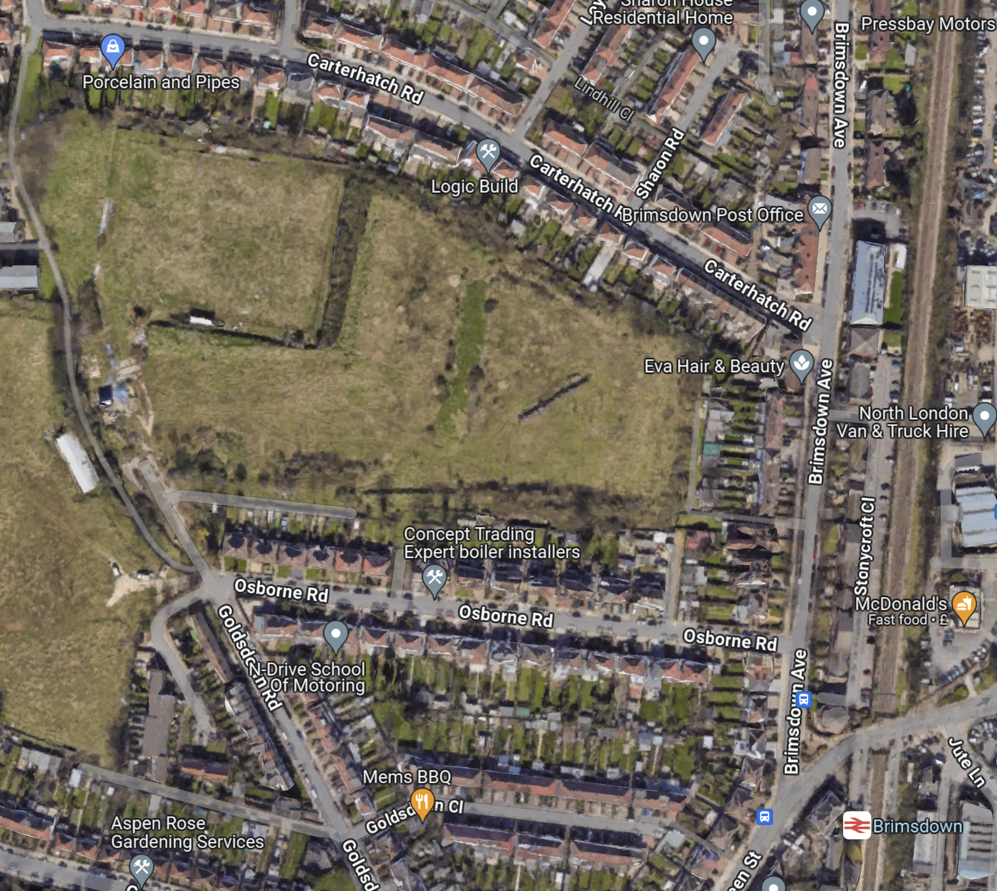
Note.
- The West Anglia Main Line runs North-South at the Eastern edge of the map.
- Brimsdown station is in the South-East corner of the map.
- Brimsdown sports ground is the green space to the North-West of the station.
- From zooming in, it looks like the main sport on the sports ground is fly tipping.
These pictures show the station.
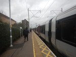
Note.
- I feel today, was probably the first time, I’d caught a train either to or from the station.
- But I must of cycled over the level crossing scores of times going to work at Enfield Rolling Mills.
- After I got my driving licence, I also used to deliver my father’s stationery and other printed goods to the same firm.
Sadly, the firm, where I got my first real taste of industry, that taught me so much is long gone.
