Could The Fenchurch Street And Grays Service Be Handed Over To The Elizabeth Line?
Before I discuss the suggestion in the title of this post, I will write down some thoughts.
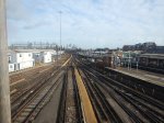
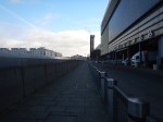
The Capacity And Connection Problems At Fenchurch Street Station
If you read the Wikipedia entry for Fenchurch Street station, this paragraph sums up some of the problems of the station.
Fenchurch Street is one of the smallest railway terminals in London in terms of platforms, but one of the most intensively operated. It is the only London terminal with no direct interchange with the London Underground. Plans to connect it stalled in the early 1980s because of the lack of progress on the Jubilee line, but it is close to Tower Hill on the Underground and to Tower Gateway on the Docklands Light Railway.
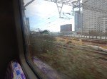
I live in Dalston and if I want to use the services out of Fenchurch Street station to get anywhere it is a struggle.
As all services out of Fenchurch Street station stop at Limehouse, West Ham and Barking stations on the approach into London, I will usually go via either West Ham or Barking stations. As the three services out of Fenchurch Street are each two trains per hour (tph), this can mean a near-thirty minute wait at either West Ham or Barking stations, which at some times of the year are not the most customer-friendly of stations.
More services out of Fenchurch Street station would help to ease the problem, but the station is at capacity and nothing short of a complete rebuild of the station will solve the problems the capacity and connectivity..
There is a section called Future in the Wikipedia entry, where this is said.
There have been proposals to move the station 380 yards to the east to allow the station to expand to 6 platforms, (up from the current 4) and would be built partly on the site of Tower Gateway DLR station, which would likely be permanently closed.
The new station could be built with direct interchange with Tower Hill tube station, which could also have a replacement DLR station for Tower Gateway as Transport for London have looked into closing Tower Gateway and constructing a replacement on the Bank branch to increase capacity.
This project sounds like it would take a long time and cause a lot of disruption and inconvenience. But it would add capacity and connectivity.
This Google Map shows the location of the station.
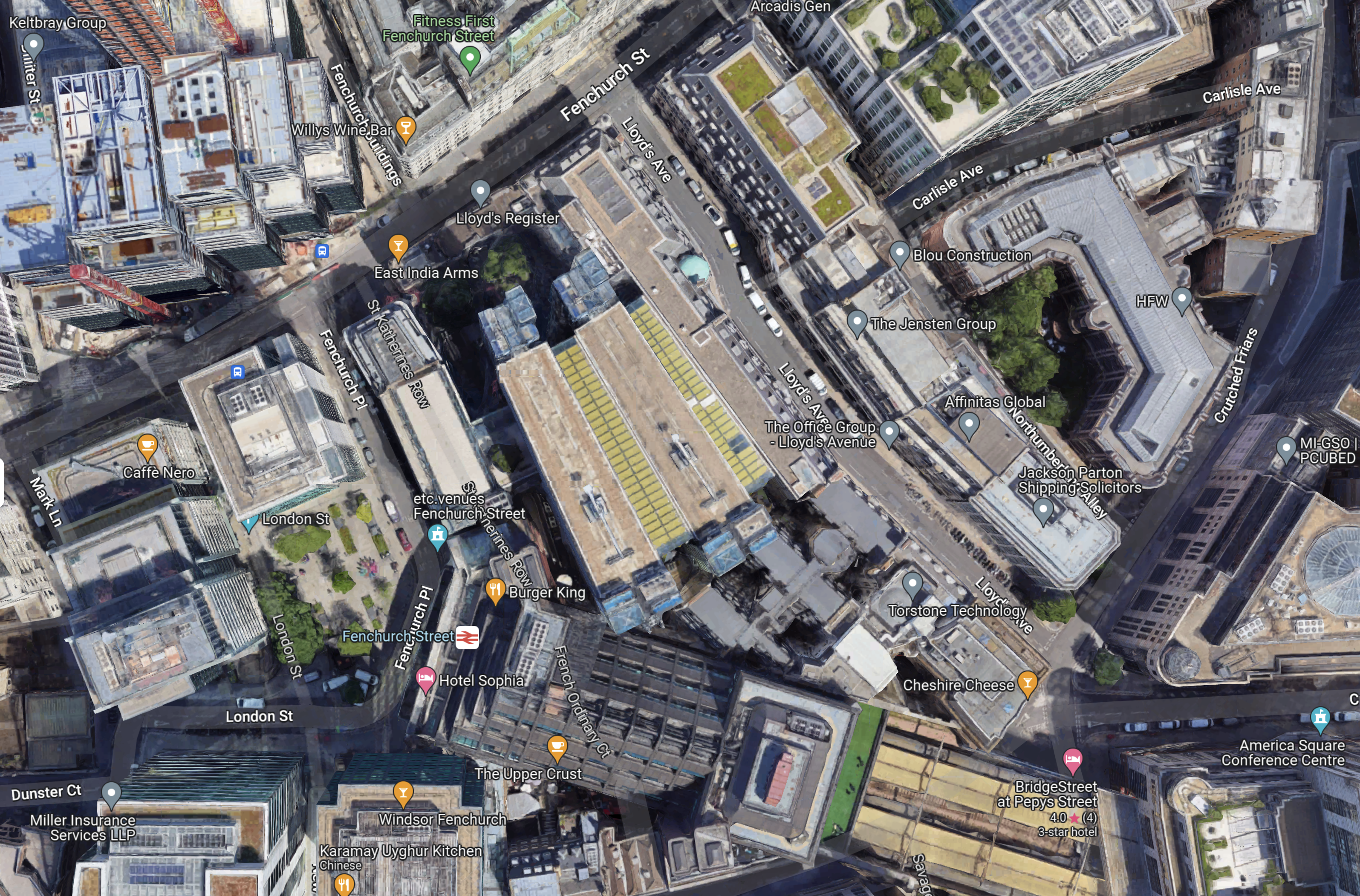
Note.
- Fenchurch Street station is towards the bottom of the map in the centre.
- It is completely hemmed in by buildings.
- There is just a small square in front.
I feel it would be very difficult to rebuild a larger station in the same place.
Services Into Fenchurch Street Station
Currently, there are three services into Fenchurch Street station.
- Fenchurch Street and Shoeburyness via Limehouse, West Ham, Barking, Upminster, West Horndon, Laindon, Basildon, Pitsea, Leigh-on-Sea, Chalkwell, Westcliff, Southend Central, Southend East and Thorpe Bay.
- Fenchurch Street and Southend Central via Limehouse, West Ham, Barking, Upminster, Ockendon, Chafford Hundred Lakeside, Grays, Tilbury Town, East Tilbury, Stanford-le-Hope, Pitsea, Leigh-on-Sea, Chalkwell and Westcliff
- Fenchurch Street and Grays via Limehouse, West Ham, Barking, Dagenham Dock, Rainham and Purfleet.
Note.
- All services are two tph.
- All services call at Limehouse, West Ham and Barking.
Each station gets the following frequency of trains.
- Barking – 6 tph
- Basildon – 2 tph
- Benfleet – 2 tph
- Chafford Hundred Lakeside – 2 tph
- Chalkwell – 4 tph
- Dagenham Dock – 2 tph
- East Tilbury – 2 tph
- Grays – 4 tph
- Laindon – 2 tph
- Leigh-in-Sea – 4 tph
- Limehouse – 6 tph
- Ockendon – 2 tph
- Pitsea – 4 tph
- Purfleet – 2 tph
- Rainham – 2 tph
- Southend Central – 4 tph
- Southend East – 2 tph
- Stanford-le-Hope – 2 tph
- Thorpe Bay – 2 tph
- Tilbury Town – 2 tph
- Upminster – 4 tph
- Westcliff – 4 tph
- West Ham – 6 tph
- West Horndon – 2 tph
c2c would appear to be offering a service, that is well-balanced about the stations it serves.
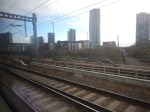
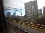
Can Elizabeth Line Trains Reach Barking?
This map from cartometro.com shows Woodgrange Park junction, where the Gospel Oak and Barking Line crosses over the Great Eastern Main Line.
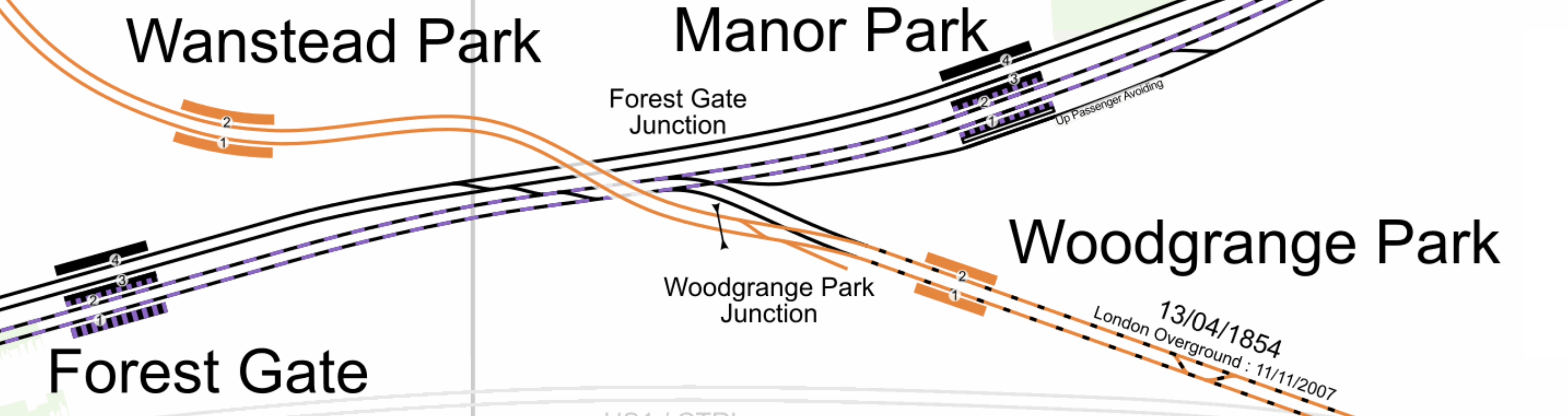
Note.
- The Gospel Oak and Barking Line is shown in orange.
- Gospel Oak station is to the North-West and Barking is to the South-East.
- The Elizabeth Line tracks are shown with a dash of purple.
- It looks to me, that a train on the Elizabeth Line going East could come through Platform 2 in Forest Gate station and then take the Gospel Oak and Barking Line through Platform 2 at Woodgrange Park station.
- It also looks as if trains could go through Platform 1 at both Woodgrange Park and Forest Gate stations to go West on the Elizabeth Line.
I don’t know whether they still do, but c2c trains used to use Woodgrange Park junction to access Liverpool Street station, when Fenchurch Street was closed or at weekends.
At Barking station, they would take the flyover over the station call in Platforms 7 and 8 in the station.
From the Eastern ends of Platforms 7 and 8, trains can use one of three routes.
- The London Overground route to Barking Riverside station.
- The c2c route to Grays via Purfleet.
- The c2c route to Upminster.
Note.
- The platforms at Barking Riverside station are probably too short for the Elizabeth Line trains.
- The Class 345 trains would fit into the bay platforms at Grays and Southend Central.
The simplest thing to do would probably be to divert the two tph between Fenchurch Street and Grays to either Liverpool Street or Paddington at the London end.
Each station would now get the following frequency of trains.
- Barking – 6 tph
- Basildon – 2 tph
- Benfleet – 2 tph
- Chafford Hundred Lakeside – 2 tph
- Chalkwell – 4 tph
- Dagenham Dock – 2 tph
- East Tilbury – 2 tph
- Grays – 4 tph
- Laindon – 2 tph
- Leigh-in-Sea – 4 tph
- Limehouse – 4 tph
- Ockendon – 2 tph
- Pitsea – 4 tph
- Purfleet – 2 tph
- Rainham – 2 tph
- Southend Central – 4 tph
- Southend East – 2 tph
- Stanford-le-Hope – 2 tph
- Thorpe Bay – 2 tph
- Tilbury Town – 2 tph
- Upminster – 4 tph
- Westcliff – 4 tph
- West Ham – 4 tph
- West Horndon – 2 tph
Only Limehouse and West Ham would get fewer trains.
But there would surely, be an extra pair of paths between Fenchurch Street and Barking.
I have also looked at trains through Pitsea, Upminster and Westcliff it appears that nearly all of the traffic is c2c’s passenger trains.
So would it be possible, with perhaps improved signalling to add an extra two trains between Fenchurch Street and Shoeburyness?
Each station would now get the following frequency of trains.
- Barking – 8 tph
- Basildon – 4 tph
- Benfleet – 4 tph
- Chafford Hundred Lakeside – 2 tph
- Chalkwell – 6 tph
- Dagenham Dock – 2 tph
- East Tilbury – 2 tph
- Grays – 4 tph
- Laindon – 4 tph
- Leigh-in-Sea – 6 tph
- Limehouse – 6 tph
- Ockendon – 2 tph
- Pitsea – 6 tph
- Purfleet – 2 tph
- Rainham – 2 tph
- Shoeburyness – 4 tph
- Southend Central – 6 tph
- Southend East – 4 tph
- Stanford-le-Hope – 2 tph
- Thorpe Bay – 2 tph
- Tilbury Town – 2 tph
- Upminster – 4 tph
- Westcliff – 6 tph
- West Ham – 6 tph
- West Horndon – 4 tph
More stations are getting four and six tph.
Conclusion
There are certainly possibilities to improve c2c by running services on the Elizabeth Line route.
East London Is A Duckers And Divers Paradise
This is the East End Tube Map, which I clipped off the full tube map.
I live just South of the East London Line between Canonbury and Dalston Junction stations.
Today started just after nine, as many others do by braving the nightmare on the buses to take a 141 bus to Moorgate.
- At Moorgate, I had breakfast as I do regularly in the Leon, by Moorgate station.
- After breakfast, it was one stop South on the Northern Line to Bank, to see if the new entrance had opened.
- It was then a trip on the new moving walkway to the Central Line.
- I took the Central Line to Stratford to do my main shopping at the start of the week, in the large Marks and Spencer in Eastfield, by the station entrance.
- It was then on to the North London Line to go back home.
- I didn’t go all the way home on the Overground, but got off the train at Hackney Central and using the new Graham Road entrance, I crossed to get a 38 bus, which would take me home.
- But two 38s passed as I tried to cross the road and in the end I took a 277 bus to Dalston Junction station.
- From the Junction, I got a 56 bus home.
I got home about eleven.
At least now, I’ve got food until Thursday!
Thoughts On Extending The Northern Line To Clapham Junction
As I wrote in Northern Line Could Be Extended To Clapham Junction In Regeneration Plans, the extension of the newly-built extension to Battersea Power Station station could be further extended to Clapham Junction station.
Railways Between Battersea And Clapham
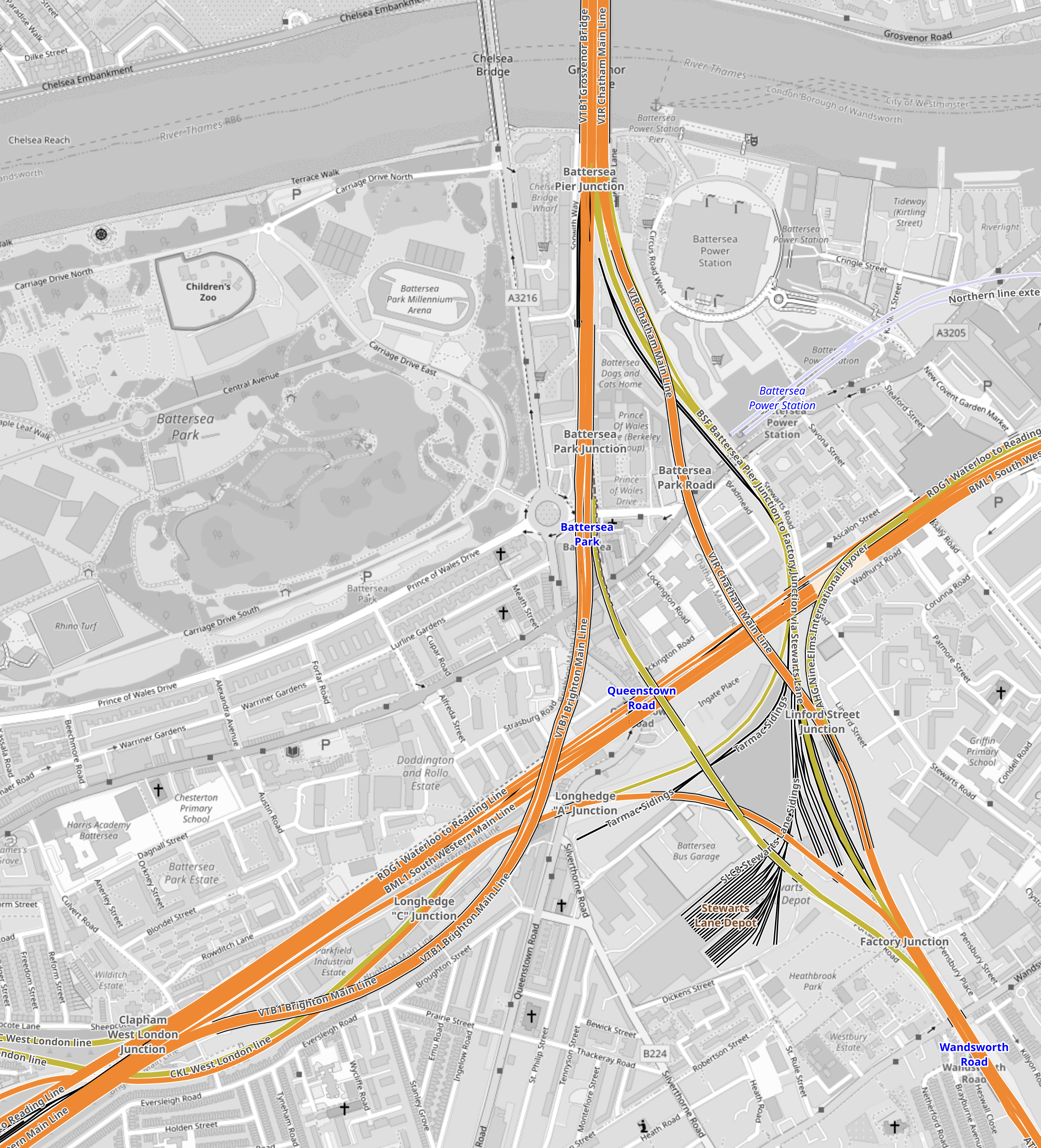
This map from OpenRailwayMap shows the tracks that run between the two stations.

Note.
- Battersea Power Station station is in the North-East corner of the map.
- The orange and yellow lines going North from that corner go to Victoria station.
- The orange and yellow lines going North-East from that corner go to Waterloo station.
- The yellow line going West is the West London Line to Shepherds Bush and Willesden Junction stations.
- Clapham Junction station is in the South-West corner of the map.
I estimate that the distance between Battersea Power Station and Clapham Junction stations is about three kilometres.
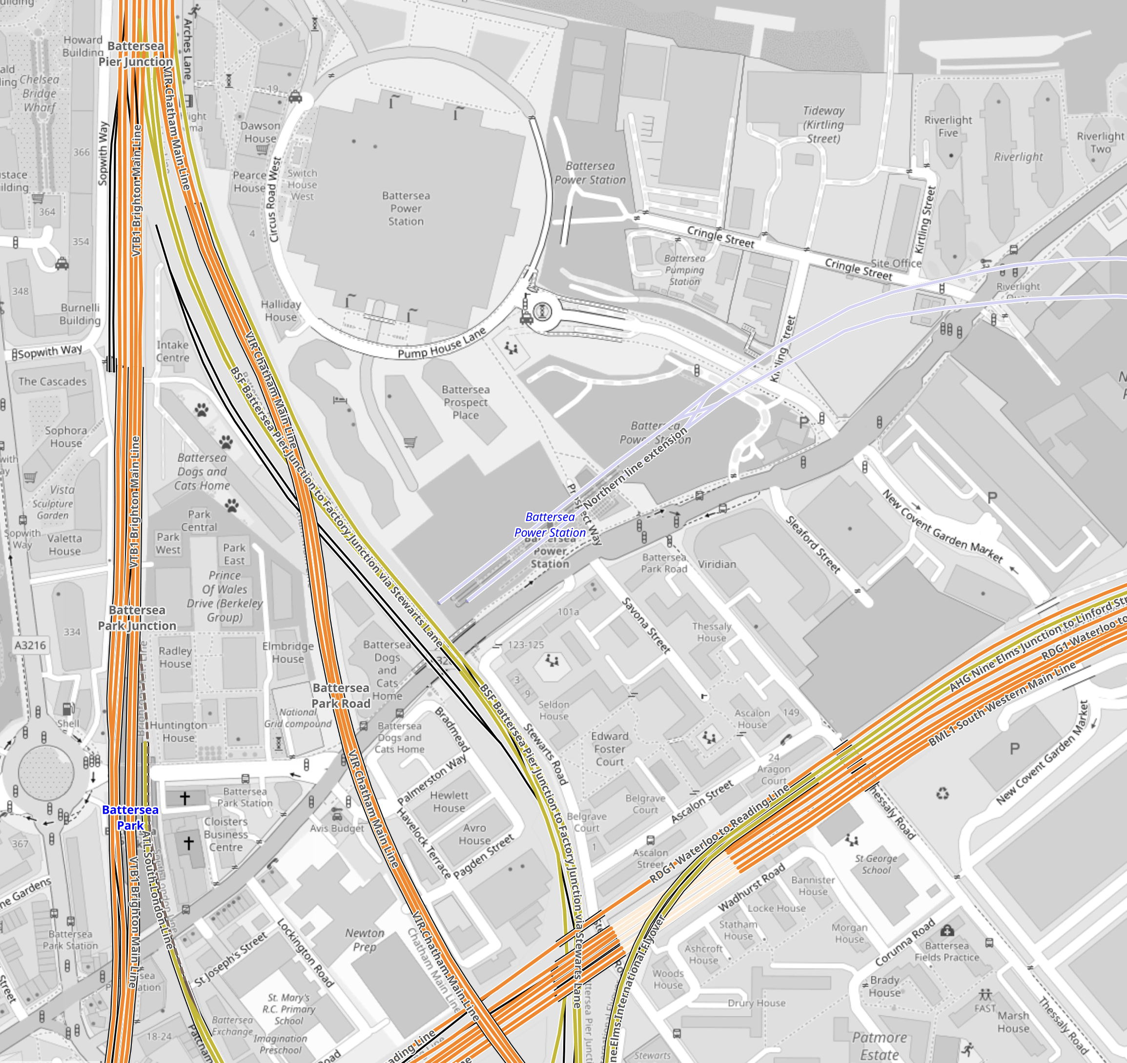
This map from OpenRailwayMap shows an enlargement of the tracks around Battersea.
Note.
- The tracks going North over the River to Victoria station.
- The tracks going East to Waterloo station.
- The tracks going South West to Clapham Junction station.
- The tracks from Victoria pass over and then join the tracks from Waterloo to continue to Clapham Junction station.
Battersea Power Station station can be seen to the North-East of the junction.
This map from OpenRailwayMap shows an enlargement of the tracks around Battersea Power Station station.
Note how the tracks go through Battersea Power Station station and terminate just before the lines into Victoria station.
It should also be noted that the platforms at Battersea Power Station station are reached using two sets of escalators, so they could be over forty metres below the surface. This would surely make the construction of tower blocks with deep foundations easier over the Northern Line.
But the depth would also enable an extended Northern Line to be below any existing or future construction.
This map from OpenRailwayMap shows the approaches to Clapham Junction station.
There are certainly a lot of tracks through Clapham Junction station.
Reasons For The Extension Of The Northern Line To Clapham Junction
These reasons come to mind.
To Enable Development In The Area
This is always a good reason.
In Network Rail To Outline Business Case For Clapham Junction Redevelopment, I said this.
The Rail Technology Magazine article talks of decking over the whole station and putting two million square feet of development on top. But it also cautions, it would be very expensive.
With that amount of development, there would be a need for as many transport links as possible.
To Improve Access To The Elizabeth Line For Passengers On Trains To And From Victoria
Victoria station does not have an Underground Line, that connects to easily the Elizabeth Line.
The best route to use is described in The Lizzie Line And Circle/District Line Interchange At Paddington – 1st July 2022, where you use the Circle to Paddington.
- To go to the West on the Elizabeth Line, take the Circle/District Line to Paddington.
- To go to the East on the Elizabeth Line, take the District Line to Whitechapel.
- To go to Liverpool Street take the Circle Line all the way.
Getting to the stations between Paddington and Liverpool Street means a change at either of those stations.
At Waterloo, you can use the Northern Line, which has a direct connection to Tottenham Court Road on the Elizabeth Line.
Connecting to the Northern Line at Clapham Junction will give Victoria-bound passengers, the advantages of those going to Waterloo.
An Alternative Way Of Connecting Victoria To The Elizabeth Line
The lack of an easy connection between the Victoria and the Elizabeth Line is a pain and I believe that it was a major omission in the design of the Elizabeth Line.
- Dear Old Vicky has a frequency of upwards of thirty trains per hour (tph)
- With some improvements at stations like Oxford Circus, Highbury & Islington and Walthamstow Central, the line could handle some more passengers.
- More step-free access would also help increase capacity.
- Engineers are a competitive bunch and I could see the day, when Vicky is running at 40 tph.
If Vicky was running at forty full tph, it would be moving 45120 passengers per hour.
This would mean that to match the passenger capacity of the older line, the Elizabeth Line would have to be running at a frequency of thirty tph.
As passengers at the ends of the line have difficulty getting to places like Paddington and Heathrow, a connection between the two Queens would really help.
Vicky was universe-class in the 1960s and now she needs updating to the 21st Century.
This map from cartometro shows the Lines through Bond Street and Oxford Circus stations.
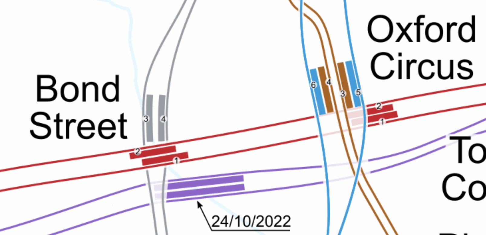
Note.
- The Bakerloo Line is shown in brown.
- The Central Line is shown in red.
- The Elizabeth Line is shown in purple.
- The Victoria Line is shown in light blue.
- The Elizabeth Line is the deepest line.
In addition, consider.
The Eastern exit of the Elizabeth Line at Bond Street station has three escalators and lifts. It also opens onto Hanover Square, so it won’t suffer from overcrowding problems outside.
- Hanover Square is just a garden, with no car park underneath, so pedestrian tunnels could pass under it
- I also suspect there are no existing or planned buildings between the two stations with deep foundations that would block a pedestrian tunnel.
- With the capability and ingenuity of three-D design software, I can see wide tunnels being created that would link Oxford Circus and the two Bond Street stations.
- The new wide tunnels at Bank station have opened up the station’s capacity and all the tunnels were dug traditionally.
- If it was felt to be needed, moving walkways could be added, just as they have been at Bank station.
I am absolutely sure, that by using the ideas and methods, that have worked so well in the upgrade of Bank station, that Oxford Circus and Bond Street stations could be turned into a London Superhub Station, that connects all the Underground lines together and has entrances all over the area.
The benefits of such a station would be.
- It would provide a high-capacity link between London’s two highest-capacity Underground Lines; Elizabeth and Victoria.
- It would provide a high-capacity link between the Elizabeth Line and Euston, St. Pancras and King’s Cross.
- It would provide a high-capacity link between the Elizabeth Line and Victoria.
- It would provide a high-capacity link between the Elizabeth Line and High Speed Two.
- Areas like Brixton, Haringey and Walthamstow would gain a much needed link to the Elizabeth Line for Heathrow and Paddington.
Wikipedia says this about the building of the Bank Station Upgrade.
As part of the development of the scheme, TfL worked with potential bidders to improve the design of the station from TfL’s original design. The design proposed in the winning bid by Dragados was 9.7% cheaper than the original design (saving TfL £60m), took 10 months less time to construct than the original design (the proposed closure of the Northern line was also 5 weeks shorter), and the layout of the station was more efficient. This substantially improved the benefit–cost ratio by 45% to 3.5:1.
The Mayor should be knocking on the door of Dragados and asking them for a price for a design and build for a West End Superhub station.
A Possible Route For The Extension Of The Northern Line To Clapham Junction
I suspect that the simplest route for the extension of the Northern Line would be to bore or dig a twin-track railway underneath the numerous other railways in the area.
It could terminate in two underground platforms at Clapham Junction station.
This is the first map of this post and it shows the tracks that run between the two stations.
Note.
- Battersea Power Station station is in the North-East corner of the map.
- Clapham Junction station is in the South-West corner of the map.
The Western of the pair of orange Lines going off the map in the North-East corner of the map is the Brighton Main Line.
It passes through Battersea Park station.
It passes over the South Western Main Line out of Waterloo.
It then loops to the West and joins the lines to Clapham Junction on the Southern side.
It serves four platforms at Clapham Junction; 12 and 14 are up platforms and 13 and 15 are down platforms.
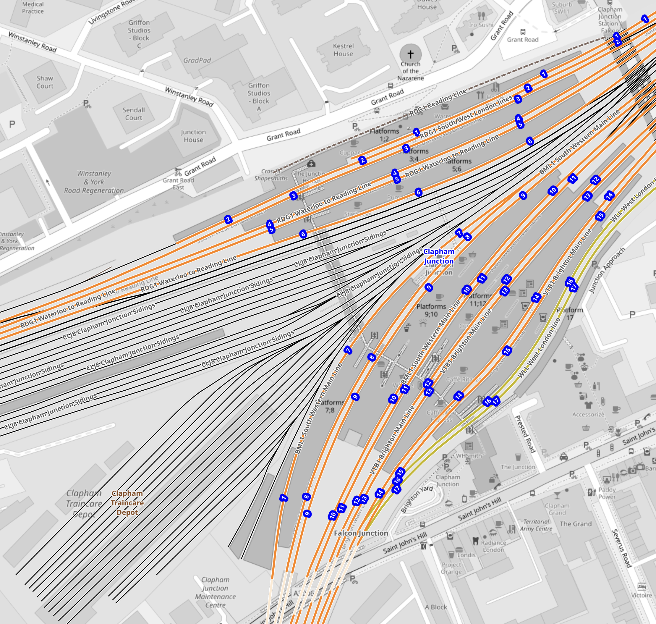
This Google Map shows an overview of Clapham Junction station.
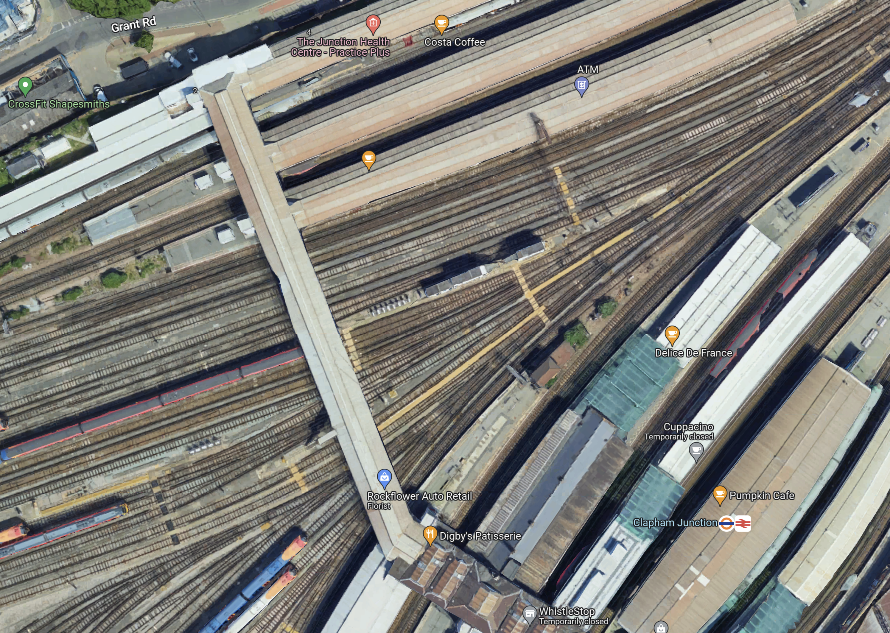
Note.
- Platforms 1 and 2 at the top of the map, handle London Overground services.
- Platforms 3 to 11 handle South Western Train services.
- Platforms 12 to 17 handle Southern services.
- Platforms 9 and 10 have a Delice de France cafe.
- Platforms 11 and 12 have a Cuppacino cafe.
- Platforms 13 and 14 have the logos.
- All platforms have full step-free access with lifts to the wide footbridge that connects all platforms.
The platforms don’t seem to be very wide and putting stairs and escalators down to underground platforms could be a difficult proposition.
This map from OpenRailwayMap shows shows the platforms at Clapham Junction station and the track layout to the West of the footbridge.
Note.
- The tracks through the platforms are shown in orange.
- The blue dots are platform numbers.
- The bridge connecting all the platforms is shown shaded in the middle of the map.
- To the West of the bridge are Clapham Junction Sidings and Clapham Traincare Depot.
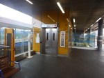
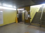
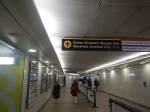
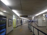
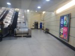
These pictures were taken from the bridge.
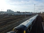
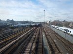
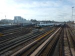
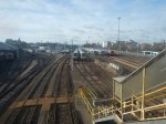
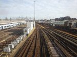
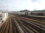
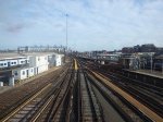
Note.
- The top row of pictures were taken looking West.
- The bottom row of pictures were taken looking East.
- Many of the tracks are electrified.
- There is a lot of space to park trains.
Will all the space be needed now, that a new depot has been built at Feltham.
Could Two New Surface Platforms Be Built For The Extension Of The Northern Line To Clapham Junction?
Consider.
- The step-free bridge across all the platforms at Clapham Junction station works well.
- It is connected to the streets around the station at both ends.
- Clapham Junction station will be redeveloped and surplus depot land could be used for housing.
- As the maps show, there is a large gap in the platforms between the South Western Railway and the Southern sides of the station.
- As Battersea Power Station station can turn services on the Northern Line with only two platforms, there would only need to be the same number of Northern Line platforms at Clapham Junction.
So could an extra pair of platforms be built under the bridge, with stairs and a lift similar to the existing platforms?
- The platform would have full step-free access.
- The platforms could be long enough for any future trains.
- There could be sidings for a few trains.
- The tunnels from Battersea Power Station would surface just outside the station.
- There would need to be a crossover or a turnback siding for operational reasons.
I also think, that once the depot and sidings at Clapham Junction have released the space, the new platforms and tracks could be installed without interrupting main line services through the station.
Would The Extension Of The Northern Line Be Electrified?
Consider.
- Merseyrail were not allowed to use third-rail electrification to Headbolt Lane station and had to use batteries.
- The Northern Line was extended to Battersea Power Station station using London’s four-rail electrified system.
- Clapham Junction station has third-rail electrification everywhere.
I think that the authorities would be very churlish not to allow electrification to Clapham Junction.
Conclusion
I believe it is possible to extend the Northern Line to two new surface platforms at Clapham Junction station.
But I also believe that using similar methods to those used in the Bank Station Upgrade, that a full interchange between the Elizabeth and Victoria Lines can be built at Oxford Circus and Bond Street.
.
Surrey Quays Station On The London Overground Getting Step-Free Access
This is part of the package of upgrades that I wrote about in More Frequent Trains And A New Station For The London Overground, that was published in 2019.
It looks like the upgrade will start this year. and be finished in 2026.
Extending The Elizabeth Line – Connection To Southeastern High Speed One Services
The Two Stratford Stations
In this post, Stratford station is the station handling Greater Anglia and London Overground, Underground and Docklands Light Railway services, with Stratford International station handles High Speed services.
The Elizabeth Line And The Great Western Railway Services
One of the most important stations on the Elizabeth Line is Paddington, where it connects to the London terminus of the Great Western Railway.
I would expect that quite a few passengers going to the West and Wales on the Great Western Railway, will be transported to Paddington by the Elizabeth Line.
The Elizabeth Line And Greater Anglia Services
Another of the important stations on the Elizabeth Line is Liverpool Street, where the station is the London terminus of the Greater Anglia.
I would expect that quite a few passengers going to East Anglia on the Greater Anglia, will be transported to Liverpool Street by the Elizabeth Line.
Southeastern High Speed One Services
Southeastern runs some High Speed services on High Speed One to provide Kent with an improved service to London.
Current services are
- London St Pancras International to Ramsgate via Faversham.
- London St Pancras International to Ramsgate via Dover Priory.
- London St Pancras International to Margate via Canterbury West.
Note
- All trains are one train per hour (tph).
- All trains stop at Stratford International and Ebbsfleet International.
- All trains are run by 140 mph Class 395 trains.
There has also been talk of running a fourth service to Hastings and Eastbourne via Stratford International, Ebbsfleet International and Ashford International.
St. Pancras Station
All of these trains terminate in three platforms; 11 to 13 at St. Pancras International station.
St. Pancras is not the ideal terminal for the Southeastern High Speed services.
- St. Pancras is not on the Elizabeth Line.
- St.Pancras doesn’t have good connections to Heathrow.
- All connections to the Underground are a long walk.
- Eurostar services are a longer walk.
- East Midland services are also a longer route, with stairs and escalators for good measure.
St. Pancras station was designed by a committee, as a museum to Victorian architecture, rather than as a working station.
Ebbsfleet International Station Must Be The Largest Parkway Station In The UK
It holds nearly five thousand cars and it is served by Southeastern High Speed Services.
Thanet Parkway Station Will Open This Year
Thanet Parkway station is under construction.
- It will have nearly three hundred parking spaces.
- It will be served by Southeastern High Speed Services.
- It should open in May 2023.
This station will need a good connection to London.
Could An Interchange Between The Elizabeth Line And Southeastern High Speed Services Be Provided At Stratford?
Such an alternative interchange would be popular with passengers.
- The Elizabeth Line from Stratford currently serves the West End, the Northern section of the City of London, East London, Liverpool Street, Paddington and the West End directly.
- The Elizabeth Line from Stratford currently serves Canary Wharf, Cannon Street, Charing Cross, Euston, Heathrow, King’s Cross. Reading, St. Pancras and Victoria with a change at Whitechapel.
- The Central Line, which shares platforms with the Elizabeth Line serves Bank and the West End directly.
- The Overground is easily accessed for travel across North London to Richmond.
- The Jubilee Line is easily accessed for travel to London Bridge, Waterloo and Westminster.
It would be connected to two large parkway stations and lots of parking all over Kent.
I believe that Stratford must be promoted as an alternative terminus for Southeastern High Speed Services.
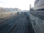
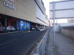
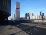
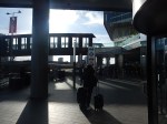
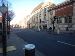
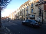
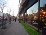
Today, I walked both ways between two Stratford stations.
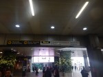
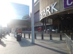
These pictures show the route I took between Stratford and Stratford International stations, through the Eastfield Shopping Centre.
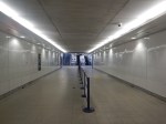
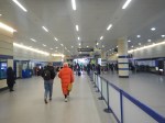


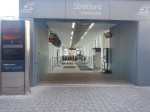
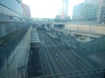
Note.
- I went through the Shopping Centre.
- I passed Marks & Spencer’s large food hall, excellent toilets and a Food Court.
- By the Food Court is an exit that leads to an entrance to Stratford International station.
- The walk took about 10 minutes.
- It was vaguely level.
- Lifts by-passed the escalators.
- One thing that makes the journey to London easier, is to travel in the Eastern end of the train, as the lifts and escalators at Stratford International station, are at that end.
It does need some better signage, but they were doing a bit of refurbishment, so that may already be underway.
It could be a very high quality interchange and it is already better than St. Pancras.
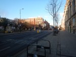
Coming back I took the longer route outside the Shopping Centre.
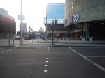

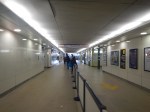
Note.
- I just turned left out of the entrance, walked along the road and turned right past the bus station.
- If the weather had been colder or wetter, I’d have gone back via the Shopping Centre.
- The walk took about 12 minutes.
I think normally, I’d go back through the Shopping Centre, as there’s a Marks and Spencer Food Hall on the route and it’s slightly quicker and often warmer.
Could Stratford Station Be A London Superhub Station?
When you consider the stations connected to Stratford in London, East Anglia and Kent, it has an excellent collection.
- Airports – Gatwick, Heathrow, Luton, Southend and Stansted
- Cities – Cambridge, Canterbury, Chelmsford, Colchester, Ipswich, Norwich and Southend-on-Sea
- London Main and Terminal Stations – Cannon Street, Charing Cross, Clapham Junction, Euston, Farringdon, King’s Cross, London Bridge, Liverpool Street, Marylebone, Moorgate, Paddington, Victoria and Waterloo
- Major Areas – Canary Wharf, City of London, Hampstead, Olympic Park and West End
- Ports – Dover, Felixstowe, Folkestone and Harwich
You can even get a train to Slough, with a change at Whitechapel.
I would think it already is a London Superhub Station.
Is The City Of London Moving Towards One Giant Station?
Bank and Monument Stations
When I was growing up in the 1950s and 1960s, there used to be an anomaly shown on Harry Beck’s iconic London Tube Map, that stood out as a bit different.
It was between Bank and Monument stations and was marked as an Escalator Connection, which connected the Northern Line at Bank to the District and Circle Lines at Monument.
This link was opened in 1933 and has its own section in Wikipedia labeled Monument Link, 1933.
This link has been joined by more tunnels, lifts and escalators over the last eight decades.
- In 1960, the Waterloo & City Line was connected to the main entrance of Bank station by two moving walkways.
- In 1991, the Docklands Light Railway was extended to the complex, with escalators to both the Bank and Monument entrances to the station complex.
- In November 2018, the new Bloomberg or Wallbrook entrance to the station opened, and I wrote about it in The Bank Station Walbrook Entrance Opened Today.
Bank and Monument stations have been developing as a pair of twin stations for eighty years.
The latest phase of the Bank Station Upgrade has added the following to the complex.
- A new and much large Southbound platform for the Northern Line.
- A moving walking between the Northern Line at Monument station and the Central Line at Bank station.
- Escalators between the Central Line and the Bank station end of the new moving walkway.
- Escalators between the Northern Line and the Docklands Light Railway.
The upgrade will be completed by a new entrance to the station complex on Cannon Street.
This Google Map shows the area of the station.
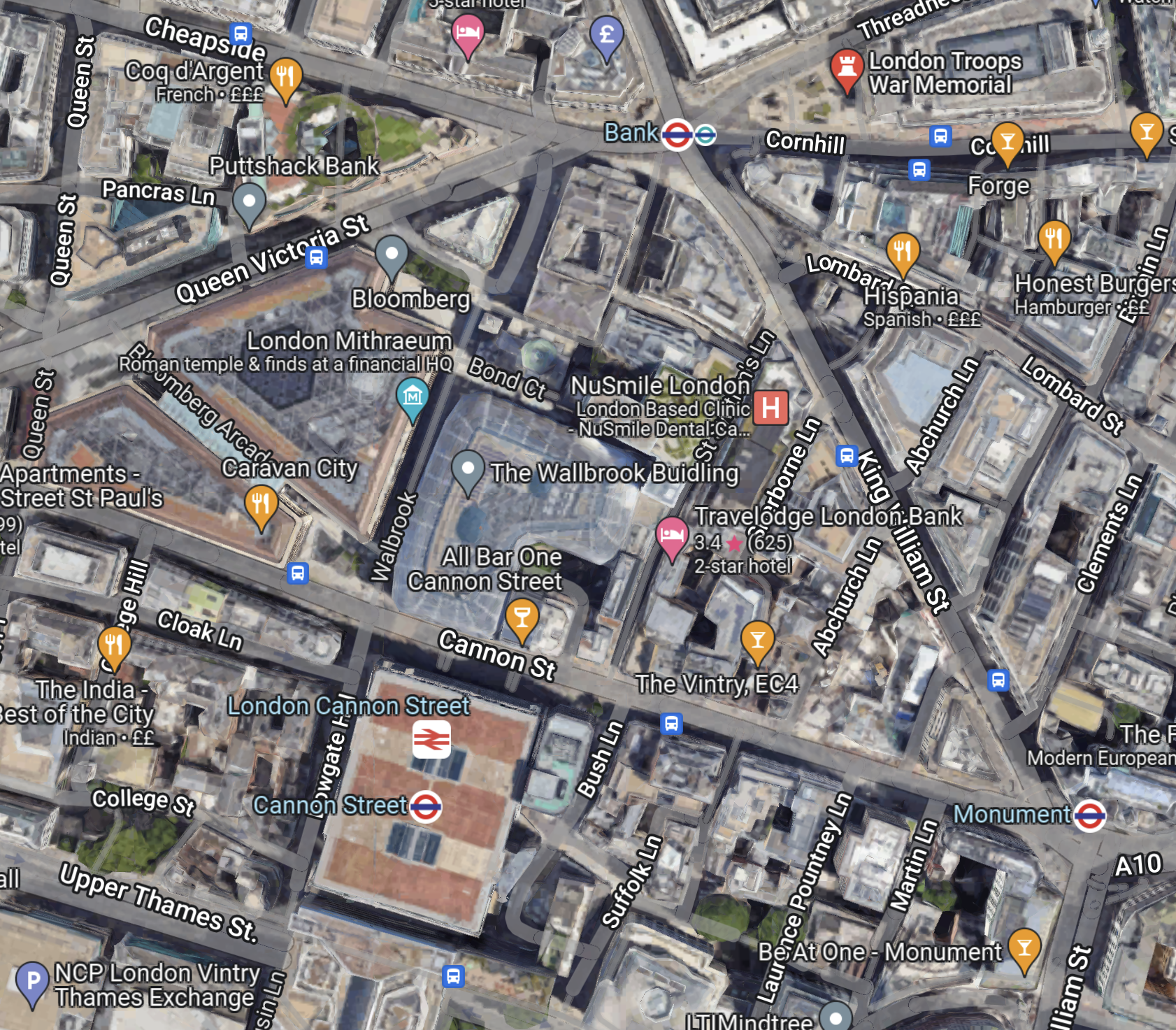
Note.
- The main Bank station entrance the top of the map, by the Bank of England with multiple entrances to the station.
- The main Monument entrance in the South-East corner of the map.
- The Cannon Street entrance will be in the triangle formed by Abchurch Lane, Cannon Street and King William Street.
- The Wallbrook entrance is under the Wallbrook Building.
The station has spread over a wide area, and I wouldn’t be surprised to see more entrances in the future.
Liverpool Street And Moorgate Stations
This Google Map shows Liverpool Street and Moorgate stations.
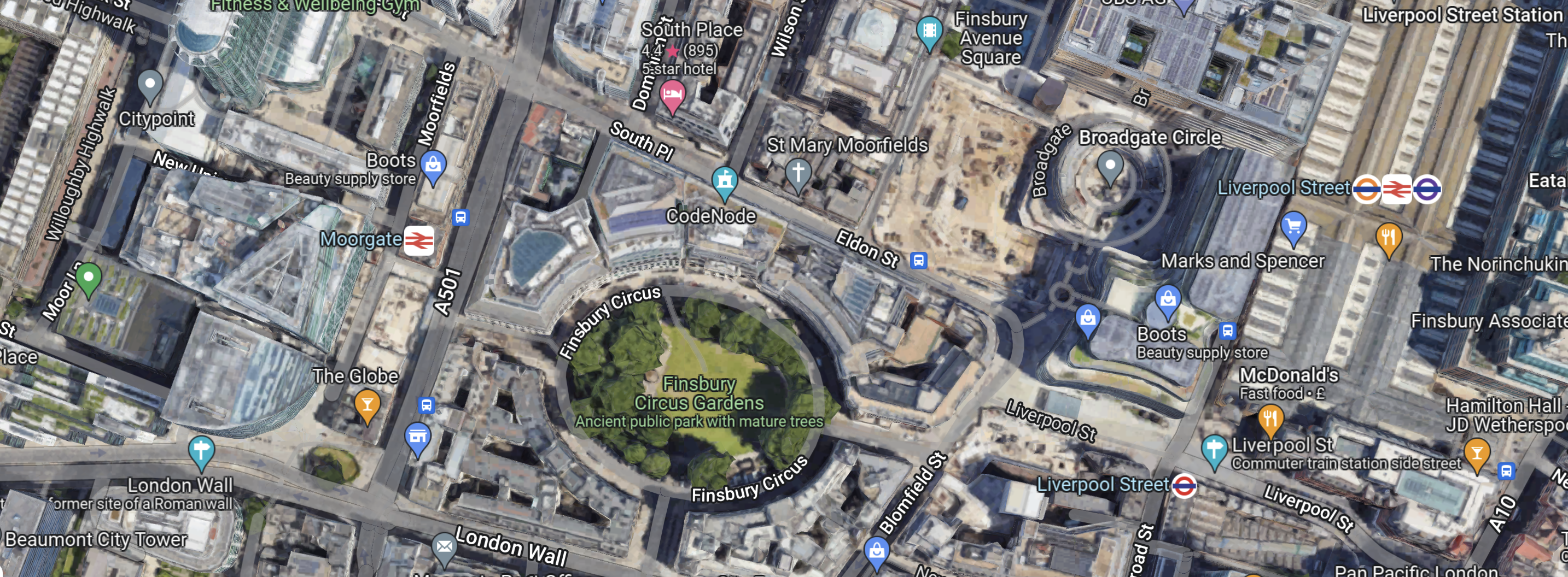
Note.
- The green space is Finsbury Circus Gardens.
- Moorgate station is to the West on the A501 or Moorgate.
- Liverpool Street station is to the East on the A10 or Bishopsgate.
There is now a tunnel between the two stations, as part of the double-ended Liverpool Street Elizabeth Line station.
The drawing from Crossrail shows a cross-section of the Liverpool Street Elizabeth Line station.
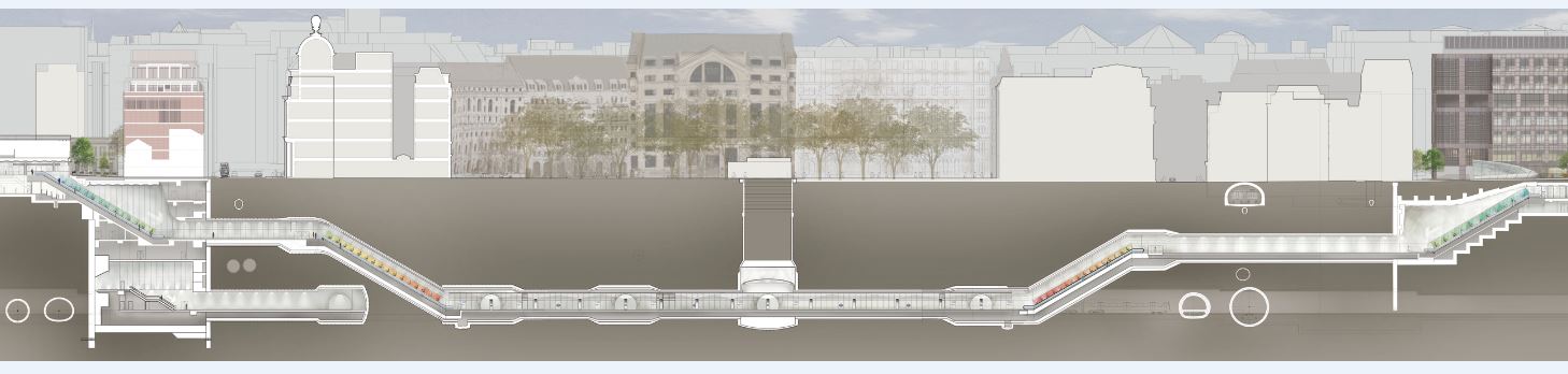
Note.
- Moorgate station is on the left.
- Liverpool Street station is on the right.
- In the middle looking like a giant juicer is the ventilation shaft in Finsbury Circus.
- The Crossrail tunnels, which consist of two running tunnels and a pedestrian walkway between them are at the deepest level.
- There are escalators and lifts all over the place.
If it’s raining it’s a good way between the two stations.
The Rail Lines At Liverpool Street And Moorgate Stations
These routes serve the two stations.
- National Rail – Liverpool Street to Essex, Suffolk and Norfolk
- National Rail – Moorgate to North London and Hertfordshire
- Central Line – Liverpool Street
- London Overground – Liverpool Street to North-East London and Hertfordshire
- City, Hammersmith & City and Metropolitan Lines – Liverpool Street and Moorgate
- Elizabeth Line – Liverpool Street and Moorgate
- Northern Line – Moorgate
Note.
- The Circle, Hammersmith & City and Metropolitan Lines have separate stations and platforms in both Liverpool Street and Moorgate.
- The Elizabeth Line station at Liverpool Street is a double-ended station with entrances in both the original Liverpool Street and Moorgate stations.
- You can walk between Liverpool Street and Moorgate stations using the connecting tunnel of the Elizabeth Line station.
- Both Liverpool Street and Moorgate stations are well-served by buses.
These connections mean that if you arrive in either of Liverpool Street or Moorgate and need to leave from the other main station, you can catch a train on the Circle, Hammersmith & City and Metropolitan Lines for one stop or walk through the Elizabeth Line tunnel or on the surface.
The Triangle Of Lines In The City Of London
The City of London effectively has three main Underground stations, that connect to all the important lines through the City.
- Bank/Monument station connects to the Central, Circle, District and Northern Lines
- Liverpool Street station connects to the Circle, Elizabeth, Hammersmith & City, Metropolitan and Northern Lines.
- Moorgate station connects to the Central, Circle, Elizabeth, Hammersmith & City and Metropolitan Lines.
All three stations have direct Underground connections.
- Bank and Liverpool Street via Central Line.
- Monument and Liverpool Street via Circle Line.
- Bank and Moorgate via Northern Line.
- Monument and Moorgate via Circle Line.
- Liverpool Street and Moorgate via Circle, Hammersmith & City and Metropolitan Lines.
Note.
- All interconnecting services are frequent.
- The Circle at six trains per hour (tph) is the least frequent
- The connections at Bank have much improved recently, due to the Bank Station Upgrade.
It is also possible to walk between the three stations.
In Where The City Of London Leads The Rest Will Follow!, I laid out the plans of the City of London to cut vehicles in the City, impose a 15 mph speed limit and improve cycling and walking routes.
If all goes to plan, then this will open up more routes between the three stations.
Conclusion
Bank, Liverpool Street, Monument and Moorgate will evolve into one large interconnected City of London station, that is served by the Central, Circle, Elizabeth, Hammersmith & City, Metropolitan and Northern Lines.
The most important thing that must be done is improve the information.
At least though, the vast walls that have been created in the Bank Station Upgrade and the Elizabeth Line stations, will be up to the task of informing passengers, the routes they need to take.
The other important thing, is to provide step-free and wheelchair-friendly routes between, Bank, Liverpool Street, Monument and Moorgate, so that passengers with reduced mobility can safely get on their way.
After the current round of construction and upgrades, I don’t think any of the rail routes between the stations are step-free.
Elizabeth Line: Commuters Say Service ‘Not What Was Promised’
The title of this post, is the same as that of this article on the BBC.
This is the sub-heading to the article by Tom Edwards.
All of the huge modernist stations are now open and it is architecturally impressive, but what has service on the Elizabeth line been like since it opened in the summer?
These three paragraphs talk about how passengers have reported problems to Tom.
Many say it has been hit and miss, and commuters in West Ealing have been in touch with me to highlight some of the problems.
They recorded some of their journeys for BBC London, and it doesn’t look pleasant.
Many are really fed up with the delays and cancellations and above all the overcrowding.
As with many new railways, like the London Overground, the Borders Railway and the Dartmoor Line, the passenger numbers on the Elizabeth Line have exceeded projections.
The main reasons are probably.
- Convenience of the new route and its stations.
- Curiosity about the new infrastructure.
- The improved access to the trains with heavy cases.
But in the case of the Elizabeth Line two other factors also apply.
Are Passengers Changing From the Piccadilly to the Elizabeth Line?
Consider.
- The Piccadilly Line trains are smaller than the Elizabeth Line trains.
- The Piccadilly Line trains are not air-conditioned.
- Heathrow Central to Holborn is 62 minutes on the Piccadilly Line and several minutes quicker using the Elizabeth and Central Lines with a change at Bond Street or Tottenham Court Road.
Many passengers, who previously used the Piccadilly Line may swap to the Elizabeth Line for a quicker journey on a more comfortable and spacious train.
The new Piccadilly Line trains will have more space, walk-through carriages and air conditioning, so may well tempt passengers back.
Bond Street And All Stations To the East On the Elizabeth Line Are Only Five Minutes Slower By Elizabeth Line Direct
Consider.
- Heathrow Central and Bond Street is 38 minutes using Heathrow Express and the Elizabeth Line with a change at Paddington.
- Using the Elizabeth Line all the way takes 43 minutes.
- The figures for Liverpool Street are 46 and 51 minutes respectively.
- The figures for Canary Wharf are 53 and 58 minutes respectively.
Note.
- The direct route avoids the change at Paddington.
- The change at Paddington between Heathrow Express and the Elizabeth Line is not onerous.
- Routes using Heathrow Express are fifteen pounds more expensive.
- If you’re desperate for a coffee, you can pick one up, when you change at Paddington using Heathrow express.
I believe a regular traveller to Heathrow, who has easy access to an Elizabeth Line station and in the past has used Heathrow Express will give the Elizabeth Line a chance.
The Jewel In The East Is On The Elizabeth Line
In 2014, I wrote Is Whitechapel Station Going To Be A Jewel In The East?.
Consider.
- The Elizabeth Line will go through the station with a frequency of up to 24 trains per hour (tph).
- The two Eastern branches of the Elizabeth Line split to the East of Whitechapel station.
- There will be four tph between Heathrow and Whitechapel.
- The East London Line of the London Overground goes through the station with a frequency of 16 tph, that will be raised to at least 20 tph in a few years.
- The District Line goes through the station with a frequency of upwards of 12 tph.
- The Hammersmith and City Line goes through the station with a frequency of 6 tph.
- The station has large numbers of lifts and escalators.
Passengers from all over the Eastern half of London will change at Whitechapel on their journey to and from Heathrow.
Farrington station Connects Thameslink And The Elizabeth Line
Consider.
- The Elizabeth Line will go through Farringdon station with a frequency of up to 24 tph.
- The Circle, Hammersmith and City and the Metropolitan Lines will go through the station with a combined frequency of up to 24 tph.
- Thameslink will go through the station with a frequency of up to 14 tph.
Passengers from Thameslink’s catchment area will change at Farringdon on their journey to and from Heathrow.
Overcrowding On The Elizabeth Line
It is not a surprise to me, that the Western end of the Elizabeth Line is overcrowded.
I noticed it in November 3022, when I wrote So Many Cases On A Train!.
What Can Be Done To Ease The Overcrowding?
These are possible ways to ease the overcrowding.
Increase The Number Of Trains To Heathrow
I would feel the obvious way to increase the number of trains to Heathrow, would be to run direct trains between Shenfield and Heathrow.
Currently, there are these trains.
- 4 tph – Heathrow Express – Paddington and Terminal 5
- 2 tph – Elizabeth Line – Abbey Wood and Terminal 4
- 2 tph – Elizabeth Line – Abbey Wood and Terminal 5
But is there the capacity to add extra trains between Hayes & Harlington and Heathrow through the tunnel?
Run A Service Between Shenfield And Hayes & Harlington
This would add capacity in West London, where it is needed, but wouldn’t add any extra trains through the tunnel to Heathrow.
By timing this service in combination with the Elizabeth Line services to Heathrow, I suspect a very efficient service between Heathrow and both Eastern terminals could be devised.
- As four tph run between Abbey Wood and Heathrow, four tph would be run between Shenfield and Hayes & Harlington.
- Going towards Heathrow, the train from Shenfield to Hayes & Harlington would be a few minutes in front of the train from Abbey Wood to Heathrow. Passengers going from Shenfield to Heathrow would be instructed to change at any station between Whitechapel and Southall, by waiting a few minutes for the following train.
- Coming from Heathrow, passengers wanting to go to Shenfield would walk across the platform at Hayes & Harlington to catch the waiting train to Shenfield. The Shenfield train would follow a few minutes behind the Abbey Wood train.
Note.
- The two train services would run as a pair, a few minutes apart.
- No new infrastructure would be required.
Currently, there are eight tph between Whitechapel and Hayes & Harlington.
Four tph between Shenfield and Hayes & Harlington would increase the following.
- The capacity between Whitechapel and Hayes & Harlington by fifty percent.
- The train frequency in the central tunnel to twenty tph or a train every three minutes.
- The frequency between Paddington and Shenfield to twelve tph.
There would still be four tph available for more services.
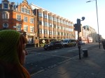
Hackney Central Before Levelling Up
This press release from Hackney Council is entitled £19m Funding Boost For Town Centre At Hackney’s ‘Beating Heart’.
This summary is in the first two paragraphs.
A greener, safer and more welcoming Hackney Central is one step closer after Hackney Council’s successful application for £19m in Levelling Up funding.
The award will see five acres of public space transformed, bringing new green space, trees and seating along Amhurst Road, investment in Hackney Central Library, a much-needed redesign of Pembury Circus junction, new creative workspace and a rejuvenated Hackney Town Hall Square.
This is the summary from the Government’s levelling-up document.
£19 million for renovating public spaces in Hackney Central, such as the iconic Town Hall Square, as well as new creative workspace and upgrades to the Hackney Central Library.
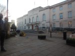
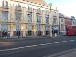
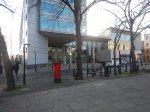
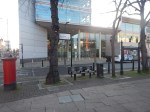
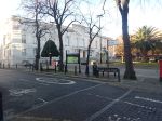
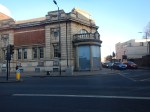
So. this afternoon I went for a walk around Hackney Central and took these pictures.

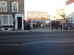
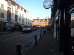
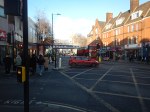
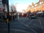
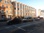


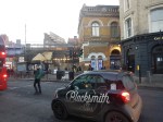

Note.
- The roundel is missing outside the Graham Road entrance to Hackney Central station.
- Hackney Town Hall is a Grade II Listed Building, dating from the 1930s.
- I wrote abut the Hackney Picturehouse in The Film That Changed My Life!.
- The Hackney Empire is a Grade II* Listed Building.
- The Pizza Express is new, swanky and spacious, and not what I’d expected. I had a late lunch there.
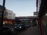
- The bridge carrying the Overground over Mare Street needs improvement.
- I wrote about the Hackney Marks and Spencer in Levelling Up – The Marks & Spencer Way.
- St. Augustine’s Tower is the oldest building in Hackney.
- The main building of Hackney Central station is now a bar and music venue.
In words that could be attributed to legendary estate agent; Roy Brooks, it is an area with potential.
These are some thoughts.
The Town Hall Square
What puzzles me about the garden in front of the Town Hall, is the two trees, which I would associate with warmer climes.
Even today, when it was rather cold, there were still flowers in front of the Town Hall.
The Overground
I argue that the coming of the London Overground raised the standard of Dalston, Hackney, Whitechapel and other parts of East and South London to that of their more desired and affluent neighbours.
We can’t really attribute the the creation of the London Overground to any one politician, as it has been an aspiration of several politicians and rail professionals since the 1990s. This History section in the Wikipedia entry for the Overground lists all the false starts and hopes.
But one man; Peter Hendy has been there most of the time and has worked with all three of London’s Mayors and several Transport Ministers.
I do wonder how much the Overground benefited from a sane, quiet hand from someone like Lord Hendy.
The Overground has certainly done its best for Hackney and we need more of its common sense approach to levelling-up all over the country.
Marks And Spencer
When I moved back to London, Hackney had a terrible Marks and Spencer.
As one of their biggest London stores, is just three stops away on the Overground, it might have been financially prudent to close the store at Hackney Central.
But Marks did the opposite and converted it into an upmarket food store, which is much more Knightsbridge than East End.
It’s certainly convenient for me, as I can get a bus there and a bus back, with only a hundred metre level walk at both ends.
The Graham Road Entrance To Hackney Central Station
This makes it easier to travel around Hackney and to get to the Town Hall, Theatre, Cinema and Library area.
How many extra entrances to railway stations will improve journeys and attract more passengers?
The Continuous Development Of The Hackney Central And Hackney Downs Complex
Since I moved to Hackney three projects have been completed on the station complex.
- A walkway has been built between the two stations to ease interchange.
- Lifts have been added to the footbridge at Hackney Central.
- The Graham Road entrance has been opened.
Two other projects have been proposed, but nothing has been actioned.
- A replacement entrance to Hackney Central station on the North side of the station.
- Step-free access to Hackney Downs station.
Will either of these projects be covered by the levelling up funding?
Pizza Express
This opened in December and I hadn’t seen it before, but you won’t notice it, unless you walk or ride on a bus up Mare Street, which I rarely do these days, since Hackney Wick station has been rebuilt.
So I was surprised to see it and like the Marks and Spencer it is more upmarket than other pizzadromes in East London.
- There is a lot of space.
- It has a proper wheel-chair entrance, that no-one could fault.
- Seating is upmarket, with several tables having a good view of the street outside. Ideal for someone eating alone, as I do regularly.
The restaurant still has a few rough edges, but it has the potential to be a pizzadrome to visit.
I do wonder, if the upmarket Marks and Spencer and Pizza Express are in a way an endorsement of Hackney’s plans for the future, by two market leaders of the High Street.
Buses
There are a lot of bus routes going through the area, which is a good thing.
But the information could also be improved.
Clapton Bus Garage
This map shows the location of Clapton bus garage.
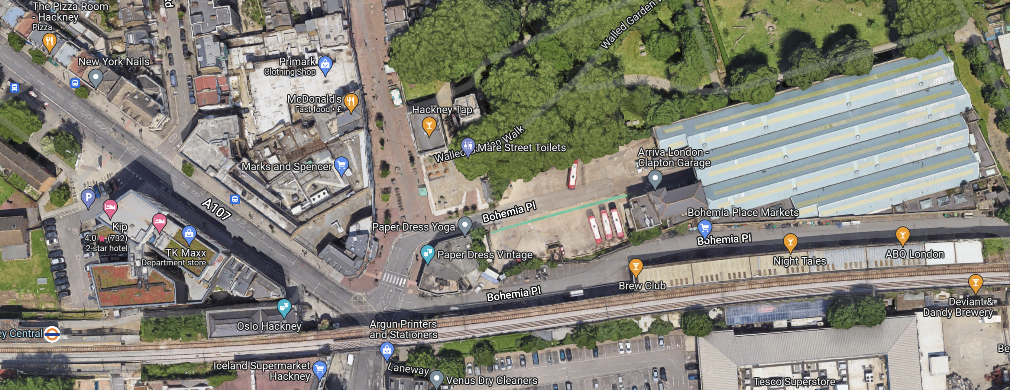
Clapton bus garage is the large building in the North-East corner of the map, red buses with white roofs outside.
This document on the Hackney Council web site is entitled Draft Hackney Central And Surrounds Masterplan, where this is said.
Relocate Clapton Bus Garage to an alternative site, to develop the site for mixed use, commercial/
residential development, and create a new route from St John-at-Hackney Churchyard Gardens to
Bohemia Place and beyond.
This sounds like a good idea, as part of the congestion in the area is caused by buses having to fight their way into the garage, when the roads are busy.
If they built, the right flats there I might be interested, as the site has good transport connections and an excellent Marks and Spencer.
Ashurst Road And Pembury Circus
This paragraph is in Hackney’s press release.
The award will see five acres of public space transformed, bringing new green space, trees and seating along Amhurst Road, investment in Hackney Central Library, a much-needed redesign of Pembury Circus junction, new creative workspace and a rejuvenated Hackney Town Hall Square.
Cut out what I have already covered and you get.
The award will see public space transformed, bringing new green space, trees and seating along Amhurst Road and a much-needed redesign of Pembury Circus junction.
This map shows Amhurst Road and Pembury Circus.

Note.
- Amhurst Road runs NW-SE across map.
- Hackney Central station is at the bottom of the map on the North London Line, which runs East-West.
- Hackney Downs station is the other station in the middle of the map.
- Pembury Circus is to the East of where Amhurst Road runs under the railway, at the top of the map.
- Dalston Lane runs between Pembury Circus Hackney Downs station.
I know the area around Hackney Downs station well.
- I regularly take a train to Hackney Downs station and get a 30 or 56 bus to my home from a bus stop on Dalston Lane.
- It can be a very unfriendly and cold place to catch a bus late at night.
But saying that, I’ve never had any trouble.
Improvements in that area, would certainly make my journey easier.
I would like to see the bus stops at Hackney Downs station moved to under the railway bridge to both improve shelter and cut the walking distance.
Conclusion
This could be £19 million very well spent and all residents of Hackney, myself included, could benefit.
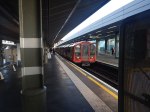
So Many Cases On A Train!
This afternoon about three, I went to West Ealing station to see what it was like to transfer between the Elizabeth Line Central Tunnel and the Western Branch at Paddington.
Coming back, I took an Elizabeth Line service that had started from Heathrow Airport and it was one of the busiest Lizzies, I’d ever ridden!
To get on the train at West Ealing station, I got in to probably coach 4 of 9, as that was in the dry and the back end of the train I needed for Moorgate station was certainly in the wet.
I then had to walk half the length of the train to get to the back of the train.
It was not easy, as the train was full of scores of passengers with large wheelie cases.
This got me thinking.
Are Passengers Transferring To The Lizzie Line?
And especially those with large cases. that are the sort you could use for bringing in a pair of folded-up contortionists.
- These cases don’t fit well on the Piccadilly Line, which has only a few step-free stations.
- From what I’ve seen cases are easily wheeled to Elizabeth Line platforms at Heathrow.
- Many of these cases won’t fit in the average family car.
- All parking is expensive at Heathrow, whether it is short, medium or long.
- Valet parking at Heathrow has been devalued by all the scam artists.
- Taxis are the province of those that own oil wells, hedge funds or belong to the highest wunch of bankers.
- Pick-up and drop-off is now very expensive.
- There were a good proportion of couples, who were both dragging or pushing a massive case.
- The Elizabeth Line is cheaper than the Heathrow Express.
- The Elizabeth Line like the Piccadilly Line allows the use of a bank card as a ticket.
- Only the Elizabeth and Piccadilly Lines take you direct to dozens of stations with only same-platform interchanges.
- The Elizabeth Line has step-free interchanges with the Bakerloo, Circle, District, Hammersmith and City, Jubilee, and Metropolitan Lines, the Docklands Light Railway and the London Overground.
- Whitechapel has been turned into a major transport hub for the Easternmost part of London.
There seems to be quite a few reasons why a traveller going to or from Heathrow might at least try the Elizabeth Line.
And travellers seemed to be doing it in droves today!
Were Upmarket Passengers Using The Lizzie Line?
Take the couple next to me on the train from West Ealing.
- Around sixty.
- Very well-dressed.
- Possibly Mediterranean or South American.
- Matching medium-size wheelie-cases.
- She was wearing expensive glasses.
A couple of years ago, they would have probably used the Heathrow Express.
They certainly weren’t the only passengers, who looked like archetypal Heathrow Express passengers.
Will The Lizzie Line Take Passengers From The Piccadilly Line?
As the cost will be the same, I suspect the answer will be yes.
Although, there will be groups of travellers, who will probably remain loyal to the Piccadilly Line.
- If you were going to or from the step-free Cockfosters or Oakwood, with a heavy case, all the way on the Piccadilly Line could be a simple sensible option. I used to live near Oakwood station and remember several long trips on the Piccadilly Line, but not too Heathrow.
- The step-free Kings Cross St. Pancras, Green Park, Knightsbridge and Earls Court may well have reasons to keep their regular passengers.
- Those only travelling a few stops to or from Heathrow will probably stay with the Piccadilly Line for convenience.
- Transport for London have been adding step-free access to the Heathrow Branch and this will surely promote use.
The Piccadilly Line is also getting new trains in a few years.
In Extending The Elizabeth Line – Piccadilly Line To Ealing Broadway, I talked about a proposal to turnback some Piccadilly Line trains at Ealing Broadway station.
I think it is a good idea, as it could make it simpler for Piccadilly Line passengers to access Heathrow and reduce congestion on the Piccadilly Line.
Will The Lizzie Line Take Passengers From The Heathrow Express?
This is an extract from Extending The Elizabeth Line – Piccadilly Line To Ealing Broadway
It will be difficult to predict what will happen to Heathrow Express, but I suspect several groups of passengers will desert it.
- Passengers wanting to go anywhere East of Paddington without changing trains.
- Passengers wanting any Elizabeth Line station.
- Passengers, who don’t like the prices of Heathrow Express.
- Passengers using Oyster or contactless cards.
- Passengers who want to ride on London’s spectacular new Elizabeth Line.
After Old Oak Common station is opened for High Speed Two, the numbers could further decrease.
Will Heathrow Express survive?
Will The Lizzie Line Attract Passengers Who Usually Drive?
Large swathes of the country already have single-change step-free access to the Elizabeth Line.
- All services out of Liverpool Street and/or Stratford.
- All services out of Moorgate.
- All Thameslink services through Farringdon.
- All services out of Paddington.
- All services through Abbey Wood.
- When Crossrail to Ebbsfleet (C2E) opens, this will add all services through Gravesend and Ebbsfleet.
- When High Speed Two opens, this will add all services through Old Oak Common.
- When the Western Rail Approach To Heathrow is completed, this will add all services through Reading.
If you can get a train direct to the Elizabeth Line network and then a train direct to your terminal, would you seriously want all the hassle of parking after a two hour drive?
I can see parking at Heathrow suffering a severe lack of demand.
Conclusion
Lizzie will start a revolution in travel to and from Heathrow.
