Improvements To Oakwood Station
This post on IanVisits is entitled Enfield Council Outlines Possible Rail Station Upgrades.
By reading Enfield Council documents, Ian has found possible station improvements that might happen.
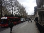
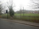
Ian says this about Oakwood station.
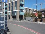
Building around 50 homes on the station car park should contribute to street improvements around the station.
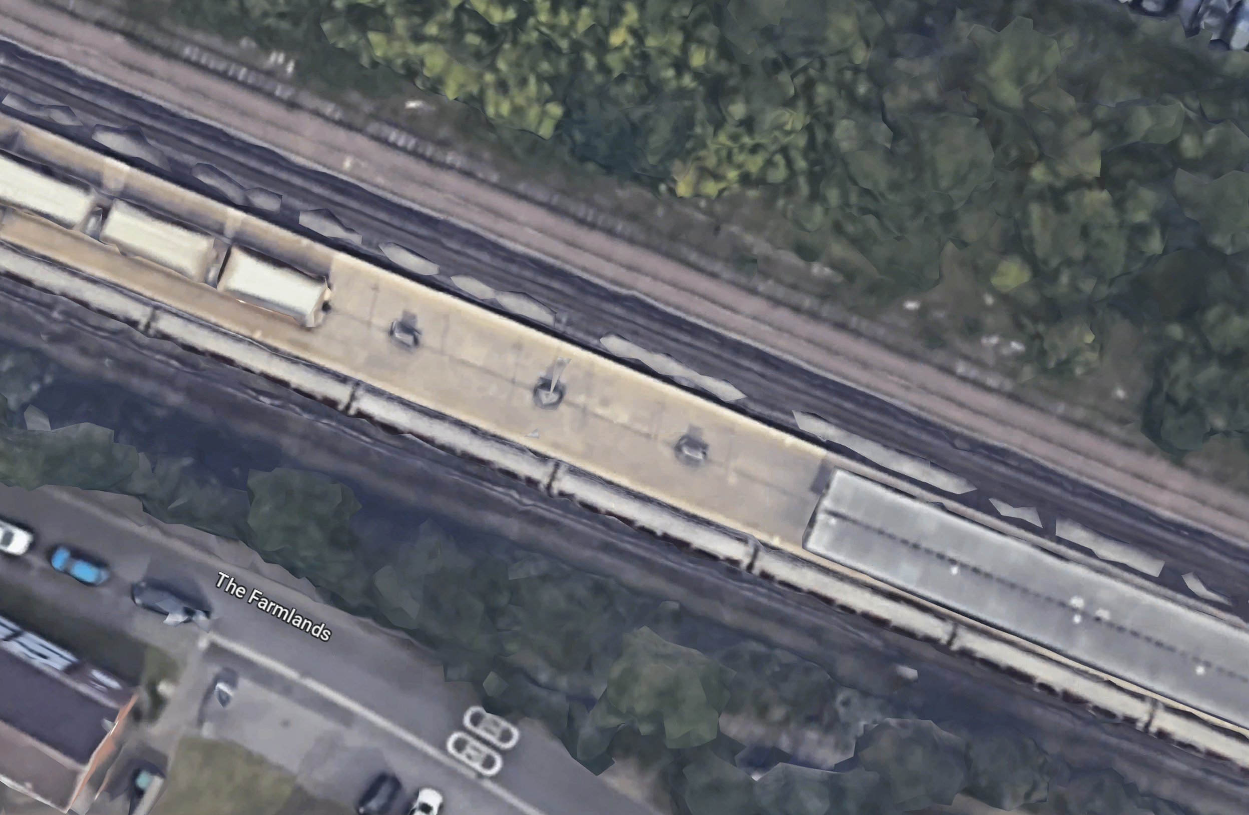
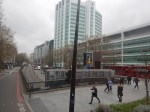
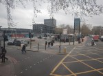
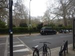
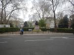
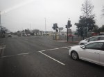
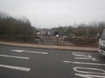
This Google Map shows the station and its two car parks.
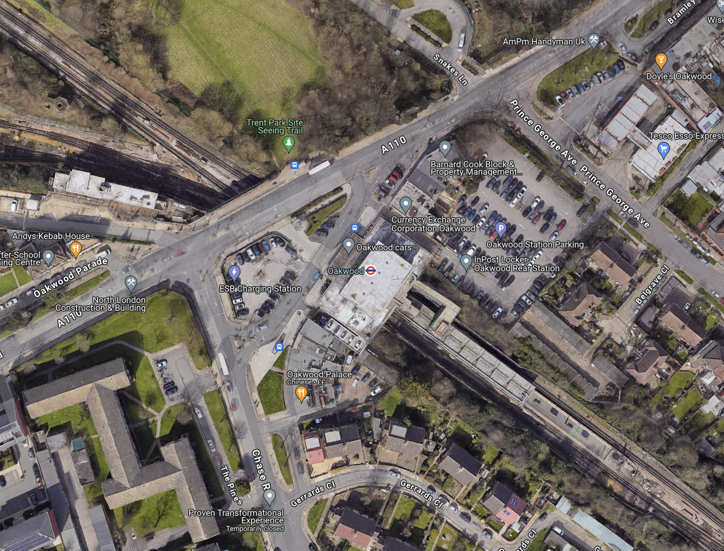
Note.
- The Piccadilly Line runs North-West-South-East diagonally across the map.
- Cockfosters station is to the North-West.
- Southgate station is to the South-East.
- Oakwood station is in the middle of the map and marked by a London Underground roundel.
- The car park to be developed is to the North-East of the station.
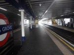
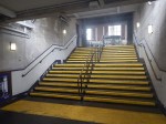
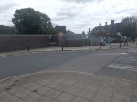
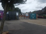
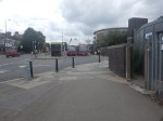
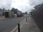
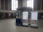
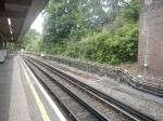
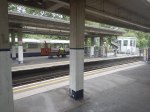
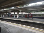
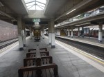
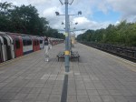
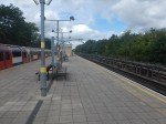
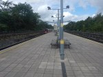
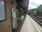
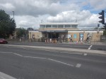
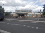
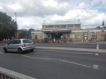
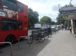
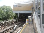
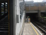
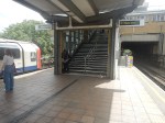
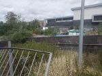
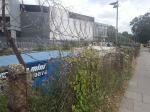
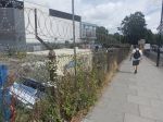
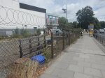
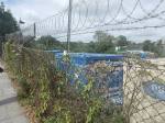
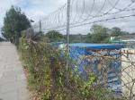
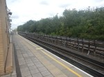
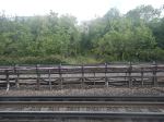
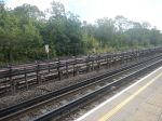
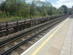
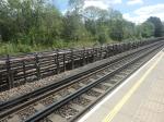
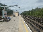
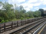
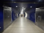
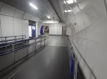
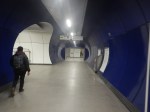
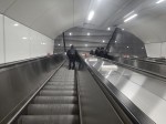
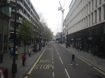
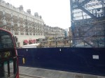
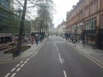
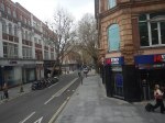
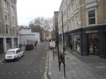
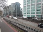
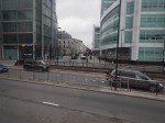
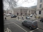
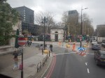
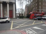
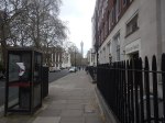
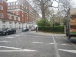
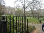
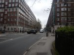
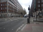
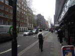
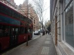
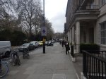
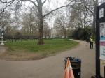
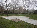
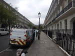
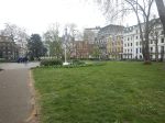
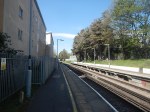
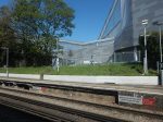
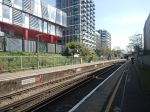
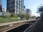
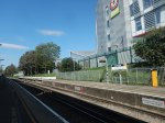
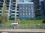
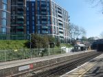
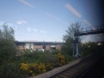
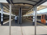
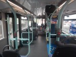
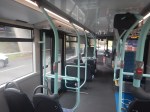
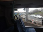
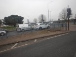
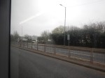
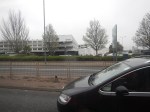
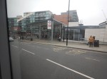
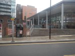
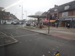
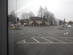
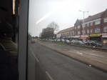
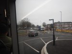
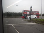
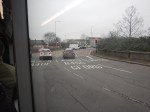
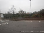
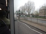
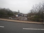
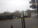
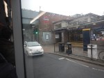
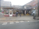
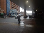
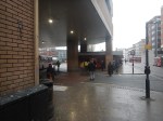
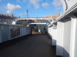
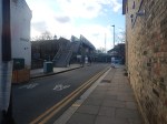
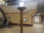
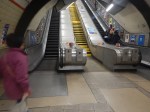
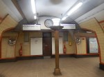
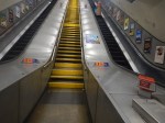
I took these pictures.
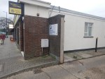

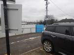

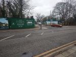


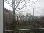
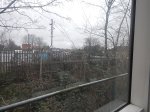
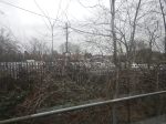
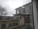
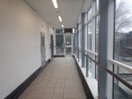
Note.
- The car-park was full.
- The station is step-free.
- Barnard Cook was there, when I lived in Oakwood in the early 1960s.
I can’t see any problems building a few houses on the car-park, but what will happen to the cars?
To me though Oakwood station is defined by this post; The Place Where The Bottom Fell Out Of A Drawer.
Are Londoners The Tunnel Kings?
I was born in 1947 and it was in the early 1960s, that I started to develop an interest in engineering, which eventually led me to study Electrical Engineering and Electronics at Liverpool University.
Like most Londoners, I was a frequent user of the Underground and for six or seven years, I took the Piccadilly Line many days between Oakwood and Southgate to go to Minchenden Grammar School. Often, after school, I would go on to my father’s print works near Word Green tube station.
But not memories of London’s tunnels were so memorable at that time. One day, we were driving to see my Uncle Bert in Broadstairs and we were held in the Blackwall Tunnel for an hour or so because of an accident.
Perhaps, this is why I can remember a black-and-white video of digging the Western Tunnel of the Dartford Crossing so vividly. But as Raymond Baxter probably explained to BBC viewers at the time, it dug using a Greathead shield under pressure to keep the water out. It was probably the last tunnel dug under the Thames using methods, that would have been familiar to Victorian engineers.
This British Pathe video shows some of the construction of the Western tunnel.
This paragraph from the Wikipedia entry for the Eastern Tunnel describes its construction.
Construction was approved in April 1971, with an initial expected opening date in 1976. Work was delayed due to a lack of funds, which was resolved by EEC funding granted in 1974. The second tunnel opened in May 1980, allowing each tunnel to handle one direction of traffic, by which time the joint capacity of the two tunnels had increased to 65,000 vehicles per day. Connection of the crossing to the M25 was completed on the northerly Essex side in September 1982 (Junction 31), and to the southerly Kent side in September 1986 (Junction 1a)
The tunnels may be inadequate in terms of capacity, but they have certainly done a reliable job for sixty and forty-three years respectively.
There are other tunnels under the Thames, that have been built in my lifetime.
- Thames Cable Tunnel – 1970 – National Grid’s 400 kV cable.
- High Speed One – 2007
- Dartford Tunnel (East) – 1980
- Dartford Tunnel (West) – 1963
- Dartford Cable Tunnel – 2004
- Docklands Light Railway Tunnel – 2009
- Elizabeth Line Tunnel – 2014
- Millennium Dome Cable Tunnel – 1999
- Jubilee Line Tunnels – 1999 – Planned by Artemis
- Blackwall Runnel (East) – 1967
- Isle of Dogs Jubilee Line Tunnels – 1999 – Planned by Artemis
- Docklands Light Railway Tunnel – 1999 – Planned by Artemis
- Deptford Cable Tunnel –
- Jubilee Line Tunnels – 1999 – Planned by Artemis
- Victoria Line Tunnel – 1971
- New Cross to Finsbury Market Cable Tunnel – 2017
- Wimbledon to Pimlico Cable Tunnel – 1996
- London Power Tunnels – 2018, 2011
There are also these tunnels, which don’t go under the Thames
Bank Station Expansion And New Southbound Northern Line Tunnel – 2022
- Elstree to St. John’s Wood Cable Tunnel – 2005
- Heathrow Rail Tunnels – 1998
- Lee Tunnel – 2016
- Limehouse Link Tunnel – 1993
- Lower Lea Valley Cable Tunnels – 2008
- Northern Line Extension To Battersea – 2021
- Piccadilly Line Extension To Heathrow – 1975-2008
- Thames Tideway Tunnel – Estimated completion in 2025 – Tunnelling ended in 2022.
- Thames Water Ring Main – 2010
Note.
- The date is the opening date.
- I am pleased to see that at least some projects were planned, with the software, I wrote in a Suffolk attic.
In my lifetime, at least 27 substantial tunnels have been completed, a very large proportion of which have been on time and on budget, with the possible exception of the Heathrow Rail Tunnels, which collapsed.
So Why Has London Got A Good Record On Tunnelling?
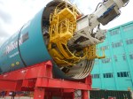
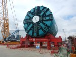
In Millicent And Ursula Prepare To Go Tunnelling, I describe my visit to the Tideway Open Day today to see the tunnel boring machines; Millicent and Ursula before they went tunnelling.
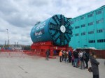
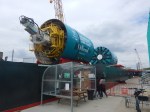
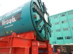
On that Sunday morning, I also chatted with the engineers and tunnelers.
- All had worked on at least one of London’s previous tunnels.
- One had worked on the Second Dartford Tunnel, the Channel Tunnel and Crossrail.
- A couple said, that after the Tideway finished, they would be off to High Speed Two.
Is London’s good record on delivering tunnels safely and on time and on budget, a case of lots of experience and practice makes perfect?
If it is, we should definitely think hard about how we handle large projects.
Wind Farms
Many have been constructed this way.
- The grid substation and connection to the grid is built.
- The foundations of the turbines are installed.
- The turbines are erected.
- All the turbines are commissioned.
This sequence or something like it can be applied to onshore and offshore wind farms.
- Most jobs are repeated many times by specialist teams using purpose-built cranes, ships and other equipment.
- Bigger wind farms, just need more repeated operations.
- All operations are generally in a small geographical area.
- I suspect specialist software has been built to project manage, the building of wind farms. If it hasn’t, I have my ideas.
Project management should be relatively easy.
Are Arnos Grove And Northolt Tube Stations Going Step Free?
BBC London local news announced this morning some Underground stations would be made step-free.
- It could have been two or ten stations, that would be made step-free.
- Arnos Grove and Northolt were definitely mentioned.
- A timescale of eighteen months was given.
The news story seems to have vanished without trace.
Arnos Grove Station
This Google Map shows Arnos Grove station.
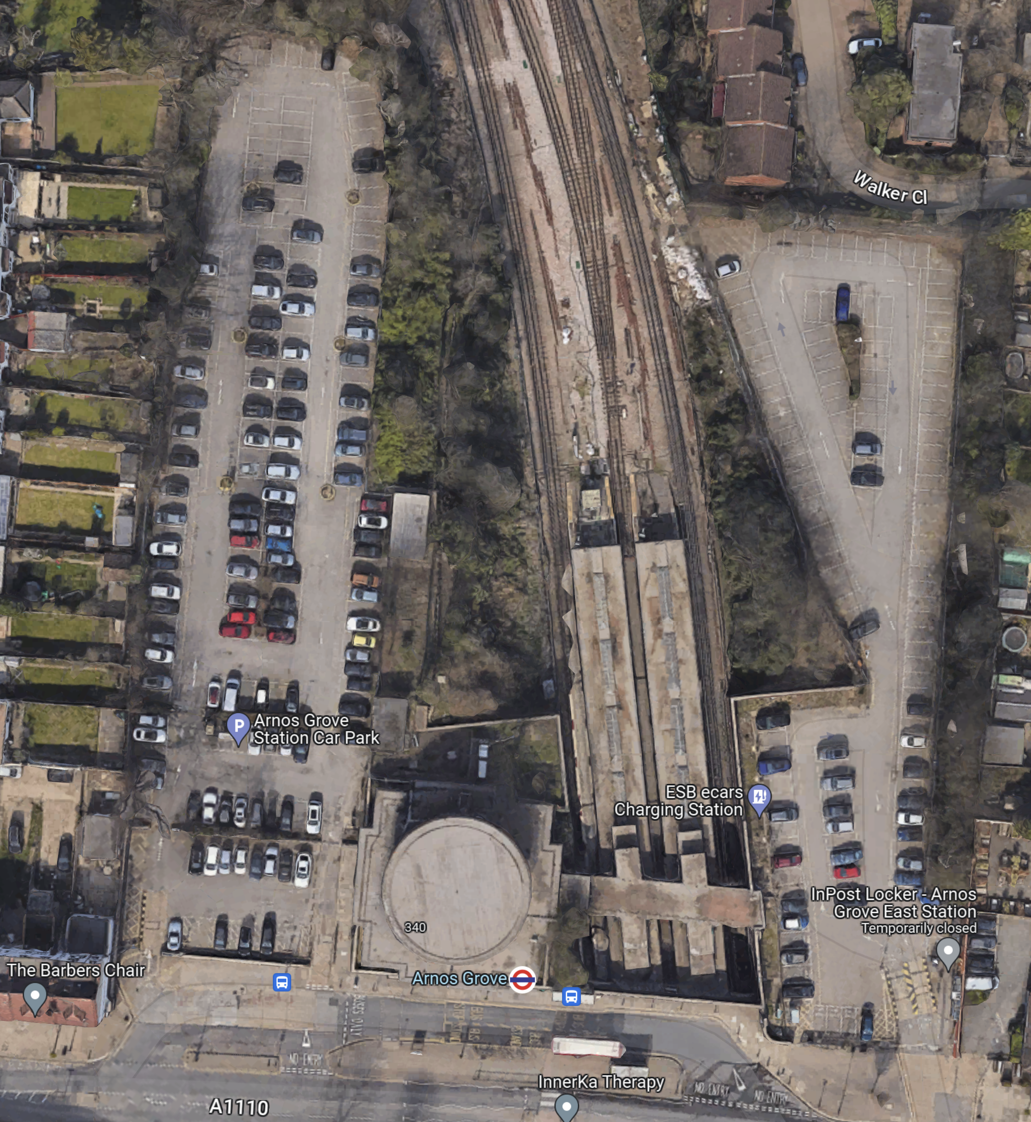
Note.
- The cylindrical shape of Arnos Grove station.
- The bridge over the tracks, which gives access to the trains to the East of the cylinder.
- Car parks to the East and West of the station.
- In Go-Ahead For West London 460-Home Build To Rent Scheme, I described how houses were to be built in the two car parks.
- According to this article on Ian Visits, which is entitled Plans To Build Flats On Arnos Grove Tube Station Car Park, there will be 162 flats in four blocks.
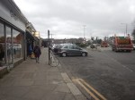
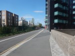
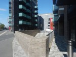
These pictures show Arnos Grove station.

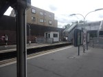
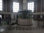
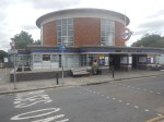


Note.
- Work on the flats on either side seems to have started.
- There are lots of period features.
- There will be a lot of work needed on the rather steep stairs.
- There will be a need for at least three lifts.
This page on Connected Living London, has a plan of the development.
- Gardens are shown each side of the iconic station.
- The gardens can be accessed from the pavement in front of the station.
- Southbound buses draw up in front of the station.
- A zebra crossing gives access to the Northbound buses on the other side of the road.
I suspect that there will be step-free access to the station bridge over the tracks from both gardens.
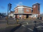
Northolt Station
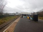
This Google Map shows Northolt station.
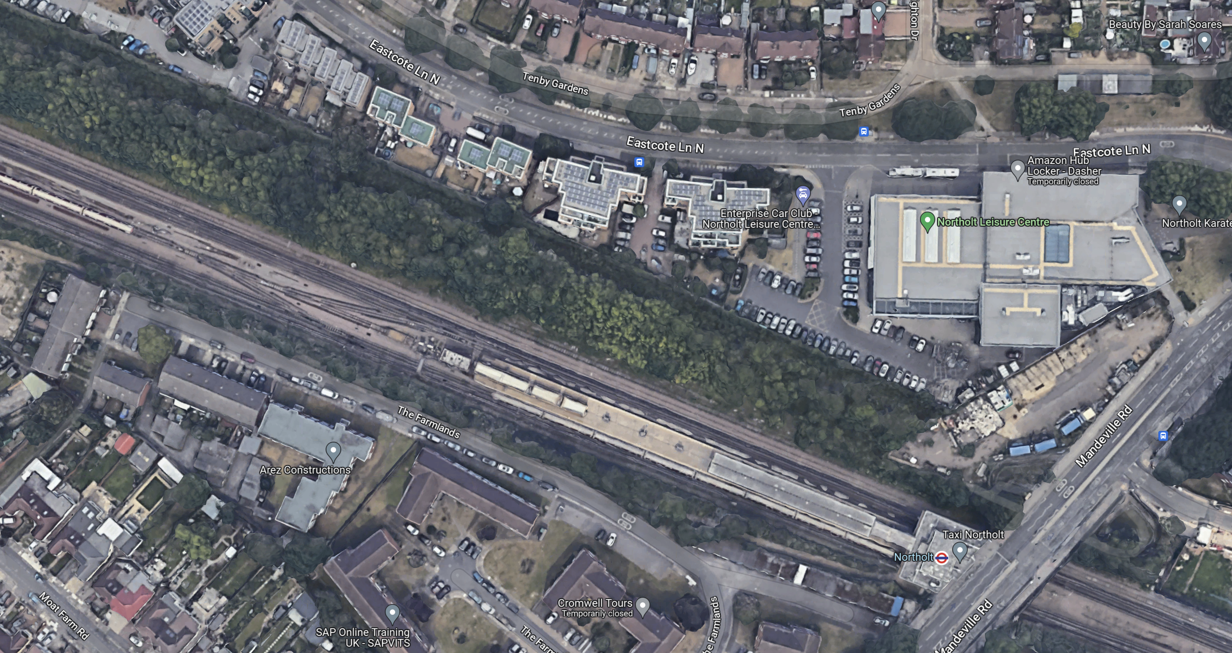
Note.
- The station entrance in the South-East corner of the map on Mandeville Road.
- The long island platform stretching North-West from the station building.
- An eight-car 1992 Stock train is in the Southern platform going West.
- The land on the Northern side of the railway appears to be low-grade woodland, which is quite similar to that at Arnos Grove station.
This map from cartometro.com shows the lines through Northolt station.
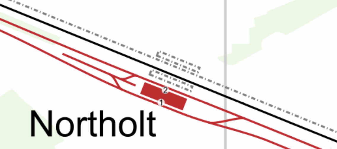
Note.
- The Central Line is shown in red.
- The Central Line is laid out so that there are two ways of turning a train back to London.
- The single-track Acton-Northolt line is shown in black.
- The former second track if the Acton-Northolt line is shown dotted, as are the two former platforms.
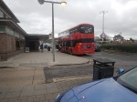
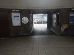
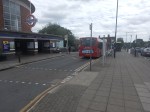
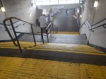
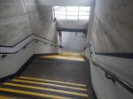
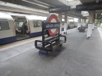
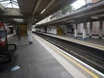
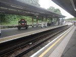
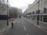
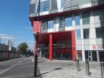
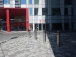
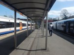
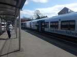
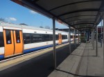
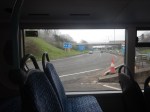
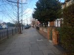
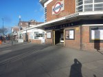
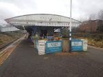
These pictures show Northolt station.
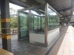
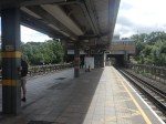
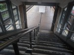
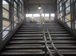

Note.
- The station is showing signs of a sympathetic refurbishment.
- The steps down to the platform is a double set of steps separated by a handrail.
- There is a stylish glass shelter.
- There doesn’t seem much space for a lift to the station entrance.
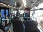
It should also be noted that for eleven in the morning, the station seemed busy.
These are Underground passenger figures for 2021 in million for stations between Hanger Lane and West Ruislip.
- Hanger Lane – 1.47
- Perivale – 1.08
- Greenford – 2.05
- Northolt – 2.47
- South Ruislip – 0.89
- Ruislip Gardens – 0.48
- West Ruislip – 0.71
Note.
- Greenford, South Ruislip and West Ruislip have some extra National Rail passengers.
- Greenford is the only station between Hanger Lane and West Ruislip, with full step-free access.
- Greenford station uses an inclined lift and I wrote about it in The Inclined Lift In An Improved Greenford Station.
As Northolt is the busiest station without step-free access, this is probably sufficient reason for step-free access to be installed.
Could Step-Free Access At Northolt Be Linked To Property Development?
This Google Map shows a close-up of the station building and Mandeville Road.

Note.
- The station building is marked by the London Transport roundel.
- To the North of the station, is Northolt Leisure Centre, which was opened in 2010.
- Mandeville Road runs across the map to the East of the station and the Leisure Centre.
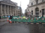
- In the South-East corner of the map, thee looks what could be a High Speed Two site, marked out with red and white barriers.
- Between the station and the Leisure Centre, there appears to be a site used for parking trucks.
Could it be possible to develop step-free access from the site to the North of the station?
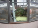
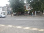
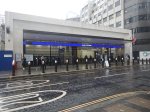
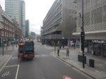
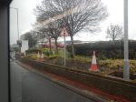
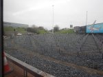
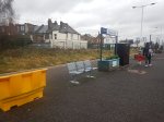
This second set of pictures show that site.

Note.
- The site is rather a dump.
- There is even a subway.
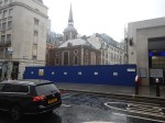
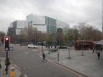
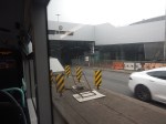
This third set of pictures, show the land on the other side of the Acton-Northolt line from the platform at Northolt station.

There are certainly possibilities! Especially if, housing were to be developed alongside the Northern side of the railway.
I suspect, that there could be a bridge across the railway, at this position in the station.
Certainly something would be possible.
Conclusion
Property development at both Arnos Grove and Northolt station would probably need step-free access at both stations.
If the BBC report was right, then to build the step-free access as the first part of the projects, is probably a good idea, as passengers get some early benefits.
I suspect though, that we’ll get a press release that says what is actually happening in a few days.
Could High Speed Two Have An Underground Station In London?
The Achievement Of The Bank Station Upgrade
This map from OpenRailwayMap shows the lines through Bank and Monument stations.
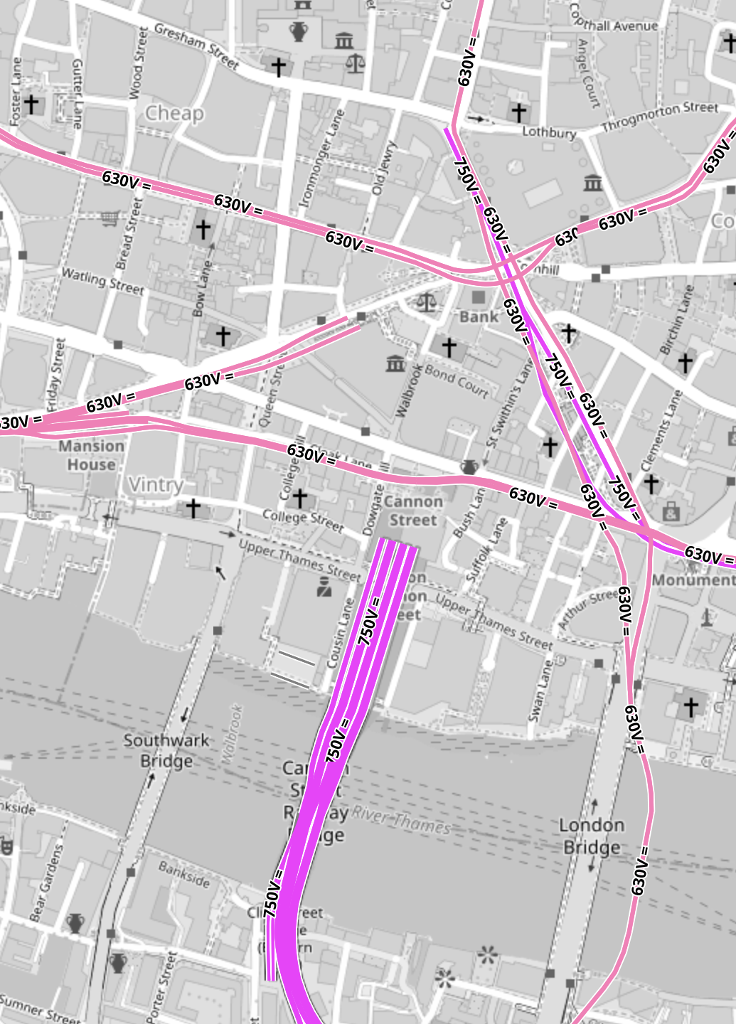
Note.
- All the pink lines are the lines of the London Underground.
- The line running alongside London Bridge is the Northern Line, which is deep under the Thames.
- The mauve lines are those with the slightly higher voltage of the UK National Rail network going into Cannon Street station.
In part of the Bank Station Upgrade, a new Southbound tunnel for the Northern Line was dug, so that the Northern Line platforms at Bank station could be farther apart.
This visualisation shows the station.
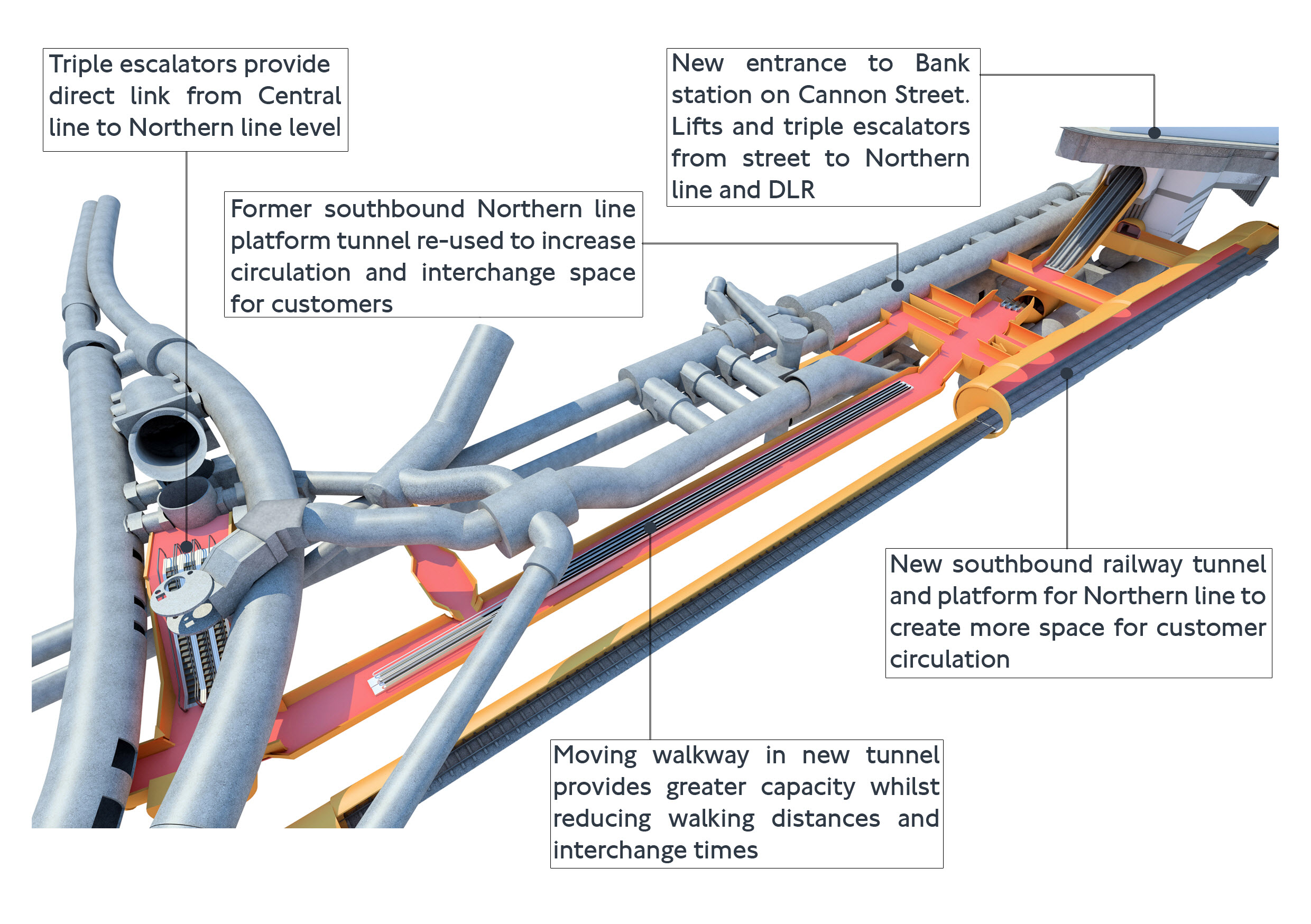
The project was an amazing demonstration of what is possible to be achieved in underground construction.
- There is a moving walkway to move passengers between the Central and Northern Lines.
- There are escalators and lifts everywhere.
It was also dug out from London’s helpful soils under scores of important buildings, many of which are listed.
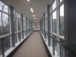
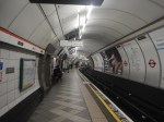
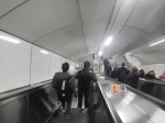
These pictures give a flavour of the underground section of the completed upgrade.


These pictures show the buildings on top of the complex.
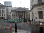
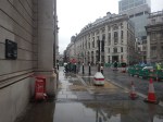


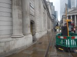


Note.
- There is no building of any great height above the station complex.
- There are a lot of quality buildings.
- During all the work underground, I didn’t see any reports of any problems with the buildings on top.
- In How Many Entrances And Exits Does A Station Need?, I counted that the complex now has twenty entries.
It is probably a project that could be repeated elsewhere.
Camden Town, Holborn and Bond Street/Oxford Circus are probably suitable cases for treatment.
Weston Williamson’s Plan For Manchester Piccadilly Station
In The Rival Plans For Piccadilly Station, That Architects Say Will ‘Save Millions’, I wrote about Weston Williamson’s plan for Manchester Piccadilly station.
This was their visualisation.

Note.
- In the visualisation, you are observing the station from the East.
- The existing railway lines into Piccadilly station are shown in red.
- Stockport and Manchester Airport are to the left, which is to the South.
- Note the dreaded Castlefield Corridor in red going off into the distance to Oxford Road and Deansgate stations.
- The new high speed lines are shown in blue.
- To the left they go to Manchester Airport and then on to London, Birmingham and the South, Warrington and Liverpool and Wigan, Preston, Blackpool, Barrow-in-Furness, the North and Scotland.
- To the right, they go to Huddersfield, Bradford, Leeds, Hull and the North East, and Sheffield, Doncaster and the East.
- Between it looks like a low-level High Speed station with at least four tracks and six platforms.
- The Manchester Metrolink is shown in yellow.
The potential for over-site development is immense. If the Station Square Tower was residential, the penthouses would be some of the most desirable places to live in the North.
Londoners Are The Tunnel Kings
Bring On The Robots
Could High Speed Two Have An Underground Station In London?
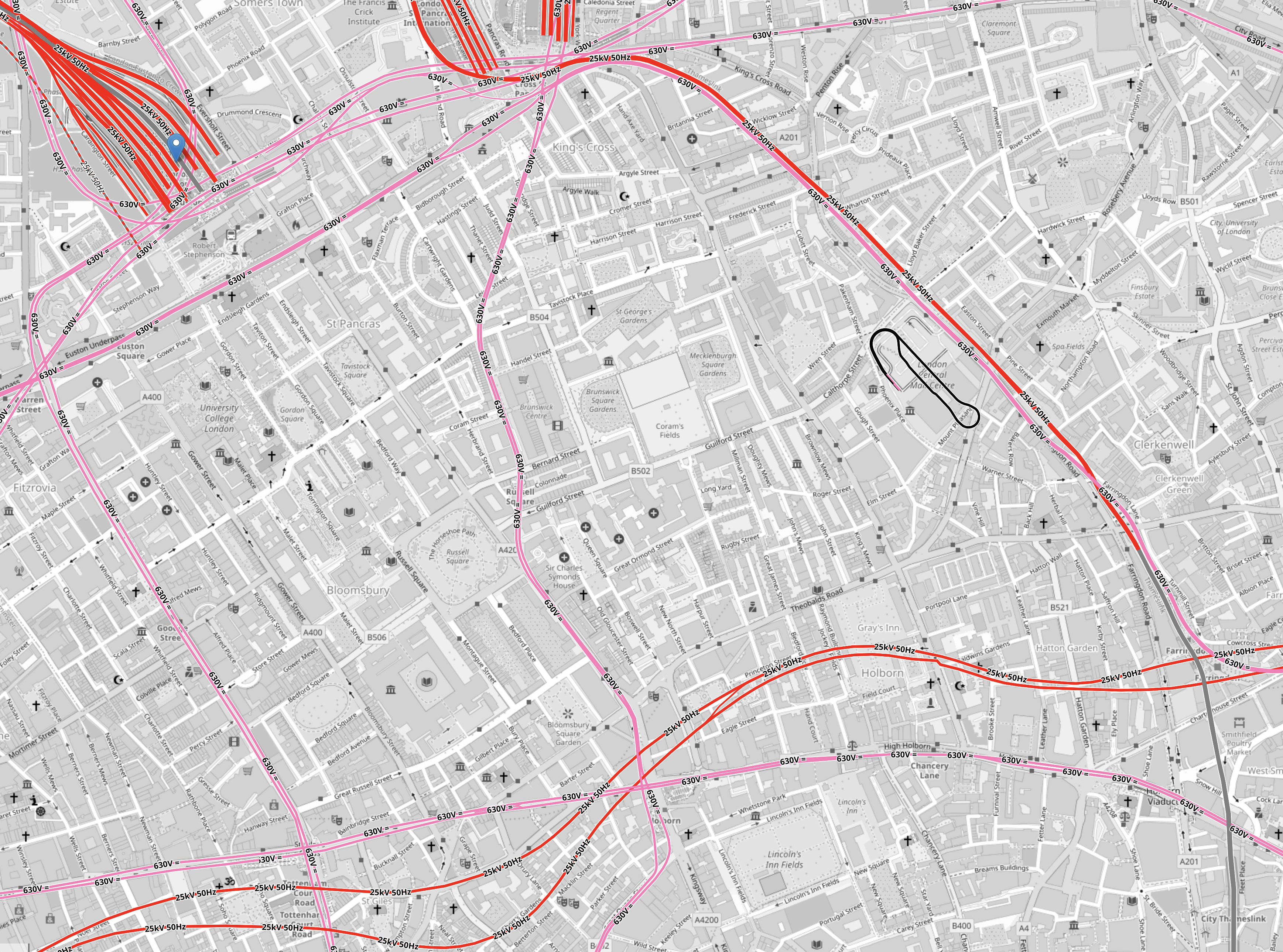
Look at this map from OpenRailwayMap.
Note.
- Euston station is in the North-West corner of the map.
- St. Pancras and King’s Cross stations can just be seen at the top of the map.
- All lines shown in red have 25 KVAC overhead electrification.
- All lines shown in pink are the London Overground.
- The double track electrified railway meandering across the map from West to East is the Elizabeth Line.
- The pink line going down the middle of the map is the Piccadilly Line.
- The pink line going down the left of the map is the Charing Cross branch of the Northern Line.
There is a large square area to the South of Euston that doesn’t have any railways crossing it.
It is shown in this map from OpenRailwayMap.
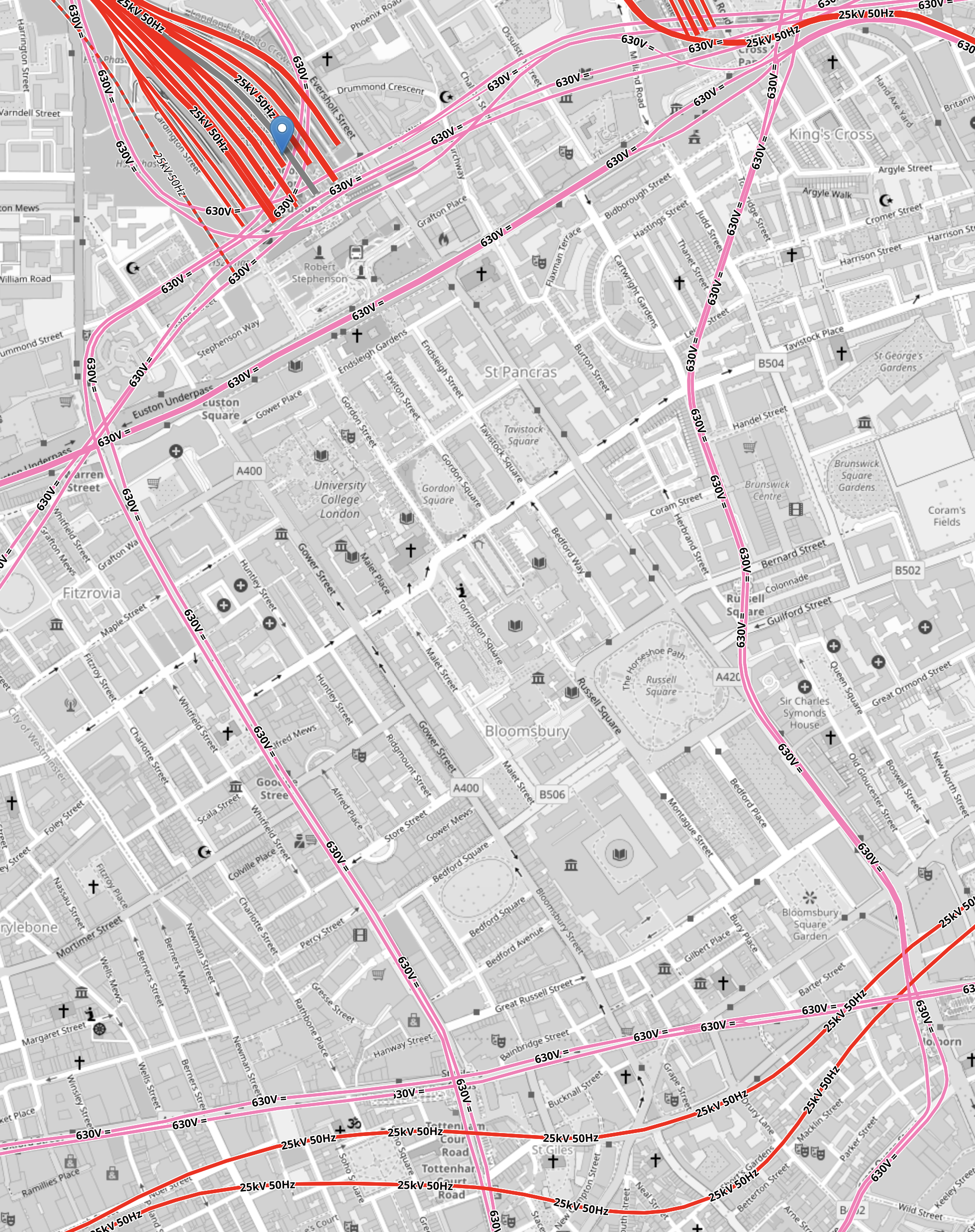
Note.
- As before, red lines have 25 KVAC overhead electrification and pink lines are the Underground.
- The Western boundary of the area is the Charing Cross branch of the Northern Line, which runs between Euston in the North and Tottenham Court Road in the South.
- The Eastern boundary of the area is the Piccadilly Line, which runs between King’s Cross in the North and Holborn in the South.
- The Northern boundary of the area is the sub-surface Circle, Hammersmith & City and Metropolitan Lines, which runs between Warren Street in the West and King’s Cross in the East.
- The Northern and Victoria Lines also run East-West to the North of the sub-surface lines.
- The Southern boundary of the area is the Central and Elizabeth Lines, which run between Tottenham Court Road in the West and Holborn in the East.
It is a substantial area.
So could it be hollowed out to create a below-ground London terminal for High Speed Two?
I got a bus from Tottenham Court Road to Euston station and then walked to Holborn, taking these pictures.
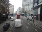
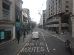


Note.
- There are only two buildings in the area with more than about six floors; University College Hospital and Senate House.
- There a lot of green spaces.
- Bloomsbury Square does have a car park beneath it.
I wonder if a terminal station could be build under the area?
- I suspect if you went fifty metres down there could be plenty of space, that could be excavated.
- Tunnels with moving walkway and escalators could link the station to the Central, Circle, Elizabeth, Hammersmith and City, Metropolitan, Northern and Piccadilly Lines.
- There would be space to have 400 metre long platforms.
- As all trains would be electric, there would be no fume problems.
- There could be lifts and escalators to the green spaces on the top.
I have a feeling that most of people living or working inside the North and South Circular Roads could get to the station by public transport with at most a single change.
London Overground: Design Work For West London Orbital Route Begins
The title of this post, is the same as that as this article on the BBC.
This is the sub-heading.
Plans for a new London Overground link in west London are progressing, London’s mayor Sadiq Khan has said.
These paragraphs outline what will happen.
Engineering consultants who worked on the Elizabeth line have been chosen for the West London Orbital service.
“This engineering design will help determine the cost of delivering the scheme, which is currently unfunded,” Transport for London (TfL) said.
It hopes the scheme, which would connect Hounslow with Hendon and West Hampstead, could start next decade.
My feeling, is that they should get on with it.
- There would be no major construction like tunnels.
- Four stations would need to be built.
- I doubt there will be any demolition.
- It wouldn’t need more electrification, as the route is electrified at both ends and battery-electric trains could be used.
- It would create more connections to Old Oak Common for High Speed Two.
But if it does for North West London, what the Overground has done for North and East London, it will be very much worth it.
These are a few thoughts and observations.
The Route
This is a schematic of the route from the BBC article.
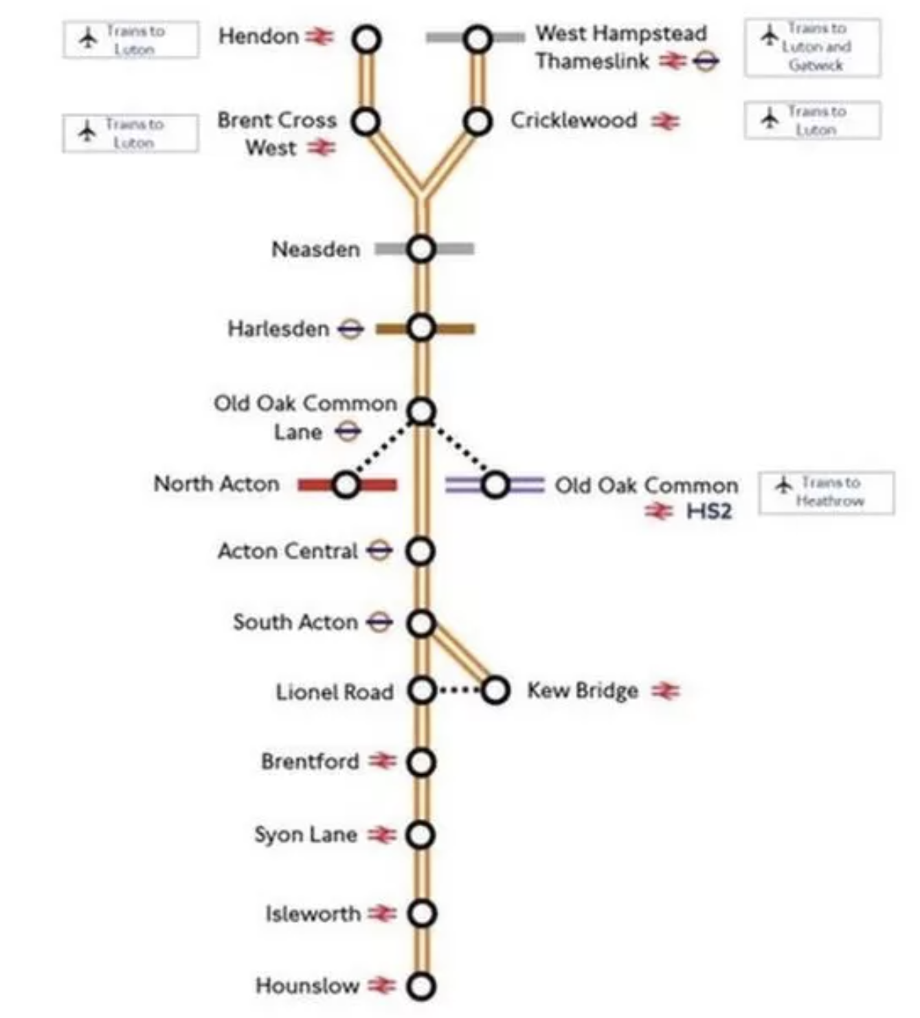
Note.
- Services will be between West Hampstead Thameslink and Hounslow stations and between Hendon and Kew Bridge stations.
- If services follow the London Overground frequency, they will be four trains per hour (tph).
- The new stations are Neasden, Harlesden, Old Oak Common Lane and Lionel Road.
- Acton Central, Brentford, South Acton, Syon Lane and West Hampstead Thameslink are step-free and Isleworth is on the way.
- The fully step-free Brent Cross West station will open soon.
- Lionel Road station will serve the new Brentford stadium.
- Old Oak Common Lane will serve High Speed Two, the Elizabeth Line and the North London Line.
They look to be a useful set of stations.
Kew Bridge Station
There’s been a lot of development at Kew Bridge station, since I was last there.

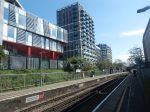
There are lots of flats and Brentford’s new stadium.
I suspect all the stations between Kew Bridge and Hounslow will see similar levels of development.
Electrification Issues On The Dudding Hill Line
The Dudding Hill Line forms the Northern section of the route between the Midland Main Line and the North London Line at Acton Wells Junction.
This map from OpenRailwayMap shows the junction between the Dudding Hill and Midland Main Lines.
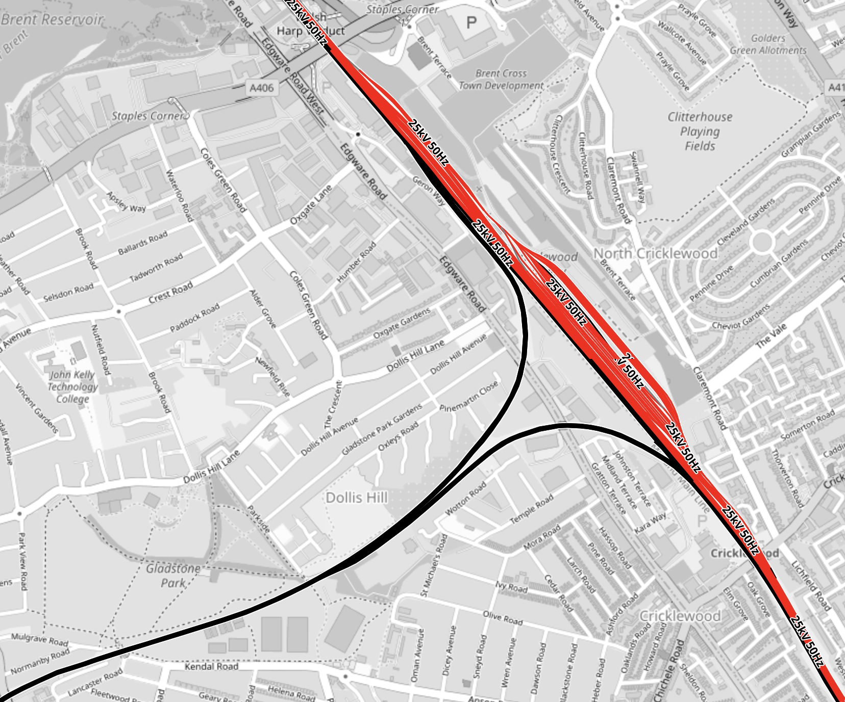
Note.
- The Midland Main Line is shown in red as it is electrified with 25 KVAC overhead wires.
- The Dudding Hill Line is shown in black, as it isn’t electrified.
This second map from OpenRailwayMap shows the junction between the Dudding Hill and North London Lines at Acton Wells junction.
Note.
- As before red tracks are electrified with 25 KVAC overhead wires and black tracks have no electrification.
- The Dudding Hill Line is the black track running North-South at the West of the map.
- Acton Wells junction, where the Dudding Hill and North London Lines join is in the South-West corner of the map.
- The North London Line is shown in red running across the North-West corner of the map.
- The Great Western Main Line is shown in red running across the South-East corner of the map.
- High Speed Two will run East-West across the map and is shown dotted in red.
- The red lines in the middle of the map is the Elizabeth Line depot.
With all the 25 KVAC overhead electrification at both ends of the Dudding Hill Line, it would appear, that if this section is ever electrified, it will be electrified with this form of electrification.
There may be a problem, in that there are three or four bridges over the line.
Electrification Issues At Kew
This map from OpenRailwayMap shows the triangular junction by Kew Bridge station.
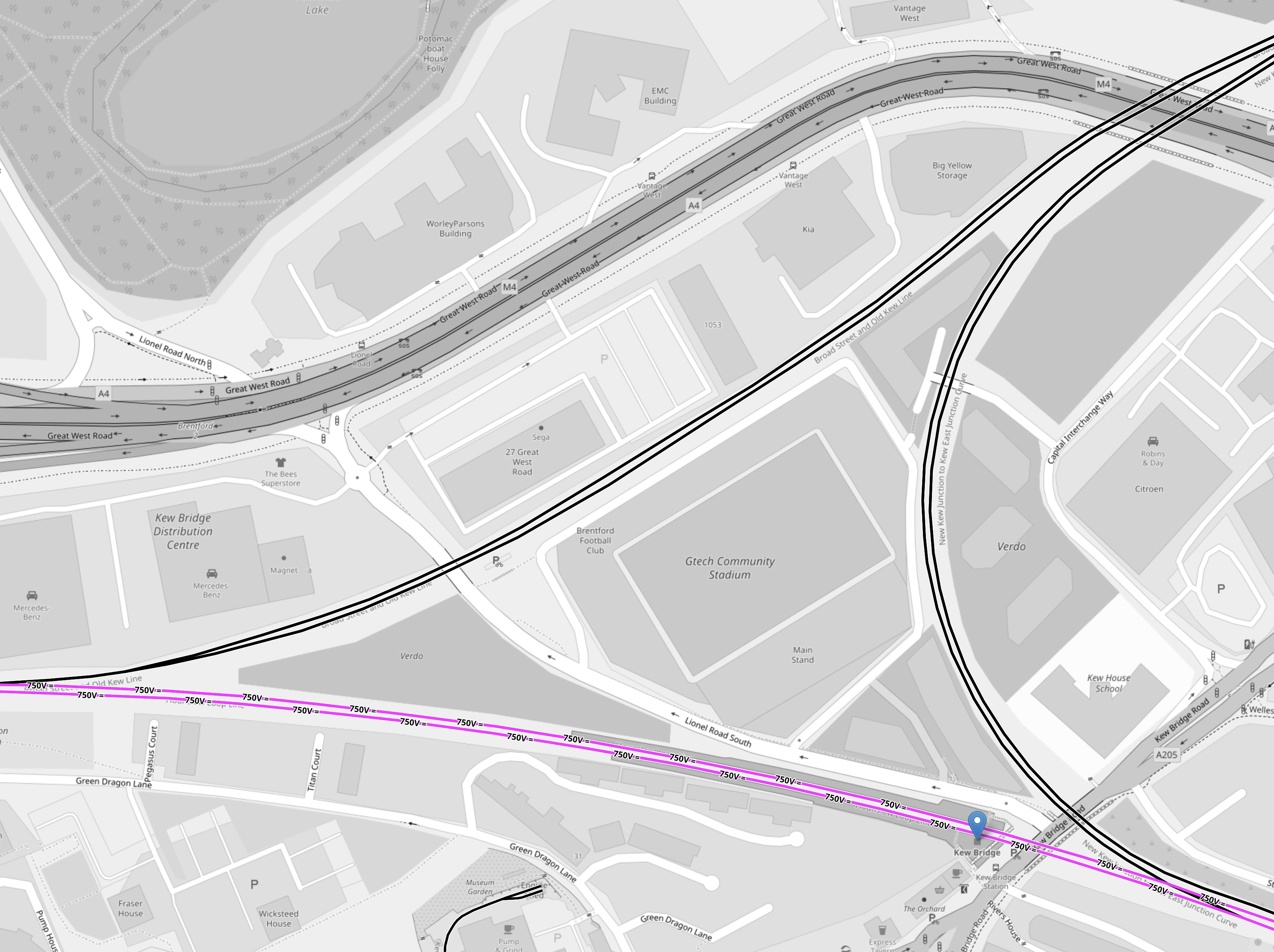
Note.
- As before black tracks have no electrification.
- Mauve tracks are electrified with 750 VDC third-rail electrification.
- Kew Bridge station is indicated by the blue arrow at the Eastern point of the junction.
- Trains to Hounslow will arrive in the North-East corner of the map and go diagonally across the map to leave in the South-West point of the junction.
- Trains to Kew Bridge will arrive in the North-East corner of the map and take the Eastern chord of the junction to a new platform in Kew Bridge station.
Brentford’s new stadium and a lot of housing are in the middle of the junction.
It would seem to be obvious to electrify the triangular junction using 750 VDC third-rail electrification.
But not to the ORR it isn’t, as they won’t allow any new third-rail electrification to be installed on Health and Safety grounds.
Charging Trains At Kew Bridge Station
Consider.
- It looks like trains from Hendon will terminate in a new platform on the chord without electrification to the North of the current Kew Bridge station.
- A short length of 25 KVAC overhead electrification could be used to charge trains.
It may be sensible to build two platforms on the chord, as this could allow more flexible operation of the London Overground during engineering works.
Charging Trains At Hounslow Station
A short length of 25 KVAC overhead electrification could be used to charge trains.
Project Management Issues
I believe this could be one of those projects, where by careful selection of the order of the sub-projects, time and money can be saved and passengers will see benefits earlier.
For example.
- Early delivery of Old Oak Common Lane station would also connect the North London Line to High Speed Two and the Elizabeth Line.
- Early delivery of step-free access at Kew Bridge station would help passengers going to the new Brentford stadium.
There may be other projects, that need an early delivery.
The Feltham And Wokingham Resignalling Programme
The Feltham And Wokingham Resignalling Programme is currently underway and there are pairs of new and old signals everywhere between Kew Bridge and Feltham and also between Feltham and Richmond.
These are digital signals and according to Network Rail, they will increase the capacity, which must surely allow the extra trains between Kew Bridge and Hounslow stations.
This signalling project finishes in mid-2024, so I suspect by then the Southern part of the West London Orbital Railway will not have any problems with interaction with other services.
The Feltham And Wokingham Resignalling Programme could be considered an important enabling sub-project of the West London Orbital Railway, that is being performed early.
Richmond Station
As I came through Richmond station, there was an Overground train in Platform 3 and I noticed that Platforms 3 to 5 were allocated to the Overground.
Has the new signalling given Network Rail and train operators more flexibility and extra capacity at Richmond?
Currently, the London Overground runs four trains per hour (tph) between Stratford and Richmond.
The increased flexibility may allow the following.
- An increase in frequency of trains to Stratford.
- An increase in frequency of District Line trains, if Ealing Broadway station swaps from being a District to a Piccadilly Line terminus, as I wrote about in Extending The Elizabeth Line – Piccadilly Line To Ealing Broadway.
- Could Richmond also act as a terminal of the West London Orbital Railway during construction and engineering works?
Another benefit that could be arranged is to run the current four tph London Overground services into Platform 3.
These pictures show a Waterloo-bound South Western Railway train in Platform 2 and a Stratford-bound London Overground train in Platform 3.
As there are 8 tph between Richmond and Waterloo via Clapham Junction, this could be quite a useful cross-platform interchange for passengers going from say Staines or Windsor to Hampstead.
Trains
Consider.
- The three most likely Northern termini are Brent Cross West, Hendon and West Hampstead Thameslink.
- There could be other terminals on the North London Line or the Gospel Oak and Barking Line.
- All possible Northern terminals have 25 KVAC overhead electrification.
- The two most likely Southern terminals are Hounslow and Kew Bridge.
- There may be other possible Southern terminals like Twickenham or Richmond.
- All possible Southern terminals have 750 VDC third-rail electrification.
- The sections without electrification of the route are less than twelve miles.
- The ORR won’t allow any new third-rail electrification.
It looks like the trains will need to be dual-voltage with a battery capability.
In this article in Global Rail News from 2011, which is entitled Bombardier’s AVENTRA – A new era in train performance, gives some details of the Aventra’s electrical systems. This is said.
AVENTRA can run on both 25kV AC and 750V DC power – the high-efficiency transformers being another area where a heavier component was chosen because, in the long term, it’s cheaper to run. Pairs of cars will run off a common power bus with a converter on one car powering both. The other car can be fitted with power storage devices such as super-capacitors or Lithium-ion batteries if required. The intention is that every car will be powered although trailer cars will be available.
Unlike today’s commuter trains, AVENTRA will also shut down fully at night. It will be ‘woken up’ by remote control before the driver arrives for the first shift
This was published over twelve years ago, so I suspect Bombardier or Alstom have refined the concept.
In an article in the October 2017 Edition of Modern Railways, which is entitled Celling England By The Pound, Ian Walmsley says this in relation to trains running on the Uckfield Branch, which is not very challenging.
A modern EMU needs between 3 and 5 kWh per vehicle mile for this sort of service.
So for a four-car running for twelve miles, the train would need a battery capacity of between 144 and 240 kWh.
These are not large batteries.
I suspect that the best trains for the route, will be dual-voltage Class 710 trains.
- The Class 710/2 variant used on the Gospel Oak and Barking Line is dual-voltage.
- London Overground has 54 Class 710 trains.
- I am certain, that the batteries needed can be fitted to the trains.
- Aventras are still in production in Derby.
A test battery-electric version could probably be created and tested on the short Romford and Upminster Line.
There may be other places in London and the rest of the UK, where a four-car battery-electric Aventra would be the ideal train.
Effects Of The ULEZ In West London
This page on the Transport for London web site is entitled ULEZ Expansion 2023.
This is the first paragraph.
To help clear London’s air and improve health, the Ultra Low Emission Zone (ULEZ) is expanding across all London boroughs from 29 August 2023.
These are some points from the rest of the page.
- Poor air quality is impacting the health of Londoners, and it’s mainly caused by polluting vehicles.
- Air pollution even contributes to the premature death of thousands of Londoners every year.
- 9 out of 10 cars seen driving in outer London already meet the ULEZ emissions standards.
- If you drive anywhere within the ULEZ and your vehicle does not meet the emissions standards, you could face a daily charge of £12.50.
- Residents of the ULEZ are not exempt from the charge.
- Any money received from the scheme is reinvested into running and improving London’s transport network, such as expanding bus routes in outer London.
There is no reference to trucks or HGVs.
These are my thoughts.
Objections To The ULEZ
If you type ULEZ into Google and look at the News page, you get a lot of stories that don’t show the ULEZ in a good light.
Here are a few headlines.
- BBC – ULEZ: Labour MPs Seek Support For Non-Londoners
- BBC – Firms In Essex Could Close Due To ULEZ, Warns Business Leader
- Big Issue – London’s Ulez Plans Could Hit Disabled People, Charities And Small Businesses The Hardest
- Daily Mail – Sadiq Khan Claims That Nazis Have Infiltrated Anti-Ulez Protests
- Guardian – EU Motorist Fined Almost £11,000 After Falling Foul Of London Ulez Rule
- Guardian – London’s Mayor Faces High Court Challenge Over Ulez Expansion
- Kent Live – Anti-ULEZ Campaign Group Support Soars As Kent Drivers ‘Unfairly Targeted’
- LBC – No More Ulez? Sadiq Khan Considers Scrapping Controversial Scheme And Replacing It With ‘Pay-As-You-Drive’ System
- Slough Observer – Ulez Faces High Court Challenge
- Which? – Why It Could Cost £17.50 To Drop A Loved One At Heathrow This Summer
It looks like Sadiq Khan has fallen into a hole.
And he hasn’t stopped digging!
To make it worse, he has suggested a Pay-As-You-Drive System. I seem to remember, that a Dutch Prime Minister, who tried it, lost the next election.
But then Sadiq Khan likes tolls as the new Silvertown Tunnel and the Blackwall Tunnel will be tolled in a few years.
Heathrow Airport
Heathrow Airport is one of the world’s busiest airports and 76,000 people work at the airport, with many more employed nearby.
The airport handled 61.6 million passengers in 2022, which is a few short of 170,000 per day.
If you consider that those that work at the airport do two trips per day and passengers generally do one, that means there are 322,000 trips per day to or from the airport.
But as it now so easy to get to the Airport using the Elizabeth Line will more people use the new line to meet and greet and say goodbye to loved ones or business associates. Since the Elizabeth Line opened, I’ve met a couple of friends at Heathrow, who were passing through.
I wonder, if that daily journey total of 322,000 could be nearer to 350,000 or even 400,000.
If the ULEZ charge makes some passengers and staff switch from their car to using a bus or train, this probably means that public transport to and from the airport, will need to be boosted by a substantial amount.
But improving public transport to Heathrow wouldn’t be easy.
- The Elizabeth Line seems to have put a big hole in the finances of Heathrow Express.
- How many more trains can be squeezed into the Heathrow Tunnel?
- The Western Rail Link to Heathrow would probably need to be built. But that seems to be in limbo.
- New trains for the Piccadilly Line are a few years away.
It might have been better to build a different scheme for Western access to Heathrow like the Heathrow Southern Railway.
I suspect that there will be a lot more passengers on the Elizabeth Line to and from Heathrow.
A ULEZ For Heathrow
This article on fleetworld, from four years ago, is entitled Heathrow To Introduce Charging ULEZ In 2022.
It hasn’t happened, but that doesn’t mean it won’t be implemented in the future.
If it did happen, there would be more passengers for the Elizabeth Line.
The Elizabeth Line
I have written three posts about how busy the Western section of the Elizabeth Line can get.
- Very Busy Lizzie
- Elizabeth Line: Commuters Say Service ‘Not What Was Promised’
- So Many Cases On A Train!
Is there sufficient capacity to accommodate all the ULEZ-dodgers on the trains to and from Heathrow?
To make matters worse, there is a large Asian population from the Indian sub-continent living along the Elizabeth Line between Ealing Broadway and Reading.
- They seem to be enthusiastic users of the line.
- Having ridden several times on crowded Indian trains, perhaps using trains is very much part of South Asian culture.
- I also suspect that a lot of Indian families have spread themselves along the line, just like my mother’s close family spread themselves along the 107 bus route.
In Very Busy Lizzie, I said this.
Reading needs four tph to Central London.
The ULEZ will make this even more essential.
The Piccadilly Line
The Piccadilly Line may be getting new trains, but it is not a line that is blessed with lots of step-free stations.
The West London Orbital Railway
It does appear that the West London Orbital Railway may be more likely to be built, than a few months ago.
In Is There Progress On The West London Orbital Railway?, I wrote about a report, that consultants were being chosen.
This railway could ease pressure on the railways in West London.
Cutting Pollution In London From Trucks
London like all big cities has a lot of trucks.
As the average truck has a much larger engine than the average car, I would suspect it gives out more pollution.
One way to cut pollution from large vehicles would be to run them on hydrogen.
But unlike some cities in the UK, London has no hydrogen policy and filling stations to fill them up.
The Mayor could at least get a workable hydrogen policy.
Conclusion
I suspect the next Mayor of London will have to have a rethink on the ULEZ and implement a hydrogen policy.
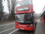
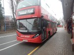
Riding The X140 Bus Between Heathrow Airport And Harrow Bus Station
I did this journey, which will be part of the Superloop, in better weather than yesterday, and was able to take these better pictures.


Note.
- The roads were much better than yesterday’s trip and were mostly two lanes each way, with large roundabouts at junctions.
- I suspect the bus was going at between 30 and 40 mph most of the way.
- There was still quite a lot of traffic.
- It is a distance of about 15 miles.
- The timetable says that buses run every 10-13 minutes.
- The X26 buses run between about six in the morning at midnight.
- There are twelve intermediate stops.
- Harrow-On-The-Hill station is next to Harrow Bus station.
- Heathrow Central connects to Heathrow Express, the Elizabeth and Piccadilly Lines.
- Hayes and Harlington connects to the Elizabeth Line and GWR’s local services.
- Northolt station connects to the Central Line.
- Northolt Park station connects to Chiltern.
- South Harrow station connects to the Piccadilly Line.
- Harrow-On-The-Hill connects to the Metropolitan Line and Chiltern
The journey took 49 minutes, which is only a minute longer than the timetable.
I have a few thoughts.
Passenger Numbers
These were my observations on my journey that started at about 11:30 on a dry day.
- Few got on at Heathrow Central, but I suspect we had just missed a bus.
- By Hayes & Harrington station, the bus was about a quarter full.
- At South Harrow station it must have been about three-quarters full.
- At Harrow bus station all the lower-deck seats were taken.
I would expect that the loading I saw fits with TfL’s expectations.
The Bus
The bus was one of the latest ADL battery-electric buses.
- It had a strong performance.
- It had wi-fi and phone charging.
- It was probably less than a year old.
- It was a lot better than yesterday’s bus!
At present not all buses on the route are battery-electric, as some are still older hybrids.
Travelling To Heathrow From The Northern Reaches Of The Metropolitan Line
Many people travel to and from Heathrow either for work or because they are flying.
- But it is not an easy journey from the Northern reaches of the Metropolitan Line.
- I believe the X26 bus could be a viable way to get to the airport for many.
- There would be a change at Harrow-on-the-Hill, but the station is at least step-free.
- It would avoid parking fees.
- Fares could be less than fuel costs.
The only big drawback, is that the X26 bus is not twenty-four hours.
More And More Frequent Buses Would Help
I believe that the Superloop should be a 24-hour service, as a lot of things go on at airports in the middle of the night.
I’ve just found out that there is an N140 bus that covers the route.
I also think, that as with the Overground, services should be at least four buses per hour.
The Bowes Park And Bounds Green Out-Of-Station Interchange
After I’d taken the latest pictures in Bowes Park Station – 12th January 2023, I walked to Bounds Green station to go back South to the Angel.
I took these pictures on the way.


Note.
- The walk is level and could be done easily, if you were pushing a buggy, dragging a case or in a wheel-chair.
- There is a footbridge over the busy Bowes Road, which doesn’t have lifts. But you don’t need it to go between the stations.
- There is a light-controlled crossing outside Bounds Green station to cross Brownlow Road.
- The walk took me about six minutes.
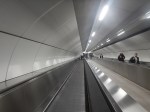
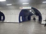
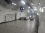
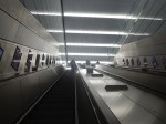
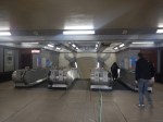
These pictures show the escalators at Bounds Green station.
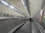
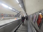
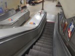
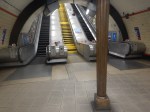
Could the central stairs be replaced by an inclined lift?
Would This Out-Of-Station Interchange Create An Easy Route Between Northern Piccadilly Line Stations And The Elizabeth Line?
Consider.
- Cockfosters, Oakwood and Arnos Grove stations have car parking.
- All stations on the Piccadilly Line from Bounds Green Northwards are well-connected by buses.
- Bounds Green station has escalators.
- Bowes Park station has stairs.
- Bowes Park station has a well-stocked cafe.
- Moorgate station has escalators and lifts to the Elizabeth Line.
For a perfect route, some things must be done.
The Frequency Of Trains On The Northern City Line
At the moment the trains through the station are two trains per hour (tph) between Moorgate and Stevenage.
But the frequency has been as high as four tph.
The frequency needs to be higher to cut waiting for a train.
Step-Free Access
This needs to be installed or improved at Bounds Green, Bowes Park and Moorgate stations.
Signage
The route between Bowes Park And Bounds Green stations needs better signage.
Conclusion
This Out-Of-Station Interchange could be made more use of.
Cockfosters Train Depot – 12th January 2023
In Would A Solar Roof With Added SeaTwirls Work?, I showed this map of Oakwood.
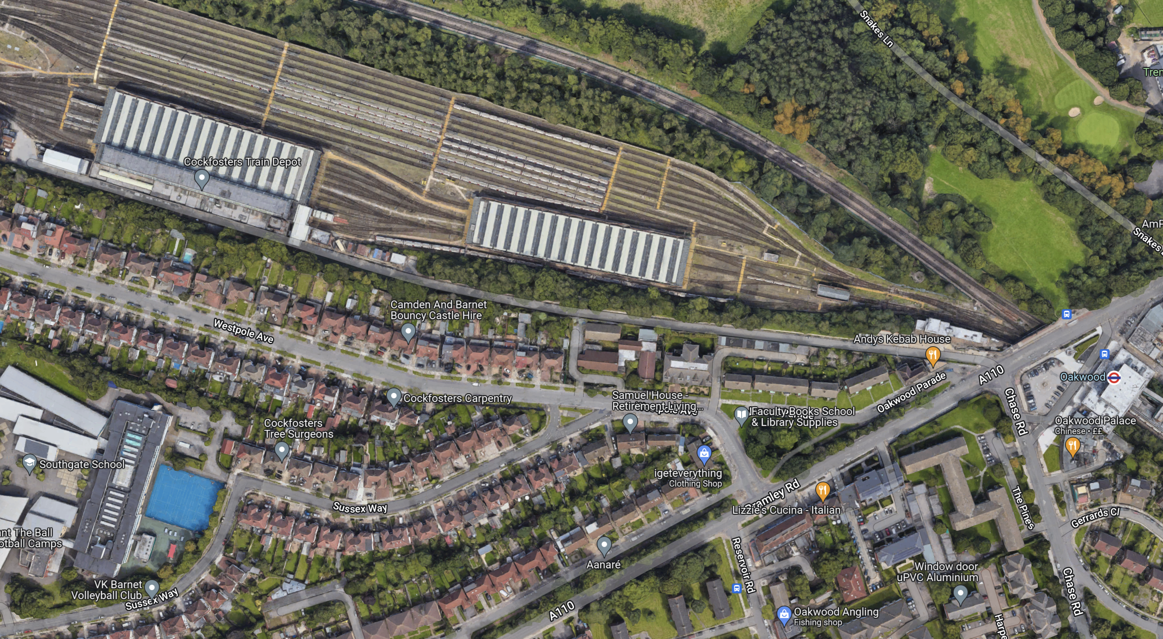
Note.
- The striped roofs at the top of the map, with sidings for trains to the North, is Cockfosters Train Depot for the Piccadilly Line.
- Cockfosters station is off the map on the West side of the map.
- Oakwood station is at the East side of the map and indicated by a London Underground roundel.
- The two tracks of the Piccadilly Line between Oakwood and Cockfosters stations, running across the map to the North of the depot.
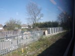
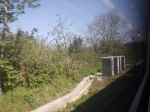
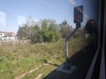
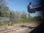
I took these pictures of the Cockfosters Train Depot as my train went between Oakwood and Cockfosters.
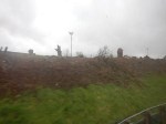
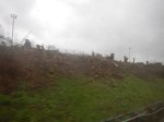
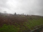

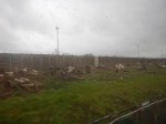

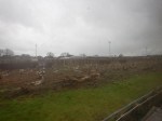
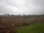
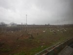

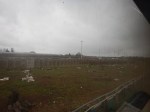
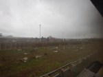

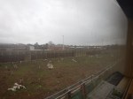
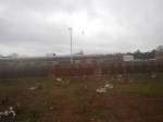

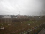
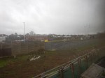


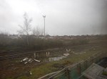

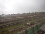
Note.
- The land between the Piccadilly Line and the depot seems to be being cleared.
- Is this to expand the depot for the new trains?
- There are some high lights mounted above the sidings.
- The depot buildings don’t look anything special.
This article on Ian Visits is entitled Depot Upgrade At Cockfosters For The Piccadilly Line’s New Trains.
- Before and after maps show a lot more sidings.
- The new siding layout reaches almost all the way to the Piccadilly Line.
- The old depot has been assessed to be utilitarian with low architectural and historic value.
- The depot will be completely rebuilt over the next two years for the new Siemens trains.
- Nothing is said as to whether the new depot will be fitted with a solar roof.
The new trains will start running in 2025. It seems that the work hasn’t progressed very far.
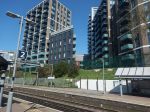
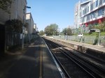
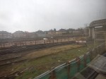
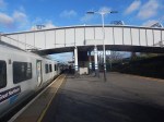
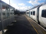
Bowes Park Station – 12th January 2023
I’d never used Bowes Park station until I moved back to London in 2011, despite the fact I had friends in the 1960s, who lived nearby.
Today, I was wanting to go from the Northern end of the Piccadilly Line to Moorgate station.
There are a number of ways to do this journey.
- Piccadilly Line to Bounds Green tube station and then a Great Northern train from Bowes Park station to Moorgate
- Piccadilly Line to Wood Green tube station and then a 141 bus to Moorgate.
- Piccadilly Line to Manor House tube station and then a 141 bus to Moorgate.
- Take the double cross-platform change route, I outlined in Extending The Elizabeth Line – Improving The Northern City Line.
I decided to take the first route.
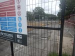
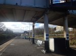
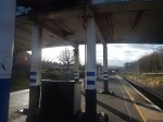
I took these pictures at Bowes Park station.
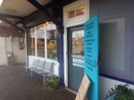

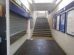
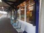
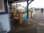
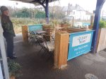
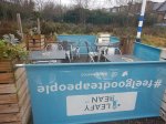
Note.
- The station has a warm well-stocked cafe, that is an asset to the station.
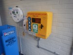
- The station has a defibrillator.
In an ideal world the station would have step-free access, as this would give a step-free route to Moorgate and the Elizabeth Line.
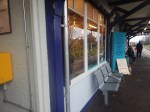
I returned a day later and took these pictures to see if a lift could be fitted.
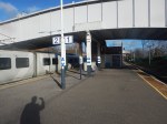
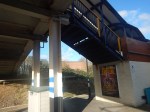
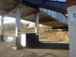
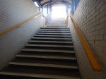
I don’t think it would be one of the most difficult or expensive jobs to fit in a lift, that took passengers between the platform and the bridge.
The existing stairs would be retained and fitted with a decent fully-compliant handrail.
If a single lift were to be placed on the opposite side to the stairs, passenger access to the station would be possible during the installation.
