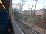
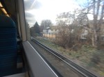
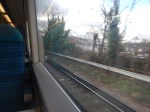
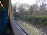
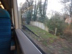
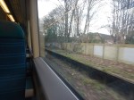
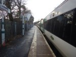
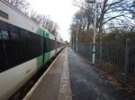
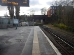
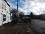
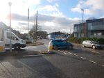
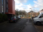
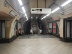
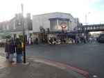
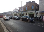
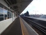
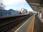
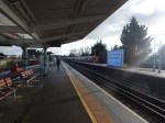
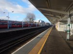
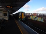
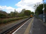
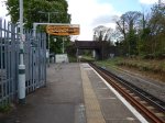
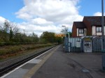
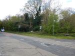
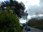
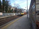
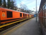
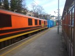
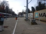
Belmont Station – 20th January 2023
These pictures show Belmont station.


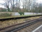
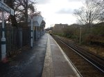
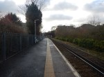
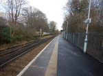
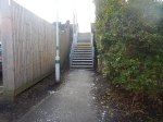

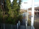
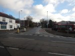
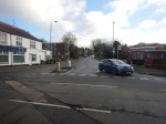


Note.
- The first four pictures show the remaining double track between Sutton and Belmont stations. The double track finishes shortly before the station.
- All trains use the only platform, which is numbered One.
- The remains of the second platform.
- There is sufficient space to put in a second track and restore the second platform.
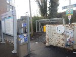
- The steel stairs up to the bridge over the railway.
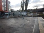
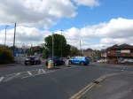
- The bus station outside the station.
- The S4 bus takes everybody to and from the Royal Marsden Hospital.
- There was no signage on the station about which bus to take to the hospital.
There is a large amount of traffic outside the station, which very much seems in a hurry.
Balham – Gateway To The Royal Marsden
With apologies to the late great Peter Sellers and his iconic Balham – Gateway To The South.
After breakfast this morning at Leon on Moorgate, I decided to go and look at Belmont station, which is the nearest station to the Royal Marsden Hospital in Sutton.
Currently, Belmont has a two train per hour (tph) service from Victoria which goes via Clapham Junction, Balham and West Croydon.
From Moorgate the easiest route was to go via the iconic Balham station, where I took these pictures.


Note.
- There are two fast and two slow tracks through Balham station.
- There is a cafe on the two slow platforms.
I transferred here to an Epsom Downs train for Belmont.
The only problem was that I just missed one train and had to wait half-an-hour for the next.
The service between Victoria and Belmont needs to be increased in frequency.
Levelling Up Funding Will Double Train Services To Belmont In Surrey
The title of this post, is the same as that of this article on Rail Advent.
This project is outlined in these three paragraphs in the article.
An award of £14.1 million to Sutton Council from the government’s Levelling Up Fund will unlock the full potential of the London Cancer Hub and allow the number of trains running to the village of Belmont in South London to be doubled.
The London Cancer Hub is a world-leading life sciences campus that is being developed at Belmont in Surrey, and which will create 13,000 jobs and £1.2 billion each year for the UK economy.
Until now, Belmont has been poorly served by public transport and the money will enable its train services to be doubled to four trains an hour, and extra direct services from Belmont to London Victoria.
This document from Sutton Council gives more details in this paragraph.
This bid will double train frequency between Belmont and London Victoria from 2 to 4 trains per hour by building a siding turnback south of Belmont Station. It will improve accessibility at the station and provide better routes for people walking and cycling to the station from the nearby area and The London Cancer Hub. As a result, public transport accessibility will improve and active travel will increase.
This map from CartoMetro shows the current track layout at Belmont station.
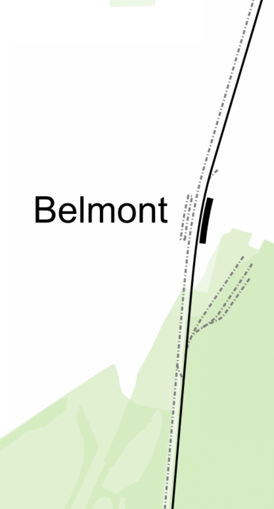
Note.
- The Epsom Downs branch used to be double track, with a second platform at Belmont station.
- There used to be a cross-over South of the station.
I suspect a length of the other track will be reinstated, with a cross-over the other way round to create the turnback siding.
This will allow two extra trains per hour to run between London and Belmont, that will turn back at Belmont.
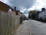
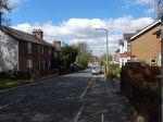
In Could Third-Rail Tram-Trains Work The Epsom Downs Branch?, I walked up the hill to the Royal Marsden Hospital and it wasn’t an easy walk, as these pictures show.
Perhaps all trains should be met by a zero-carbon shuttle bus.
Going to a cancer hospital is not a pleasurable experience, especially for a child, so why not liven it up a bit with a ride in the best zero-carbon bus, that can be found?
Toyota Unveils AE86 Hydrogen Car Concept
The title of this post, is the same as that of this article on Hydrogen Fuel News.
The article is all about Toyota showing off, what they can do with hydrogen internal combustion engines.
It is an article that is very much worth a read.
This paragraph explains the work Toyota did to run the car on hydrogen.
Toyota explained that to create its new H2 burning internal combustion engine vehicle involved changing only “fuel injectors, fuel pipes, and spark plugs,” to make it possible to burn cleanly.
The article also suggests that conversion kits may be made available for older cars.
Hydrogen power is not one technology, but several that all might end up with sizeable shares of the market.
Landmark Levelling Up Fund To Spark Transformational Change Across The UK
The title of this post, is the same as that of this press release from the UK Government.
These are the four bullet points.
- More than 100 projects awarded share of £2.1 billion from Round 2 of government’s flagship Levelling Up Fund.
- Projects will benefit millions of people across England, Scotland, Wales and Northern Ireland and create jobs and boost economic growth.
- £672 million to develop better transport links, £821 million to kick-start community regeneration and £594 million to restore local heritage sites.
- Successful bids include Eden Project North in Morecambe, a new AI campus in Blackpool, regeneration in Gateshead, and rail improvements in Cornwall
The press release expands the last bullet point.
Projects awarded Levelling Up Fund money today include:
Eden Project North
Eden Project North will receive £50 million to transform a derelict site on Morecambe’s seafront into a world class visitor attraction. It will also kick-start regeneration more widely in Morecambe, creating jobs, supporting tourism and encouraging investment in the seaside town.
Note.
- Because of its closeness to the West Coast Main Line, it will have excellent rail connections to all over the North of England and Central and Southern Scotland, through Lancaster, which will only be a shuttle train away.
- One of High Speed Two’s direct destinations will be Lancaster, which will be served by High Speed Two by hourly trains to Birmingham, Carlisle, Crewe, London, Preston, Warrington and Wigan and by two-hourly trains to Edinburgh, Glasgow, Lockerbie and Motherwell.
- London and Lancaster will be a journey of just two hours and three minutes.
I believe that this high quality rail access will ensure the success of the Eden Project North.
Cardiff Crossrail
Cardiff Crossrail has been allocated £50 million from the fund to improve the journey to and from the city and raise the economic performance of the wider region.
The Cardiff Crossrail is obviously a good project from the little that I’ve read about it. But it does need a web site to explain the reasoning behind it.
Blackpool Multiversity
Blackpool Council and Wyre Council will receive £40 million to deliver a new Multiversity, a carbon-neutral, education campus in Blackpool’s Talbot Gateway Central Business District. This historic funding allows Blackpool and The Fylde College to replace their ageing out-of-town centre facilities with world-class state-of-the-art ones in the heart of the town centre. The Multiversity will promote higher-level skills, including automation and artificial intelligence, helping young people secure jobs of the future.
Blackpool certainly needs something.
My suggestion in Blackpool Needs A Diamond, was to build a second Diamond Light Source in the North to complement the successful facility at Harwell.
I don’t think the two proposals are incompatible.
Fair Isle Ferry
Nearly £27 million has been guaranteed for a new roll-on, roll-off ferry for Fair Isle in the Shetland Islands. The service is a lifeline for the island, supporting its residents, visitors and supply chains, and without its replacement the community will become further isolated.
Note.
- Will it be a British-built ferry?
- Will it be hydrogen-powered? After all by the time it is built, the Northern Scottish islands will be providing enough of the gas to power a quarter of Germany.
- Surely, a hydrogen-powered roll-on, roll-off ferry will be a tourist attraction in its own right.
I hope the Government and the islanders have a good ship-yard lined up
Gateshead Quays And The Sage
A total of £20 million is going towards the regeneration of Gateshead Quays and the Sage, which will include a new arena, exhibition centre, hotels, and other hospitality. The development will attract nearly 800,000 visitors a year and will create more than 1,150 new jobs.
I don’t know much about the Sage, but this project seems very reasonable.
Mid-Cornwall Metro
A £50 million grant will help create a new direct train service, linking 4 of Cornwall’s largest urban areas: Newquay, St Austell, Truro, and Falmouth/Penryn. This will level up access to jobs, skills, education, and amenities in one of the most economically disadvantaged areas in the UK.
I wrote about this scheme in The Proposed Mid-Cornwall Metro, where I came to this conclusion.
I believe that a small fleet of Hitachi Regional Battery Trains could create an iconic Metro for Cornwall, that would appeal to both visitors and tourists alike.
Judging by the recent success of reopening the Dartmoor Railway to Okehampton in Devon, I think this scheme could be a big success. But it must be zero-carbon!
Female Changing Rooms For Northern Ireland Rugby
There is £5.1 million to build new female changing rooms in 20 rugby clubs across Northern Ireland.
Given the popularity of the female version of the sport in England, Scotland and Wales, perhaps this is a sensible way to level it up in Northern Ireland. As rugby is an all-Ireland sport, perhaps the Irish have already sorted the South?
Could Class 777 Trains Create A Metro Centred On Preston?
Preston station is a major station on the West Coast Main Line, that will be served by High Speed Two.
- Electric long distance services to and from Birmingham, Carlisle, Liverpool, London Euston, Manchester, Edinburgh and Glasgow serve the station.
- Electric and diesel local services fan out from the station to Barrow-in-Furness, Blackburn, Blackpool, Burnley, Colne, Liverpool, Manchester and Ormskirk.
- Other local services could be developed.
Could the local services be turned into a zero-carbon Metro centred on Preston station, that would possibly use a version of Merseyrail’s Class 777 trains?
The Routes
These routes could be part of the Metro.
Preston And Barrow-in-Furness
Consider.
- This route is 55.8 miles long.
- The service calls at Lancaster, Carnforth, Silverdale, Arnside, Grange-over-Sands, Kents Bank, Cark, Ulverston, Dalton and Roose
- The route is electrified between Preston and Carnforth.
- 28.1 miles of the route are without electrification.
Northern use Class 195 diesel trains on this route.
Preston And Blackpool North
Consider.
- This route is 17.5 miles long.
- The service calls at Kirkham & Wesham, Poulton-le-Fylde and Layton
- The route is fully-electrified.
Northern use Class 195, 319 and 331 trains on this route.
Preston And Blackpool South
Consider.
- This route is 19.9 miles long.
- The service calls at Salwick, Kirkham & Wesham, Moss Side, Lytham, Ansdell & Fairhaven, St Annes-on-the-Sea, Squires Gate and Blackpool Pleasure Beach
- The route is electrified between Preston and Kirkham & Wesham
- 12.1 miles of the route are without electrification.
Northern use diesel trains on this route.
Preston And Colne
Consider.
- This route is 29.1 miles long.
- The service calls at Lostock Hall, Bamber Bridge, Pleasington, Cherry Tree, Mill Hill, Blackburn, Rishton, Church & Oswaldtwistle, Accrington, Huncoat, Hapton, Rose Grove, Burnley Barracks, Burnley Central, Brierfield and Nelson.
- Colne is 165 metres above sea level.
- The route is not electrified.
Northern use diesel trains on this route.
This route could also be extended to Skipton in Yorkshire, which is something that was promised by Government a few years ago.
The extension to Skipton could be another 15 miles.
Preston And Fleetwood
Consider.
- This route is 20.9 miles long.
- The service could call at Salwick, Kirkham & Wesham and Poulton-le-Fylde
- The route is electrified between Preston and Poulton-le-Fylde
- This route would need to be reinstated.
6.6 miles of the route are without electrification.
Preston And Liverpool Lime Street via St. Helens
Consider.
- This route is 35.2 miles long.
- The service calls at Huyton, St Helens Central, Wigan North Western, Euxton Balshaw Lane and Leyland
- The route is fully-electrified.
Northern use Class 319 and 331 trains on this route.
Preston And Manchester Airport
Consider.
- This route is 35.2 miles long.
- The service calls at Heald Green, Manchester Piccadilly, Manchester Oxford Road, Deansgate, Salford Crescent, Bolton, Lostock, Horwich Parkway, Blackrod, Adlington (1tph), Chorley, Buckshaw Parkway and Leyland
- The route is fully-electrified.
Northern use Class 195 and 331 trains on this route.
Preston And Ormskirk
Consider.
- This route is 15.3 miles long.
- The service calls at Burscough Junction, Rufford and Croston.
- The route is not electrified.
Merseyrail have their eyes on this route.
Preston And Windermere
Consider.
- This route is 50.3 miles long.
- The service calls at Lancaster, Carnforth, Oxenholme Lake District, Kendal, Burneside and Staveley
- The route is electrified between Preston and Oxenholme Lake District.
- 10.2 miles of the route are without electrification.
Northern use Class 195 diesel trains on this route.
Class 777 Trains
Consider.
- According to Stadler’s specification for the Class 777 IPEMU, the battery-equipped Class 777 trains have a range of 55 km or 34.2 miles.
- But, according to New Merseyrail Train Runs 135km On Battery, these trains have done 135 km or 83.9 miles.
- As there is no third-rail electrification at Preston, but lots of 25 KVAC overhead electrification, the version of the Class 777 train for 25 KVAC overhead will need to be used.
- There is no way that any third-rail electrification can be installed.
One comment to my post; The Stadler Data Sheet For A Class 777 IPEMU, suggests that batteries can’t be used with the 25 KVAC variant of the Class 777 due to lack of space.
I will use a starting point for the Class 777 IPEMU, that can access 25 KVAC has a range of 40 miles, which is just under half of the demonstrated maximum range of the current trains.
Class 331 Trains With Batteries
CAF have proposed a battery-electric version of their Class 331 train.
The closely-related Class 195 diesel trains and Class 331 trains already work some of the routes through Preston.
In Thoughts On CAF’s Battery-Electric Class 331 Trains, I estimated the range of these trains and reckoned that they would be between 35 and 70 miles.
The South Wales Valley Lines Solution
In The Greening Of The Valleys, I describe how the South Wales Metro will use a mix of trains.
- Stadler Citylink tram-trains for local routes.
- Stadler FLIRTs for routes on the main lines.
So could a Metro centred on Preston be based on the same principle?
I’ll look at each line in order.
Preston And Barrow-in-Furness
Consider.
- This route is 55.8 miles long.
- 28.1 miles of the route are without electrification.
- Northern use Class 195 diesel trains on this route.
A Class 331 with a battery range of sixty miles could work this route, charging the batteries between Preston and Carnforth.
Preston And Blackpool North
Any train that could use 25 KVAC electrification could use this route.
Preston And Blackpool South
Consider.
- This route is 19.9 miles long.
- 12.1 miles of the route are without electrification.
- Northern use diesel trains on this route.
A Class 777 with a battery range of 24.2 miles could work this route, charging the batteries between Preston and Kirkham & Wesham.
Preston And Colne
Consider.
- This route is 29.1 miles long.
- Colne is 165 metres above sea level.
- The route is not electrified.
- Northern use diesel trains on this route.
A Class 777 with a battery range of 30 miles could work this route, charging the batteries at Preston and Colne.
It might be prudent to electrify the single track line between Gannow Junction and Colne, so that trains have enough power to climb the hill to Colne and reach Colne with a full battery.
The extension to Skipton would require a range of 30 miles or just fifteen miles, if the 25 KVAC at Skipton was used to recharge the trains.
Preston And Fleetwood
Consider.
- This route is 20.9 miles long.
- 6.6 miles of the route are without electrification.
A Class 777 with a battery range of 13.2 miles could work this route, charging the batteries between Preston and Poulton-le-Fylde.
Preston And Liverpool Lime Street via St. Helens
Any train that could use 25 KVAC electrification could use this route.
Preston And Manchester Airport
Any train that could use 25 KVAC electrification could use this route.
Preston And Ormskirk
Consider.
- This route is 15.3 miles long.
- The route is not electrified.
A Class 777 with a battery range of 30.6 miles could work this route.
Trains would charge on their home network.
Preston And Windermere
Consider.
- This route is 50.3 miles long.
- 10.2 miles of the route are without electrification.
- Northern use Class 195 diesel trains on this route.
A Class 331 with a battery range of 20.4 miles could work this route, charging the batteries between Preston and Oxenholme Lake District.
Electrification Between Preston and Skipton Via Colne
Earlier when discussing the service to Colne and Slopton, I said this.
It might be prudent to electrify the single track line between Gannow Junction and Colne.
But surely, as this would mean, that virtually the whole route between The West Coast Main Line at Preston and the East Coast Main Line would be electrified, it would be sensible to electrify between Preston and Gannow Junction.
If this electrification were to be made continuous, this would mean the following.
- There would be a fully-electrified line between Blackpool and Leeds, which could be worked by Class 331 trains.
- There could be a valuable diversion route to help, whilst the main transPennine routes were upgraded.
- Class 777 trains with batteries would only be needed on the Blackpool South and Fleetwood routes from Preston.
The battery range needed would be just 24.2 miles to handle the longer Blackpool South route.
The Stadler Data Sheet For A Class 777 IPEMU
This data sheet is now available on the Stadler web site.
These are my observations.
Battery Charging
The datasheet says this about battery charging.
While an IPEMU is running on the electrified network, the batteries can be charged from the third rail, as well as through regenerative braking.
I’m glad to see the trains have regenerative braking, which in a train with frequent stops saves electricity.
Battery Charging Time
The datasheet says this about battery charging time.
IPEMUs can be recharged in less than 15 minutes.
That time compares favourably with Hitachi’s time.
Expected Battery Life
The datasheet says this about expected battery life.
The IPEMU battery can undergo more than 10,000 charge/discharge cycles, which is about four times the lifetime of a battery used in EVs.
Stadler also give the battery a minimum expected life of eight years.
Transition Between Electrification And Battery
The datasheet says this about this important transition.
Transition between electrified and non-electrified networks without interruption, reducing travel times.
Stadler certainly do the changeover from electric to diesel smoothly on a Class 755 train.
A Comparison To Tesla
This is a paragraph in the introduction of the data sheet.
The battery/vehicle weight-ratio of a Tesla is about 25 per cent, while the ratio of the IPEMU is only about 6 per cent.
I suspect the rolling resistance, is also a lot less, than the rolling resistance of a Tesla, due to the superior properties of steel wheels on rail, as opposed to rubber tyres on road.
Battery Range
The data sheet gives the following.
- Installed battery capacity – 320 KWh
- Maximum speed (IPEMU mode) – 62 mph
- Range in battery operation – 34 miles
- Maximum demonstrated range – 84 miles
Note.
- I would assume the 55 km given for range on the datasheet is a guaranteed range.
- The maximum demonstrated range is from New Merseyrail Train Runs 135km On Battery.
- All other figures are from the datasheet.
In an article in the October 2017 Edition of Modern Railways, which is entitled Celling England By The Pound, Ian Walmsley says this in relation to trains running on the Uckfield Branch, which is not very challenging.
A modern EMU needs between 3 and 5 kWh per vehicle mile for this sort of service.
I don’t think the terrain of Merseyrail’s services are much different from the Uckfield branch, so what are the figures for the Class 777 trains on battery power?
- 55 km range – 2.353 kWh per vehicle mile
- 135 km range – 0.952 kWh per vehicle mile
The train appears to be very miserly with electricity.
But if the attention to detail in the electrical system of the train is of the standard of a Swiss watch, I don’t think they are unreasonable.
Operation With 25 kV Overhead Electrification
The datasheet says nothing about this, but the Wikipedia entry for the Class 777 train says this under Design.
Because current regulatory policy makes it unlikely that future extensions of Merseyrail’s unshielded third rail traction power supply will be approved, Class 777 units will be delivered with provision for the future installation of 25 kV 50 Hz AC overhead line traction equipment.
This is probably needed for charging at locations without third-rail electrification.
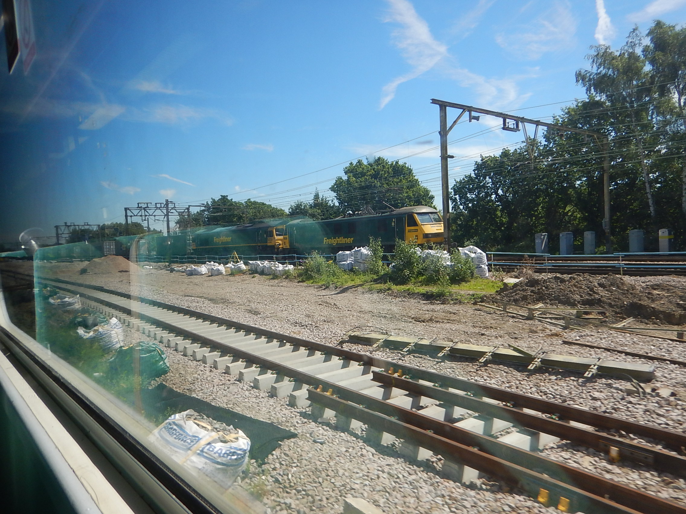
A Heavy Load From Felixstowe To Manchester
As I waited for my train at Canonbury station this morning, this very long train went through.

After I got home, I found that it was going from the Port of Felixstowe to Trafford Park Freightliner Terminal.
The journey will take around nine-and-a-half hours.
- This time includes a sixty-five minute stop at Ipswich to change the diesel locomotive or locomotives used to haul the train out of the Port of Felixstowe for the pair of Class 90 electric locomotives for the rest of the journey to the North-West.
- The two locomotives together have a power output of about 7.5 MW.
- The train will pick up the West Coast Main Line at Primrose Hill and then take the Trent Valley Line between Rugby and Stafford before approaching Trafford Park, using the Castlefield Corridor through Manchester Piccadilly and Oxford Road stations.
- As I write this, the train is on time as it approaches Tamworth.
The train has done well as at Watford, it was running twenty minutes late. The train crew have used the 7.5 MW well to claw back the time.
Did it help the crew to regain the schedule, that they had 7.5 MW on hand, as opposed to the less than 3 MW from the UK’s largest diesel locomotive?
To my mind, this illustrates one of the reasons, why long distance trains are best run by powerful electric locomotives.
In Do Cummins And Stadler Have a Cunning Plan?, I describe the new Class 99 locomotive.
- It is an electro-diesel locomotive.
- It has 6 MW available on 25 KVAC overhead electrification.
- It has a 1.8 MW Cummins diesel engine, which may be powerful enough to haul the largest trains in and out of the Port of Felixstowe, where the route is not electrified.
Thirty of these locomotives have been ordered by GB Railfreight.
I believe that one of these locomotives could handle a very heavy freight train between the Port of Felixstowe and Trafford Park Freightliner Terminal.
- The locomotive working alone could handle the train on the unelectrified line between Felixstowe and Ipswich.
- There would be no need to electrify the lines in the Port of Felixstowe.
- There would be no need for a prolonged stop in Ipswich.
- An hour on the journey could be saved.
- There might be a saving in the number of crew.
The Class 99 locomotive seems to be well-designed for handling freight trains out of Felixstowe.
Were Freightliner experimenting with what they needed from an electro-diesel locomotive, when I took this picture at Shenfield?
Note.
- The Class 90 electric locomotive has 3.7 MW of power.
- The Class 66 diesel locomotive has 2.4 MW of power.
Was what I saw an affordable electro-diesel locomotive?
New Merseyrail Train Runs 135km On Battery
The title of this post, is the same as that of this article on Liverpool Business News.
This paragraph gives the details.
Posting on social media site Linked In, Joaquim Font Canyelles, project leader at Stadler Rail, said: “Our new Merseytravel class 777 IPEMU (Independent Powered Electrical Multiple Unit) proved its strength after running 135 km fully loaded and without external current supply, which is much longer than we expected.
Note that 135 km is 83.9 miles.
These are possible routes, where the battery-electric trains could be deployed.
- Bidston and Wrexham Central – 27.5 miles
- Canada Dock Branch – 4.6 miles
- Chester and Crewe – 21.2 miles
- Chester and Runcorn East – 13 miles
- Ellesmere Port and Runcorn East – 10.8 miles
- Ormskirk and Preston – 15.3 miles
- Hunts Cross and Manchester Oxford Road – 27.1 miles
- Kirkby and Manchester Victoria – 30 miles
- Kirkby and Wigan Wallgate – 12 miles
- Liverpool Lime Street and Chester via Runcorn – 27 miles
- Liverpool Lime Street and Manchester Oxford Road – 31.5 miles
- Southport and Manchester Oxford Road – 37.8 miles
- Southport and Stalybridge – 45.5 miles
- Southport and Wigan Wallgate – 17.4 miles
Note.
- All routes could be done both ways with the exception of Southport and Stalybridge and possibly Southport and Manchester Oxford Road.
- Southport trains to Wigan and Manchester would charge their batteries at Southport.
- Central Liverpool and Wrexham Central would not need the change at Bidston.
- Hunts Cross and Preston via Central Liverpool would not need the change at Ormskirk.
- A Liverpool Lime Street and Manchester Oxford Road service would be possible.
Batteries can add a lot of range to a city’s railway system.
Conclusion
If Merseyrail can get hold of the routes to Crewe, Manchester, Preston and Wrexham, the Liverpool City Region will have one of the best metros for a city of its size.
Bus Information In Shops And Cafes
Several years ago, I wrote to Transport for London and suggested that the 5- digit code that you text to get bus information, be displayed inside the bus shelter. So you could read it whilst staying in the dry in bad weather.
There is now a space for the code on the instructions inside the shelter, but it is never filled in.
This morning, I had breakfast in Leon and afterwards I did some food shopping in Marks & Spencer, before walking back to Leon to get the bus home from outside.
It was cold in London this morning, so as I had a few minutes to wait for a bus, I ducked back into the Leon, as it was warmer in there.
I know the 5-digit code, that I should use, so I only emerged, when the bus was close.
Perhaps Transport for London, should provide small information posters that can be downloaded, printed and displayed by cafes, shops and other businesses close to a bus stop.
