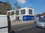
It’s Time To Detopsify Stratford Station
Stratford Station has grown like Topsy for too long and has several problems and possible future expansions.
Not least of these include.
- The final arrival of Crossrail.
- A direct connection to Chingford.
- A Stansted Express service.
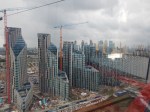
- Massive housing developments in the area.
- More hotels
- New cultural developments like the branch of the Victoria and Albert Museum.
- A new campus for University College London.
This article on IanVisits is entitled Stratford Station Set For Massive Transformation.
This is his opening paragraph.
Stratford station could be radically redeveloped under plans being worked on by the rail companies and local council.
That is rather understated!
The station will become several times busier and needs a complete rethink, many more services and deTopsification.
These are my thoughts.
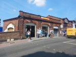
The Development Of The High Meads Loop
The High Meads Loop exists and is a double-track loop that can turn trains arriving at Stratford station via Lea Bridge station.
- It is underneath the Eastfield Shopping Centre – Westfield is in the West of London.
- Each track of the loop has its own long platform in the station. – Platform 11 is for clockwise trains and Platform 12 is for anti-clockwise.
- It has been used in the past for a Stansted Express service.
The Wirral Line in Liverpool like the High Meads Loop is now a modern loop for turning trains.
- The Wirral Loop is only single-track.
- It gives connections for over thirty stations on the Wirral and in Cheshire and North Wales to Liverpool City Centre.
- It is run by fifty-year-old Class 507 and Class 508 trains.
- The loop has now been improved and can handle upwards of the fourteen trains per hour (tph) it currently does.
Merseyrail will soon be introducing new Class 777 trains on the Wirral Line in the near future and will be increasing services and the number of destinations.
British Rail’s vision for Liverpool, that was cruelly cut-short by Liverpool MP; Harold Wilson, is finally coming to fruition.
Newcastle also got its British Rail tunnel which is now being used by the Metro, but what would have happened in Manchester if British Rail had been allowed to build the Picc-Vic Tunnel?
I have a strong belief, that a Lea Valley Metro can be developed on the West Anglia Main Line.
- It would have two Southern terminals – Liverpool Street station and the High Meads Loop at Stratford.
- When it opens, Crossrail will mean that Liverpool Street and Stratford stations will be seven or eight minutes apart with a frequency of at least 12 tph.
- Northern terminals would include Broxbourne, Cheshunt, Chingford, Enfield Town and Hertford East.
- Crossrail 2 was planned to have a frequency of 10 and 15 tph between Tottenham Hale and Broxbourne stations.
I believe that if services in East London are thoroughly reorganised, that all the benefits of Crossrail 2 can be brought to East London by the use of the High Meads Loop and the upgrading of existing lines.
Stansted Express Services
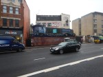
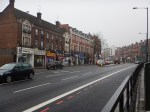
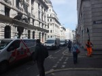
Go to Stratford station and there is an out-of-date sign at the end of Platform 1 and 2, where the Overground trains terminate.

It directs passengers to Platform 12 for Stansted Airport.
The picture was taken in 2017, but there is still a walk-through to Platform 12, that I use regularly, if I’m changing between London Overground and Greater Anglia or TfL Rail services to destinations on both the West Anglia or Great Eastern Main Lines.
I believe that there is still a need for a Stansted Express services from Stratford, as for some people, including myself, it is easier to get to Stratford, than Liverpool Street.
From some places the connections to and from Stansted are not very good. Try going between London Bridge, Canterbury, Euston, Victoria or Waterloo and Stansted with a few mobility issues like a heavy suitcase and/or a baby, without a degree in Ducking-and-Diving!
An additional Stansted Express service from Stratford would make things a lot easier to get to the airport for many travellers, because of Stratford’s connections to the Central, Jubilee and North London Lines and SouthEastern’s Highspeed services.
Better Connection Between High Speed One And The High Meads Loop For Passengers
Some passenger connections are missing at Stratford.
This is indicated in the IanVisits article.
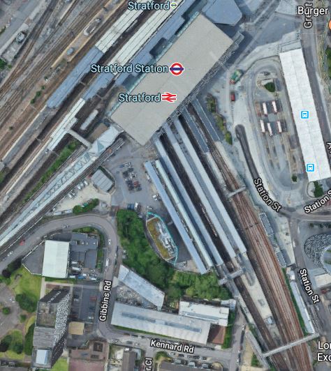
This map from cartometro.com shows the Topsy-like nature of the platforms at Stratford.
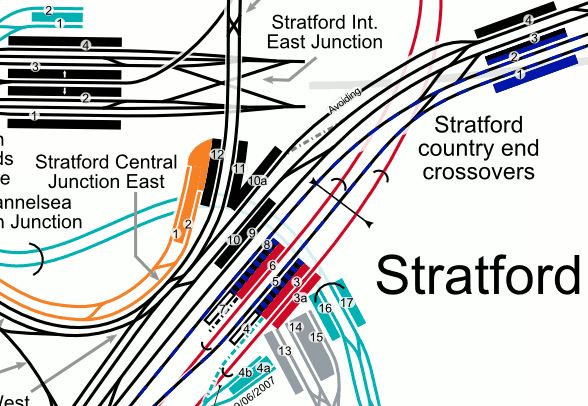
Note.
- The Docklands Light Railway is shown in turquoise.
- The DLR platforms in the North-West corner of the map are those of Stratford International station.
- High Speed One and the four platforms of Stratford International station are shown in black.
- The North London Line of the London Overground is shown in orange.
- The North London Line terminates in Platforms 1 and 2, which have a level link to Platform 12.
- Platform 12 is on the anti-clockwise platform for the High Meads Loop and has step-free access to the subway system underneath the station.
- Platform 11 is on the clockwise platform for the High Meads Loop and has level access to Platform 10a and full step-free access,
- Platform 10a is used by some services to East Anglia.
- Crossrail is shown in blue.
- The Central Line is shown in red.
- The Jubilee Line is shown in silver.
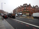
It is not the best passenger-friendly station layout.
- Inevitability, you often find yourself trudging a long way at Stratford station.
- Changing to or from any high speed services is supremely difficult.
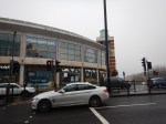
- Often you have to walk through the busy Eastfield Shopping Centre.
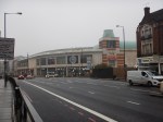
Particularly annoying for me is coming back from Kent on High Speed One and needing to take the North London Line, as I do several times a year.
As it involves a long walk through the Shopping Centre, I now take the easy way out and carry on to St. Pancras and get a taxi home.
As Stratford International is one of the draughtiest stations in England, the station is a real Design Crime and it needs a serious makeover.
Conclusion
Sort it!
Would A Mutant Many-Parent Child Help To Solve London’s Transport Problems?
London needs to increase the capacity of its public transport system, as the City continues to get larger and larger.
Current Major Projects
There are only three major rail projects ongoing in London at the present time.
The Bank Station Upgrade
The Bank Station Upgrade appears to be progressing well, albeit perhaps it’s a bit late due to the pandemic.
It is a complex project and from what I have heard and observed, it has been well designed and planned.
The Barking Riverside Extension
As with the Bank Station Upgrade the Overground extension to the new Barking Riverside station, appears to be going reasonably well.
But compared to that project, it is a relatively simple project, built mainly in the open air, with no tunneling.
Crossrail
Crossrail is in trouble, after what many believe was a very good tunnelling phase of the project.
But then tunnels under London usually seem to go well. I can remember the Victoria Line tunnelling and many other under London since the 1960s and all of these tunnels seem to have been dug without trouble. As I write, there don’t seem to be any tunneling problems with the Thames Tideway Tunnel.
Crossrail now has been reduced to a series of station builds and rebuilds, some of which are as large as the Bank Station Upgrade, with other ongoing projects like the testing of trains and systems.
So why are some of these stations running late in their delivery?
If you walk along the route of Crossrail in the City of London and through Clerkenwell and the West End, it is one massive building side as developers raise massive clusters of new developments around and above the Crossrail stations.
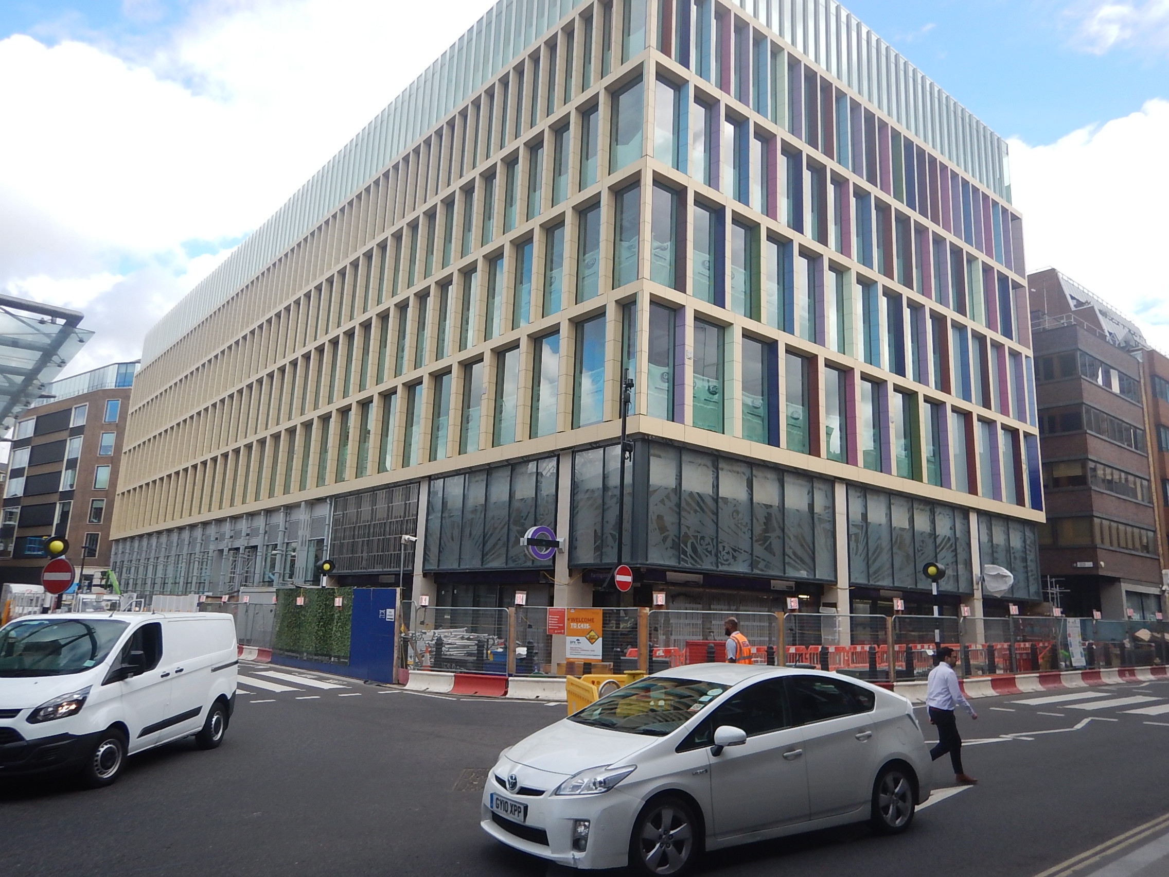
The picture shows Farrington station’s Eastern entrance, with a new development on top.
This one wasn’t a big one, but it went up in record time.
These buildings are often funded by Sovereign Wealth Funds, who want their buildings finished ASAP and as they have bottomless pockets, they are prepared to pay more to get the builders and tradesmen they need.
And where did they get the workers from? Other projects, including Crossrail.
This problem happened in Aberdeen at the height of the oil boom in the last century.
I also think that Brexit worsened the problem, as workers from mainland EU moved to large projects closer to home, like Stuttgart 21 and the new Berlin Brandenburg airport, that were both very much in trouble and could have been offering premium salaries as well!
The solution would have been to phase developments so that the limited pool of workers was not exhausted.
But that probably wouldn’t have suited the developers and politicians for all sorts of reasons.
- An uncompleted building doesn’t bring in money and jobs.
- Early completion must improve chances of letting the building.
- Delaying the building would probably have meant fewer holidays for politicians in exotic locations.
Hopefully, a comprehensive enquiry into the lateness of Crossrail will provide answers.
High Speed Two
High Speed Two is to my mind a London local project. But only in a secondary way!
- Rebuilding Euston station will improve Underground connections and interchange at Euston and Euston Square stations.
- It is claimed by High Speed Two, that the rebuilt Euston station will create 16000 jobs and 2200 homes.
- High Speed Two will enable massive development at Old Oak Common, with tens of thousands of homes and jobs.
- Old Oak Common station will be a very important rail hub in North-West London.
With seventeen trains per hour (tph) between Euston and Old Oak Common will High Speed Two attract local traffic?
- I suspect High Speed Two between Manchester Airport and Manchester Piccadilly and between Birmingham Interchange and Birmingham Curzon Street will also attract local traffic.
- I’ve used TGVs between Nice and Antibes.
- Tourists might visit, just like they did and still do at the Olympic Park.
- Many Londoners will join High Speed Two at Old Oak Common.
Some wag will suggest putting it on the Tube Map. But is it such a stupid idea?
Where Does London Need More Rail Services?
Having lived in London on and off for over seventy years, I feel the worst areas for rail links are probably.
- North West London
- South East London
- South Central London between Wimbledon and Croydon.
- South West London
Note.
- Over the years, there is no doubt that East and North London have improved considerably, with the development of the East London, North London and Gospel Oak to Barking Lines.
- Thameslink has been improved in North London and now it is being supported with improvements to the Northern City Line. Both routes now have new Siemens trains, which give a whole new dimension to using ironing-boards as seats.
- Crossrail will produce major improvements in West, East and South East London.
- Building of a new Penge Interchange station, which I wrote about in Penge Interchange could improve routes to and from South East London.
- Hopefully the work in recent years at Waterloo will improve suburban services out of Waterloo. In An Analysis Of Waterloo Suburban Services Proposed To Move To Crossrail 2, I showed that four tph could be run to Chessington South, Epsom, Hampton Court and Shepperton stations.
It looks like North West and South Central London are missing out.
How Can Services Be Improved In North West London?
There are radial routes from the centre of London to the suburbs.
Starting from the North and going to the West, there are the following lines.
- The High Barnet branch of the Northern Line
- The Mill Hill East branch of the Northern Line
- The Midland Main Line to St. Albans, Luton, Bedford and the East Midlands.
- The Edgware branch of the Northern Line
- The Jubilee Line to Stanmore
- The West Coast Main Line to Watford, Milton Keynes, the West Midlands, the North West of England and West Scotland.
- The Bakerloo Line to Harrow & Wealdstone.
- The Watford DC Line of the London Overground
- The Amersham, Chesham and Watford branches of the Metropolitan Line
- The Chiltern Route to Aylesbury.
- The Chiltern Main Line to High Wycombe, Banbury, Bicester, Birmingham and Oxford.
- The West Ruislip branch of the Central Line.
- The Uxbridge branch of the Metropolitan and Piccadilly Lines
When I used to live at Cockfosters as a child, to visit my many cousins in North West London, there was no alternative but to use a bus and take well over an hour each way.
There are now some circular rail routes in London but nothing in the North West of the capital.
The Dudding Hill Line And The West London Orbital Railway
But there is the little-used freight route called Dudding Hill Line.
- It runs between Cricklewood on the Midland Main Line and Acton Central on the North London Line.
- It is four miles of double-track railway.
This YouTube video shows a cab ride from Acton to Cricklewood.
Plans exist to turn it into the West London Orbital Railway, which will run two services.
- West Hampstead and Hounslow via Cricklewood, Neasden, Harlesden, Old Oak Common Lane, Acton Central, South Acton, Lionel Road, Brentford, Syon Lane and Isleworth
- Hendon and Kew Bridge via Brent Cross West, Neasden, Harlesden, Old Oak Common Lane, Acton Central, South Acton
Note.
- The proposed frequency of both services is four tph.
- There would be some stations to be built, but the track exists.
- There would be no new tunnels.
- The route is technically feasible.
- The route would connect West London to High Speed Two.
- There would be little disruption whilst it was built.
- The services could be run by dual-voltage battery-electric trains charged on the electrification at both ends of the route.
- The scheme represents a high value for money, with a benefit-cost ratio (BCR) of 2.2.
On the other hand, the scheme has two serious problems, as far as the current London Mayor is concerned.
- Transport for London has no money, partly because of London’s Fare Freeze.
- The project is not in South London.
This important and value-for-money project will not be built, whilst Sadiq Khan is still Mayor of London.
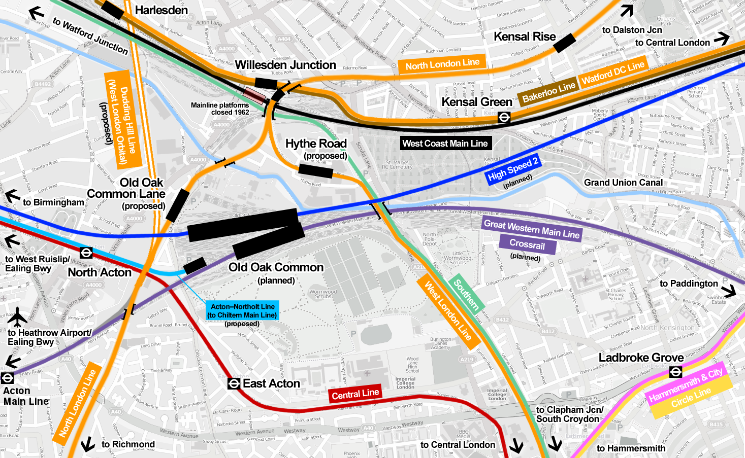
Harlesden Interchange
I believe that if we get the interchanges right on the West London Orbital Railway correct we can do things like.
- Increase the benefit cost ratio.
- Link the route to South London to make the Mayor a bit happier about the North London Scheme.
This Google Map shows Harlesden station.
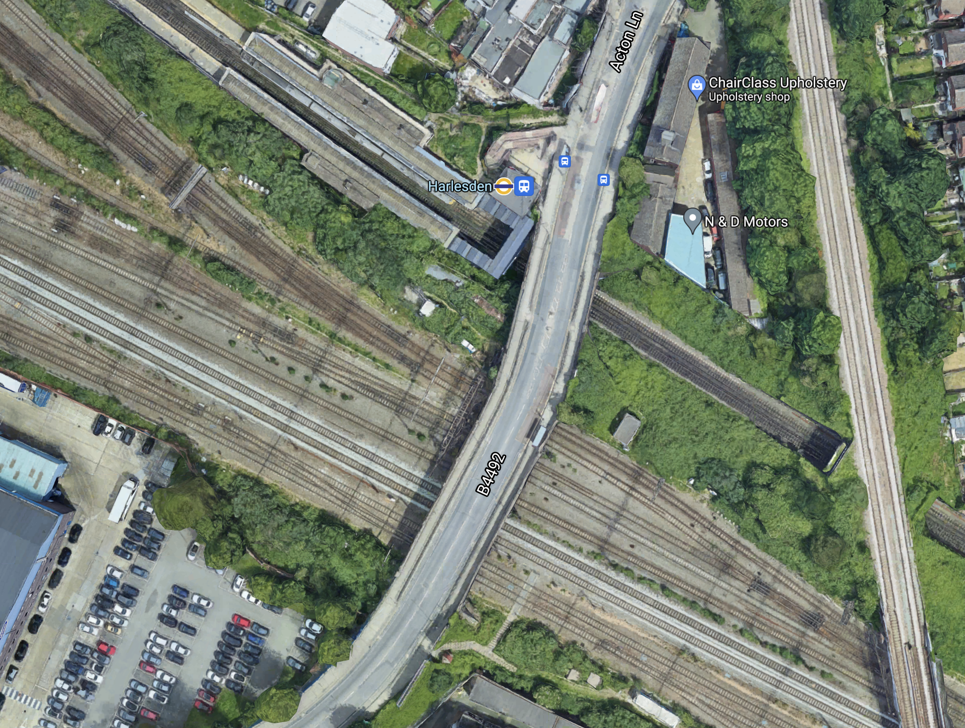
Note.
- The Bakerloo Line/Watford DC Line running North-West/South-East through Harlesden station.
- The West Coast Main Line in the Southern section of the map.
- The Dudding Hill Line running North-South across the map.
Platforms will be built on the Dudding Hill Line to connect that would probably be new or extended platforms in the current Harlesden station to enable interchange between the West London Orbital and the Watford DC Lines.
I also think there is a possibility that platforms could be added to the slow tracks of the West Coast Main Line, so that suburban services into London Euston can also connect to the West London Orbital Line.
It would also enable a connection between Southern’s Clapham Junction and Milton Keynes service and the West London Orbital Railway.
Looking at this from various angles, I think that an architect good at designing three-dimensional structures could develop a quality Harlesden Interchange station.
Neasden Interchange
Like Harlesden, Neasden is another possibility for a comprehensive interchange.
This Google Map shows Neasden station.
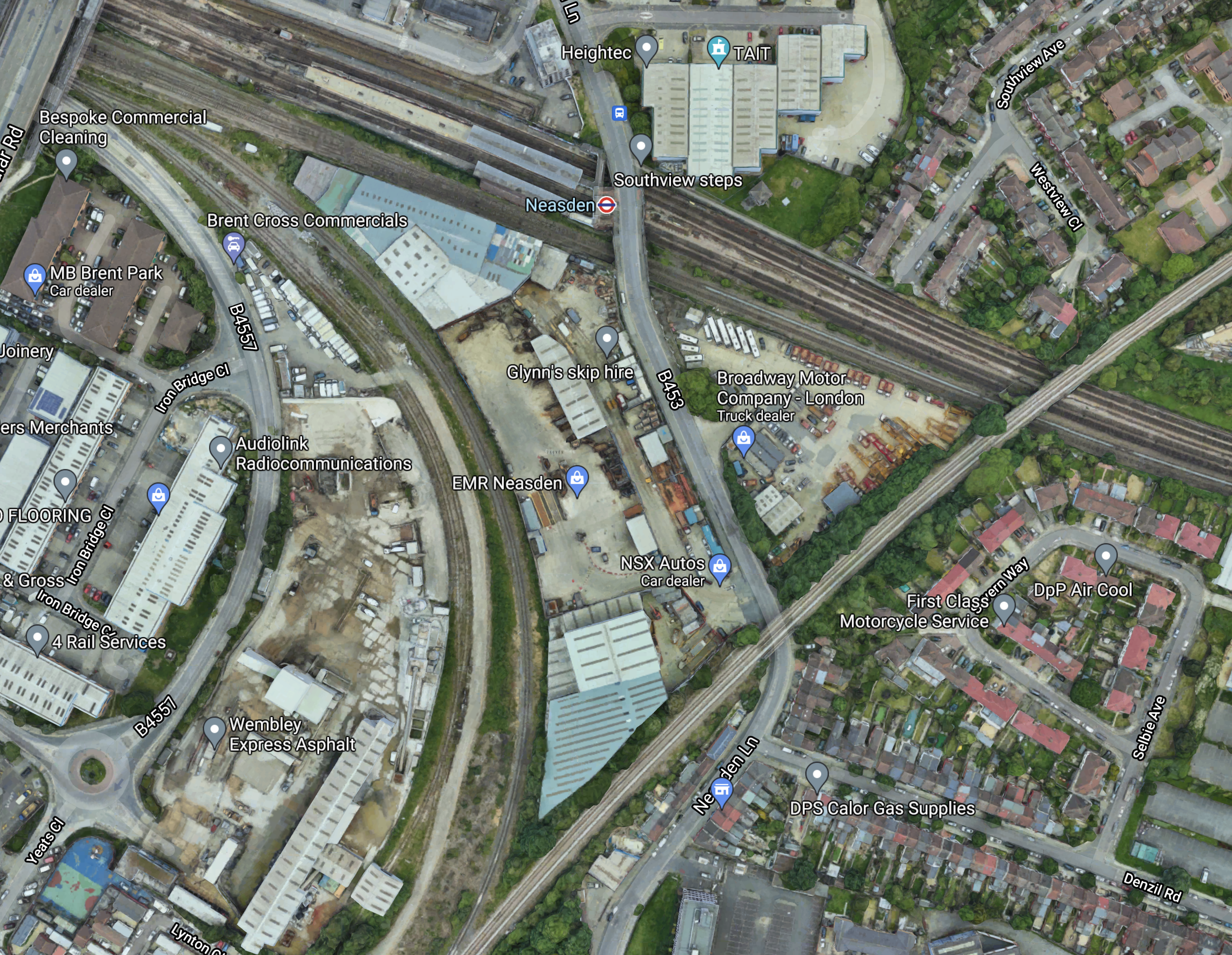
Note.
- There are a lot of lines going through Neasden station.
- The Dudding Hill Line goes across the South-East corner of the map.
- There is plenty of space in the area.
This map from cartometro.com shows the lines in the area.
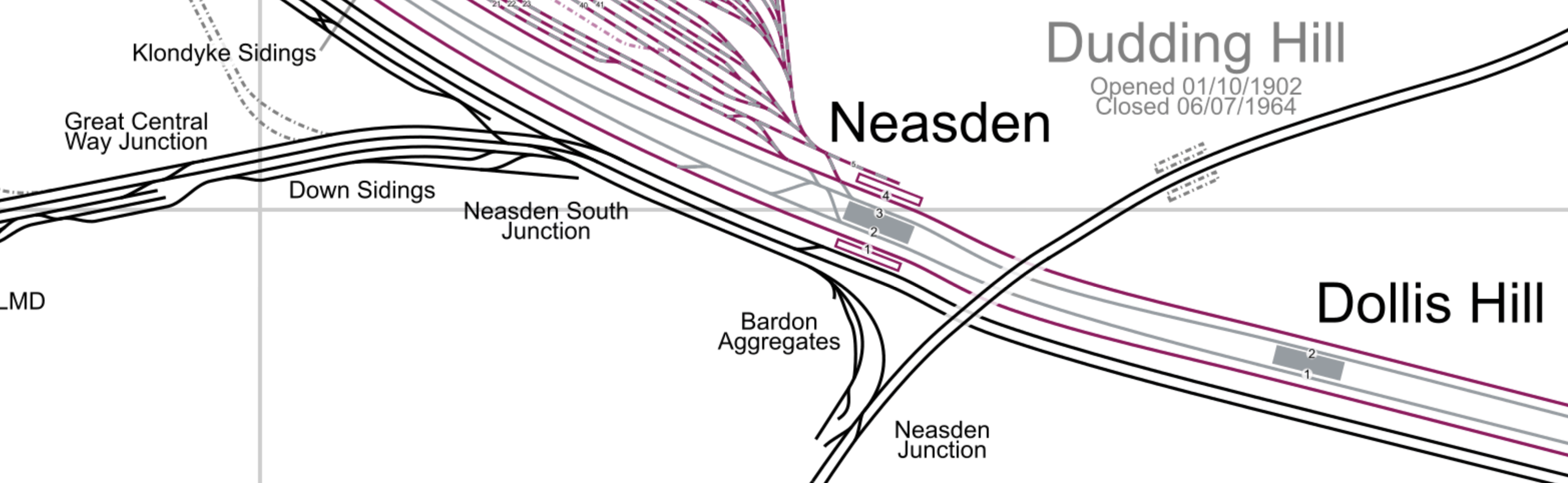
Note.
- The Dudding Hill Line is indicated by the former Dudding Hill station.
- The red tracks are Metropolitan Line tracks.
- The silver tracks are Jubilee Line tracks.
- The Southerly pair of lines through Neasden and Dollis Hill stations are Chiltern’s lines into Marylebone.
- The Chiltern tracks divide to the West of Neasden station, with the Aylesbury line following the other tracks and the Chiltern Main Line diverging to the West.
- London’s largest Underground Depot at Neasden, lies to the North-West in an area of London noted for few merits with the North Circular Road passing through.
I wonder, if the station and the depot offers a unique opportunity to offer large scale additions to London’s housing stock over the top of a rebuilt station and depot.
This Google Map shows the wider area.
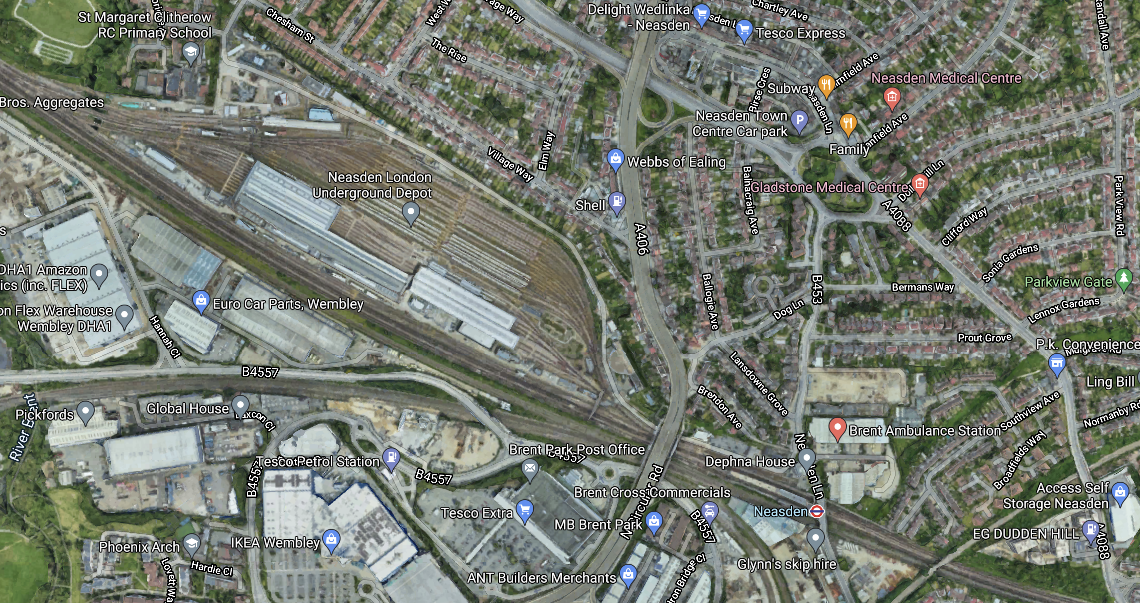
Note.
- Much of the depot appears to be open-air stabling for trains.
- The North Circular Road passes North-South between the depot and Neasden station.
- The Dudding Hill Line cuts across the South-East corner of the map.
- This corner of the map is labelled as Dudden Hill.
- According to Wikipedia, Dudding Hill is considered a more genteel spelling of Dudden Hill and could be as old as 1544.
It looks as if it would be relatively easy to develop over the top of the depot to create housing, industrial or commercial properties.
But why stop there and cover both the North Circular Road and the six tracks through Neasden station?
Neasden station could be rebuilt into a station with platforms on the following lines.
- Metropolitan Line
- Jubilee Line
- Chiltern Lines
- Dudding Hill Lines
Note.
- I estimate that Chiltern has a train about every six minutes, so some could stop.
- There might be space for a bay platform for Chiltern.
Neasden could be a major housing and transport hub.
- There could be large amounts of parking.
- Road access would be good.
- It would have good rail connections.
- It could have a bus interchange.
- London needs housing.
It might even be an alternative to Chiltern’s plan for a West Hampstead Interchange.
The Mayor of London, Transport for London and the Borough of Brent need to be bold!
Improvements To Chiltern’s Routes
Chiltern Railways have some plans that could improve services in North West London.
Using The Acton-Northolt Line
Wikipedia says this about using the Acton-Northolt Line to access new platforms at Old Oak Common station.
Upgrading the Acton–Northolt line (formerly the “New North Main Line”) to new platforms at Old Oak Common. This upgrade will also extend to London Paddington to increase capacity on the Chiltern Main Line as there is no room to expand the station at Marylebone.
This scheme has merit.
- The platforms would be connected to the Chiltern Main Line along the route of a partly-disused railway.
- The route could be double-tracked.
- There must be space for at least two new platforms.
- The new platforms could easily handle four tph.
- There may be a case for some new stations.
The scheme could add valuable extra capacity for Chiltern.
A Chiltern Metro
Wikipedia says this about a proposed metro service between Marylebone and West Ruislip stations.
- The Metro would have a frequency of four tph.
- It would call at Wembley Stadium, Sudbury & Harrow Road, Sudbury Hill Harrow, Northolt Park and South Ruislip.
- The service would require a reversing facility at West Ruislip.
- There would need to be passing loops at Sudbury Hill Harrow, and Wembley Stadium.
Given that the Chiltern Metro was first proposed over a decade ago, perhaps the concept could be increased in scope.
- Housing and other developments along the route may suggest that a station further out like High Wycombe might be a better terminal.
- ERTMS in-cab digital signalling is likely to be installed at some time, which would decrease headways between trains and allow more services.
- Electrification is likely in some form before 2040 and this will improve train performance.
- If Neasden station were to be rebuilt, as a comprehensive transport and residential development, I believe that this Metro service should also call at Neasden, as it would complement the West London Orbital Railway.
I believe that a review of the Chiltern Metro may mean, that an improved version is worth building.
Improvements To The Milton Keynes And Clapham Junction Service
I feel that this service could be key in improving services between North London and South London via the West London Line and High Speed Two’s station at Old Oak Common.
Currently, this service is as follows.
- It runs between Milton Keynes and Clapham Junction stations.
- It has a frequency of one tph.
- It calls at Bletchley, Leighton Buzzard, Tring, Berkhamsted, Hemel Hempstead, Watford Junction, Harrow & Wealdstone, Wembley Central, Shepherd’s Bush, Kensington (Olympia), West Brompton and Imperial Wharf stations.
- The service used to extend to South Croydon via Wandsworth Common, Balham, Streatham Common, Norbury, Thornton Heath, Selhurst and East Croydon.
- It uses Class 377 trains.
- It shares parts of the route with the London Overground.
I also think it has various issues and questions with respect to the future.
- The Class 377 trains are only 100 mph units, whereas the outer suburban trains on the West Coast Main Line are 110 mph Class 350 trains, which will soon be replaced by 110 mph Class 730 trains. Do the slower trains cause timetabling problems?
- Is one tph enough?
- The route doesn’t serve High Speed Two at Old Oak Common station.
- Is the service run by the right operator?
- What is the ideal Southern terminal?
These are my thoughts on the various issues.
The Service As A North-South Link
A friend, who lives in South London has told me, that if you go to an event at Wembley stadium the route is busy.
On the other hand, I’ve used it at midday on a Tuesday and found the trains empty.
But developed properly it could connect the following.
- Milton Keynes Central
- Bletchley for the East West Rail Link
- Watford for the West Coast Main Line to the North
- Wembley Central for Wembley Stadium and other entertainments
- Willesden Junction for the North London Line
- Hythe Road for High Speed Two, Crossrail and the Great Western Railway
- Shepherd’s Bush for the shopping.
- Clapham Junction for most of South London and the South of England
It would be a very useful cross-London route to complement Thameslink and the East London Line.
The Frequency
The current Milton Keynes and Clapham Junction has a frequency of one tph.
This may be enough for some parts of the route, as other services also provide services.
But many would argue, that perhaps South of Watford Junction, the service needs to be increased to connect the area to Old Oak Common and Clapham Junction.
I feel that High Speed Two, Crossrail and the Great Western Railway give so much connectivity, that between Clapham Junction and Willesden Junction needs a frequency of at least eight tph.
As the North London Line and the Watford DC Line are working at a frequency of four tph, this could indicate that a four tph direct service Watford Junction and Clapham Junction be ideal. Perhaps, it could continue North to Milton Keynes with a frequency of two tph.
The Trains
I am absolutely certain, that the full service needs to be operated by dual voltage trains, that are capable of running at 110 mph.
The Class 350/1 trains of West Midlands Trains would probably be ideal for the full service.
- They are dual voltage trains.
- They are 110 mph trains.
- They have a long distance interior.
They are being replaced with new Class 730 trains, so would be available.
If some services were running only as far North as Watford Junction, these could be either Class 378 or Class 710 trains of the London Overground.
The Connection To The West London Line And High Speed Two
This map from Wikipedia by Cnbrb shows the latest iteration of the lines at Old Oak Common station.
Note.
- The green route is taken by the Milton Keynes and Clapham Junction trains.
- The bright blue is High Speed Two.
- The purple is Crossrail.
- The orange is the Overground
- Hythe Road station is proposed for the West London Line to connect to Old Oak Common station for High Speed Two.
- Hythe Road station will have a bay platform to turn trains from the South.
- Old Oak Common Lane station is proposed for the North London Line to connect to Old Oak Common station for High Speed Two.
But where is the connection between the Milton Keynes and Clapham Junction service and Old Oak Common station for High Speed Two?
- Access from the South is not a problem as the Overground can be used to Hythe Road station.
- Extra services from the South can be run to and from the bay platform at Hythe Road station.
- Access from the East is not a problem as the Overground can be used to Hythe Road station.
- How do passengers go between say Wembley Central and Heathrow?
In addition for access from the West is the Overground can be used to Old Oak Common Lane station.
But as things stand at the moment the Milton Keynes and Clapham Junction service bypasses Hythe Road station and the only ways to go from Milton Keynes to Old Oak Common station for either High Speed Two, Crossrail or the Great Western is to do one of the following.
- Change to the Watford DC Line at Watford Junction, Harrow & Wealdstone or Wembley Central and then change to the Overground at Willesden Junction for either Old Oak Common Lane or Hythe Road station.
- Continue South to Shepherd’s Bush station, cross over to the other platform and then come back to Hythe Road station.
- Go via Euston station. OK for High Speed Two, but not for Crossrail or the Great Western.
They cannot be serious!
I hope that there is a cunning plan to enable the Milton Keynes and Clapham Junction service to connect.
Whilst on the subject of connections at Old Oak Common, where is the promised connection of Crossrail to the West Coast Main Line?
Were all these connections just kicked into the long grass and quietly forgotten, as they were deemed too difficult and/or expensive?
I think serious questions need to be asked about the design of Crossrail and High Speed Two at Old Oak Common.
Why weren’t Crossrail and High Speed Two designed to connect directly to the London Overground at Willesden Junction station perhaps by the use of a North South people mover serving the following lines?
- Bakerloo, Watford DC, West Coast Main and West London Orbital Lines at a rebuilt Harlesden station.
- London Overground at the high-level Willesden Junction station.
- High Speed Two
- Crossrail and the Great Western Railway
- The new Chiltern platforms.
- Central Line at East Acton station.
Note.
- Hythe Road and Old Oak Common stations would not be needed.
- The Milton Keynes and Clapham Junction service would call additionally at the rebuilt Harlesden station.
The current design of Old Oak Common stinks like a horse designed by a committee!
The Northern Terminal
I suggested earlier that some trains use Watford Junction and others use Milton Keynes Central.
Both stations have the capacity and the connectivity.
The Southern Terminal
In the last ten years, South Croydon, East Croydon and Clapham Junction have been used as the Southern terminal.
Thameslink seems to have chosen its various terminals to satisfaction of the travelling public, so perhaps the same method or personnel should be used.
The Operator
The Gibb Report said that this service should be transferred to the London Overground and I wrote about this proposal in Gibb Report – East Croydon – Milton Keynes Route Should Be Transferred To London Overground.
This is one suggestion, but I do wonder, if it should be transferred to West Midlands Trains and run in conjunction with their West Coast Main Line services.
- The service needs 110 mph trains.
- Timetabling and operation should be easier.
- London Overground trains don’t have a long-distance interior.
On the other hand, trains running between Watford Junction and Clapham Junction would probably be better if they were London Overground trains.
Conclusion
I believe that by using the current network and some modern trains and signalling, the passenger services to the West of the capital can be substantially improved.
Thoughts On Step-Free Access At Oxford Circus Station
The London Underground station most in need of step-free access is probably Oxford Circus, where the Bakerloo and Victoria Lines have a cross-platform step-free interchange, which connects to the Central Line.
- Oxford Circus is the third-busiest station on the Underground.
- The capacity of the station probably limits the capacity of the Victoria Line.
This map from carto.metro.free.fr, shows the lines through the station.

Note.
- The cross-platform interchange between the Bakerloo and Victoria Lines
- The Central Line running East-West under Oxford Street.
- Crossrail is shown by dotted lines, passing to the South of the station..
South of the Central Line, it would probably be difficult to squeeze in lifts and more escalators, but to the North, there may be space for another entrance building.
- The great advantage of making either the Victoria or Bakerloo Lines at Oxford Circus step-free, is that the other one will get it as well.
- I think it will probably depend on which of the buildings in the area, need to be replaced.
- I also suspect that the areas under Oxford Circus, Oxford Street and Regent Street are well surveyed, as there has been continuous development of Oxford Circus station since the 1960s.
On the other hand, the opening of Crossrail, with a new entrance to Bond Street station in Hanover Square, may mean that passenger numbers reduce at Oxford Circus, thus allowing a simpler solution.
I wouldn’t be surprised to see a very innovative solution to provide step-free access at Oxford Circus station.
I feel that the Proposed Shopping Centre Under Cavendish Square could be the elephant in the room.
- An upmarket shopping centre and medical centre needs good access for taxis, cars and public transport.
- Cavendish Square was used to build the Victoria Line.
- Tunnelling techniques have improved since the 1960s.
This Google Map shows Cavendish Square and the area between the square and Oxford Circus station.
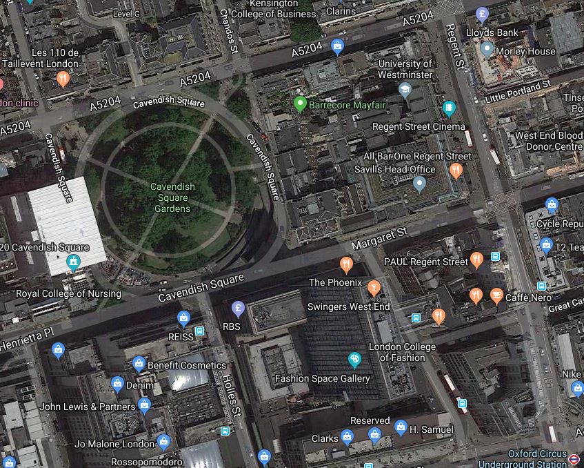
Consider the four corners of the map..
- Oxford Circus station is in the South-East corner.
- Harley Street is just on the map at the North-West corner.
- The BBC is just off the map in the North-East corner.
- John Lewis’s flagship store occupies the South-West corner.
But perhaps the most interesting building is the former BHS flagship store, that lies to the East of John Lewis, with Cavendish Square to the North and Oxford Street to the South.
The proposed development under Cavendish Square will be upmarket and it will need high quality access to attract tenants, visitors and clients.
- I doubt there will be masses of car parking, although they could probably dig up to a hundred metres below the square. Could there be an automatic car park, where vehicles are taken and stacked deep underground?
- Good access for taxis, private hire vehicles and delivery trucks will be needed..I suspect that planning permission, would specify electric vehicles only.
- The Bond Street station complex, with Crossrail, Central and Jubilee Lines is perhaps two hundred metres away. I feel the developers of Cavendish Square, will see access to Crossrail as being essential.
- Oxford Street station is closer, but good access will be needed between the station and Cavendish Square.
Access to Bond Street and Oxford Circus stations would probably be via wide, deep tunnels with travelators as are being installed to solve the horrendous access problems at Bank station.
The former BHS building could be key in any design.
- The BHS building has a superb location.
- Tunnels between the two stations and the Cavendish Square complex could go via any development of the BHS building.
- It might be possible to go higher on the site.
- It might even be possible to put another station on the Central Line in the basement.
There is certainly a lot of scope for an innovative solution at Oxford Circus station.
Funding Secured For New Entrance At Stratford Tube Station
The title of this post is the same as that of this article on IanVisits.
The new entrance will give those coming from the Carpenters Estate direct access to Stratford station.
This Google Map shows the South East section of the station.
The main station building has the two station symbols on the top and the Jubilee Line platforms run Southwards from the building.
It would appear that the new entrance will be close to the Southernmost corner of the station building in a staff car park.
Knowing the station well, I suspect it will be a very useful new entrance for both residents and visitors to the Olympic Park.
It will make it easier to avoid the clutches of Eastfield.
The only details on the cost of the scheme is this sentence from Ian’s article.
Newham council has agreed to contribute £1 million to the scheme, which is being funded from its Community Infrastructure Levy.
As it incorporates some extra lifts in the station, the scheme is probably going to be more than a million pound one, but the London Legacy Development Corporation (LLDC) is involved, I suspect that everything is securely funded.
Should There Be Other Small Schemes Like This?
At Shepherd’s Bush station on the Overground, in 2015, a new entrance was built to give better access to Westfield. It is not very busy during the day, but I suspect that workers at Westfield use it more than shopper. Wikipedia says it cost £1.35 million, so I should think that the Stratford scheme wouldn’t cost a great deal more.
I believe there are other places, where extra entrances could be built.
Simple Ungated Entrances
Entrances don’t have to be grand, as I showed in An Ungated Entrance Used To Create Step-Free Access At Crofton Park Station.
These two entrances are just a hole in the station fence, Oyster readers and a bit of tarmac. There must be other places, where these entrances can be installed.
An Entrance At Hackney Central Station Into Graham Road
In It Looks Like The Hackney Downs/Central Link Is Ready To Open, I also talk in detail about adding a Southern entrance to Hackney Central station, that would lead directly into Graham Road. Eith a pedestrian crossing and changes to the bus stops, it would be a very useful step-free entrance for those living between the centres of Hackney and Dalston.
A Second Entrance At Highbury & Islington Station
In Could We Create A Second Entrance To The Overground At Highbury And Islington Station?, I investigated creating a West-facing entrance at Highbury & Islington station, that would improve access for those going to football.
Conclusion
I believe that a lot of stations can be improved, by adding extra entrances in convenient places.
It is probably easier to do in London’s Oyster/contactless card area, as a couple of readers can sort out ticketing.
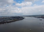
The Future Of The Emirates Air Line
I’ve always liked the Emirates Air Line, but I hadn’t used it for some time until today.
As I was in the area, I used it to cross the river, this morning.


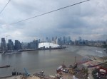


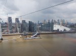
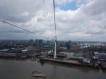

I can make these observations.
The Weather Could Have Been Better
The cable-car needs sunny weather, although I did once go across in the snow.
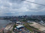
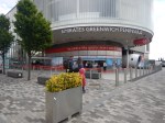
The Cable-Car Wasn’t Busy
Compare today’s pictures wit this one taken in February 2014.
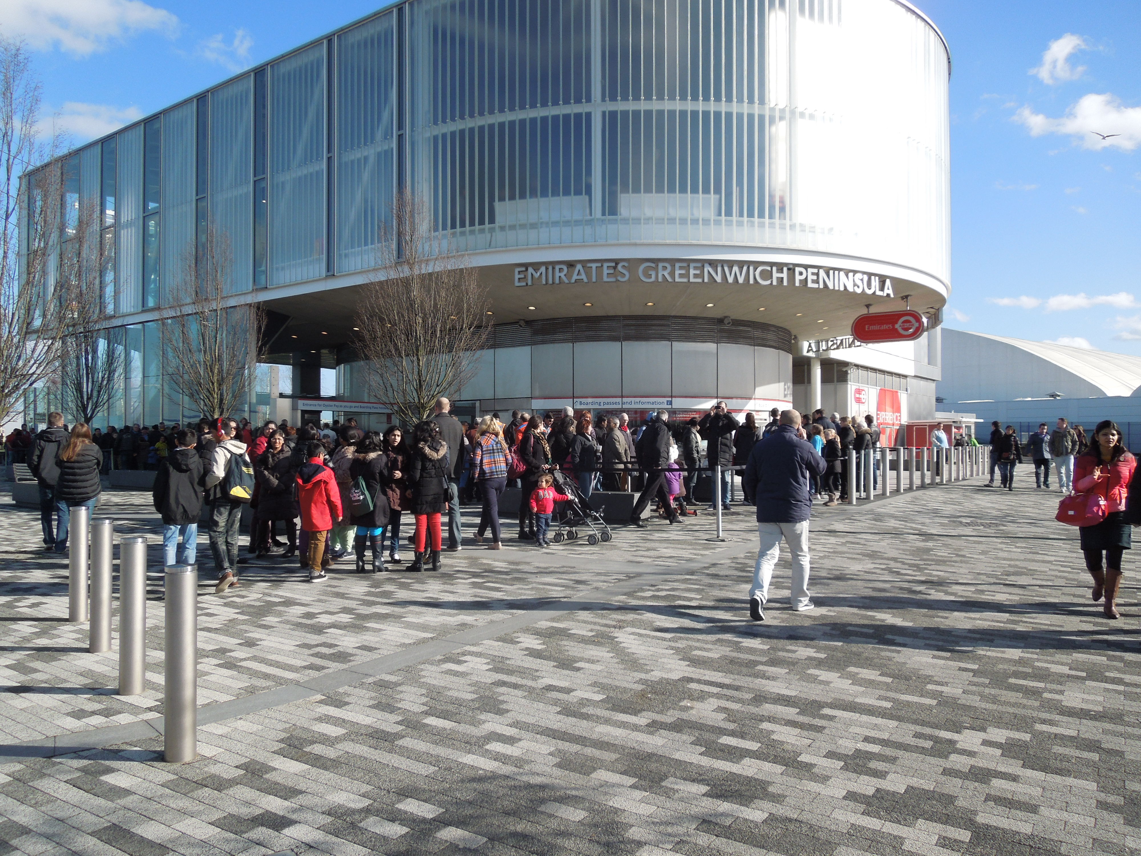
The Cable Car Was Busy
One of the attendants said it was becoming more of a tourist attraction rather than a means of transport.
This meant today, I had a car to myself and didn’t have to share it with several excited kids.
I think too, that the weather was against visitors and tourists now know the best times to use the cable car.
In my view, when the sun is setting is by far the best.
There Are A Lot More Skyscrapers
The last time I rode across was in March 2016, after which I wrote Riding The Cable Car.
There has been a lot of high rise building in the intervening years.
I suspect that as more and more skyscrapers are built, a ride between them all across the river will become more popular.
The Line
The Line is a sculpture trail, that runs from Greenwich to the Olympic Park. The cable-car has to be used by non-swimmers to cross the river.
The Line is connected OR or close to London’s railways as follows.
- Stratford – Central Line, Jubilee Line, DLR, London Overground, National Rail and in the future; Crossrail.
- Stratford High Street – DLR
- Pudding Mill Lane – DLR
- Bromley-by-Bow – District and Hammersmith & City Lines
- Star Lane – DLR
- Canning Town – Jubilee Line and DLR
- Royal Victoria – DLR
- North Greenwich – Jubilee Line
All these connections mean that it can be done in sections.
The Tide
The Tide is an partly elevated five km route, that will be linked to the cable-car, that will be fully-open in two years.
Crossrail
Crossrail will affect all travel in East London and it connects at Stratford stayion to The Line.
I don’t know the route of the Tide, but it may make walking from the O2 to Woolwich sttion for Crossrail much more relaxing.
Although it doesn’t serve Greenwich directly, I believe Crossrail will draw more tourists to the cable-car.
Docklands Light Railway
The DLR is getting new trains in the next few years and an extension to Thamesmead.
As with Crossrail it will draw more tourists to the area and the cable-car.
Thames Clippers
These are expanding and they will bring more tourists to the cable-car.
Conclusion
These and other factors, such as tourists venturing out of the centre of London, will mean that more vistors will explore the East and use the cable-car.
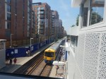
West Hampstead Station – 7th July 2018
The new bridge at the West Hampstead station is now in use and it looks like the new station will be completed by the end of the year.
As the last picture shows this could be one of those station developments, where a deck could have been built over the North London Line to increase the number of flats built in the development on the South side of the railway.
This Google Map shows West Hampstead station on the North London Line and West Hampstead tube station on the Jubilee and Metropolitan Lines, although the latter don’t stop.
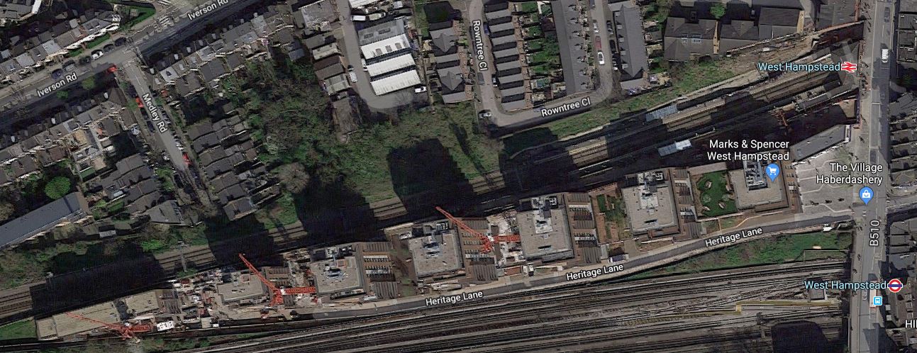
Note the development stretches a long way to the West between the North London Line and Underground Lines.
There have been plans to create a West Hampstead Interchange on West End Lane.
As these envisaged moving the Overground station to the East side of West End Lane and the new station is being built on the West side, It would appear there’s been a rethink.
Perhaps the Underground station is to be moved to the West side of West End Lane and will have an entrance on the small square in front of the M & S Simply Food and alongside the new Overground station.
This Google Map shows an enlargement of the area.
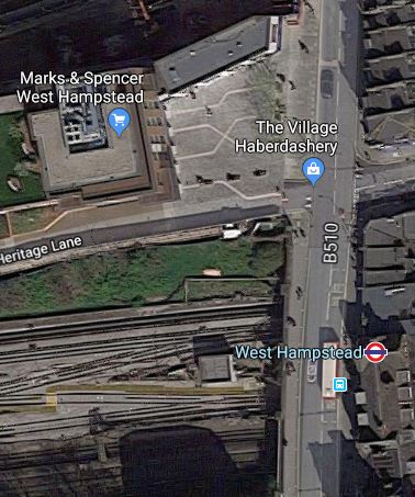
The new station could have platforms on the following lines.
- Jubilee Line
- Metropolitan Line
- Cjhiltern Railway
It would be a very worthwhile interchange. Especially, as passengers could do the following.
- Walk across the square for the Overground for East London.
- Walk perhaps another hundred metres to West Hampstead Thameslink station, which is also proposed as the terminus of the West London Orbital Railway.
There could also be a development on the top of the new station, which would hopefully contribute to the cost.
I have no idea, if anything will happen here, but Transport for London are looking to create new stations with over-site development. The Mayor also seems keen on the West London Orbital Railway, as it is based on under-used infrastructure and requires no new track or tunnels.
A Walk Down The Finchley Road
Aleks2cv made this comment on my long post about the West London Orbital Railway, which was entitled New Railway Line For West London Proposed.
West London’s version of Goblin, an available resource with potential. All urban London so suitable for Overground 4 car metro service.
I would add extensions to your outline.There is space at the former Midland Finchley Road station for a single terminating platform with existing street facade. Interchange with North London, Metropolitan, and Jubilee and coaches on Finchley Road such as Stansted AirLink.
It got me thinking.
This is only part of the comment and I’ll deal with the rest after Christmas, if I renmember.
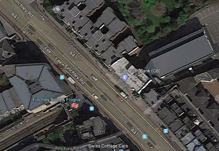
This is a Google Map of the area along the Finchley Road, between Finchley Road and Frognal station in the North and Finchley Road station in the South.
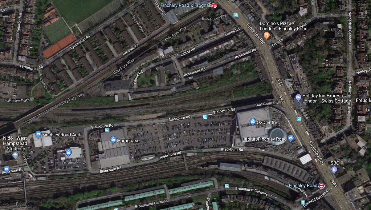
It is one of those interchanges, you might do in a North to South direction, as you have gravity assistance.
This second map from carto.metro.free.fr shows the various rail lines.

Note, the following lines can be seen in both maps.
- The Midland Main Line through West Hampstead Thameslink station, which crosses Finchley Road between Finchley Road and Frognal and Finchley Road stations.
- The Metropolitan and Jubilee Lines going through West Hampstead and Finchley Road stations.
- The North London Line going through West Hampstead and Finchley Road and Frognal stations.
I took these pictures as I walked down Finchley Road.


My thoughts on various parts of the area.
Finchley Road And Frognal Station
The station is a very poor example.
- There is no step-free access.
- Station buildings are minimal.
- There is a ruin next door.
- There is a need for perhaps a light-controlled crossing outside the station, as the road is very busy.
Improvement wouldn’t be helped, by the fact that the station is at the end of Hampstead Heath tunnel.
This Google Map shows a close-up of the station.
The only solution is probably a full rebuilding with perhaps a block of housing or offices on the top of a modern station.
The Midland Main Line
This Google Map shows the Midland Main Line as it passes under Finchley Road, to the North of the O2 Centre.
Note.
- There is not much space between the railway and the service road for the O2 Centre.
- The large surface-level car park of the O2 Centre is visible.
- The two slow lines are the Northern pair of lines, with the two fast lines to the South.
At least there is space in the middle of the lines.
A Terminus For The West London Orbital Railway
Aleks2cv in his comment, felt that the West London Orbital Railway can be extended to Finchley Road.
I think this could be very difficult, as the West London Orbital Railway will probably be a single track railway sneaking up the South side of the Midland Main Line.
- There is very little space.
- Passengers would still have to walk about a hundred metres to connect to the Underground.
- Connecting to the Overground would require a stiff walk up the hill.
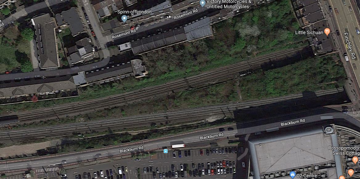
This Google Map shows the limit of the freight line, that could possibly be turned into the West London Orbital Railway.
Note.
- The railway going East-West is the Midland Main Line.
- The diagonal railway is the North London Line through West Hampstead station.
In the shadows on the South side of the Midland Main Line, you can just see tyhe freight line, which connects to the Down Fast of the Midland Main Line to the East of the bridge.
It looks to me, that years ago, the land now occupied by the O2 Centre was some form of railway yard or factory premises.
Finchley Road Underground Station
Finchley Road Underground station is a station in need of a degree of refurbishment.
- It is not step-free.
- Pedestrian access to the O2 Centre is not good.
But it is a cross-platform interchange between the Jubilee and Metropolitan Lines.
This Google Map shows the station.
Note.
- The two Chiltern tracks to the South of the station.
- The closeness of the Western end of the station to the Car Park of the O2 Centre.
- There is space to the South of the Chiltern tracks.
I feel very much that this station could be developed sympathetically to be a very good station, that could be paid for by housing on the top.
The O2 Centre
I think the O2 Centre could be the key to Aleks2cv’s idea for the West London Orbital Railway.
- The O2 Centre appears tired.
- Public transport can take people easily to the shopping at Oxford Street or Brent Cross.
- Surface car parking is so Twentieth Century.
As the O2 Centre is owned by British Land, who are one of the UK’s biggest property companies, I think that it is likely the site could be redeveloped.
Suppose the site was developed as follows.
- It extended over and connected to the Western ends of the platforms at Finchley Road Underground station.
- A two-platform terminal station for the West London Orbital Railway could probably be fitted in reasonably close to the Underground station.
- A small bus station.
Over the top would be shops, offices, housing or whatever was desired.
Conclusion
I believe that something will be done to redevelop this site.
Whether it has the terminal for the West London Orbital Railway underneath, will only be made clear, when planning permissio is given.
Upgrades For Northern And Jubilee Lines Have Been Brought To A Halt By Transport for London
The title of this post is the same as that of this article in City AM. This is the first paragraph.
Planned upgrades for the Northern and Jubilee Lines have been paused by Transport for London (TfL), though train drivers’ union Aslef says they will be cancelled entirely.
But is it such a disaster?
The Jubilee and othern Lines need more trains to increase the service frquencies. This is said in the article.
The Northern Line upgrade plan was to buy 17 additional trains so the Northern Line could run a 30 trains per hour service on all branches of the line, while the Jubilee Line would have had 10 new trains to operate a 36 trains per hour service.
So it looks like twenty-seven new trains are needed.
The Central Line Train Upgrade
This article on Railway-news.com is untitled London Underground’s Central Line Trains Set For Upgrade.
Currently, the Central Line‘s 1992 Stock have DC motors, which will be replaced by more efficient motors and a sophisticated control system.
The cost of the upgrade will be £112.1 million or about £1.3 million per train.
Transport for London are only making a reliability claim for the upgrade. Hopefully, if the trains are more reliable, then more can be in service. so can a higher frequency be run?
I also think in addition, the trains could possibly accelerate faster from stops, thus reducing the dwell times at stations and ultimately the journey times.
- Epping to West Ruislip currently takes ninety minutes with 38 stops.
- Ealing Broadway to Newbury Park takes sixty minutes with 24 stops.
- Northolt to Loughton takes sixty-seven minutes with 28 stops.
Saving just ten seconds on each stop will reduce journey times by several minutes.
I suspect that Transport for London will rearrange the timetable to increase the service frequency from the current twenty-four trains per hour (tph).
It will be interesting to see what frequency of trains and journey times are achieved, when all the Central Line trains have been updated.
The Victoria Line Upgrade Of 2016
In 2016, the Victoria Line track was upgraded at Walthamstow Central station, so that services could be increased to thirty six tph.
The Problem Of Ordering A Small Batch Of Unique Trains
This article on London Reconnections is entitled Third World Class Capacity: Cancelling Tube Upgrades.
The article talks about the problems of building small batches of unique trains and I would conclude they will be expensive, unless you could find some way of not buying them.
Could The Jubilee And Northern Line Trains And Stations Be Upgraded To Increase The Capacity And Avoid The Need For More Trains?
I’ve no idea, but I suspect that Transport for London have looked into the possibility.
The Jubilee Line
Currently, the Jubilee Line is worked by sixty-three 1996 Stock trains.
Wikipedia gives a good description of the Traction Control of the trains. This is the first sentence.
1995 and 1996 stocks have similar body shells but they use different AC traction control systems. The 1995 stock system is more modern, since the 1996 stock design specification was frozen in 1991.
This gives me the impression, that a more modern traction control system could improve the train performance, as electronics have moved on in the last twenty years.
The Northern Line
Currently, the Northern Line is worked by one hundred and six 1995 Stock trains.
Upgrading The Traction Control
I wonder if the most economic way is to update the traction control on both sets of trains with the same system.
If the upgrade needed new AC motors at the Central Line cost £1.3 million a train, would give total cost of around £220 million.
Upgrading The Stations
I suspect that Transport for London will upgrade the stations with Harrington Humps and other facilities to make train loading and unloading easier and less likely to delay the train.
I suspect that all the lessons learned in raising the Victoria Line to 36 tph will be applied.
Crossrail And The Jubilee Line
Crosrail appears to have been designed, so that it works in co-operation with London’s older Underground lines.
When considering Crossrail’s relationship with the Jubilee Line, the following must be taken into account.
- The two lines have interchanges at Bond Street, Canary Wharf and Stratford stations.
- Crossrail has good connections to the Metropolitan and Baskerloo Lines, which in North-West London serve Jubilee Line territory.
Perhaps more importantly, there is a cross-platform interchange at Whitechapel between the two Eastern branches of Crossrail. This will give passengers an easy route between Sssex and Canary Wharf.
These features should divert passengers away from the Jubilee Line.
Will this make upgrading the Jubilee Line, less urgent?
London Bridge Station, Thameslink And The Jubilee Line
One of the problems with the Jubilee Line is that you have to walk miles to get to the platforms at some stations.
London Bridge and Waterloo stations are bad examples.
These two stations are now connected by a fourteen tph link across the South Bank, which goes from London Bridge to Charing Cross via Waterloo East.
I use the route regularly back from Waterloo, as I can get a 141 bus to my home at London Bridge station.
Next year, when Thameslink is fully open even more passengers will be able to avoid the Jubilee Line.
And then there’s West Hampstead Interchange!
If this station were to be created to link all the lines together at West Hampstead, it would also create a second connection between Thameslink and the Jubilee Line.
The Splitting Of The Northern Line
Once Camden Town and Bank stations have been upgraded in 2025, the Northern Line will become two separate lines, with cross-platform interchange at Camden Town and Kennington stations. This will enable thirty-six tph on both branches and allow trains to be used more efficiently.
I do wonder, if in the detailed design and planning of the station extension at Camden Town, has shown that the split can be performed earlier, thus efficient train usage can start earlier.
Thameslink And The Northern Line
My late wife used to live in Barnet until we were married.
From that area in the 1960s, you could either take the Northern Line from High Barnet station or the two tph local train into Kings Cross from Oakleigh Park or New Barnet stations.
The local rail service is now three tph to Moorgate. Not a great improvement in fifty years!
However, things are changing at New Barnet and Oakleigh Park stations.
- New trains and an uprated service into Moorgate.
- Thameslink will add a two tph service to Sevenoaks.
Will these developments take a small amount of pressure off the Northern Line?
The Provision Of Depot Space
One of the disadvantages of buying more trains, would be that the depots would need to be expanded, so they could be stored.
London is a crowded city, which is short of land.
So is this a problem?
Londoners
Londoners are World Champions at ducking and diving!
So don’t underestimate their abilities to find the quickest routes that take the pressure off the Jubilee and Northern Lines.
Replacing The Whole Jubilee And Northern Fleets
It is intended that new trains will be in service on the Piccadilly Line around 2022. Wikipedia says this about Siemens proposal for the trains.
Siemens has publicised an outline design, which would feature air-conditioning and would also have battery power enabling the train to run on to the next station if third and fourth rail power were lost. It would have a lower floor and 11% higher passenger capacity than the present tube stock. There would be a weight saving of 30 tonnes, and the trains would be 17% more energy-efficient with air-conditioning included, or 30% more energy-efficient without it.
By the end of the 2020s, the Jubilee and Northern Line trains will be over thirty years old, and by then the two lines will be in need of even more capacity.
Replacing the current trains with a London-proven new train would surely be a distinct possibility.
Conclusion
The more I look at whether the top-up order for new trains is needed, the more I’m convinced it isn’t!
Bank Junction Goes Buses And Cyclists Only
On Monday, the 22nd of June 2017, the City of London brought in an order making the busy Bank Junction buses and cyclists only between seven in the morning and seven in the evening from Monday to Friday.
I took these pictures soon after ten in the morning.
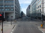


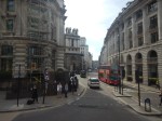


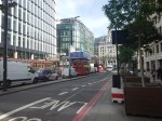


The first few pictures were taken from the top of a Routemaster bus on Route 21, as it travelled from where I live across the city to London Bridge station.
Note.
- Most drivers seemed to be avoiding the area.
- The City of London Police were telling drivers, but didn’t appear to be ticketing anybody.
- Much of the congestion seemed to be caused by half-empty polluting Tour Buses.
- One pedestrian was moaning that he couldn’t use his car to get around the City.
Overall, it appeared to be a calm start.
The Upgrade Of Bank Station
I have only shown the area on the surface, but under the ground around Bank Junction, a massive construction project is starting in the City of London’s twin goals of more and better office accomodation and transport links.
Bank station is getting a major upgrade, which will include.
- In The New Tunnel Under Bank Station, I wrote about an upgraded pedestrian tunnel that crosses the area.
- In Between Bank And Cannon Street Station, I wrote about how Bloomberg are helping develop a new step-free entrance to the Waterloo and City Line and Bank station, which will open by early 2018.
- A new Northern Line tunnel to create more space on the platforms and increase frequency on the line.
- The station weill receive a forty percent increase in capacity.
- Full step-free access with thirteen new escalators and three new lifts.
- A new entrance to Bank station opposite Cannon Street station.
- Two North-South moving walkways.
- Some of the £600million project cost will be funded by oversite office development.
- Hopefully, much of the work will be finished by 2021.
There’s more in this article in the Guardian, which is entitled Bank station upgrades point to London’s bigger, busier future.
Bank Station And Crossrail
You may wonder, why if Bank station is so important, that Crossrail doesn’t call and Crossrail 2 won’t either.
It may not, but the Central Line will have good connections to Crossrail at Stratford, Liverpool Street, Tottenham Court Road and Bond Street stations.
So passengers for Bethnal Green, Bank, St. Paul’s, Chancery Lane and Holborn will change from Crossrail to the Cwntral Line at a convenient station.
In addition, Crossrail will feed passengers into loops in the District, Hammersmith and City and Jubilee Lines.
Travellers will pay their money and take their choice.
Other Developments At Bank
I wouldn’t be surprised to see more pedestrian routes linking the City stations of Bank, Cannon Street, Fenchurch Street, Liverpool Street and Moorgate; both on the surface and possibly underground.
I would also make sure that all buses in the centre of London are low-emission vehicles. That certainly doesn’t apply to those polluting and jam-creating Tour Buses and tourist coaches.
Using Southern Crossrail Lite
On my trip to Shepperton today, I went from and to Waterloo station for the Shepperton Branch Line.
For both journeys, I used the route between London Bridge and Waterloo East stations, that some want to use as part of Southern Crossrail.
Going to Waterloo, I started at Farringdon, and this waan’t a good place to start, as I didn’t have a clue to the best way and neither did the London Underground staff.
So I took the Metropolitan to Moorgate and hopped South on the Northern Line to London Bridge, from where I had three routes.
- Jubilee Line
- Train from London to Waterloo East.
- Bus
At a pinch, I could walk along the Embankment
I suspect that when Crossrail and Thameslink are fully open, there will be a better route, between Farringdon and Waterloo.
- Crossrail to Paddington, then Bakerloo Line to Waterloo.
- Crossrail to Tottenham Court Road, then Northern Line to Waterloo.
- Thameslink to London Bridge, then train to Waterloo East.
As a special Crossrail-Bakerloo pedestrian tunnel is being built at Paddington, that may be the best way. I wrote about this in Paddington Is Operational Again.
My route to Waterloo worked today, as did the route home after a raid on the excellent Marks and Spencer at Waterloo. The only problem was that a 141 bus to my house, had broken down and I had to wait at London Bridge.
I tend to use a 141 bus to and fropm London Bridge, as one stop is in the forecourt of the station and the other is less than a hundred metres from my house.
So how could this abbreviated Southern Crossrail Lite route be improved?
- The London Bridge end works well, as generally all trains for Waterloo East station turn up on Platforms 8 or 9, which are the two sides of the same island.
- Only one up escalator at London Bridge was available and I have a feeling, there could be a bit of a reliability issue.
- I used a lift to go down coming back, to avoid walking to the escalator, and the lift was the sort of size the Victorians used because escalators weren’t in common use until later.
- The lift was certainly big enough for a cricket team and all their kit.
- There needs to be better connection between main line and Underground at London Bridge. I suspect this will get better, as more of the station opens.
- For this route four trains per hour, as you get on a Sunday, aren’t enough.
- At Waterloo East, the walking route could be improved.
- Waterloo East needs a Next Train To London Bridge Indicator.
- Waterloo has twin up and down escalators between the main concourse and the walking route, which is more than enough. Especially, as they were all working!
But I did notice several passengers used the route from London Bridge to Waterloo East stations, including at least two couples with children in pushchairs.
This new Southern Crossrail Lite is going to prove an invaluable alternative to the Jubilee Line.
