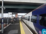
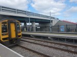
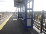
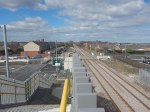
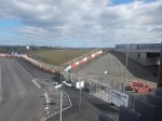
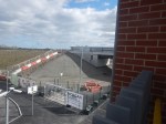
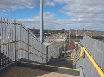
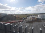
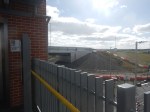
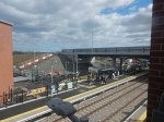
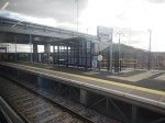
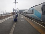
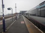
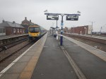
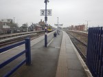
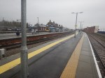
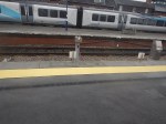
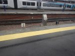
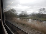
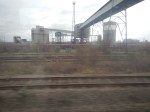
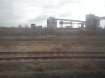
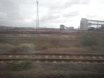
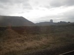
Newsham Station – 30th March 2025
Today, I went to Newcastle and took a ride to the recently-opened ; Newsham station on the Northumberland Line.


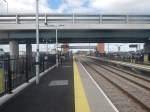


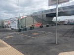


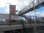
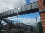
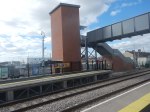
Note.
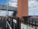
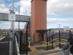
- The road bridge over the railway.
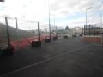
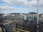
- When complete there will be a lot of parking space.
- The orange bollards in the parking could be electric vehicle chargers, ready to be unveiled.
- The full step-free access over the railway via the lifts is already working.
- British Railways, its predecessors and many other countries would have just put in a level crossing.
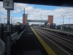
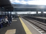
- The Completed platform is wide.
- Both platforms already have a shelter.
- There are help points, information displays, facilities for those with limited hearing and readers for smart ticketing on both platforms.
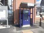
- There is a ticket machine by both lift towers.
- The disabled parking is already marked out.
- The brickwork and other workmanship is top-class.
- There is space behind the platforms for taxis, buses and emergency service vehicles.
- There is enough clearance under the two bridges for overhead electrification.
There is still some finishing off and landscaping to do, but it is a station with everything.
I have some other thoughts.
The High Quality Lifts Are By Stannah
Several of the passengers I saw, were getting on in years.
Does the maker of the well-advertised stair-lifts use station lifts, which are likely to be used by those of reduced mobilility, as a promotional tool?
The Station Will Be One Of The Best Rural Stations In The UK, When It is Complete
I can see other stations on a similar theme being built.
Especially, where a level crossing is to be eliminated.
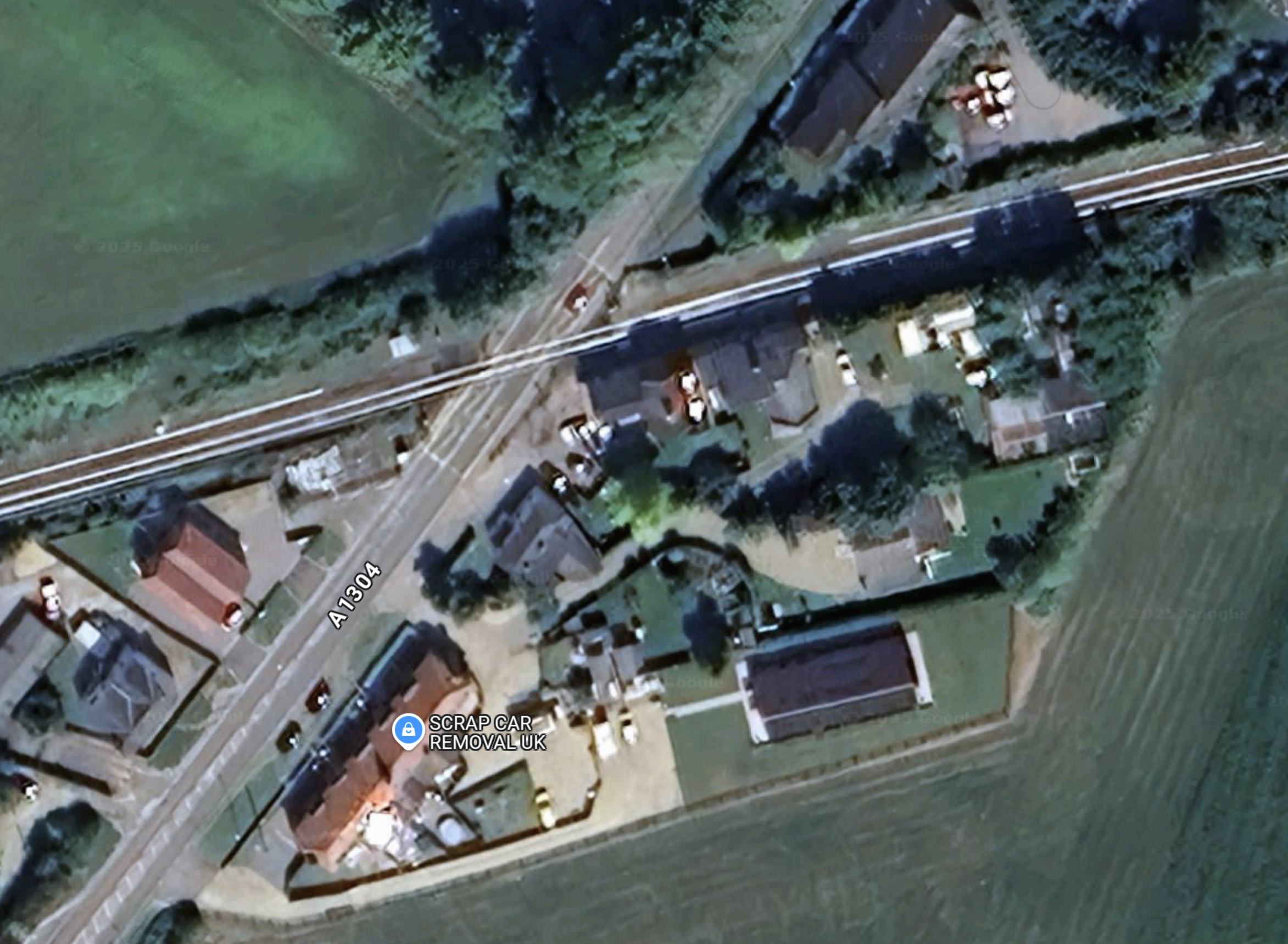
This Google Map shows the level crossing and former station at Six Mile Bottom, near where I used to live.
Note.
- The Cambridge and Newmarket railway goes across the map.
- Cambridge is to the West and Newmarket is to the East.
- The main Newmarket to London road crosses the railway here in a level crossing.
- Newmarket is to the North and London and the M11 is to the South.
- There used to be a station here and some want it back.
- There have been several incidents on the level crossing and Greater Anglia have had serious damage to more than one train.
A station like Newsham would be ideal here.
I can see Morgan Sindall building a few more on this theme.
Could they licence the design to construction companies all over the world?
I’ve certainly, seen similar layouts in Eastern Poland, where there are lots of level crossing accidents, according to our guide on one trip. But he said Russia is a lot worse for level crossing accidents.
Are There Any Plans For The Bay Sub-Surface Platforms At Moorgate Station?
I use Moorgate station regularly, as there’s a Leon Restaurant just outside the station, that looked after me properly during the Covid-19 Pandemic, so when I’m in the area and need feeding I pop in.
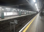
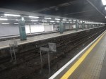
These pictures show the four bay platforms on the Sub-Surface lines.
Note.
- The pair of platforms to the left or South are numbered 5 and 6 and used to handle Thameslink trains, that ran to Moorgate station.
- Platforms 5 and 6 used to be electrified with 25 KVAC overhead wires.
- The pair of platforms to the right or North are numbered 3 and 4 and are used to terminate some Metropolitan Line services at Moorgate station.
- Platforms 3 and 4 are electrified with London Underground four-rail electrification.
- The number for Platform 4 can clearly be seen.
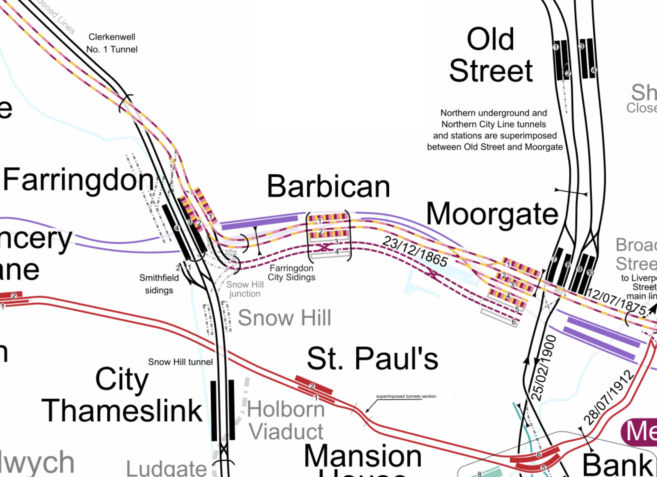
This map from cartometro shows the track layout in Farringdon, Barbican and Moorgate stations.
Note.
- The multi-coloured tracks and platforms of the Metropolitan, Circle and Hammersmith & City Lines running through Platforms 1 & 2 at Farringdon, Barbican and Moorgate stations.
- The multi-coloured tracks and platforms of the Metropolitan, Circle and Hammersmith & City Lines terminating in Platforms 3 & 4 at Moorgate station.
- The purple tracks and platforms of the Elizabeth Line running underneath the Metropolitan, Circle and Hammersmith & City Lines and their stations.
- The maroon and white tracks and platforms of Thameslink running through Platforms 3 & 4 in Barbican station and terminating in Platforms 5 & 6 at Moorgate station.
- The black tracks of Thameslink running through Farringdon and City Thameslink stations.
- It would appear there used to be two junctions to allow trains from Moorgate to go North through Farringdon station or South through City Thameslink station.
- The Thameslink tracks have two useful crossovers.
- The black tracks of the City branch of the Northern Line running through Old Street, Moorgate and Bank stations.
- The black tracks of the Northern City Line running through Old Street station and terminating in Moorgate station.
- The red tracks of the Central Line running through Chancery Lane, St. Paul’s and Bank station.
Because of the layout of the various tracks new connections and improvements may be possible.
Extending The Northern City Line To Bank Station
In Walking Along Moorgate – 30th September 2020, I describe some of the possibilities opened up by the design of Moor House, which has been built to allow more tunneling underneath.
I believe two extensions South from Moorgate station would be possible.
- It was intended by the builders of the Northern City Line, to take the route to just North of Bank station at Lothbury.
- Has The Possibility Been Created For A Pedestrian Tunnel Between Bank And Moorgate Stations?
Note.
- As the extension to Bank station has dug tunnels all over the place, I would expect that the engineers on that project would have a good idea on the best way to connect Moorgate and Bank stations.
- I usually use the Northern Line between Moorgate and Bank stations, but sometimes the Northern Line is rather crowded.
- The Northern City Line is being resignalled and may have an increased number of trains, so more passenger capacity may be needed.
- If a new station were to be built at Lothbury, it might be possible to improve step-free access to the Northern City Line.
- A new station on the Northern City Line and a pedestrian tunnel could connect to the newly-installed travelator at Bank station.
There are certainly serious possibilities to improve connections between Moorgate and Bank stations.
Could Metropolitan Line Trains Be Turned At Moorgate Station?
Currently, there are eight trains per hour (tph) between Aldgate and Uxbridge in the Off Peak.
With the new signalling on the Sub-Surface Lines would it allow more trains to operate, if some Metropolitan Line services were terminated in Platforms 3 & 4 at Moorgate station.
Would It Be Worthwhile To Run Thameslink Trains Again Into Moorgate Station?
It would only need to terminate trains from the North, as trains from the South can terminate at Black friars Station.
Perhaps a two tph service from a convenient station would suffice.
A Pedestrian Connection Between City Thameslink Station And St. Paul’s Tube Station
I covered this in A Pedestrian Connection Between City Thameslink Station And St. Paul’s Tube Station.
Hydrogen-Powered Trains To Be Introduced In Northern Italy
The title of this post, is the same as that of this article on Fuel Cell Works.
These three paragraphs introduce the project.
Residents and visitors to Valcamonica, an Alpine region in northern Italy, will be able to ride hydrogen-powered trains from next year.
The pioneering project, the first of its kind in Italy and supported by an investment of 367 million euros ($396 million), marks a significant adoption of hydrogen fuel for a rail line, despite the high production and operational costs.
The region currently uses polluting diesel trains, which will be replaced by 14 zero-emission hydrogen-powered trains made in Italy by a unit of French group Alstom
The trains will run on the Brescia–Edolo railway, which has this Wikipedia entry.
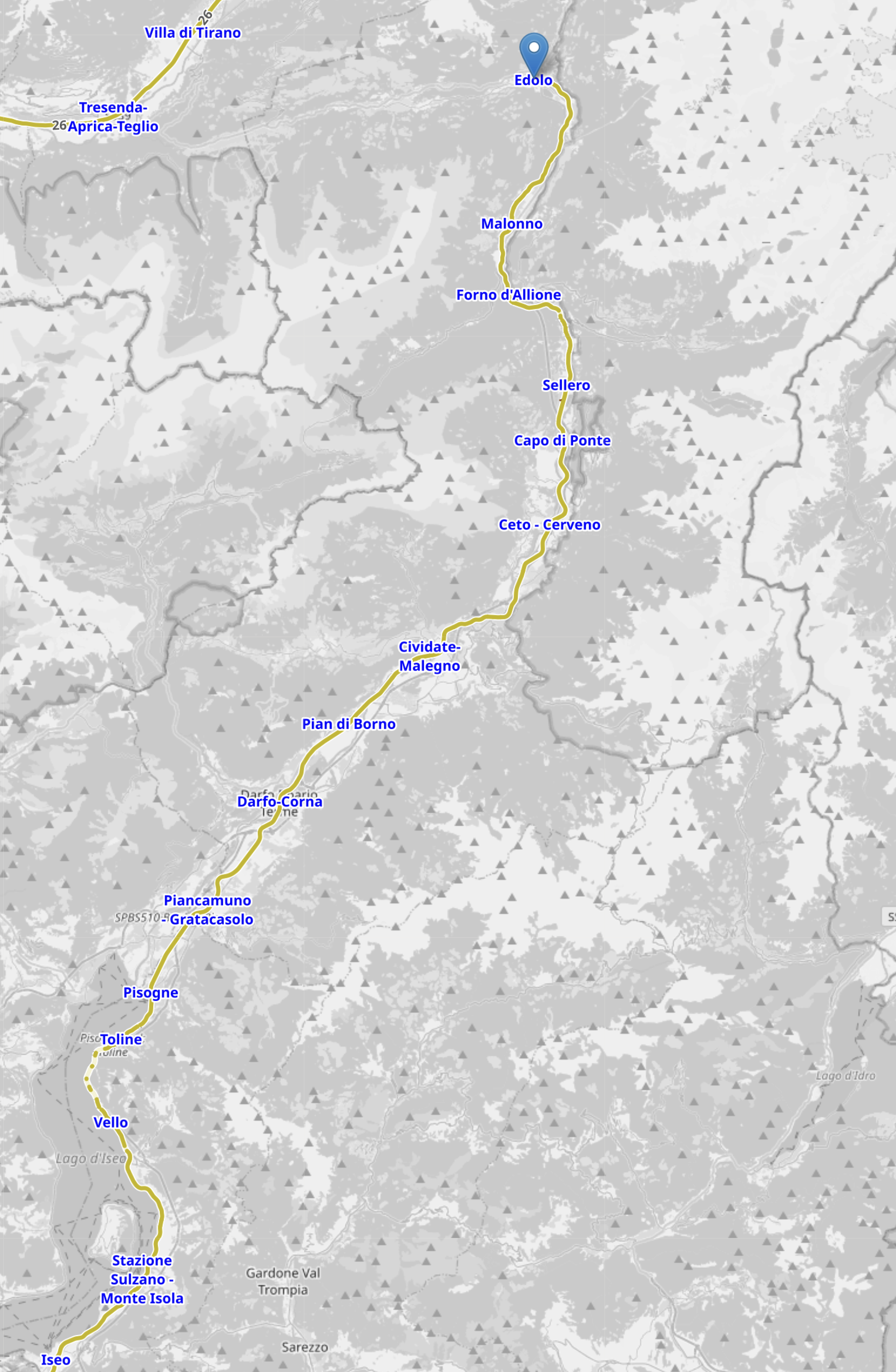
This OpenRailwayMap shows the Northern part of the railway.
Note.
- Edolo station is indicated by the blue arrow at the top of the map.
- The Brescia–Edolo railway is indicated by the yellow line.
- Stations are indicated by blue lettering.
- Iseo is the station in the South-West corner of the map.
- Click the map to show it to a larger scale.
This second OpenRailwayMap shows the Southern part of the railway to the same scale.
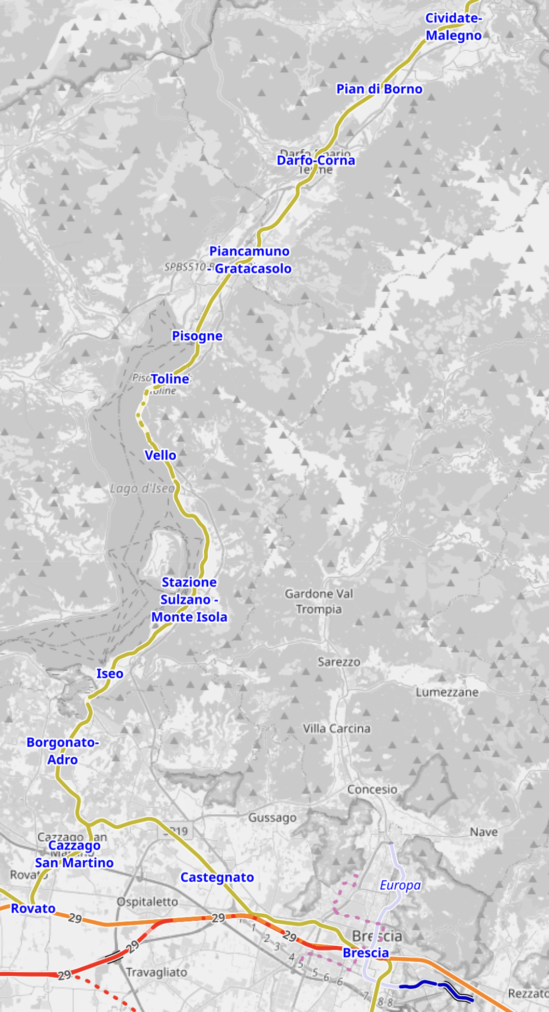
Note.
- The Brescia–Edolo railway is indicated by the yellow line.
- The Venice-Milan railway is indiated by the orange line across the bottom of the map.
- Stations are indicated by blue lettering.
- Iseo station is in the South-West corner of the map.
- Brescia station is in the South-East corner of the map on the Venice-Milan railway.
- Click the map to show it to a larger scale.
It looks to me, that the Brescia–Edolo railway could be a day-out if you were having a holiday in Milan, Venice or Verona.
- The railway is a single track railway.
- It appears to go through the mountains.
- Currently, it is diesel powered, but I suspect running hydrogen trains on the route will turn it into a major tourist attraction.
Could other rail routes attract visitors, by going for zero-carbon traction using hydrogen?
In the UK, these are surely six of many possibilities.
- Settle and Carlisle
- Marshlink Line
- Mid-Cornwall Metro
- Norwich and Sheringham
- Sheffield and Huddersfield
- Mid-Cornwall Metro
- Uckfield Branch
Infrastructure costs would just need a hydrogen supply to be arranged.
Conclusion
You can always trust the Italians to use a stylish solution.
London Gatwick Implementing Time-Based Separation On Single Mixed-Mode Runway
The title of this post, is the same as that of this article on Flight Global.
These four paragraphs introduce the technique.
UK air navigation service NATS has applied its intelligent arrival separation system to a mixed-mode single runway for the first time, with implementation at London Gatwick.
The system uses dynamic time-based – rather than distance-based – approach spacing in order to maintain sufficient arrival rates in strong headwind conditions.
Headwinds reduce the groundspeed of inbound aircraft flying at a set airspeed. This means a longer interval between two arrivals spaced a fixed distance apart.
“Having to maintain set separation distances in those conditions reduces the landing rate and can have a significant knock-on effect to the airport operation,” says NATS.
I have flown light aircraft onto main runways at major airports several times, including Cardiff, Dublin, Edinburgh, Hamburg, Leeds, Liverpool, Manchester, Naples, Nice, Southend and Stansted.
In one approach I made to Dublin airport, this type of approach may well have been of assistance.
I was flying into Dublin in my Piper Arrow; G-JMTT.
- I had crossed over Anglesey to leave Wales and I was talking to RAF Valley, whilst I crossed the Irish Sea in more of a direct line for Dublin Airport.
- The RAF handed me over to Dublin Approach, who gave me a series of vectors to point me at the main runway at Dublin Airport.
- Dublin Tower, then gave me the instruction. “Tango-Tango Can you speed it up a bit! There’s a Jumbo on your tail!”
- I replied. “Affirmative! Tango-Tango!” I then lowered the nose and pointed it at the runway to speed things up a bit.
- Dublin Tower, then asked. “Tango-Tango On landing, can you expedite clearing the runway?”
- There was then a brief exchange, where I negotiated my route off the runway, by taking the first taxiway on the left and then stopping.
- After a safe landing and a stop on the taxiway, Dublin Tower called. “Tango-Tango! We’ll give you ten out of ten for that!”
- After which the Jumbo rushed past on the runway, with the pilot giving a quick laugh over the radio.
- Dublin Tower called. “Welcome to Dublin!”
The Irish have different ways of doing things!
But, seriously, NATS are probably just implimenting a computerised form of what good air traffic controllers have done for years.
In that arrival at Dublin, the controllers had stretched the time and distance between my small Piper and the Jumbo, so everything was safe.
There alternative would have been to delay one of the planes.
Conclusion
It looks to me that the application of a new algorithm by NATS, will squeeze a few more aircraft into Gatwick’s single runway.
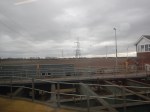
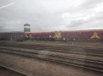
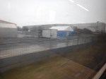
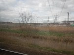
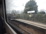
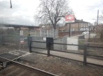
Cleethorpes Station – 25th March 2025
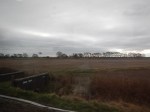
When I got to Cleethorpes station, I took these pictures.


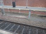
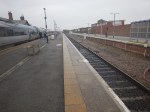
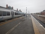
Note.
- The weather wasn’t up to much.
- The restaurant, where I had intended to have lunch appeared closed.
- So I just turned round and went back to Doncaster.
- The station appears to have four long platforms and a siding, where trains could be cleaned during a short or possibly overnight stay.
I do have a few thoughts about Cleethorpes station.
The Platform Lengths At Cleethorpes Station
In
Taking Pictures In Doncaster And Cleethorpes Today
My faith was restored a bit in UK railways today.
I had to go to Cleethorpes at the last minute to take some pictures for this blog.
I went with a change at Doncaster each way.
- I bought the single ticket to Doncaster from a person in King’s Cross for £28.55 on LNER.
- I bought the return ticket to Cleethorpes from a person in Doncaster for £20.55 on TransPennine Express.
- I bought the single ticket to King’s Cross from a person in Doncaster for £15.30 on Hull Trains.
I bought all tickets with my railcard on a walk up basis.
All four trains were on time.
The only problem was the weather in Cleethorpes and the pictures could have been better.
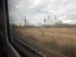
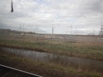
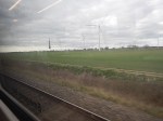
From Doncaster To Cleethorpes
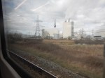
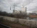
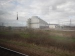
These pictures were taken on my journey between Doncaster and Cleethorpes.

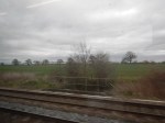


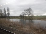
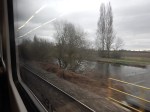
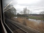


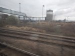


The area is best summed up as flat and decorated with these features.
- A few hedges.
- Some trees and some woodland.
- dozens of wind turbines.
- Lots of pylons carrying electricity.
- Scunthorpe steelworks
- A few stations and railway sidings.
- A couple of waterways.
- Estates of new housing as you approach Grimsby.
When I returned there was more of the same on the other side of the tracks.


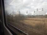


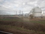


With the addition of all the power stations at Keadby and a couple of wind farms.
These are my thoughts on how this landscape will look at some time after 2030.
More Onshore Wind Farms
There will be a lot more wind farms lining the Doncaster and Cleethorpes railway.
The government has said it might pay for turbines and transmission lines to spoil views.
I feel they will have to, to meet their net-zero targets.
There Will Be Massive Hydrogen Storage On The Other Side Of The Humber
SSE are developing Albrough and Centrica are developing Rough into two of the largest hydrogen stores in the world.
The wind farms of the North Sea will provide them with hydrogen.
More Housing
If the government has its wish there will be a lot more new housing.
And as the newer houses show in my pictures, many of them will have solar panels.
More Power Stations At Keadby
Consider.
- The main purpose of the power stations at Keadby will be to provide backup to the wind and solar power in the area and far out to sea.
- The power stations will use hydrogen stored at Albrough and Rough.
- Some of the gas-fired power stations at Keadby will be fitted with carbon capture.
- One hydrogen-fired power station is already being planned.
The power stations at Keadby will probably be capable of supplying several GW of zero-carbon energy.
There Will Be Energy-Hungry Industries Along The South Bank Of The Humber
Just as in the Victorian era, coal attracted steel-making, chemicals and refining to the area, a South Humberside with large amounts of energy will attract heavy industry again.
Already, Siemens have built a train factory at Goole.
There Will Also Be Large Greenhouses In Lincolnshire
Greenhouses are a wonderful green way of absorbing waste heat and carbon dioxide.
Where Have I Seen This Blend Of Offshore Energy, Hydrogen, Heavy Industry And Agriculture Before?
After I visited Eemshaven in the Northern Netherlands, I wrote The Dutch Plan For Hydrogen.
We are not doing something similar, but something much bigger, based on the hydrogen stores at Aldbrough and Brough, the massive offshore wind farms and Lincolnshire’s traditional heavy industry and agriculture.
The Railway Between Doncaster and Cleethorpes Will Be Developed
Just as the Dutch have developed the railways between Groningen and Eemshaven.
Grand Central To Submit Application For Direct Services Between Lincolnshire And London
The title of this post, is the same as that of this news item from Grand Central.
These three bullet points act as sub-headings.
- Grand Central has today launched an application process for direct services between Cleethorpes, Grimsby, Habrough, Scunthorpe and London – plans to bring significant benefits to underserved areas.
- The application will be welcomed by communities, businesses, and organisations, who have been actively campaigning for the introduction of direct rail links to London.
- If approved, the new services could unlock £30.1 million annually for the region.
These three paragraphs add more details.
Grand Central has today notified Network Rail of its plans to operate new direct services between Lincolnshire and London that, if approved by the rail regulator (the ORR), will bring significant benefits to underserved areas across Lincolnshire and the wider region.
Under the proposals, direct services to London will be provided from Cleethorpes, Grimsby, Habrough, and Scunthorpe, with Grand Central planning to operate the services from as early as December 2026.
The plan makes best use of capacity on the rail network by running trains from the proposed new stops before connecting into existing Grand Central services at Doncaster.
The service seems very similar to the proposed King’s Cross and Cleethorpes service described in the this section of the Grand Central Wikipedia entry, where this is said.
In December 2017, Grand Central announced plans to bid for a service from London King’s Cross to Cleethorpes in early 2018 for a date in 2020. It would involve the existing Bradford Interchange service extended to ten coaches from London to Doncaster then dividing with five coaches going to Cleethorpes via Scunthorpe, Barnetby, Habrough and Grimsby. The other five coaches would be the existing service to Bradford Interchange. This proposal would require permission for a split of trains as it has not been used on the East Coast Main Line before. In February 2018, Grand Central announced plans for an additional call at Crow The company planned to operate four trains per day from 2020. However, in July 2018, the Office of Rail and Road announced new access charges which would affect the business case for the new service, leading to Grand Central announcing that it would delay bidding until 2019.
Note.
- It appears that the service is not calling at Crow.
- By splitting and joining at Doncaster, Grand Central will be getting more coaches and passengers, up and down a single path between King’s Cross and Doncaster stations.
- Grand Central run four trains per day (tpd) between King’s Cross and Bradford Interchange, so as four tpd will be running between King’s Cross and Doncaster stations, it appears Grand Central will be running a full service.
It appears that open access applications come to those who wait eight years.
I have some further thoughts.
What Class Of Trains Do Grand Central Currently Use?
According to Real Time Trains on Friday the 21st of March 2025, two Class 180 trains and two Class 221 trains each ran a service between King’s Cross and Bradford Interchange stations.
Both type of train appear to be able to run as a pair of trains.
As Bradford is the UK City of Culture in 2025, that could prove useful.
What Trains Will Grand Central Use For The New Service?
It would appear that either type of train type could run the service,
So it would probably come down to factors like reliability, comfort and what is available.
I Was Mildly Surprised When I Saw This Application Had Gone In
But, circumstances change.
- Grand Central now run two Class 221 trains, in addition to the Class 180 trains.
- There are more Class 221 trains in store, if needed.
- The UK has had several changes of government since the original application in 2017 and track-access charges may have been reduced.
- Cleethorpes station has been refurbished.
Cleethorpes Station – 28th June 2023 shows the station in 2023.
But a new problem has arisen. The new Transport Secretary doesn’t seem keen on open access services, from some of the things she’s said.
Perhaps, she has had a change of heart or as she looks to be a good doer, someone has bought her a decent meal of fish and chips in Cleethorpes? My meal in the town is described in Lunch On The Pier In Cleethorpes.
But would Grand Central put in an application, if they knew they were wasting their money?
Or could this be an application funded by all the open access operators to get a definitive view on the government’s policy?
Could The Cleethorpes Service Be Run By Battery-Electric Trains?
Consider.
- Doncaster and Cleethorpes are 52.1 miles apart.
- Surprisingly Doncaster and Bradford Interchange are 52.1 miles apart.
- King’s Cross and Doncaster are 155.9 miles apart and fully-electrified.
- A battery that had enough capacity to do the return trips from Doncaster to either Cleethorpes or Bradford Interchange, would be easily recharged on the way to and from London.
With careful calculation of the battery size and good capacity management, I also suspect a battery-electric train could be able to take the GNGE Diversion via Lincoln.
Could The Cleethorpes Service Be Run By Hydrogen-Electric Trains?
Consider the daily services will be made up of these runs.
- Eight runs between London and Bradford Interchange each consisting of 155.9 miles on wires and 52.1 miles on hydrogen.
- Eight runs between London and Cleethorpes each consisting of 155.9 miles on wires and 52.1 miles on hydrogen.
Which means there are 833.6 miles per day run on hydrogen.
If there are four trains running the service as now, that is 208.4 miles per train per day on hydrogen.
A hydrogen-powered train with this daily range is very much a possibility.
The German Dimension To Grand Central Trains
Consider.
- Grand Central are owned by Arriva.
- Arriva are owned by Deutche Bahn.
- Siemens have a train factory at Goole close to Doncaster.
- Siemens have built quite a few electric multiple units for various UK railways.
- Siemens have designs for battery-electric and hydrogen-electric multiple units, that would be suitable for Grand Central Trains.
- Jürgen Maier was senior in Siemens UK, when the train factory at Goole was built and is now chair of Great British Energy.
I believe that Siemens at Goole could build trains, that would do nicely for Grand Central Trains.
- It would surely be handy for Grand Central Trains to have their fleet stabled in easy reach of the factory.
- In addition, hydrogen will soon be readily-available in the Doncaster area.
Grand Central trains could do a lot worse than buy trains built or assembled at Siemen’s factory at Goole.
Thousands Of Jobs To Be Axed In Great Rail Shake-Up
The title of this post, is the same as that of this article in The Times.
This is the sub-heading.
Most of the cuts are expected to be in back-office roles where staff are not members of the most active transport trade unions
Welcome to the Summer of Discontent.
Times Of Avanti West Coast Trains Between London Euston And Crewe
This table shows the first few Avanti West Coast trains between London Euston and Crewe on the 17th March 2025.
- 390119 – IS37 – Glasgow – 11 cars – 05:31 – 07:29 – 2 stops – 118 mins – 80.3 mph.
- 390155 – IH61 – Manchester Piccadilly – 11 cars – 06:29 – 08:08 – 2 stops – 99 mins – 95.7 mph.
- 807007 – IF11 – Liverpool Lime Street – 7 cars – 06:36 – 08:23 – 2 stops – 107 mins – 88.6 mph.
- 390104 – IS42 – Glasgow – 11 cars – 07:29 – 08:59 – 0 stops – 90 mins – 105.3 mph
- 390010 – IH62 – Manchester Piccadilly – 9 cars – 07:33 – 09:10 – 1 stop – 97 mins – 97.7 mph.
- 390044 – IF12 – Liverpool Lime Street – 9 cars – 07:43 – 09:18 – 2 stops – 95 mins – 99.7 mph.
- 390118 – IS45 – Glasgow – 11 cars – 08:30 – 10:01 – 0 stops – 91 mins – 104.2 mph
- 390040 – IH63 – Manchester Piccadilly – 11 cars – 08:33 – 10:19 – 1 stop – 106 mins – 89.4 mph.
- 807001 – IF14 – Liverpool Lime Street – 7 cars – 08:43 – 10:28 – 1 stop – 95 mins – 99.7 mph.
- 805001/805011 – ID83 – Holyhead – 10 cars – 09:02 – 10:51 – 1 stop – 109 mins – 86.9 mph.
- 390136 – IS48 – Glasgow – 11 cars – 09:30 – 11:02 – 0 stops – 92 mins – 103.0 mph
- 390040 – IH64 – Manchester Piccadilly – 9 cars – 09:33 – 11:08 – 1 stop – 95 mins – 99.7 mph.
- 390154 – IF16 – Liverpool Lime Street – 11 cars – 09:43 – 11:31 – 1 stop – 108 mins – 87.7 mph.
- 805012/805003 – ID84 – Chester – 10 cars – 10:10 – 11:53 – 1 stop – 103 mins – 92.0 mph.
- 390130 – IS52 – Glasgow – 11 cars – 10:30 – 12:00 – 0 stops – 90 mins – 105.3 mph
- 390151 – IH65 – Manchester Piccadilly – 11 cars – 10:35 – 12:09 – 1 stop – 94 mins – 100.8 mph.
- 807008 – IF18 – Liverpool Lime Street – 7 cars – 10:43 – 12:30 – 1 stop – 107 mins – 88.6 mph.
- 805009 – ID85 – Chester – 5 cars – 11:00 – 11:46 – 1 stop – 106 mins – 89.4 mph.
Note.
- All trains shown, go through Crewe.
- Some trains were delayed, hence their slow average speed.
- The Glasgow trains, which run non-stop from Euston to Warrington Bank Quay were the fastest, with four trains over 100 mph.
I have a few other thoughts.
The Class 805 Trains Are Crying Out For Batteries
In The Data Sheet For Hitachi Battery Electric Trains, I said this on how the Hitachi Class 80x trains will perform on batteries.
These are my conclusions about Hitachi’s battery packs for Class 80x trains.
- The battery pack has a capacity of 750 kWh.
- A five-car train needs three battery-packs to travel 100 miles.
- A nine-car train needs five battery-packs to travel 100 miles.
- The maximum range of a five-car train with three batteries is 117 miles.
- The maximum range of a nine-car train with five batteries is 121 miles.
Holyhead and Crewe is only 105.5 miles.
As battery technology gets better, these distances will increase.
The Fast Glasgow Train Appears To Be Leading A Convoy
The non-stop to Warrington Bank Quay Glasgow trains, also appear to be leading one Manchester Piccadilly, a Liverpool Lime Street and a Chester/North Wales train in a convoy, through Milton Keynes Central and the Trent Valley.
This convoy could grow as other services are added to the West Coast Main Line.
The Open Access Services Might Have Their Own Convoy
It would seem to me, that it might be possible to run a second convoy every hour, out of phase with the current one following the Glasgow service.
It also might be more virtual than real and under the control of the digital signalling, that will be installed on the line.
