On The Bonnie, Bonnie Banks o’ Loch Lomon’
I couldn’t resist using the first line of one of the most famous Scottish traditional songs, as the title of this post.
But a very significant power station project, is to be undertaken in the area.
These are the opening few sentences of the Wikipedia entry for the Loch Sloy Hydro-Electric Scheme.
The Loch Sloy Hydro-Electric Scheme is a hydro-electric facility situated between Loch Sloy and Inveruglas on the west bank of Loch Lomond in Scotland. It is also within the Arrochar Alps. The site was originally suggested as the location of a huge pumped-storage scheme in 1936 by Edward MacColl, but this was rejected as being uneconomic. After the North of Scotland Hydro-Electric Board was created in 1943, it became the first of their proposed schemes.
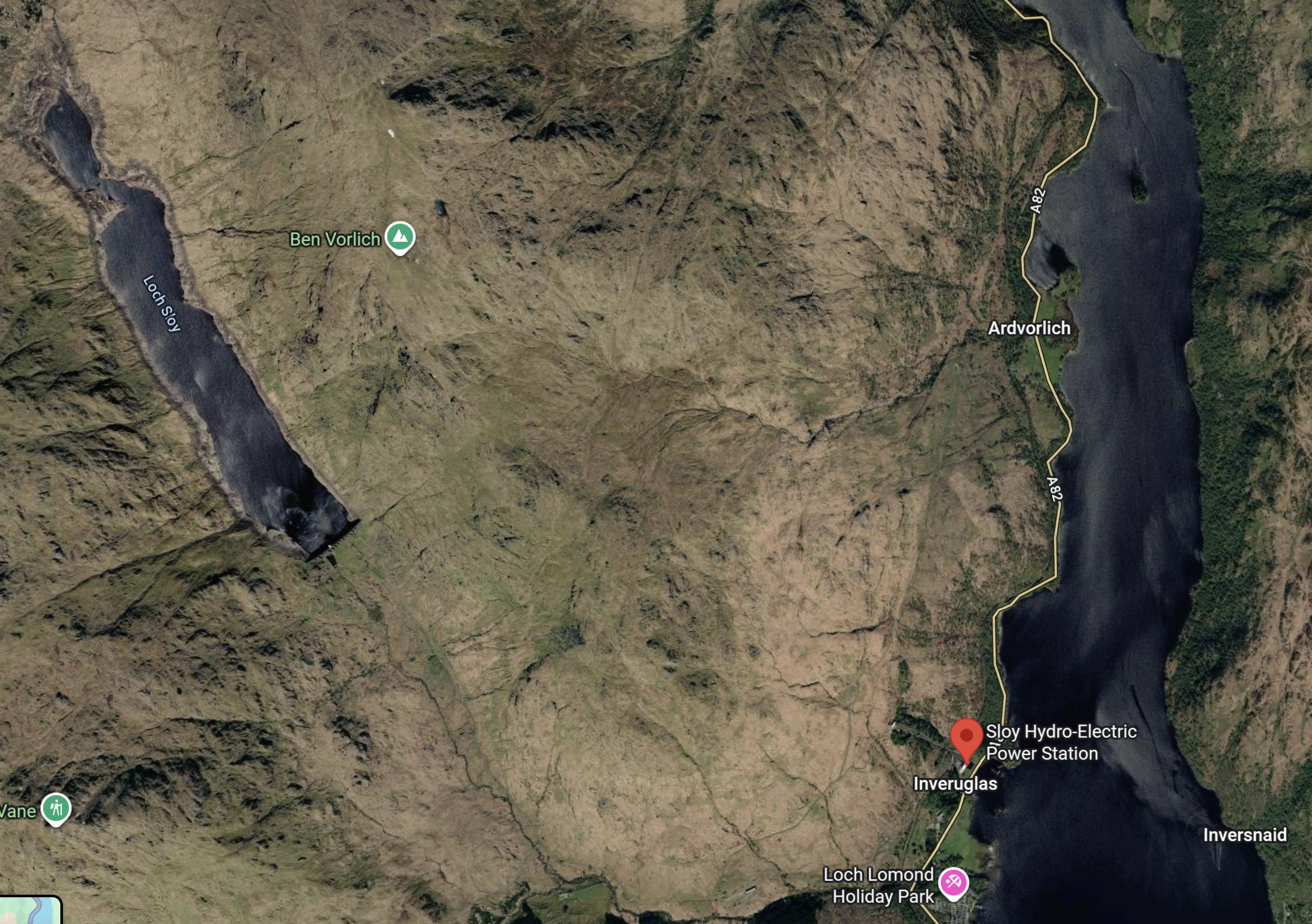
This Google Map shows Loch Lomond and Loch Sloy.
Note.
- Loch Sloy is in the North-West corner of the map.
- Loch Lomond is on the Eastern side of the map.
- The red arrow indicates the main buildings of the LochSloy Hydro-Electric Power Station.
- Loch Sloy is eight-hundred feet above Loch Lomond.
- The total generating capacity of the power station is 152.5 MW.
The facility is operated by Scottish and Southern Energy, and is normally in standby mode, ready to generate electricity to meet sudden peaks in demand. It can reach full capacity within 5 minutes from a standing start.
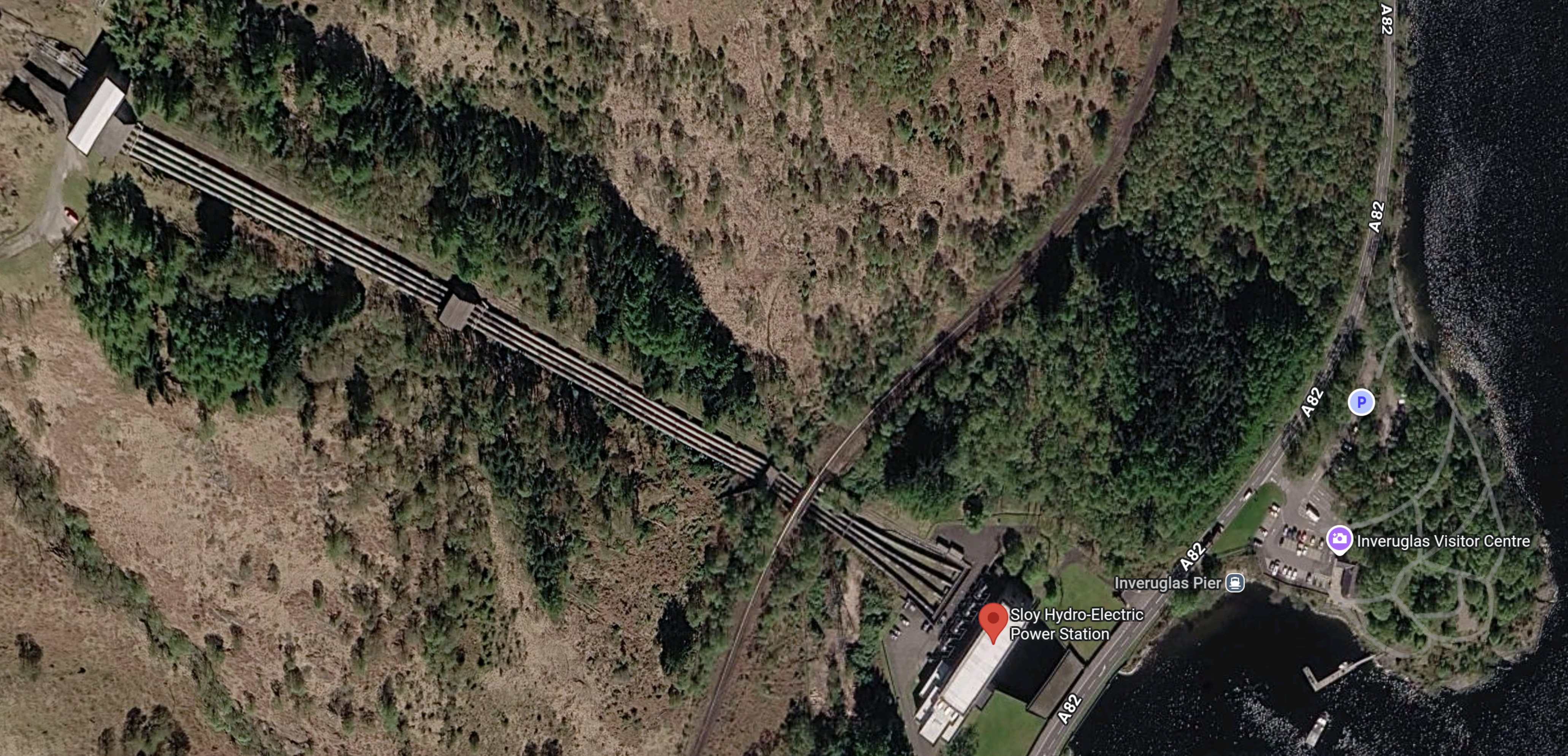
This second Google Map shows the power station to a larger scale.
Note.
- Loch Sloy is to the North-West of the North-West corner of the map.
- Loch Lomond is on the Eastern side of the map.
- The red arrow indicates the main buildings of the Loch Sloy Hydro-Electric Power Station.
- The four pipes carry water from Loch Sloy to the actual power station.
- The single-track West Highland Line crosses over the four pipes at their South-Eastern end.
The design of Loch Sloy Hydro-Electric Power Station is typical of many hydro-electric stations all over the world.
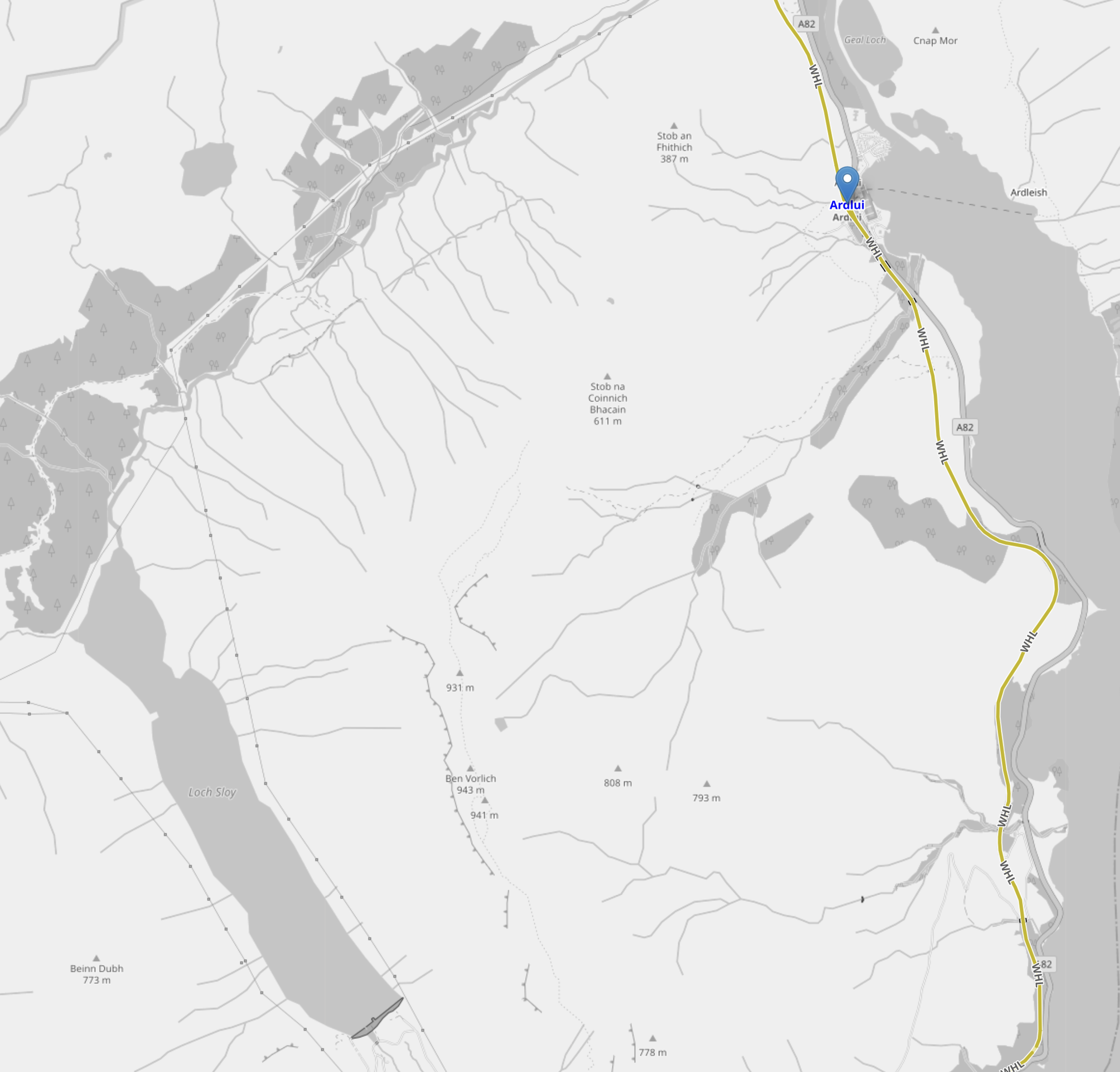
This third map is an OpenRailwayMap of the area.
Note.
- Loch Sloy is on the Western side of the map.
- Loch Lomond is on the Eastern side of the map.
- The yellow track is the single-track West Highland Line between Glasgow and Mallaig via Fort William
- The blue arrow indicates Ardlui station.
The railway goes close to the power station.
A Platinum Celebration for Sloy Power Station!
The title of this section is the same as this must-read web page on the SSE web site, which dates from 2020.
Sloy Power Station Development Plans
This second must read web page on the SSE web site is entitled Sloy Power Station.
This is the sub-heading.
We’re Proposing To Convert Our Iconic 1950s Hydro Station To Pumped Storage Hydro
This is the introduction to the development.
In April 2025, we submitted a planning application to the Scottish Government to convert the iconic Sloy Power Station into a pumped storage hydro scheme.
Our proposals would bolster energy security and help provide the large-scale and flexible renewable energy back-up needed in a future UK net zero power system, helping meet the UK Government’s ambition of Clean Power by 2030.
If approved for delivery, the converted Sloy scheme would be capable of delivering up to 16GWh of long-duration electricity storage capacity.
It could provide firm, flexible renewable energy for up to 100 hours non-stop.
It appears that the upgraded power station will effectively become a 160 MW/16 GWh long duration energy store.
Currently, the UK’s largest pumped storage power station is the 1727 MW/9.1 GWh Electric Mountain in North Wales.
The updated Sloy power station will have less output, but more storage capacity, than Electric Mountain.
Should There Be A Railway Station At Loch Sloy Power Station?
Google AI gives this answer in reply to “Loch Sloy Railway Station”.
There was never a permanent public railway station called Loch Sloy, but temporary private platforms like Inveruglas railway station and Faslane Platform railway station served the area. These stops were built in 1945 by the London and North Eastern Railway (LNER) to haul materials and workers—including prisoners of war—for the construction of the Loch Sloy Hydro-Electric Scheme.
Note.
- Surely, similar reasons to those in 1945 could apply to the development of the power station. Materials and workers could be brought in by rail.
- Given, the power station’s historic significance, I believe that it could become a tourist attraction and/or education centre.It could be a stop for the Caledonian Sleeper.
I believe that as time passes, the power station’s historic significance will increase.
Are There Any Other Hydro Power Stations, That Can Be Upgraded To Pumped Storage Hydro?
Google AI can’t find anything at present.


The project has now received planning consent https://projectscot.com/2026/07/sse-secures-planning-consent-for-sloy-power-station-upgrades/
Comment by Peter Robins | July 25, 2026 |
That is good news.
Google AI says this about the cost of the project.
Converting the UK’s largest conventional hydro station at Loch Sloy into a pumped storage facility is estimated by owner SSE Renewables to require an investment in the high tens of millions of pounds. Following the receipt of official planning consent in July 2026, a final investment decision on the project budget is targeted for late 2027.
But Google AI also says it could be completed around 2030
My wonderful bank manager, who definitely wasn’t part of the wunch and rose to the top of one of the UK’s High Street Banks would certainly have arranged the finance, against a professional financial forecast.
Comment by AnonW | July 25, 2026 |
SSE’s press release is at https://www.sserenewables.com/news-and-views/2026/07/sse-secures-planning-consent-for-sloy-power-station-upgrades/ They’re being cautious at the moment, but finance shouldn’t be a problem, as these are all well-established technologies. The substation apparently also needs an update as it’s getting long in the tooth. But I’m sure the Grid would welcome this – 100 hours of power at 5 minutes notice!
I was actually there last weekend, walking along the W Highland Way on the other side of the loch. Rather more strenuous than I was anticipating. Ember now run their electric coaches along the W side of the loch, and stop at Inveruglas.
Comment by Peter Robins | July 25, 2026